Today I headed out to Warner Springs in northern San Diego County. I wanted to experience an authentic stagecoach ride at the historic Warner-Carrillo Ranch House.
I arrived too early, so I drove a few miles further up State Route 79 to the Eagle Rock Trailhead, near the Warner Springs fire station. There I parked under some shady oak trees and began a slow hike south along the Pacific Crest Trail.
The short (perhaps half mile) segment of the PCT that I walked followed a dry creek bed. It passed through several swinging gates, but I encountered no grazing livestock.
In addition to many ancient oaks, I saw the autumn yellows of a few riparian trees–mostly willows it seemed. A couple sycamores I noticed had lost most of their leaves.
I also spotted interesting rock outcroppings and a distant woodpecker. And only a few hikers.
Had I time, I might have continued all the way to Eagle Rock–an impressive outcropping three miles from the trailhead that looks exactly like an bird with spread wings. I’ll do that some other day.
Enjoy these photos of autumn beauty along a very small part of the Pacific Crest Trail…
…
I live in downtown San Diego and love to walk around with my camera! You can follow Cool San Diego Sights via Facebook or Twitter!
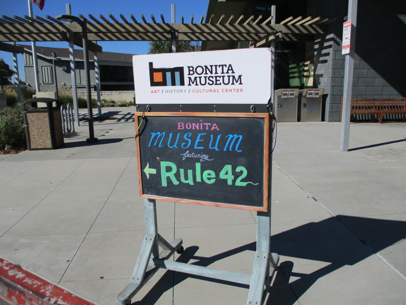
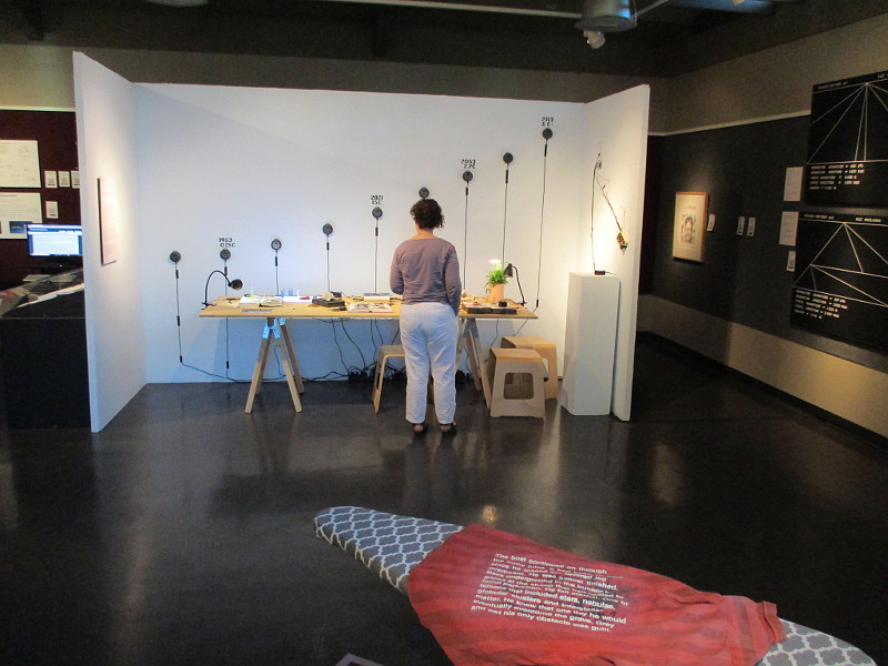
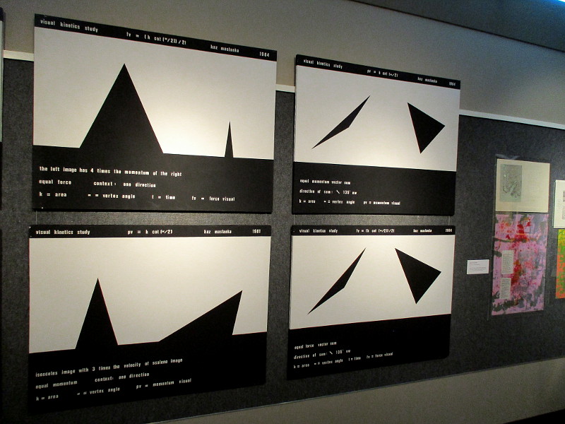
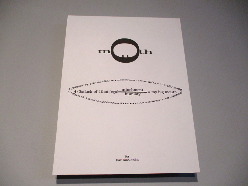
If you are intrigued by human creativity, science or philosophy, you might enjoy the artwork now on display at the The Bonita Museum and Cultural Center. The title of the exhibition is Rule 42, Stretched Language.
Why Rule 42? According to one popular work of fiction, 42 is the answer to the ultimate question of Life, the Universe and Everything. Go ahead, smile!
Why Stretched Language? Perhaps because human language can be stretched in endless ways. Words assembled in infinite combinations can represent one’s personal experience or shine light into dark places. Be made into poetry.
Words are symbolic. Numbers, variables and equations are also symbolic. They, too, can be used in poetic expression. Indeed, the exhibition’s subtitle is “Explorations into visual, concrete and mathematical poetry.”
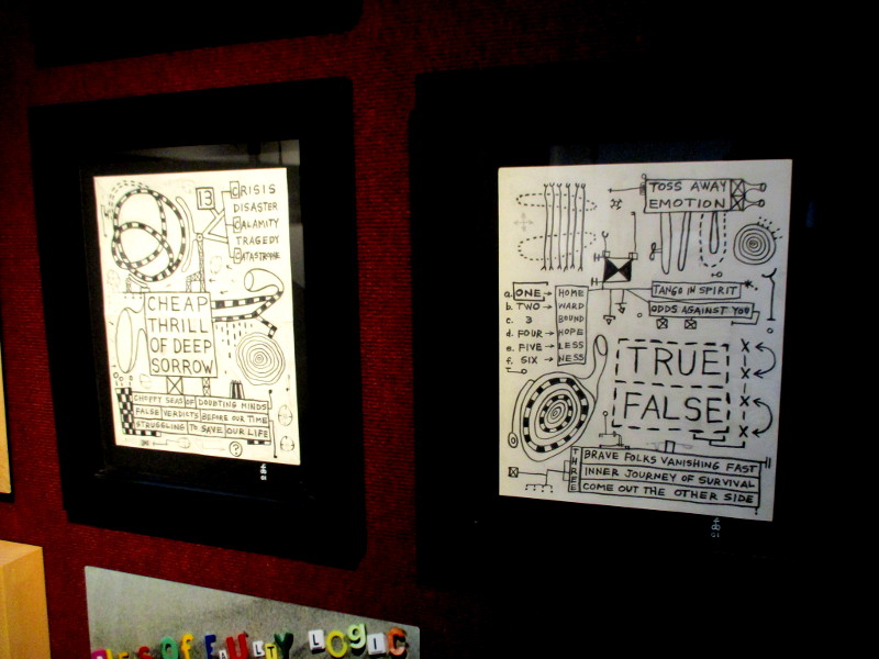
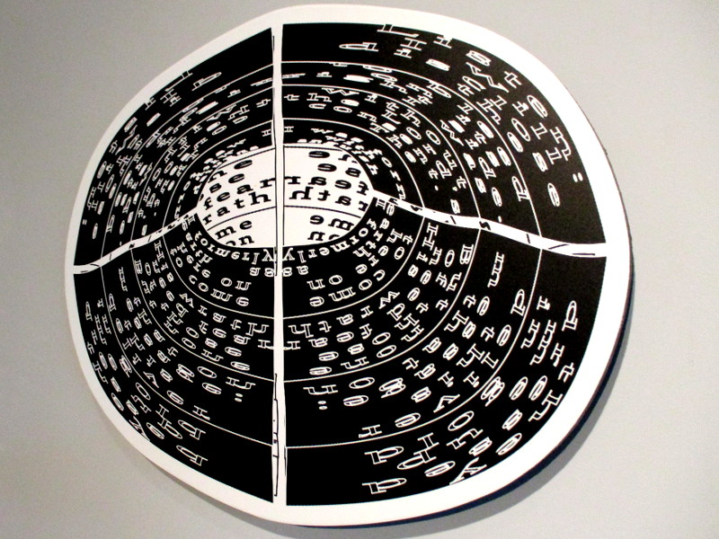
Supposedly, the works in this exhibition each have something to do with mathematics. It seemed to me, however, that they all celebrate something larger: the unique capacity of diverse human minds to imagine, rationalize and create. And even embrace pure nonsense.
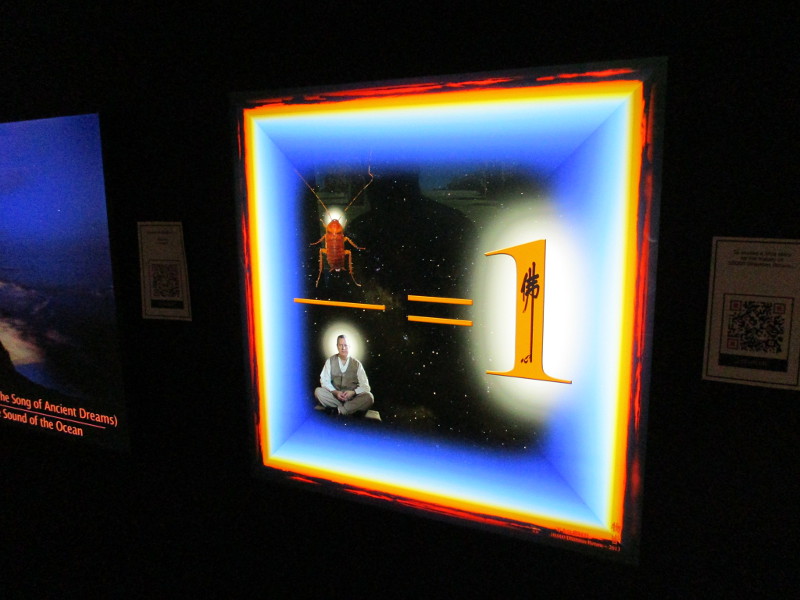
Psychronometrics. Sounds scientific. Sounds profound. The equation and description is impressive. But the assertion is that our psychological experience of time, and how time seems to accelerate as we become older, is related to Einstein’s theory of relativity.
To compare the two is utterly absurd. That equation in the photograph above includes velocity. Neither the young nor the old have managed (yet) to approach the speed of light!
But you know what? The plasticity of the human mind, which can imagine and rationalize absolutely anything and everything, is what is on display. These are the metaphorical works of visionary artists, not “serious” scientists. Infinite artistic truths cannot be defined with a few equations.
More rational visitors to the exhibit might laugh at some of the jumbled assertions and associations. Rule 42, Stretched Language can be a stretch.
My advise? Don’t be too critical. Step outside your own idea of Truth and enjoy!
This rather unusual exhibition ends on December 3, 2021.
…
I live in downtown San Diego and love to walk around with my camera! You can follow Cool San Diego Sights via Facebook or Twitter!
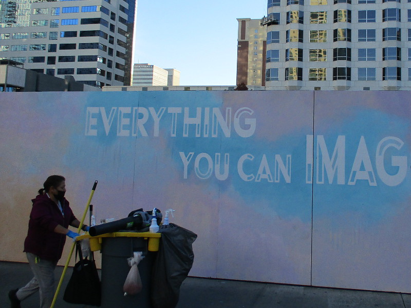
Everything you can imagine is real–on Kettner Boulevard.
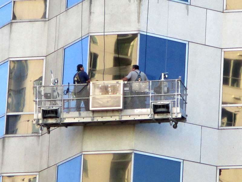
This morning I saw this long mural across the street from the Museum of Contemporary Art San Diego. Looking up, I discovered window washers on a downtown building. They appeared to be suspended in a maze of reflecting mirrors.
I imagined eyes looking down from places behind the mirrors, searching the streets of reality below…imagining–
Everything you can imagine is real.
But can everything that is real be imagined?
Incidentally, the mural’s quote is by Picasso. The words, many colors and geometric fragments were painted by @StefanieBalesFineArt.
…
I live in downtown San Diego and love to walk around with my camera! You can follow Cool San Diego Sights via Facebook or Twitter!
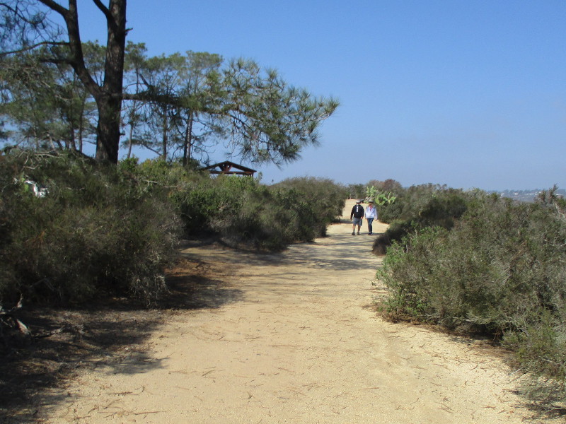
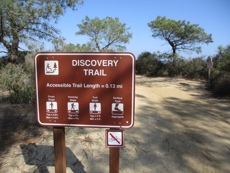
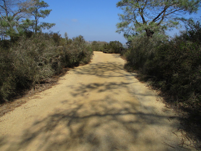
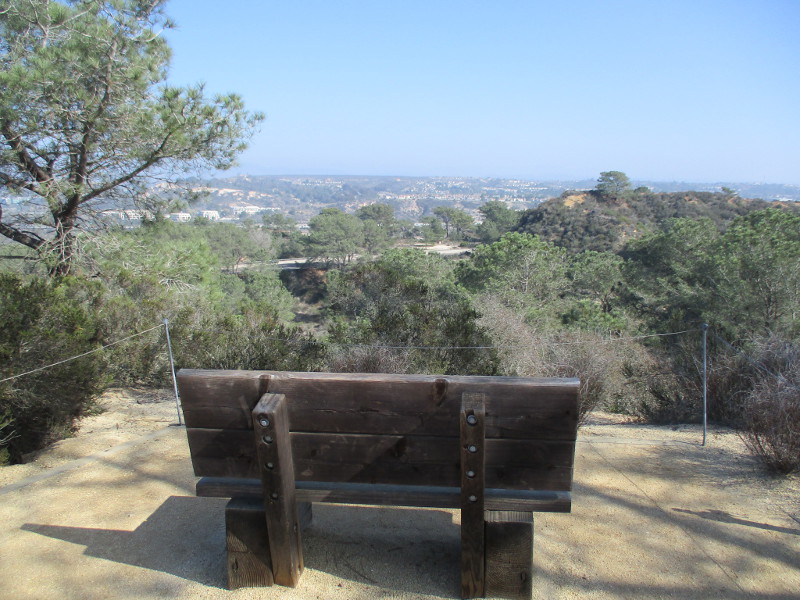
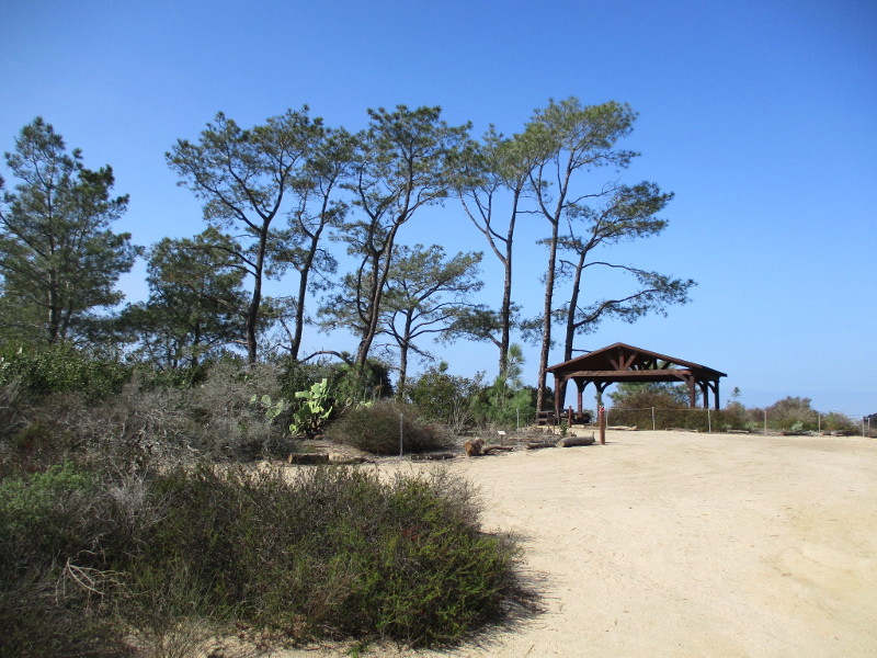
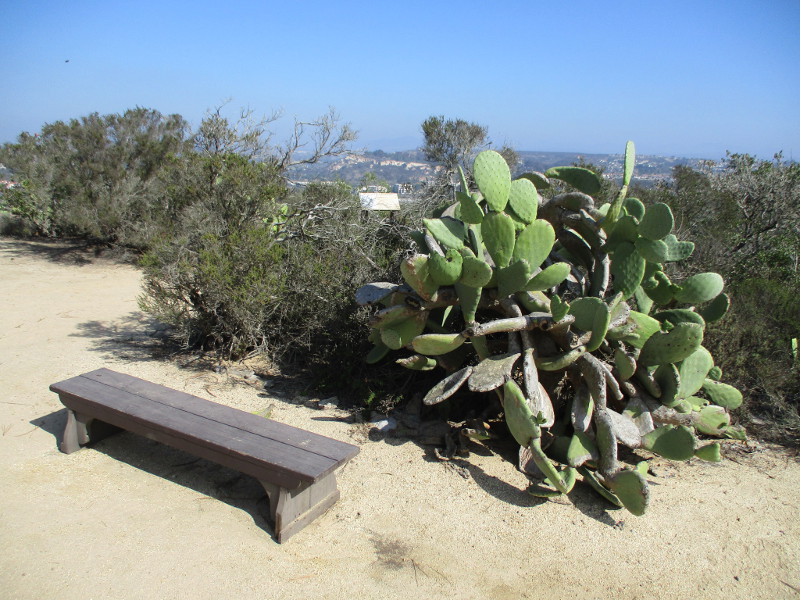
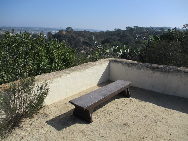
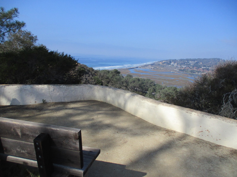
The very easy Discovery Trail at Torrey Pines State Natural Reserve is a fine place to walk or sit on a bench, while drinking in nature’s beauty.
The short .13 mile highly accessible trail follows the edge of a bluff just east of the historic Lodge (the park’s Visitor Center) and its parking lot.
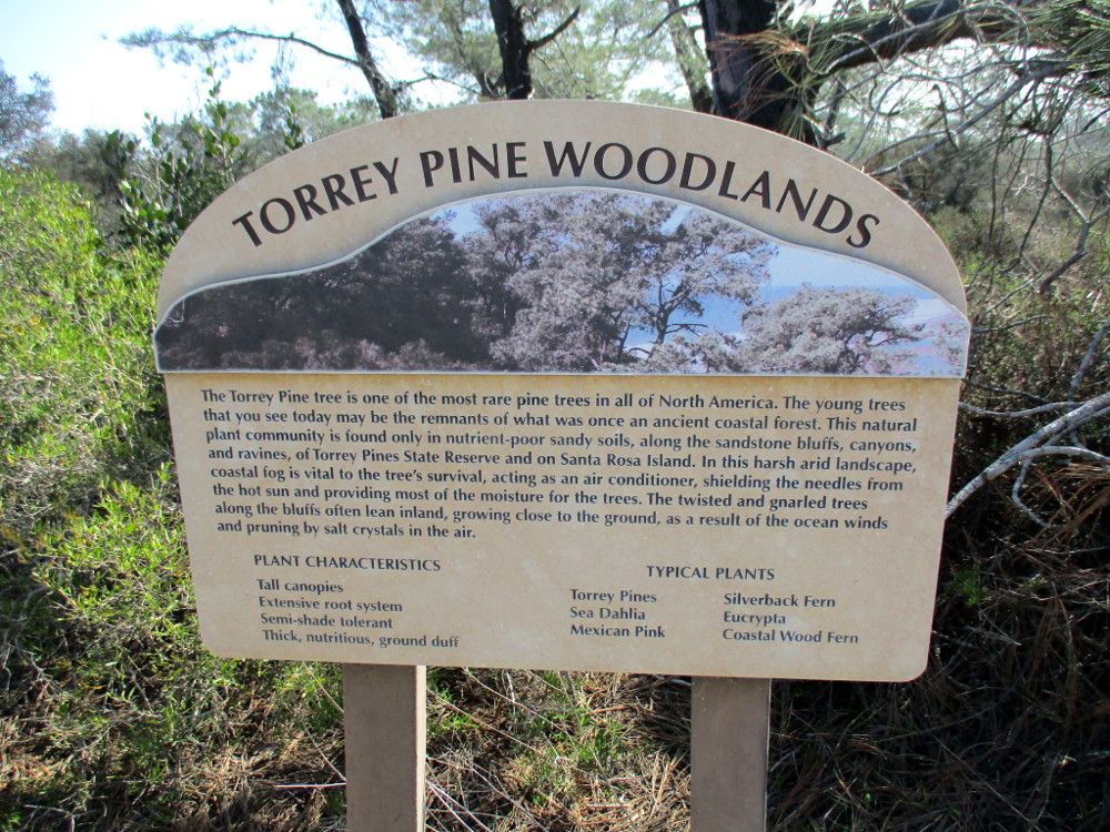
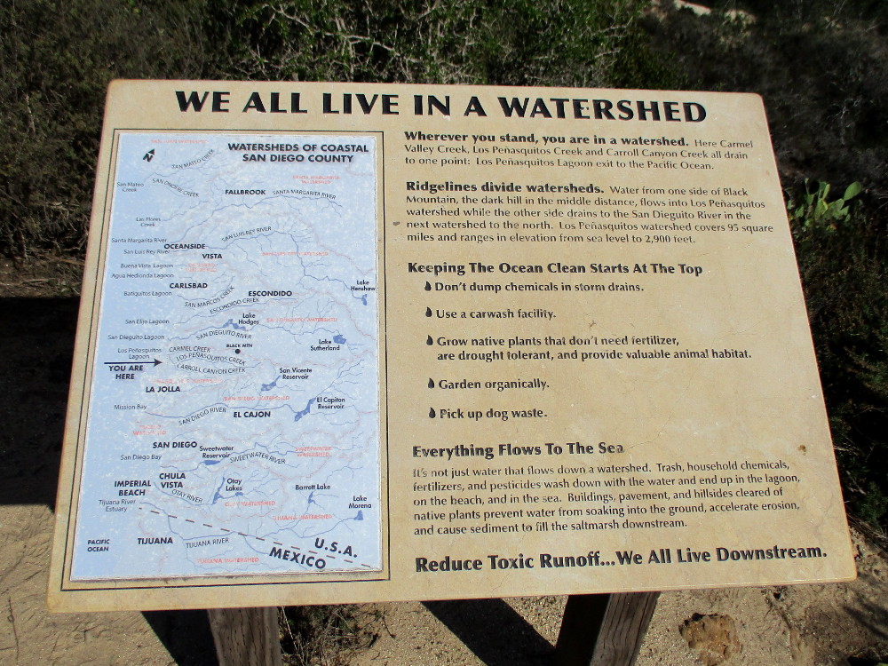
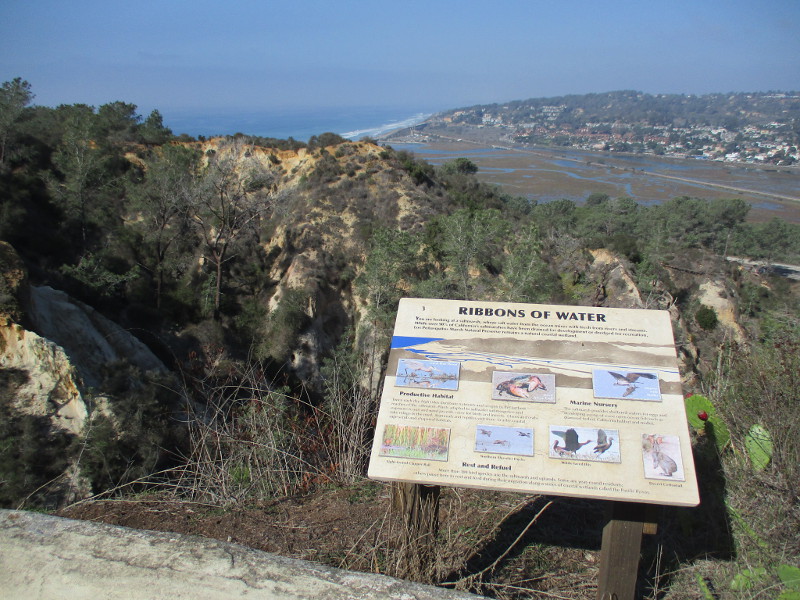
There are scenic overlooks with views of Carmel Valley, Los Peñasquitos Lagoon and even the Pacific Ocean. Signs describe many of the natural marvels around you. Native plants along the way are identified with information plaques.
Last weekend I slowly walked north along the Discovery Trail.
I began at Torrey Pines Park Road across from the Beach Trailhead parking lot. That’s where I saw the sign pictured below. I then headed north until I reached the rear of the old Lodge.
TORREY PINE WOODLANDS. The Torrey Pine tree is one of the most rare pine trees in all of North America. The young trees that you see today may be the remnants of what was once an ancient coastal forest. This natural plant community is found only in nutrient-poor sandy soils, along the sandstone bluffs, canyons, and ravines of Torrey Pines State Reserve and on Santa Rosa Island…
Wherever you stand, you are in a watershed. Here Carmel Valley Creek, Los Peñasquitos Creek and Carroll Canyon Creek all drain to one point: Los Peñasquitos Lagoon’s exit to the Pacific Ocean…
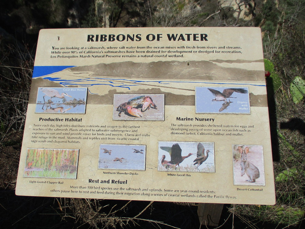
You are looking at a saltmarsh, where salt water from the ocean mixes with fresh from rivers and streams…Los Peñasquitos Marsh Natural Preserve remains a natural coastal wetland.
…
I live in downtown San Diego and love to walk around with my camera! You can follow Cool San Diego Sights via Facebook or Twitter!
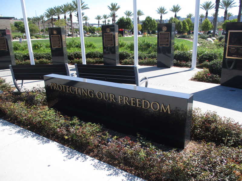
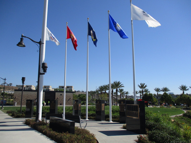
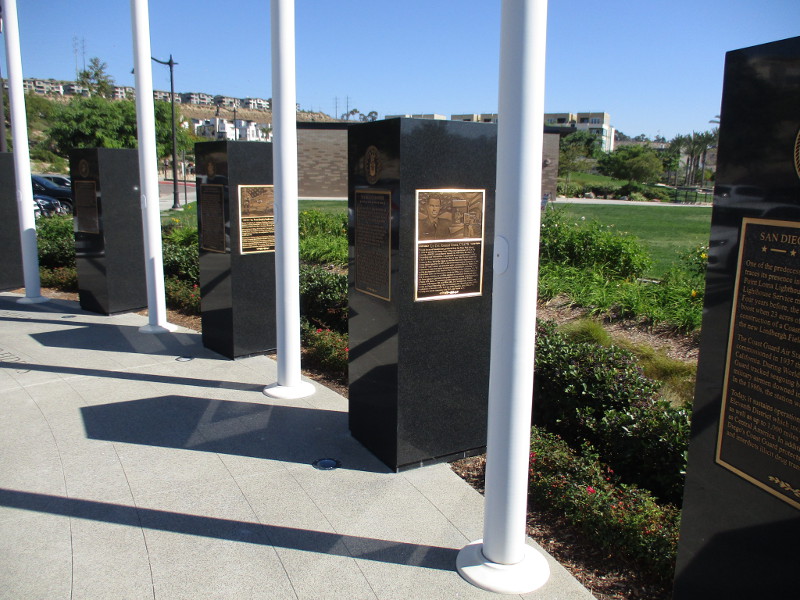
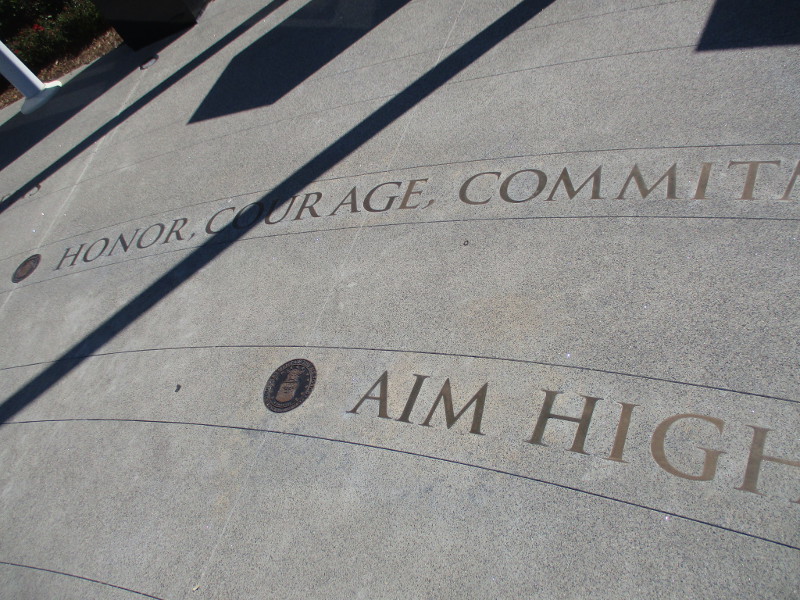
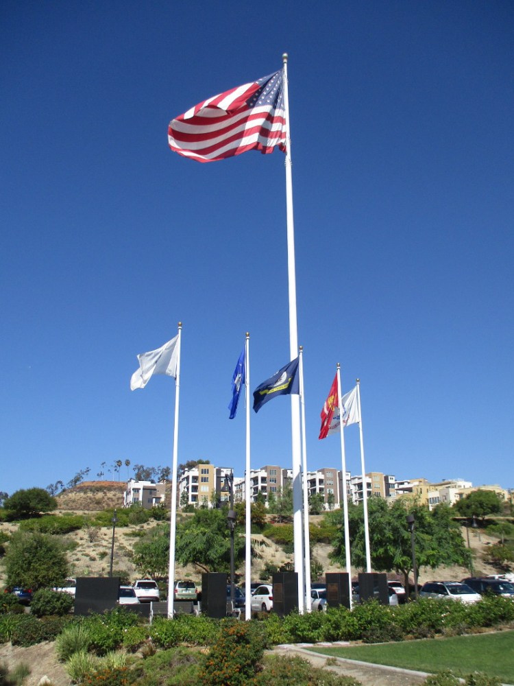
Four years ago, Military Tribute Plaza was dedicated at Civita in Mission Valley.
This monument, saluting the United States Armed Services, features flags above black marble columns. Bronze plaques recall the history of each military branch in San Diego. Veterans are also honored.
I took these photographs a few weeks ago when I enjoyed a walk through the large Civita residential community. I thought now would be a good time to post them, because Veterans Day has arrived.
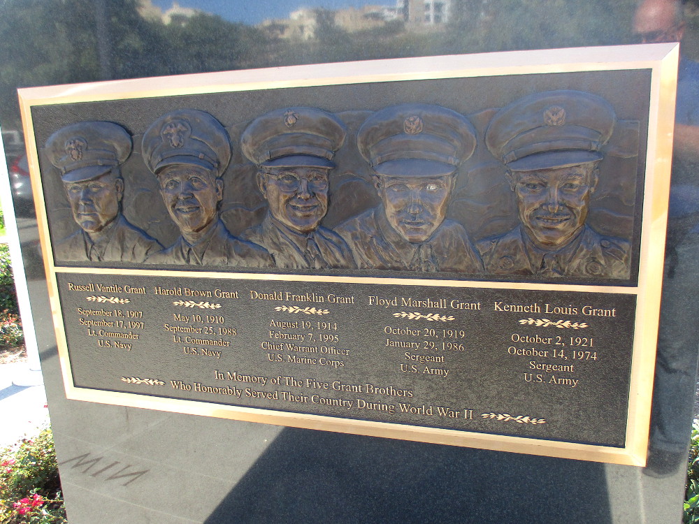
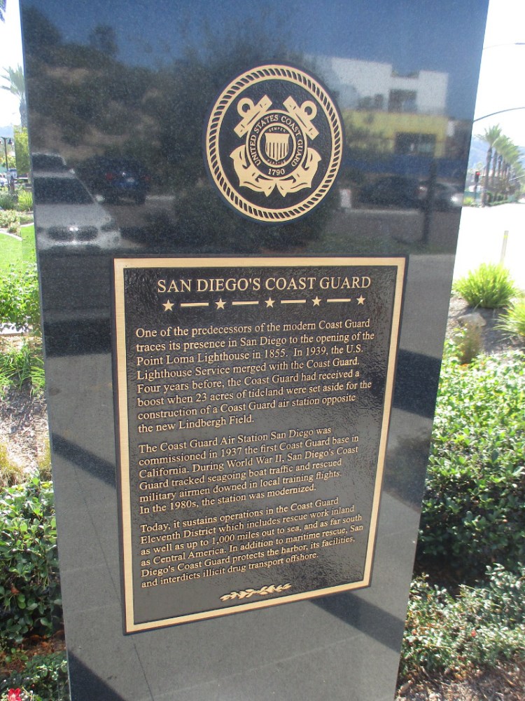
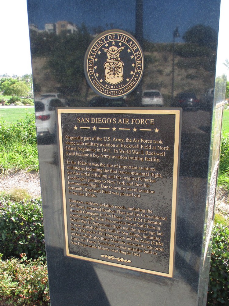
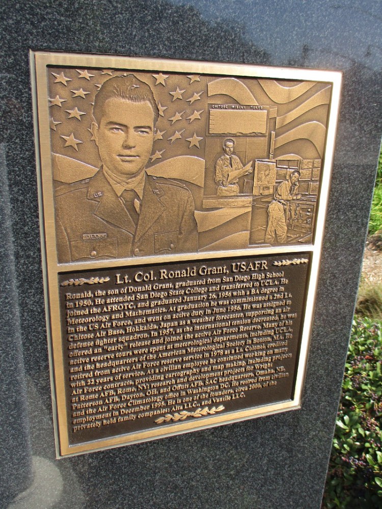
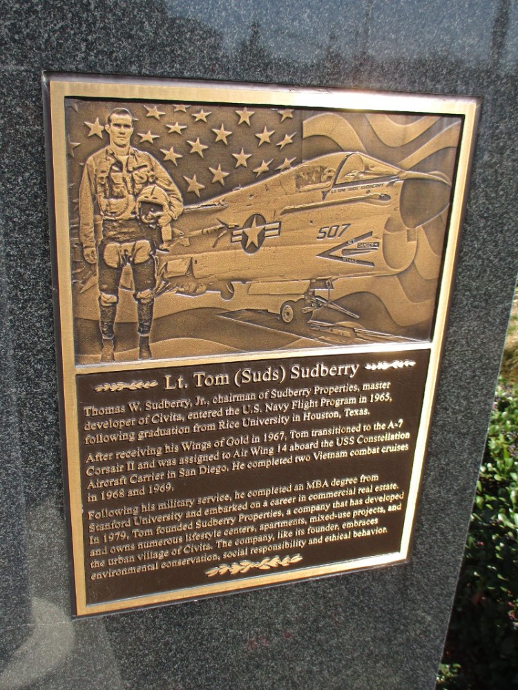
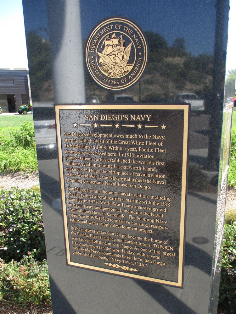
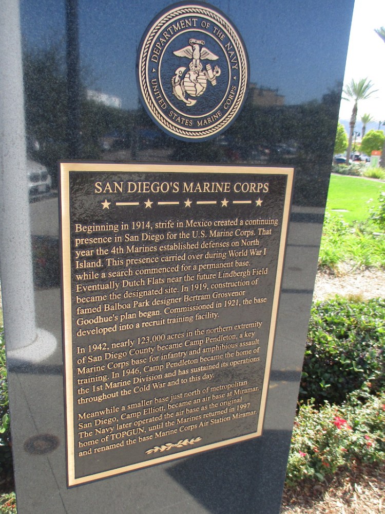
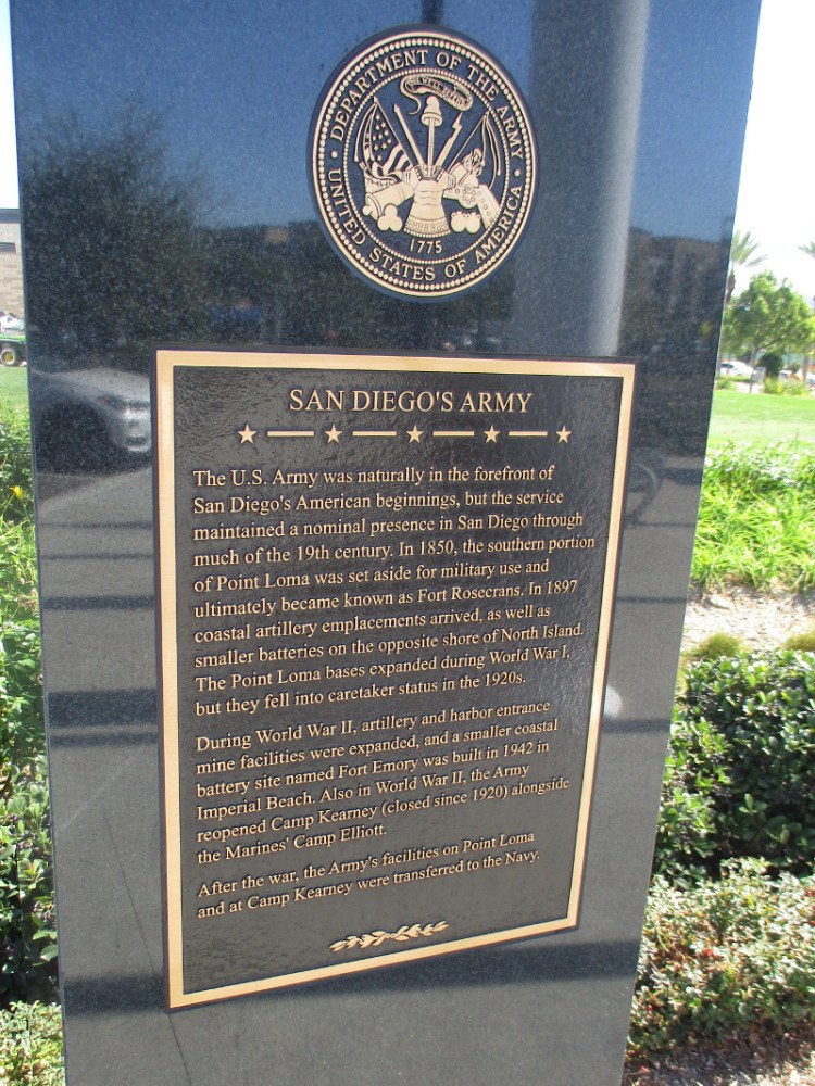
In Memory of The Five Grant Brothers Who Honorably Served Their Country During World War II.SAN DIEGO’S COAST GUARD. One of the predecessors of the modern Coast Guard traces it presence in San Diego to the opening of the Point Loma Lighthouse in 1855…SAN DIEGO’S AIR FORCE. Originally part of the U.S. Army, the Air Force took shape with military aviation at Rockwell Field at North Island, beginning in 1912…Lt. Col. Ronald Grant, USAFR.Lt. Tom (Suds) Sudberry.SAN DIEGO’S NAVY. San Diego’s development owes much to the Navy, starting with the visit of the Great White Fleet of 16 battleships in 1908…SAN DIEGO’S MARINE CORPS. Beginning in 1914, strife in Mexico created a continuing presence in San Diego for the U.S. Marine Corps…SAN DIEGO’S ARMY. The U.S. Army was naturally in the forefront of San Diego’s American beginnings…
…
I live in downtown San Diego and love to walk around with my camera! You can follow Cool San Diego Sights via Facebook or Twitter!
You can easily explore Cool San Diego Sights by using the search box on my blog’s sidebar. Or click a tag! There are thousands upon thousands of photos for you to enjoy!
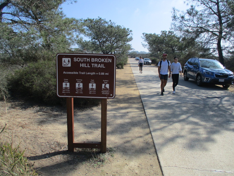
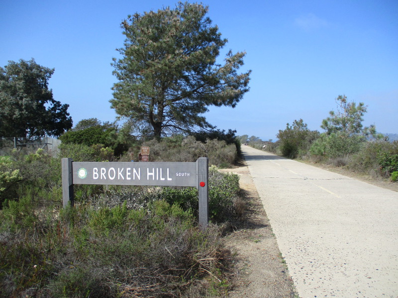
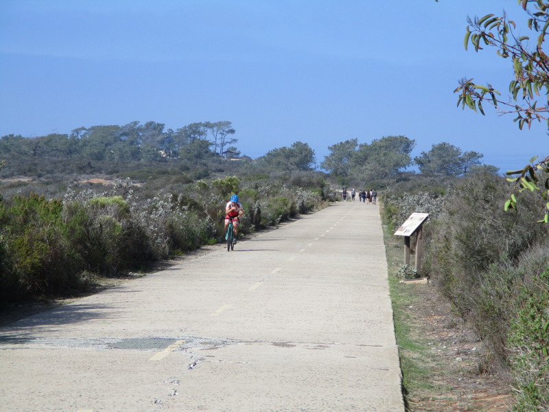
Explore the south end of Torrey Pines Park Road at Torrey Pines State Natural Reserve and you’ll discover breathtaking beauty and fascinating history.
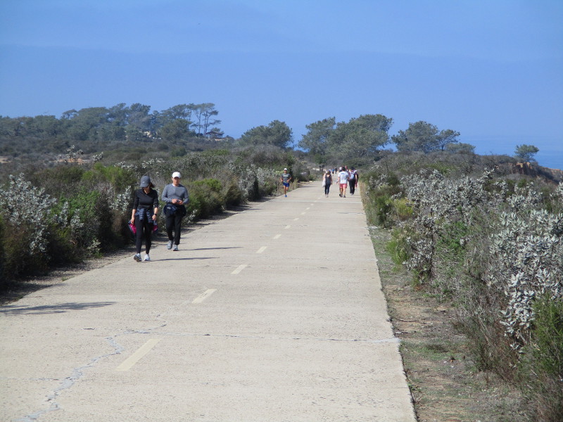
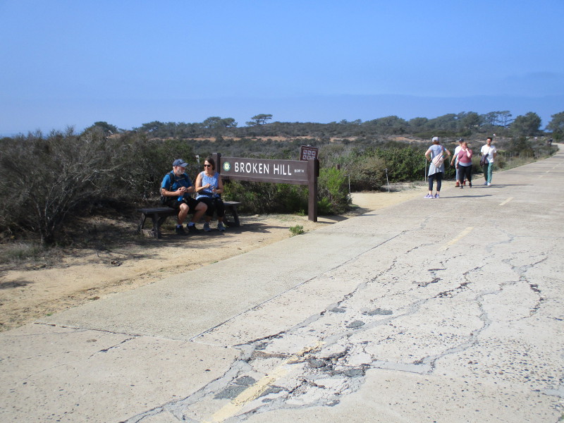
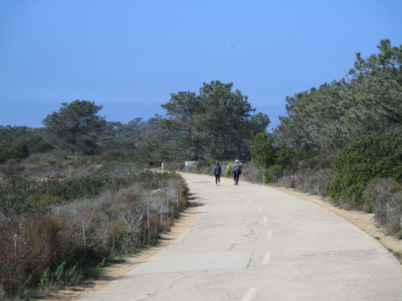
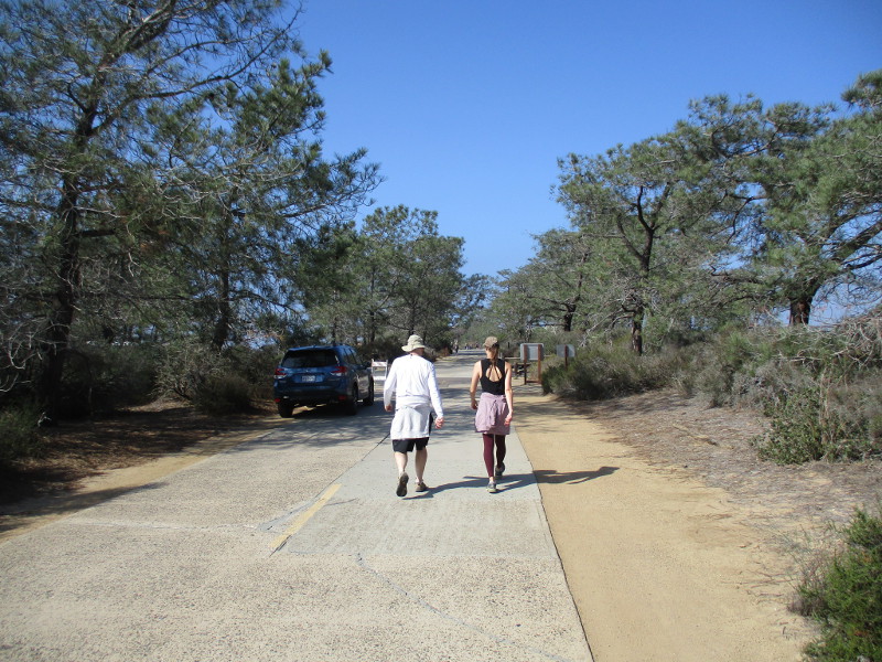
Last weekend I walked north along the paved trail, which a century ago was part of the main road from San Diego to Los Angeles. The following photographs begin near Torrey Pines Golf Course and end just short of the Visitor Center at Torrey Pines State Reserve’s old Lodge. The historic road, closed to vehicle traffic, is how hikers access Broken Hill Trail, which winds through a rugged landscape down to the beach.
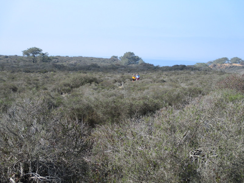
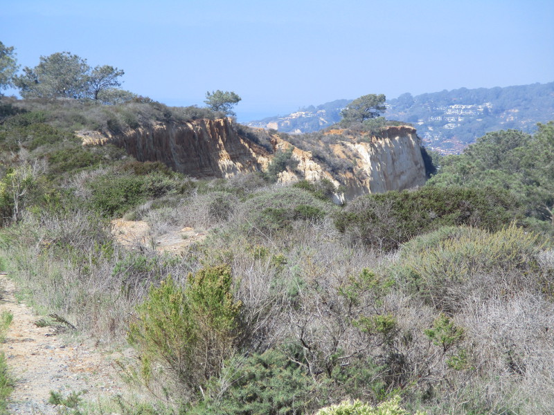
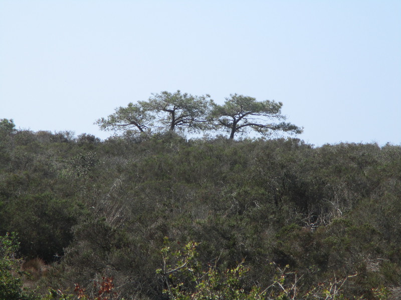
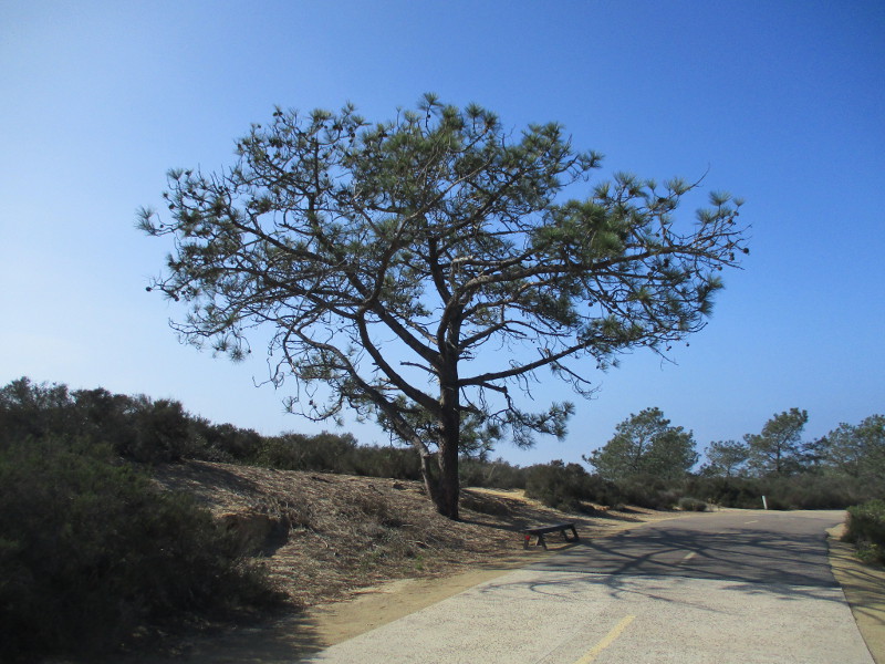
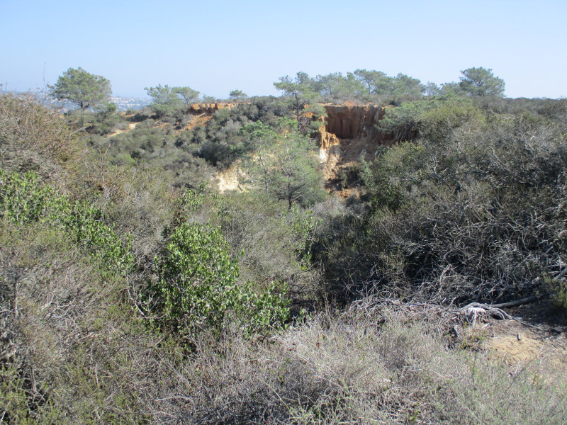
In my photos you’ll see native coastal sage scrub and chaparral plants, rare Torrey pine trees, the Pacific Ocean in the distance to the west and sandstone cliffs overlooking North Torrey Pines Road to the east. Signs along the way speak of the history of this place.
Come along as I walk down old Torrey Pines Park Road on a sunny November day!
Other walkers and bicyclists were also enjoying a fun adventure.
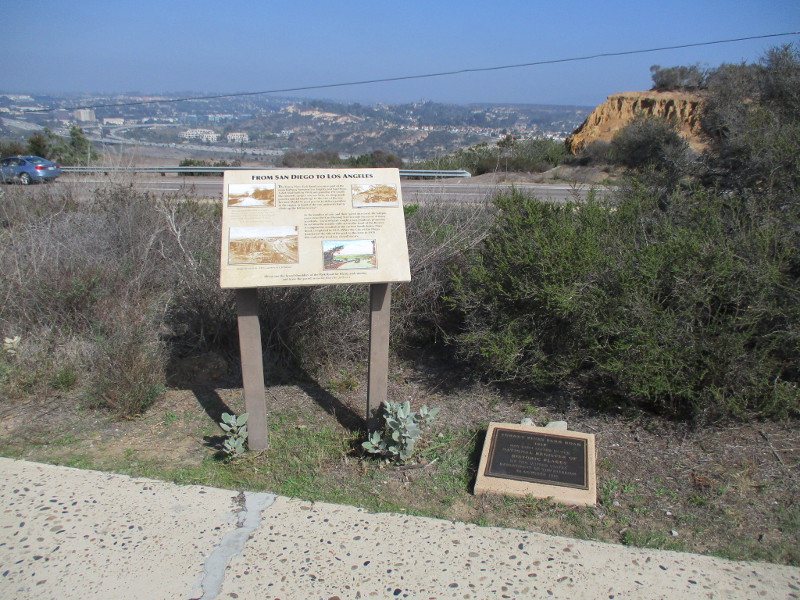
To the east beyond an information sign and historical marker one can see North Torrey Pines Road, Carmel Valley and Interstate 5.
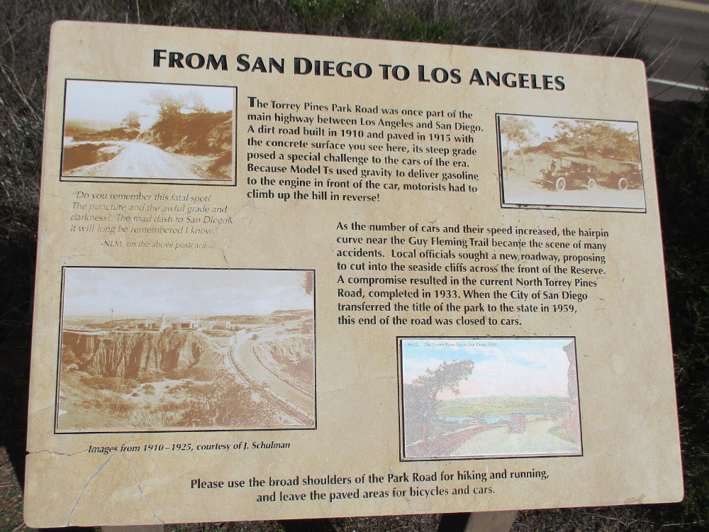
FROM SAN DIEGO TO LOS ANGELES
The Torrey Pines Park Road was once part of the main highway between Los Angeles and San Diego. A dirt road built in 1910 and paved in 1915 with the concrete surface you see here, its steep grade posed a special challenge to the cars of the era. Because Model Ts used gravity to deliver gasoline to the engine in front of the car, motorists had to climb up the hill in reverse.
As the number of cars and their speed increased, the hairpin curve near the Guy Fleming Trail became the scene of many accidents. Local officials sought a new roadway, proposing to cut into the seaside cliffs across the front of the Reserve. A compromise resulted in the current North Torrey Pines Road, completed in 1933. When the City of San Diego transferred the title of the park to the state in 1959, this end of the road was closed to cars.
The steep hill and its hairpin curves mentioned in the sign are north of the Lodge, beyond this particular walk. Cars entering the park still use it.
If you’d like to see past photos of the Guy Fleming Trail which is also referenced in the sign, click here!
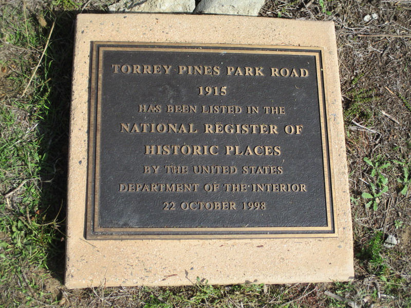
TORREY PINES PARK ROAD
1915
HAS BEEN LISTED IN THE NATIONAL REGISTER OF HISTORIC PLACES BY THE UNITED STATES DEPARTMENT OF THE INTERIOR
22 OCTOBER 1998
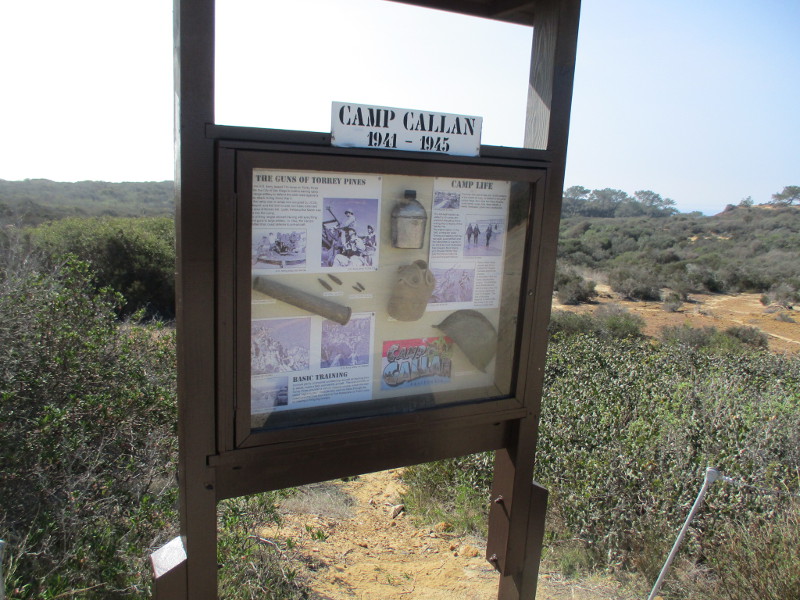
Hikers explore nature’s beauty.The North Fork Trailhead leads west to the Broken Hill Trail.Picturesque sandstone cliffs overlook North Torrey Pines Road (not visible) to the east.A sign details the history of Camp Callan, which was located here from 1941 to 1945.
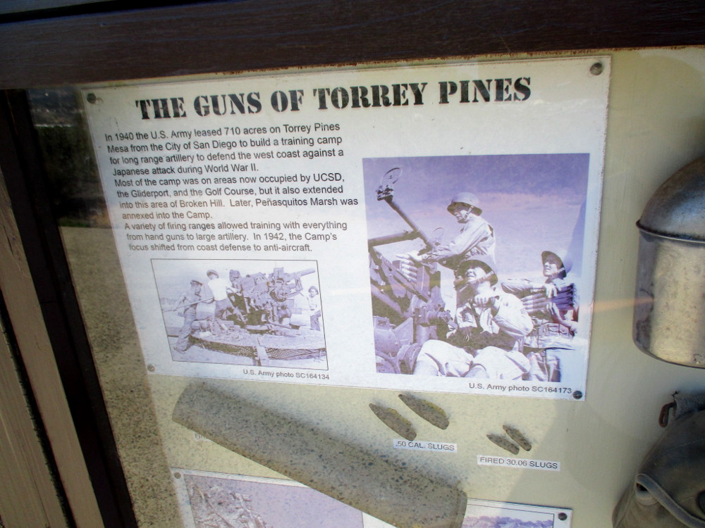
THE GUNS OF TORREY PINES
In 1940 the U.S. Army leased 710 acres on Torrey Pines Mesa from the City of San Diego to build a training camp for long range artillery to defend the west coast against a Japanese attack during World War II. Most of the camp was on areas now occupied by UCSD, the Gliderport, and the Golf Course, but it also extended into the area of Broken Hill. Later, Penasquitos Marsh was annexed into the Camp. A variety of firing ranges allowed training with everything from hand guns to large artillery. In 1942, the Camp’s focus shifted from coast defense to anti-aircraft.
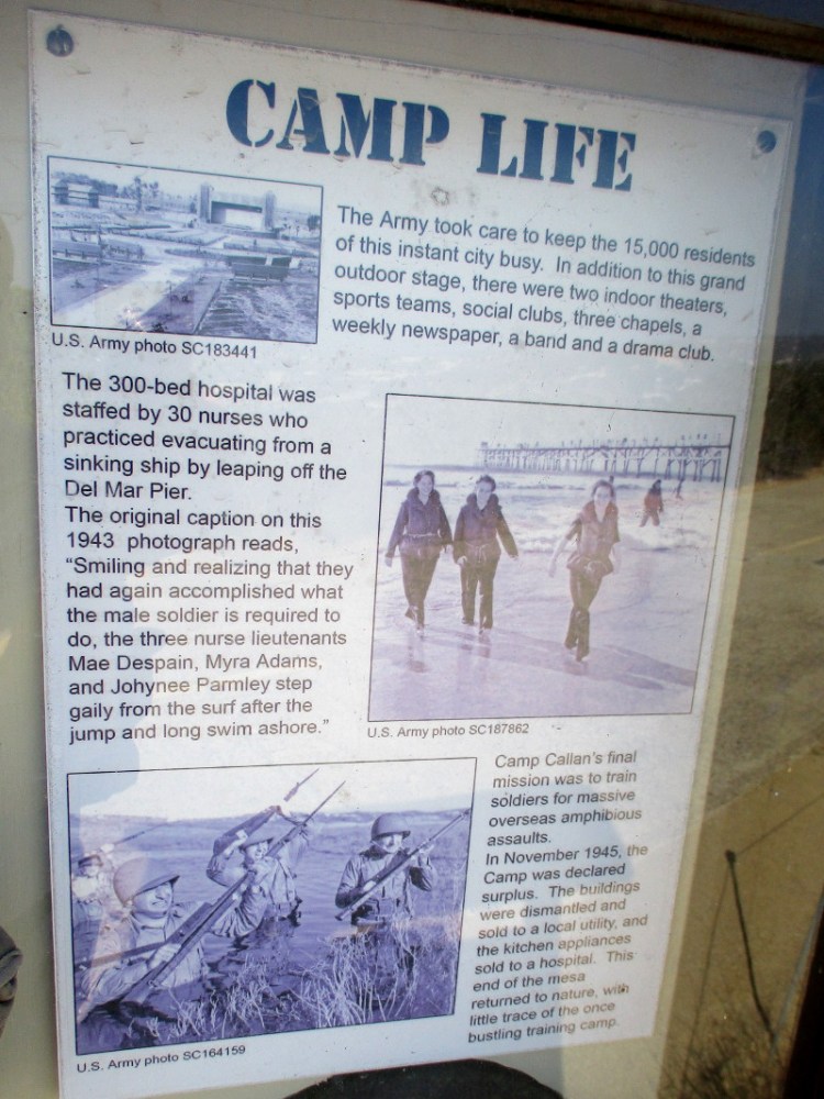
CAMP LIFE
The Army took care to keep the 15,000 residents of this instant city busy. In addition to this grand outdoor stage, there were two indoor theaters, sports teams, social clubs, three chapels, a weekly newspaper, a band and a drama club.
The 300-bed hospital was staffed by 30 nurses who practiced evacuating from a sinking ship by leaping off the Del Mar Pier. The original caption on the 1943 photograph reads, “Smiling and realizing that they had again accomplished what the male soldier is required to do, the three nurse lieutenants Mae Despain, Myra Adams, and Johynee Parmley step gaily from the surf after the jump and long swim ashore.”
Camp Callan’s final mission was to train soldiers for massive overseas amphibious assaults. In November 1945, the Camp was declared surplus. The buildings were dismantled and sold to a local utility, and the kitchen appliances sold to a hospital. This end of the mesa returned to nature, with little trace of the once bustling training camp.
A postcard. Greetings from CAMP CALLAN CALIFORNIA.Torrey pine trees in the distance.More eroded sandstone to the east.Approaching a small parking lot at the Beach Trailhead near The Lodge.
…
This blog now features thousands of photos around San Diego! Are you curious? There’s lots of cool stuff to check out!
Here’s the Cool San Diego Sights main page, where you can read the most current blog posts. If you’re using a phone or small mobile device, click those three parallel lines up at the top–that opens up my website’s sidebar, where you’ll see the most popular posts, a search box, and more!
To enjoy future posts, you can also “like” Cool San Diego Sights on Facebook or follow me on Twitter.
I observed a few interesting things in downtown San Diego during my morning walk.
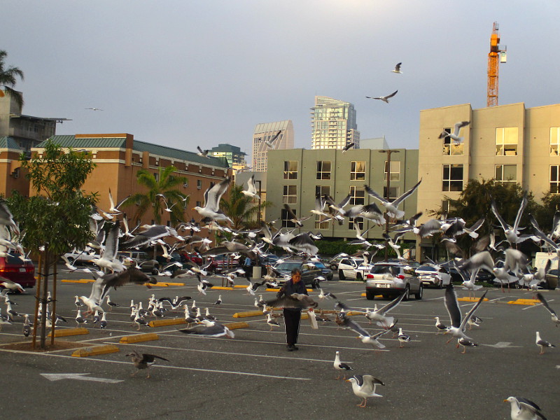
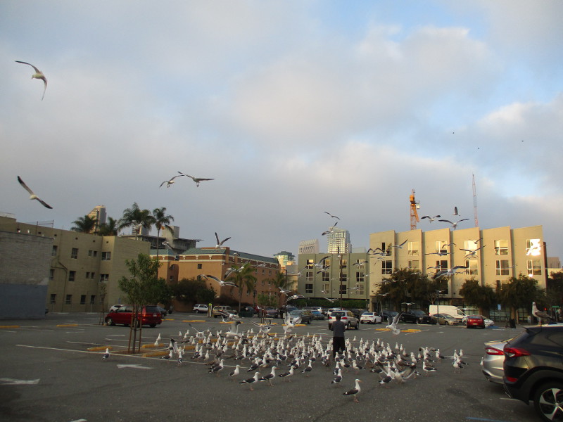
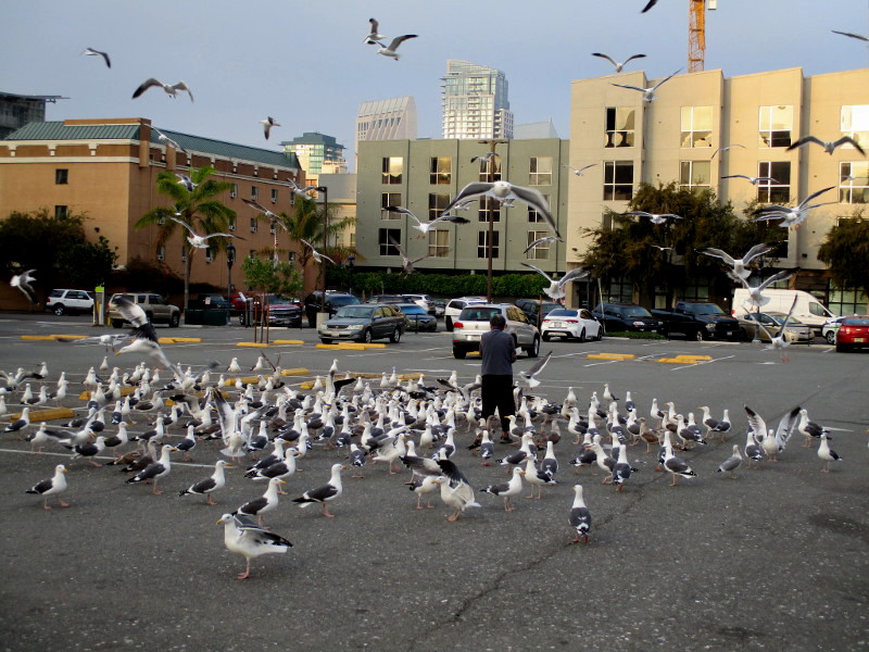
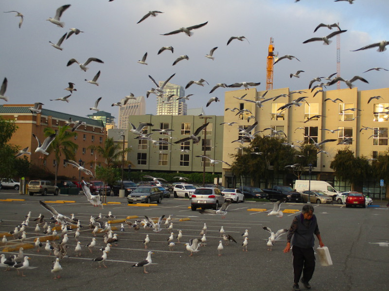
First, a parking lot in East Village was swarming with hundreds of seagulls. Someone was tossing the gulls a large quantity of crumbs. It was quite a spectacle, as you can see in my photographs.
Of course, feeding birds downtown makes them more of a potential nuisance. And the people who’d parked nearby might have something to say…
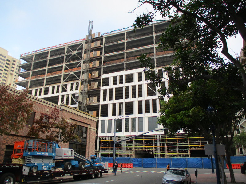
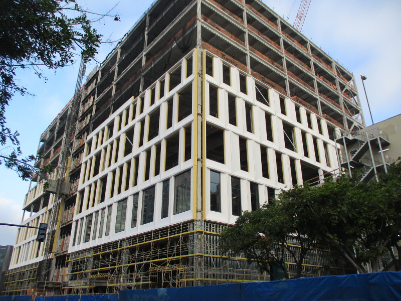
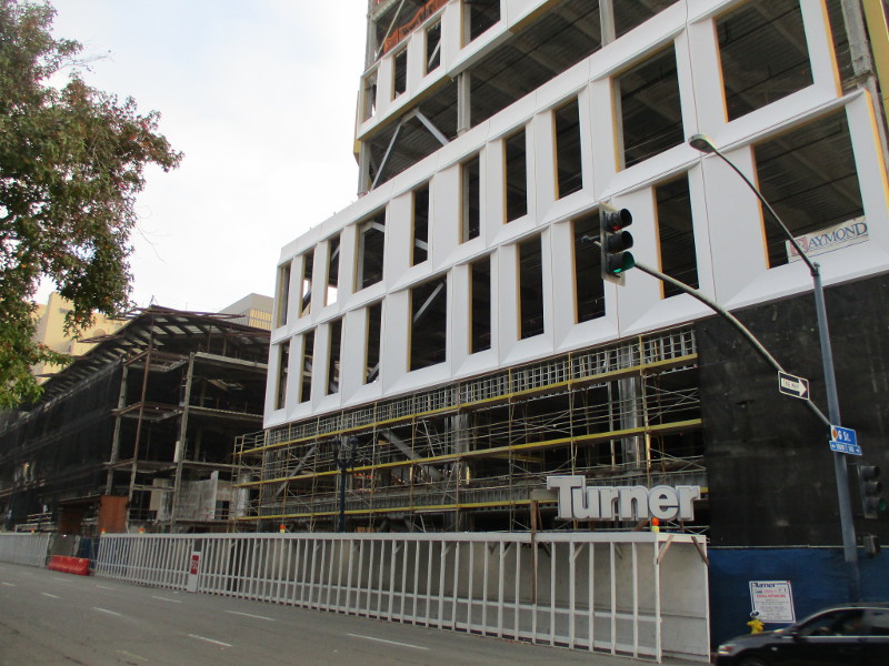
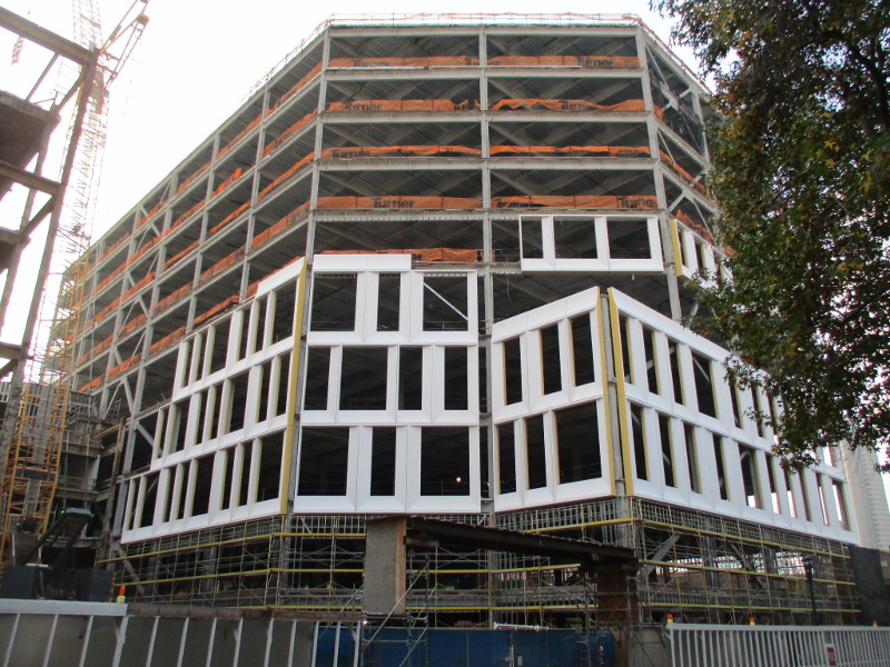
Next, as I walked past old Horton Plaza, I noticed its redevelopment is progressing right along. The exterior of the now enlarged building at the corner of G Street and 1st Avenue, former home of a Nordstrom department store, has some new skin!
If you want to see how the project appeared about a year ago, with the once popular shopping mall stripped and gutted, click here!
If you want to see how the new mixed-use high-tech downtown campus will appear when finished, click here!
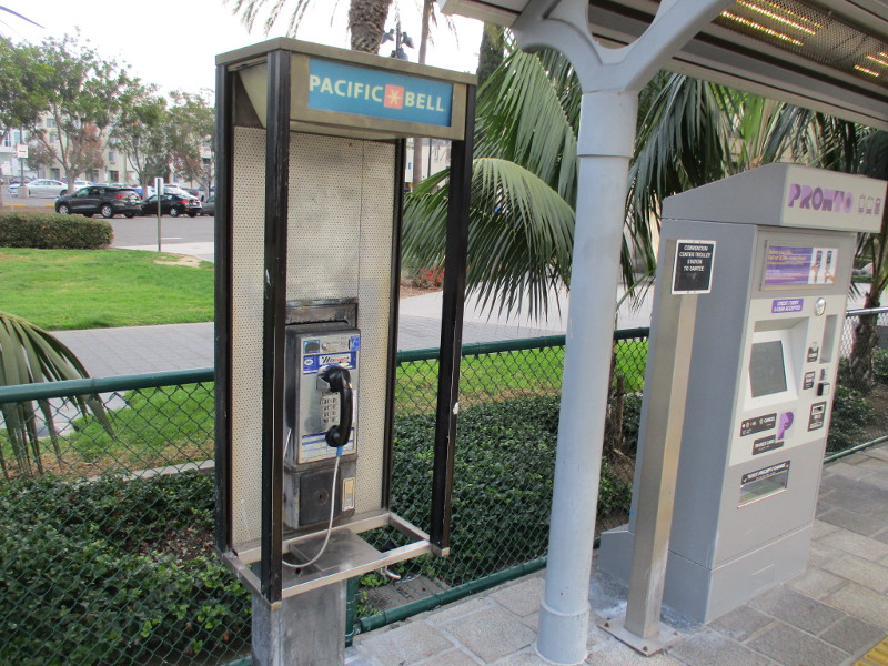
Finally, check out the following old relic.
How many pay phones remain in the city? I never see them anymore. I did find one here, at the Convention Center trolley station, next to a brand new high-tech PRONTO ticket machine!
Put that pay phone in a museum!
…
I live in downtown San Diego and love to walk around with my camera! You can follow Cool San Diego Sights via Facebook or Twitter!
You can easily explore Cool San Diego Sights by using the search box on my blog’s sidebar. Or click a tag! There are thousands upon thousands of photos for you to enjoy!
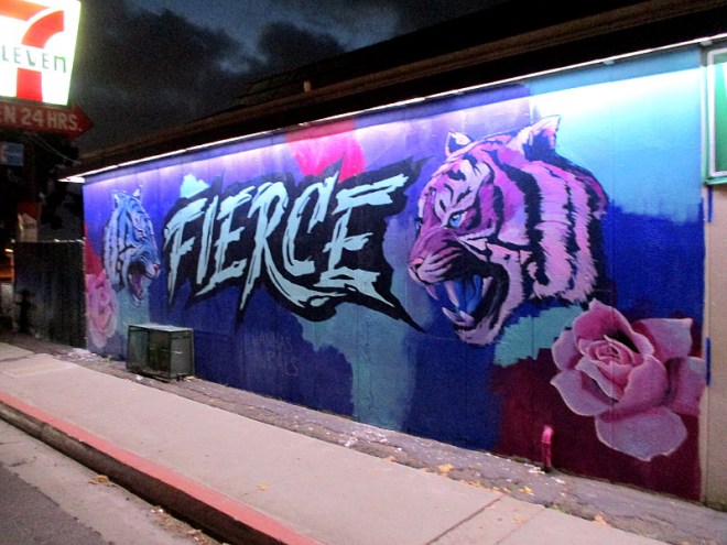
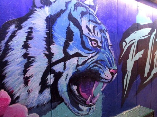
A new mural was being painted today near Morena Boulevard!
I noticed the artist at work when I drove through the intersection of Linda Vista Road and Napa Street. The mural is on the side of a 7-Eleven.
After dark, I had the opportunity to return and take a good look at the colorful mural and get these photographs. At night the wall is brightly illuminated.
A signature indicates the artist is Hanna of Hanna’s Murals. You’ve seen her work elsewhere on Cool San Diego Sights, particularly here.
This awesome new mural depicts two tigers and the word FIERCE. I’m not sure if the artwork is entirely finished.
Check it out!
…
I live in downtown San Diego and love to walk around with my camera! You can follow Cool San Diego Sights via Facebook or Twitter!
You can easily explore Cool San Diego Sights by using the search box on my blog’s sidebar. Or click a tag! There are thousands upon thousands of photos for you to enjoy!