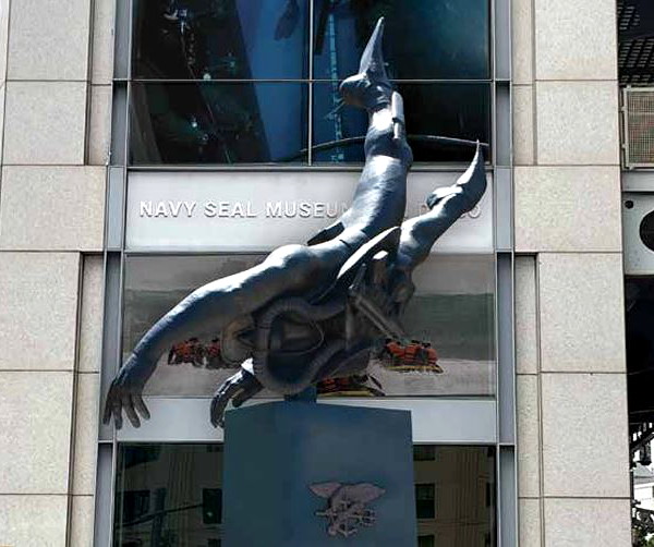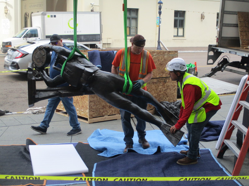
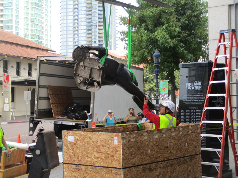
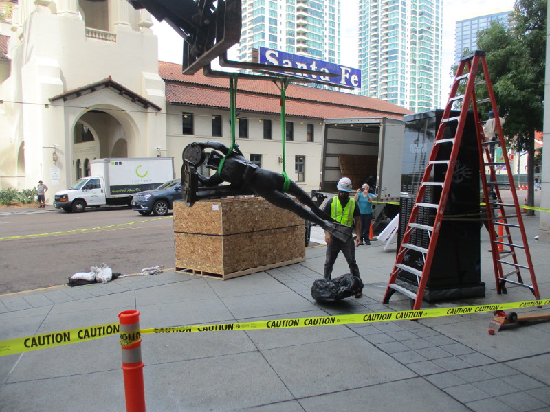
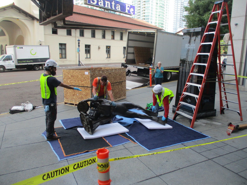
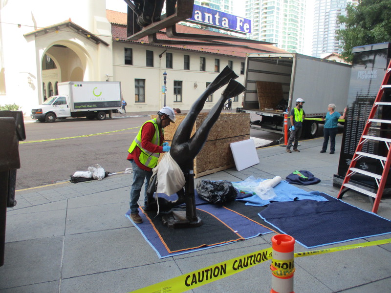
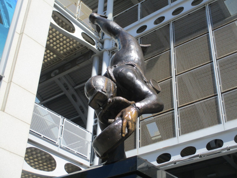
A lifelike bronze statue of a Navy SEAL frogman was installed this morning in downtown San Diego!
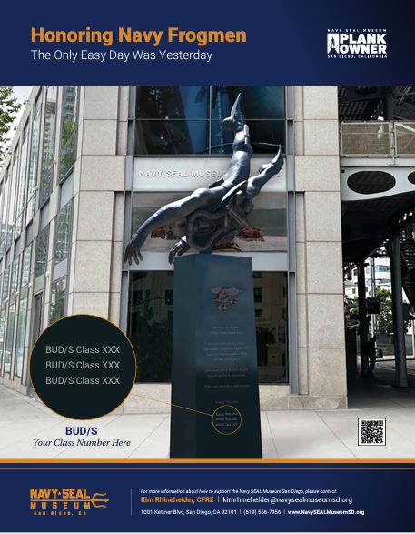
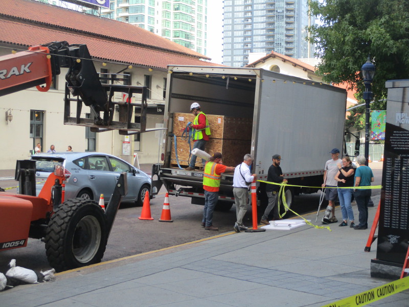
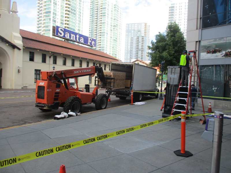
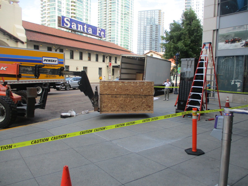
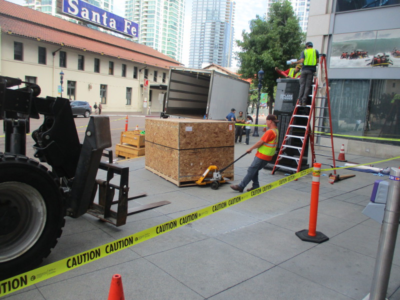
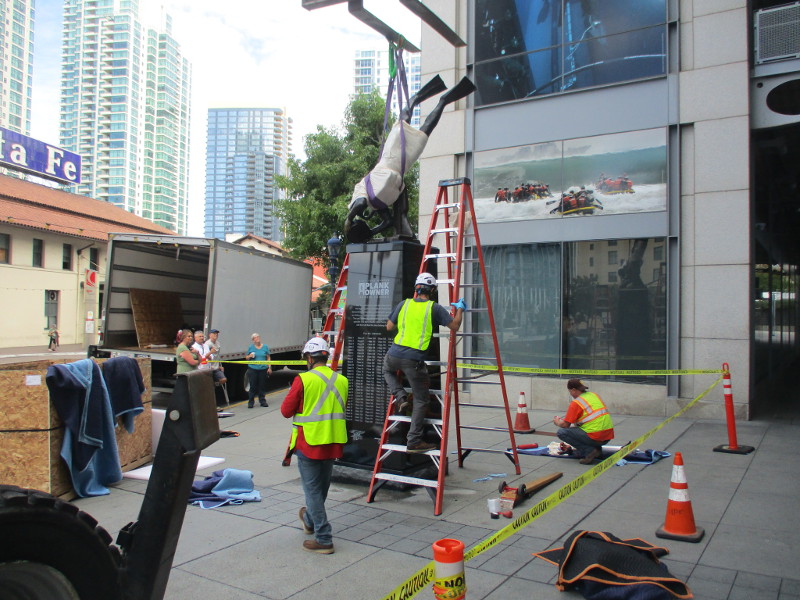
The frogman sculpture arrived by box truck, which parked on Kettner Boulevard near One America Plaza, just outside the future Navy SEAL Museum San Diego. (The museum opens very soon–on October 4, 2025.)
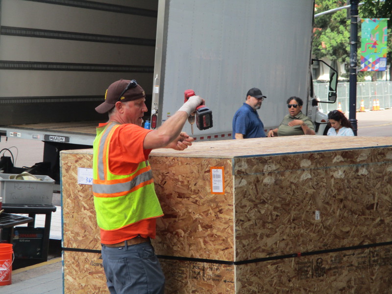
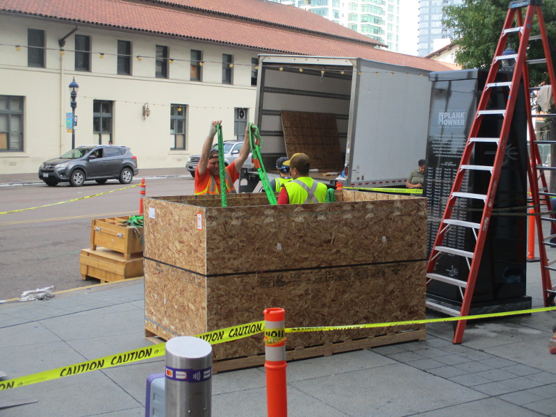
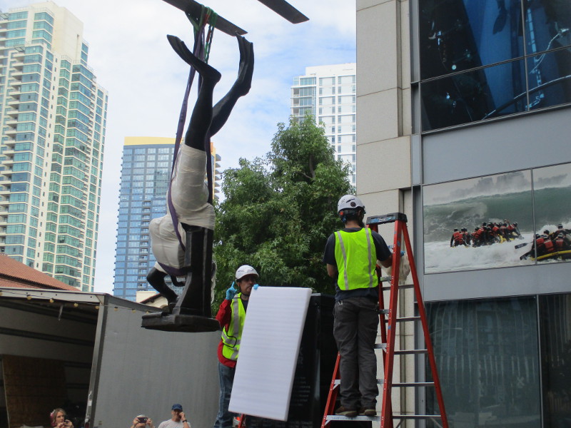
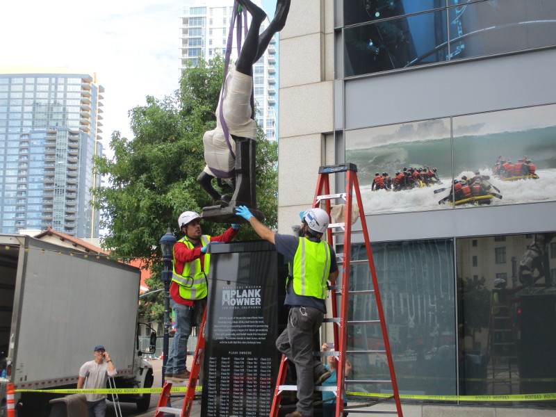
With extreme care, slowly, methodically, the new public art was removed from its crate and elevated to its black marble pedestal, which had been installed outside the museum a few days ago.
I and some bystanders were wondering how exactly the operation would proceed. We watched with great interest, and I snapped a bunch of photos.
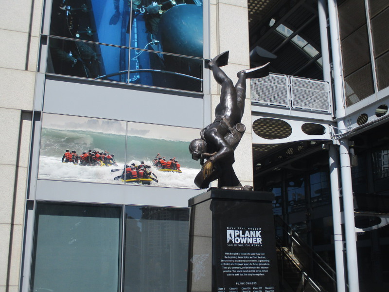
Words engraved on the pedestal explain:
This statue is adapted from the original at the Navy SEAL Museum in Fort Pierce, Florida. It depicts a SEAL placing a limpet mine, an underwater explosive device.
It was designed by master bronze portrait sculptor Lena Toritch, and honors the U.S. Navy SEAL combat diver: a symbol of unwavering courage, stealth, and precision, standing as a testament to their dedication, rigorous training, and selfless service to our nation.
Cleaning the top of the pedestal…
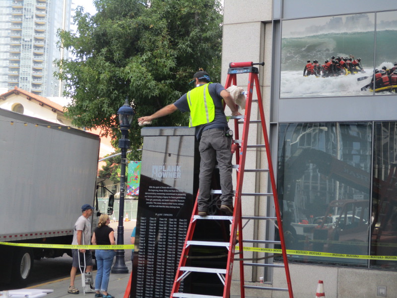
Injecting epoxy into four holes atop the supporting pedestal…

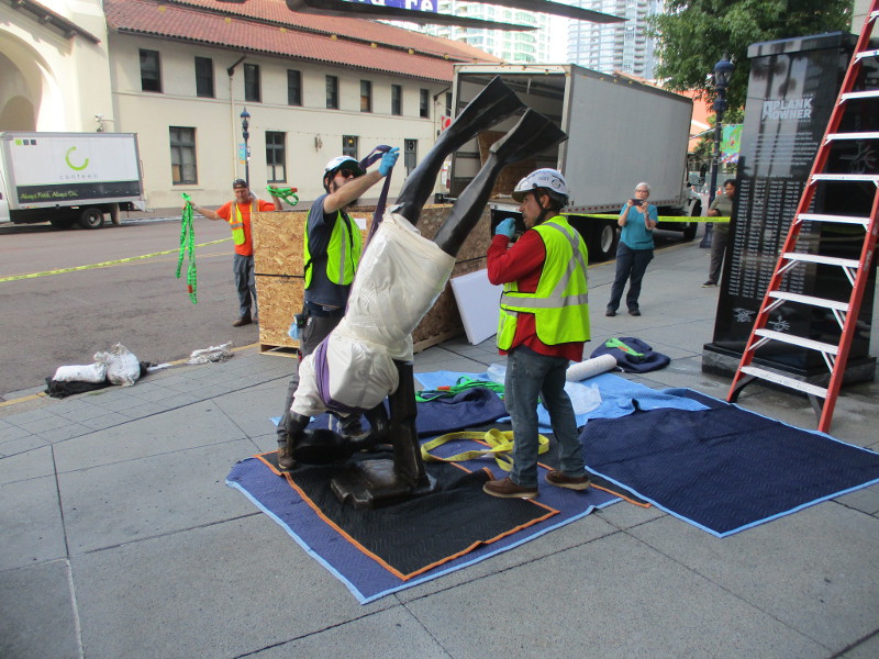
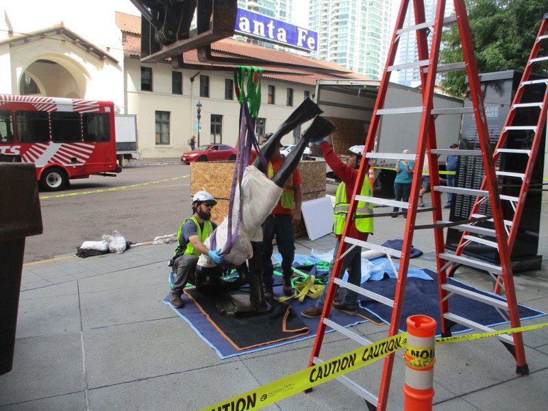
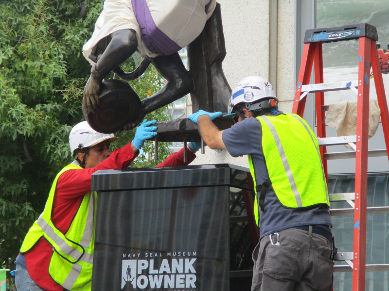
Aha! They’re going to use straps.
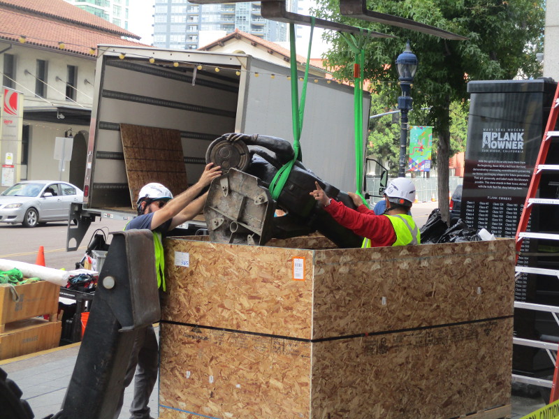
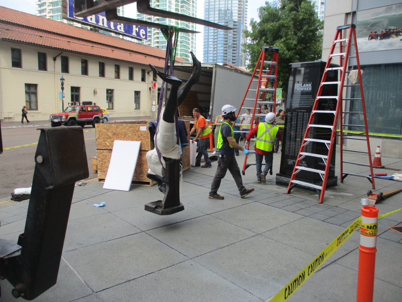
Tilting the diving frogman sculpture upright.

Up it goes!
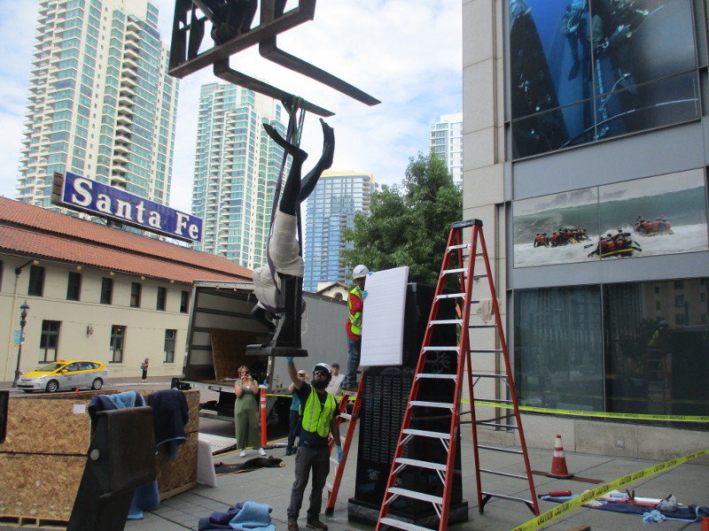
So far, so good!
Centering it…
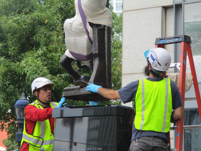
Workers screw in four rods, which will descend into the epoxy-filled holes on top of the pedestal.
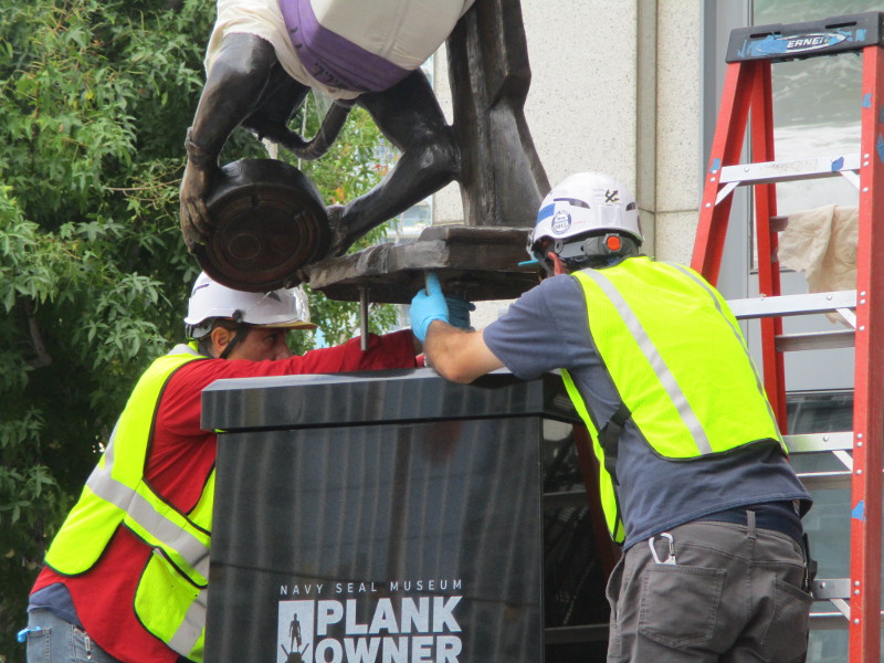
Success!
As I understood it, the statue would remain this way for a while as the epoxy hardened. So I left.
I returned several hours later and found…
…
I post new blogs pretty often. If you like discovering new things, bookmark coolsandiegosights.com and swing on by occasionally!
I live in downtown San Diego and love to walk around with my camera! You can follow Cool San Diego Sights via Facebook or X.
Feel free to share!