Today I headed out to Warner Springs in northern San Diego County. I wanted to experience an authentic stagecoach ride at the historic Warner-Carrillo Ranch House.
I arrived too early, so I drove a few miles further up State Route 79 to the Eagle Rock Trailhead, near the Warner Springs fire station. There I parked under some shady oak trees and began a slow hike south along the Pacific Crest Trail.
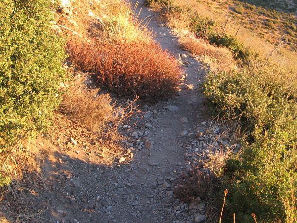
The short (perhaps half mile) segment of the PCT that I walked followed a dry creek bed. It passed through several swinging gates, but I encountered no grazing livestock.
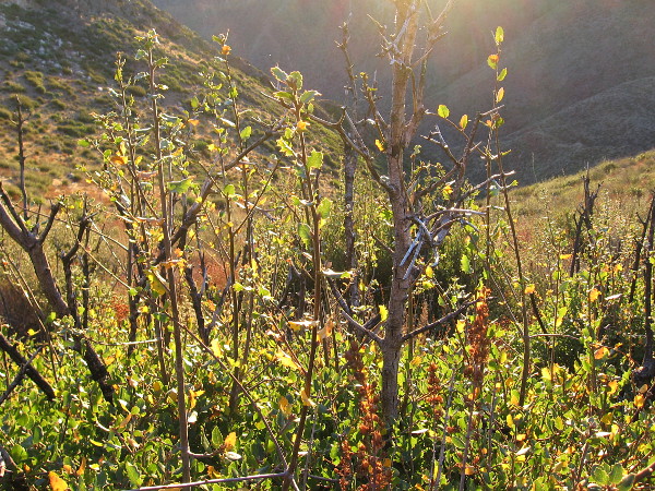
In addition to many ancient oaks, I saw the autumn yellows of a few riparian trees–mostly willows it seemed. A couple sycamores I noticed had lost most of their leaves.
I also spotted interesting rock outcroppings and a distant woodpecker. And only a few hikers.
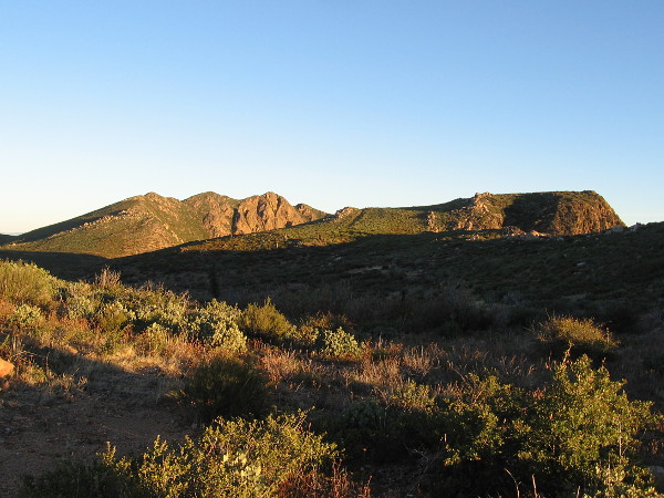
Had I time, I might have continued all the way to Eagle Rock–an impressive outcropping three miles from the trailhead that looks exactly like an bird with spread wings. I’ll do that some other day.
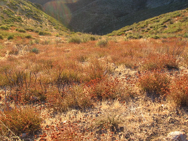
Enjoy these photos of autumn beauty along a very small part of the Pacific Crest Trail…
…
I live in downtown San Diego and love to walk around with my camera! You can follow Cool San Diego Sights via Facebook or Twitter!
The sky turns red and yellow just before sunrise on Mount Laguna. Photo taken at the Storm Canyon Overlook on the Sunrise Highway.
This morning I left downtown San Diego very early and drove an hour east to Mount Laguna. I wanted to see sunrise from a mountaintop.
I began taking photos from the Storm Canyon Overlook a bit north of the Laguna Mountain Lodge and Store. Breathtaking views of the desert below can be enjoyed at various points along the Sunrise Highway.
I then drove a short distance farther north to the Penny Pines Trailhead, parked, and hiked about a mile and a half northward along the Pacific Crest Trail. I didn’t go all the way to Garnet Peak, because the sun came to me!
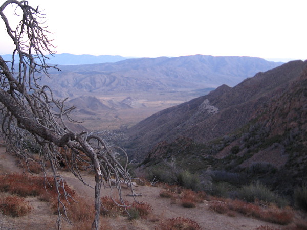
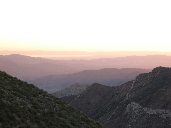
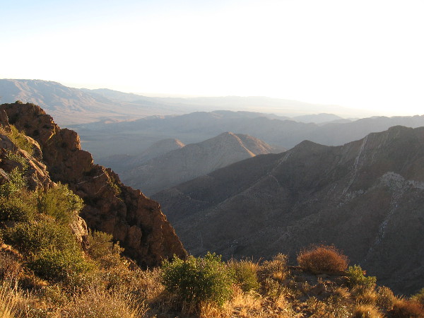
Looking down toward a section of Anza-Borrego Desert State Park northeast of the beautiful Laguna Mountains, which rise to around 6000 feet in San Diego County.
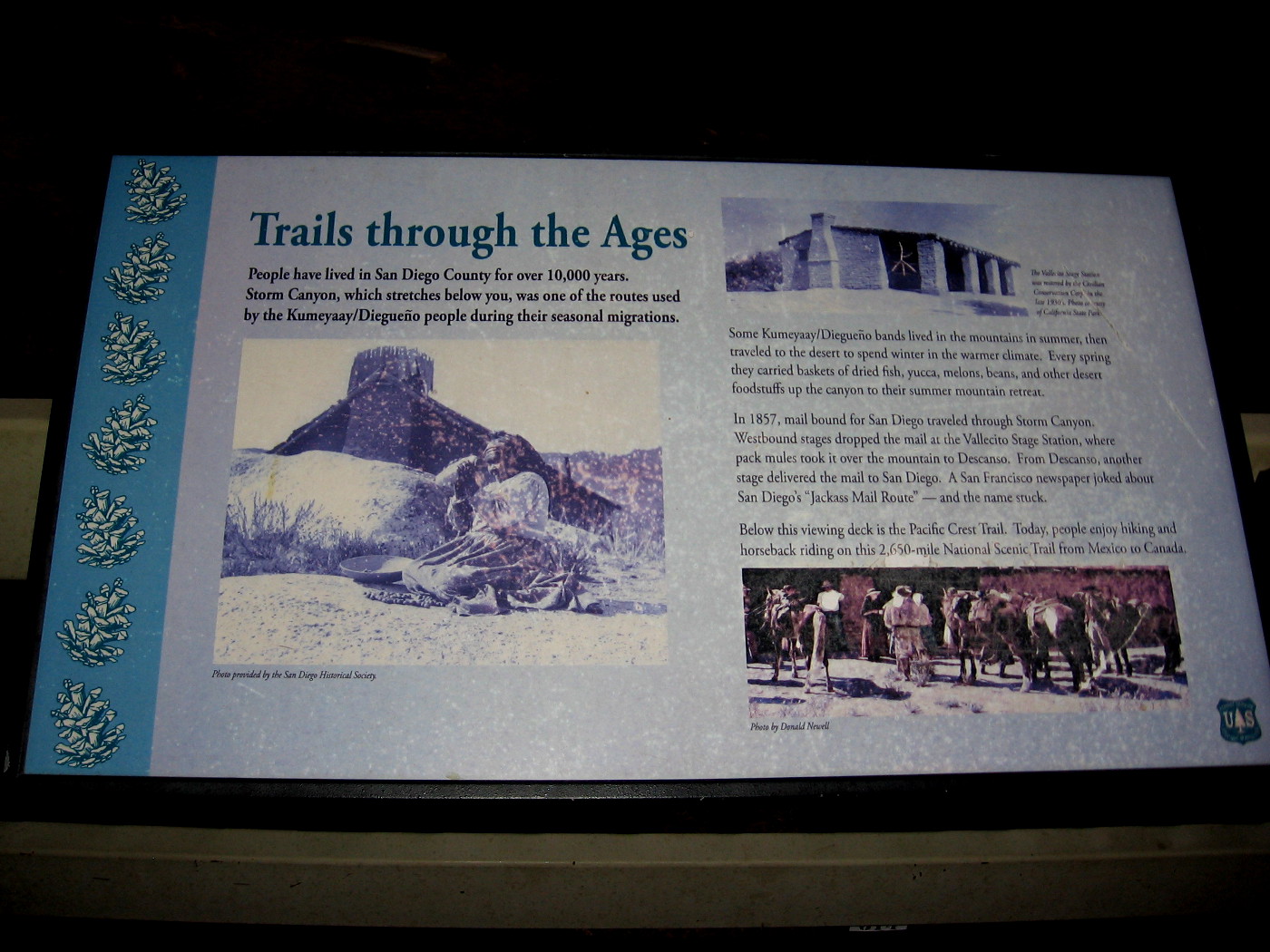
Sign at the overlook explains Trails Through the Ages. Storm Canyon below was used by the Native American Kumeyaay for thousands of years for seasonal migrations. (Click photo to enlarge for easy reading.)
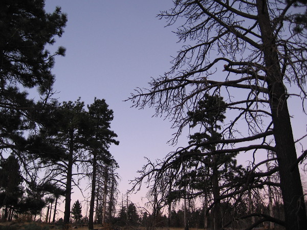
Trees west of the Storm Canyon Overlook are still a bit dark before sunrise.
I’ve started hiking toward the Pacific Crest Trail from the Penny Pines Trailhead. The eastern sky is slowly brightening.
A slightly chilly early November morning in the Cleveland National Forest near the top of Mount Laguna.
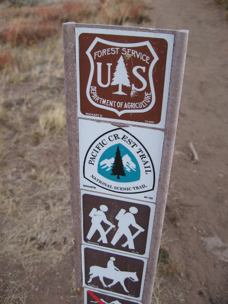
I’m now heading north along the Pacific Crest Trail, which stretches 2,650 miles from Mexico to Canada. I’ll go about a mile and a half toward Garnet Peak before turning around. Sunrise is imminent.
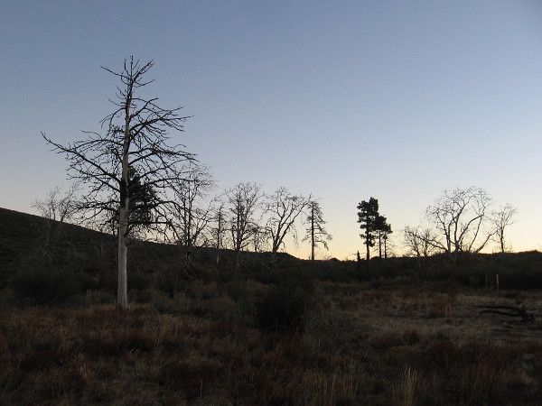
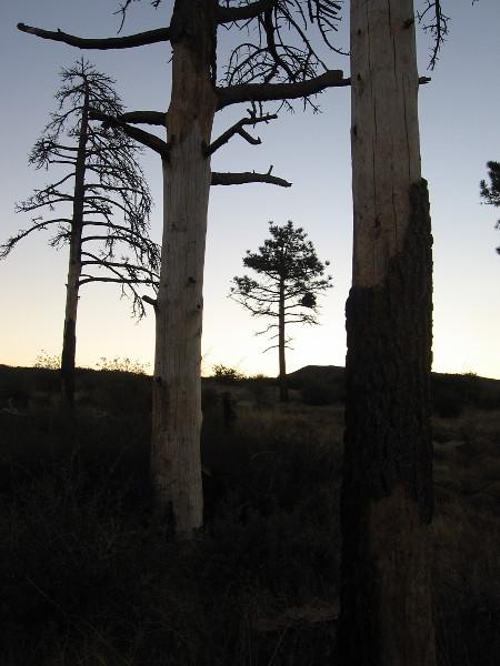
Many of the trees in the Penny Pines grove have died due to an ongoing bark beetle infestation. The recent drought caused many trees in the Cleveland National Forest to struggle, too.
Looking roughly northeast as color creeps over the desert contours below.
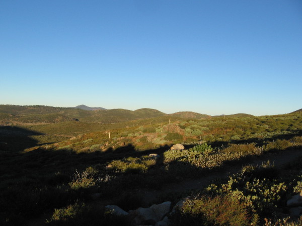
Miles of beauty, to the horizon.
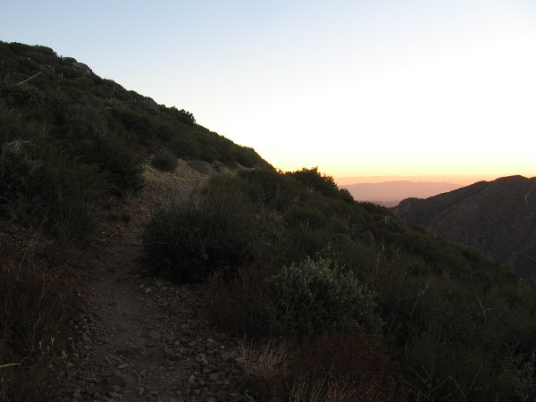
The trail here is still in shadow. Not for long…
Early sunlight touches a rocky rise.
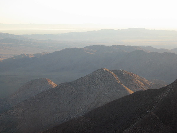
That shiny strip in the distance is light reflecting from the inland Salton Sea.
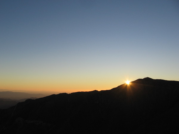
The sun is about to clear a rocky desert mountain.
The sun appears.
Sudden morning light brightens vegetation beside the rough trail.
The sunshine is warm. I will soon have to remove my light jacket. Even though it is late November, the dry air from the desert is very pleasant.
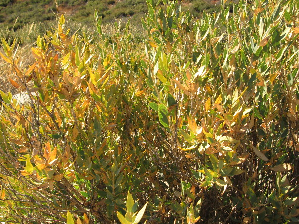
Slanting sunlight on small leaves.
Looking down into a small canyon beneath the trail that descends toward the desert.
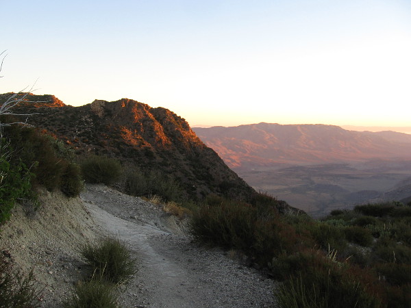
I’m rounding a corner, approaching a light-splashed peak.
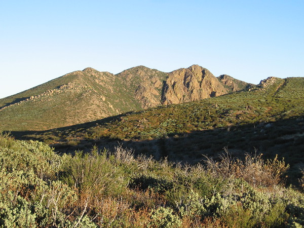
Garnet Peak, on the left, rises into the morning sunlight. A short trail leads to its summit from the Pacific Crest Trail.
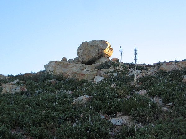
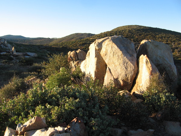
Light on one side of a boulder above me.
A beautiful view. I encountered nobody else on the trail this morning. Perhaps because today is Thanksgiving.
I am thankful that I could pause for a moment and enjoy this.
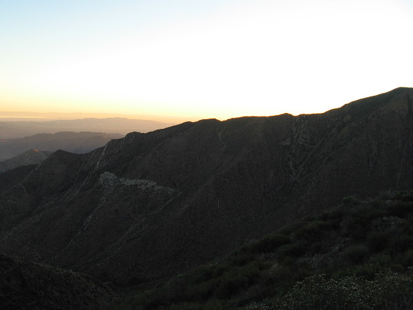
New light all around.
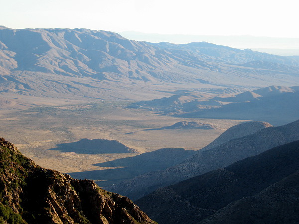
The dry contours of one section of Anza-Borrego State Park become more apparent. I believe the bulky mountain on the left is Whale Peak.
Looking east, shadows are retreating from fresh mountain green.
Looking south, bright light on a broken boulder.
Leaves feed on sunshine.
I’m now headed back south toward the Penny Pines Trailhead. One last look north at Garnet Peak in full daylight.
…
I live in downtown San Diego and love to walk around with my camera! Occasionally, when I get the itch, I travel to more distant parts of San Diego County. You can follow Cool San Diego Sights via Facebook or Twitter!
You can easily explore Cool San Diego Sights by using the search box on my blog’s sidebar. Or click a tag! There are thousands upon thousands of photos for you to enjoy!