Today I headed out to Warner Springs in northern San Diego County. I wanted to experience an authentic stagecoach ride at the historic Warner-Carrillo Ranch House.
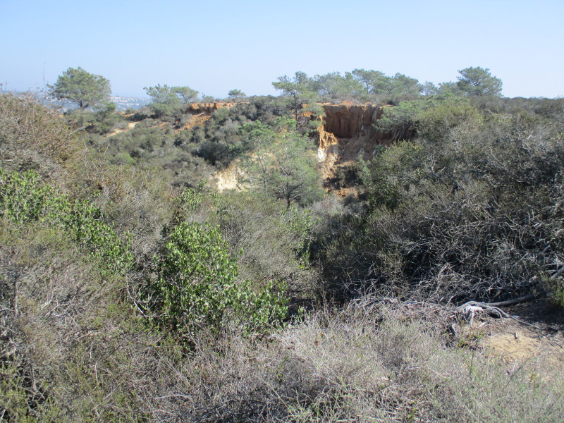
I arrived too early, so I drove a few miles further up State Route 79 to the Eagle Rock Trailhead, near the Warner Springs fire station. There I parked under some shady oak trees and began a slow hike south along the Pacific Crest Trail.
The short (perhaps half mile) segment of the PCT that I walked followed a dry creek bed. It passed through several swinging gates, but I encountered no grazing livestock.
In addition to many ancient oaks, I saw the autumn yellows of a few riparian trees–mostly willows it seemed. A couple sycamores I noticed had lost most of their leaves.
I also spotted interesting rock outcroppings and a distant woodpecker. And only a few hikers.
Had I time, I might have continued all the way to Eagle Rock–an impressive outcropping three miles from the trailhead that looks exactly like an bird with spread wings. I’ll do that some other day.
Enjoy these photos of autumn beauty along a very small part of the Pacific Crest Trail…
…
I live in downtown San Diego and love to walk around with my camera! You can follow Cool San Diego Sights via Facebook or Twitter!
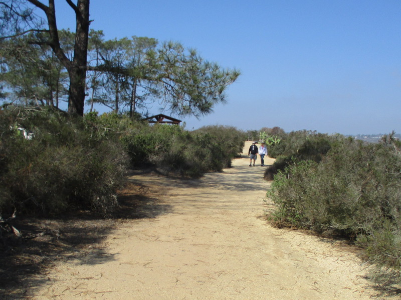
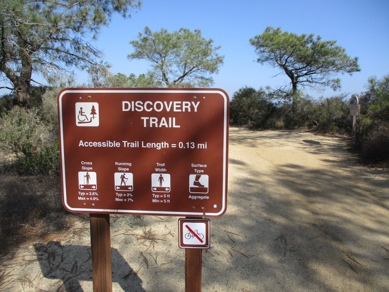
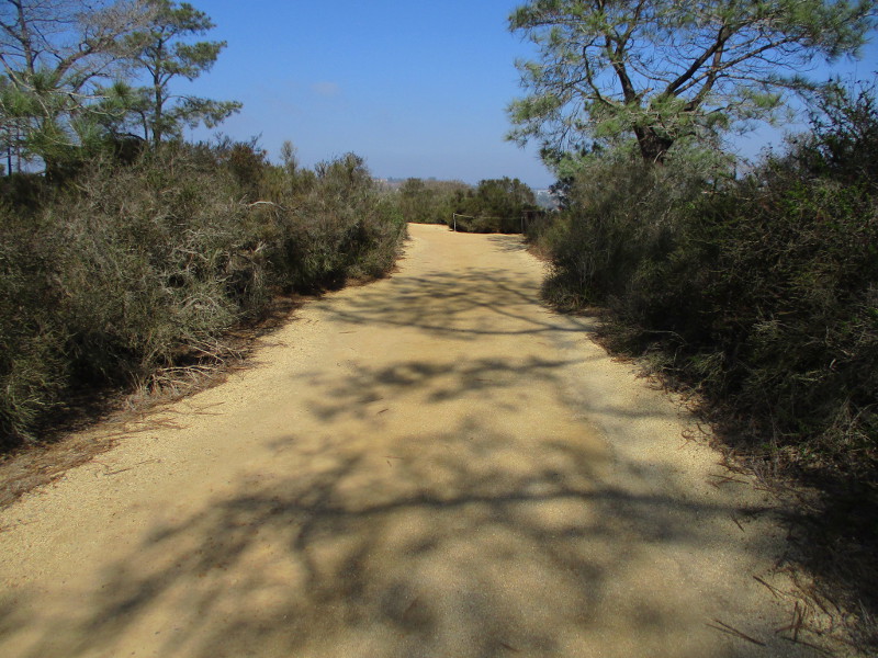
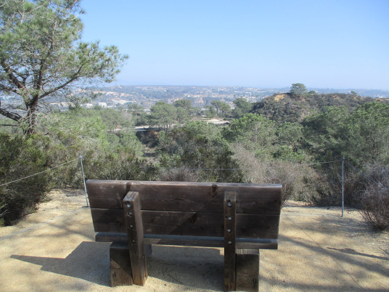
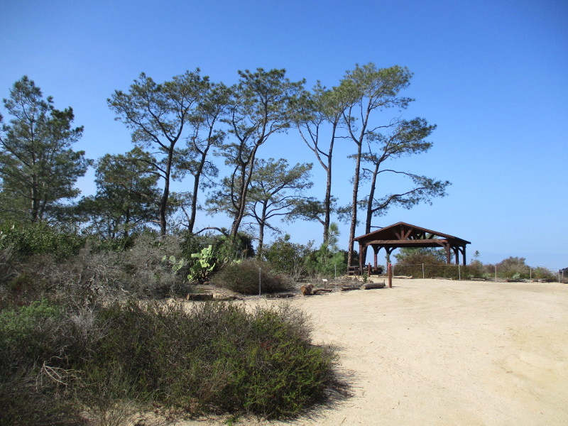
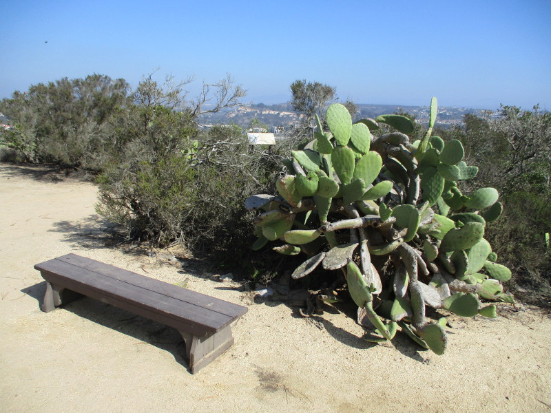
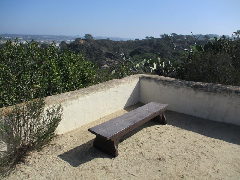
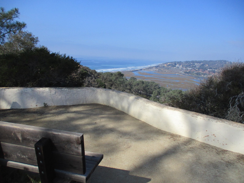
The very easy Discovery Trail at Torrey Pines State Natural Reserve is a fine place to walk or sit on a bench, while drinking in nature’s beauty.
The short .13 mile highly accessible trail follows the edge of a bluff just east of the historic Lodge (the park’s Visitor Center) and its parking lot.
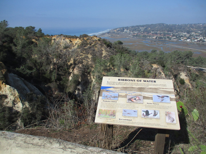
There are scenic overlooks with views of Carmel Valley, Los Peñasquitos Lagoon and even the Pacific Ocean. Signs describe many of the natural marvels around you. Native plants along the way are identified with information plaques.
Last weekend I slowly walked north along the Discovery Trail.
I began at Torrey Pines Park Road across from the Beach Trailhead parking lot. That’s where I saw the sign pictured below. I then headed north until I reached the rear of the old Lodge.
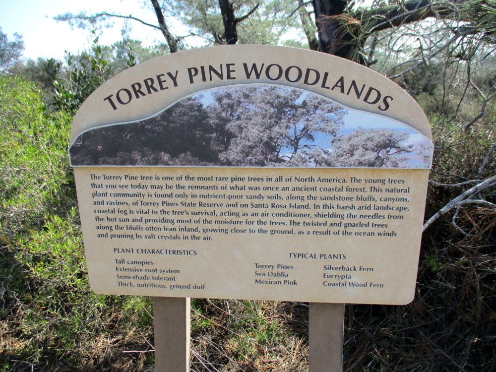
TORREY PINE WOODLANDS. The Torrey Pine tree is one of the most rare pine trees in all of North America. The young trees that you see today may be the remnants of what was once an ancient coastal forest. This natural plant community is found only in nutrient-poor sandy soils, along the sandstone bluffs, canyons, and ravines of Torrey Pines State Reserve and on Santa Rosa Island…
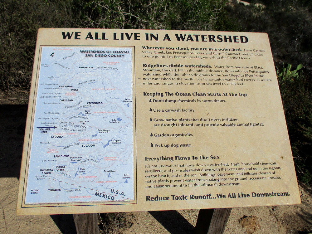
Wherever you stand, you are in a watershed. Here Carmel Valley Creek, Los Peñasquitos Creek and Carroll Canyon Creek all drain to one point: Los Peñasquitos Lagoon’s exit to the Pacific Ocean…
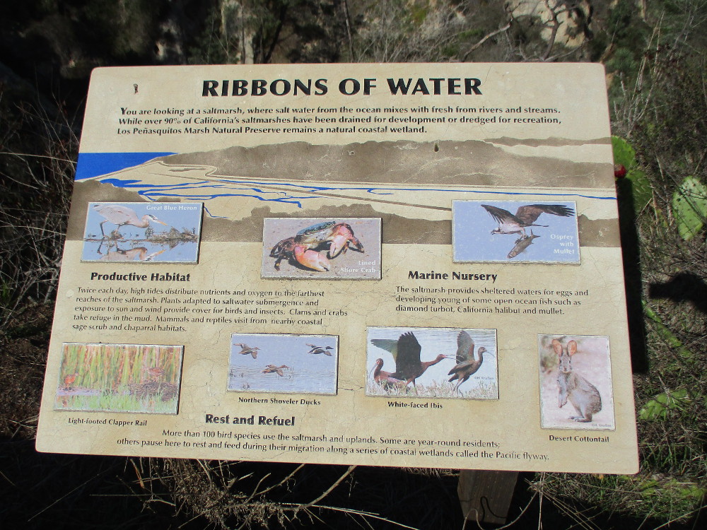
You are looking at a saltmarsh, where salt water from the ocean mixes with fresh from rivers and streams…Los Peñasquitos Marsh Natural Preserve remains a natural coastal wetland.
…
I live in downtown San Diego and love to walk around with my camera! You can follow Cool San Diego Sights via Facebook or Twitter!
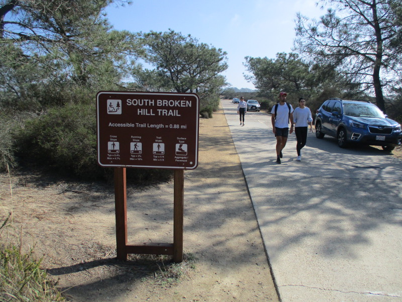
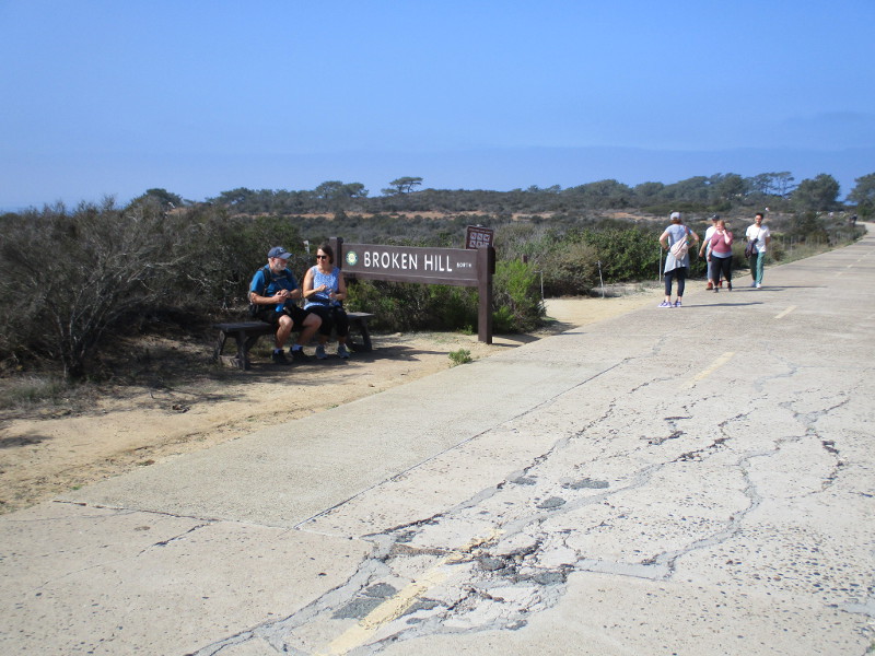
Explore the south end of Torrey Pines Park Road at Torrey Pines State Natural Reserve and you’ll discover breathtaking beauty and fascinating history.
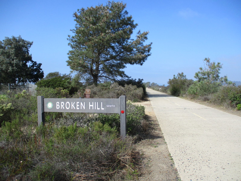
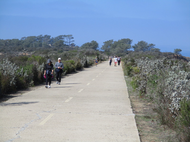
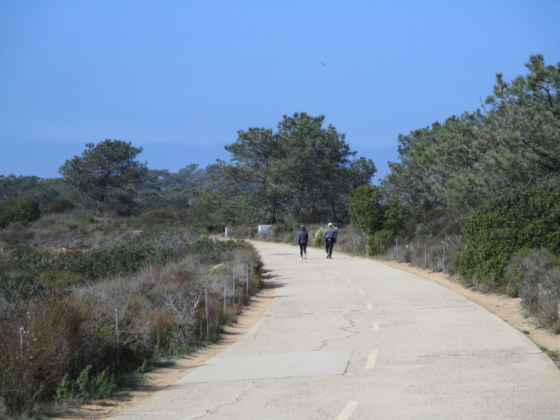
Last weekend I walked north along the paved trail, which a century ago was part of the main road from San Diego to Los Angeles. The following photographs begin near Torrey Pines Golf Course and end just short of the Visitor Center at Torrey Pines State Reserve’s old Lodge. The historic road, closed to vehicle traffic, is how hikers access Broken Hill Trail, which winds through a rugged landscape down to the beach.
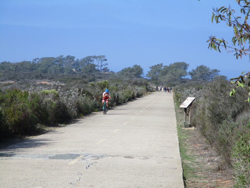
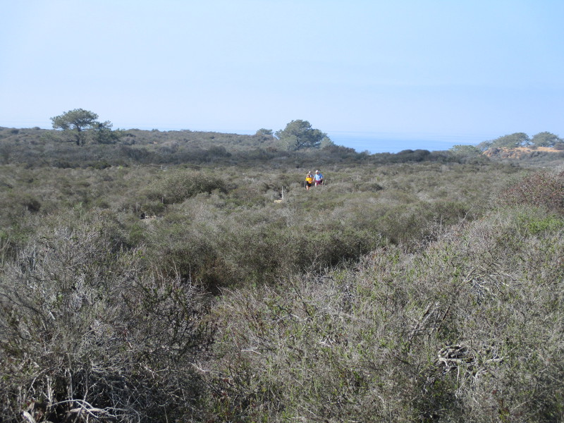
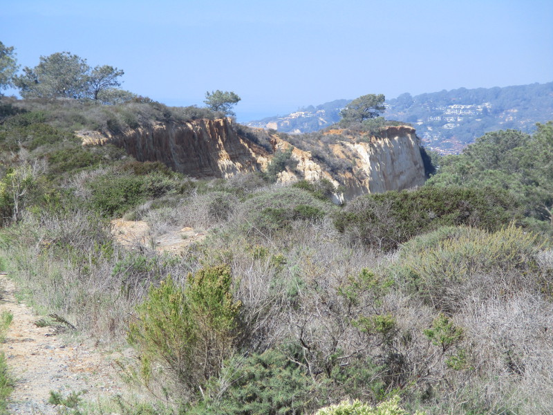
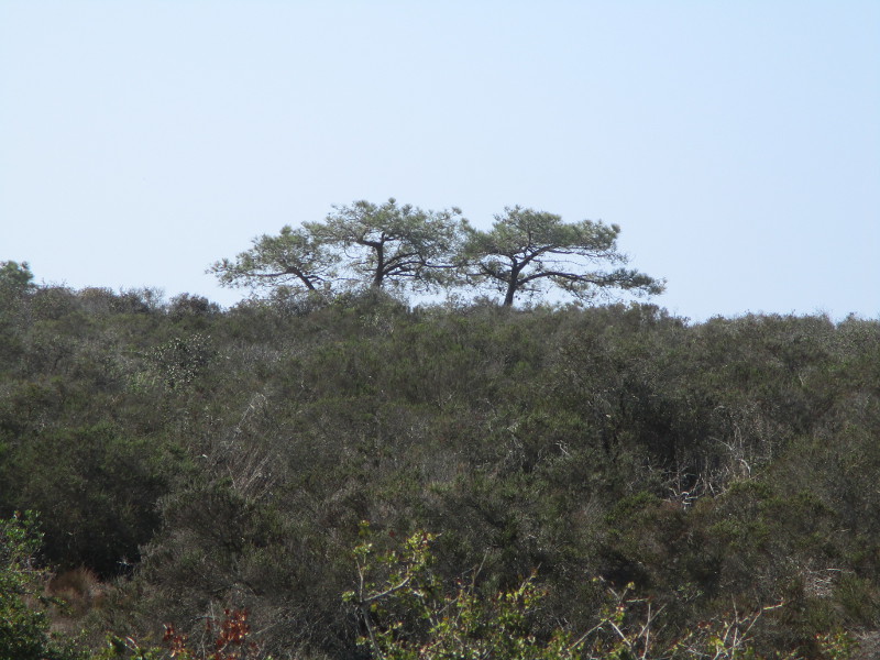
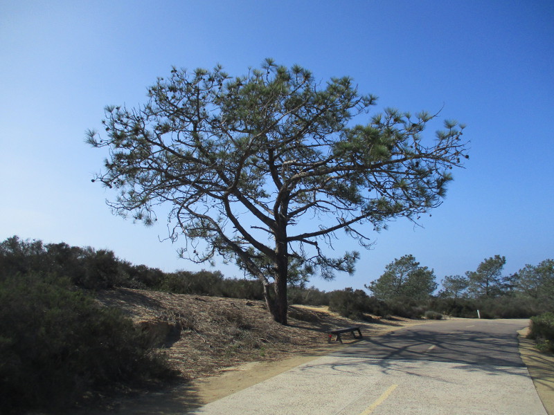
In my photos you’ll see native coastal sage scrub and chaparral plants, rare Torrey pine trees, the Pacific Ocean in the distance to the west and sandstone cliffs overlooking North Torrey Pines Road to the east. Signs along the way speak of the history of this place.
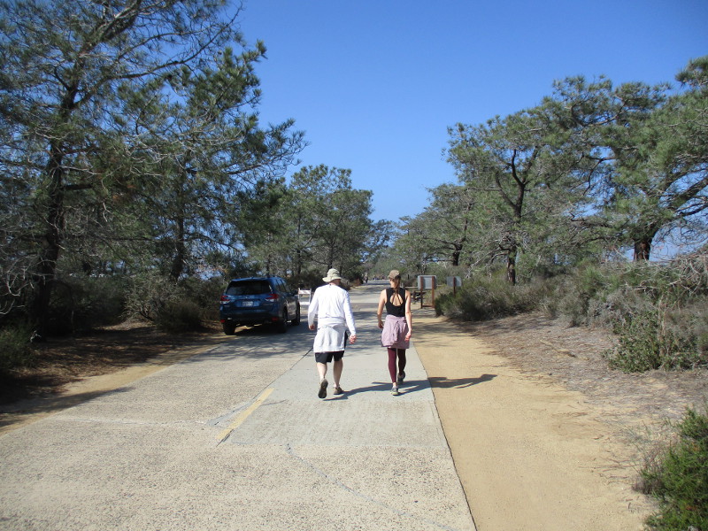
Come along as I walk down old Torrey Pines Park Road on a sunny November day!
Other walkers and bicyclists were also enjoying a fun adventure.
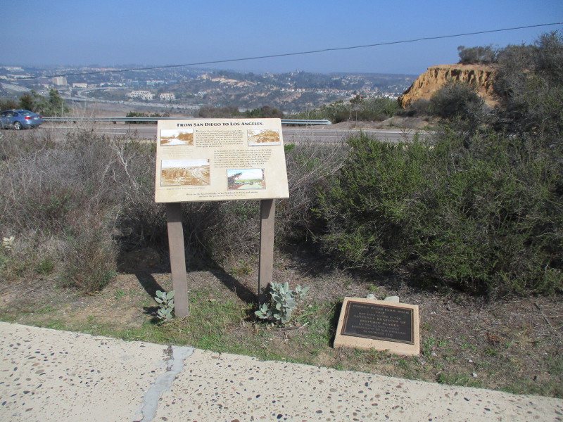
To the east beyond an information sign and historical marker one can see North Torrey Pines Road, Carmel Valley and Interstate 5.
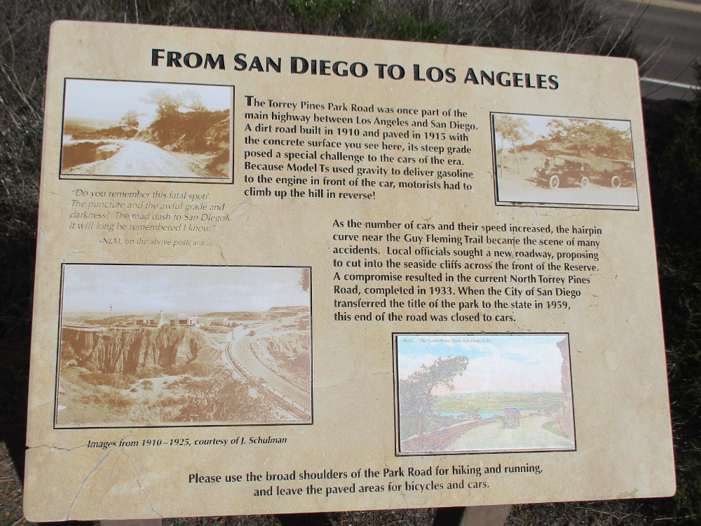
FROM SAN DIEGO TO LOS ANGELES
The Torrey Pines Park Road was once part of the main highway between Los Angeles and San Diego. A dirt road built in 1910 and paved in 1915 with the concrete surface you see here, its steep grade posed a special challenge to the cars of the era. Because Model Ts used gravity to deliver gasoline to the engine in front of the car, motorists had to climb up the hill in reverse.
As the number of cars and their speed increased, the hairpin curve near the Guy Fleming Trail became the scene of many accidents. Local officials sought a new roadway, proposing to cut into the seaside cliffs across the front of the Reserve. A compromise resulted in the current North Torrey Pines Road, completed in 1933. When the City of San Diego transferred the title of the park to the state in 1959, this end of the road was closed to cars.
The steep hill and its hairpin curves mentioned in the sign are north of the Lodge, beyond this particular walk. Cars entering the park still use it.
If you’d like to see past photos of the Guy Fleming Trail which is also referenced in the sign, click here!
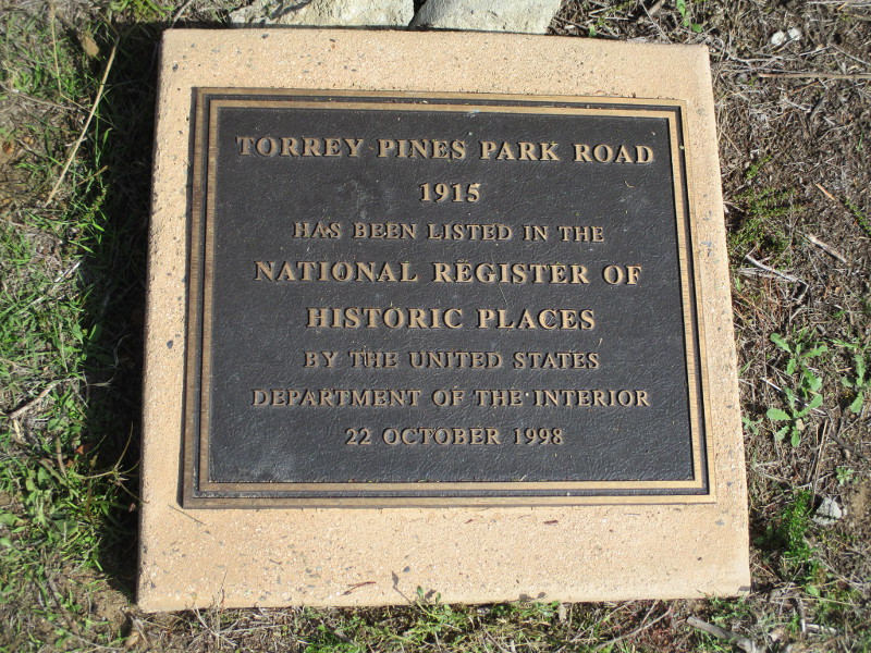
TORREY PINES PARK ROAD
1915
HAS BEEN LISTED IN THE NATIONAL REGISTER OF HISTORIC PLACES BY THE UNITED STATES DEPARTMENT OF THE INTERIOR
22 OCTOBER 1998
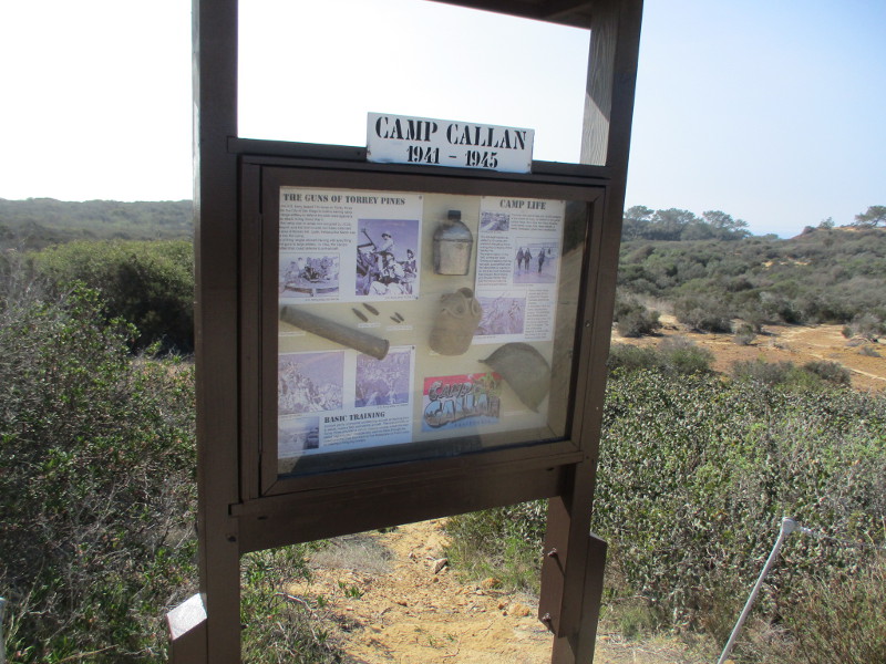
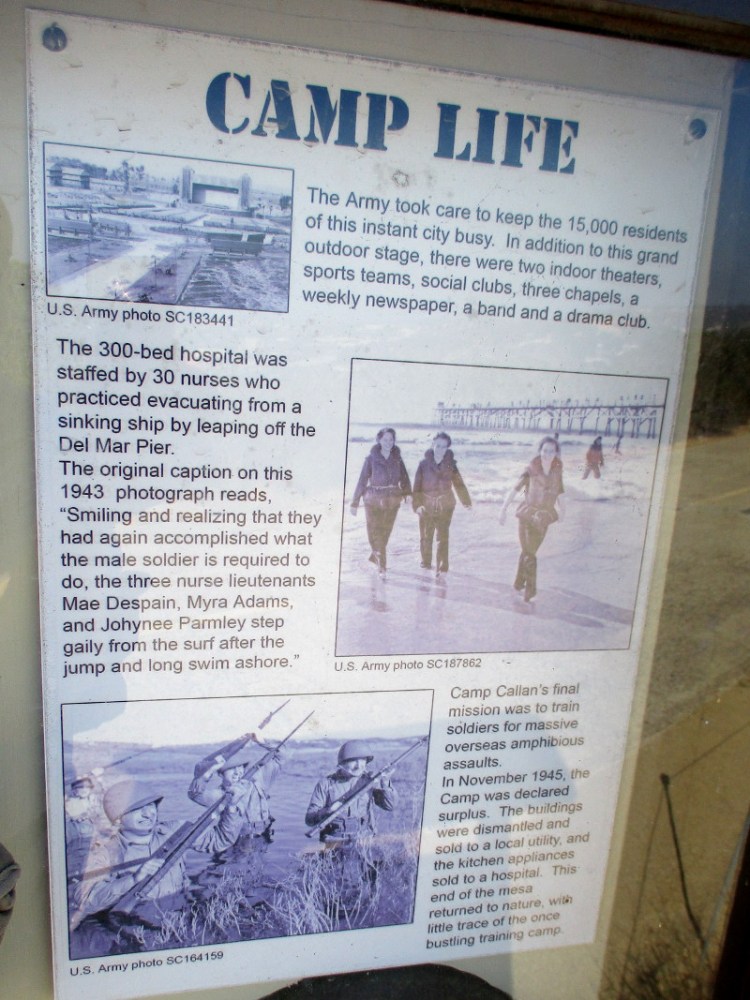
Hikers explore nature’s beauty.The North Fork Trailhead leads west to the Broken Hill Trail.Picturesque sandstone cliffs overlook North Torrey Pines Road (not visible) to the east.A sign details the history of Camp Callan, which was located here from 1941 to 1945.
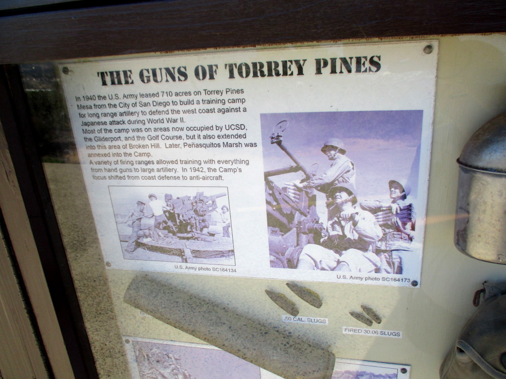
THE GUNS OF TORREY PINES
In 1940 the U.S. Army leased 710 acres on Torrey Pines Mesa from the City of San Diego to build a training camp for long range artillery to defend the west coast against a Japanese attack during World War II. Most of the camp was on areas now occupied by UCSD, the Gliderport, and the Golf Course, but it also extended into the area of Broken Hill. Later, Penasquitos Marsh was annexed into the Camp. A variety of firing ranges allowed training with everything from hand guns to large artillery. In 1942, the Camp’s focus shifted from coast defense to anti-aircraft.
CAMP LIFE
The Army took care to keep the 15,000 residents of this instant city busy. In addition to this grand outdoor stage, there were two indoor theaters, sports teams, social clubs, three chapels, a weekly newspaper, a band and a drama club.
The 300-bed hospital was staffed by 30 nurses who practiced evacuating from a sinking ship by leaping off the Del Mar Pier. The original caption on the 1943 photograph reads, “Smiling and realizing that they had again accomplished what the male soldier is required to do, the three nurse lieutenants Mae Despain, Myra Adams, and Johynee Parmley step gaily from the surf after the jump and long swim ashore.”
Camp Callan’s final mission was to train soldiers for massive overseas amphibious assaults. In November 1945, the Camp was declared surplus. The buildings were dismantled and sold to a local utility, and the kitchen appliances sold to a hospital. This end of the mesa returned to nature, with little trace of the once bustling training camp.
A postcard. Greetings from CAMP CALLAN CALIFORNIA.Torrey pine trees in the distance.More eroded sandstone to the east.Approaching a small parking lot at the Beach Trailhead near The Lodge.
…
This blog now features thousands of photos around San Diego! Are you curious? There’s lots of cool stuff to check out!
Here’s the Cool San Diego Sights main page, where you can read the most current blog posts. If you’re using a phone or small mobile device, click those three parallel lines up at the top–that opens up my website’s sidebar, where you’ll see the most popular posts, a search box, and more!
To enjoy future posts, you can also “like” Cool San Diego Sights on Facebook or follow me on Twitter.
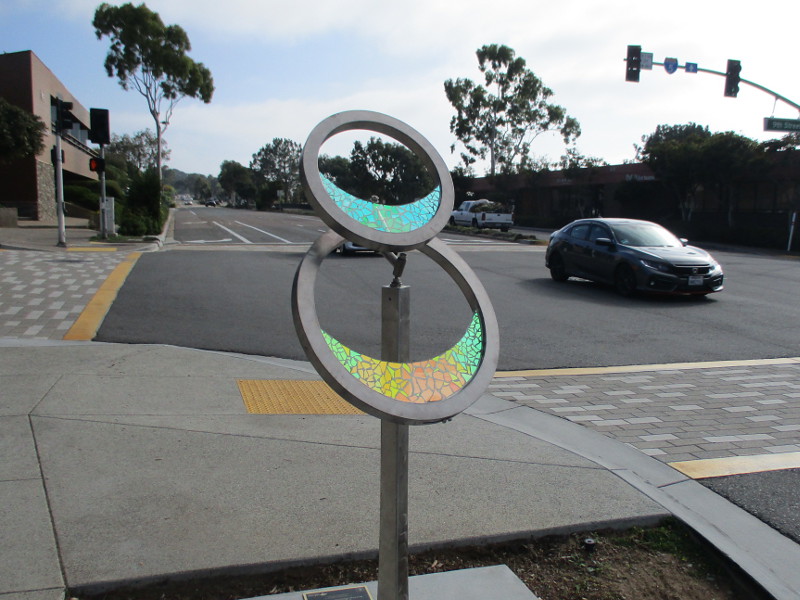
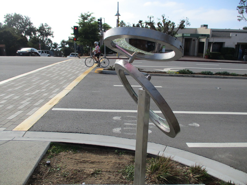
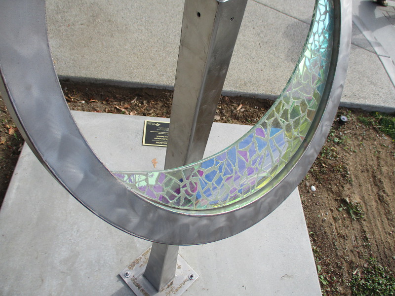
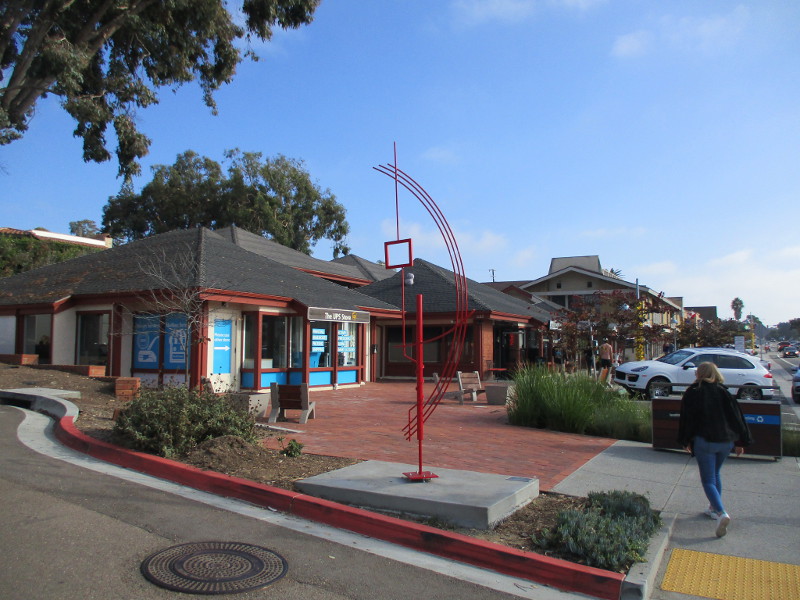
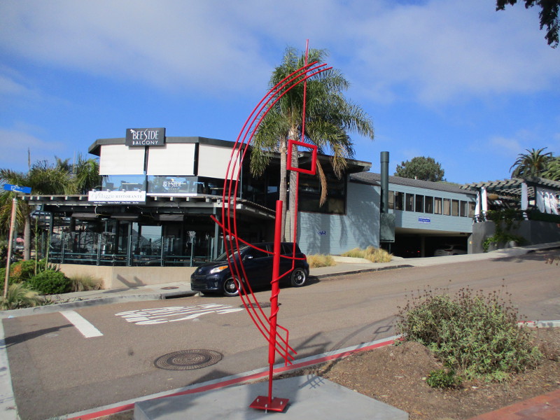
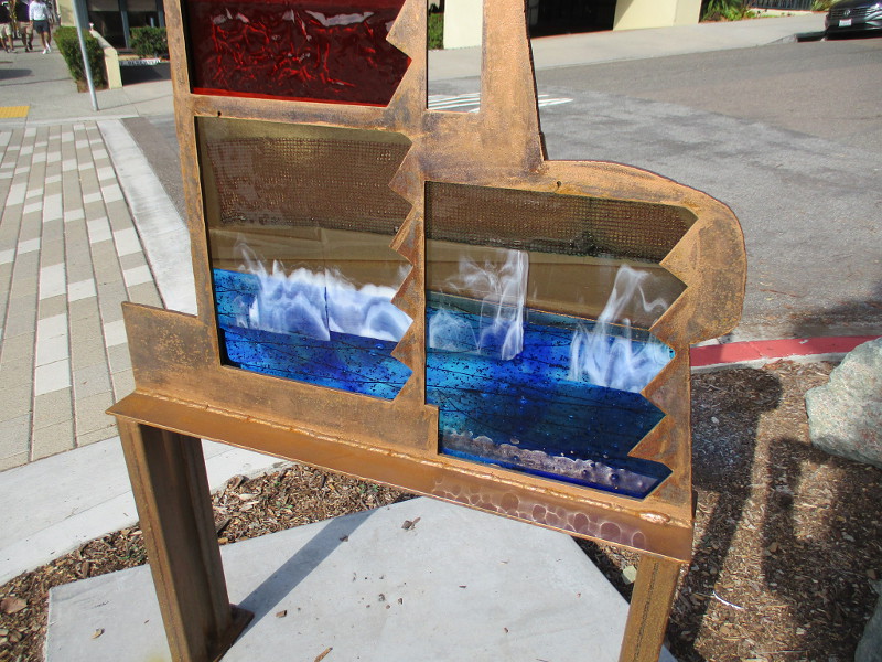
Five eye-catching works of public art recently debuted in Del Mar! They are part of a City of Del Mar Temporary Outdoor Sculpture Exhibit.
These new pieces join a couple of other interesting sculptures along Camino Del Mar that I photographed previously here and here.
During a leisurely “art walk” through Del Mar Village yesterday I captured the following images…
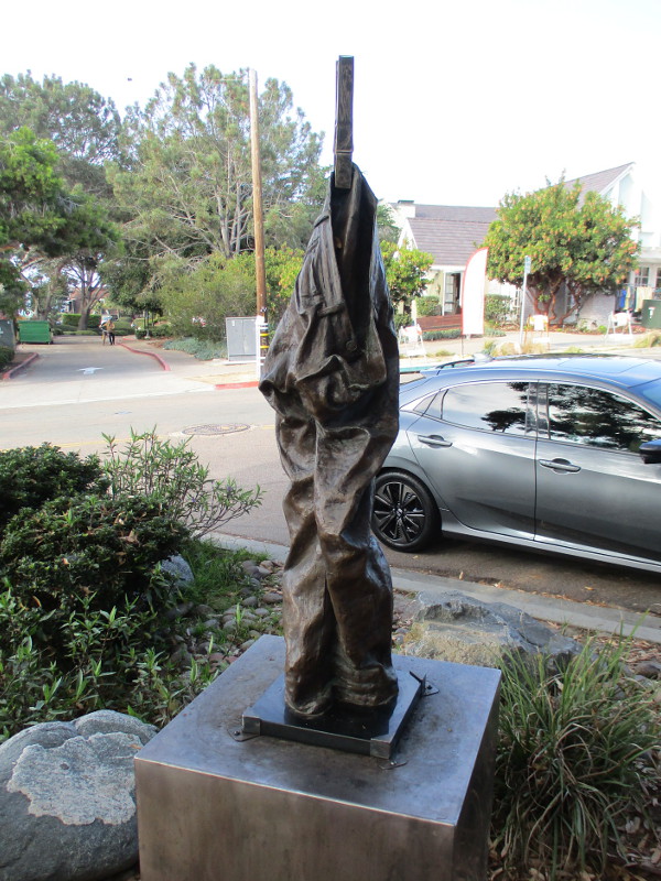
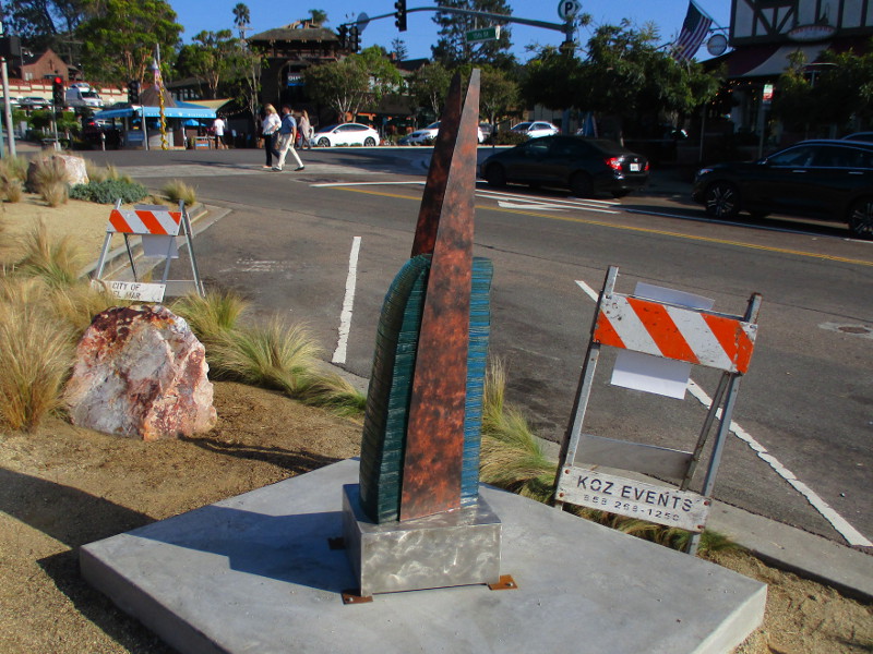
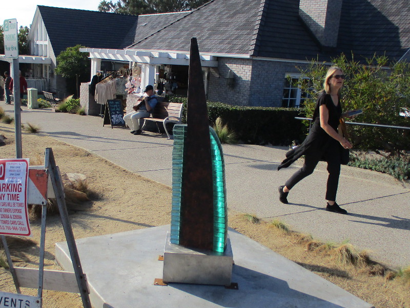
Moonshadow, by artists Jeffery Laudenslager and Deanne Sabeck. Stainless steel, titanium and dichroic glass mosaic. At Camino Del Mar and 9th Street.Terpsichore, by artist David Beck Brown. Monochrome steel, paint. At Camino Del Mar and 12th Street.Bird’s Eye View of Torrey Pines Beach, by artists Robert Petrello and Drew Graham. Fused glass, copper and raw metal with rubbed bronze finish. At Camino Del Mar and 14th Street.Hanging Out #3, by artist Maidy Morhous. Bronze on stainless steel pedestal. At 15th Street and Stratford Court.Pasaje a lo Infinito, by artist Hugo Heredia. Fused glass, fabricated stainless steel and fabricated steel. Just west of Camino Del Mar on 15th Street.
…
I live in downtown San Diego and love to walk around with my camera! You can follow Cool San Diego Sights via Facebook or Twitter!
You can easily explore Cool San Diego Sights by using the search box on my blog’s sidebar. Or click a tag! There are thousands upon thousands of photos for you to enjoy!
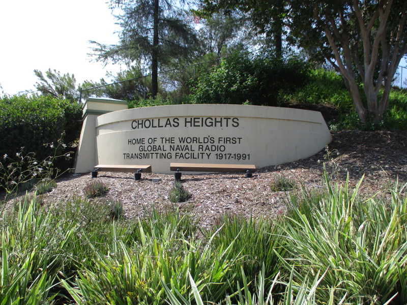
For over seventy-five years, the tallest structures that have ever been built in San Diego County stood atop a hill in Chollas Heights, four miles east of downtown San Diego. Three enormous towers marked the location of U.S. Naval Radio Transmitting Facility Chollas Heights, which operated the most powerful radio transmitter in North America.
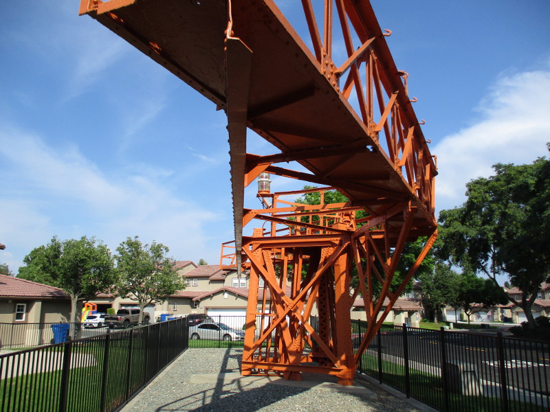
A monument to these historically important towers can be viewed today at Lincoln Military Housing, across the street from the small Chollas Heights Naval Radio Transmitting Facility Museum, near the corner of College Grove Way and Transmitter Road.
The unusual monument is in fact a remnant of the old Navy communication station–an antenna that once was suspended 600 feet above ground.
While many San Diego residents saw three tall radio towers rising just north of Chollas Lake, their historical importance is less widely known. This is where the mainland United States received the first news of the attack on Pearl Harbor on December 7, 1941.
The U.S. Naval Radio Transmitting Facility Chollas Heights was purposely built beside Chollas Lake so that its water might cool the heated transmitter tubes.
Chollas Heights. Home of the world’s first global naval radio transmitting facility. 1917-1991.
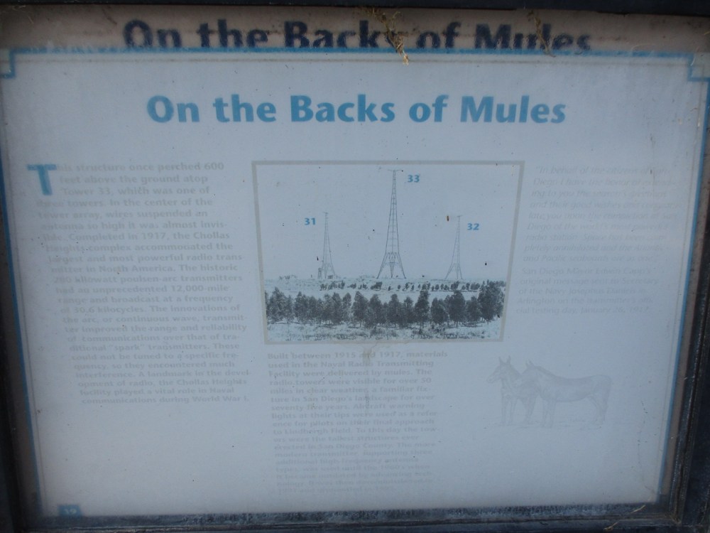
A small, very badly faded sign in front of the old antenna provides interesting information. I’ve transcribed the words:
This structure once perched 600 feet above the ground atop Tower 33, which was one of three towers. In the center of the tower array, wires suspended an antenna so high it was almost invisible. Completed in 1917, the Chollas Heights complex accommodated the largest and most powerful radio transmitter in North America. The historic 200 kilowatt poulsen-arc transmitters had an unprecedented 12,000-mile range and broadcast at a frequency of 30.6 kilocycles. The innovations of the arc, or continuous wave, transmitter improved the range and reliability of communications over that of traditional “spark” transmitters. These could not be tuned to a specific frequency, so they encountered much interference. A landmark in the development of radio, the Chollas Heights facility played a vital role in Naval communications during World War I.
Built between 1915 and 1917, materials used in the Naval Radio Transmitting Facility were delivered by mules. The radio towers were visible for over 50 miles in clear weather, a familiar fixture in San Diego’s landscape for over seventy five years. Aircraft warning lights at their tips were used as a reference for pilots on their final approach to Lindbergh Field. To this day the towers were the tallest structures ever erected in San Diego County. The more modern transmitter, supporting three additional high-frequency antenna types, was used until the 1960’s, when it became outdated by advancing technology. It was then decommissioned in 1991 and dismantled in 1995.
“In behalf of the citizens of San Diego I have the honor of extending to you the season’s greetings and their good wishes and congratulate you upon the completion at San Diego of the world’s most powerful radio station. Space has been completely annihilated and the Atlantic and Pacific seaboards are as one.”
San Diego Mayor Edwin Capp’s original message sent to Secretary of the Navy Josephus Daniels in Arlington on the transmitter’s official testing day, January 26, 1917.
…
I live in downtown San Diego and love to walk around with my camera! You can follow Cool San Diego Sights via Facebook or Twitter!
You can easily explore Cool San Diego Sights by using the search box on my blog’s sidebar. Or click a tag! There are thousands upon thousands of photos for you to enjoy!
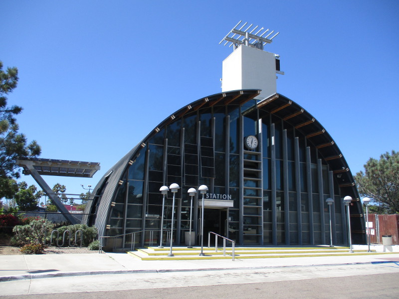
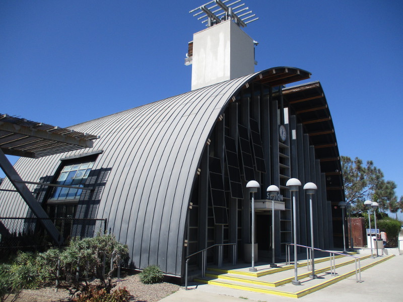
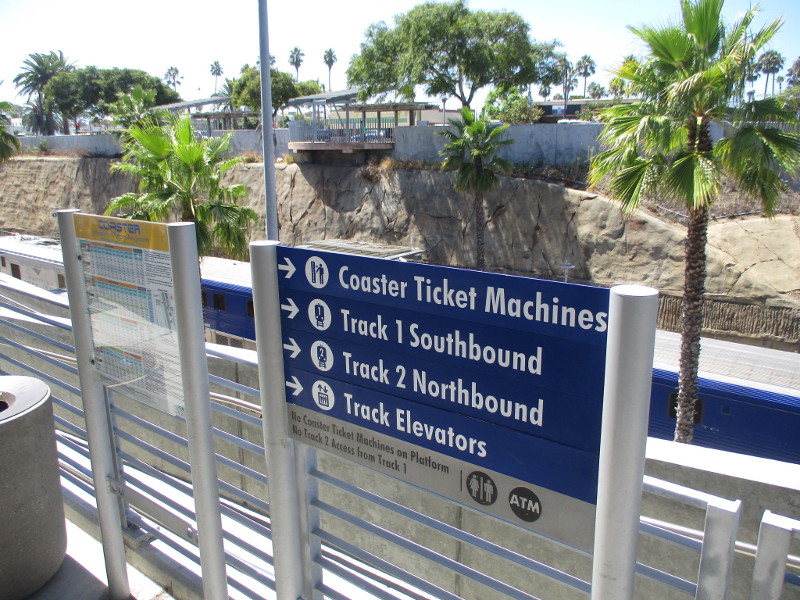
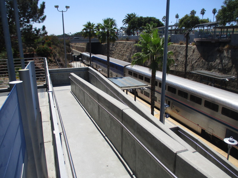
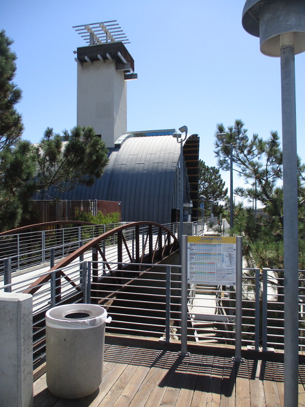
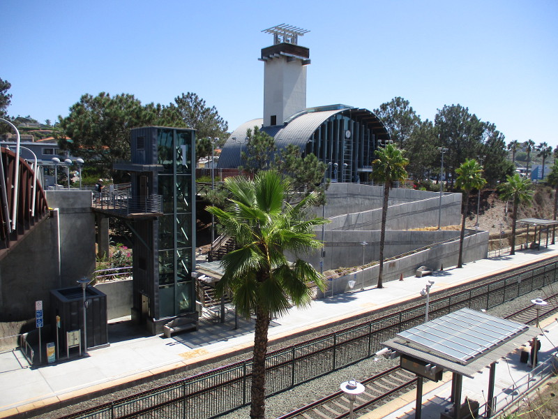
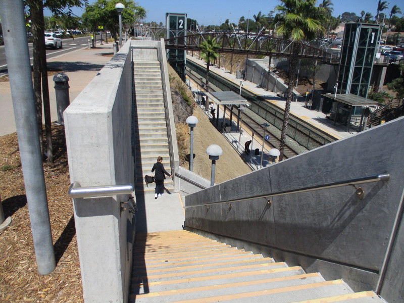
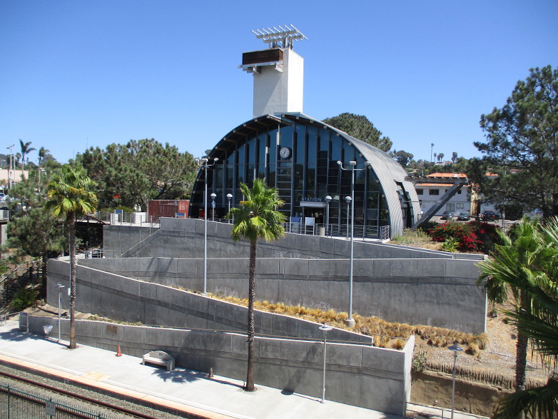
From any angle, the Solana Beach train station appears unusual and interesting. The architecture of this Coaster and Amtrak station makes it one of the most intriguing landmarks in San Diego’s North County.
The Solana Beach station opened in 1994. The building was designed by Rob Wellington Quigley, who is also known for the San Diego Central Library and its iconic dome, The New Children’s Museum, the Ocean Discovery Institute in City Heights, Bayside Fire Station No. 2, and the Beaumont Building in Little Italy. It seems all of his architectural work is just as surprising and visually stimulating.
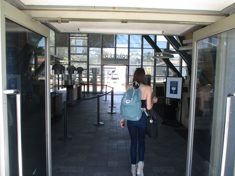
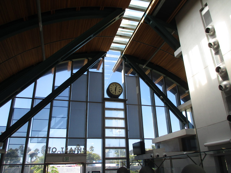
The last time I rode the Coaster to Solana Beach I walked around the train station, taking these photographs. To my eye, there’s something undefinably attractive about the building’s sharp lines and simple curved shape, and its singular symmetry.
I particularly like the passenger waiting room. Those artfully arranged windows on either side are bright with outdoor sunlight, as if beckoning travelers to venture out into a magical, multi-faceted, welcoming big world.
…
I live in downtown San Diego and love to walk around with my camera! You can follow Cool San Diego Sights via Facebook or Twitter!
You can easily explore Cool San Diego Sights by using the search box on my blog’s sidebar. Or click a tag! There are thousands upon thousands of photos for you to enjoy!
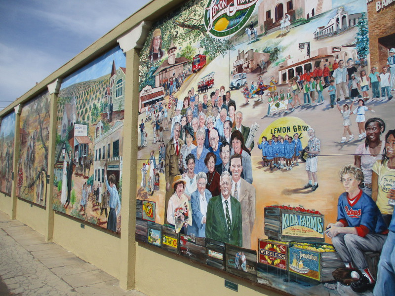
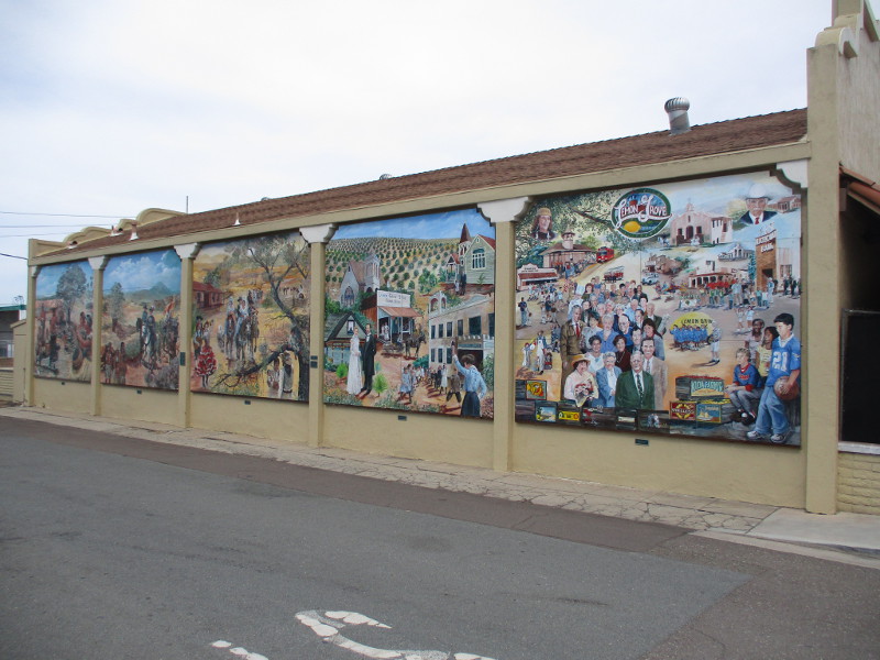
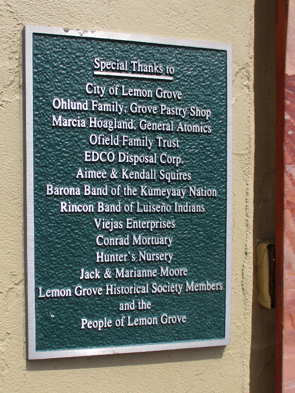
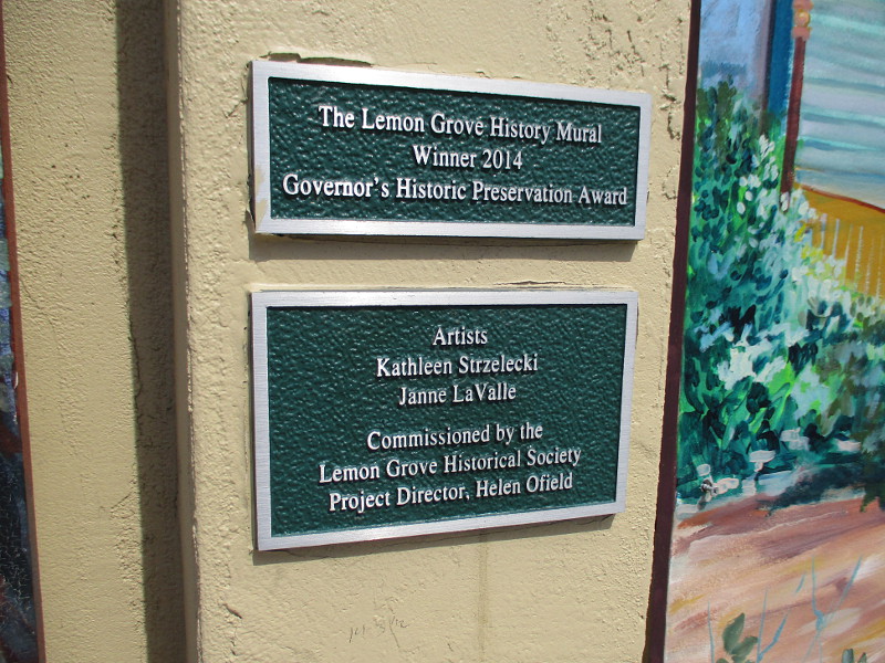
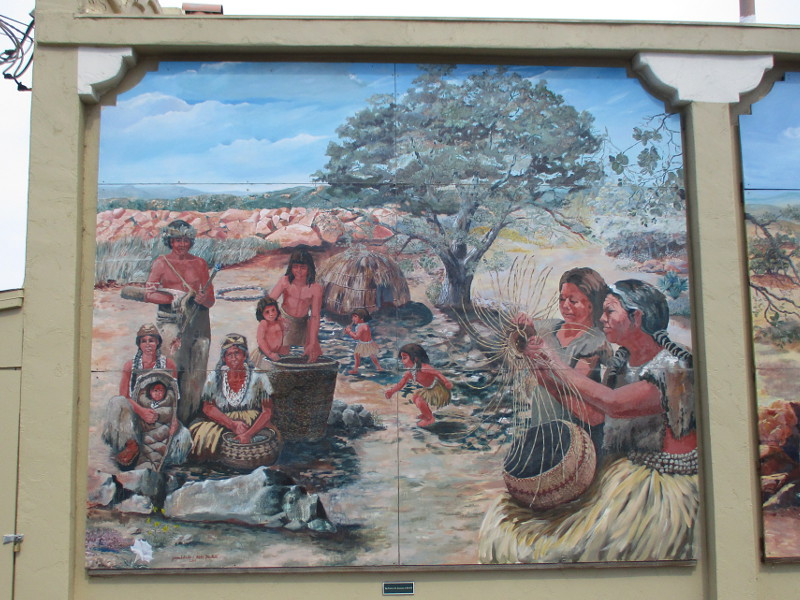
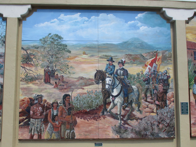
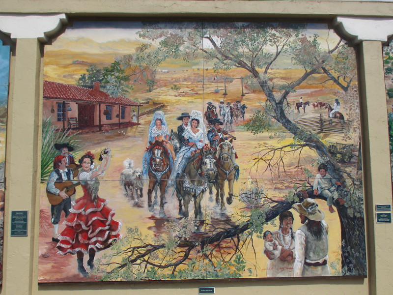
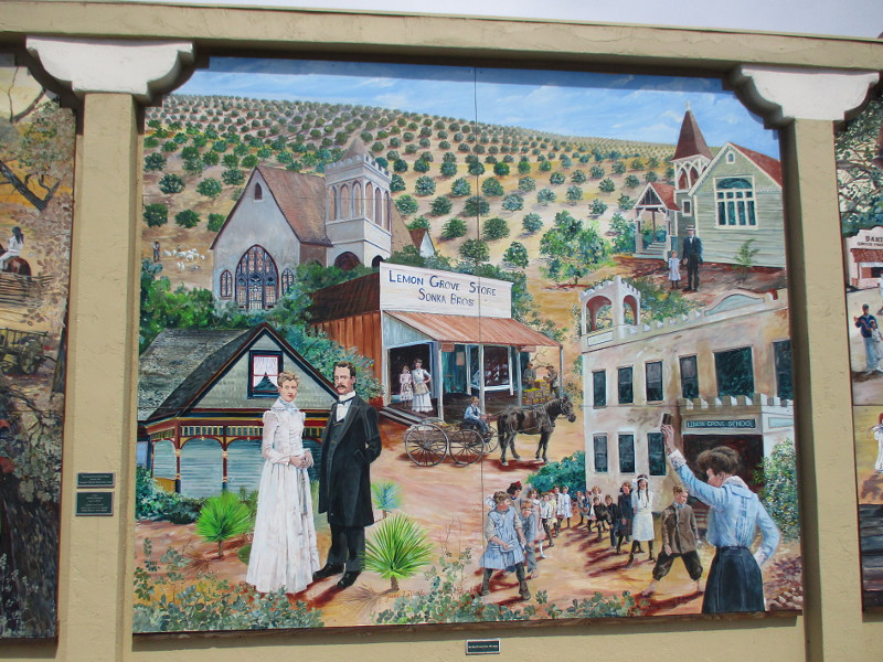
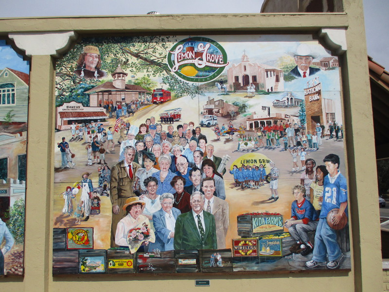
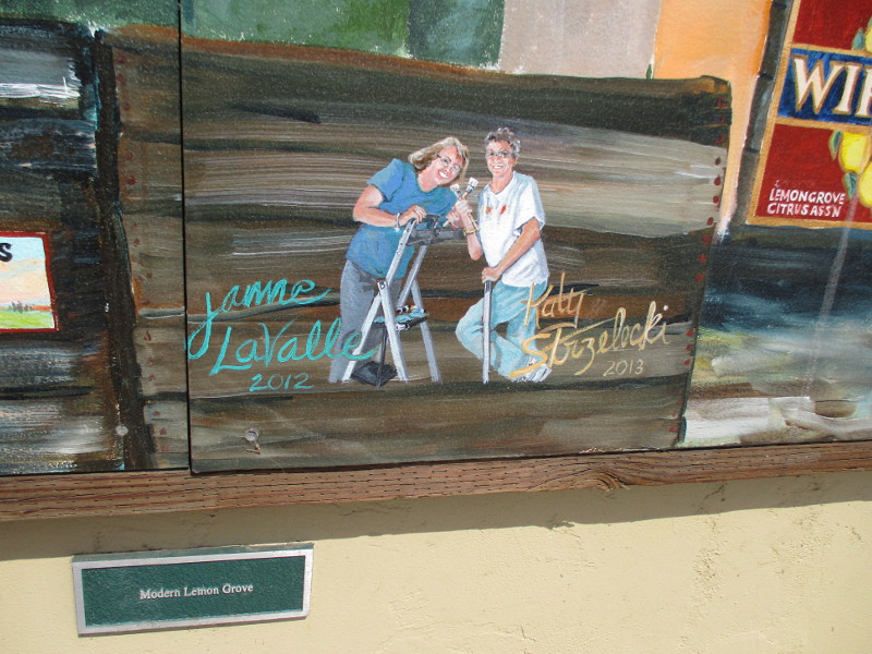
One of San Diego’s finest murals can be seen in Lemon Grove. Beautifully detailed scenes painted on five large panels represent the history of Lemon Grove.
The impressive 65 by 18 foot mural, which was commissioned by the Lemon Grove Historical Society, was created over the course of several years (2005 to 2013) by artists Kathleen Strzelecki and Janne LaValle. In 2014 the Lemon Grove History Mural won the prestigious Governor’s Historic Preservation Award.
Small plaques indicate the historical period of each panel. From left to right they read: The World of the Kumeyaay 1,000 BCE, The Spanish Conquest 16th Century, The Mexican Empire 1821-1846, The Birth of Lemon Grove 19th century, and Modern Lemon Grove.
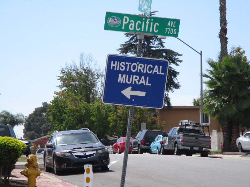
If you’d like to experience this remarkable mural with your own eyes, it’s located in Lemon Grove on the south side of the building at 3308 Main Street. The historic building was once home of the Sonka Brothers General Store.
The World of the Kumeyaay 1,000 BCEThe Spanish Conquest 16th CenturyThe Mexican Empire 1821-1846The Birth of Lemon Grove 19th centuryModern Lemon Grove
…
This blog now features thousands of photos around San Diego! Are you curious? There’s lots of cool stuff to check out!
Here’s the Cool San Diego Sights main page, where you can read the most current blog posts. If you’re using a phone or small mobile device, click those three parallel lines up at the top–that opens up my website’s sidebar, where you’ll see the most popular posts, a search box, and more!
To enjoy future posts, you can also “like” Cool San Diego Sights on Facebook or follow me on Twitter.
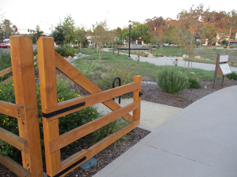
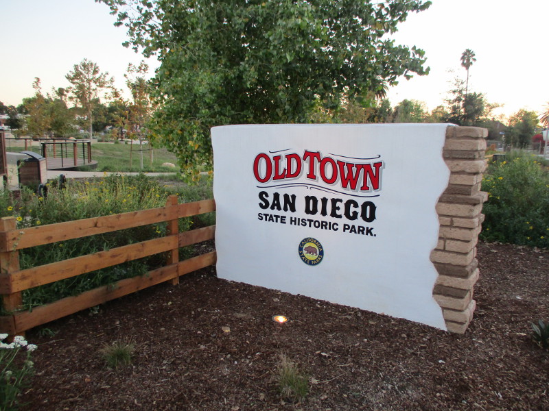
Old Town San Diego State Historic Park’s major expansion has opened!
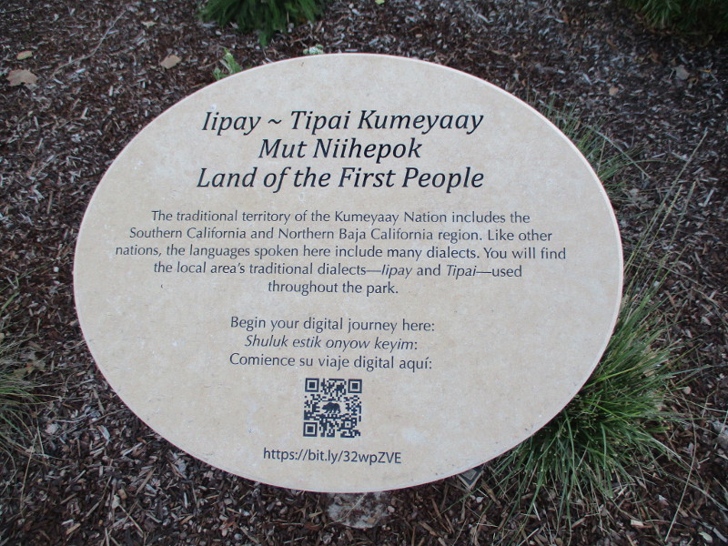
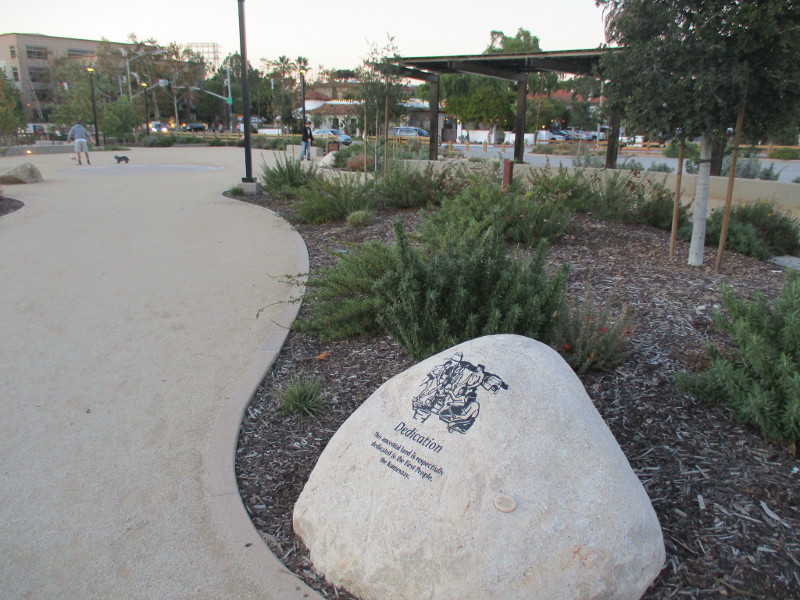
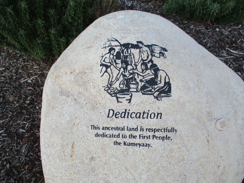
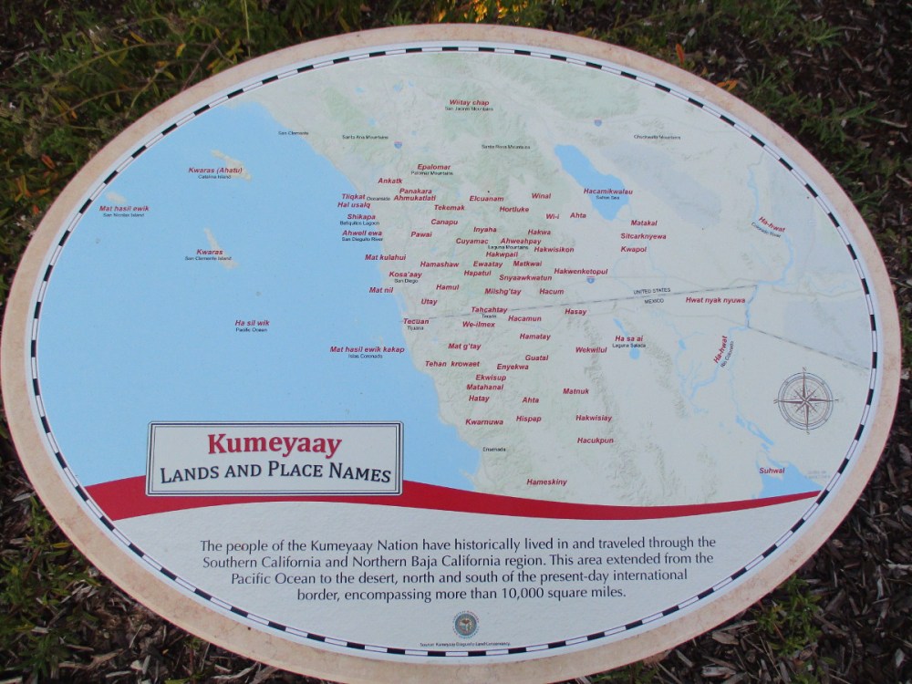
The beautiful new outdoor area, situated at the north end of the State Park, near the intersection of Taylor Street and Juan Street where an old Caltrans building used to stand, is called Land of the First People. It honors our region’s Native American Kumeyaay.
Pathways wind through native vegetation, beautiful public artwork, and interpretive displays on stones that describe the history and culture of the Kumeyaay, who lived here for many thousands of years before the arrival of Europeans. A Kumeyaay village called Kosa’aay existed where Old Town is now, near the mouth of the San Diego River.
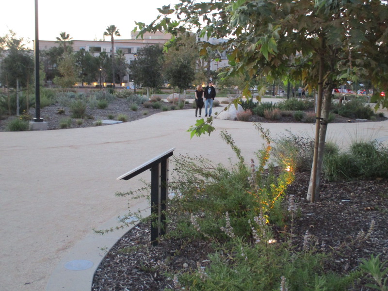
I arrived at Old Town San Diego State Historic Park this evening just before sunset and noticed the construction fence circling this new area had finally come down! So I had to investigate immediately!
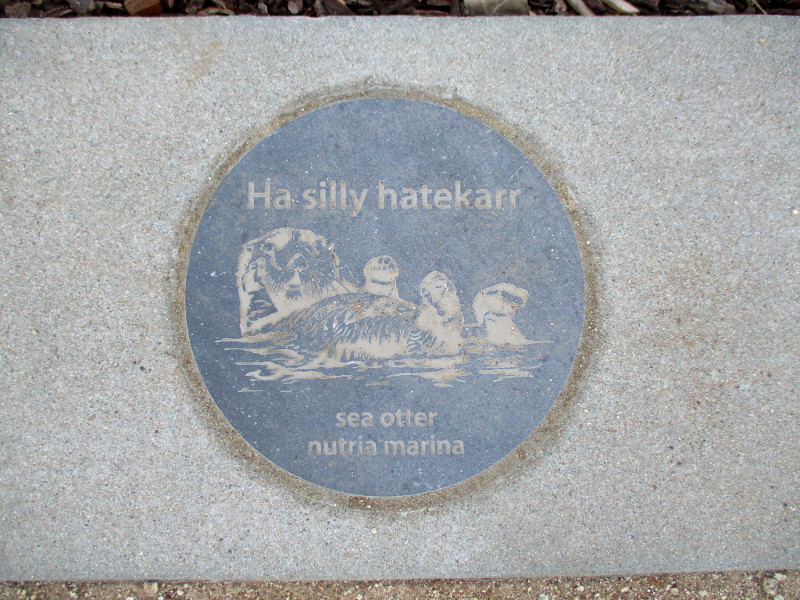
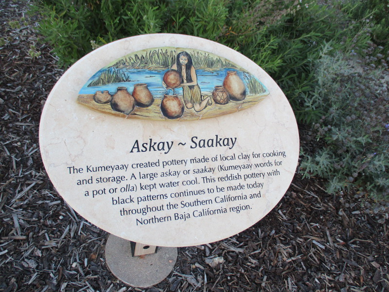
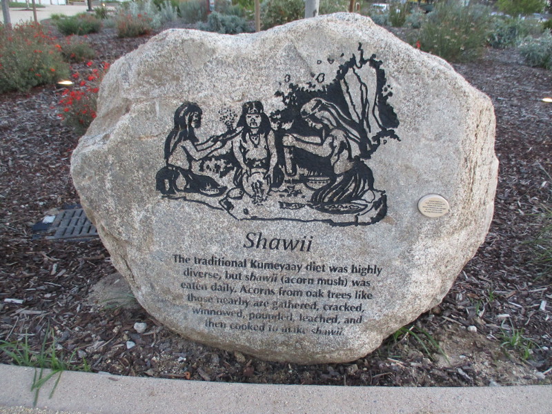
Artwork I discovered includes numerous disks along the pathways, showing native animals and the Kumeyaay words for each; a circular plaza with a mosaic depicting stars and constellations recognized by the Kumeyaay; and two benches made extraordinary with mosaics by local artist Betsy K. Schulz. Her amazing mosaics can be found all around San Diego. I’ll provide more photographs of these two benches in my next blog post!
Before it became too dark as night fell, this is what my camera captured…
Iipay ~ Tipai Kumeyaay Mut Niihepok — Land of the First People.Ha silly hatekarr – sea otterThe Kumeyaay created pottery made of local clay for cooking and storage. A large askay or saakay kept water cool…The traditional Kumeyaay diet was highly diverse, but shawii (acorn mush) was eaten daily…The traditional Kumeyaay cosmology of Maay Uuyow (Sky Knowledge) is extensive and elaborate…Hand tools like those shown here are used with the bowl-like hollows and other indentations in xepiicha (grinding stones) to process acorns, seeds, fibers…This ancestral land is respectfully dedicated to the First People, the Kumeyaay.The people of the Kumeyaay Nation have historically lived in and traveled through the Southern California and Northern Baja California region. This area extended from the Pacific Ocean to the desert…
…
I live in downtown San Diego and love to walk around with my camera! You can follow Cool San Diego Sights via Facebook or Twitter!
You can easily explore Cool San Diego Sights by using the search box on my blog’s sidebar. Or click a tag! There are thousands upon thousands of photos for you to enjoy!
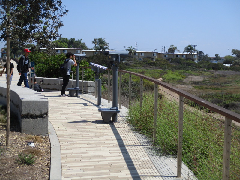
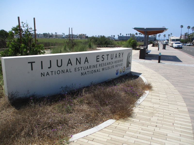
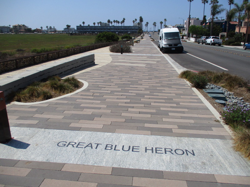
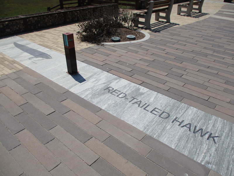
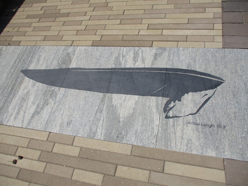
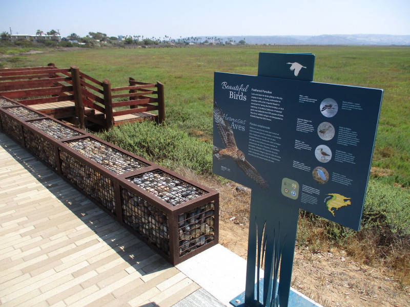
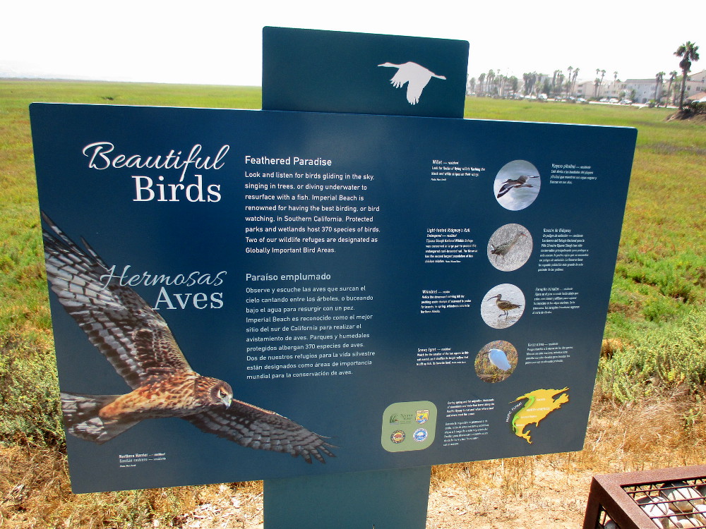
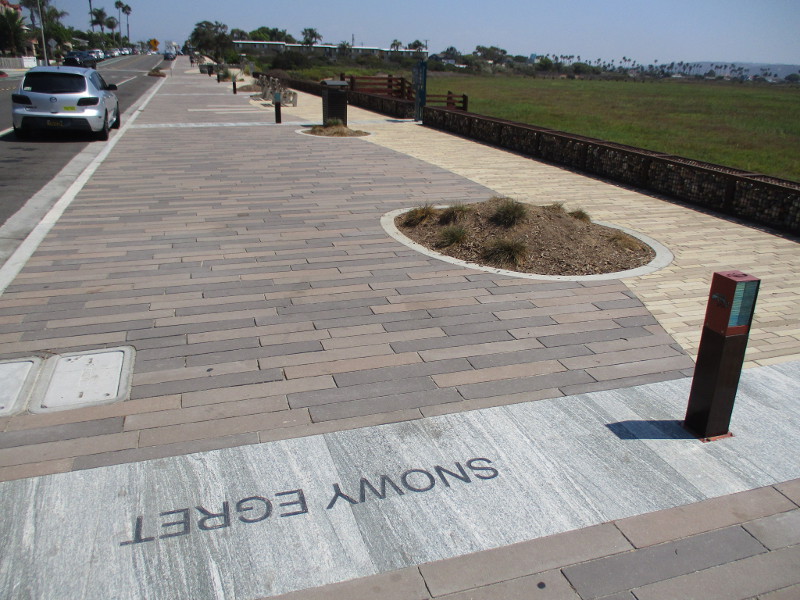
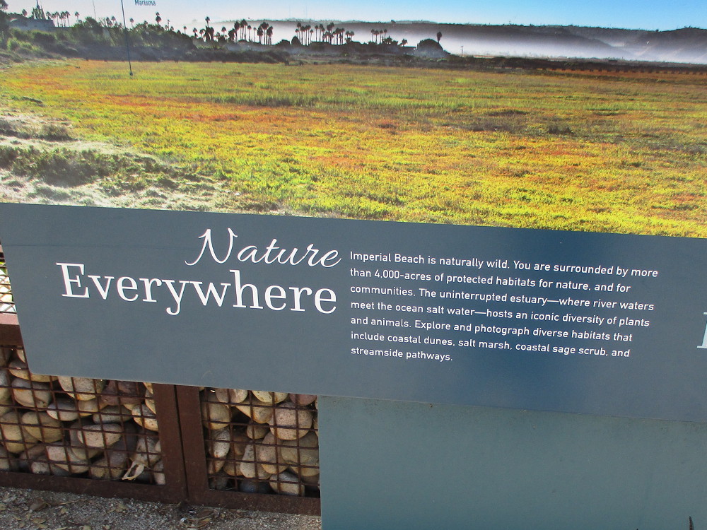
Walk down the recently improved Tijuana Estuary boardwalk in Imperial Beach and you’re certain to see birds. You’ll find many down at your feet!
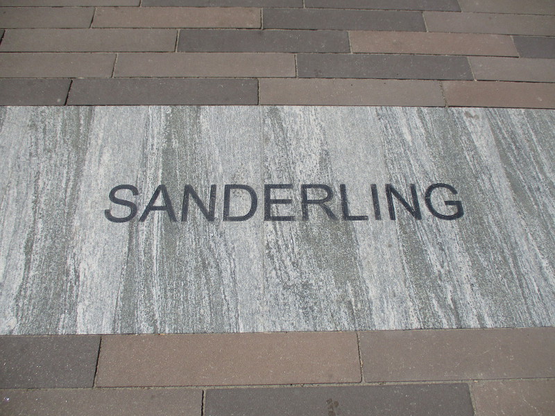
The widened, beautified boardwalk along Imperial Beach Avenue, west of 3rd Street, now includes the names of many birds that make Tijuana Slough National Wildlife Refuge their home.
Next to the bird names you’ll also find images of outstretched wings. The wings are to scale, providing an idea of how different species of birds compare.
During my last walking adventure in IB, about a month or so ago, I was surprised and delighted to find this improved boardwalk. There are new benches, and information signs at scenic Tijuana River estuary overlooks, and even a great bus stop shelter that I used.
It’s about time I shared these photos!
Great Blue Heron.Red-Tailed Hawk.Beautiful birds.Sanderling.Snowy Egret.Nature everywhere. Imperial Beach is naturally wild.
…
I live in downtown San Diego and love to walk around with my camera! You can follow Cool San Diego Sights via Facebook or Twitter!
You can easily explore Cool San Diego Sights by using the search box on my blog’s sidebar. Or click a tag! There are thousands upon thousands of photos for you to enjoy!
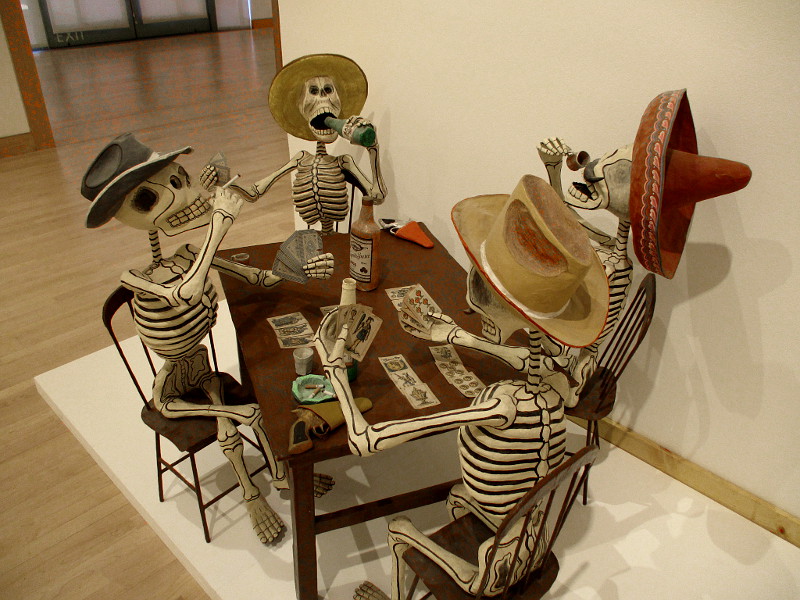
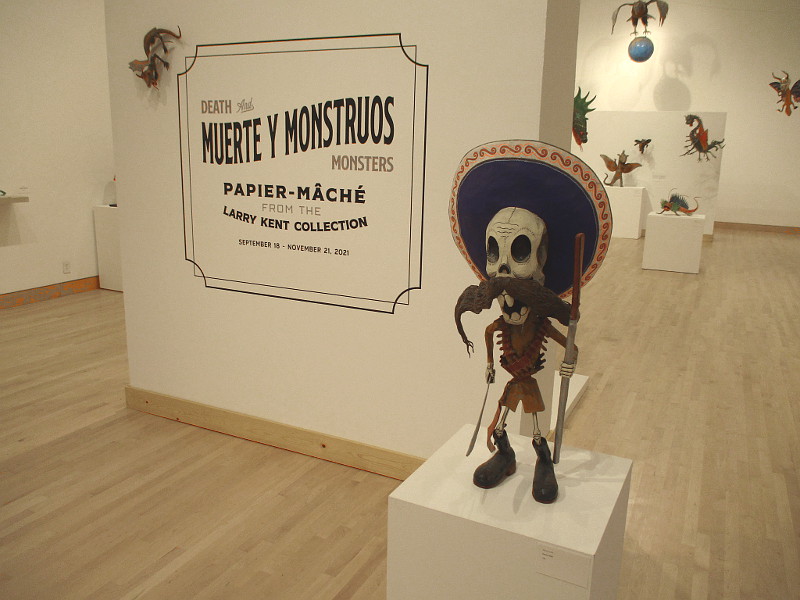
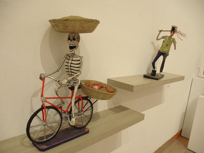
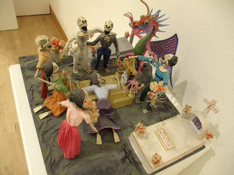
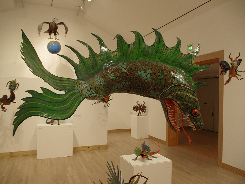
Fearless people (and art lovers) have the rare opportunity to view Death and Monsters in Escondido!
Muerte y Monstruos (Death and Monsters) is an exhibition currently on view in the museum at the California Center for the Arts, Escondido. The collection of traditional Mexican artwork, created by the Linares family of Mexico City, includes many papier-mâché sculptures depicting skeletons and skulls, or calaveras, engaged in living and death.
And there are fantastic monsters, or alebrijes, too! Pedro Linares is credited with inventing that form of very colorful folk art.
It’s fortunate many of the fragile pieces on display have survived. Their purpose was to be burned or broken during holiday festivals in Mexico. The sculptures in Death and Monsters were preserved by San Diego art collector Larry Kent.
Much of this art was inspired by legendary Mexican printmaker José Guadalupe Posada. His iconic work is being concurrently displayed in the main gallery of the museum!
Would you enjoy a unique experience during the upcoming season of Día de los Muertos? The exhibition continues through November 21, 2021.
…
I live in downtown San Diego and love to walk around with my camera! You can follow Cool San Diego Sights via Facebook or Twitter!