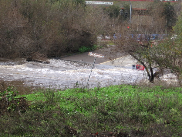
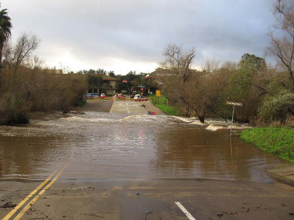
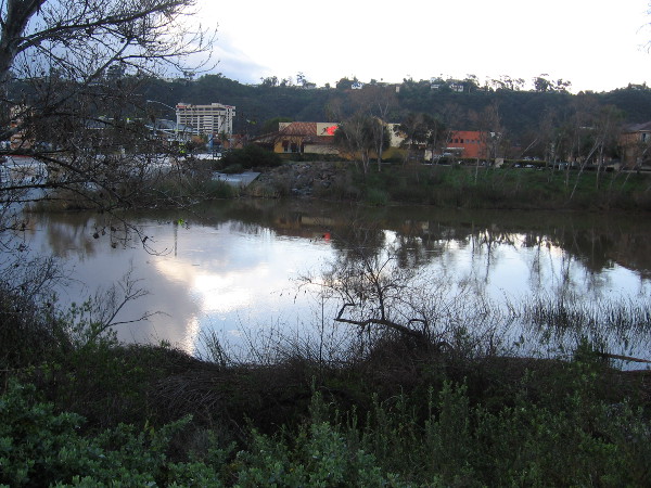
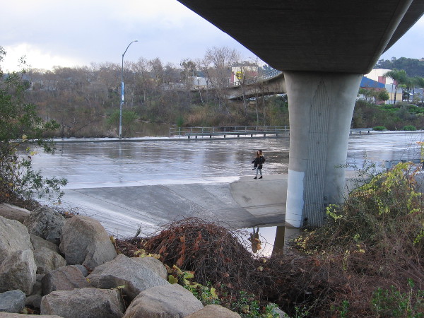
The swollen San Diego River after three winter storms in six days. A gauge beside the water shows the river has subsided to about the 8 foot mark, after reaching a high level–I believe–of around 11 feet.
I did some walking in a drizzle this morning before work.
I got off the trolley at the Fashion Valley station and proceeded to investigate the San Diego River in a section of Mission Valley that is often hit with flooding. Three very rainy winter storms were finally coming to an end. What did I see?
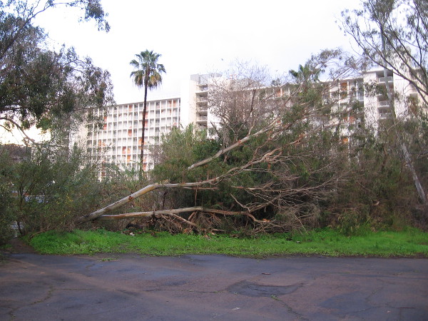
Palm trees surrounded by flowing river water. Photo taken from the pedestrian bridge between the Fashion Valley Transit Center and the Town and Country Resort and Convention Center.A tall, shallow-rooted eucalyptus tree knocked over by the gusty winter storms. A common sight around San Diego.Fashion Valley Road this morning was still blocked off from traffic, even though the San Diego River’s water had subsided to street level.A friendly San Diego Lifeguard makes the rounds to make sure nobody needs a swift water rescue. My photo just missed his wave!The parking structures at Fashion Valley Mall that are susceptible to flooding were definitely well underwater. Thank goodness, I saw no submerged cars.Bright green grass and dark clouds. I was sheltered from raindrops by the trolley tracks overhead.As usual, the San Diego River was flooding Avenida del Rio just south of the mall. The short, dipping street is appropriately named!Yesterday someone foolishly trying to walk through this powerful moving water had to be rescued. They got washed away. A helicopter was even brought in.No worries about flooding for the trolley–at least right here!The Highway 163 underpass was flooded and muddy. I had to walk another way around to reach work. Good thing I got an early start!Sign by the San Diego River. The low rainfall and the geologic composition historically allowed the river to run below ground much of the year, hence the nickname: the Upside Down River.The beautiful river this morning through leaves.Morning sky and clouds through bare winter trees.The San Diego River is unusually wide in its swollen state after the storms. It looks like an honest-to-goodness actual river!Walking along Mission Center Road in the rain by the San Diego River.
…
I live in downtown San Diego and love to walk around with my camera! You can follow Cool San Diego Sights via Facebook or Twitter!
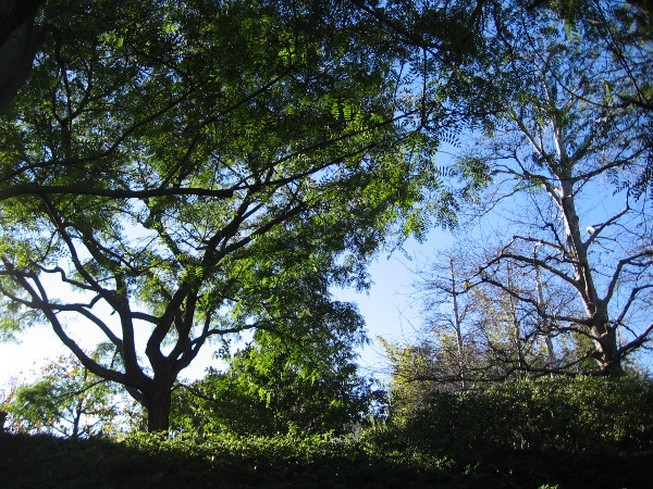
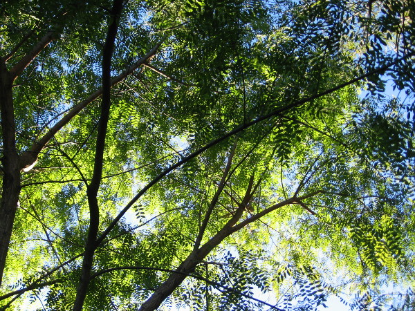
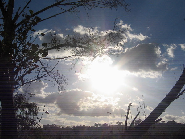
Glorious sun and clouds through trees high above Mission Valley.
I’m going through thousands of photographs stored in my computer this morning. I’ve found a number of beautiful nature shots taken over the past year or so.
Sometimes I can be in a hurry (or feeling a bit lazy) and I don’t properly label or categorize my images. I’m not sure exactly where I captured a couple of these. Somewhere around San Diego . . .
I’d like to thank those of you who follow this blog. I know there’s loads of stuff on the internet, and a whole lot of San Diego websites that are slicker and more professional. I’m just a regular guy and my amateur photo blog is nothing more than a work of joy. And a way for me to see this complex world more closely as I walk around the city. I hope that together, in the weeks and months ahead, we experience even more beauty and many more Cool San Diego Sights!
Now I’m off on a leisurely Sunday walk. Where will I go? I haven’t decided yet! I guess I’ll begin by stepping out the door . . .
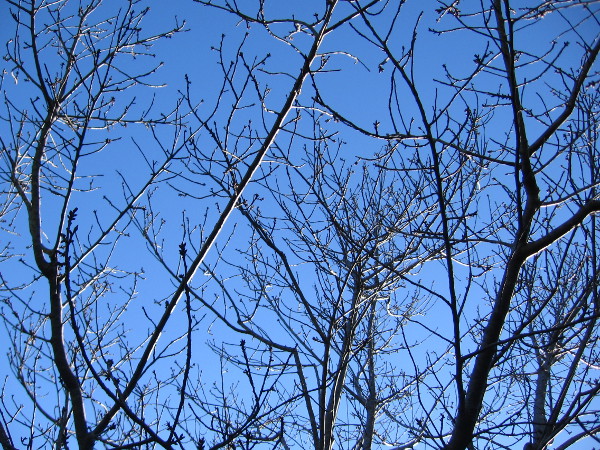
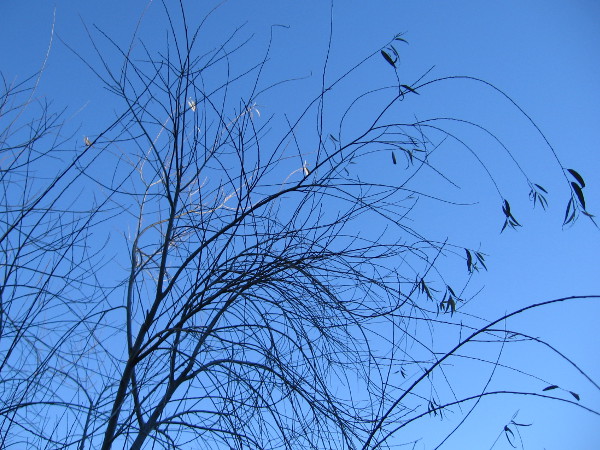
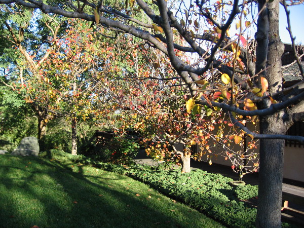
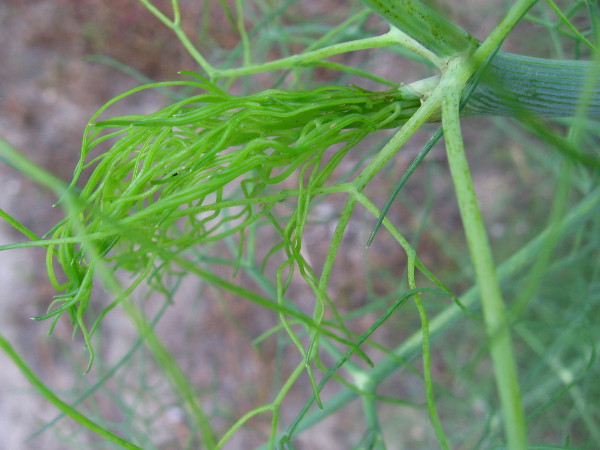
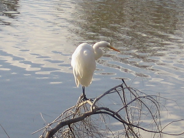
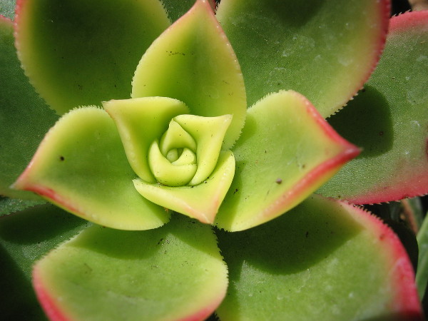
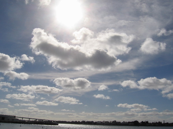
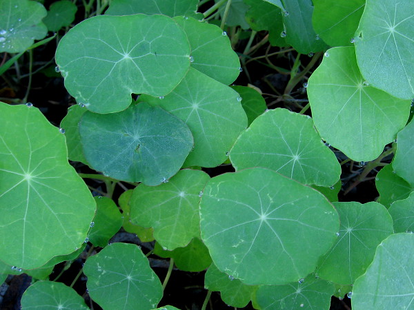
One tiny part of a vast, intricate, simply wonderful world.Dazzling bits of stone (and a couple pieces of broken glass) in the water of Mission Bay.Colorful leaves inside Balboa Park’s Botanical Building.Complex, dramatic clouds above our fair city.Delicate natural beauty seen during a hike in Mission Trails Regional Park.A pure white egret on a branch by the shining San Diego River.Crashing water meets wet, smooth stones on the ocean shore in La Jolla.A shapely succulent in Balboa Park. Nature produces another marvel.Beautiful clouds and blue sky above San Diego Bay.I took this photo yesterday walking along Friars Road as I approached the San Diego River estuary. A few droplets cling to green leaves.Photo of a beautiful pink rose taken during a walk somewhere in San Diego.
…
I live in downtown San Diego and love to walk around with my camera! You can follow Cool San Diego Sights via Facebook or Twitter!
Do you enjoy beautiful things? Please visit my other fun photography blog which I call A Small World Full of Beauty.
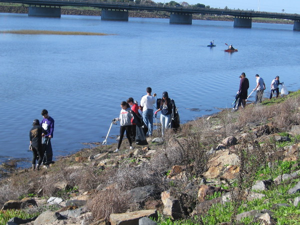
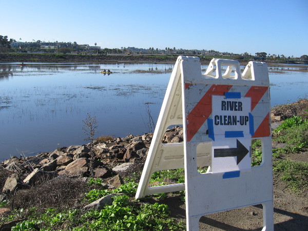
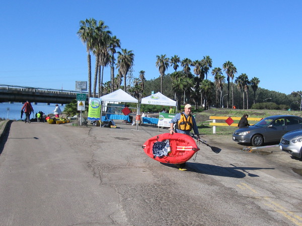
Many ordinary people came out today to help clean up the San Diego River Estuary.
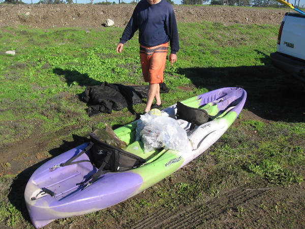
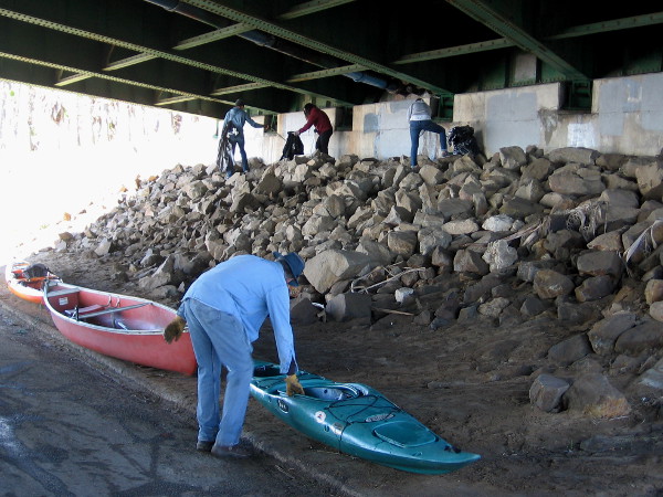
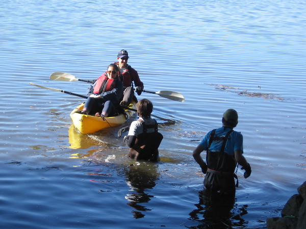
Lots of good people volunteered to clean up the San Diego River Estuary today. Some took to kayaks, others walked along the shoreline, filling bags with nasty litter and debris. The river estuary, emptying into the Pacific Ocean between Mission Bay and Ocean Beach, is a very important wetland in this region, and millions of birds rely on it during their migrations. Small bits of trash ingested by birds and other wildlife can be fatal.
The estuary cleanup was organized by The San Diego River Park Foundation. Kayakers are permitted to enter the San Diego River Estuary only one time every year–during this special event. I walked along the river and saw what ordinary people can achieve when working unselfishly for the good of our world.
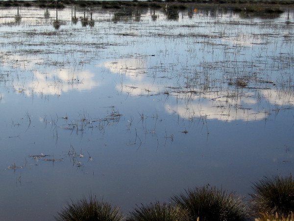
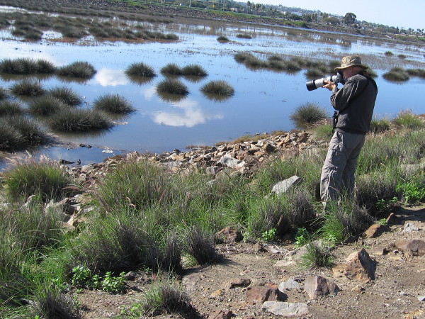
A sign directs people to the river cleanup.Beautiful white clouds are reflected in the calm water of the San Diego River as it approaches the ocean.Many birds make the river and its mud flats their home, including ducks, herons and egrets.A photographer captures images of waterfowl swimming through grass down the river.My camera isn’t quite so fancy, but I did get an okay photo of this snowy egret!As I walked west along the San Diego River, I noticed a number of kayaks out on the water.A sign by the river describes the problem of stormwater pollution. During rains, a good deal of runoff enters the estuary, carrying all sorts of pollutants and trash. (I had to really alter this photograph so we could make out what the old sign says. Click the image to enlarge it.)A cleanup volunteer with a kayak is arriving!Plastic bags in these kayaks have been filled with garbage found in the river. I learned much of it was snagged in the grass.Dozens of caring people were on the rocky river shore, looking for trash.San Diego is fortunate to have many thoughtful people, concerned about our environment.Volunteering is often a family affair, teaching the next generation about generosity and responsibility.This guy was carrying his kayak back to his car.Another guy showed me the trash he collected. He said he found a variety of garbage. Some flows downstream. Some of it is windblown. Some comes from Interstate 5 and other bridges which cross the river nearby.A tent where people can sign up to volunteer and learn more about The San Diego River Park Foundation.From the mountains to the ocean, we care for the San Diego River!Sadly, the river isn’t healthy. A grade is assigned each year based upon trash, water quality and the extent of invasive plants.Sign shows volunteering possibilities. (Click these sign images to read–they will enlarge.)Picking up garbage and readying kayaks underneath the West Mission Bay Bridge.Collected trash was placed in a nearby dumpster.Smiles in the San Diego sunlight. A perfect day to make our world cleaner, healthier and more beautiful.Kayakers launch into the San Diego River during a special event to clean the estuary.
…
I live in downtown San Diego and love to walk around with my camera! You can follow Cool San Diego Sights via Facebook or Twitter!
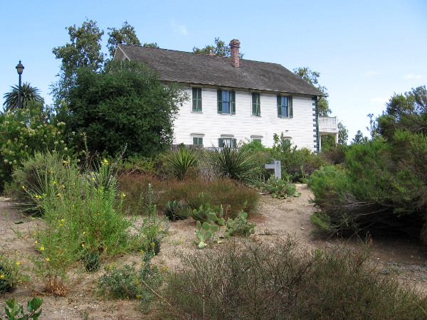
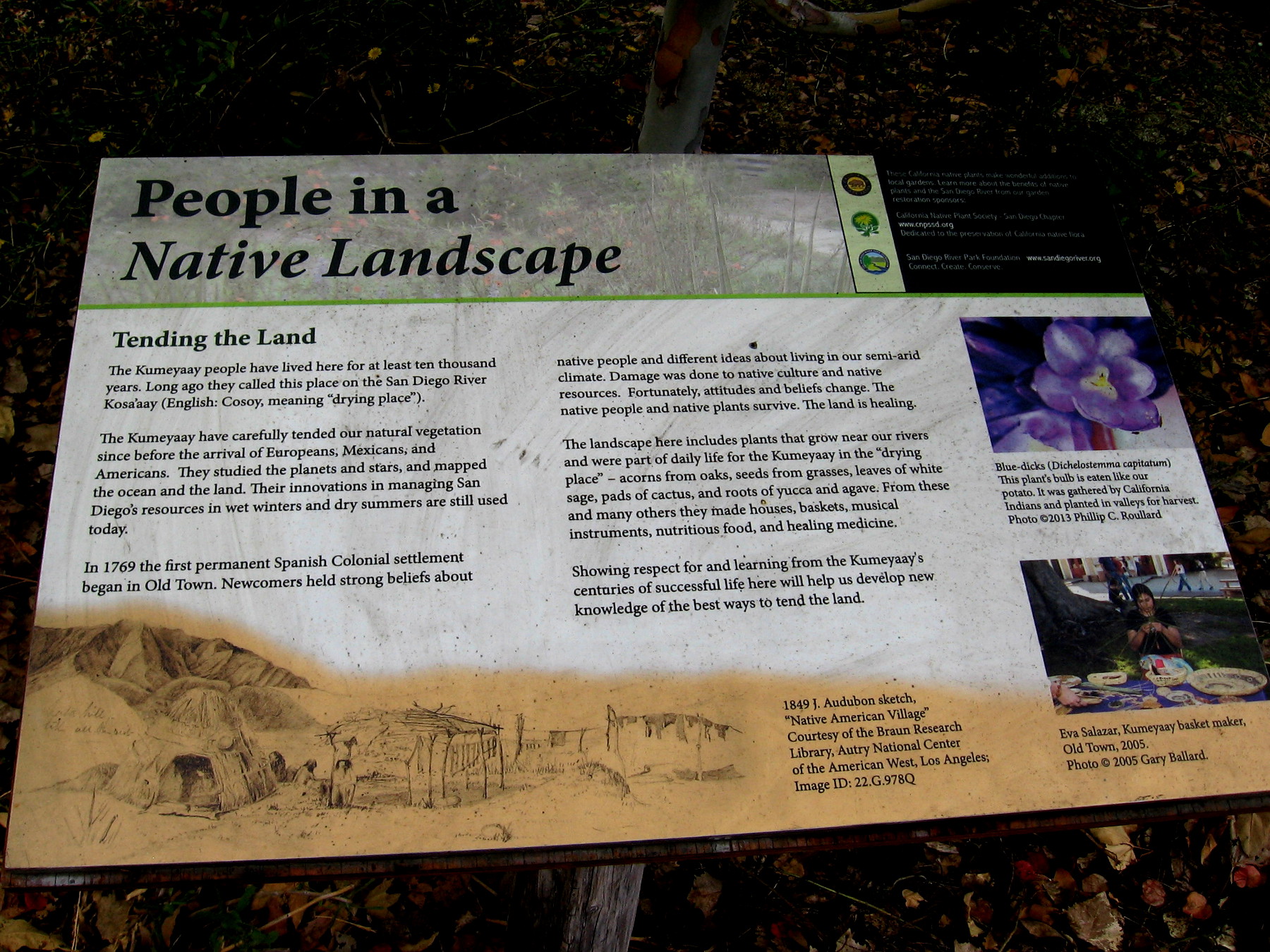
Photo of historic McCoy House in Old Town San Diego from the Native Garden. Today’s garden is located in a spot that was once very close to the San Diego River, before the river was diverted to the north, through Mission Valley.
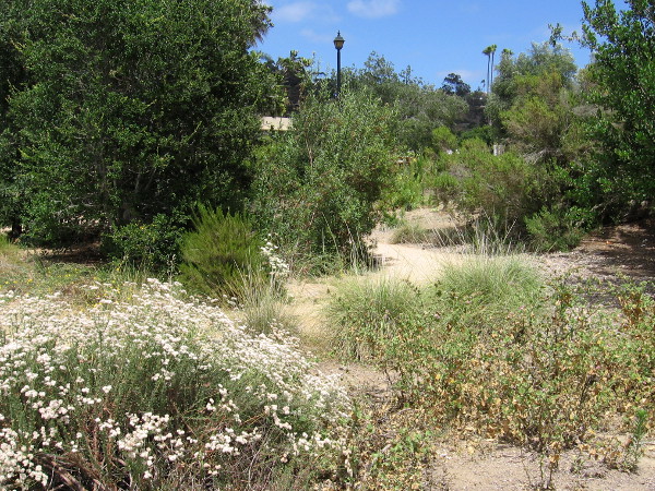
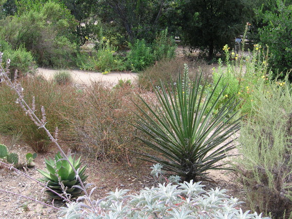
A small, ragged but beautiful native garden can be found in the northwest corner of San Diego’s Old Town, next to the McCoy House Museum. The Native Plant Garden contains vegetation that grows naturally along the rivers of our semi-arid region.
Long before Europeans arrived in Southern California, the Native American Kumeyaay lived where Old Town was eventually established; the Kumeyaay village at the base of Presidio Hill was called KOSA’AAY, or Cosoy. Many of the plants in the garden were used by the Kumeyaay people in everyday life.
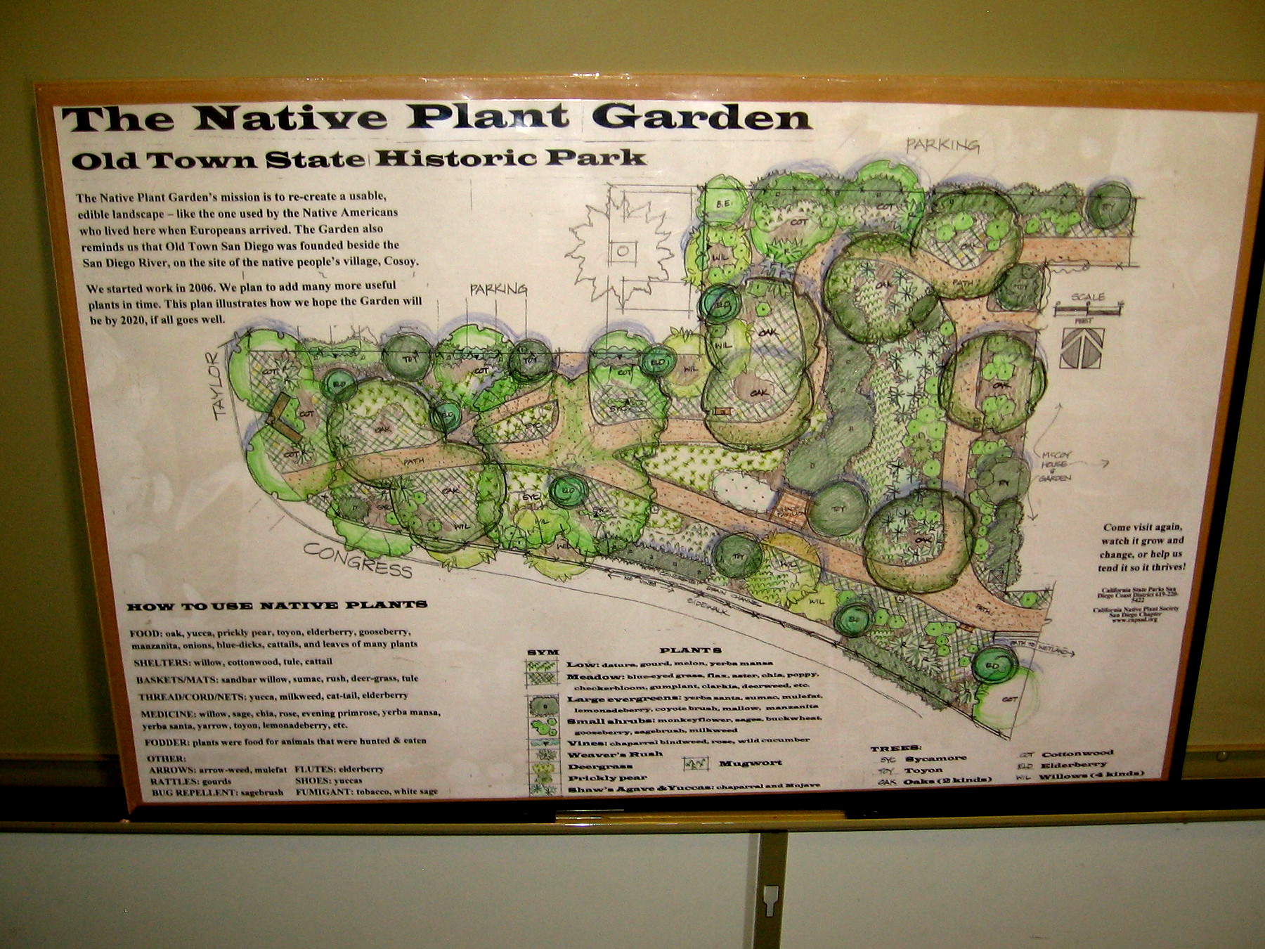
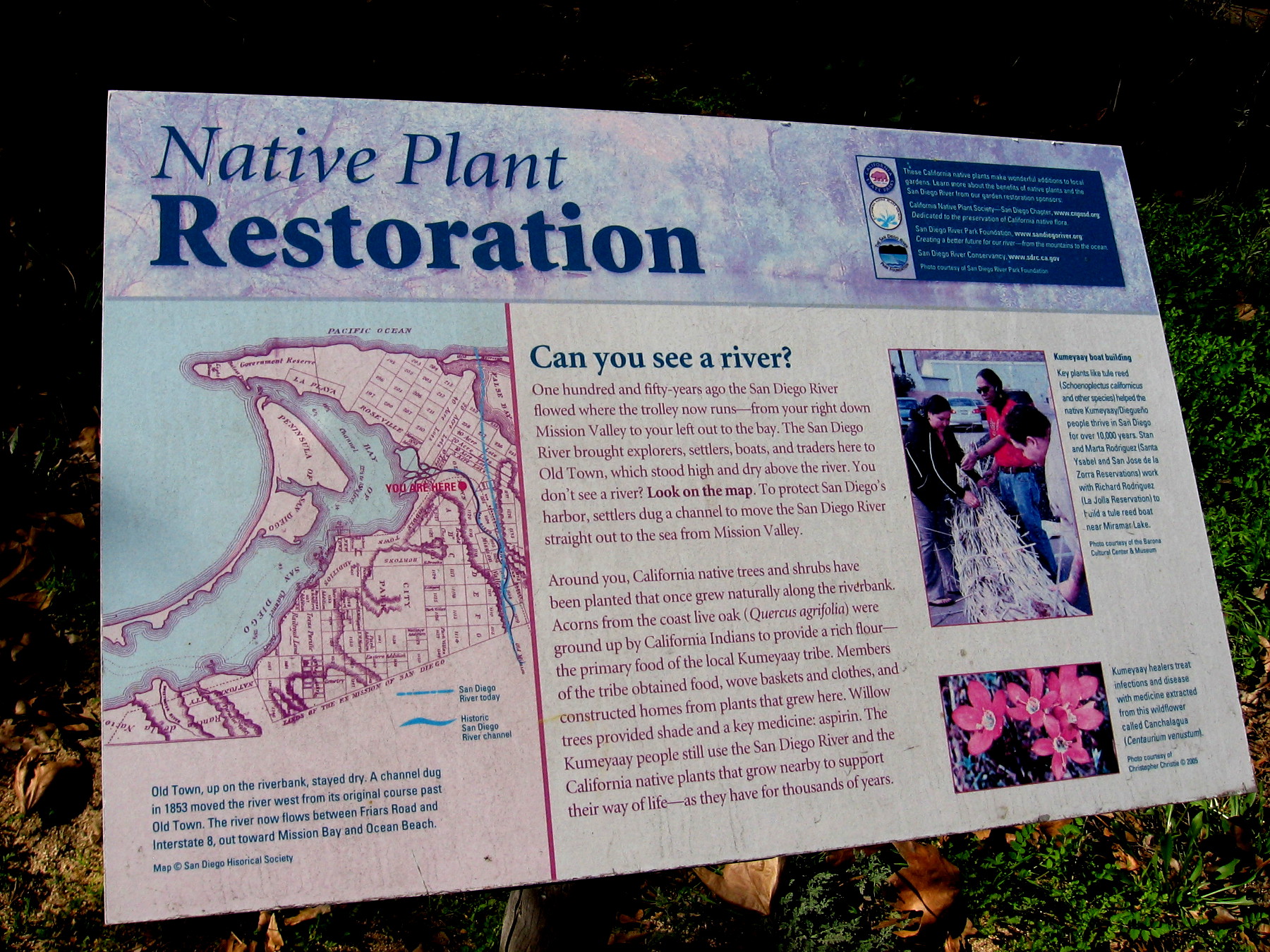
Read the photo captions to learn much more. Click the garden plans and the two signs, and those images will expand providing additional information!
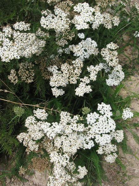
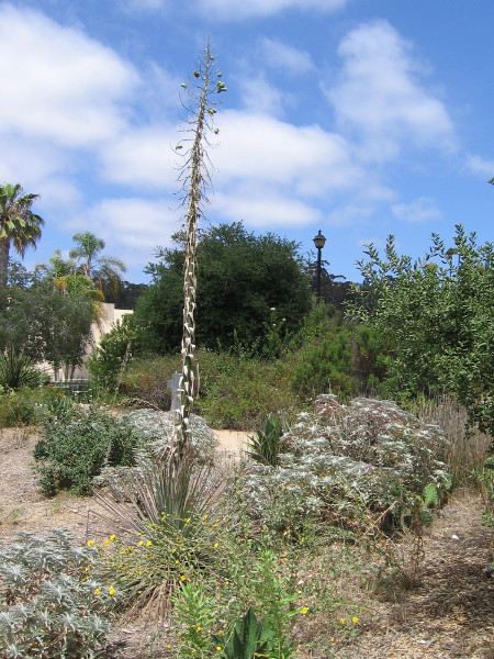
Plans of the Native Plant Garden in Old Town San Diego State Historic Park. Included are species used by the Native American Kumeyaay for food, shelter and medicine. Their village Cosoy was located here.Looking northwest from the second floor of the McCoy House Museum in Old Town San Diego. The Native Garden beyond the fence is a bit dry and scraggly–but that’s how local vegetation naturally appears.150 years ago the San Diego River flowed nearby, bringing explorers, settlers, boats and traders to Old Town. California native trees and shrubs have been planted that once grew along the riverbank.Dirt walking paths meander through the small Native Garden at the northwest corner of Old Town San Diego State Historic Park.Yarrow was used by the Kumeyaay as a treatment for various medical conditions, including burns, inflammation, and pain from toothache, headache and arthritis.Tall stalk of a yucca that already flowered still juts into the sky in Old Town San Diego.The Kumeyaay people have lived here for at least ten thousand years. Their innovations in managing San Diego’s resources in wet winters and dry summers are still used today.A variety of native plants found naturally in coastal San Diego’s semi-arid climate, including sages and prickly pear cactus.Fibers from the yucca were used by the Kumeyaay to produce cords, nets, shoes and other useful items.
…
I live in downtown San Diego and love to walk around with my camera! You can follow Cool San Diego Sights via Facebook or Twitter!
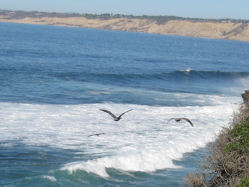
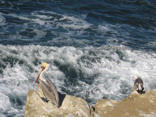
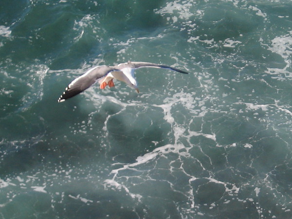
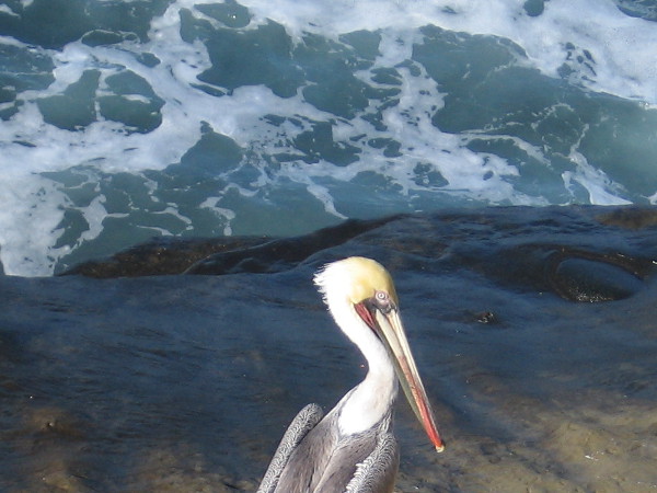
Brown pelicans come in for a landing on a cliff near La Jolla Cove.
Yesterday I spent some time at one of the most beautiful places in San Diego. I walked along the cliffs near La Jolla Cove, just taking in the fresh ocean breeze, sunshine and scenery.
I managed to get several fun photographs of pelicans and gulls flying above the water and perched on the rocks.
Sea birds fly along the water’s edge as the surf breaks. The cliffs of Torrey Pines stretch in the distance.A pelican and gull share a cliff above the turbulent, foaming Pacific Ocean.A seagull descends gracefully with outstretched wings.Photo of pelican standing on a dark rock provides interesting contrast.
…
I live in downtown San Diego and love to walk around with my camera! You can follow Cool San Diego Sights via Facebook or Twitter!
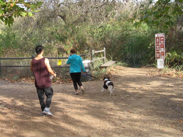
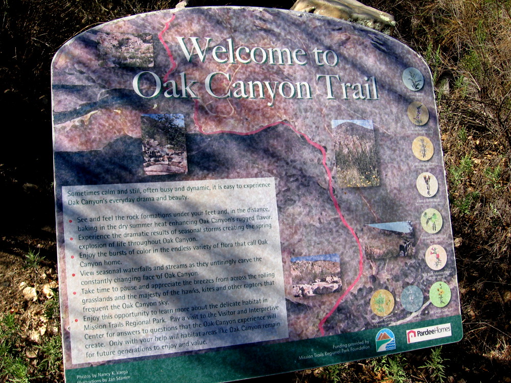
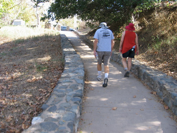
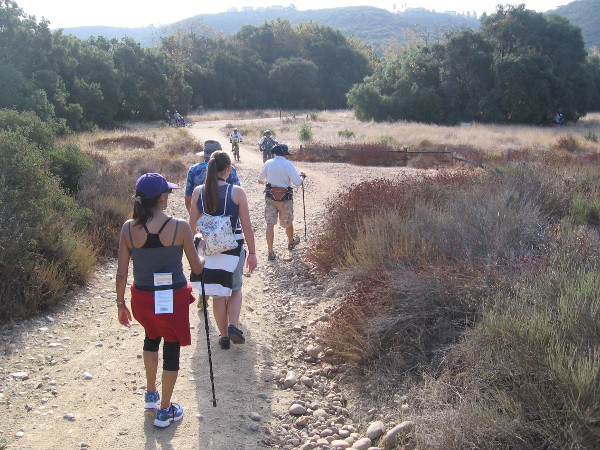
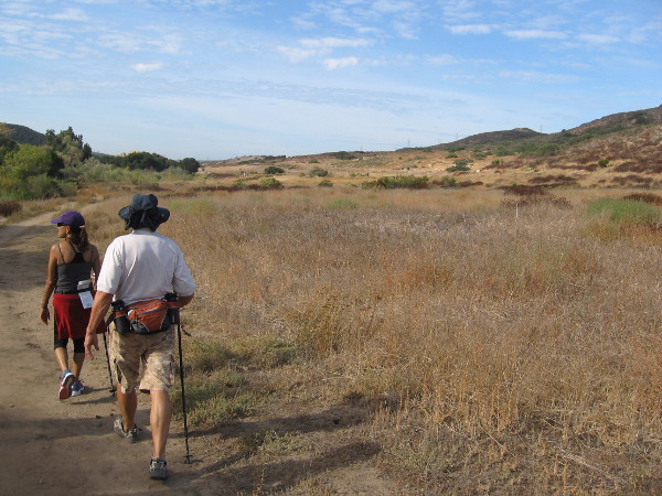
Hikers head from the Kumeyaay Campground at Mission Trails Regional Park toward a shady nature trail that runs beside Kumeyaay Lake.
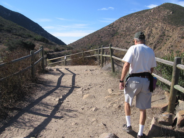
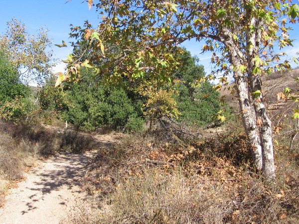
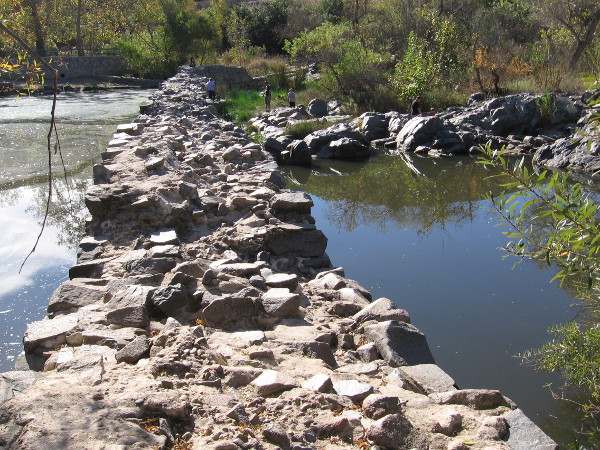
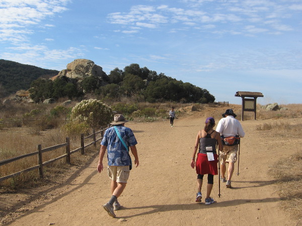
I enjoyed an amazing walk last weekend at Mission Trails Regional Park. The guided hike met under the flagpoles of the Kumeyaay Campground, and started down a pleasant nature trail at nearby Kumeyaay Lake. The hike then proceeded at a leisurely, easy pace along several trails by the San Diego River, ending up at the Old Mission Dam.
Every month, anyone can go on a variety of free interpretative nature walks at Mission Trails Regional Park. The walks are led by experienced trail guides, who point out the native flora and fauna, and relate the fascinating history of this mountainous wilderness in the city. To learn more check out the park’s website.
Please enjoy my photos and read the descriptive captions to join me on a virtual hike. Not only will you experience natural beauty, but you’ll learn a bit about early San Diego history!
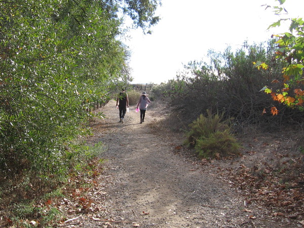
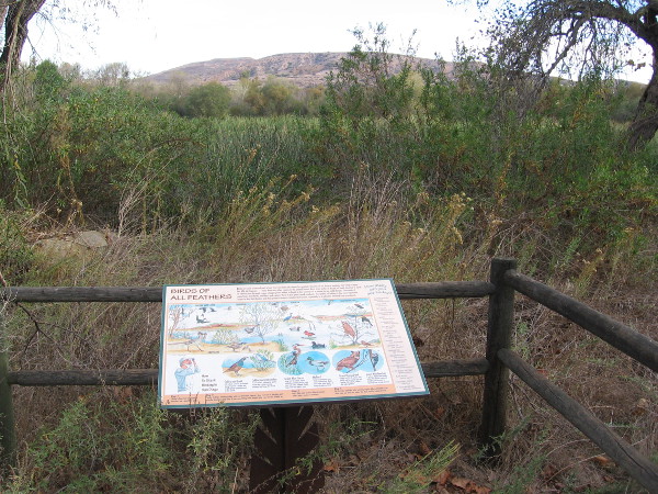
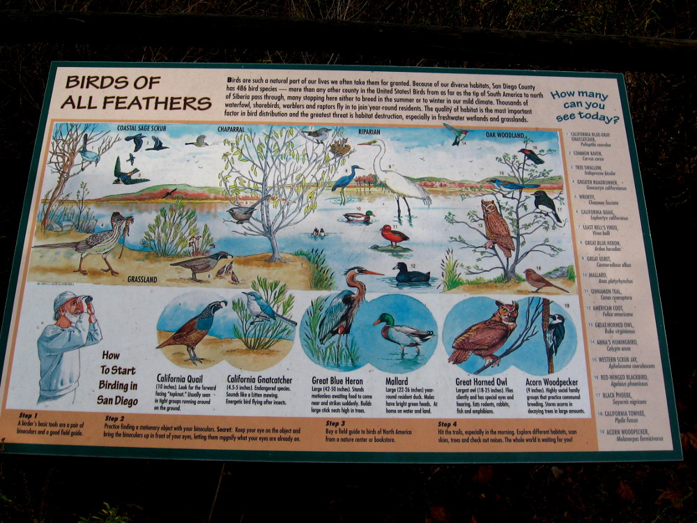
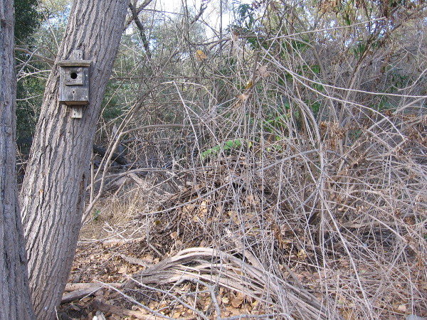
A couple walks slowly along the Kumeyaay Nature Trail, enjoying a beautiful November day.Signs along the nature trail include descriptions of wildlife that can be found around Kumeyaay Lake (once called Hollins Lake). Open water can be glimpsed beyond cattails.At Mission Trails Regional Park, birds of all feathers include quail, gnatcatchers, herons, egrets, ducks, woodpeckers, scrub jays, owls, and the endangered least Bell’s vireo!
The sign includes the following: “Because of our diverse habitats, San Diego County has 486 bird species–more than any other county in the United States! Birds from as far as the tip of South America to north of Siberia pass through, many stopping here either to breed in the summer or to winter in our mild climate.”
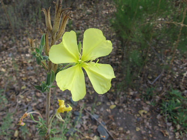
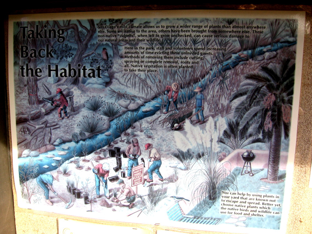
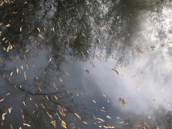
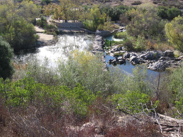
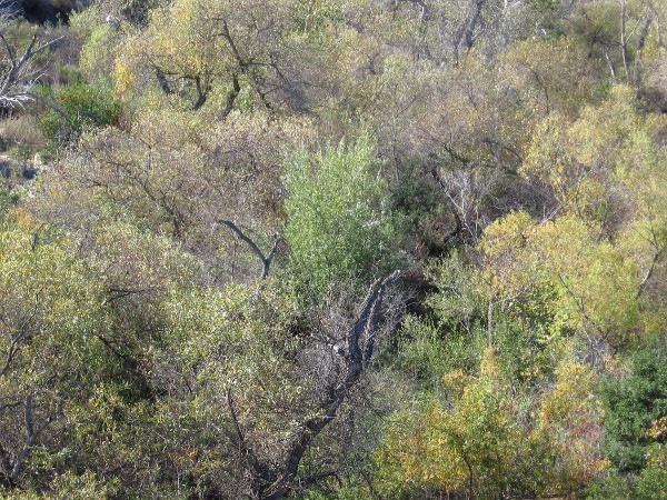
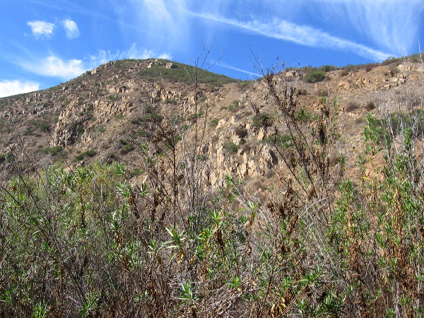
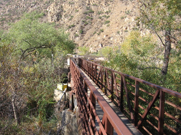
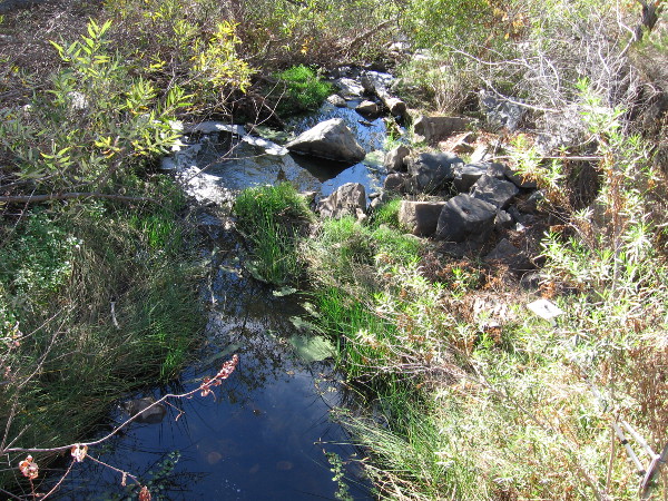
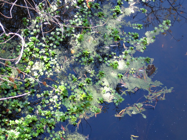
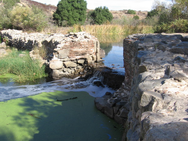
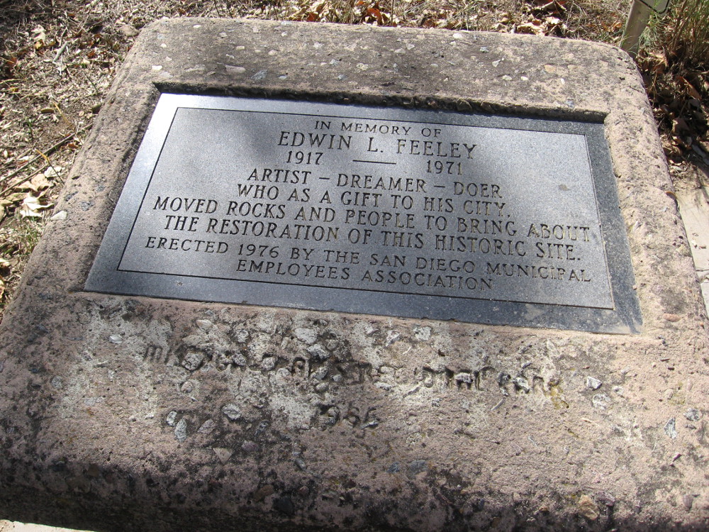
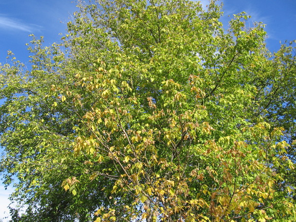
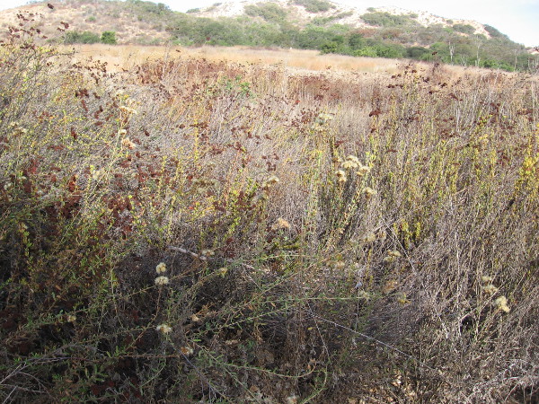
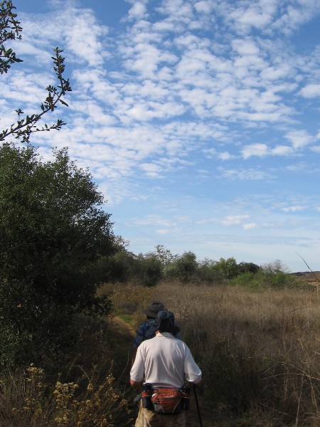
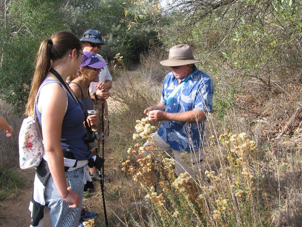
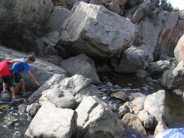
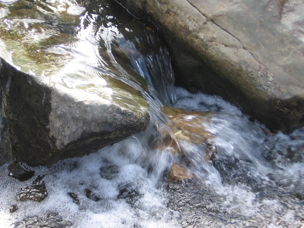
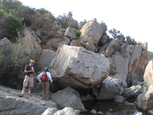
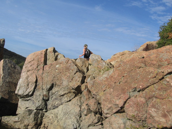
Photo of the San Diego River emerging from Kumeyaay Lake. This is near an outdoor amphitheater and fire pit. The park is a perfect place to learn about nature from rangers, and for stargazing at night!An Autumn wildflower at Mission Trails Regional Park.We head from the lake back toward the campground. Our pleasant hike has just begun.Non-native plants can cause serious damage to natural areas and wildlife. Park staff and volunteers work to protect the natural ecosystems.Hiking down the Grasslands Crossing Trail, my guide and I pass over the San Diego River. It has been a typically dry summer, and the pooled water here is still.Leaves and reflections of trees in the quiet water.We spied a wood rat’s nest of twigs and branches near the hiking trail. I learned these nests contain several rooms with different functions, not unlike a human home.Larry the trail guide showed me a photo of a wood rat.Now we are heading along the easy Grasslands Loop Trail, following the north bank of the San Diego River. Riparian trees such as willows, sycamores and cottonwoods thrive along the river.Mountain bikers enjoy a warm, sunny morning at Mission Trails Regional Park.Approaching an overlook of the Old Mission Dam.Photo of the Old Mission Dam from the north. The dam was built around 1813 and powered a water wheel that drove a grist mill. A tiled flume brought water to Mission San Diego de Alcala, about five miles away.Families play on the rocks near the Old Mission Dam at Mission Trails Regional Park.Lush trees along the San Diego River. Autumn leaves have yellowed a bit.We have descended onto Oak Canyon Trail, and are working our way down to the river and the historic dam.Standing on the north end of the Old Mission Dam. Materials used in constructing the dam include abundant volcanic rock found in this area.A slot in the dam wall where a water wheel was located. The river water, after driving the wheel, flowed along a tile-lined aqueduct south to the mission, where it was used to grow crops.Walking along the Oak Canyon Trail. Mission Trails Regional Park is like a small wilderness inside the city of San Diego. At 5,800 acres, it’s the largest city park in California.Riparian plants recover quickly after a fire because all are vigorous resprouters as long as they have a steady water supply.Granitic rocks seen along the trail.South Fortuna Mountain, elevation 1094 feet, rises to the south. Its sides are covered with native chaparral and sage scrub.Crossing the San Diego River via a steel footbridge.Looking down at the San Diego River. During rains, the river swells. The water runs down into Mission Valley and finally to the Pacific Ocean, sustaining an estuary near Mission Bay.Larry, my knowledgeable trail guide, informed me that the tiny green vegetation is duckweed, an aquatic plant that floats on the water’s surface.Sign at one end of the Oak Canyon Trail, near the Old Mission Dam.A cool 3-D model of the Old Mission Dam beside the trail. The dam was constructed from granite boulders and limestone mortar. At the gap there was a 12-foot wide floodgate.It’s possible to walk out onto the old dam, but one must be careful!A vertical groove in the dam wall shows where the floodgate used to exist. The dam was completed around 1813, and the long flume to Mission San Diego was completed several years later.Inscription in a boulder dated 1941, by the Daughters of the American Revolution. OLD MISSION DAM. Built 1813-1816. A part of the first permanent irrigation project by Padres and Indians in California.A plaque by the old dam. In memory of Edwin L. Feeley. 1917 – 1971. Artist – Dreamer – Doer who as a gift to his city, moved rocks and people to bring about the restoration of this historic site.Bright fluttering leaves of a river tree growing beside the Father Junipero Serra Trail, a road that leads past the Old Mission Dam.Walking to the parking lot by the Old Mission Dam, also called the Padre Dam.The site is a California historical landmark. A dam and flume system was finished between 1813 and 1816 by Indian laborers and Franciscan missionaries. It provided a reliable source of water for crops and livestock for Mission San Diego de Alcala. The system continued until 1831 when it fell into final disrepair.Beautiful hiking trails, and a fascinating look back at early San Diego and California history await at Mission Trails Regional Park.
…
I live in downtown San Diego and love to walk! You can follow Cool San Diego Sights via Facebook or Twitter!
You can easily explore Cool San Diego Sights by using the search box on my blog’s sidebar. Or click a tag! There are thousands upon thousands of fun photos for you to enjoy!
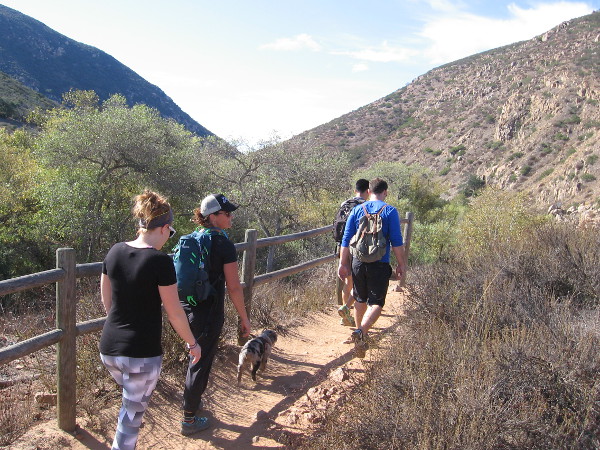
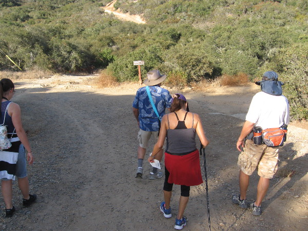
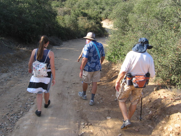
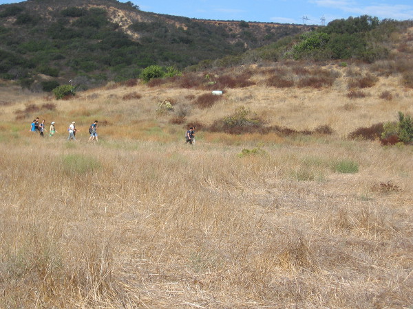
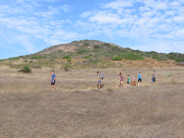
Naturalist Mike Kelly leads a small group of hikers into Los Peñasquitos Canyon Preserve from the Del Mar Mesa trailhead.
Free guided nature walks in the Los Peñasquitos Canyon Preserve introduce the public to unexpected wild beauty in the heart of San Diego. Yesterday I went on one of these easy walks.
Our guide, naturalist Mike Kelly, longtime member of the Friends of Los Peñasquitos Canyon Preserve, has been an advocate working to safeguard this beautiful and historic San Diego canyon for over three decades. He’s a friendly fellow whose knowledge of the canyon’s flora, fauna and fascinating history made for an extremely enjoyable hike.
Years ago, Mike and others fought to save Los Peñasquitos Canyon from development. Their efforts resulted in about half of the canyon being protected. Fortunately, the preserve is connected to other similar natural areas in San Diego through various corridors, allowing wildlife to move about and thrive. Owls, woodpeckers, hawks, raccoons, bobcats, coyotes, mule deer, even an occasional mountain lion make the canyon their home. Native trees, chaparral, grass and spring flowers are abundant and the source of endless enjoyment.
I learned there are also wildlife tracking hikes, plus night walks, when deer are frequently seen. There are also free guided tours of San Diego’s second oldest residence, which stands near the east end of the preserve, the Rancho Santa Maria de Los Peñasquitos adobe. To learn about all these wonderful adventures, which are ideal for families, click here.
To learn more about the Friends of Los Peñasquitos Canyon Preserve, click here! Perhaps you’d like to become a member!
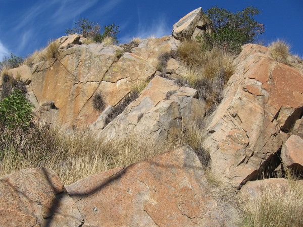
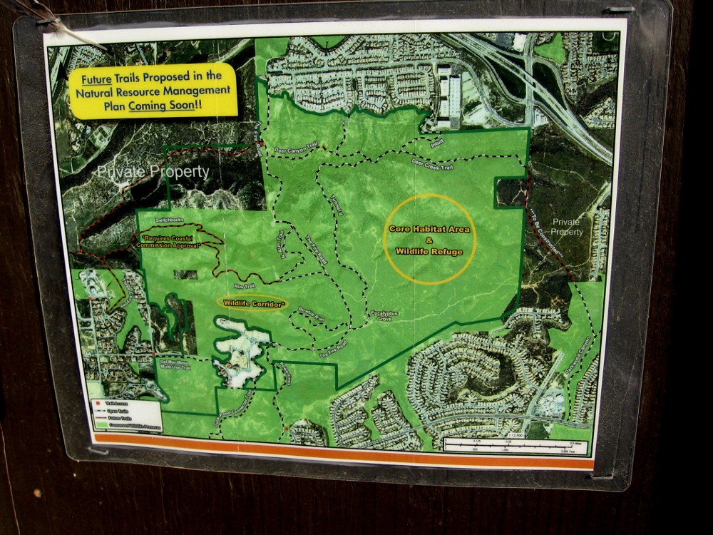
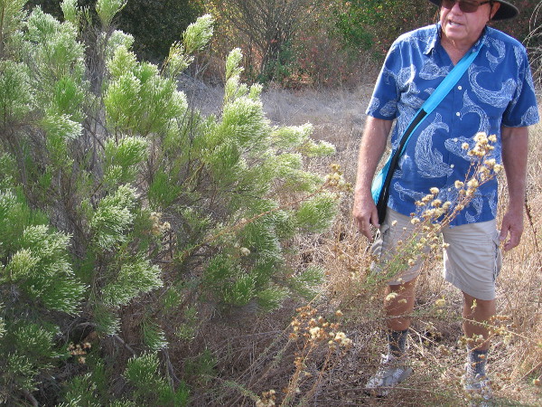
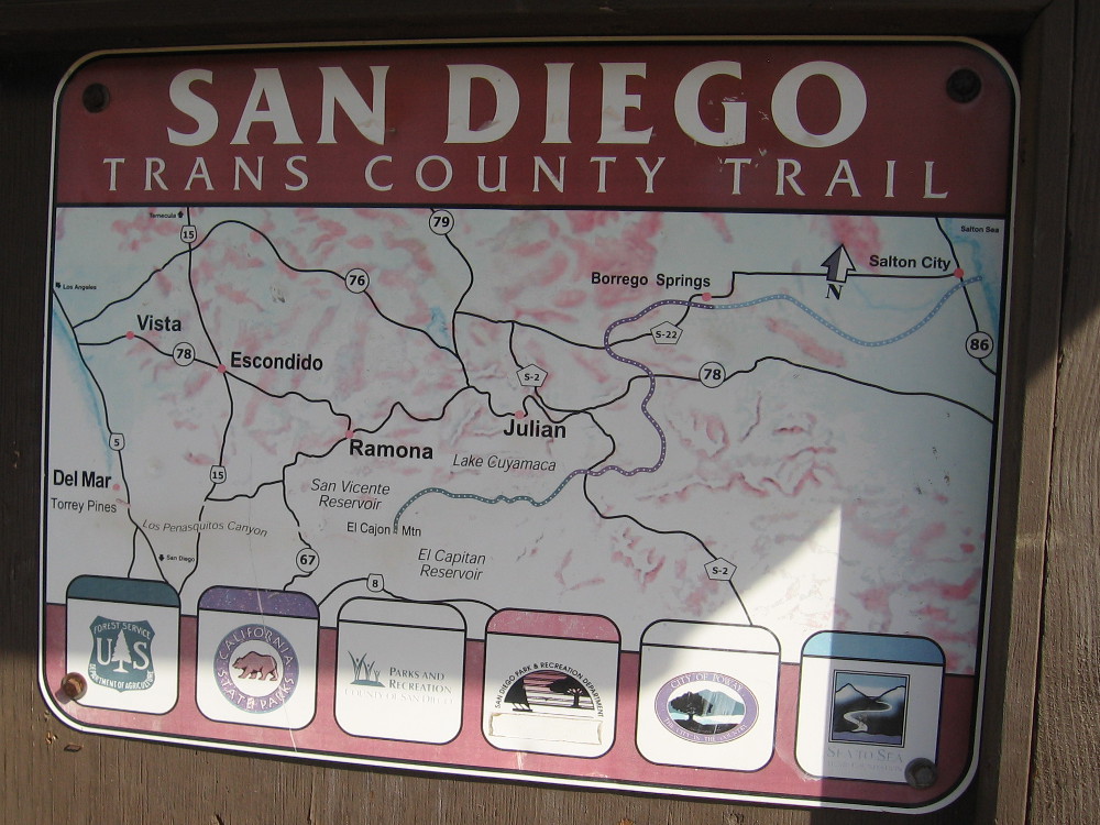
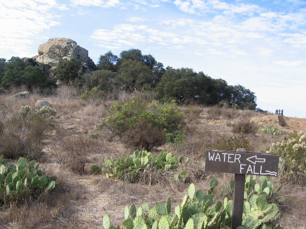
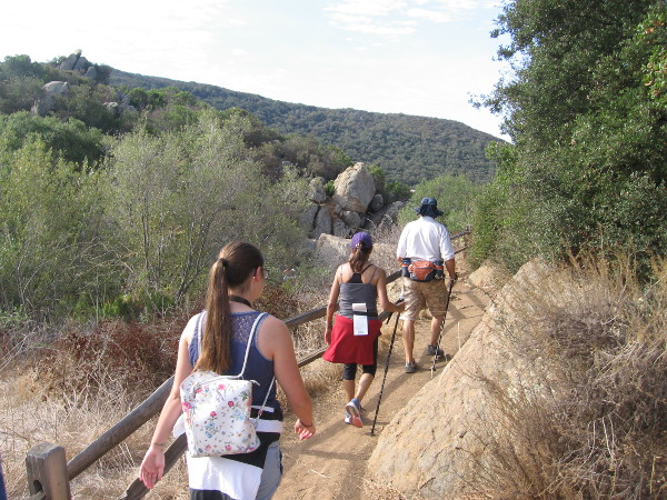
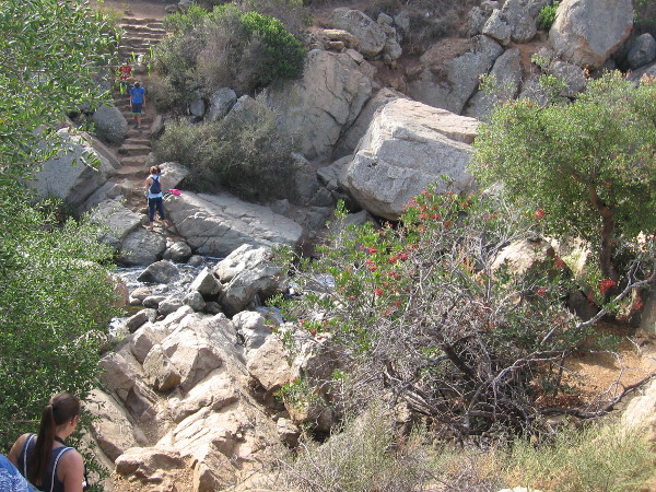
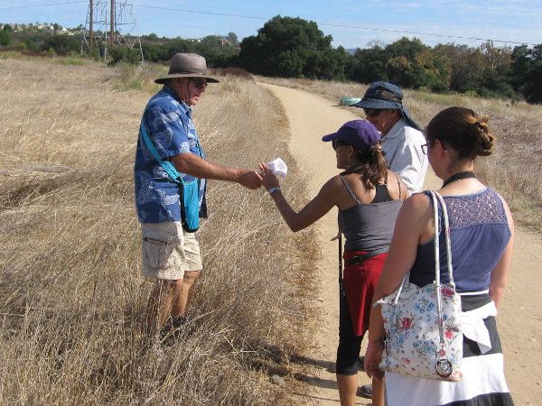
The Del Mar Mesa trailhead is located near suburban homes at the north edge of Los Peñasquitos Canyon.A sign posted at the trailhead shows future trails proposed in the Natural Resources Management Plan.Our small group of hikers heads down into the canyon through Coastal Sage Scrub habitat. We are passing California scrub oaks.We headed to Carson’s Crossing before checking out the popular waterfall.Approaching the central part of the long, narrow canyon, which runs from Poway west to Del Mar and the Pacific Ocean. Peñasquitos Creek lies beyond those coast live oaks in the distance.Carson’s Crossing is an historically important spot in Peñasquitos Canyon. Kit Carson crossed the creek here during the Mexican-American War. General Kearny’s US Army of the West was faced with formidable Californio lancers in San Pasqual, and the legendary frontiersman Kit Carson snuck away in the middle of the night to summon reinforcements from San Diego. He knew to come this way. The later 1857 Jackass Mail stagecoach line also ran through the canyon here enroute to San Diego.Heading west through the beautiful canyon in the shade of oaks, sycamores and willows. It’s an easy, pleasant hike.Looking north across a field in Los Peñasquitos Canyon Preserve in late October. Summers are very dry. Many leaves and flowers are now brown, awaiting winter rains.Walking slowly, senses alert. I smell the nearby sagebrush. I hear acorn woodpeckers and quail. I see beautiful clouds.Mike Kelly is a guide and activist whose knowledge of Peñasquitos is deep. Here he shows us some poison oak which is growing a short distance off the trail.A peaceful walk through nature. Over several decades, activists like Mike have worked hard to preserve the canyon and protect it from development. Today it is maintained by volunteers and both the City and County of San Diego.Mike Kelly shows us some California broom. Native American Kumeyaay and pioneers used the plant like a broom for sweeping.Los Peñasquitos Canyon Preserve is a very popular place for jogging, hiking and mountain biking. Even marathoners use it for training.Now we’re approaching a trail sign and a large rock outcropping, which I learned is volcanic.Sign shows proposed San Diego Trans County Trail, which when completed would run from the Pacific Ocean over the mountains east of San Diego and out to the Salton Sea in the desert.I see lots of prickly pear cacti. Now we are getting close to the popular waterfall!Approaching the Peñasquitos Creek waterfall from the east.Descending rough stone steps to the waterfall. I learned the steps were a project of an Eagle Boy Scout.The small waterfall and its rocky pools are located near the center of Los Peñasquitos Canyon. It is the destination of many hikes. A great place to relax, cool off, and listen to the soothing water.Water spills over rocks. It isn’t Niagara Falls, but it’s wonderful nonetheless.Hikers pause above a pool of water which is captured by large blocks of volcanic rock. When the creek crests, it can rise many feet and submerge this area.A hiker up above seems to walk in the sky.Families wander down a pleasant trail in Los Peñasquitos Canyon Preserve. There is much here to see and appreciate. So much to learn.Naturalist Mike Kelly shows us a poisonous flower of Datura. In nature, beauty and danger are often found together. One should be thoughtful when hiking, and be careful to wear sturdy footwear and bring water. We didn’t see any rattlesnakes or mountain lions!
…
This blog now features thousands of photos around San Diego! Are you curious? There’s lots of cool stuff to check out!
Here’s the Cool San Diego Sights main page, where you can read the most current blog posts. If you’re using a small mobile device, click those three parallel lines up at the top–that opens up my website’s sidebar, where you’ll see the most popular posts, a search box, and more!
To enjoy future posts, you can also “like” Cool San Diego Sights on Facebook or follow me on Twitter.
Wheelchairs are welcome on the beautiful Jas Arnold Trail For All People in Black Mountain Open Space Park.
A hiking trail that welcomes wheelchairs recently opened in San Diego’s North County. It’s called the Jas Arnold Trail For All People, and it’s located in the Black Mountain Open Space Park.
This morning I walked the short loop for the first time.
What a wonderful place. Peaceful, a bit meandering, easily accessible, with pleasant views into the sunlit distance, fresh air, the scent of sage, the sound of birds–it’s a fine place that one can explore at a easy pace and just relax–a place to feel energized, spiritually whole and free.
Here are some photographs. To read the signs, click the images and they will enlarge. This morning I spotted a shy rabbit, a curious scrub jay and a cheerful young mockingbird. And a bunch of small flitting birds that I couldn’t identify.
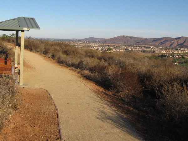
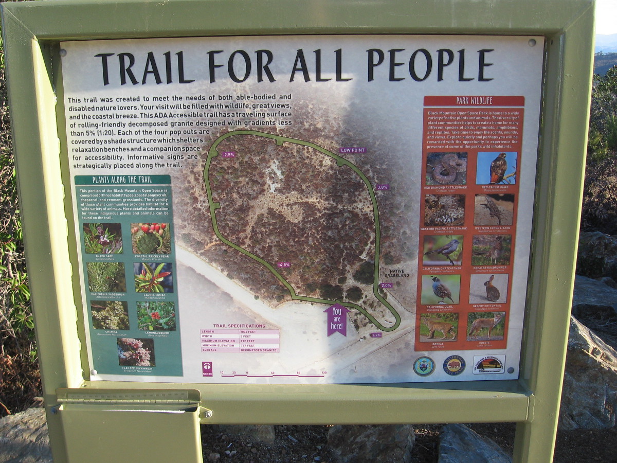
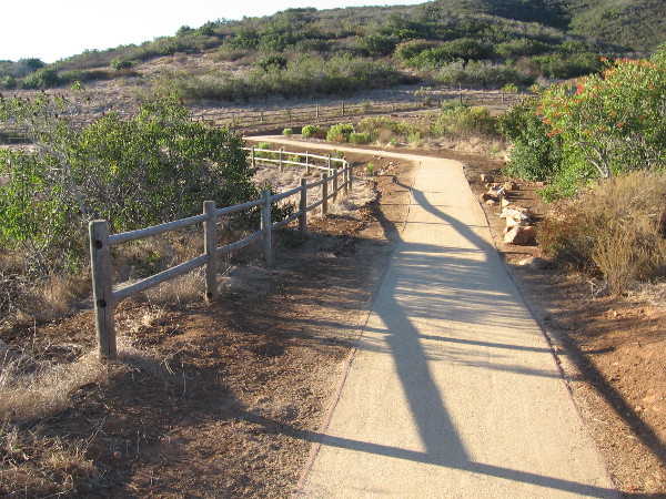
The Trail For All People is a 1076 feet long, nearly level loop. The elevation runs between 777 and 792 feet. The five foot wide hiking trail’s decomposed granite surface is very easily navigated on wheels or by foot. Those in a wheelchair who love nature and the outdoors should definitely check it out!
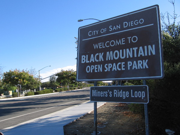
To reach the Trail For All People’s trailhead, drive up Carmel Valley Road and watch for the Black Mountain Open Space Park sign that mentions Miner’s Ridge Loop. You’ll spot it just south of the Valle Del Sur Court traffic light. Turn in to the narrow entrance and head up a slightly rough and winding paved road for about a half mile until you reach the trailhead parking lot. Once parked, it’s easy to spot the Trail For All People. (You might also see trailheads for the Miner’s Ridge Loop and Lilac Canyon Trail.)
On warm days, make sure to bring water! Enjoy!
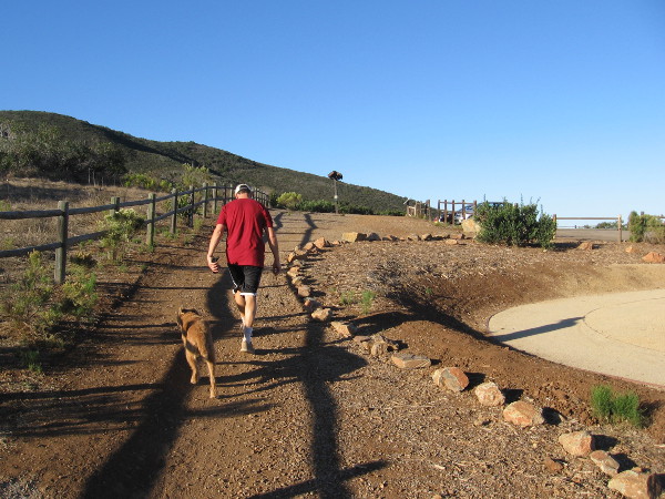
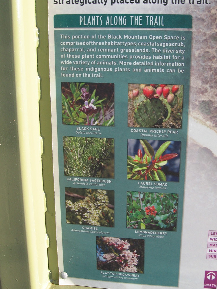
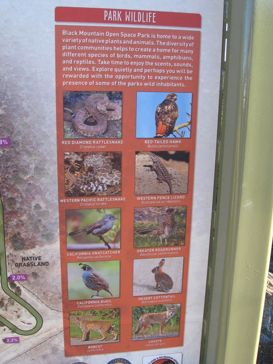
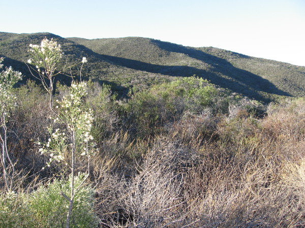
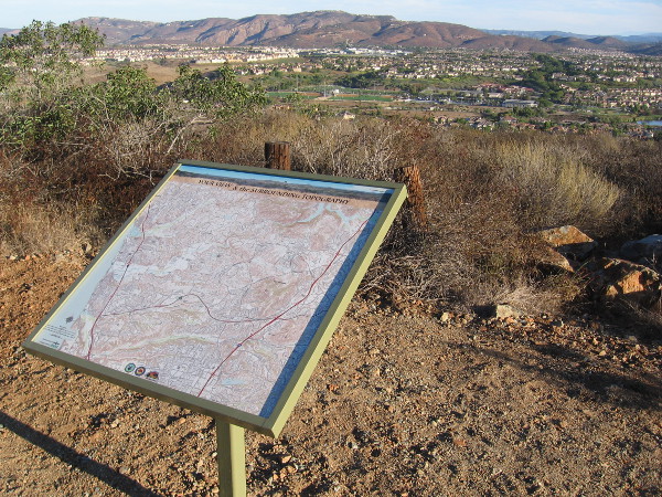
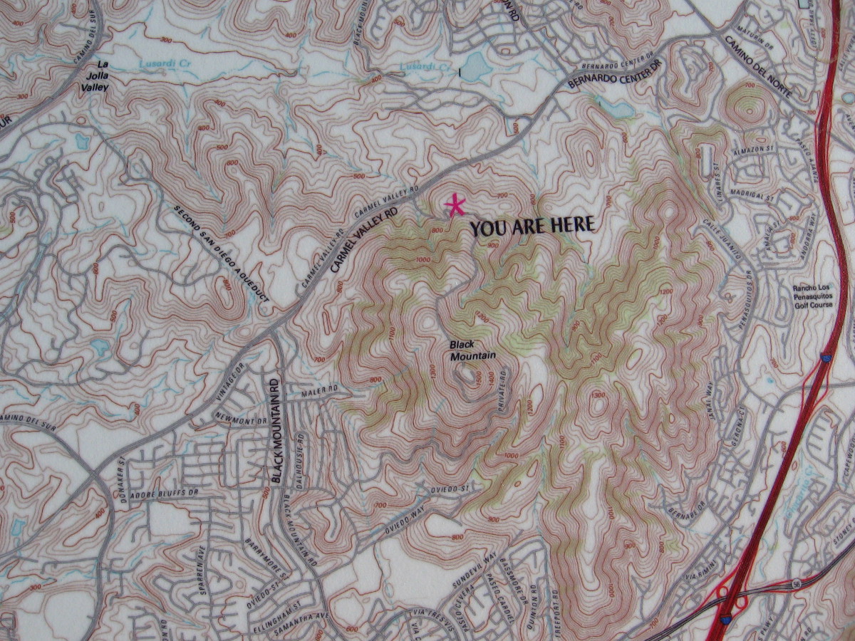
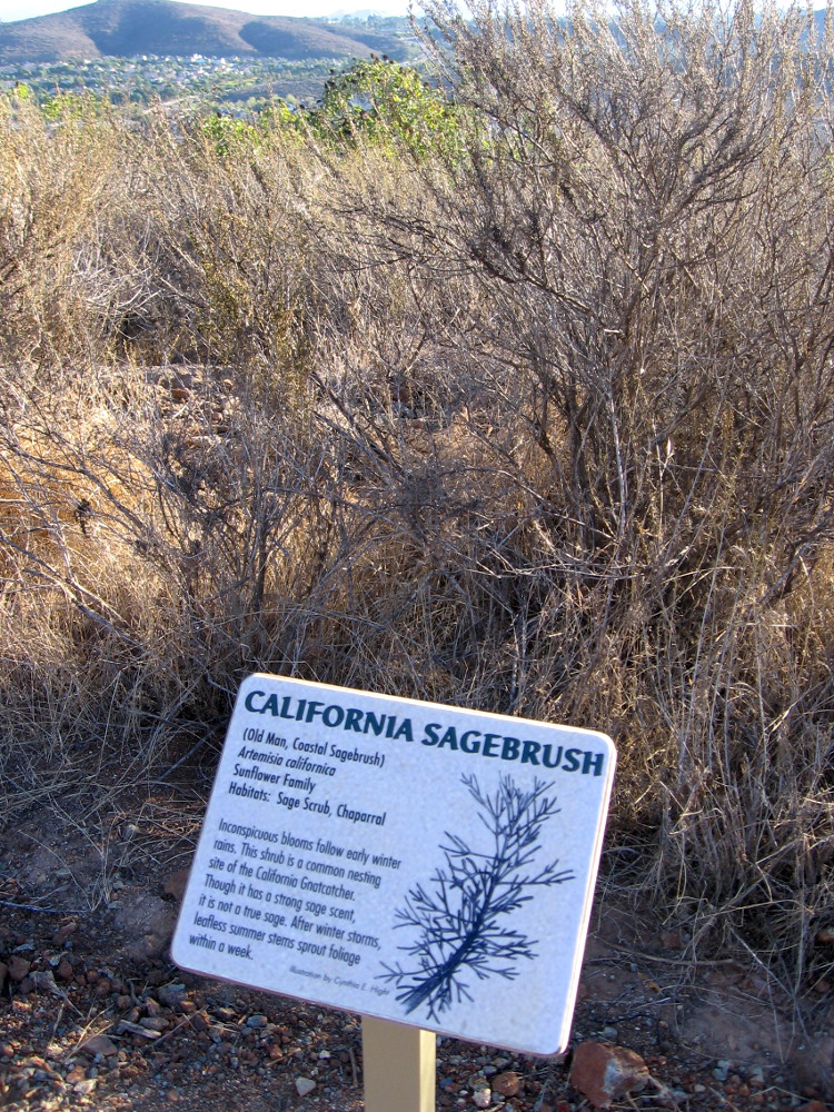
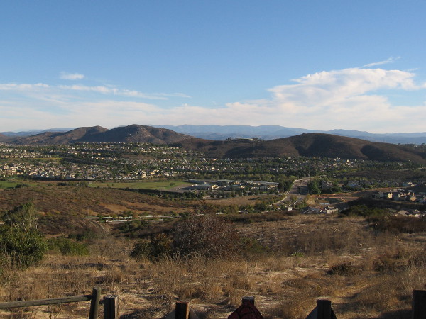
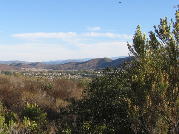
To find the trailhead for the Trail For All People, turn off of Carmel Valley Road at this sign, just south of the traffic light at Valle Del Sur Court.Early morning walker with dog on the Miner’s Ridge Loop Trail, across a parking lot from the Trail For All People.The Jas Arnold Trail For All People is an ADA Accessible loop composed of wheelchair-friendly decomposed granite. Four small shelters provide shade for those enjoying the views.Native plants along the trail include Black Sage, Coastal Prickly Pear, California Sagebrush, Laurel Sumac, Chamise, Lemonadeberry and Flat-top Buckwheat.Animals one might spot along the trail include rattlesnakes, Red-tailed Hawks, California Quail, Greater Roadrunners, Desert Cottontails, Bobcats and Coyotes.Here I’m hiking down the easy Jas Arnold Trail For All People on Black Mountain early one Saturday morning. The sun had just risen and very few people were about.One of the benches and shelters along the Trail For All People. Views to the north include mountains and nearby 4S Ranch.Looking southeast toward the chaparral-covered slopes of Black Mountain in north San Diego County.A topographical map shows the position of the Trail For All People in relation to its surroundings.The Jas Arnold Trail For All People was built on a small plateau in the Black Mountain Ranch Open Space Park.Another sign along the trail provides detailed information about some of the wildlife one might see.Another section of the relatively level Trail For All People. The easy loop is ideal for the mobility challenged and families with very small children. On warm days, bring water!One of many fascinating signs along the trail. The smell of sage adds a pleasant element to one’s invigorating journey through fresh open air.A pleasant view from the Jas Arnold Trail For All People on Black Mountain.The natural beauty, open spaces and sunlight make one feel happy and alive.
…
I live in downtown San Diego and love to walk! You can follow Cool San Diego Sights via Facebook or Twitter!
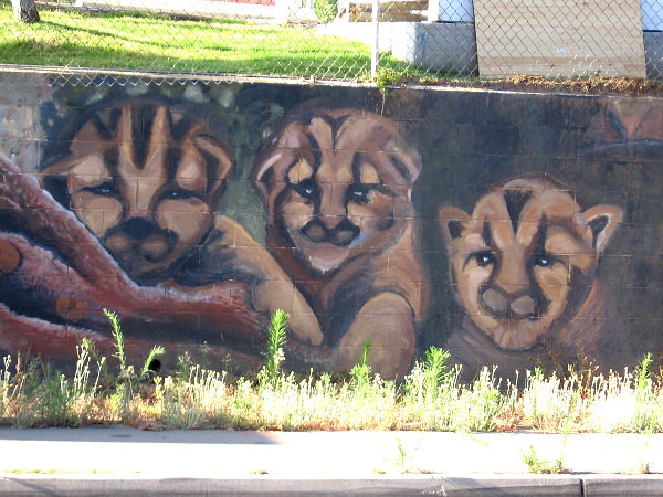
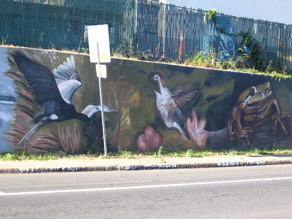
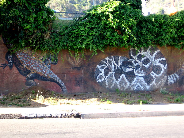
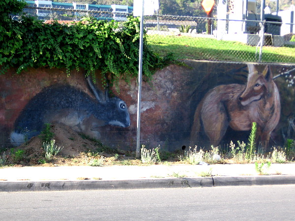
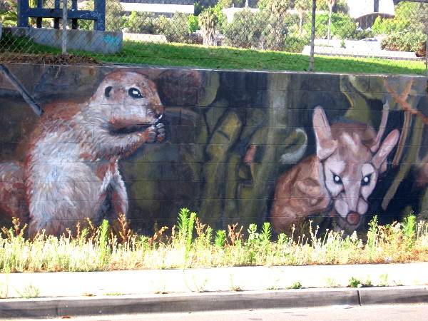
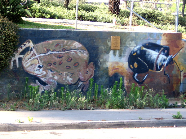
Faces peer from a wall near the San Diego River. The very long mural, titled River Life, contains images of wildlife one might find here–or have found here before urban development.
I love this mural in Mission Valley. I remember driving through the intersection at Qualcomm Way and Camino de la Reina years ago, and seeing a whole bunch of people painting wild river animals along the ugly low wall. A little research today tells me that memory was from late 2009.
“River Life” was completed by almost 200 volunteers over four days. The design came from artist Lori Escalera. It’s one of of six murals (so far) that the San Diego River Park Foundation has helped to create. I’ve featured others on my blog. Here are some links if you want to check out more of the beautiful San Diego River murals…
The left end of a long, colorful mural in Mission Valley. Birds of the air and water are featured here. The art was designed by Lori Escalera in 2009.A heron, hummingbird and frog. Down by the beautiful River Trail, just north of where we stand, many different birds can be spotted on the quiet surface of the San Diego River, and in thick reeds and overhanging tree branches.A butterfly, a fox (peeking from behind a transformer box on Camino de la Reina) and a raccoon.Some sort of lizard–perhaps a Gila monster–is half hidden by leaves, while a rattlesnake coils nearby!A jackrabbit and wild coyote.A skunk and perhaps kitten bobcats.I recognize a squirrel, but I’m not sure about the other animal whose eyes seem to be glowing in the dark.I believe that’s a Red-winged Blackbird and a moth.Looks to me like a toad and a beetle. If you can accurately identify these creatures, feel free to leave a quick comment!That looks to me like a turtle–or a tortoise! It’s obvious this blogger still has a whole lot to learn!
…
I live in downtown San Diego and love to walk! You can follow Cool San Diego Sights via Facebook or Twitter!
You can easily explore Cool San Diego Sights by using the search box on my blog’s sidebar. Or click a tag! There are thousands upon thousands of fun photos for you to enjoy!