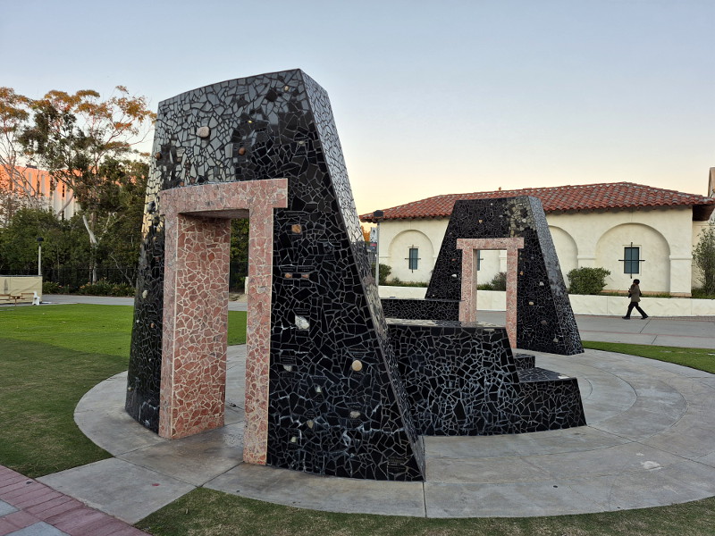
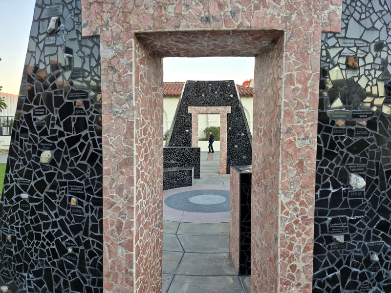
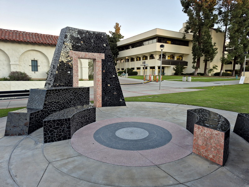
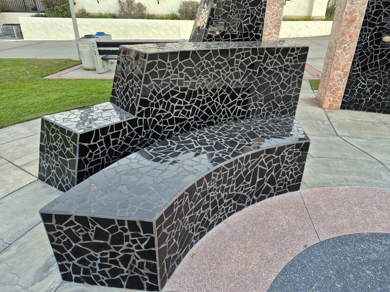
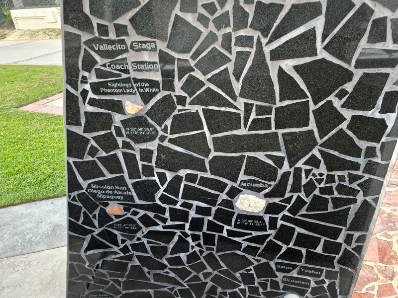
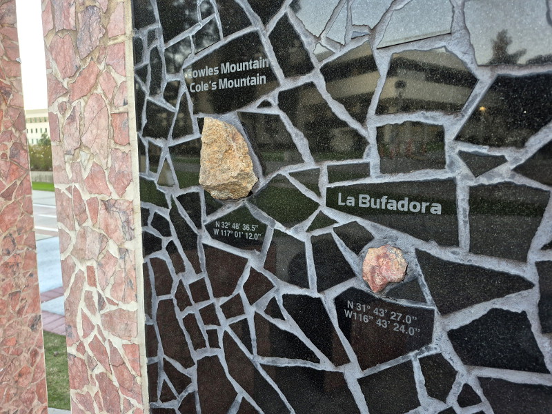
In 1997 the 100 Years, 100 Stones monument debuted at San Diego State University. It was created to celebrate the 100th anniversary of SDSU.
If you’ve ever walked down the campus’ central Campanile Walkway you’ve no doubt seen this unique stone-like sculpture with its two portals. It has an appearance suggestive of ancient temples or ruins.
Those who look closely at the monument will see small rock samples embedded in it, with informative labels. The rocks come from locations all around our region, within a hundred miles of SDSU, including places in Mexico. The art blends culture with geology.
Installation artist Eve Andree Laramee designed 100 Years, 100 Stones. There’s no plaque by this public art with any sort of explanation (that I’ve noticed), so I wonder if students walking past it understand its origin and nature. For years I myself didn’t know. Thank you Google!
…
To follow my blog, find the “Follow” box in this website’s sidebar. Or bookmark coolsandiegosights.com and swing on by occasionally!
(If you’re viewing this on a phone, open my website’s sidebar by tapping those three parallel lines at the top of the page.)
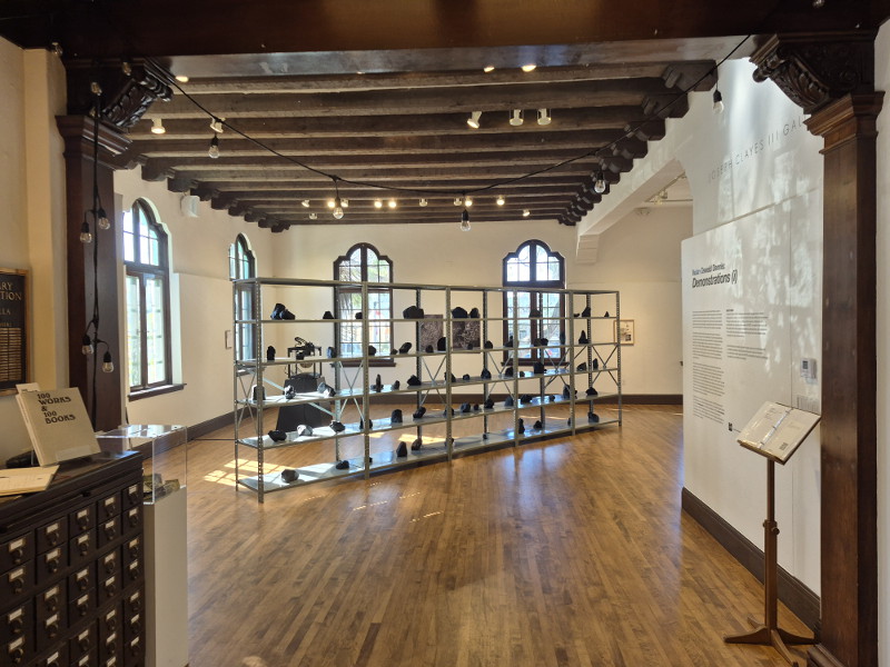
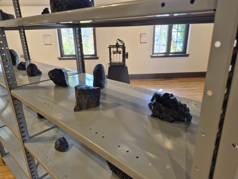
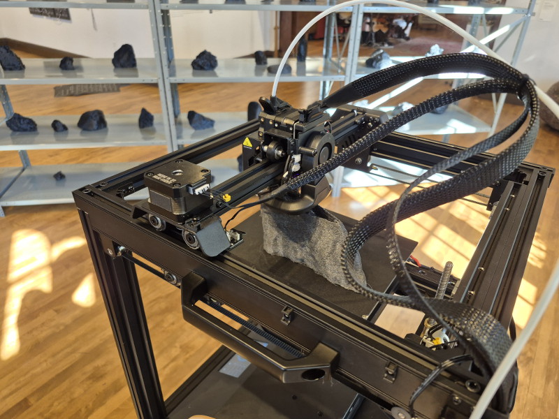
A rather unusual exhibition of art can now be viewed in La Jolla at the Athenaeum Music & Arts Library. Yes, those shelves in the above photo are full of 3D printed “rocks!”
They’re actually a kind of lightweight plastic material, but they do resemble black volcanic rocks. Visitors to the Athenaeum’s Joseph Clayes III Gallery can watch a rock being printed and handle a specimen and consider the deeper meaning of Nolan Oswald Dennis: Demonstrations (i).
As the exhibition webpage explains, this collection of art, selected by The Athenaeum and INSITE from many entries, is informed by the study of geological and planetary systems—and situated within African and diasporic relations to the land, cosmos, and anti-colonial political structures.
A further description in the gallery includes: This artwork explores the political and spiritual history of the land in South Africa as a proxy for an after-history of the planet as a discontinuous but interrelated whole, imagining that we can use the digital shadow of a simulated rock (the thing without itself) to hold the immaterial social, spiritual and political relations which are also part of the geo-physics of the planet.
I’m afraid I’m not terribly sophisticated, so those explanations are a little beyond me. It struck me the exhibition is about something that is universal: the enormous complexity of essence and connection. That’s probably too simple.
Visit this very unique exhibition, turn over a simulated rock, and arrive at your own particular conclusion!
Nolan Oswald Dennis: Demonstrations (i) can be experienced through January 17, 2026.
…
To follow my blog, find the “Follow” box in this website’s sidebar. Or bookmark coolsandiegosights.com and swing on by occasionally!
(If you’re viewing this on a phone, open my website’s sidebar by tapping those three parallel lines at the top of the page.)
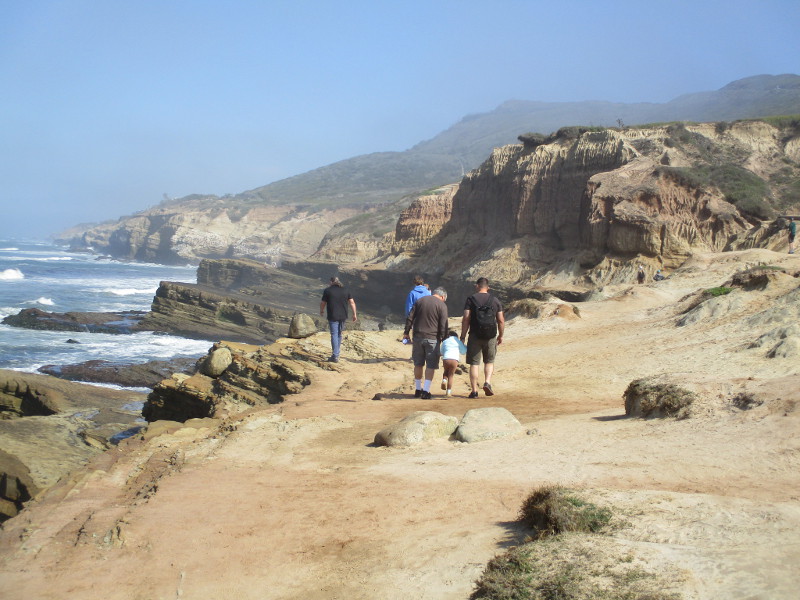
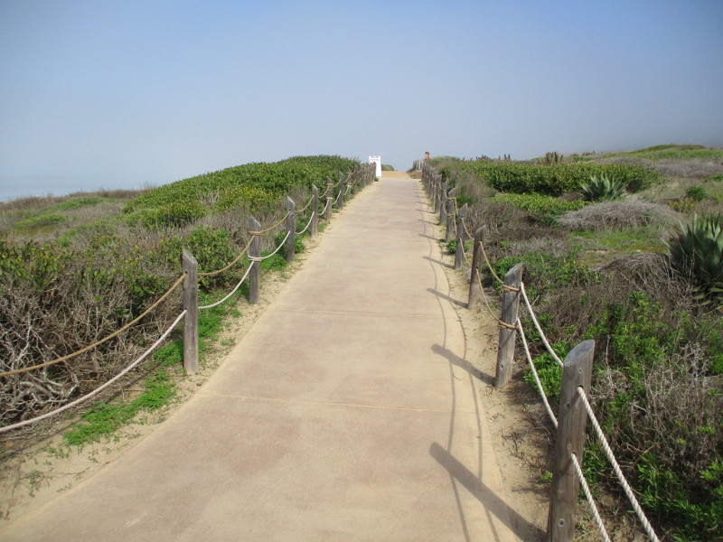
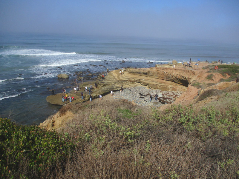
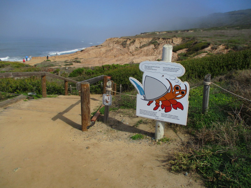
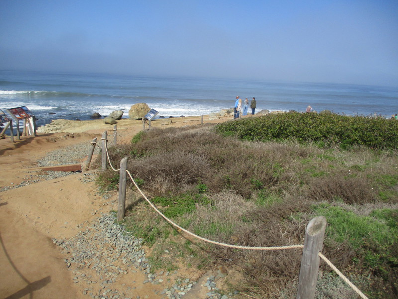
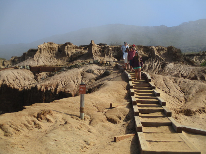
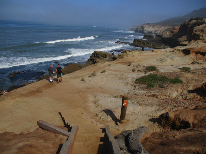
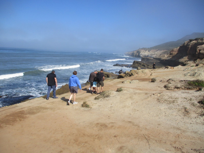
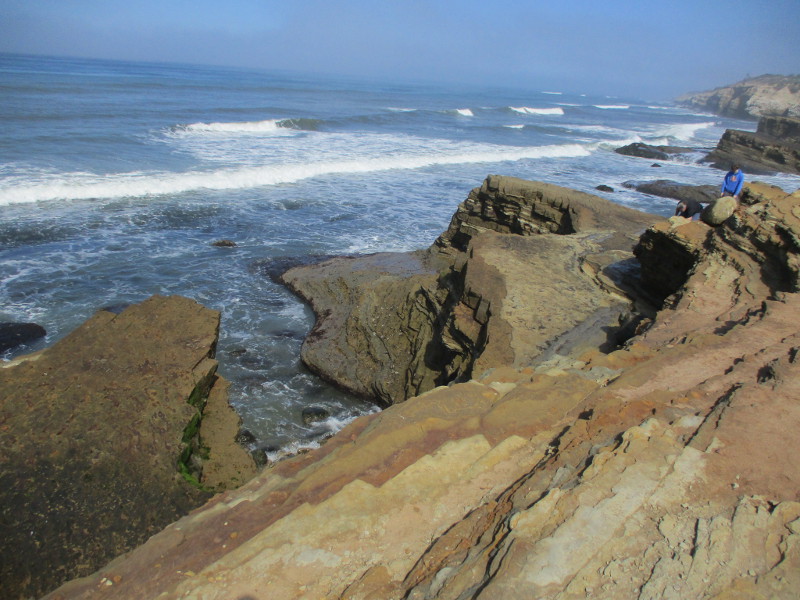
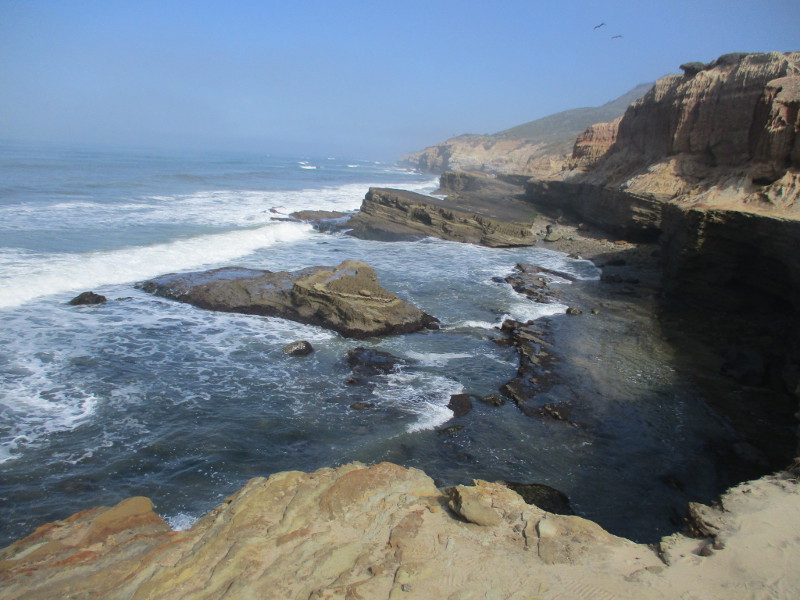
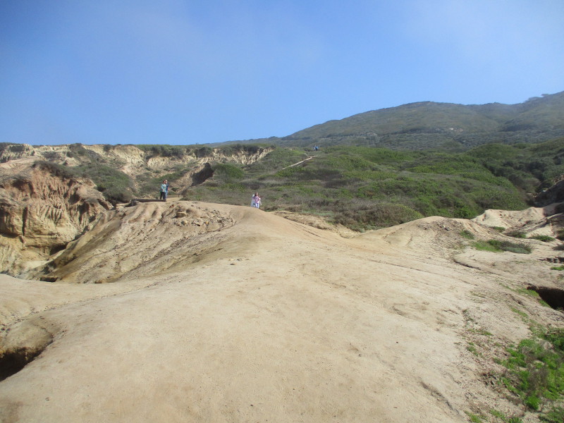
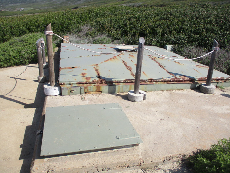
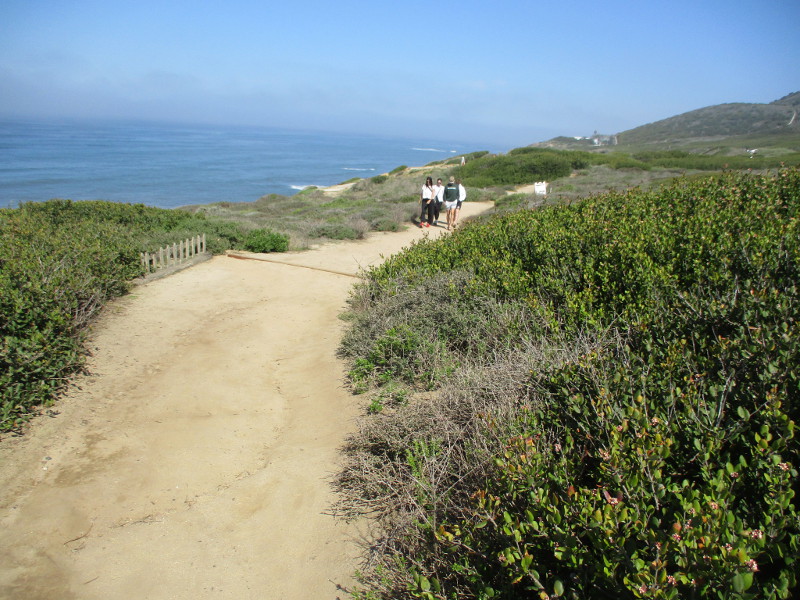
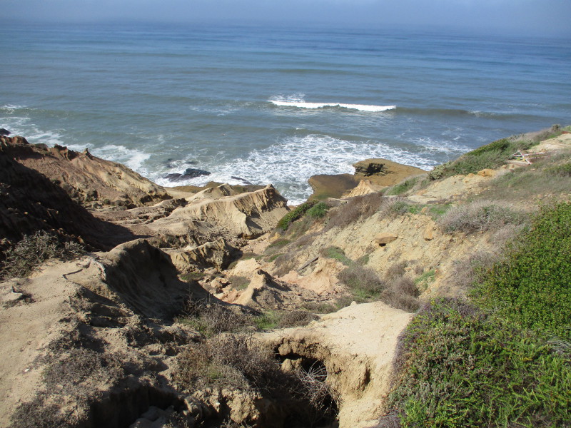
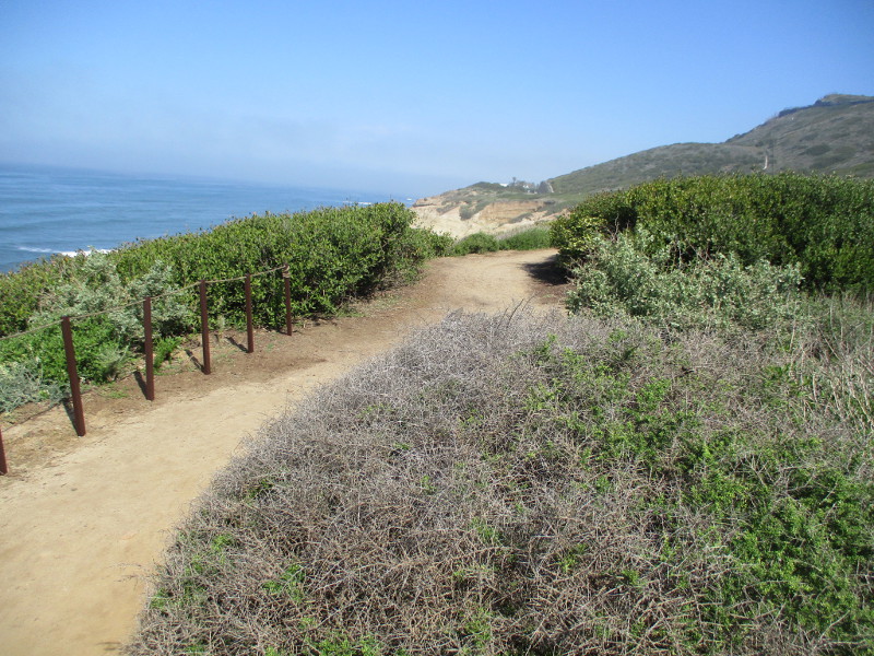
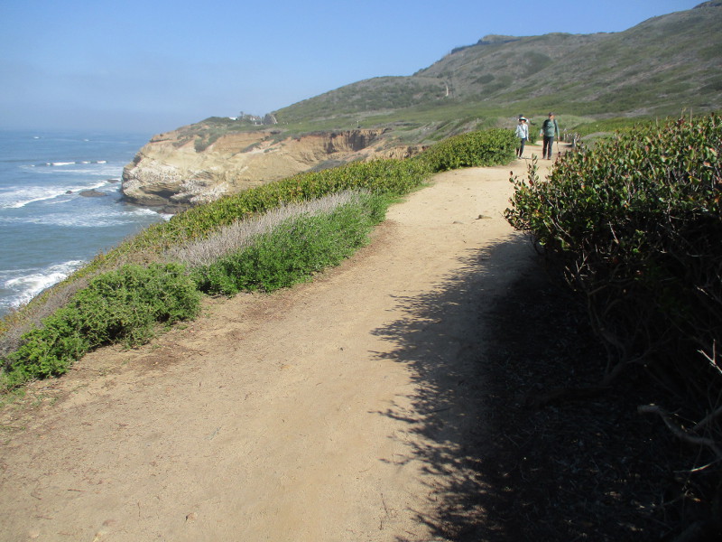
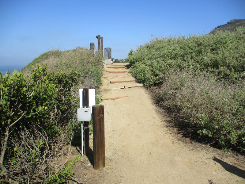
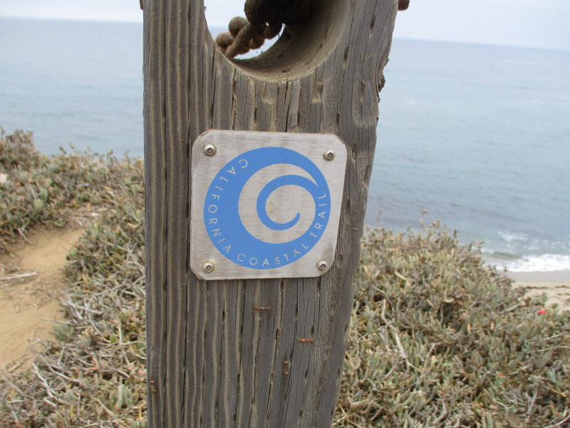
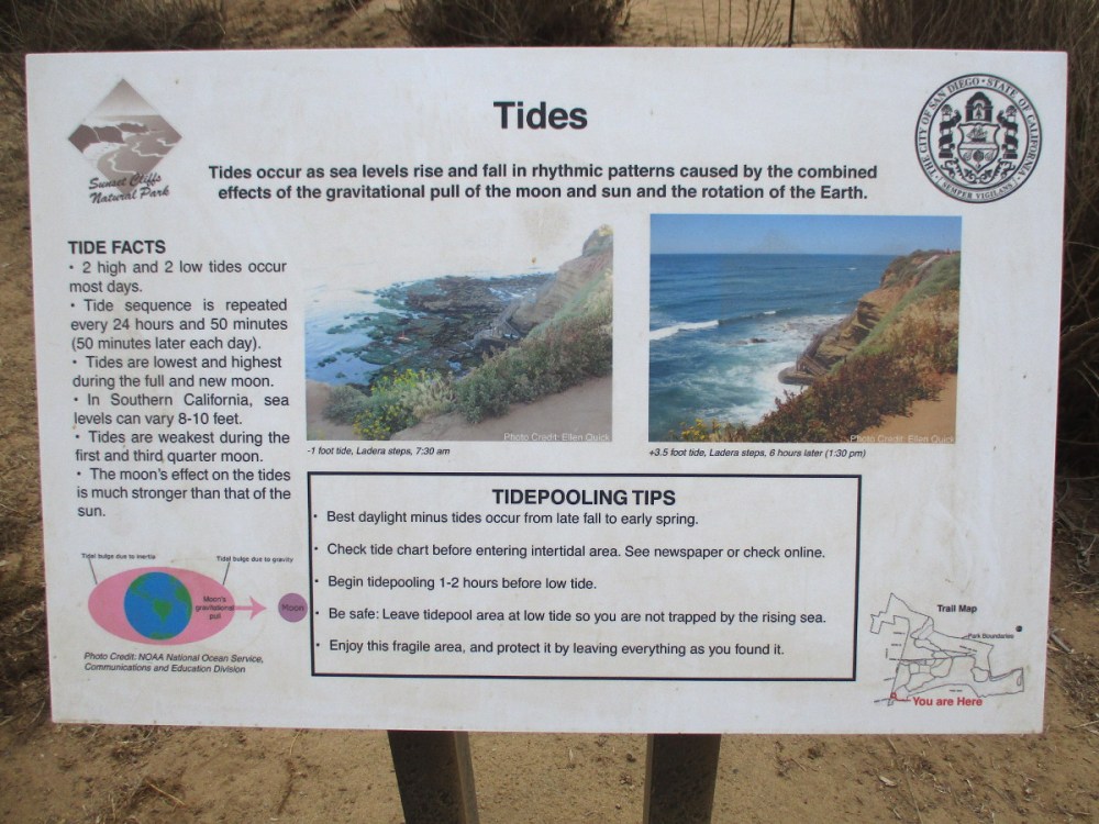
The Coastal Trail provides an incredibly scenic walk at Cabrillo National Monument. It runs for about half a mile along rugged sandstone bluffs beside the Pacific Ocean.
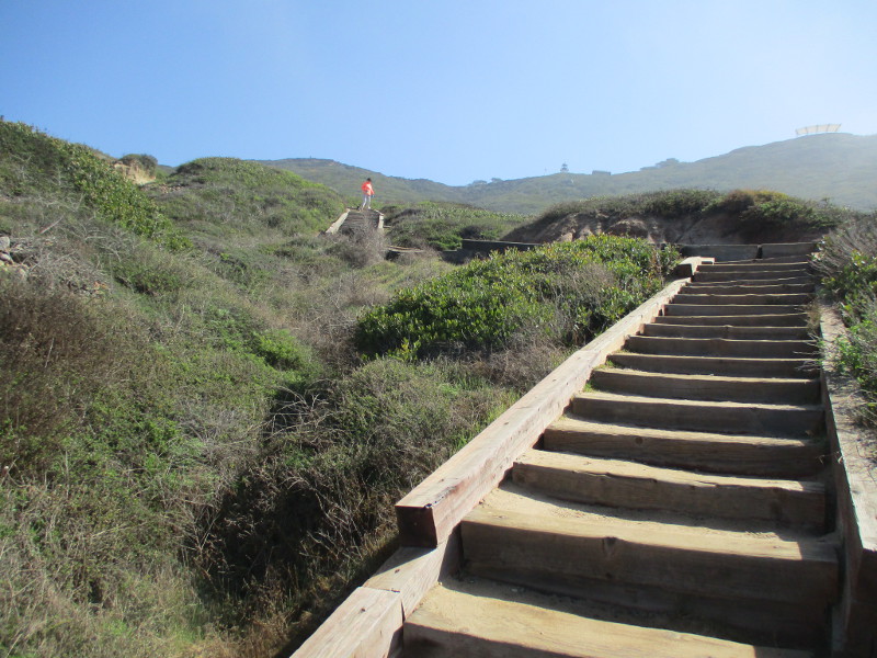
The easy to moderate trail, with occasional steep steps leading up and down, begins by the park’s Tidepool Parking and winds north to Sea Cove Parking.
I asked a park ranger her favorite aspect of this trail. She loved how lines of pelicans soar along the ocean’s edge at eye level. I love that too.
I went for a walk along Coastal Trail the other day and took photos as I proceeded north. One comes to the tidepools very quickly. If you’d like a closer look at the tidepools, you can click here.
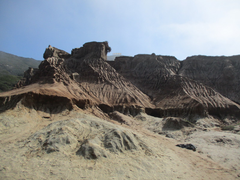
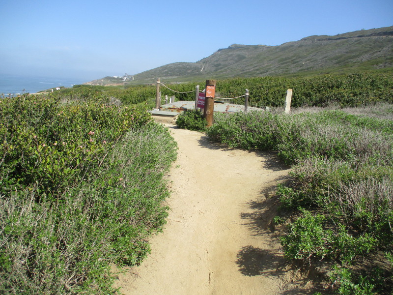
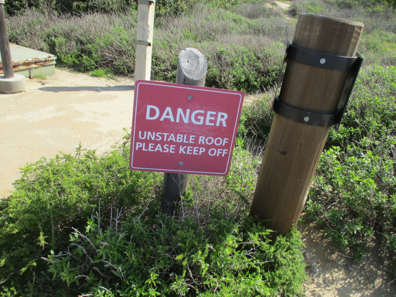
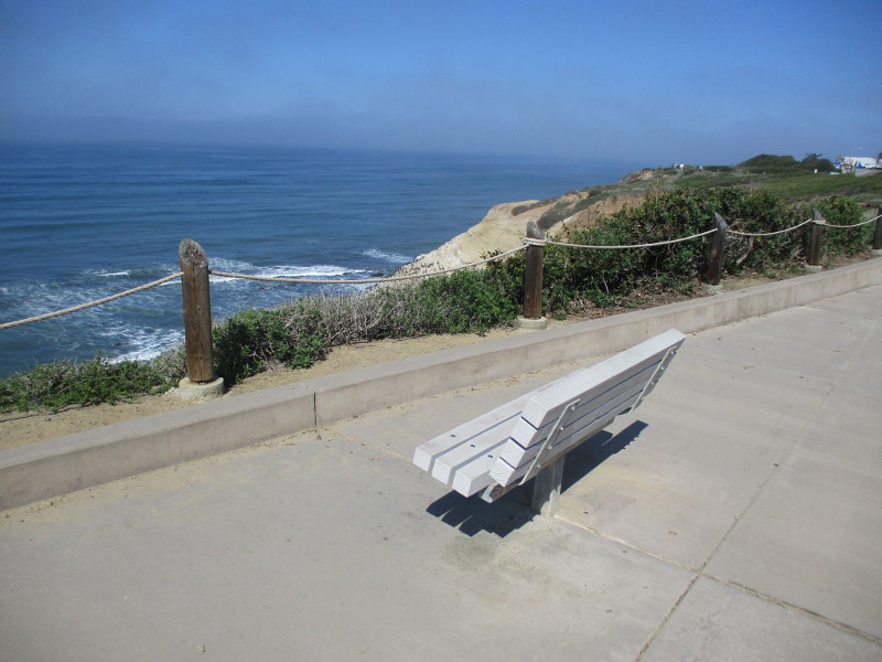
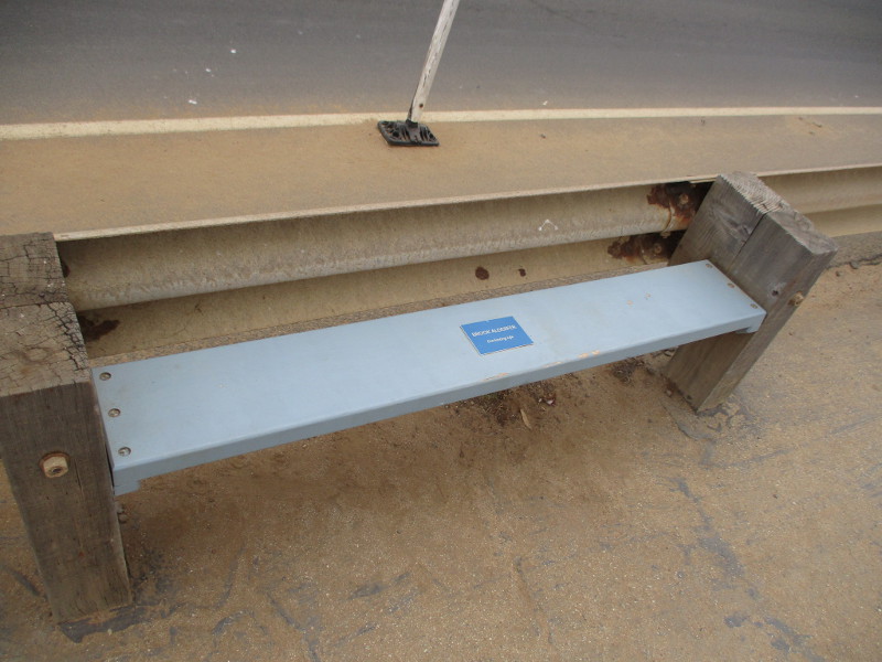
Starting north along the Coastal Trail near the Tidepool Parking at Cabrillo National Monument.Map shows the Coast Trail and other parts of Cabrillo National Monument, which is located near the south end of San Diego’s Point Loma.The scenic trail is very popular. Misty fog drifting in from the ocean is common.The tidepools come into view soon.Visitors like to pause and relax in this wide area just north of the tidepools.Continuing north along the Coastal Trail, up then down some narrow steps.Indescribable natural beauty.A climb is coming up…This stretch of steps is fairly long. I took it slow and easy. The steps are uneven in places.Here comes something interesting…This is an underground searchlight shelter from World War II. Visitors must safely stay off the unstable roof.More stunning ocean vistas ahead as walkers proceed through native coastal vegetation.The farther north you go, the fewer walkers you’ll likely encounter.Brown pelicans soar along at eye level. Your spirit might soar, too.Almost to Sea Cove Parking, also called Lot 2.A welcoming bench at Sea Cove Parking overlooks vast beauty.
…
I post new blogs pretty often. If you like discovering new things, bookmark coolsandiegosights.com and swing on by occasionally!
I live in downtown San Diego and love to walk around with my camera! You can follow Cool San Diego Sights via Facebook or X.
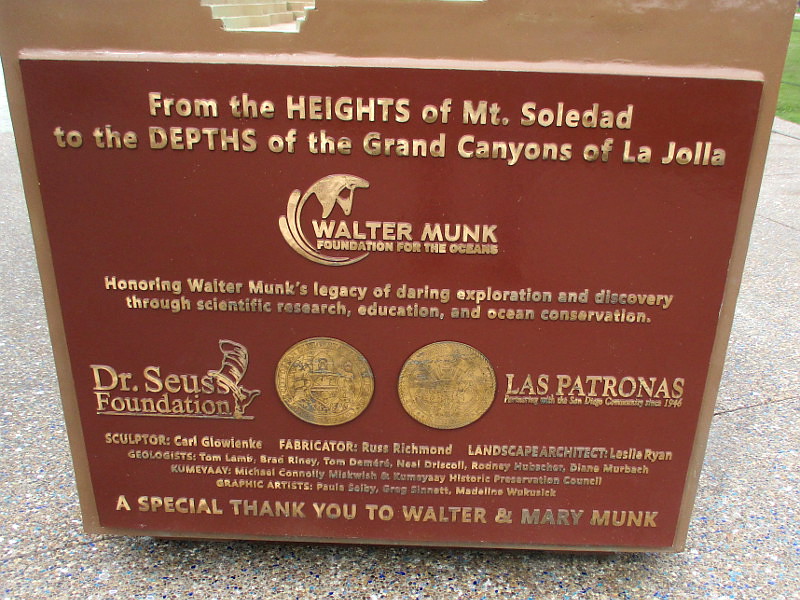
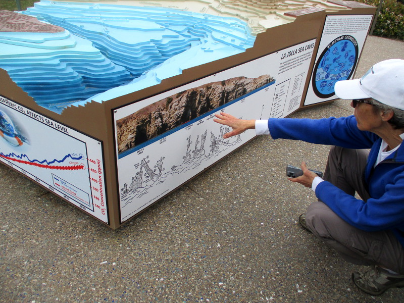
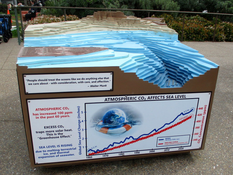
Kellogg Park at La Jolla Shores features environmental displays in an outdoor plaza by the busy beach boardwalk. A three dimensional model of underwater canyons in the Pacific Ocean is one part of The Map of the Grand Canyons of La Jolla Educational Plaza.
I blogged about this amazing plaza a couple years ago. See those images (which include stunning mosaic art) and read descriptions by clicking here.
During that previous walk, the three-dimensional, topographic model that you see in the above photo was under construction. Well, it was finished when I and some friends walked by recently!
The fascinating model depicts canyons running down from Mount Soledad into the ocean. On the sides of the model, plaques present information concerning the geology of the canyons, ocean wave dynamics, and other related environmental issues.
Should you ever walk past Kellogg Park in La Jolla Shores, pause for a few moments and learn a good deal about oceanographic history, our local environment, and this planet we live on.
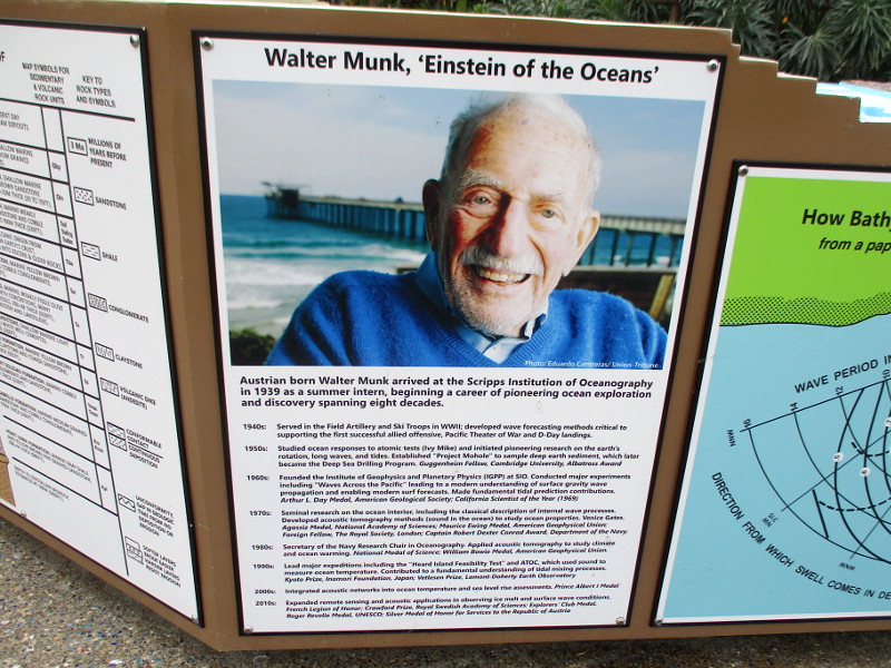
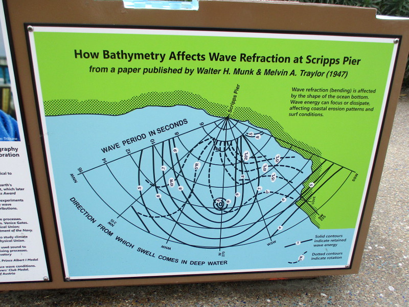
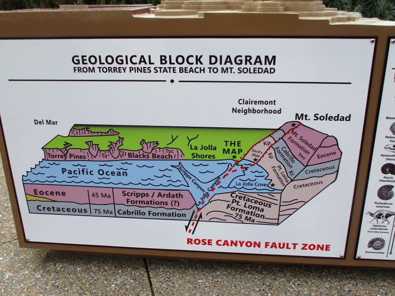
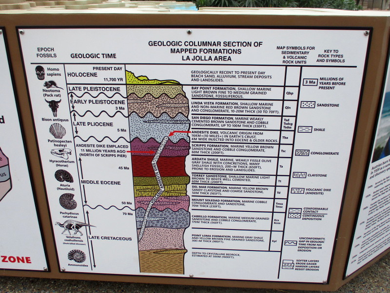
From the HEIGHTS OF Mt. Soledad to the DEPTHS of the Grand Canyons of La Jolla – Walter Munk Foundation for the Oceans – Honoring Walter Munk’s legacy of daring exploration and discovery through scientific research, education, and ocean conservation… A SPECIAL THANK YOU TO WALTER & MARY MUNKChecking out information about the La Jolla Sea Caves, and Native American Kumeyaay Cosmology.Walter Munk, “Einstein of the Oceans” – Austrian born Walter Munk arrived at the Scripps Institution of Oceanography in 1939 as a summer intern, beginning a career of pioneering ocean exploration and discovery spanning eight decades…How Bathymetry Affects Wave Refraction at Scripps Pier from a paper published by Walter H. Munk & Melvin A. Traylor (1947) – Wave refraction (bending) is affected by the shape of the ocean bottom. Wave energy can focus or dissipate, affecting coastal erosion patterns and surf conditions.Geologic Block Diagram From Torrey Pines State Beach To Mt. SoledadGeologic Columnar Section of Mapped Formations La Jolla Area (from Late Cretaceous to Holocene)Graph shows how Atmospheric CO2 (carbon dioxide) Affects Sea Level.
“People should treat the oceans like we do anything else that we care about–with consideration, with care, and affection.” –Walter Munk
…
Thanks for visiting Cool San Diego Sights!
I post new blogs pretty often. If you like discovering new things, bookmark coolsandiegosights.com and swing on by occasionally!
I live in downtown San Diego and love to walk around with my camera! You can follow Cool San Diego Sights via Facebook or X (formerly known as Twitter)!
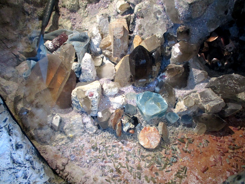
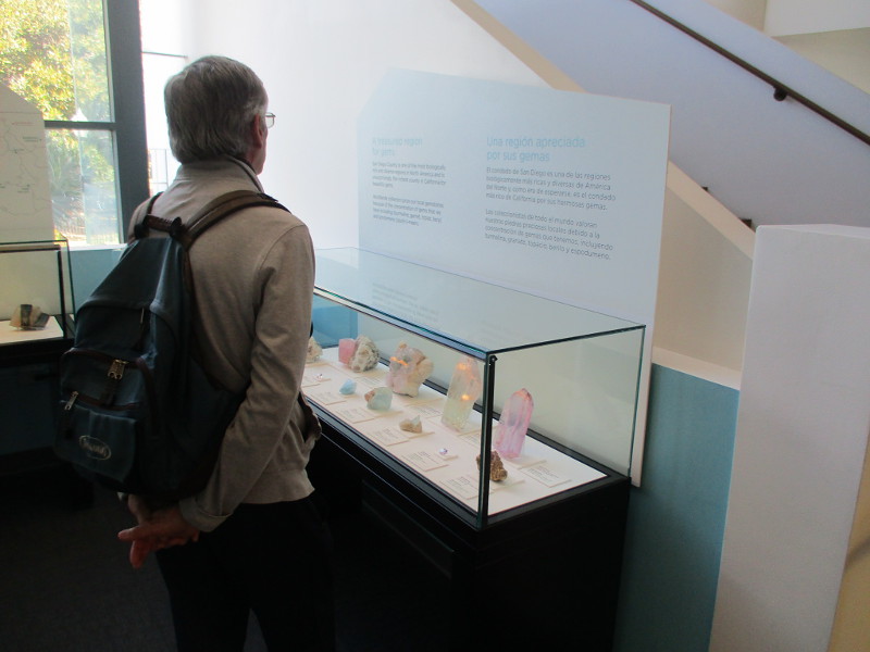
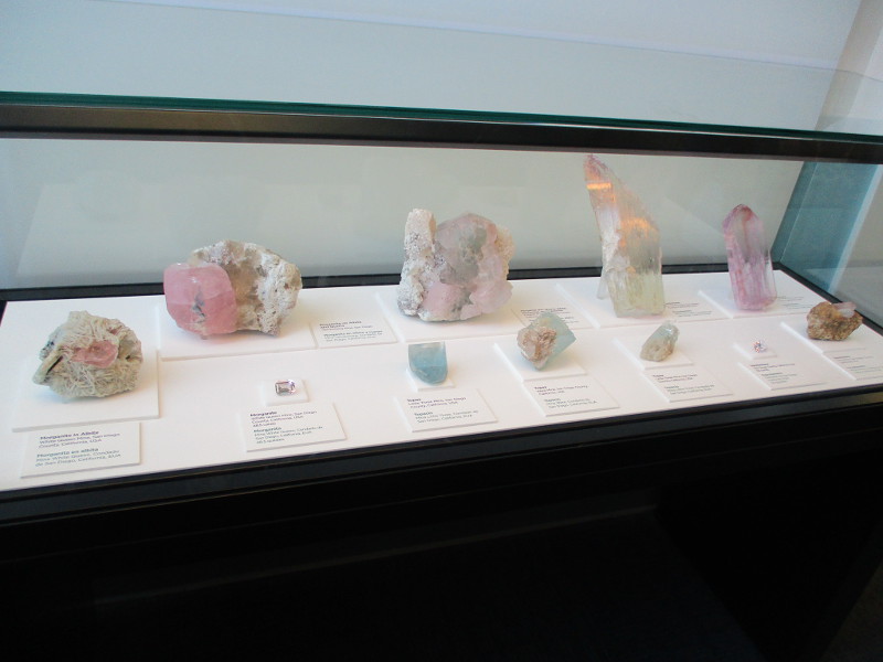
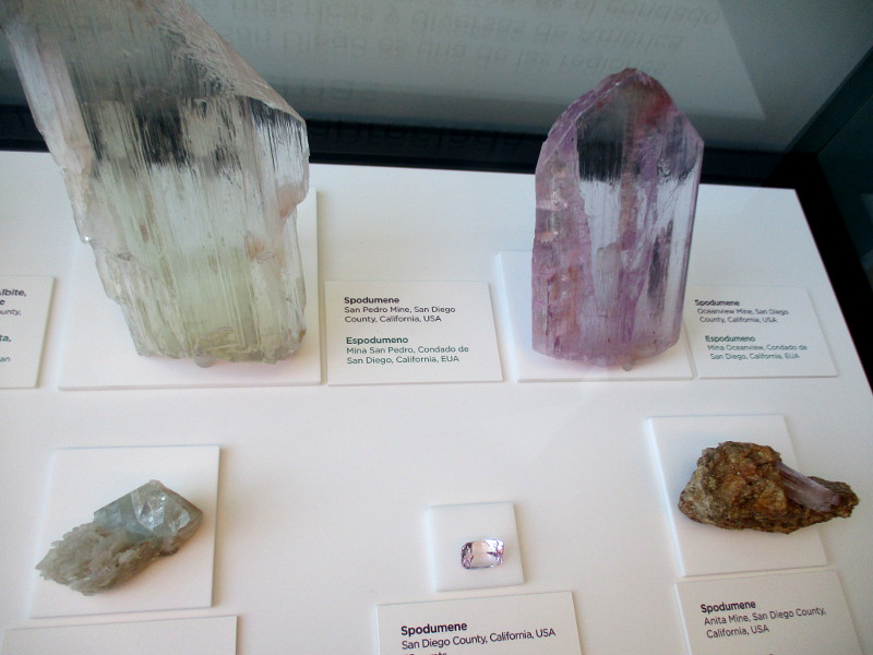
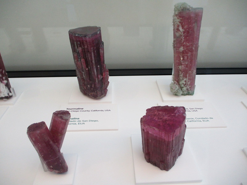
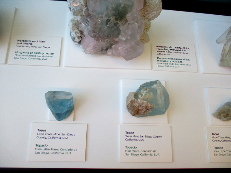
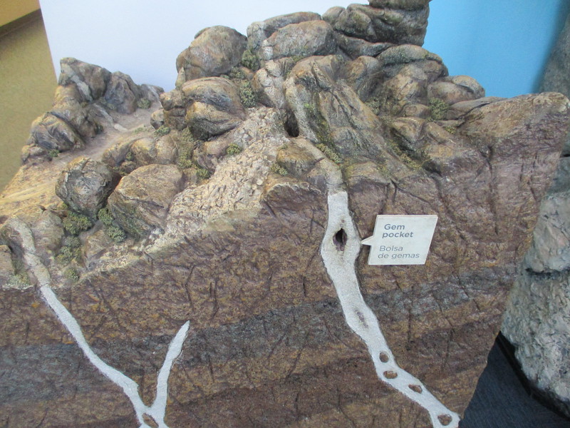
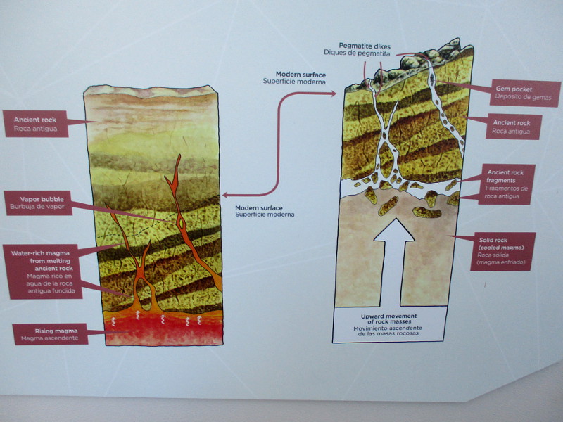
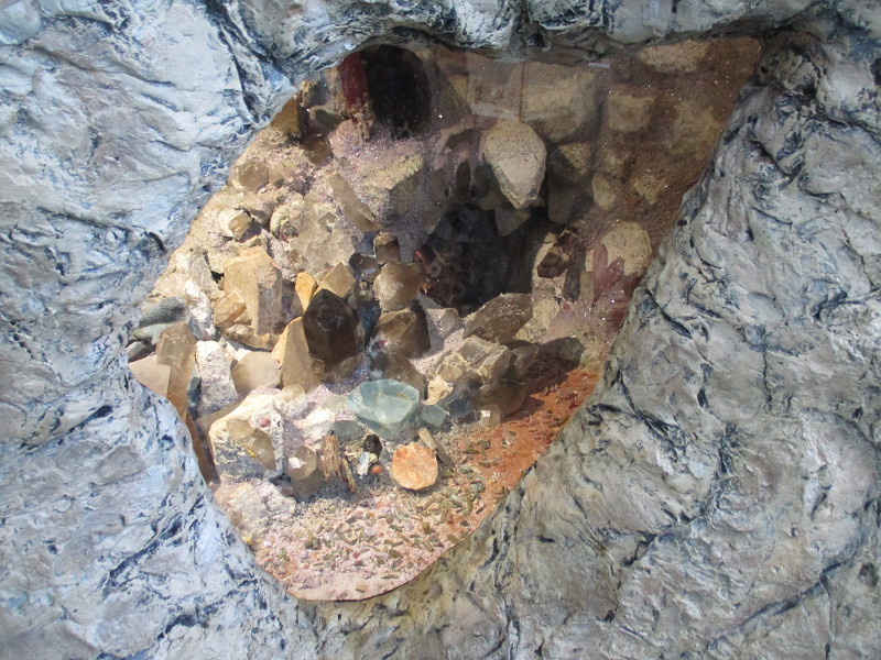
An exhibit at the San Diego Natural History Museum explains how San Diego County is the richest region in California for precious gems.
Gemstones that can be found in the mountains of San Diego County include tourmaline, garnet, topaz, beryl and spodumene. We are world-renowned for our tourmaline!
The exhibit demonstrates how these precious gems form inside pegmatites–a rock formation that can occur as magma cools. Large gem bearing pegmatites are found in San Diego’s North County, near Palomar Mountain.
Tourmaline has been mined in San Diego County since the 1890s. The Himalaya Mine alone has extracted about 250,000 pounds of mineral specimens.
I remember as a boy heading with my family up to the Stewart Lithia mine in Pala. For a fee, we spent an hour on hands and knees sifting through the mine tailings, searching for gems. We were delighted to find a handful of small pink, green and watermelon tourmalines! We also found a fair amount of lepidolite (a source of lithium). It was a lot of fun!
I see the Himalaya Mine has a Facebook page. Check it out here.
…
Thanks for visiting Cool San Diego Sights!
I post new blogs pretty often. If you like discovering new things, bookmark coolsandiegosights.com and swing on by occasionally!
I live in downtown San Diego and love to walk around with my camera! You can follow Cool San Diego Sights via Facebook or Twitter!
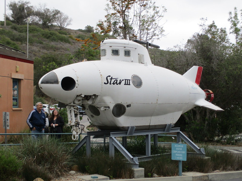
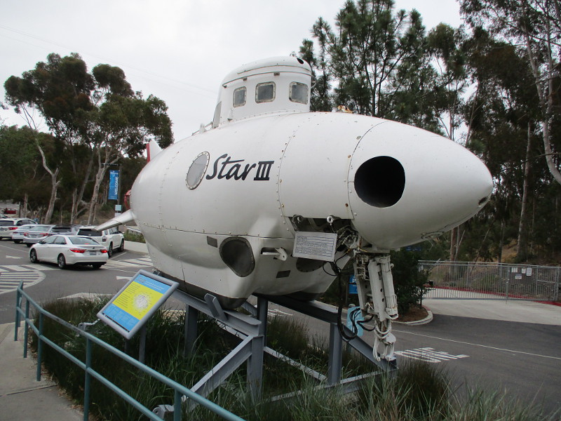
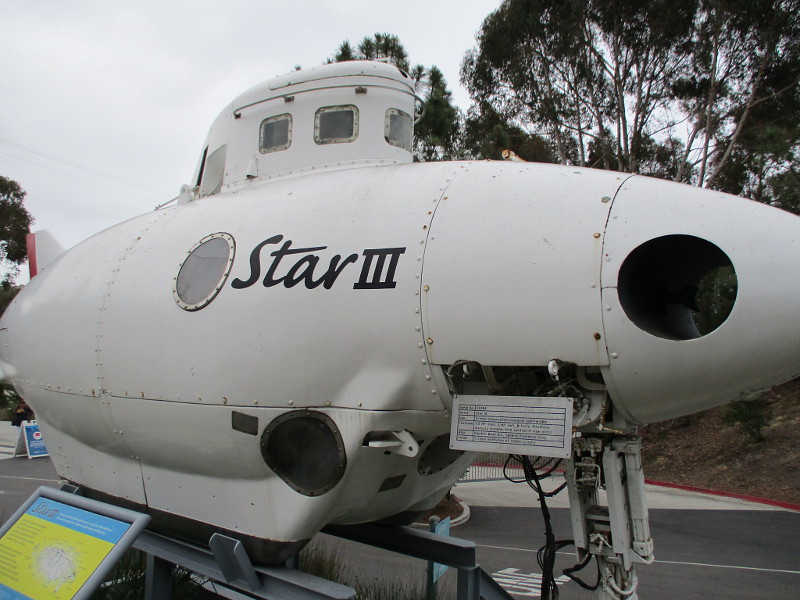
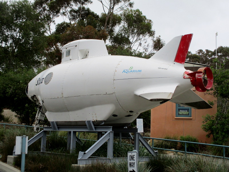
Should you walk from the parking lot by Birch Aquarium at Scripps Institution of Oceanography to the popular attraction’s entrance, you’ll see what looks like a small submarine. On its side is written Star III.
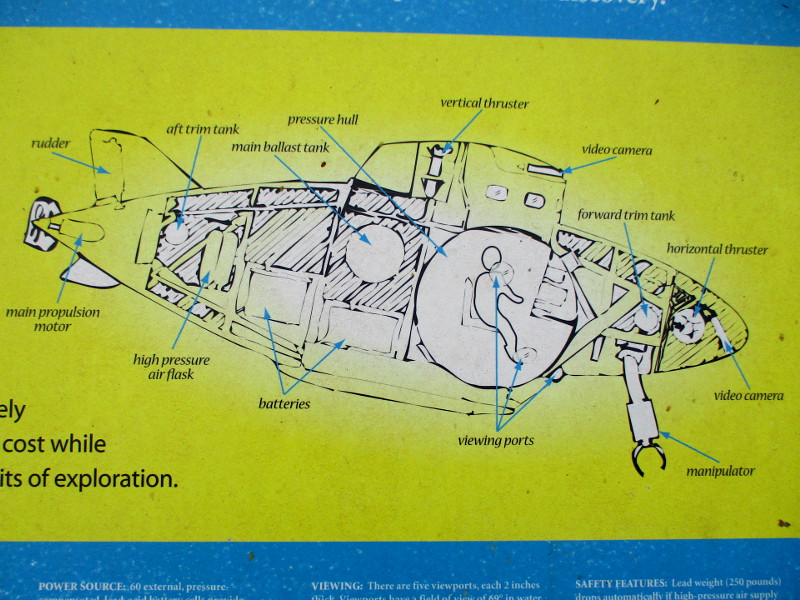
Star III is actually a submersible that was used for undersea studies back in the mid-20th century.
I looked at the cool little marvel of technology and wondered about its history.
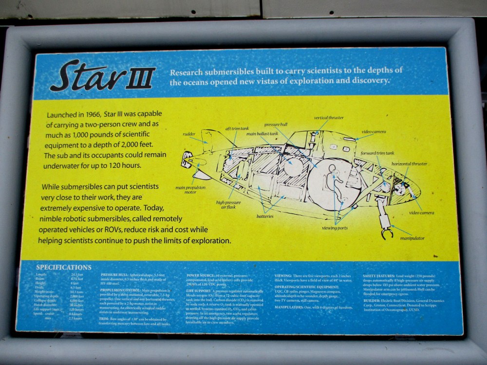
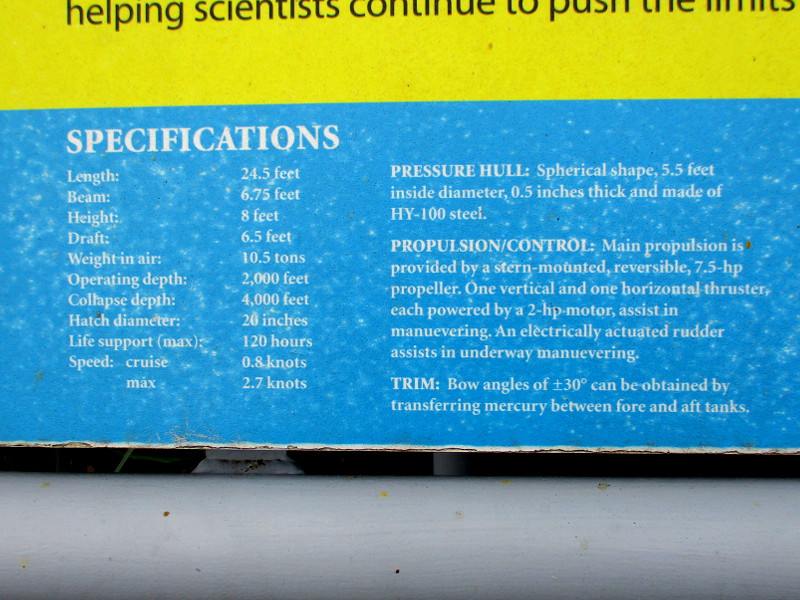
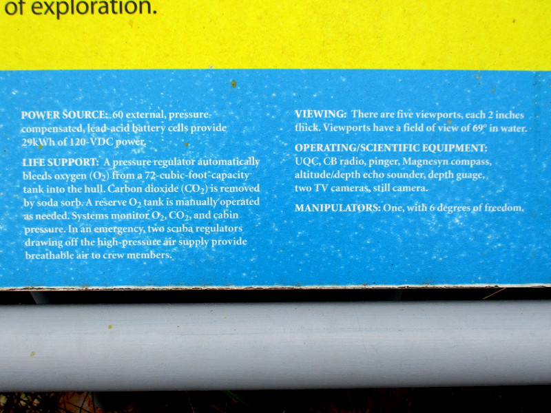
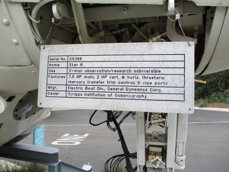
A nearby sign provides interesting information concerning the submersible, which was built by General Dynamics.
When I got home, I found a book published in 1968 by the Naval Oceanographic Office titled Undersea Studies With the Deep Research Vehicle Star III which you can preview here. It concerns a series of 21 dives off Key West Florida in March 1967…to evaluate the Star III system as a platform from which to conduct underwater photogrammetric and various surveying tasks.
I also found the following old public domain photograph of Star III suspended above the water from a seagoing vessel.
Launched in 1966, Star III was capable of carrying a two-person crew and as much as 1,000 pounds of scientific equipment to a depth of 2,000 feet. The sub and its occupants could remain underwater for up to 120 hours…
…
I live in downtown San Diego and love to walk around with my camera! You can follow Cool San Diego Sights via Facebook or Twitter!
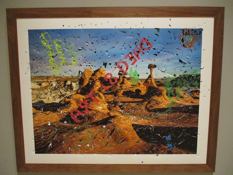
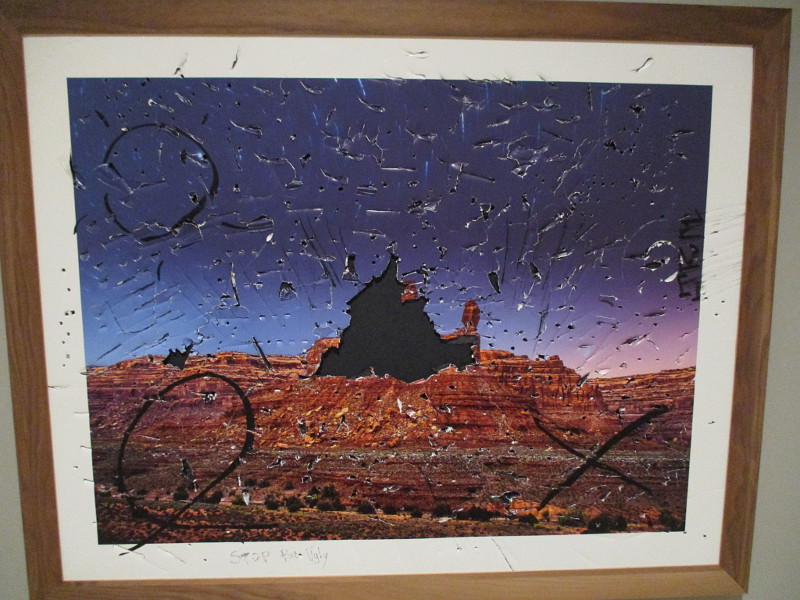
Two galleries at the San Diego Museum of Art in Balboa Park feature slashed, defaced and vandalized landscape photographs. The title of the exhibition is Disestablishment.
Galleries 14 and 15, freely accessible to the public from the May S. Marcy Sculpture Court (home of Panama 66), are filled with this disquieting artwork.
San Diego artist John Raymond Mireles took photographs of natural beauty at areas once part of Grand Staircase-Escalante and Bears Ears National Monuments in Southern Utah, then invited people to hammer upon, cut, scratch and pen graffiti on each piece. This intentional damage is said to represent how the land can now be exploited for oil drilling and coal mining.
Like much contemporary art with a political message, these not-so-subtle pieces aim to shock the viewer. Learn more about Disestablishment, on view until January 30, 2022, at the SDMA website here.
Here are a couple more examples…
…
I live in downtown San Diego and love to walk around with my camera! You can follow Cool San Diego Sights via Facebook or Twitter!
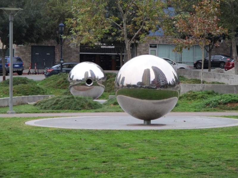
Fault Line Park in downtown San Diego’s East Village neighborhood made its debut a little over six years ago.
Has the Earth moved since then?
More specifically, has the Earth on either side of the Rose Canyon Fault System rupture just under the park moved since then?
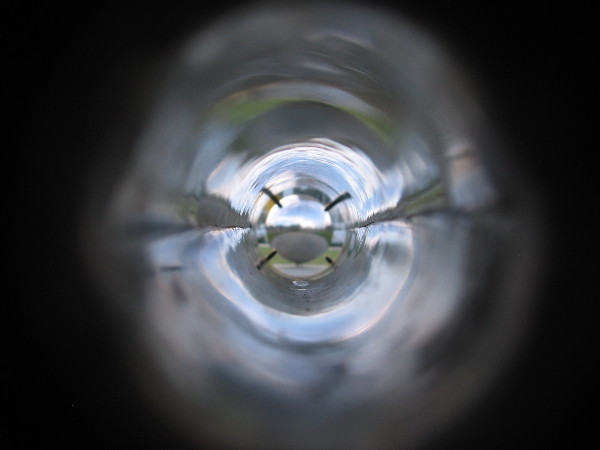
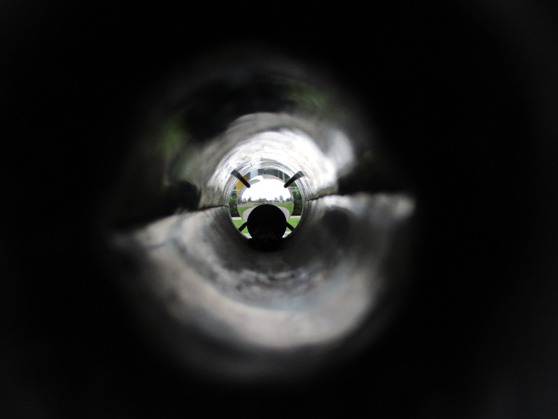
Very unique public art in this city park helps casual observers determine whether any such movement has occurred. I first blogged about Fault Line Park and its two giant spheres in September, 2015. Revisit that old post by clicking here.
Back then I took a photograph through one of the spheres. The twin stainless steel spheres stand on opposite sides of the shallow underground rupture. Should the ground on either side move over time, the targeting crosshairs inside the one sphere will shift in relation to the other sphere.
Here’s a photo I took over six years ago…
Compare it to the next photo that I took early this morning.
Something is now stuck inside the sphere’s hollow tube, but you can see how the crosshairs still roughly center on the opposite sphere:
I know this isn’t scientific, but if there has been any movement of the ground on either side of the fault line, it appears to be very slight!
I’ll have to take another photo a few years from now!
…
I live in downtown San Diego and love to walk around with my camera! You can follow Cool San Diego Sights via Facebook or Twitter!
You can easily explore Cool San Diego Sights by using the search box on my blog’s sidebar. Or click a tag! There are thousands upon thousands of photos for you to enjoy!
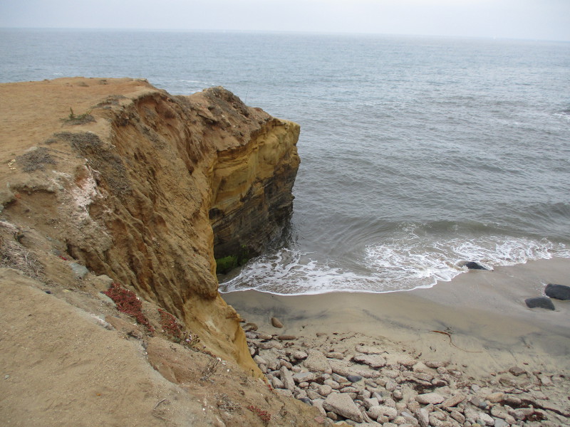
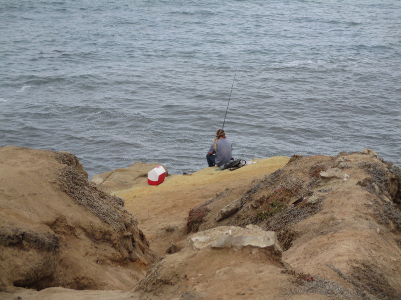
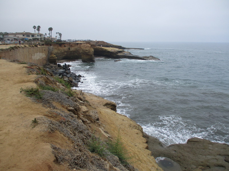
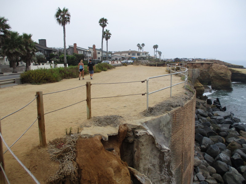
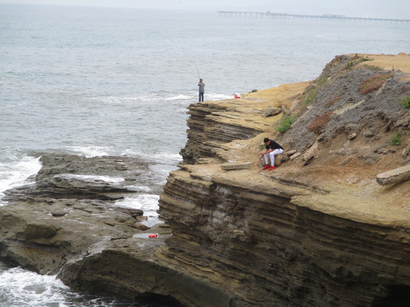
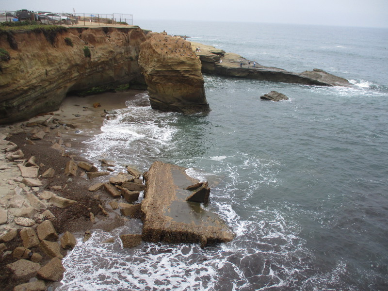
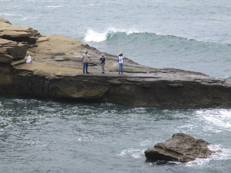
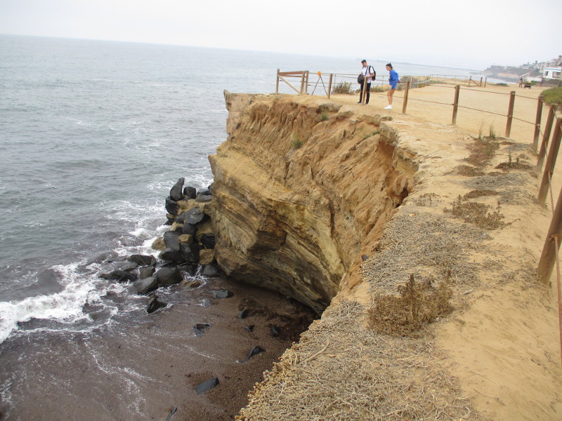
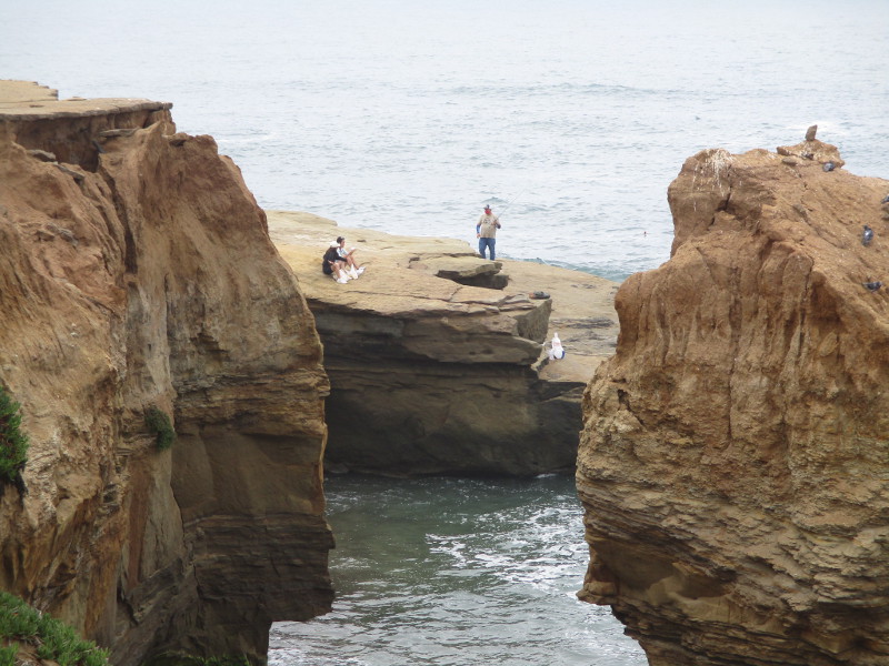
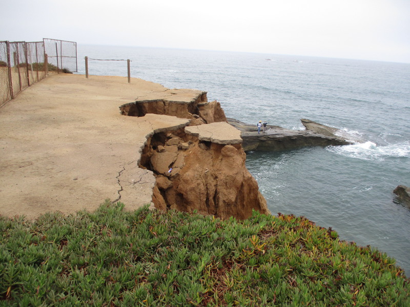
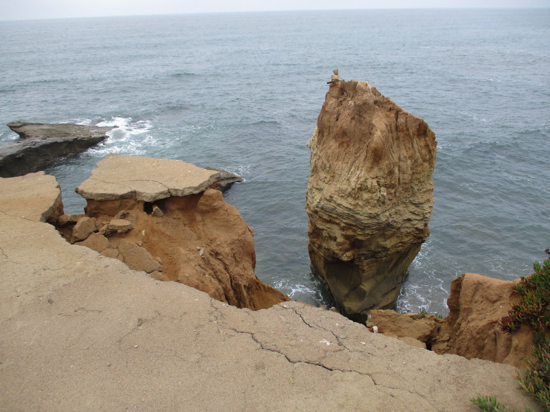
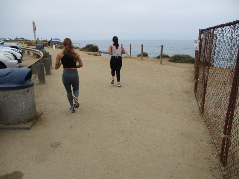
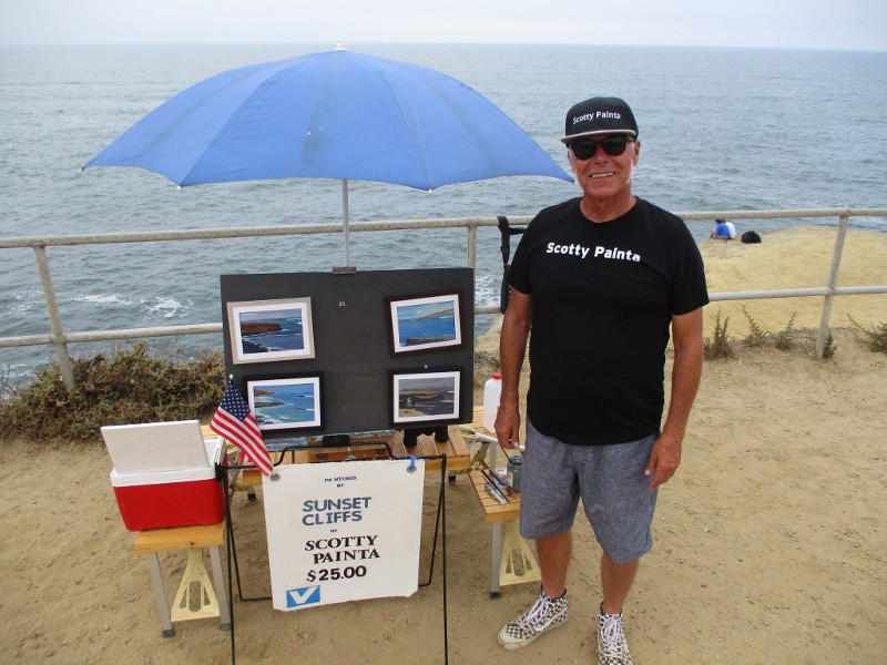
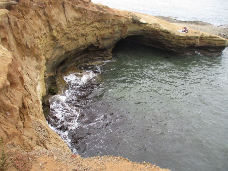
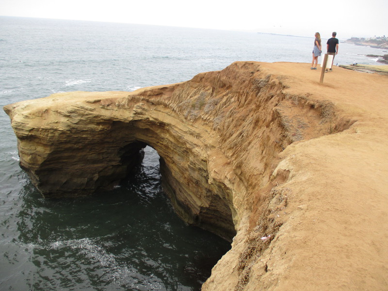
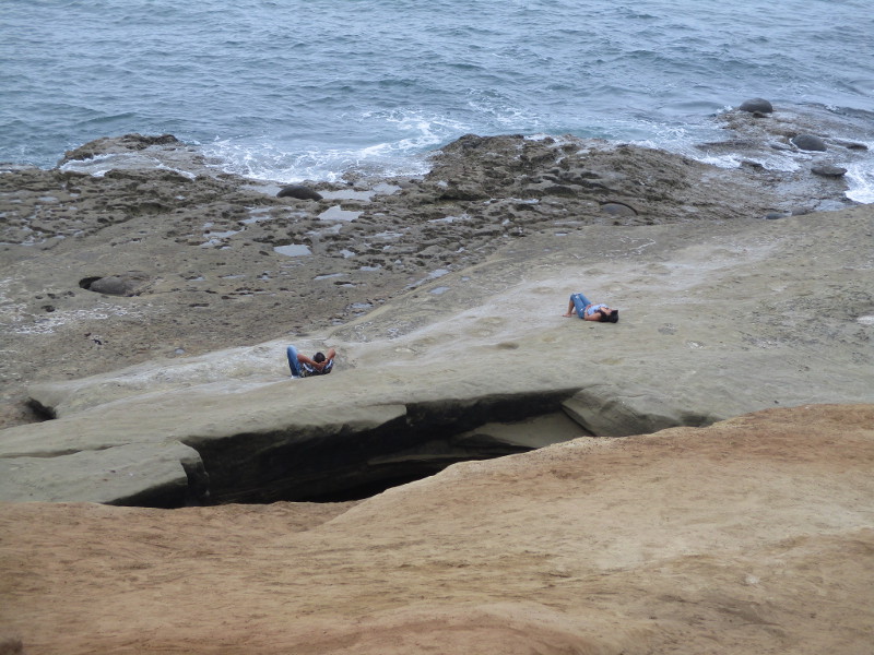
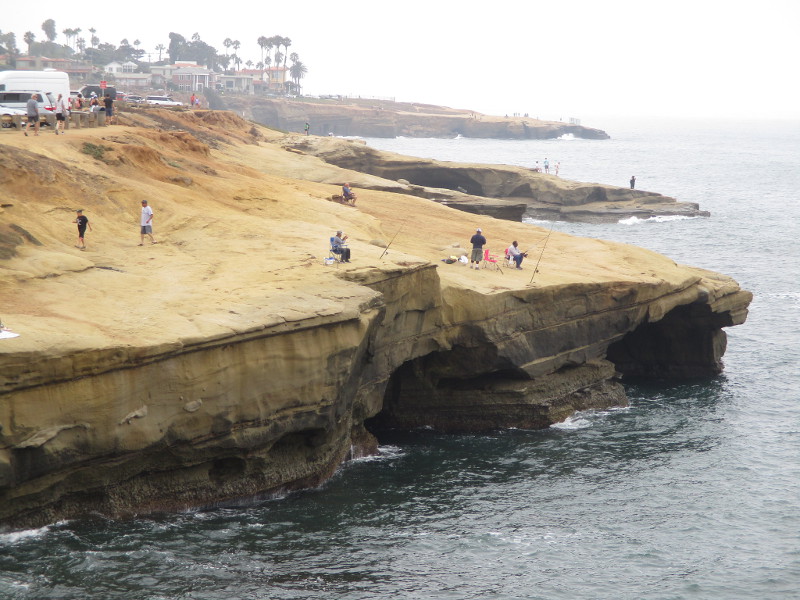
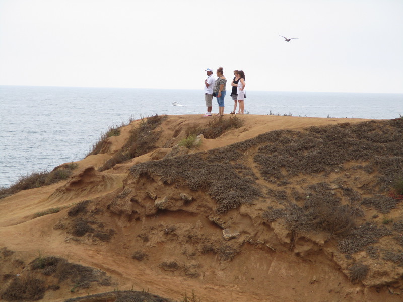
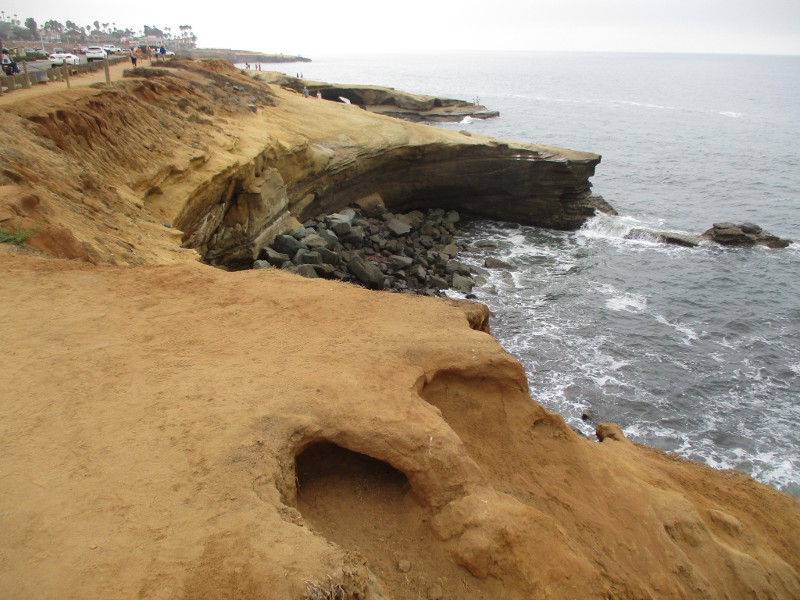
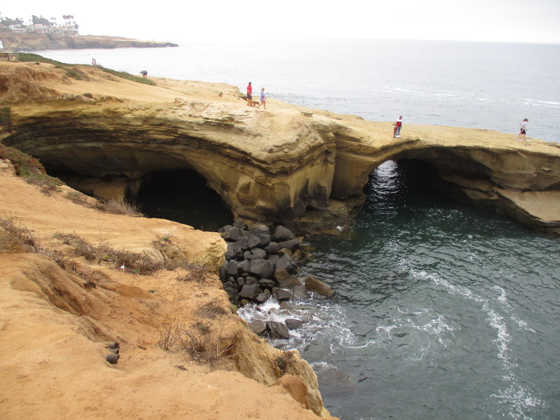
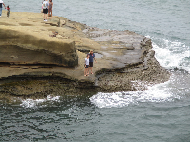
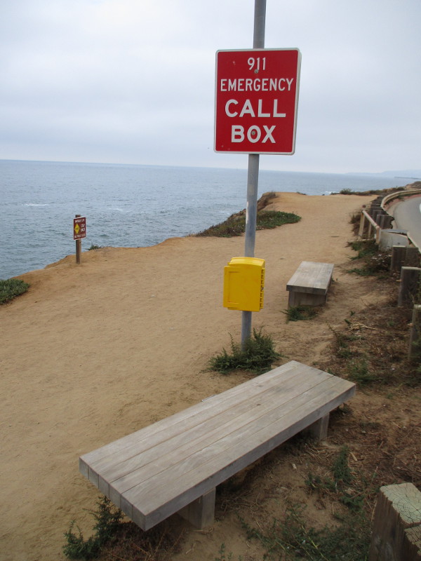
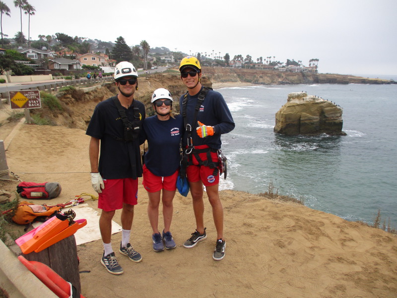
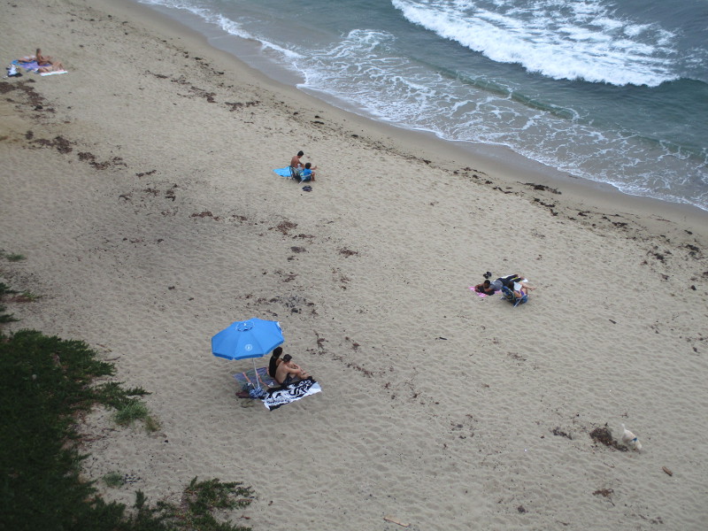
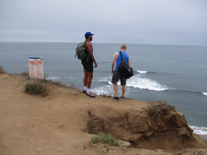
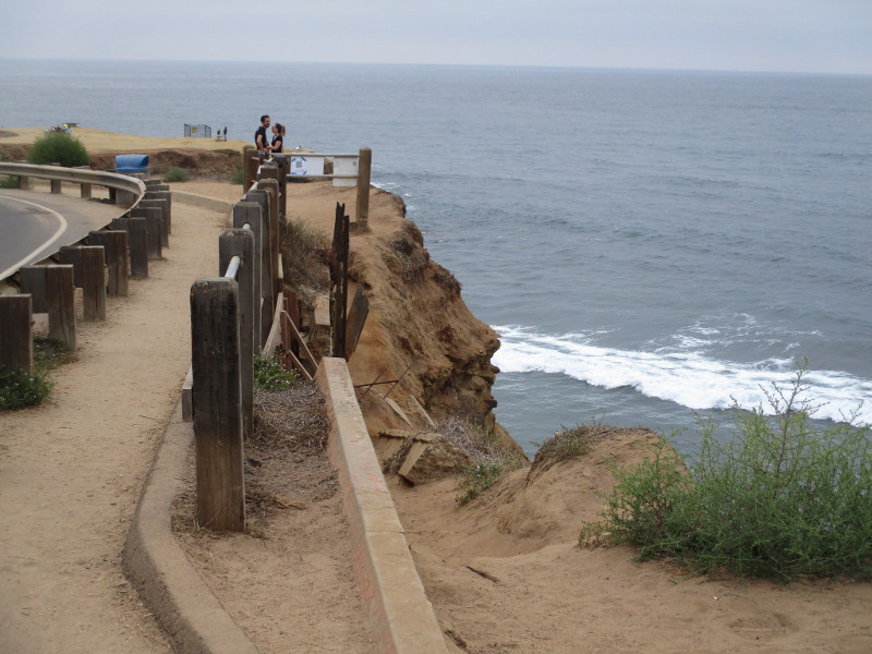
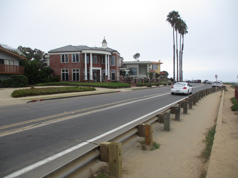
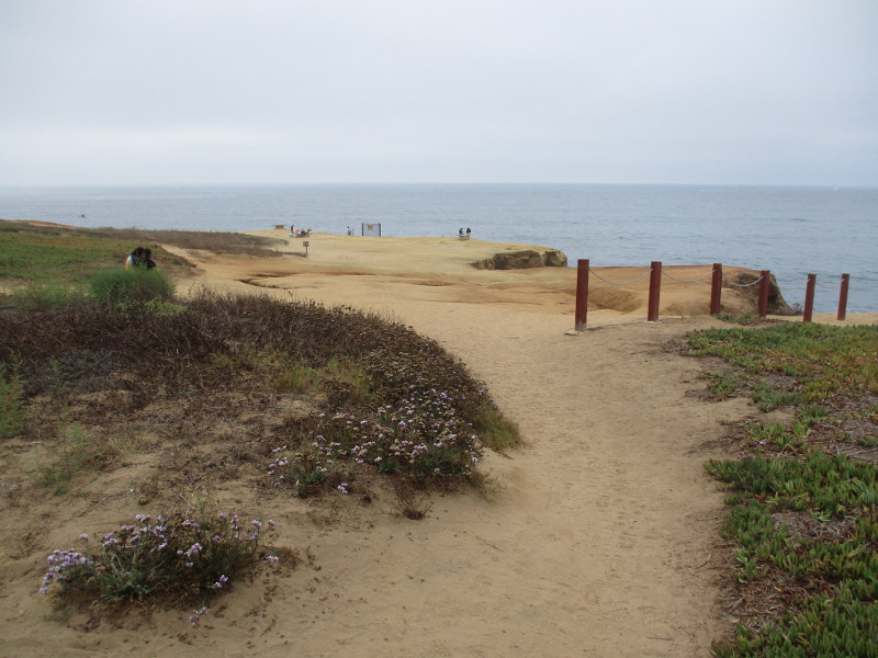
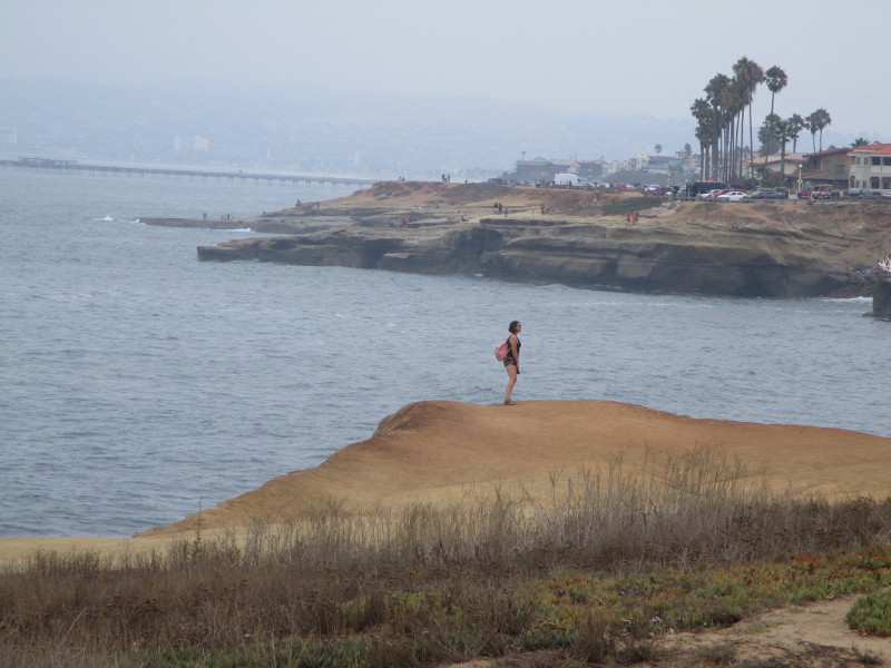
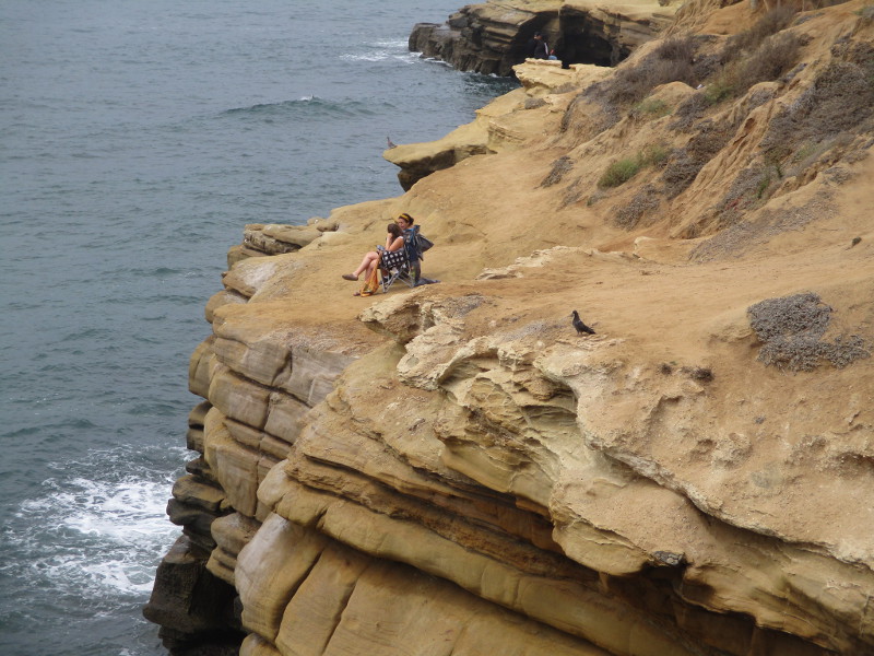
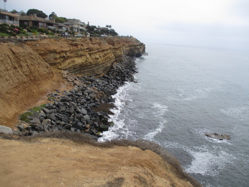
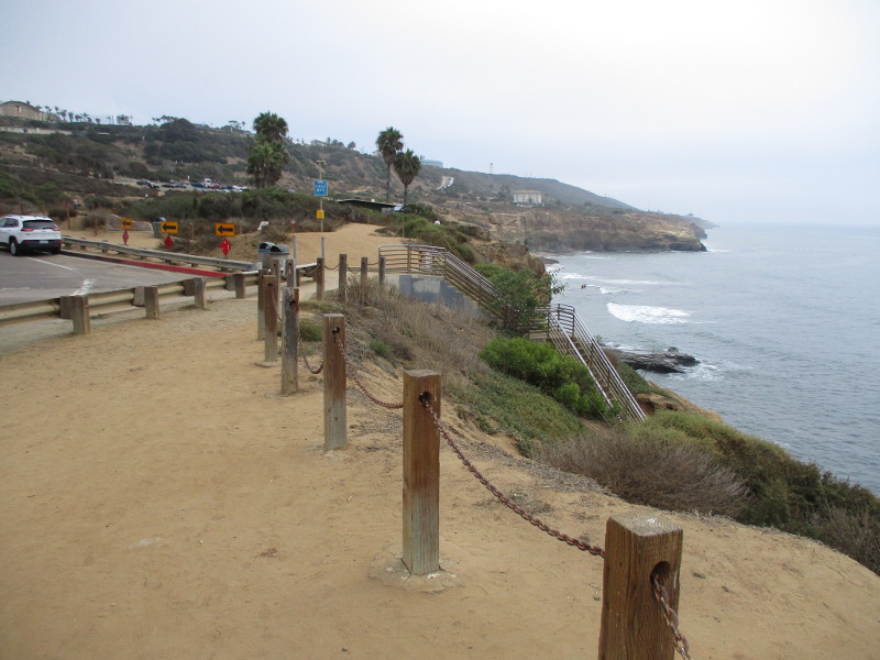
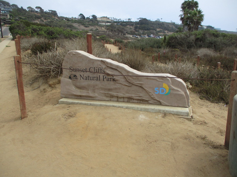
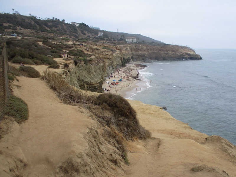
One of San Diego’s most amazing, scenic walks is along Sunset Cliffs in Point Loma.
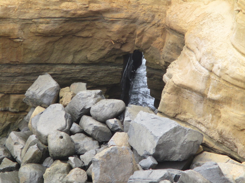
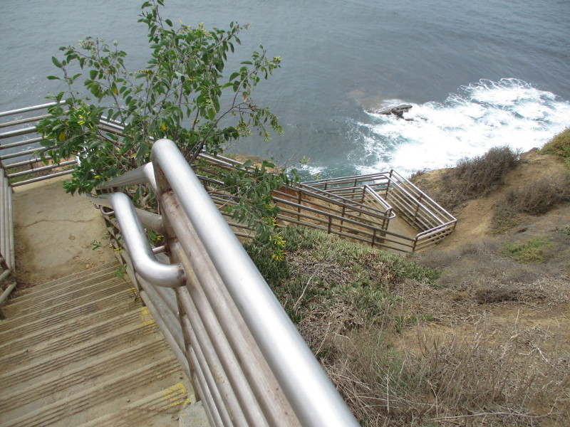
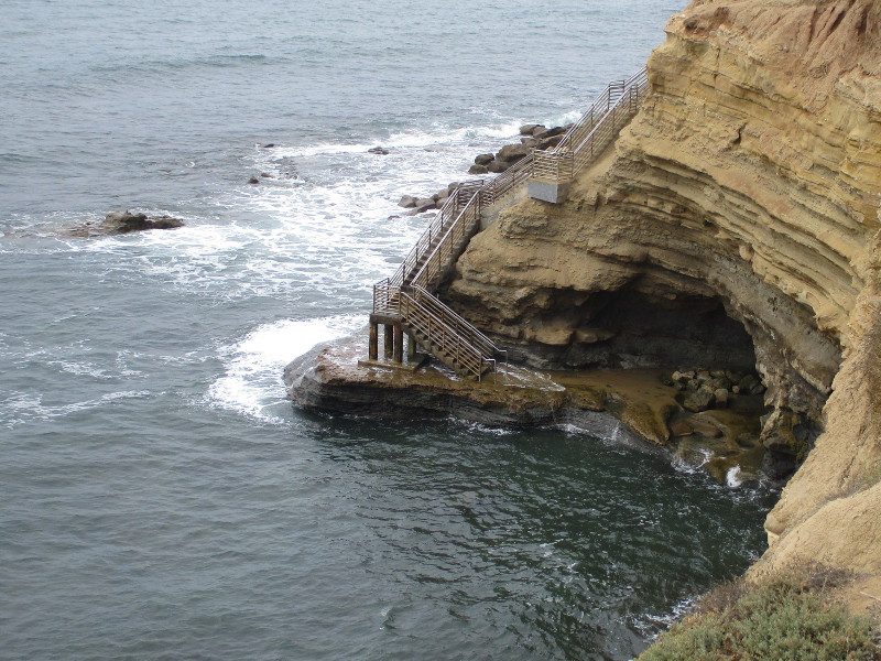
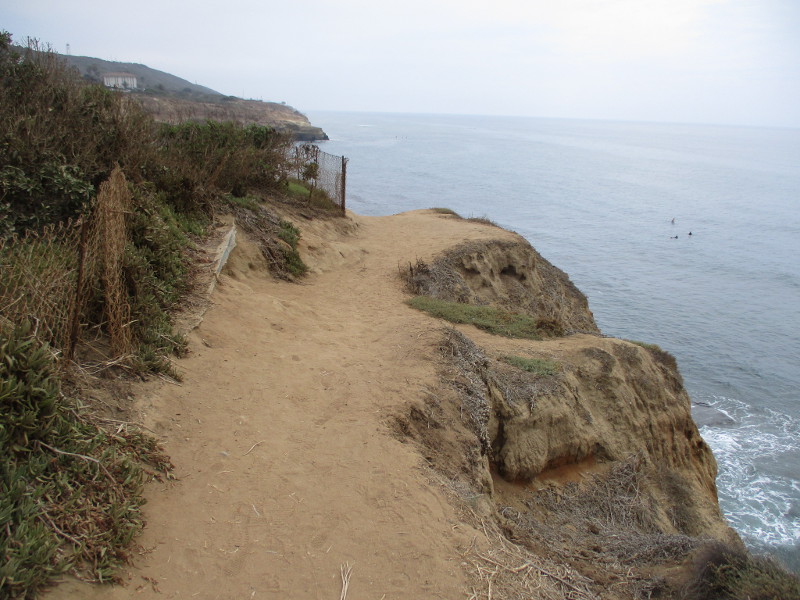
Yesterday I walked along the length of Sunset Cliffs Natural Park, which stretches for about 1.5 miles beside the Pacific Ocean. I started near the intersection of Sunset Cliffs Boulevard and Adair Street and headed south to Ladera Street, where there’s a popular beach, nature trails and stairs down to a small cave and rocky tide pools.
The August summer day was perfect for a long walk. The sun didn’t break through the coastal marine layer until the very end of my adventure, and the sea breeze was pleasantly cool.
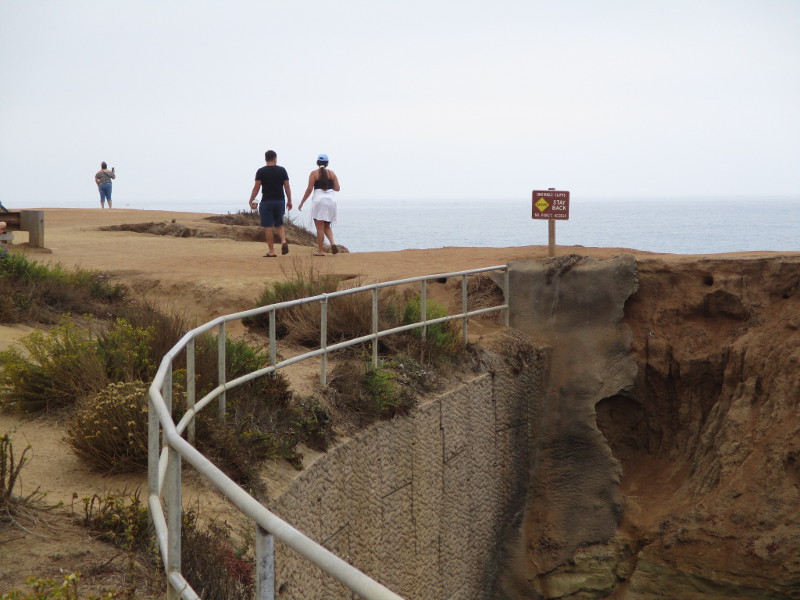
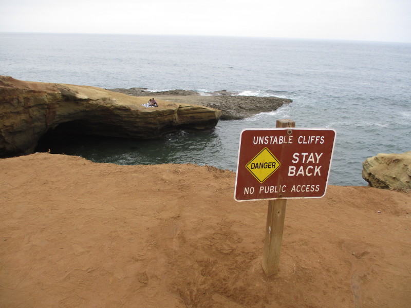
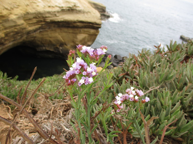
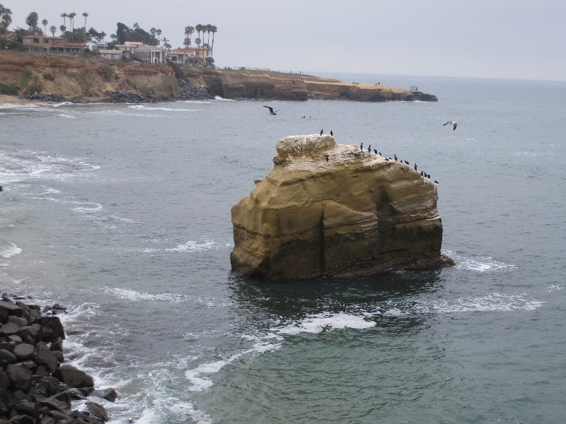
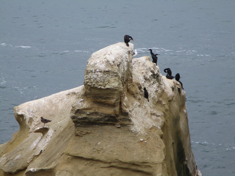
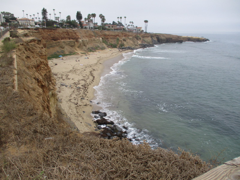
Views of the Pacific Ocean crashing against the steep, rugged cliffs seemed endless. The mostly dirt Coastal Trail I followed wound above the high eroded bluffs, past a few pocket beaches and past sea caves and picturesque sandstone arches.
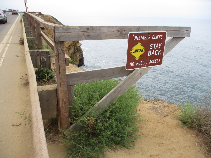
In places the cliffs have collapsed from the constant powerful action of tides and incoming waves. Many signs warn people away from the edge of the unstable cliffs.
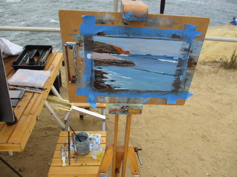
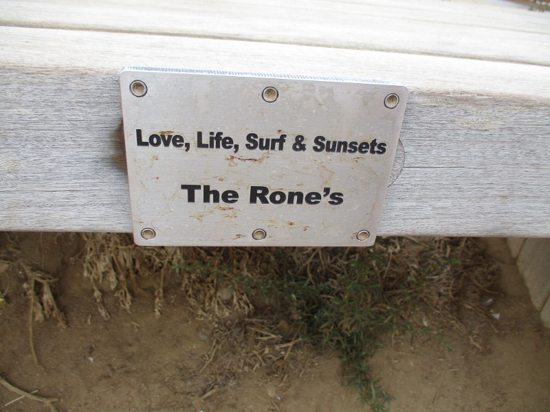
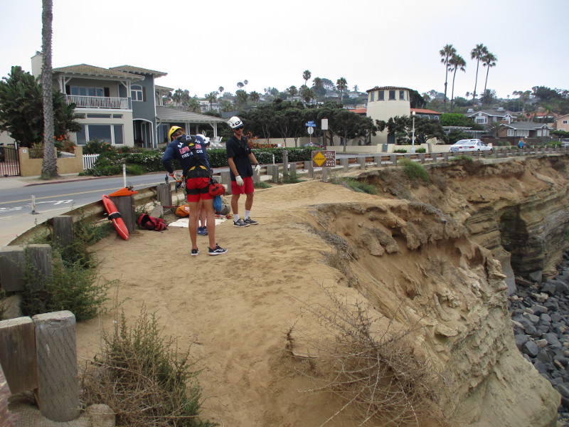
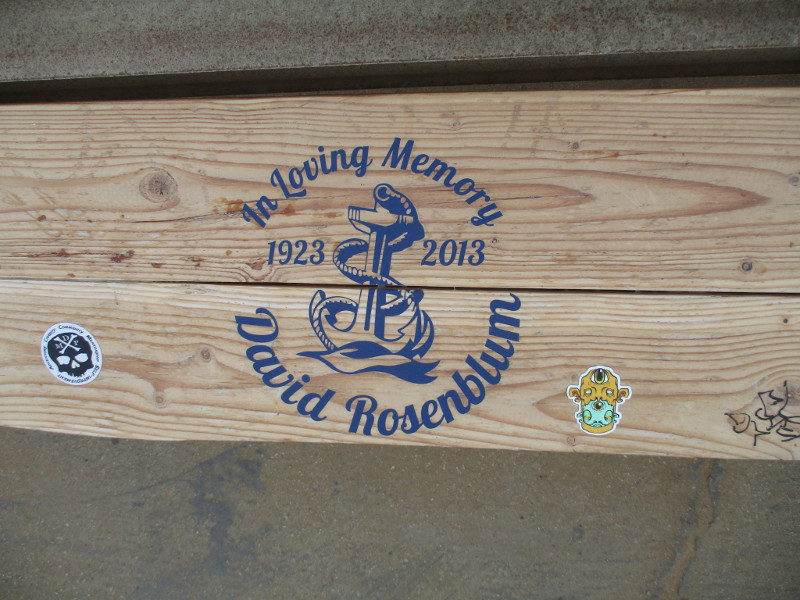
I met a painter. I met friendly lifeguards training for cliff rescues. I saw benches along the path dedicated to lost loved ones and sunsets. Many were standing and sitting at the ocean’s edge, peering at eternity with silent wonder.
As you can see from my photographs, nature’s hand creates beauty everywhere it moves.
If you like to stretch your legs and spirit, and you happen to be in San Diego, it’s likely you’ll love this walk, too.
Looking north for a moment. You can see the Ocean Beach pier in the distance.
As I walked along, I met Scotty Painta. He paints beautiful small scenes from Sunset Cliffs. We had a friendly chat and my day was enriched.
I met three lifeguards. They had slender ropes dangling down an almost vertical bluff. They were practicing cliff rescues. Jake told me a little about what they do. Thank you.
…
This blog now features thousands of photos around San Diego! Are you curious? There’s lots of cool stuff to check out!
Here’s the Cool San Diego Sights main page, where you can read the most current blog posts. If you’re using a phone or small mobile device, click those three parallel lines up at the top–that opens up my website’s sidebar, where you’ll see the most popular posts, a search box, and more!
To enjoy future posts, you can also “like” Cool San Diego Sights on Facebook or follow me on Twitter.
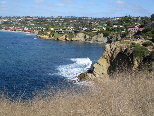
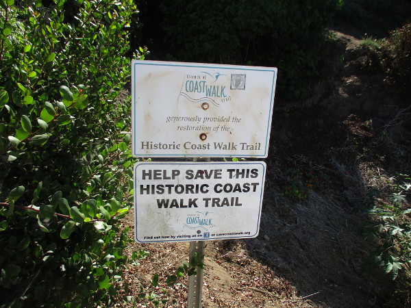
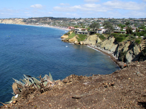
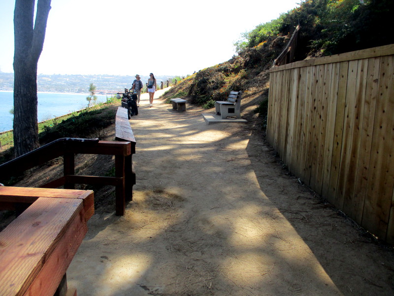
The short but incredibly scenic Coast Walk Trail in La Jolla winds along the Pacific Ocean from the Cave Store on Coast Boulevard to Torrey Pines Road. You can find it by walking east up the hill from La Jolla Cove. Google Maps shows the trail.
Should your feet move down the Coast Walk, heading east, a short distance beyond rocky Goldfish Point, these photographs provide an idea of the breathtaking views you’ll likely experience…
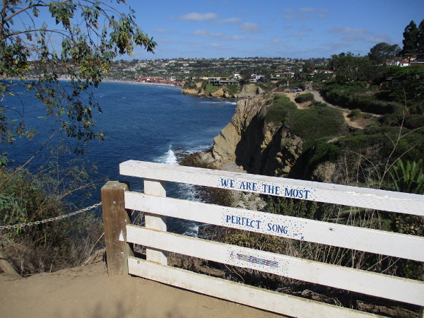
We are the most perfect song.
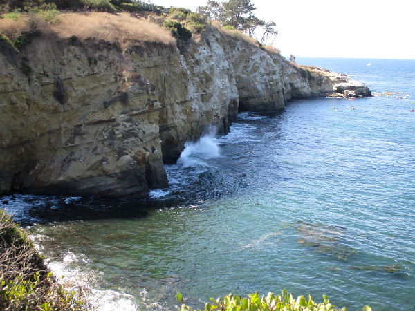
The Coast Walk Trail follows the edge of high sandstone bluffs. It offers amazing views of the Pacific Ocean, La Jolla Shores and the more distant cliffs of Torrey Pines.
Sign asks those who walk by to help save this historic Coast Walk Trail.
Sections of the Coast Walk follow a white wooden fence.
Gazing back at the 200-foot high sandstone bluffs where we walked a few photos back. You can make out some of the seven different La Jolla Caves that can be visited from the ocean.
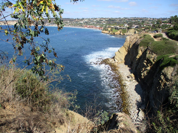
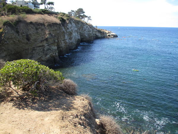
Kayakers gather in the distance off Goldfish Point not far from the watery entrance to famous Sunny Jim Cave.
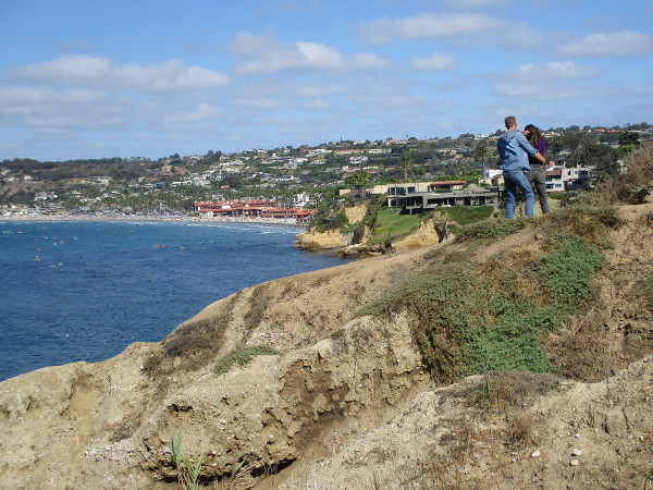
A couple enjoys the view east, toward La Jolla Shores.
Several kayakers paddle across the ocean, just off the rocks down below!
Another photo back toward the 75 million years old eroded sandstone cliffs, the La Jolla Caves and Goldfish Point.
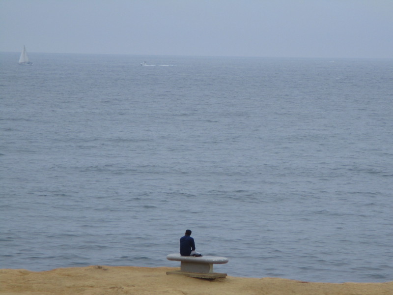
As I near the east end of the Coast Walk Trail, I find a perfect bench with an incredible view.
A very beautiful and inspiring place to be.
Waves curling in brush white foam across the deep blue.
In a few places, at the cliff’s edge, if you aren’t afraid of sheer drops and dizzying heights, you can look straight down and see underwater features!
An amazing view from the east end of the Coast Walk Trail in La Jolla.
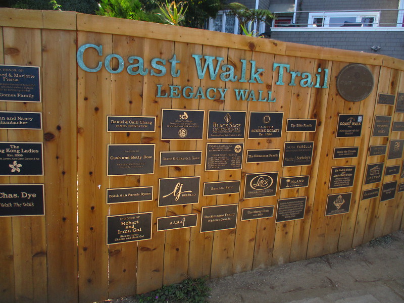
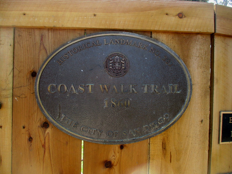
UPDATE!
Here are several more pics taken on a later walk. The historical marker is on a fence featuring the Coast Walk Trail Legacy Wall, not far from the Cave Store…
…
I live in downtown San Diego and love to walk around with my camera! You can follow Cool San Diego Sights via Facebook or Twitter!
You can easily explore Cool San Diego Sights by using the search box on my blog’s sidebar. Or click a tag! There are thousands upon thousands of photos for you to enjoy!