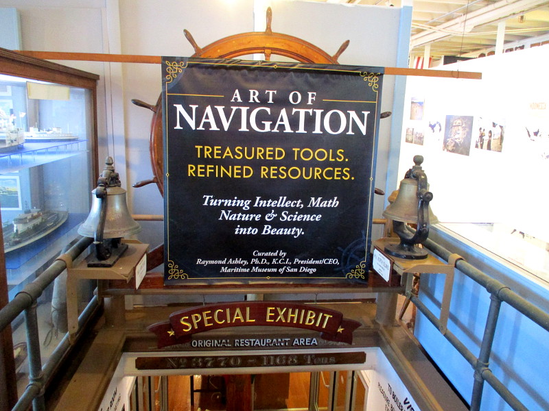
Those who are fascinated by tall ships, exploration and the evolution of technology don’t want to miss a great new exhibit at the Maritime Museum of San Diego. It’s titled the Art of Navigation.
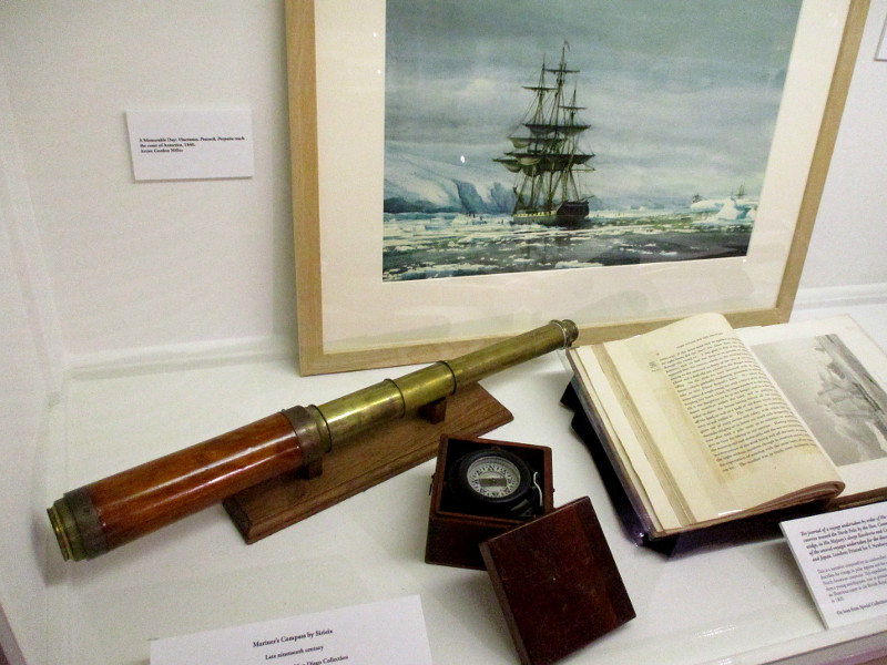
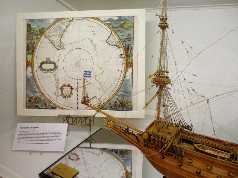
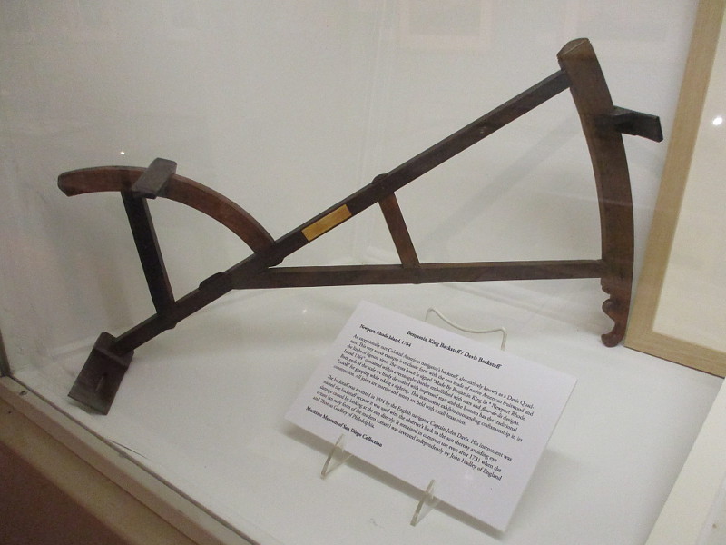
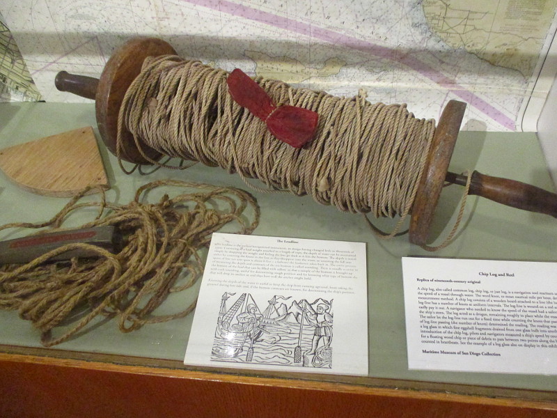
Visitors to the exhibit learn how navigators have used maps, charts and a variety of tools to find their way across the oceans and through dangerous waters. The extensive displays include some exceptionally rare antiques. Old instruments that can be viewed include an astrolabe, backstaff, nocturnal, traverse board, chip log and reel, hand-held telescope, cross-staff, quadrant, taffrail log, navigation slate and more! These instruments might seem primitive when compared with modern technology, but ship’s captains successfully sailed around the planet with the information they provided.
Personally, I like to read nautical stories set during the Age of Sail. As I read I’ll come across the names of these instruments, and at times puzzle over their application. The descriptive Art of Navigation exhibit brings helps to bring those adventurous old stories to life!
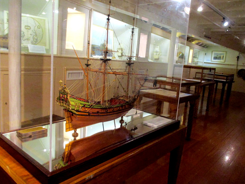
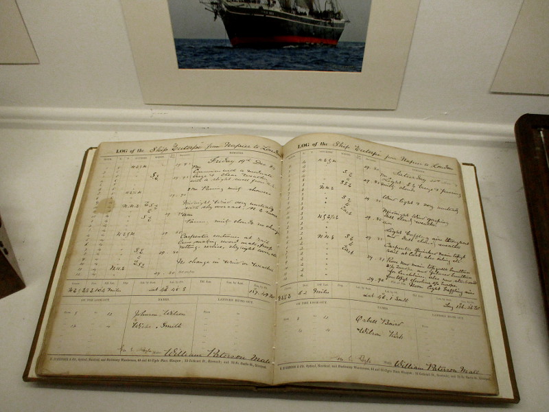
The exhibit also includes beautiful paintings and model ships, and even a display directly related to the Maritime Museum’s famous Star of India!
The Art of Navigation is free with museum admission. As advertised, it does indeed turn intellect, math, nature and science into beauty!
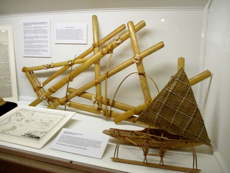
Micronesian stick chart, used by the indigenous island peoples of the Pacific to navigate across great distances of open water.Henricus Hondius. Polus Antarcticus. Map of Dutch discoveries published in Amsterdam, 1638.Benjamin King Backstaff (also known as Davis Quadrant), Newport, Rhode Island, 1764. Used by Colonial American navigators.Replica of 19th century chip log and reel. Used to estimate the speed of a ship through water.Log of Euterpe, a historic ship later known as Star of India.
…
Thanks for visiting Cool San Diego Sights!
I post new blogs pretty often. If you like discovering new things, bookmark coolsandiegosights.com and swing on by occasionally!
I live in downtown San Diego and love to walk around with my camera! You can follow Cool San Diego Sights via Facebook or X.
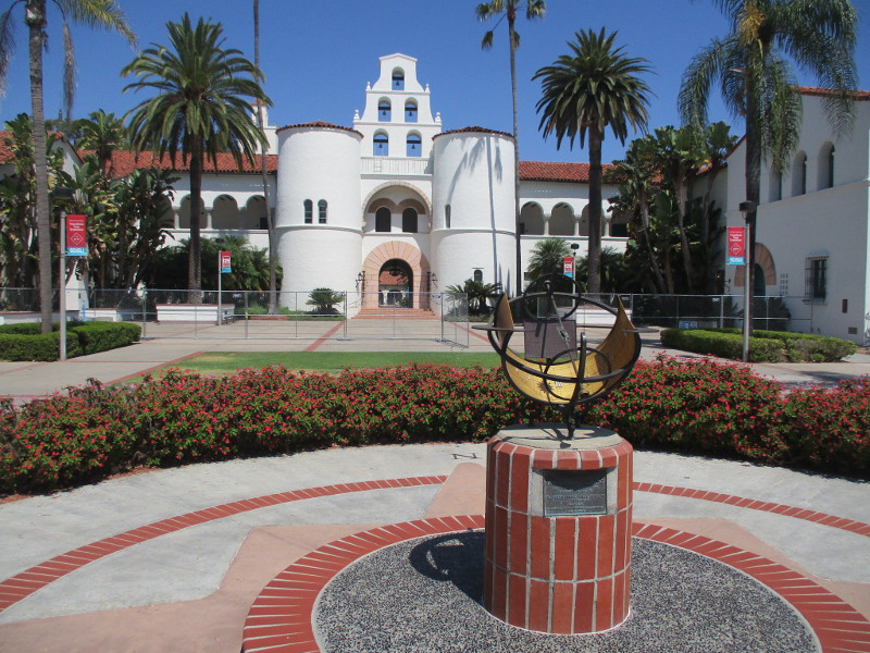
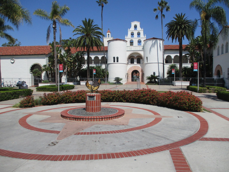
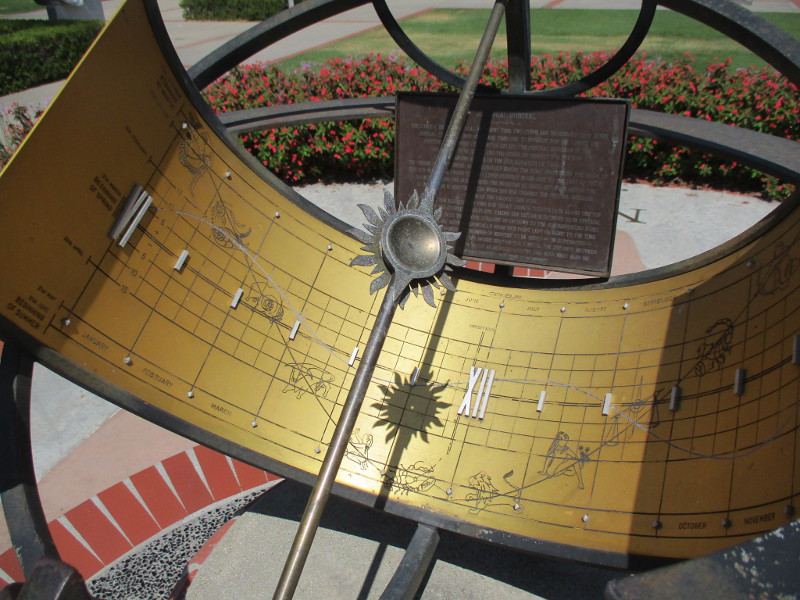
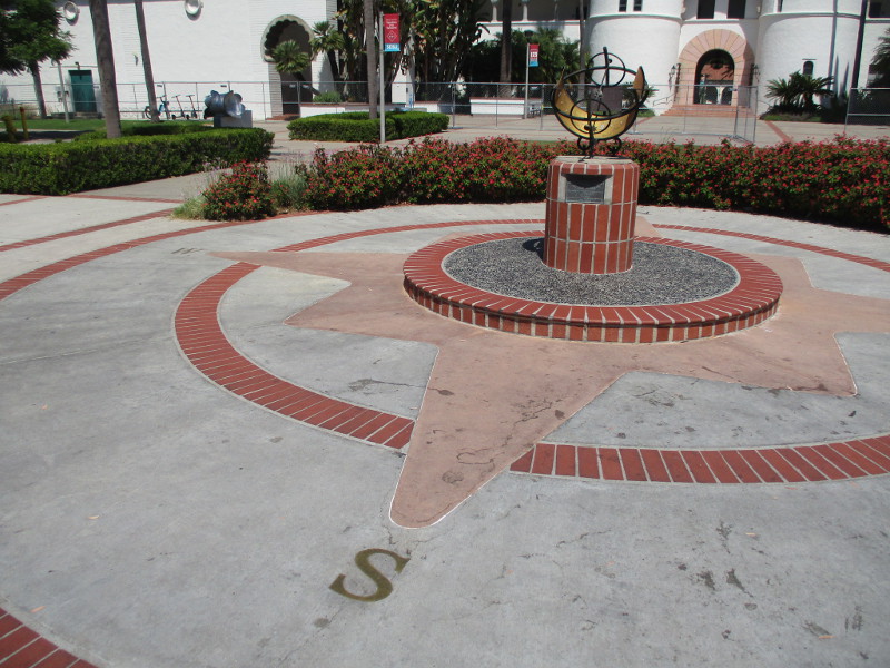
The Koester Memorial Sundial stands prominently in San Diego State University’s Campanile Mall, directly in front of the iconic Hepner Hall. I took photographs of the sundial when I walked through the SDSU campus a few days ago. A couple of corroded plaques invite a closer look.
According to this article, dedicated on November 4, 1978, the Gübelin Equatorial Sundial [is] in memory of the late George A. Koester…
Koester began his career at San Diego State in 1950 and went on to complete 14 years as a professor of education and 10 years as executive dean. During his time on Montezuma Mesa, Koester played a prominent role in building the campus, working on the creation of Love Library, the music and drama buildings, Aztec Center, Zura Hall, student health services, and multiple parking structures…
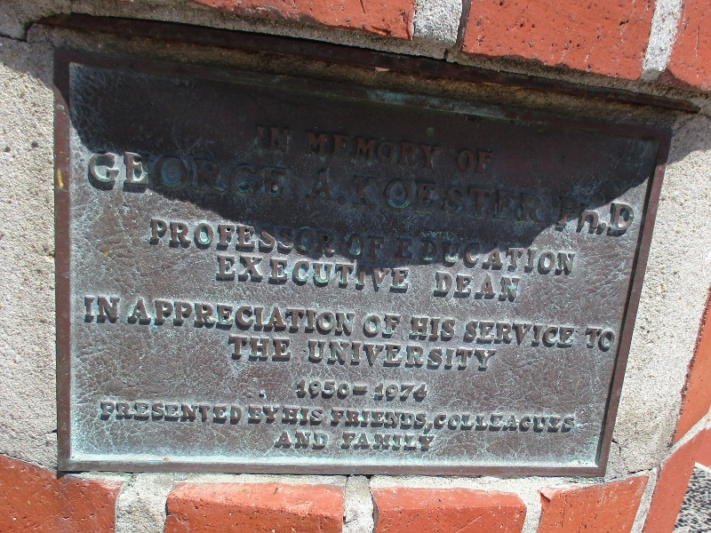
A plaque embedded in the brick pedestal states:
IN MEMORY OF GEORGE A. KOESTER Ph.D – PROFESSOR OF EDUCATION – EXECUTIVE DEAN – IN APPRECIATION OF HIS SERVICE TO THE UNIVERSITY 1950 – 1974 – PRESENTED BY HIS FRIENDS, COLLEAGUES AND FAMILY
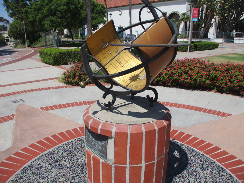
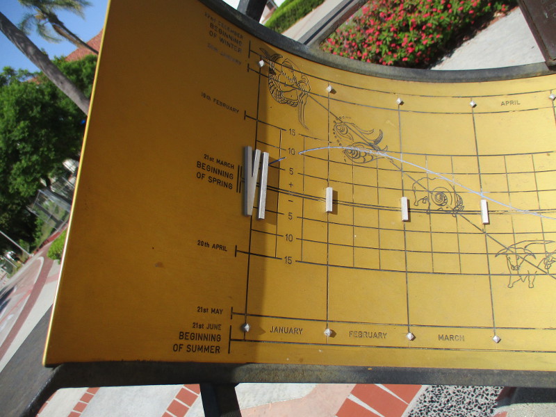
Within the sundial, a faded plaque (I increased the image contrast) describes how the beautiful and fascinating device works. I transcribed as best I could, without every word in caps:
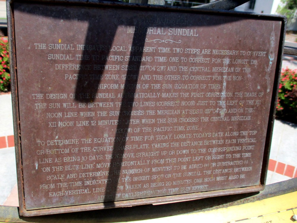
THE KOESTER MEMORIAL SUNDIAL
The sundial indicates local apparent time. Two steps are necessary to convert sundial time to Pacific Standard Time: one to correct for the longitude difference between SDSU (117°04`2W) and the central meridian of the Pacific Time Zone (120°W), and the other to correct for the non-uniform motion of the sun (equation of time).
The design of the sundial automatically makes the first correction. The image of the sun will be between the two lines (correct noon) just to the left of the XII noon line when the sun crosses the meridian at SDSU (117°04`2W) and on the XII noon line 12 minutes later when the sun crosses the central meridian (120°W) of the Pacific Time Zone.
To determine the equation of time for today, locate today’s date along the top or bottom the curved brass plate. Taking the distance between each vertical line as being 10 days, then move straight up or down to the corresponding point on the blue line. Move horizontally from this point left or right to the time scale and determine the number of minutes to be added (+) or subtracted (-) from the time indicated by the bright spot on the sundial. The distance between each vertical line is now taken as being 20 minutes. One hour must also be added if Daylight Savings Time is in effect.
Whew! Got that?
I think I’ll stick to my wristwatch or phone!
…
Thanks for visiting Cool San Diego Sights!
I post new blogs pretty often. If you like discovering new things, bookmark coolsandiegosights.com and swing on by occasionally!
I live in downtown San Diego and love to walk around with my camera! You can follow Cool San Diego Sights via Facebook or X.
Very sad news. One of San Diego’s most important museums will soon be closing permanently. The Map and Atlas Museum of La Jolla, considered one of the top map museums in the world, will remain open through the end of this month. After August 31, 2023, it’s gone.
If you are interested in art, printing or world history, you absolutely must visit this museum before it vanishes forever.
Extremely rare maps fill the galleries. Many contain blank spaces–those places on the planet that centuries ago hadn’t been fully explored. By observing the known (or surmised) outlines of oceans and continents, and the shifting boundaries of nations, it’s possible to follow history and the evolution of geographic knowledge.
Five years ago I carefully explored the museum. You can find that informative blog post here.
The Map and Atlas Museum of La Jolla is located at 7825 Fay Avenue. Take the office building’s elevator down to the lower Courtyard Level. The museum is open to the public on Wednesday and Thursday, and the 1st and 3rd Saturdays, from 11 am to 4 pm.
Those who are curious have few chances left to visit. You won’t regret it!
…
Thanks for visiting Cool San Diego Sights!
I post new blogs pretty often. If you like discovering new things, bookmark coolsandiegosights.com and swing on by occasionally!
I live in downtown San Diego and love to walk around with my camera! You can follow Cool San Diego Sights via Facebook or Twitter!
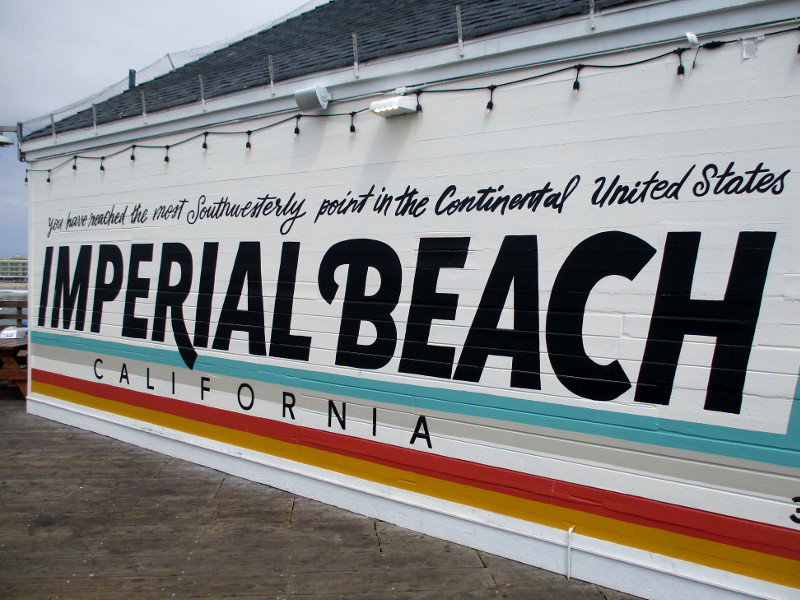
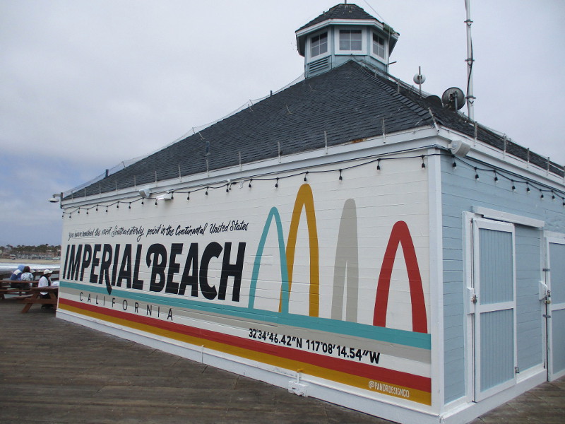
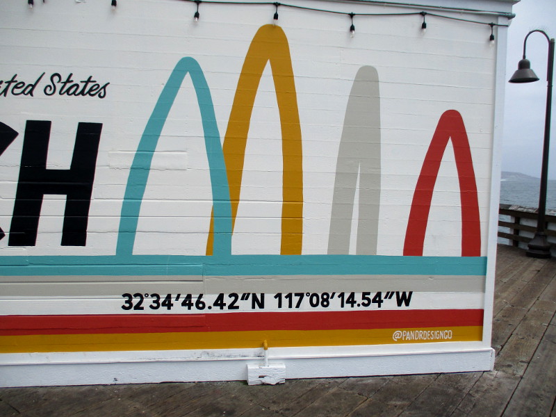
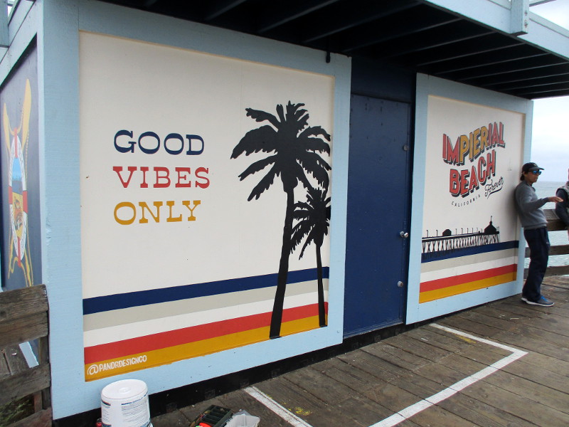
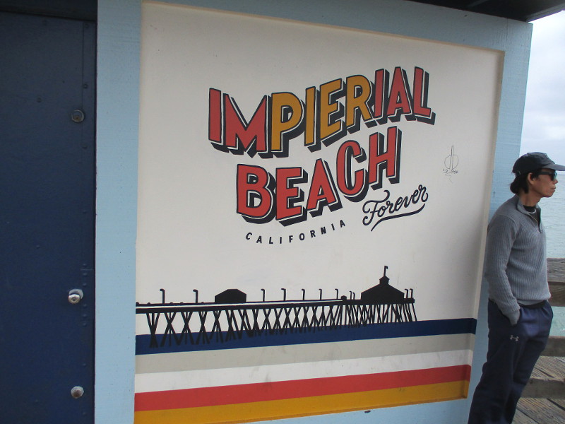
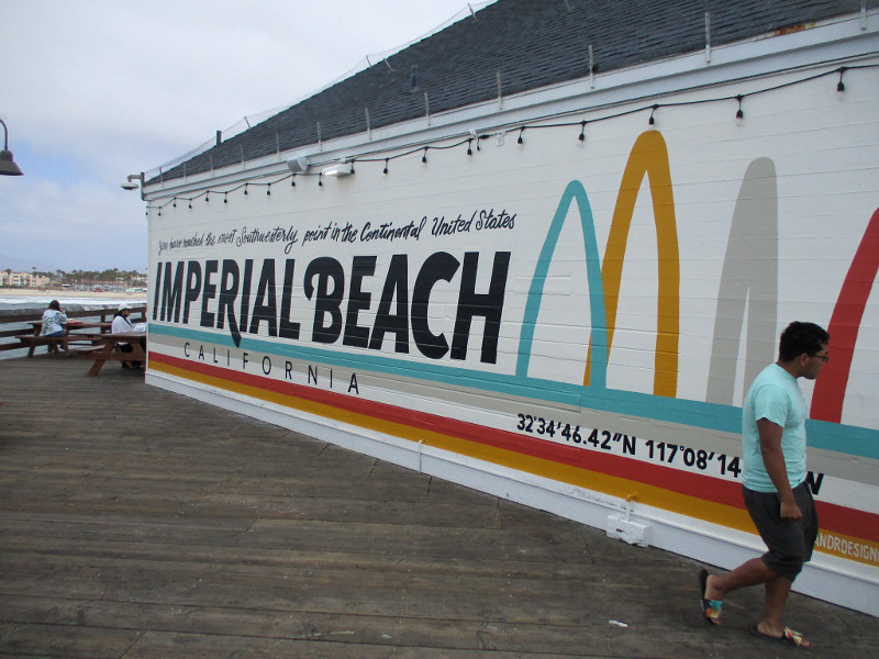
Walk out to the end of the Imperial Beach Pier and you’re standing near the most southwesterly point in the continental United States!
And if you turn around at the end of the pier to look at one side of the Tin Fish restaurant, you’ll see a big mural created late last year by the local artists of Pandr Design Co. The mural includes geographic coordinates in degrees of latitude and longitude that prove its assertion!
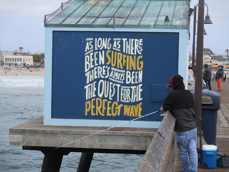
While walking along the pier I noted a few other cool murals which were also painted recently by Pandr Design Co….
AS LONG AS THERE’S BEEN SURFING THERE’S ALWAYS BEEN THE QUEST FOR THE PERFECT WAVEGOOD VIBES ONLYIMPIERIAL BEACH CALIFORNIA Forever
…
I live in downtown San Diego and love to walk around with my camera! You can follow Cool San Diego Sights via Facebook or Twitter!
You can easily explore Cool San Diego Sights by using the search box on my blog’s sidebar. Or click a tag! There are thousands upon thousands of photos for you to enjoy!
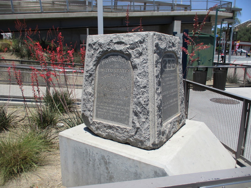
Two historical markers can be seen just north of the San Ysidro Port of Entry border crossing. They stand near the entrance to the pedestrian bridge that crosses over Interstate 5 to Camino de la Plaza. I spotted them during my last walk around San Ysidro and took photographs.
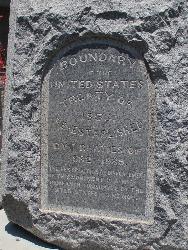
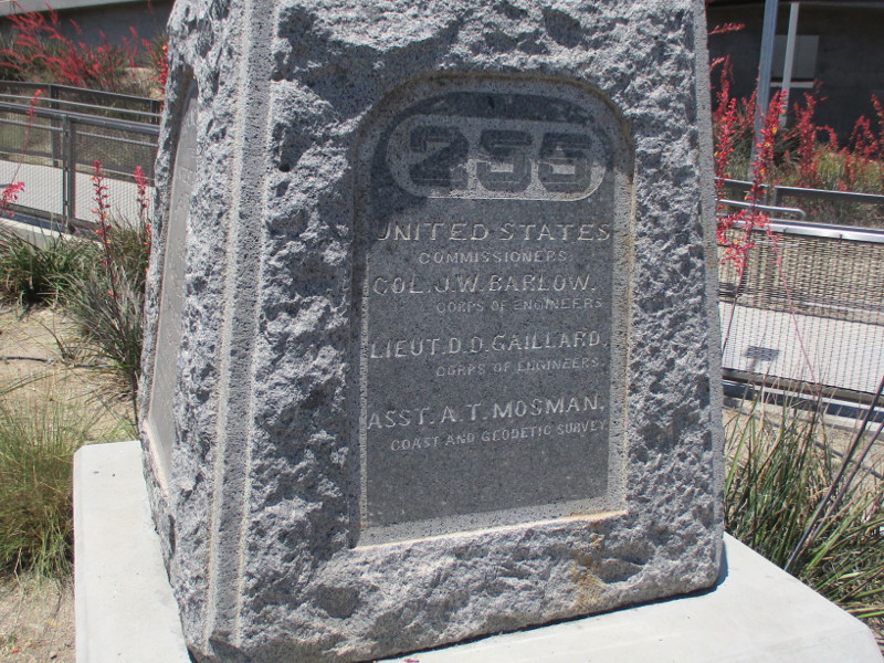
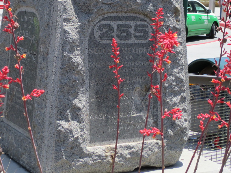
A granite monument, marker number 255, reads Boundary of the United States–Treaty of 1853–Re-Established by Treaties of 1882-1889. The opposite side contains the same information in Spanish. The monument’s two other sides show the principal names from the international commission that precisely determined the previously disputed boundary with Mexico in 1892 to 1896. It was one of 258 markers placed along 689 miles of border.
The fascinating story of this particular marker includes a flood, a replacement duplicate, and the original marker’s rediscovery and relocation to this spot. Read more about its complicated history here.
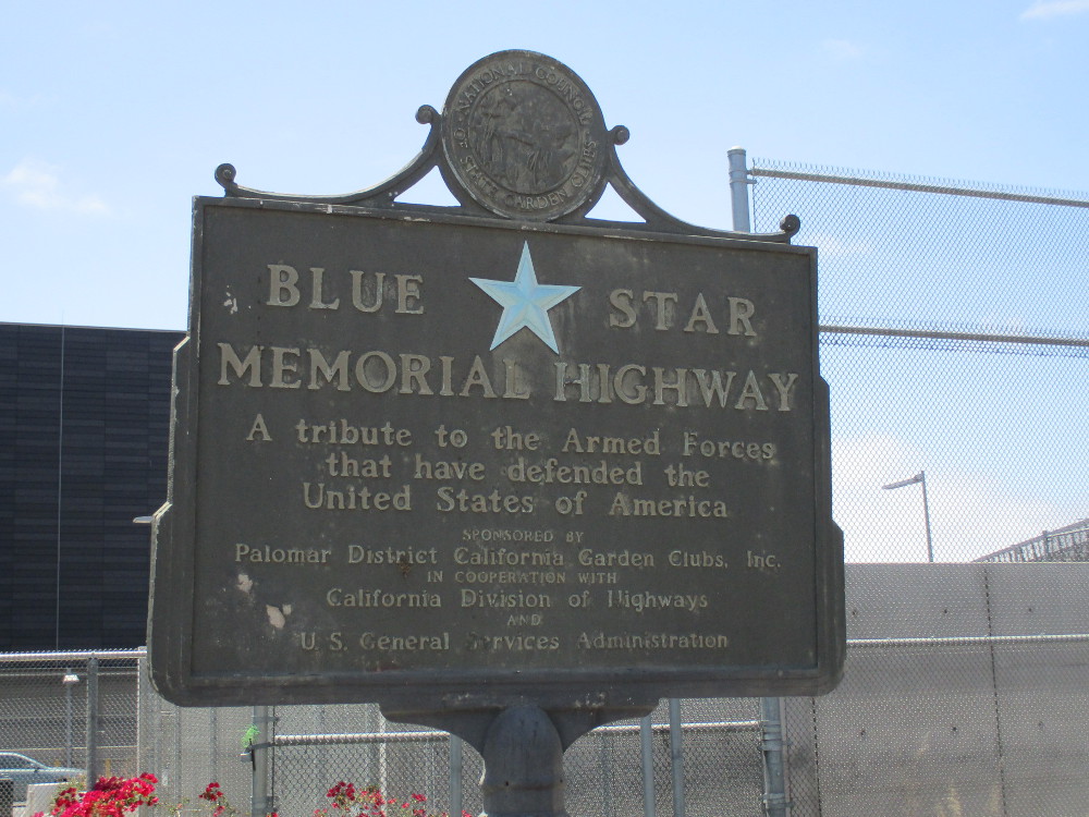
Behind the granite boundary monument, a historical sign on a post marks the Blue Star Memorial Highway. The sign describes the highway as A tribute to the Armed Forces that have defended the United States of America.
Perhaps you’ve seen these signs elsewhere across the United States. Read more about the Blue Star Memorial Highway (which is in fact numerous highways) here.
…
I live in downtown San Diego and love to walk around with my camera! You can follow Cool San Diego Sights via Facebook or Twitter!
You can easily explore Cool San Diego Sights by using the search box on my blog’s sidebar. Or click a tag! There are thousands upon thousands of photos for you to enjoy!
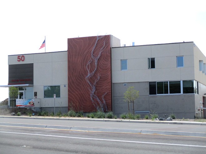
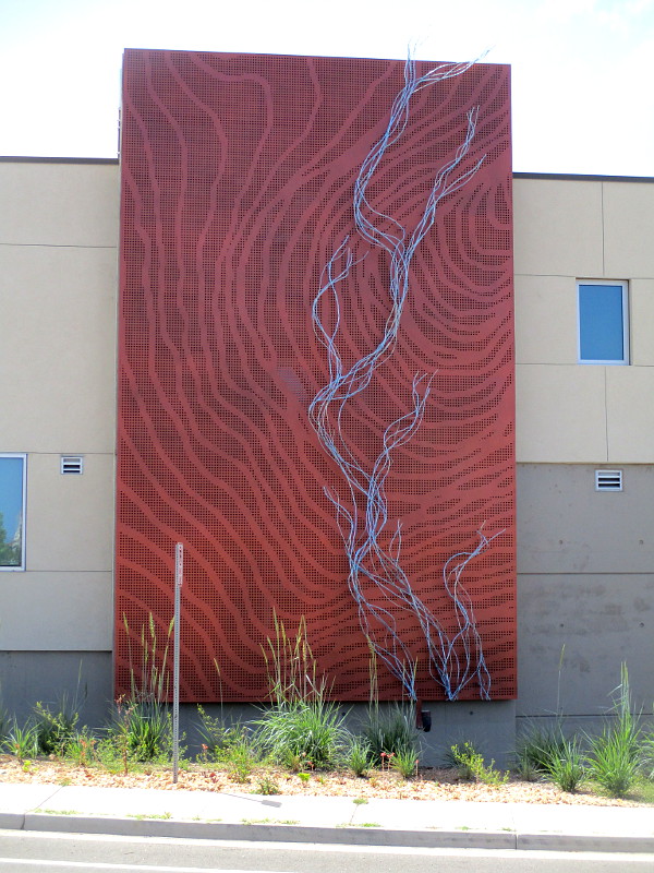
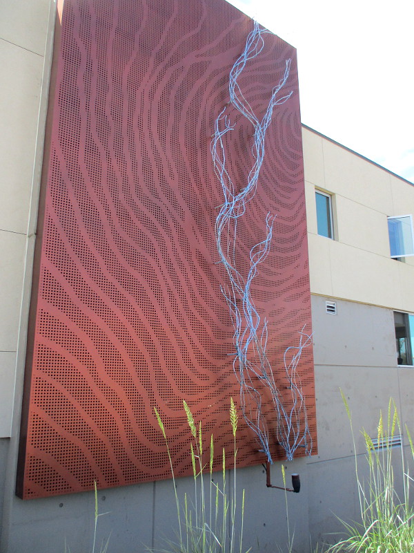
Monumental public art debuted late last year, when the new San Diego Fire-Rescue Department Station 50 opened in University City. I saw the artwork for the first time on Saturday and took these photographs!
The huge metal sculpture on the building’s side represents “blue” Rose Creek running through “coppery” Rose Canyon, which the fire station is positioned above!
The artist, Susan Zoccola, has an assortment of great photos on her website, including images taken at night when the sculpture is lit. (I had to take my own shots into the sunlight. A little photo editing produced the results you see here.)
At first sight I thought the bluish wire-like tubes that compose the river represent smoke! Or perhaps the tall grass by the sidewalk! But, no. The vertically arranged river runs across perforated copper layers that intentionally appear like a topographic map–the type of map firefighters often use.
…
I live in downtown San Diego and love to walk around with my camera! You can follow Cool San Diego Sights via Facebook or Twitter!
You can easily explore Cool San Diego Sights by using the search box on my blog’s sidebar. Or click a tag! There are thousands upon thousands of photos for you to enjoy!
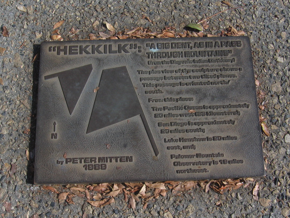
Unusual public art stands in the middle of the Escondido Transit Center. The abstract concrete sculpture is surrounded by North County Transit District bus stops.
Tilted concrete slabs, like geometric planes, form a narrow passage. The title of the sculpture is Hekkilk, and it was created by Peter Mitten in 1989. According to a nearby plaque, Hekkilk is a Diegueño Indian word that means “a big dent, as in a pass through mountains.”
The abstract concrete sculpture is apparently a representation of local geography.
The passage is oriented north/south. Approximate distances from the sculpture to various geographic points in San Diego County are noted on the plaque.
For several decades, those travelling through Escondido have been able to take a few steps through this “big dent” and contemplate the larger world around them.
…
I live in downtown San Diego and love to walk around with my camera! You can follow Cool San Diego Sights via Facebook or Twitter!
You can easily explore Cool San Diego Sights by using the search box on my blog’s sidebar. Or click a tag! There are thousands upon thousands of photos for you to enjoy!
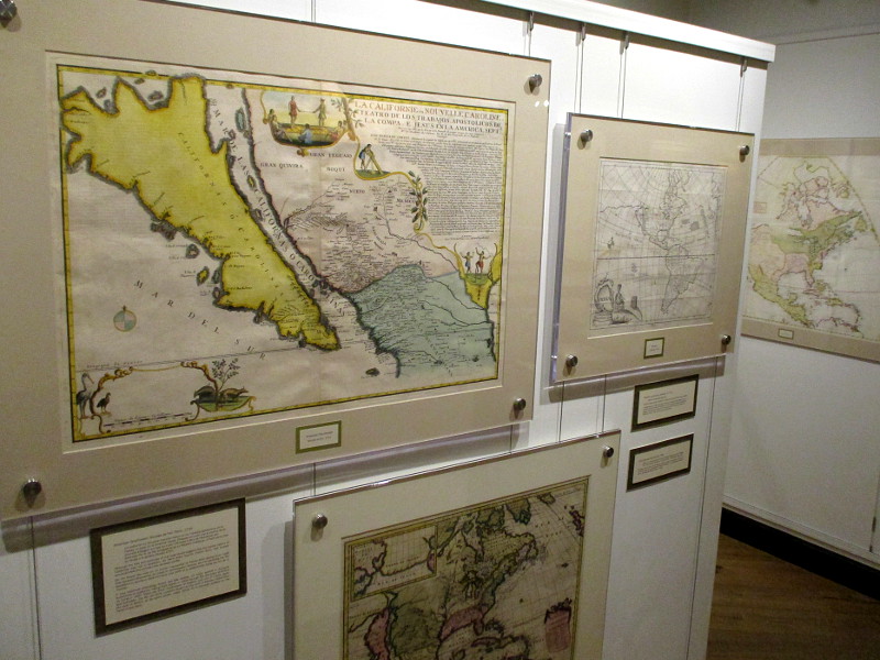
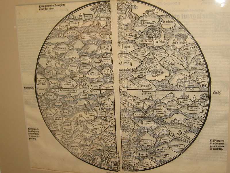
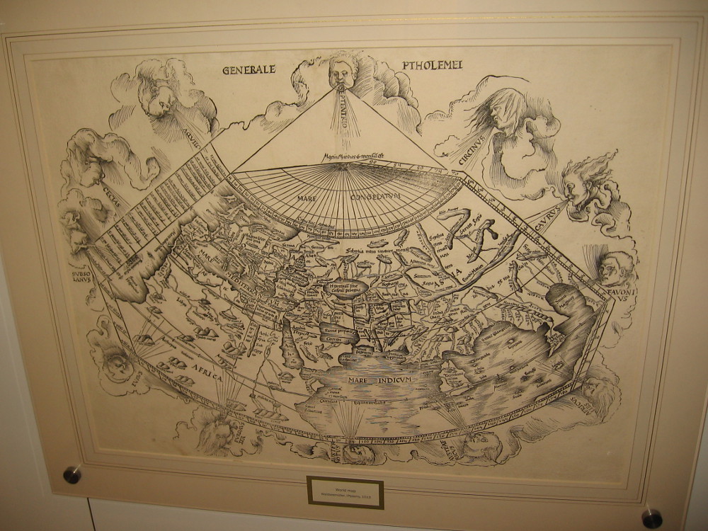
World Map (Ptolemy), Johann Schnitzer, 1482 or 1486.
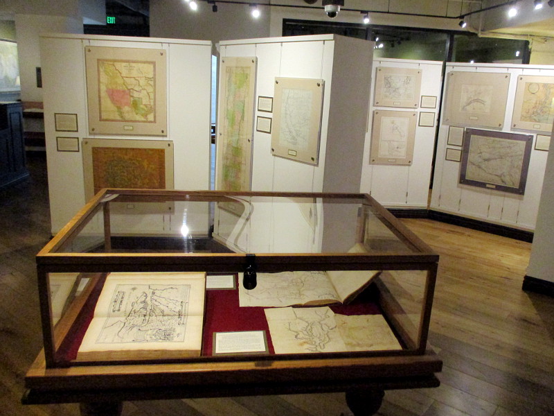
I was surprised to learn recently that a world-class map museum is located in San Diego. The Map and Atlas Museum of La Jolla is considered to be one of the best dedicated map museums in the entire world!
Out of curiosity, I swung by the small museum yesterday and lingered for at least an hour. I could have spent the entire day looking at the amazing collection of historical maps that fill several themed galleries.
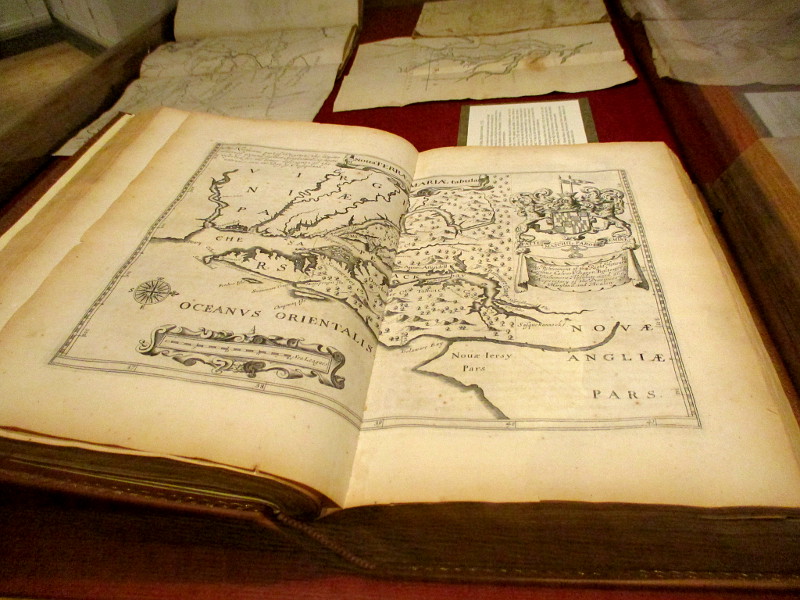
Many of the rare maps are antique, dating from centuries ago when the world’s outlines were unknown, and sea monsters inhabited the watery margins. Every map in the collection is original and authentic, including the first map ever printed!
As I stepped through the door I was greeted by Richard, the friendly director of the museum. I learned that this free museum was founded by Michael Stone, a local businessman and collector with a love for maps. In his youth he collected baseball cards, stamps and coins, before maps and cartography became his passion. At any given time, about ten percent of his vast collection is on display. I was told that Michael is one of the top half dozen map collectors in the world.
There are antique maps showing Earth as the center of Creation, maps from the Age of Exploration, maps from the Revolutionary War, Victorian maps, tourist maps, even maps showing early San Diego. There’s a woodcut map that was created by Benjamin Franklin! There are artistic maps, humorous maps, playing card maps, practically every variety of map or atlas ever conceived by the human mind. There are also historical instruments used by the old explorers and map makers.
For history lovers, the Map and Atlas Museum of La Jolla is a jaw-dropping delight! Visitors might feel they’ve stepped into the vaults of the Smithsonian or National Archives. The collection is that extraordinary!
Richard wandered about the museum during my visit, greeting people and providing tidbits of fascinating information. He informed me many students come by the museum, where they can study history, cartography, design and art.
The museum contains such an abundance of cool stuff, I don’t know where to possibly begin. To provide an idea of what you will see, I offer a sampling of photos. I’ve roughly arranged these maps in chronological order. Read the captions!
In my opinion, this little-known attraction in San Diego is an absolute must see! You can find it in the lower courtyard level of the office building at 7825 Fay Avenue in La Jolla. Check out their website for hours and more info, including special exhibitions.
Visitors look at an amazing collection of historic maps at the Map and Atlas Museum of La Jolla.
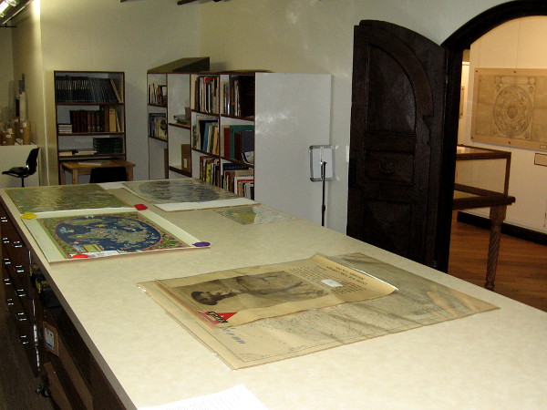
I was shown the museum’s work room, containing a library of books that the public can access. A variety of museum projects like the scanning of maps and historical documents is also done here.
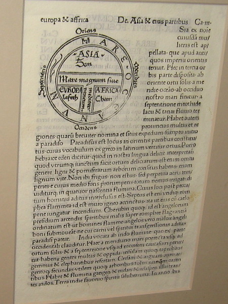
The following is a tiny sample of the many original, rare maps you’ll see when you visit the museum:
The world’s first printed map of a certain date, 1472. This woodcut T-O shaped world map is from Isidorus Hispalensis (Isidore of Seville).
World Map, anonymous, 1491. This map was often hung in medieval monasteries or palaces. It first appeared in the Rudimentum Novitiorum of 1475.
World Map (Ptolemy), Martin Waldseemuller, 1513. Even after the discovery of America, Ptolemaic maps devoid of a Western Hemisphere were still printed.
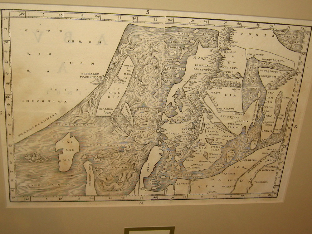
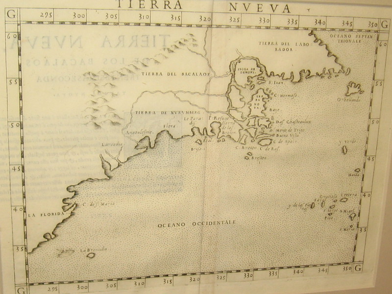
North Atlantic, Jacob Ziegler, 1532. Information for this map was obtained from two Archbishops in Rome. Newfoundland is Terra Bacallaos, or land of codfish.
America, Sebastian Munster, Basle, 1540. This depiction of North America came from reports by explorer Giovanni da Verrazano.
Eastern North America, Girolamo Ruscelli, 1561. Little was known about the inland geography.
North America, Paolo Forlani, 1565. A map that shows America and Asia separated with a strait.
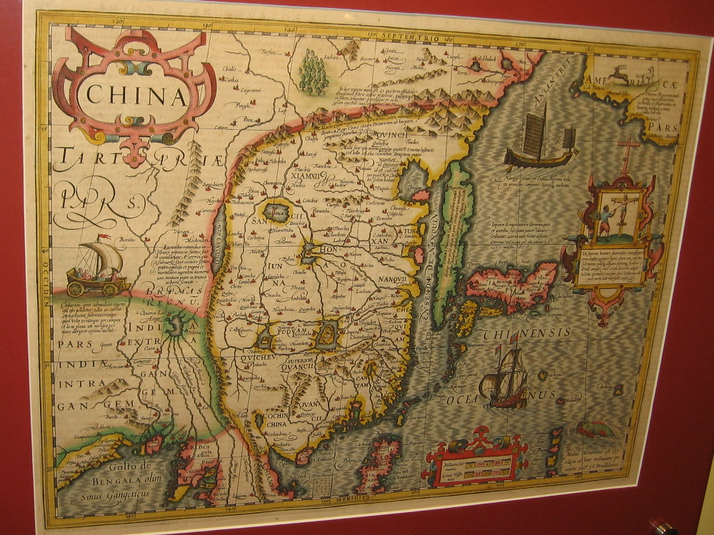
China, Japan and Korea, Jodocus Hondius, 1606. Copperplate engraving from the Mercator Atlas.
View of Macao, Theodore de Bry, 1607. A stylized map, the first published image of Macao.
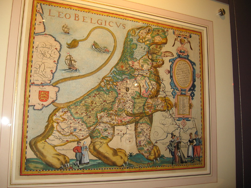
The Low Countries in the Form of a Lion, Petrus Kaerius, 1617. A map of the Netherlands and Belgium.
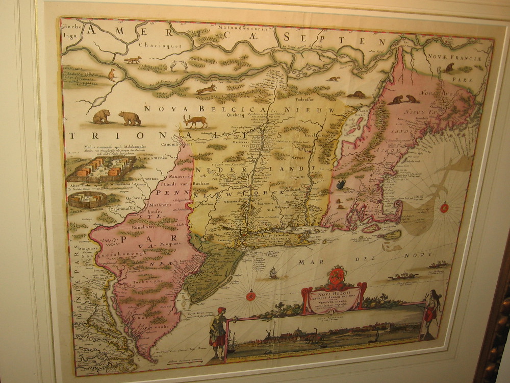
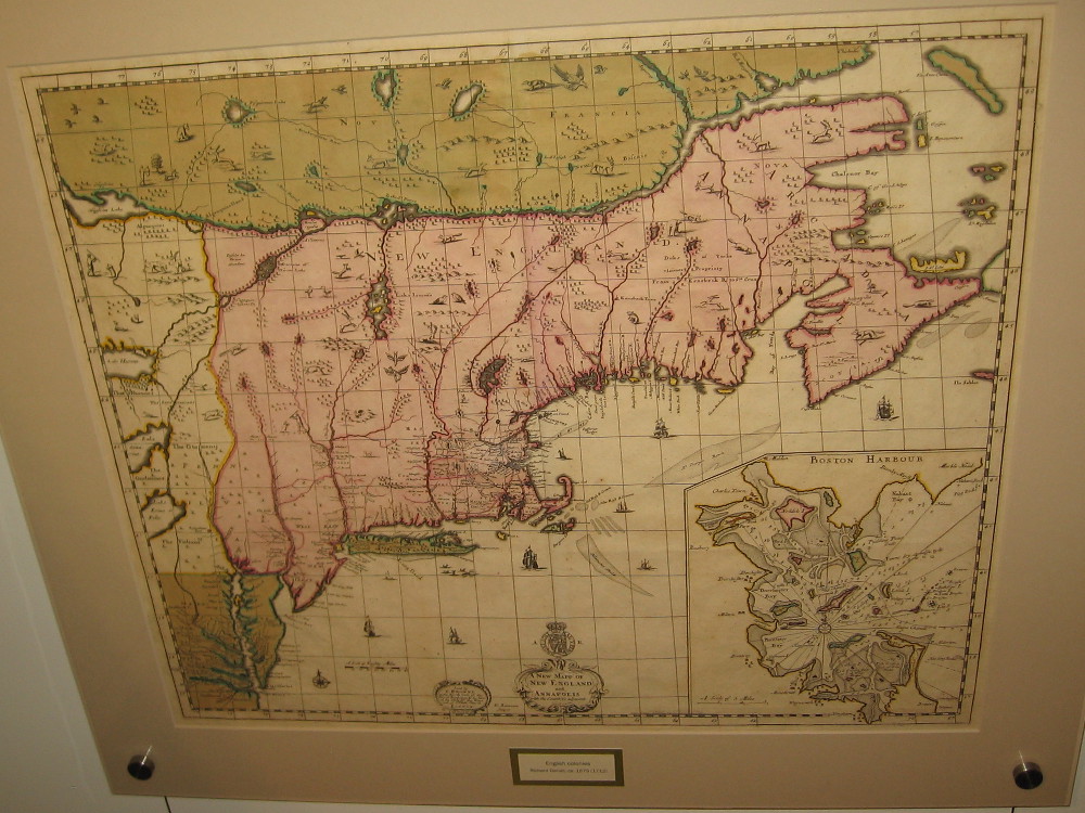
Northeast North America, Jan Jansson and Nicholas Visscher, 1655.
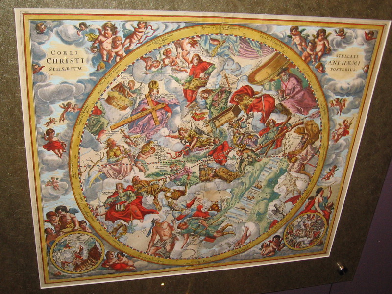
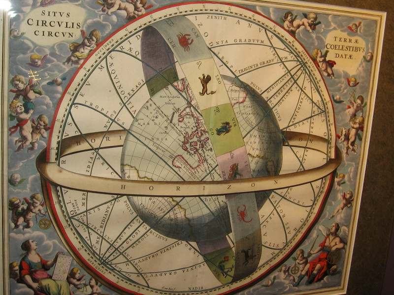
Second Hemisphere with the Christianized firmament, Andreas Cellarius, 1660. The twelve apostles supplanted the old zodiacal constellations in this map.
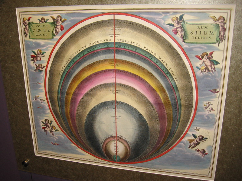
The Sizes of the Celestial Bodies, Andreas Cellarius, 1660. The heavenly bodies compared with Earth, according to Ptolemy.
English colonies, Richard Daniel, ca. 1679. The first printed map of the colonies depicting roads.
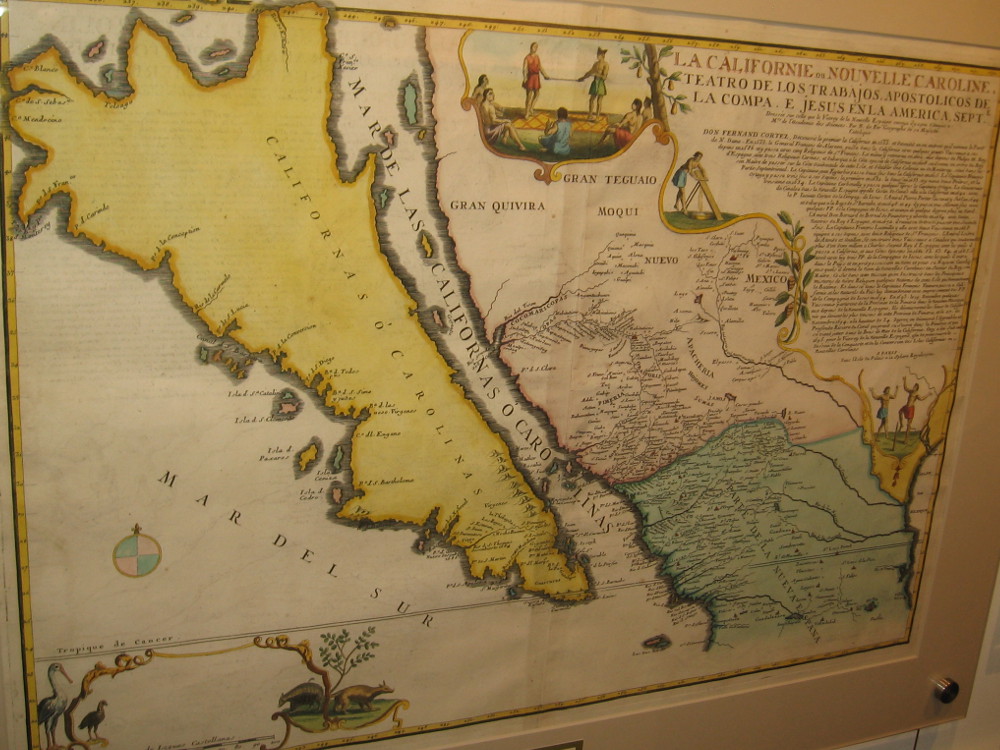
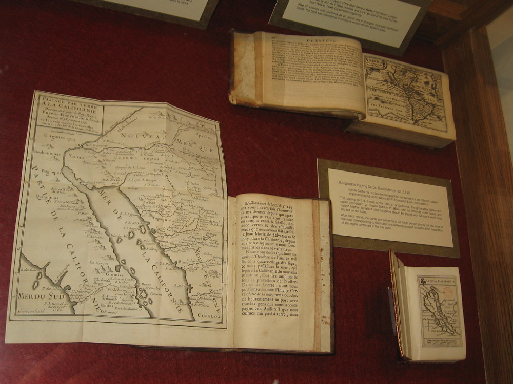
California on early maps was depicted as an island.
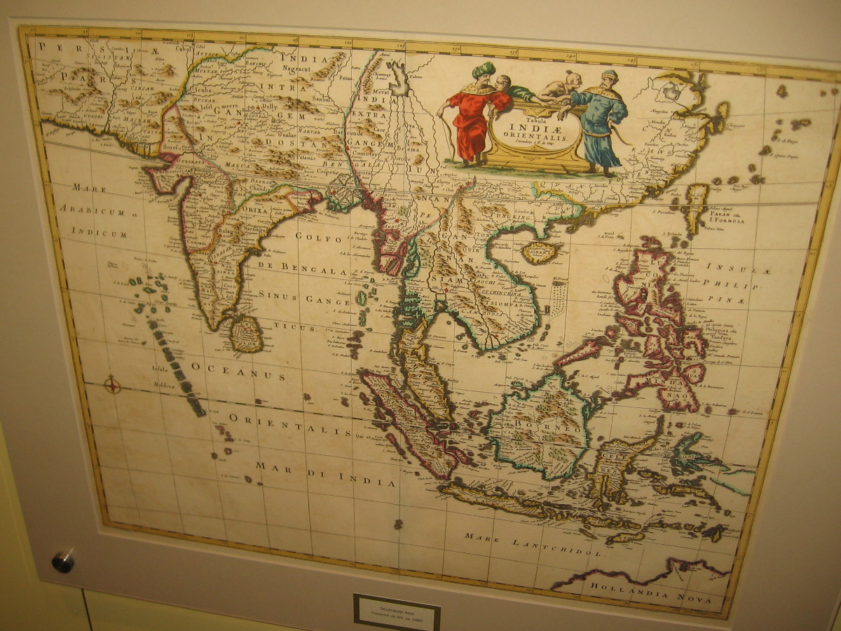
Southern and Southeast Asia, Frederick de Wit, ca. 1680. A standard Dutch published map.
Eastern North America, Hermann Moll, 1715. Beautiful illustration on what is commonly called the beaver map, which was copied from an earlier 1698 map by Nicolas de Fer.
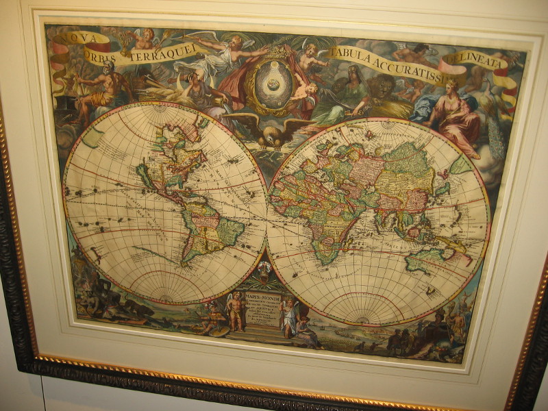
Nova Orbis Terraquei Tabula Accuratissime Delineata, Pieter Van Der Aa, 1713. I love the extensive Latin name given to this highly ornate copper-plate engraving Dutch map!
A display case at the Map and Atlas Museum of La Jolla includes geographic playing cards from the early 18th century.
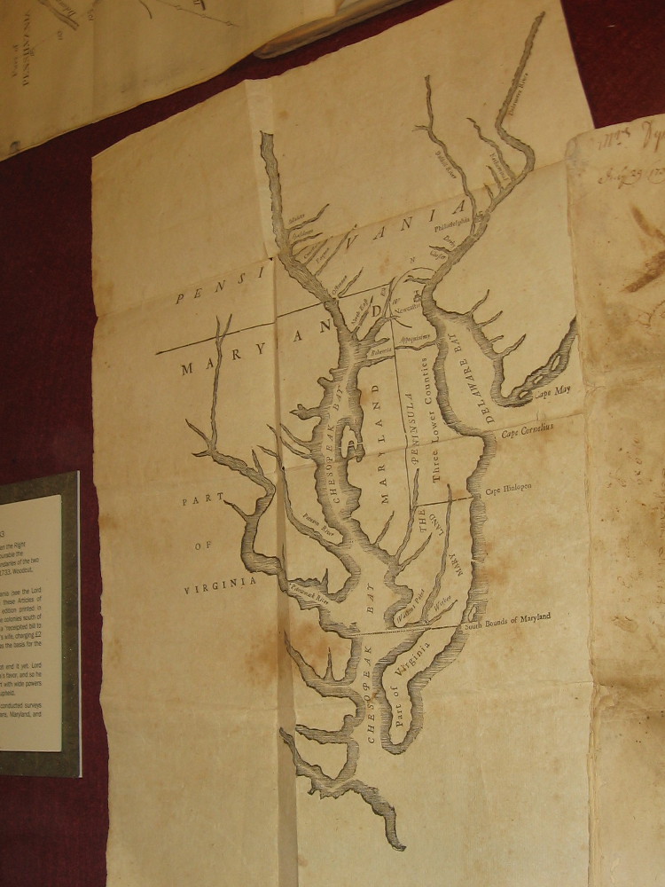
Chesapeake and Delaware Bays, Benjamin Franklin, 1733. Franklin likely cut the woodblock himself. The map shows the newly delineated boundaries of Maryland and Pennsylvania.
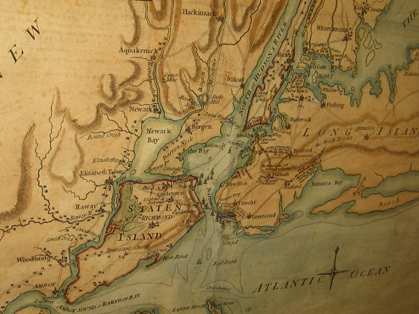
Battle of Long Island, Samuel Holland, 1776. A section of a map that shows the plan of the first major battle in the American Revolution.
New Jersey and Pennsylvania, William Faden, 1777. Plan of the Operations of General Washington, against the King’s Troops in New Jersey.
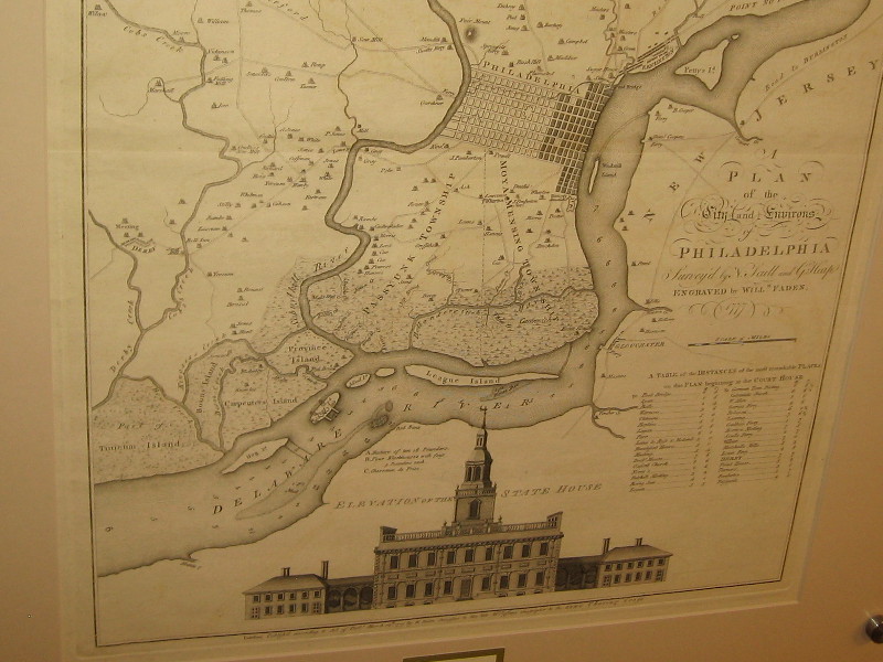
Philadelphia, William Faden, 1777. Lower half of the map includes copy of the earliest known printed image of Independence Hall.
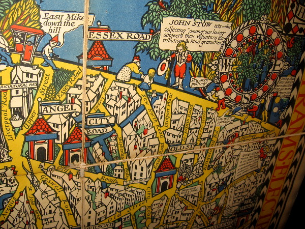
The Wonderground Map of London Town, MacDonald Gill, 1915. This small section shows some of the delightful retail map’s humor.
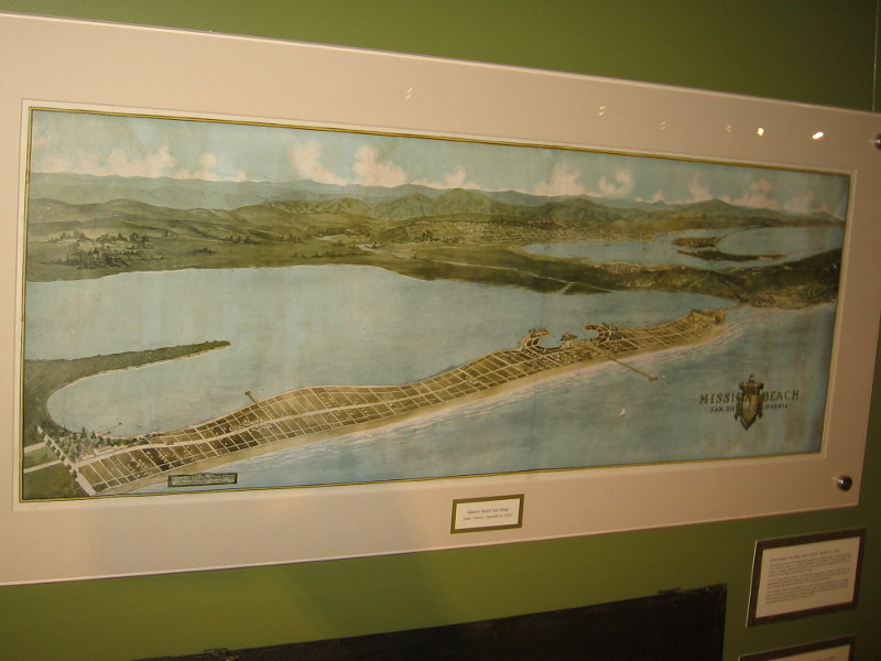
Mission Beach, San Diego, 1915. Map of the projected development of Mission Beach.
San Diego, Joseph Jacinto Mora, 1928. Corner of a map containing illustrations of local history and important places, like the pictured Union Station (now Santa Fe Depot), Horton House (where the U.S. Grant Hotel stands today), Army and Navy YMCA, and Casa de Estudillo in Old Town, which was then called Ramona’s Marriage Place.
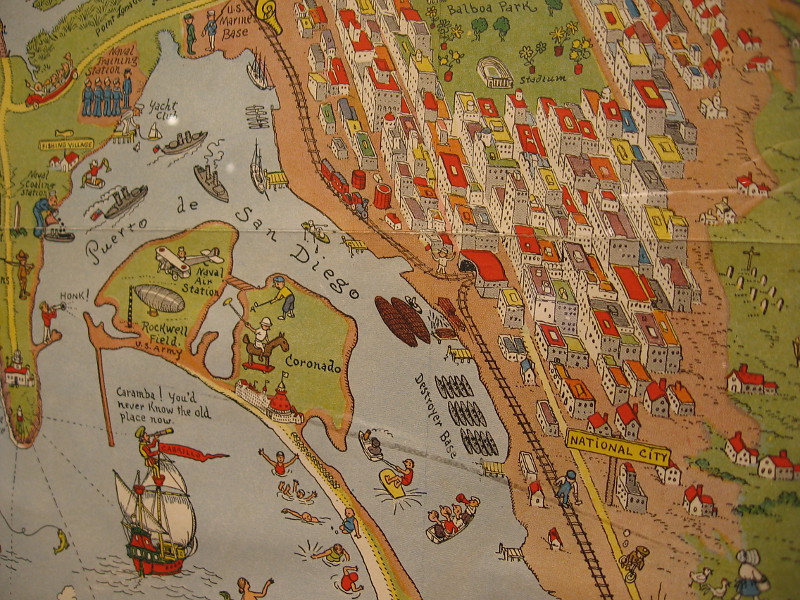
Another section of the same map showing areas around San Diego Bay including downtown, National City, Coronado and Point Loma.
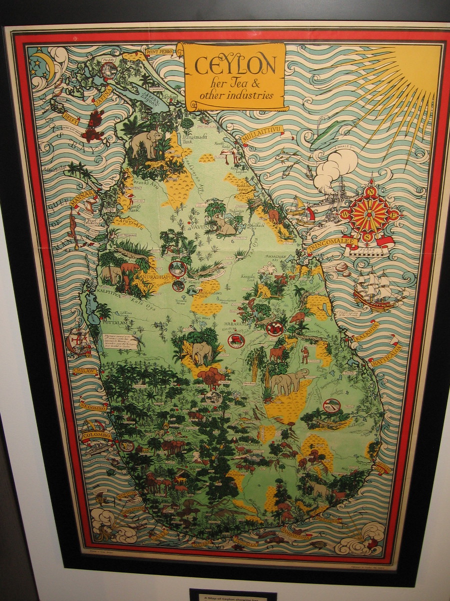
A Map of Ceylon showing her Tea and Other Industries, MacDonald Gill, ca. 1934.
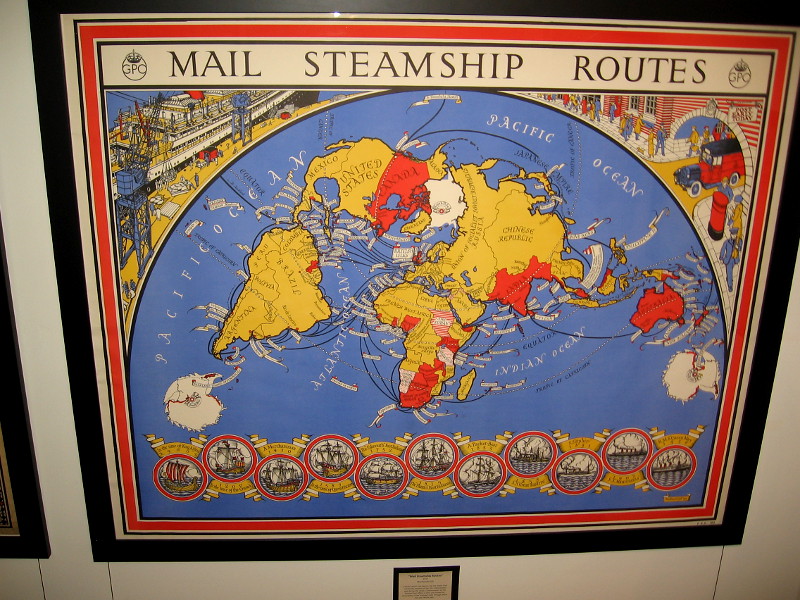
Mail Steamship Routes, MacDonald Gill, 1937.
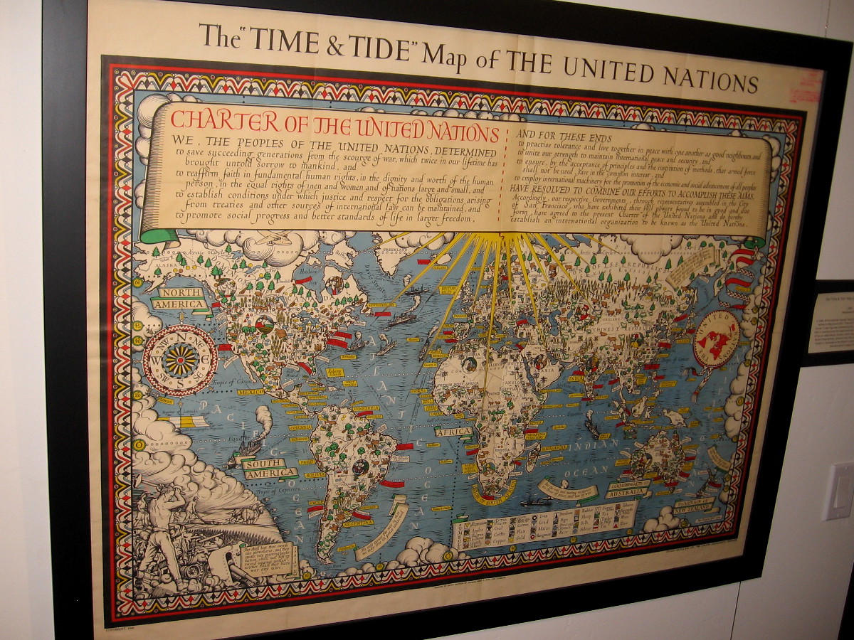
The Time and Tide Map of the United Nations, MacDonald Gill, 1948.
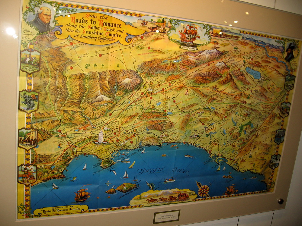
Southern California, Roads To Romance, a tourist map ca. 1958.
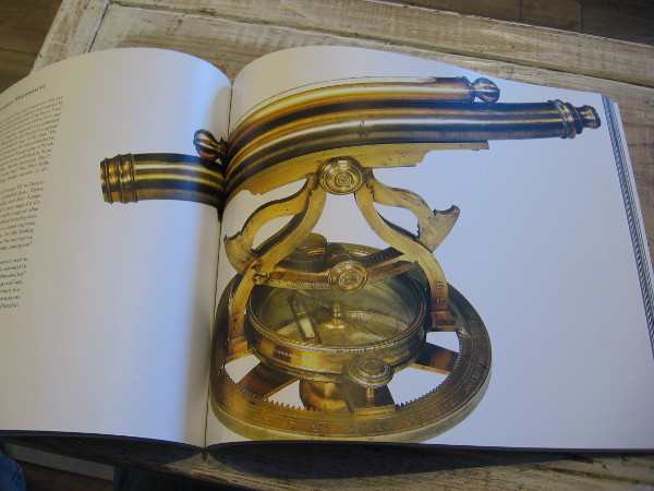
Thomas Jefferys’ brass theodolite, part of the museum’s collection. Jefferys was geographer to King George III. The antique theodolite is pictured in the extraordinary book The Cartographical Collection of Michael R. Stone.
The Location of the Earth, Encircled by the Celestial Circles, Andreas Cellarius, 1660.
…
I live in downtown San Diego and love to walk around with my camera! You can follow Cool San Diego Sights via Facebook or Twitter!
You can easily explore Cool San Diego Sights by using the search box on my blog’s sidebar. Or click a tag! There are thousands upon thousands of photos for you to enjoy!
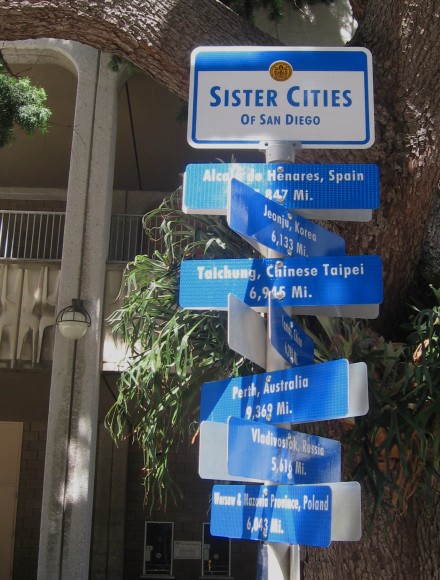
Should you ever walk through Civic Center Plaza, you’ll probably see this unusual group of signs. These are a few of San Diego’s sister cities. Pointing in almost every direction, the signs indicate distances in miles and kilometers.
Another similar group of fun signs can be found directly across the plaza.
San Diego’s 16 sister cities are:
Alcala de Henares, Spain
Campinas, Brazil
Cavite, Philippines
Edinburgh, Scotland
Jalalabad, Afghanistan
Jeonju, South Korea
Leon, Mexico
Perth, Australia
Quanzhou, China
Taichung City, Taiwan
Tema, Ghana
Tijuana, Mexico
Vladivostok, Russia
Warsaw, Poland
Yantai, China
Yokohama, Japan
UPDATE! I walked through Civic Center Plaza about half a year later and I noticed brand new signs!