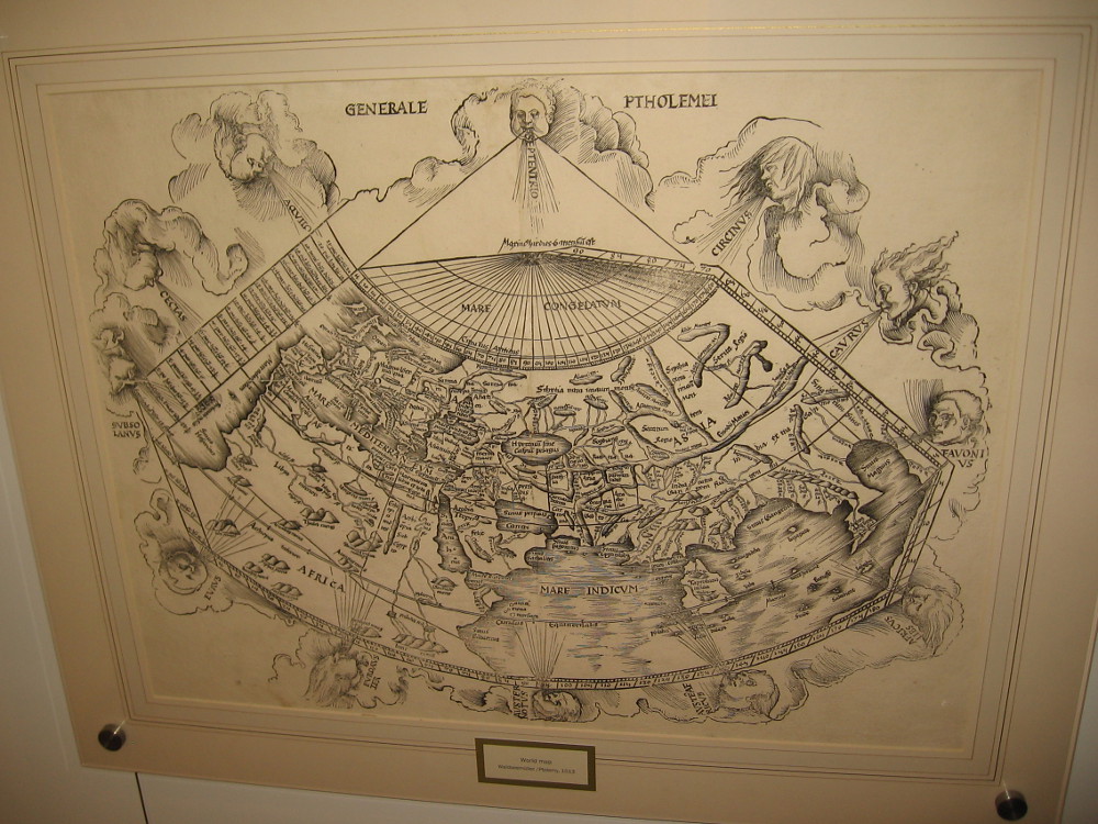
World Map (Ptolemy), Johann Schnitzer, 1482 or 1486.
I was surprised to learn recently that a world-class map museum is located in San Diego. The Map and Atlas Museum of La Jolla is considered to be one of the best dedicated map museums in the entire world!
Out of curiosity, I swung by the small museum yesterday and lingered for at least an hour. I could have spent the entire day looking at the amazing collection of historical maps that fill several themed galleries.
Many of the rare maps are antique, dating from centuries ago when the world’s outlines were unknown, and sea monsters inhabited the watery margins. Every map in the collection is original and authentic, including the first map ever printed!
As I stepped through the door I was greeted by Richard, the friendly director of the museum. I learned that this free museum was founded by Michael Stone, a local businessman and collector with a love for maps. In his youth he collected baseball cards, stamps and coins, before maps and cartography became his passion. At any given time, about ten percent of his vast collection is on display. I was told that Michael is one of the top half dozen map collectors in the world.
There are antique maps showing Earth as the center of Creation, maps from the Age of Exploration, maps from the Revolutionary War, Victorian maps, tourist maps, even maps showing early San Diego. There’s a woodcut map that was created by Benjamin Franklin! There are artistic maps, humorous maps, playing card maps, practically every variety of map or atlas ever conceived by the human mind. There are also historical instruments used by the old explorers and map makers.
For history lovers, the Map and Atlas Museum of La Jolla is a jaw-dropping delight! Visitors might feel they’ve stepped into the vaults of the Smithsonian or National Archives. The collection is that extraordinary!
Richard wandered about the museum during my visit, greeting people and providing tidbits of fascinating information. He informed me many students come by the museum, where they can study history, cartography, design and art.
The museum contains such an abundance of cool stuff, I don’t know where to possibly begin. To provide an idea of what you will see, I offer a sampling of photos. I’ve roughly arranged these maps in chronological order. Read the captions!
In my opinion, this little-known attraction in San Diego is an absolute must see! You can find it in the lower courtyard level of the office building at 7825 Fay Avenue in La Jolla. Check out their website for hours and more info, including special exhibitions.
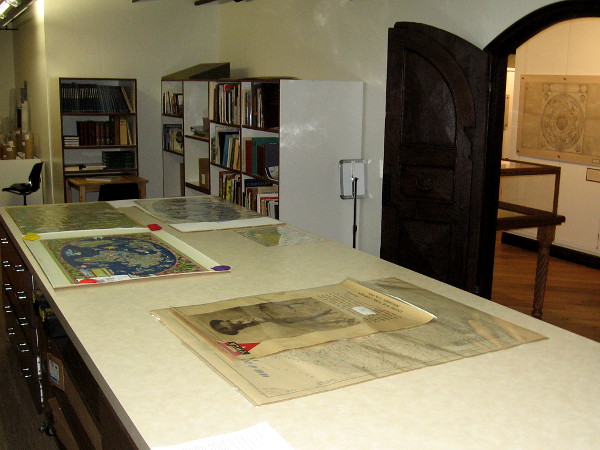
Visitors look at an amazing collection of historic maps at the Map and Atlas Museum of La Jolla.I was shown the museum’s work room, containing a library of books that the public can access. A variety of museum projects like the scanning of maps and historical documents is also done here.
The following is a tiny sample of the many original, rare maps you’ll see when you visit the museum:
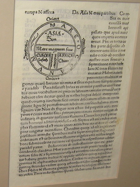
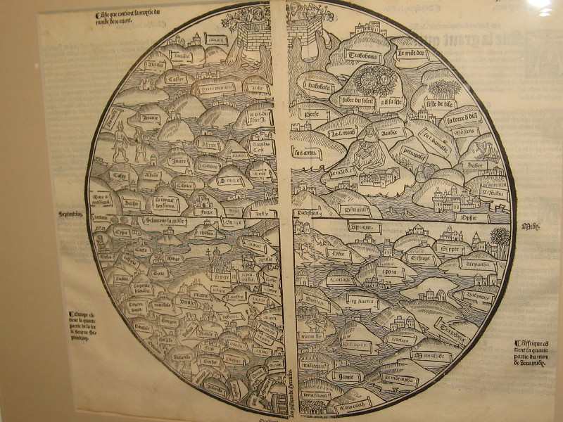
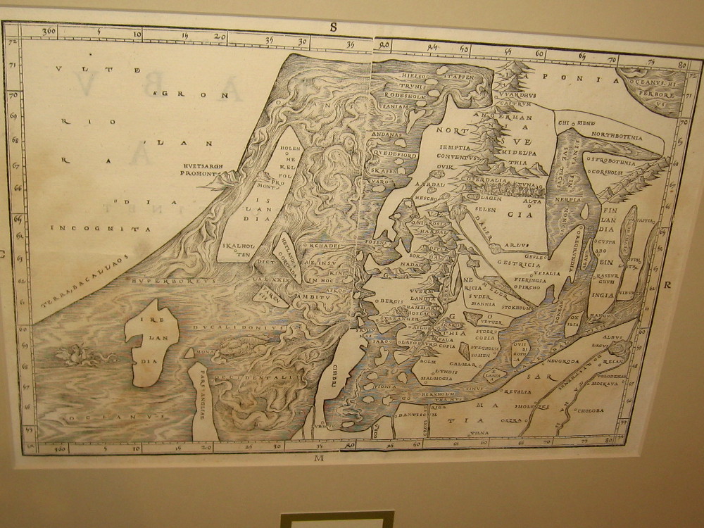
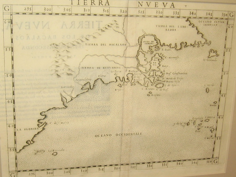
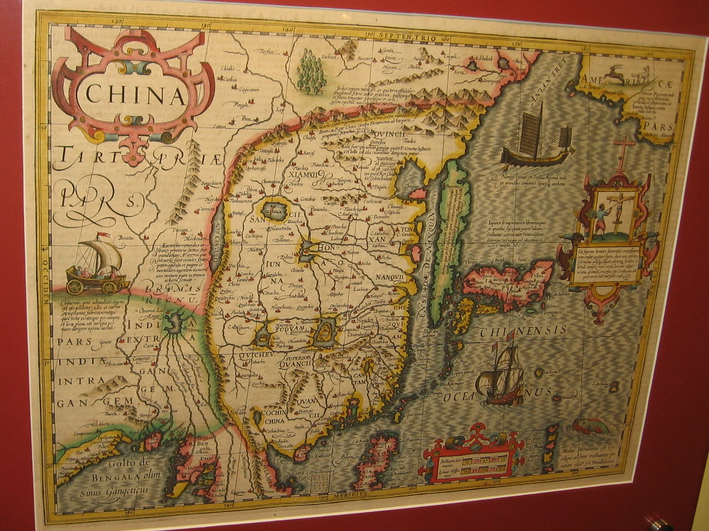
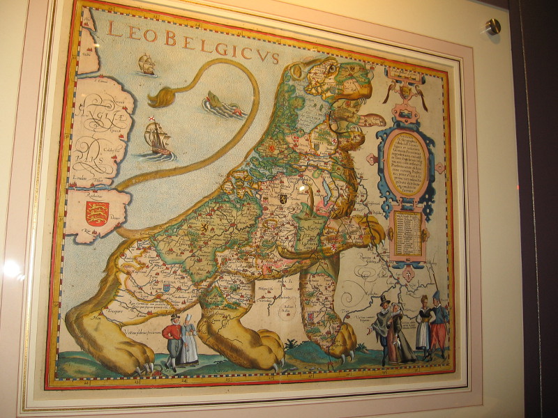
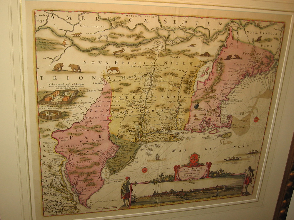
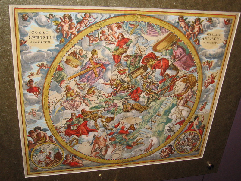
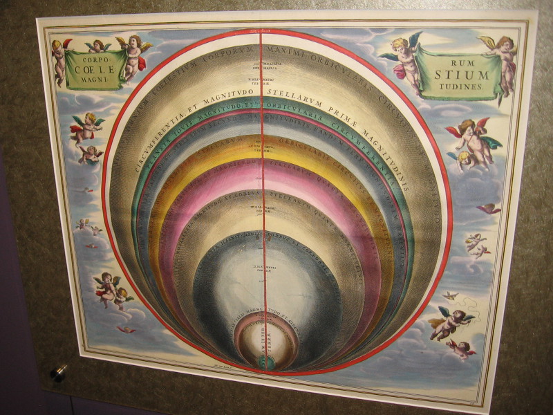
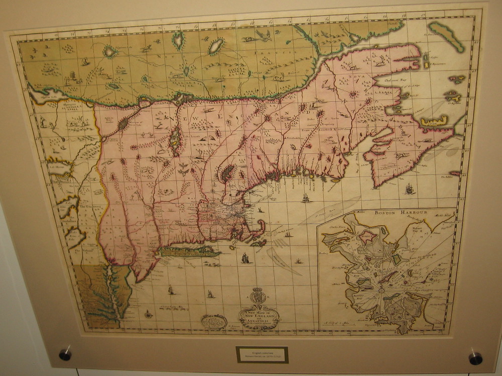
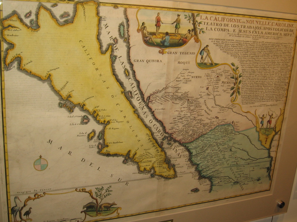
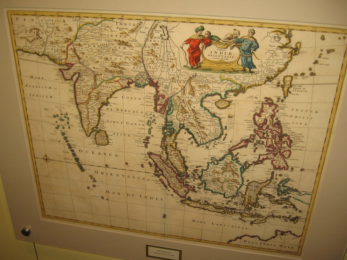
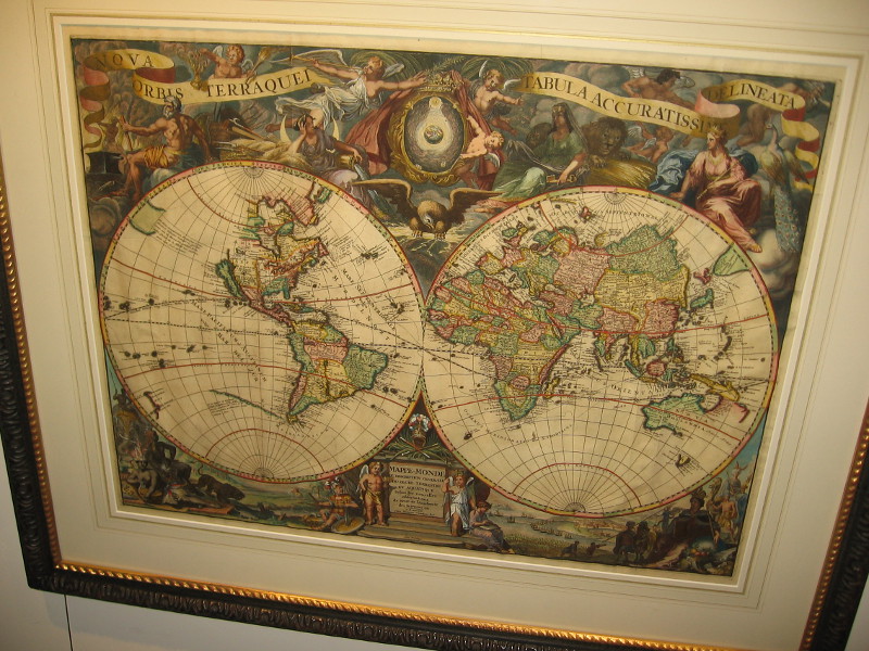
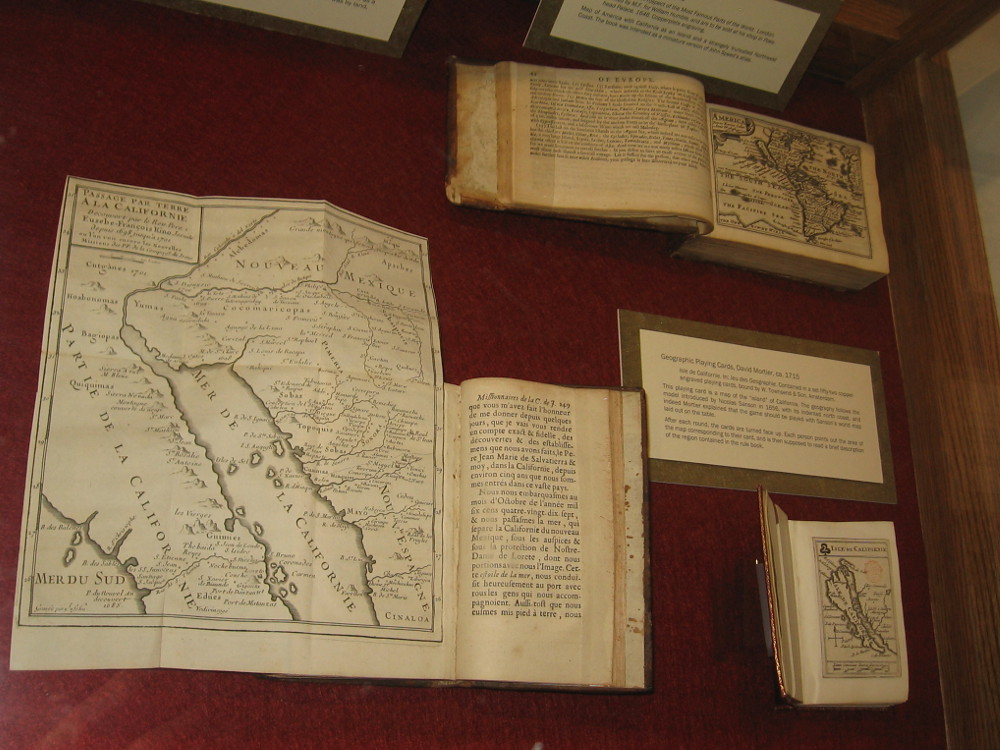
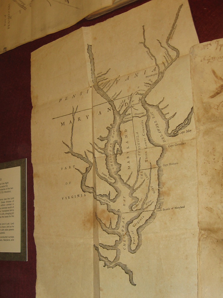
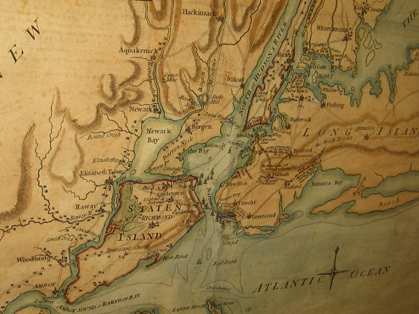
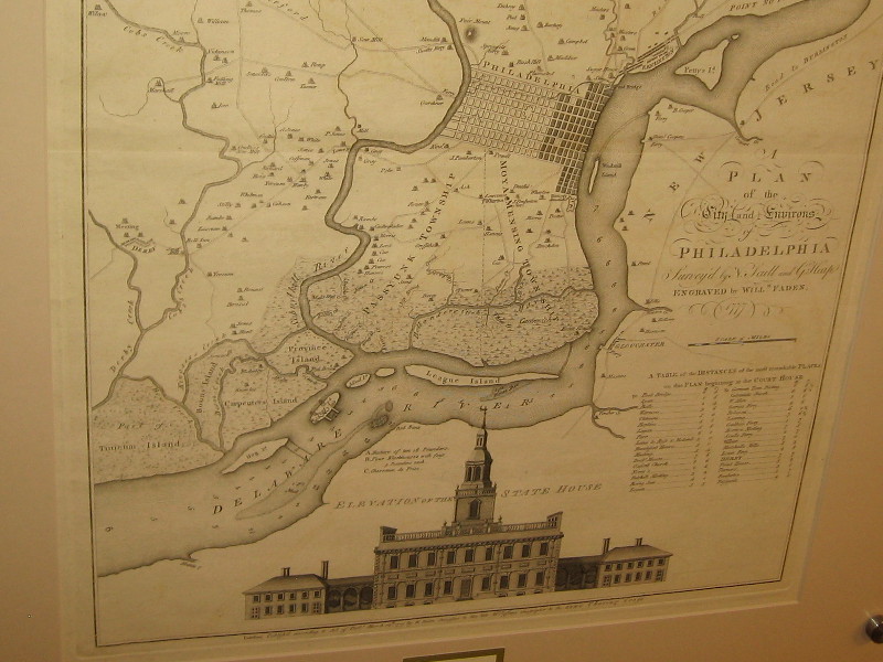
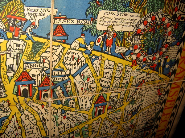
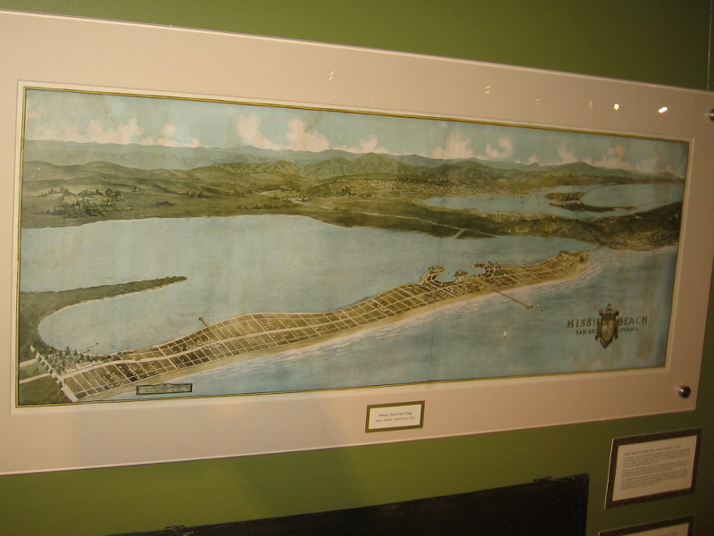
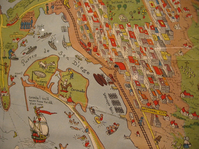
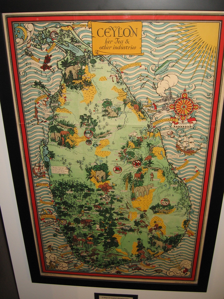
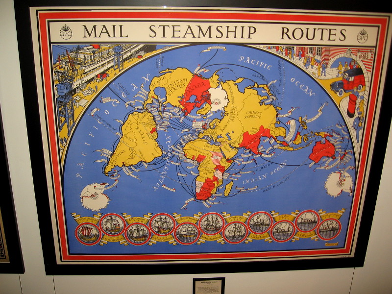
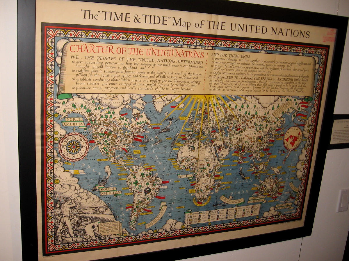
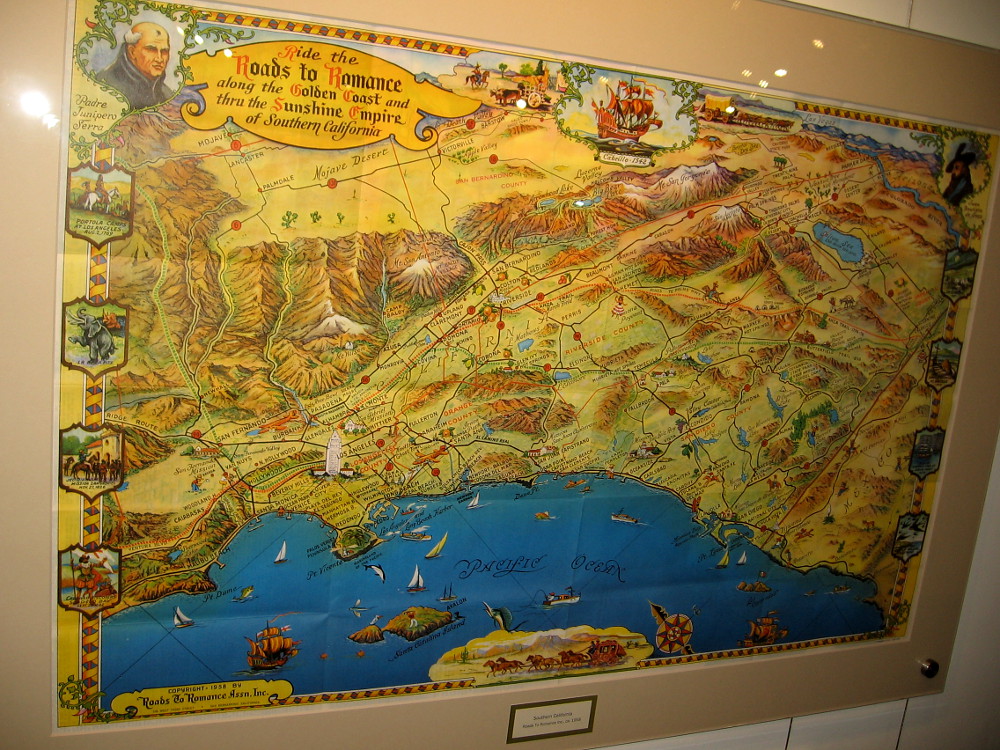
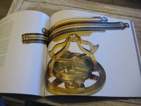
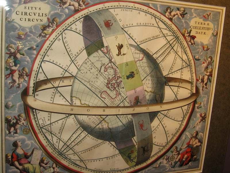
The world’s first printed map of a certain date, 1472. This woodcut T-O shaped world map is from Isidorus Hispalensis (Isidore of Seville).World Map, anonymous, 1491. This map was often hung in medieval monasteries or palaces. It first appeared in the Rudimentum Novitiorum of 1475.World Map (Ptolemy), Martin Waldseemuller, 1513. Even after the discovery of America, Ptolemaic maps devoid of a Western Hemisphere were still printed.North Atlantic, Jacob Ziegler, 1532. Information for this map was obtained from two Archbishops in Rome. Newfoundland is Terra Bacallaos, or land of codfish.America, Sebastian Munster, Basle, 1540. This depiction of North America came from reports by explorer Giovanni da Verrazano.Eastern North America, Girolamo Ruscelli, 1561. Little was known about the inland geography.North America, Paolo Forlani, 1565. A map that shows America and Asia separated with a strait.China, Japan and Korea, Jodocus Hondius, 1606. Copperplate engraving from the Mercator Atlas.View of Macao, Theodore de Bry, 1607. A stylized map, the first published image of Macao.The Low Countries in the Form of a Lion, Petrus Kaerius, 1617. A map of the Netherlands and Belgium.Northeast North America, Jan Jansson and Nicholas Visscher, 1655.Second Hemisphere with the Christianized firmament, Andreas Cellarius, 1660. The twelve apostles supplanted the old zodiacal constellations in this map.The Sizes of the Celestial Bodies, Andreas Cellarius, 1660. The heavenly bodies compared with Earth, according to Ptolemy.English colonies, Richard Daniel, ca. 1679. The first printed map of the colonies depicting roads.California on early maps was depicted as an island.Southern and Southeast Asia, Frederick de Wit, ca. 1680. A standard Dutch published map.Eastern North America, Hermann Moll, 1715. Beautiful illustration on what is commonly called the beaver map, which was copied from an earlier 1698 map by Nicolas de Fer.Nova Orbis Terraquei Tabula Accuratissime Delineata, Pieter Van Der Aa, 1713. I love the extensive Latin name given to this highly ornate copper-plate engraving Dutch map!A display case at the Map and Atlas Museum of La Jolla includes geographic playing cards from the early 18th century.Chesapeake and Delaware Bays, Benjamin Franklin, 1733. Franklin likely cut the woodblock himself. The map shows the newly delineated boundaries of Maryland and Pennsylvania.Battle of Long Island, Samuel Holland, 1776. A section of a map that shows the plan of the first major battle in the American Revolution.New Jersey and Pennsylvania, William Faden, 1777. Plan of the Operations of General Washington, against the King’s Troops in New Jersey.Philadelphia, William Faden, 1777. Lower half of the map includes copy of the earliest known printed image of Independence Hall.The Wonderground Map of London Town, MacDonald Gill, 1915. This small section shows some of the delightful retail map’s humor.Mission Beach, San Diego, 1915. Map of the projected development of Mission Beach.San Diego, Joseph Jacinto Mora, 1928. Corner of a map containing illustrations of local history and important places, like the pictured Union Station (now Santa Fe Depot), Horton House (where the U.S. Grant Hotel stands today), Army and Navy YMCA, and Casa de Estudillo in Old Town, which was then called Ramona’s Marriage Place.Another section of the same map showing areas around San Diego Bay including downtown, National City, Coronado and Point Loma.A Map of Ceylon showing her Tea and Other Industries, MacDonald Gill, ca. 1934.Mail Steamship Routes, MacDonald Gill, 1937.The Time and Tide Map of the United Nations, MacDonald Gill, 1948.Southern California, Roads To Romance, a tourist map ca. 1958.Thomas Jefferys’ brass theodolite, part of the museum’s collection. Jefferys was geographer to King George III. The antique theodolite is pictured in the extraordinary book The Cartographical Collection of Michael R. Stone.The Location of the Earth, Encircled by the Celestial Circles, Andreas Cellarius, 1660.
…
I live in downtown San Diego and love to walk around with my camera! You can follow Cool San Diego Sights via Facebook or Twitter!
You can easily explore Cool San Diego Sights by using the search box on my blog’s sidebar. Or click a tag! There are thousands upon thousands of photos for you to enjoy!
Downtown San Diego has been my home for many years. My online activities reflect my love for writing, blogging, walking and photography.
View all posts by Richard Schulte
6 thoughts on “Visit a world-class map museum in La Jolla!”
Thanks for the information. I will visit the museum because I love to admire antique maps. Have a great day!
Marianne


Thanks for the information. I will visit the museum because I love to admire antique maps. Have a great day!
Marianne
LikeLiked by 1 person
It’s a really cool museum! Have fun!
LikeLiked by 1 person