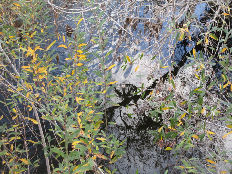
Please enjoy these photographs of winter beauty by the San Diego River in Mission Valley.
I framed this natural beauty during several January morning walks. Some photos were taken from the pedestrian bridge that spans the river by the Fashion Valley Transit Center; others near Mission Center Road.
Reflections created magic. White clouds in the sky floated on water. Trees were turned upside down.
Branches, leaves, river and sky danced together mysteriously.
…
I live in downtown San Diego and love to walk around with my camera! You can follow Cool San Diego Sights via Facebook or Twitter!
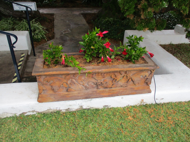
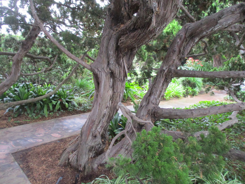
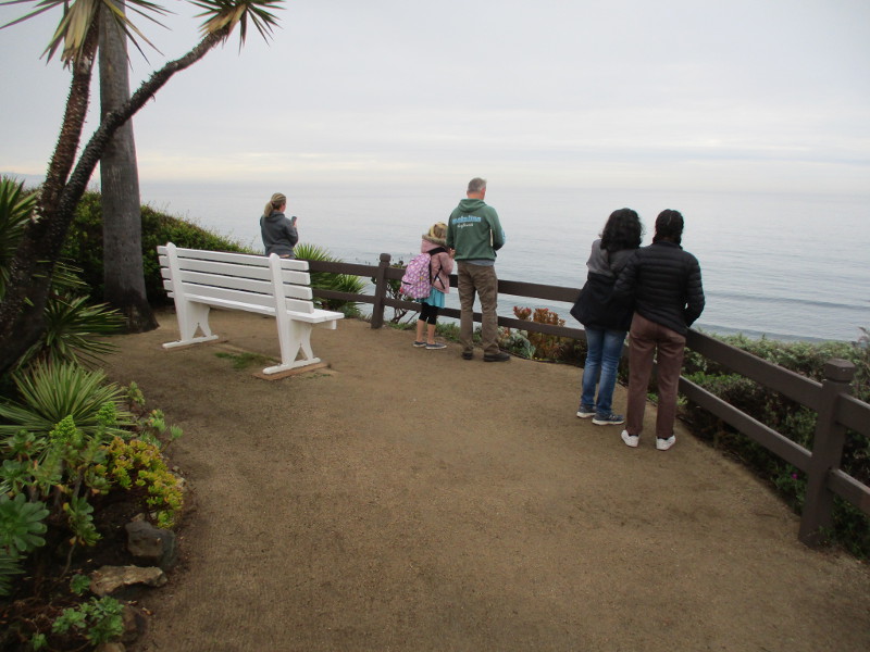
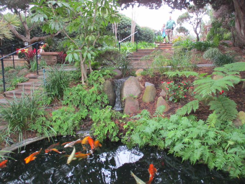
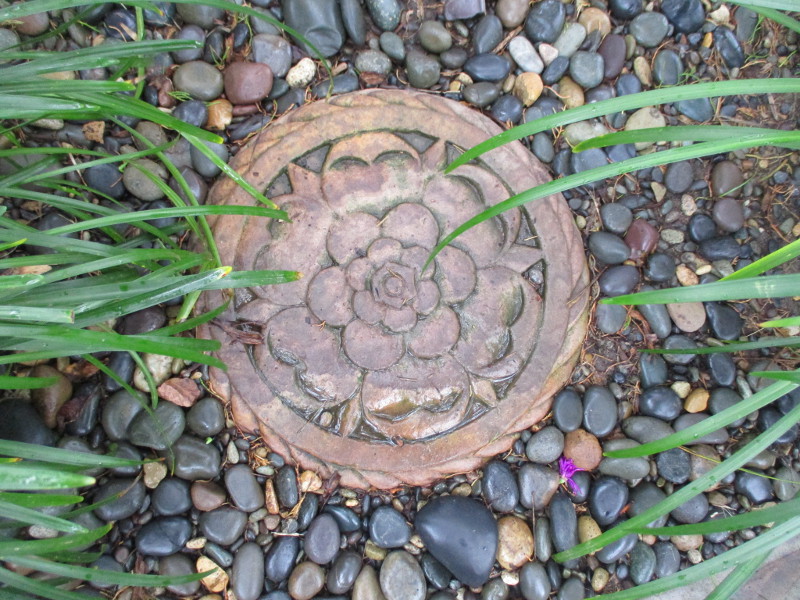
Some of the most beautiful gardens in San Diego County can be found in Encinitas. I visited one of those gardens this weekend.
The Meditation Gardens at Self-Realization Fellowship is a quiet retreat for those who like to walk or sit quietly in a place where the mind can find peace and the spirit, inspiration.
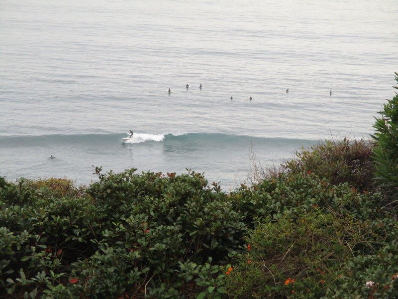
Pathways wind through a lush, carefully tended world. Benches in green nooks invite rest and reflection. There are exotic plants, trees and flowers, ponds filled with bright koi, and breathtaking views of the Pacific Ocean. Like distant poetry, surfers far below ride the curling rhythmic waves of Swami’s.
The Meditation Gardens recently reopened after a long closure due to the COVID-19 pandemic. Visitors to the garden, as the Self-Realization Fellowship website suggests, might discover “a greater realization of the Divine Presence that lies within.”
The amazing garden is free to the public.
Enjoy a sample of its beauty…
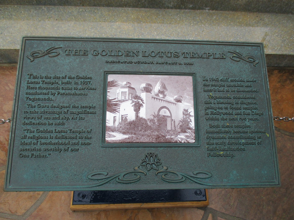
This is the site of the Golden Lotus Temple, built in 1937. Here thousands came to services conducted by Paramahansa Yogananda… In 1942 cliff erosion made the temple unstable and later it had to be dismantled…
…
I live in downtown San Diego and love to walk around with my camera! You can follow Cool San Diego Sights via Facebook or Twitter!
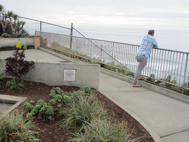
Head west through Encinitas along J Street. When you reach the end, climb the stairs to the J Street Viewpoint.
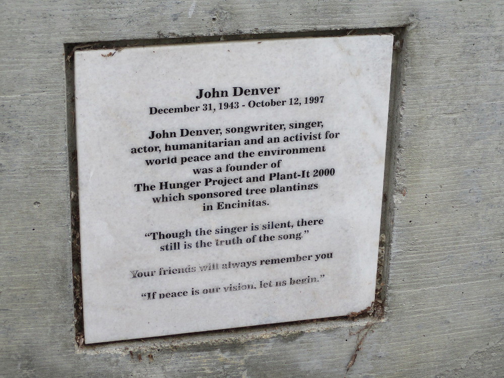
You’ll discover beautiful views of the Pacific Ocean, unexpected works of public art . . . and a small plaque.
John Denver
December 31, 1943 – October 12, 1997
John Denver, songwriter, singer, actor, humanitarian and an activist for world peace and the environment was a founder of The Hunger Project and Plant-It 2000 which sponsored tree plantings in Encinitas.
“Though the singer is silent, there still is the truth of the song.”
Your friends will always remember you.
“If peace is our vision, let us begin.”
…
I live in downtown San Diego and love to walk around with my camera! You can follow Cool San Diego Sights via Facebook or Twitter!
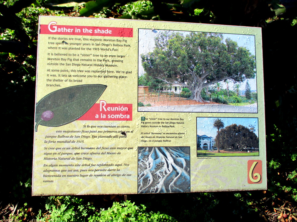
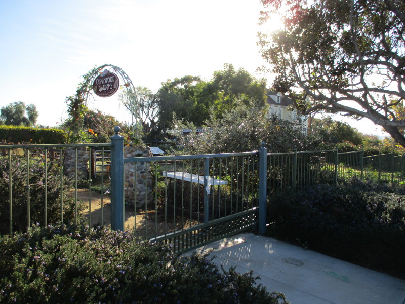
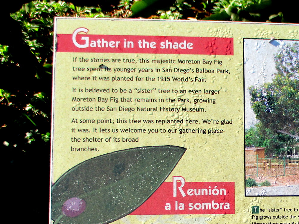
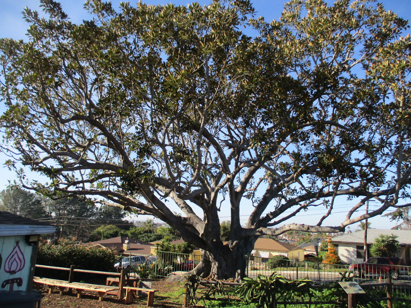
Did you know the huge Moreton Bay Fig tree in Balboa Park, which stands near the San Diego Natural History Museum, has a sister tree in National City?
I was surprised to learn this when I visited Olivewood Gardens and Learning Center today!
According to one sign at Olivewood Gardens, their Moreton Bay Fig, which shades a demonstration vegetable garden, was also planted in Balboa Park for the 1915 Panama California Exposition. But years ago it was transplanted to National City, and now students and families visiting Olivewood Gardens can gather in its ample shade.
Olivewood Gardens and Learning Center is a wonderful place where people from around the community can learn about gardening, preparing healthy food, protecting the environment, and becoming civic leaders. It’s located on the expansive grounds of an historic home that was donated for this cause by its philanthropic former owners. I will be blogging more about Olivewood Gardens shortly.
I was given an incredible tour of wonders all around National City today, and I’ll be sharing lots of inspiring and beautiful photographs, so stay tuned!
…
I live in downtown San Diego and love to walk around with my camera! You can follow Cool San Diego Sights via Facebook or Twitter!
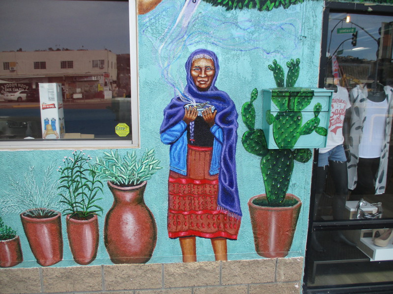
There’s a beautiful new mural on the front of the Welcome Home Boutique & Art Space in Lemon Grove. I spotted it yesterday during a walk down Broadway near Grove Street.
The art is by muralist and social justice activist Mario Chacón. It was painted this year.
Included in the artwork is the image of migrant workers collecting fruit from citrus trees.
Lemon Grove used to be largely agricultural. It’s sunny climate is perfect for growing citrus. The San Diego Union newspaper in 1894 referred to Lemon Grove as “a sea of lemon trees.”
My adventure yesterday included a visit to the Lemon Grove Parsonage Museum, which is operated by the Lemon Grove Historical Society. I’ll be sharing those fascinating photos in the next few days!
…
I live in downtown San Diego and love to walk around with my camera! You can follow Cool San Diego Sights via Facebook or Twitter!
You can easily explore Cool San Diego Sights by using the search box on my blog’s sidebar. Or click a tag! There are thousands upon thousands of photos for you to enjoy!
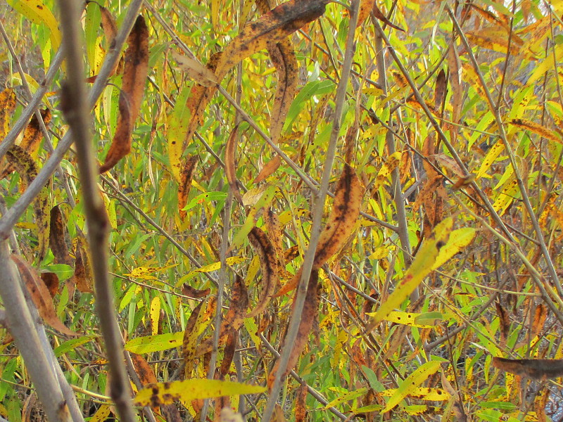
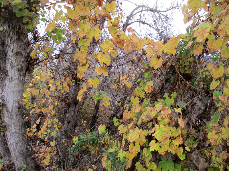
Today I headed out to Warner Springs in northern San Diego County. I wanted to experience an authentic stagecoach ride at the historic Warner-Carrillo Ranch House.
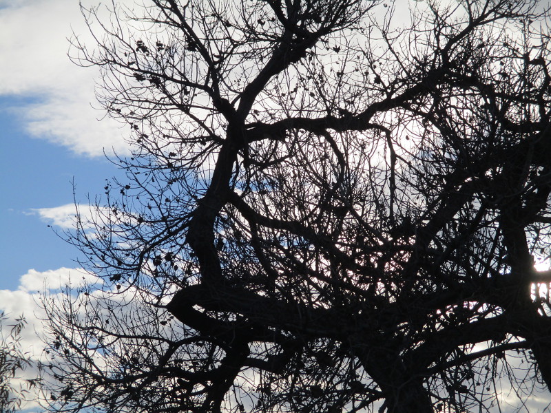
I arrived too early, so I drove a few miles further up State Route 79 to the Eagle Rock Trailhead, near the Warner Springs fire station. There I parked under some shady oak trees and began a slow hike south along the Pacific Crest Trail.
The short (perhaps half mile) segment of the PCT that I walked followed a dry creek bed. It passed through several swinging gates, but I encountered no grazing livestock.
In addition to many ancient oaks, I saw the autumn yellows of a few riparian trees–mostly willows it seemed. A couple sycamores I noticed had lost most of their leaves.
I also spotted interesting rock outcroppings and a distant woodpecker. And only a few hikers.
Had I time, I might have continued all the way to Eagle Rock–an impressive outcropping three miles from the trailhead that looks exactly like an bird with spread wings. I’ll do that some other day.
Enjoy these photos of autumn beauty along a very small part of the Pacific Crest Trail…
…
I live in downtown San Diego and love to walk around with my camera! You can follow Cool San Diego Sights via Facebook or Twitter!
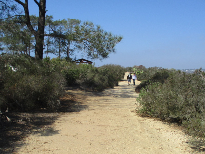
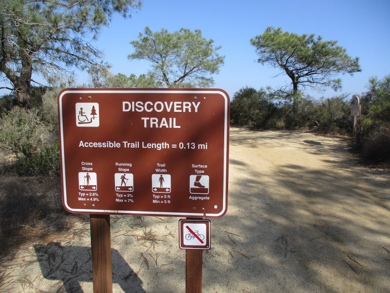
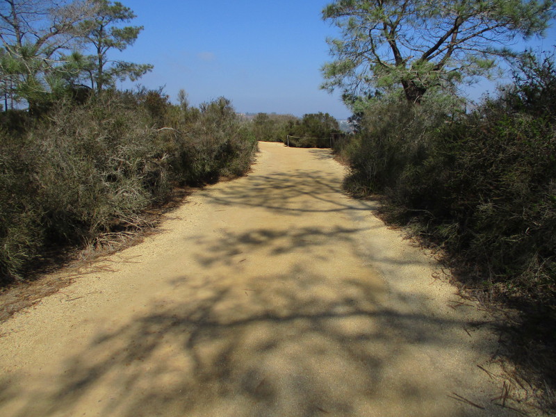
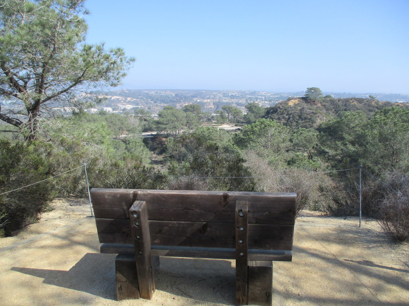
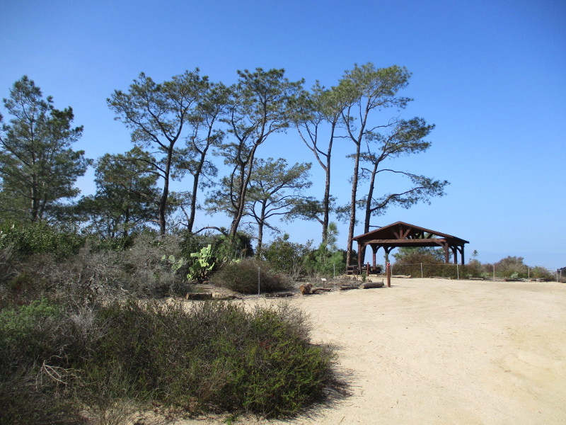
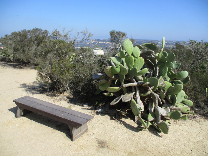
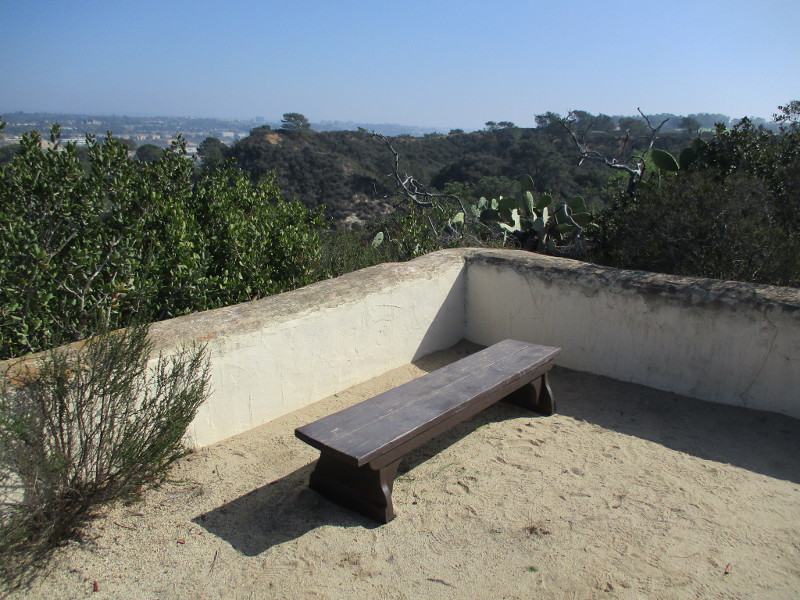
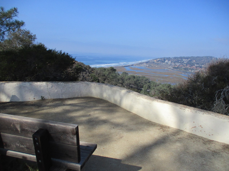
The very easy Discovery Trail at Torrey Pines State Natural Reserve is a fine place to walk or sit on a bench, while drinking in nature’s beauty.
The short .13 mile highly accessible trail follows the edge of a bluff just east of the historic Lodge (the park’s Visitor Center) and its parking lot.
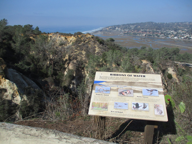
There are scenic overlooks with views of Carmel Valley, Los Peñasquitos Lagoon and even the Pacific Ocean. Signs describe many of the natural marvels around you. Native plants along the way are identified with information plaques.
Last weekend I slowly walked north along the Discovery Trail.
I began at Torrey Pines Park Road across from the Beach Trailhead parking lot. That’s where I saw the sign pictured below. I then headed north until I reached the rear of the old Lodge.
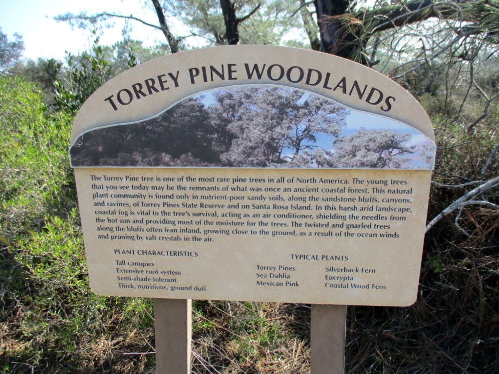
TORREY PINE WOODLANDS. The Torrey Pine tree is one of the most rare pine trees in all of North America. The young trees that you see today may be the remnants of what was once an ancient coastal forest. This natural plant community is found only in nutrient-poor sandy soils, along the sandstone bluffs, canyons, and ravines of Torrey Pines State Reserve and on Santa Rosa Island…
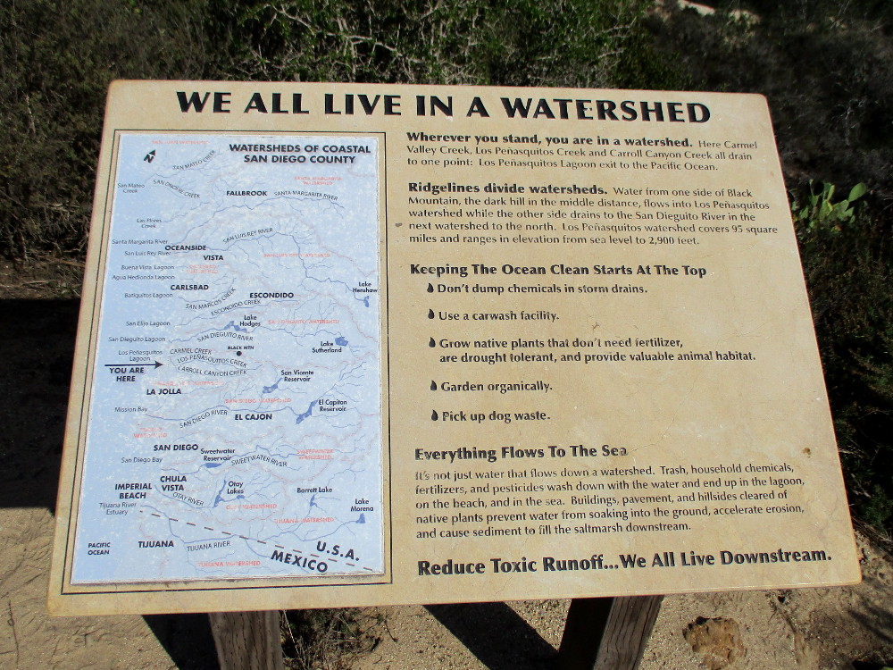
Wherever you stand, you are in a watershed. Here Carmel Valley Creek, Los Peñasquitos Creek and Carroll Canyon Creek all drain to one point: Los Peñasquitos Lagoon’s exit to the Pacific Ocean…
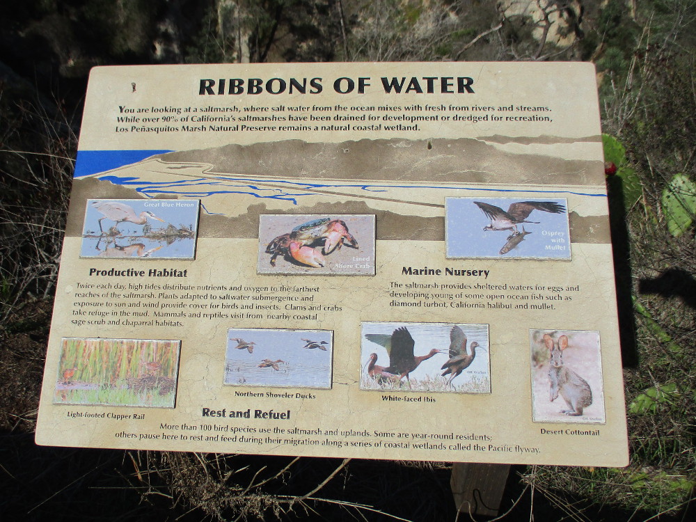
You are looking at a saltmarsh, where salt water from the ocean mixes with fresh from rivers and streams…Los Peñasquitos Marsh Natural Preserve remains a natural coastal wetland.
…
I live in downtown San Diego and love to walk around with my camera! You can follow Cool San Diego Sights via Facebook or Twitter!
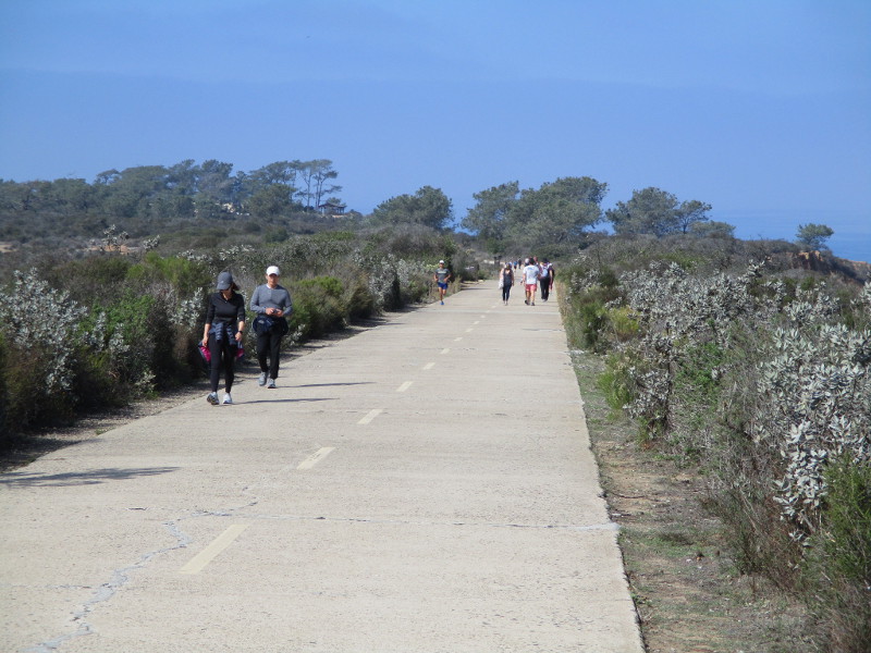
Explore the south end of Torrey Pines Park Road at Torrey Pines State Natural Reserve and you’ll discover breathtaking beauty and fascinating history.
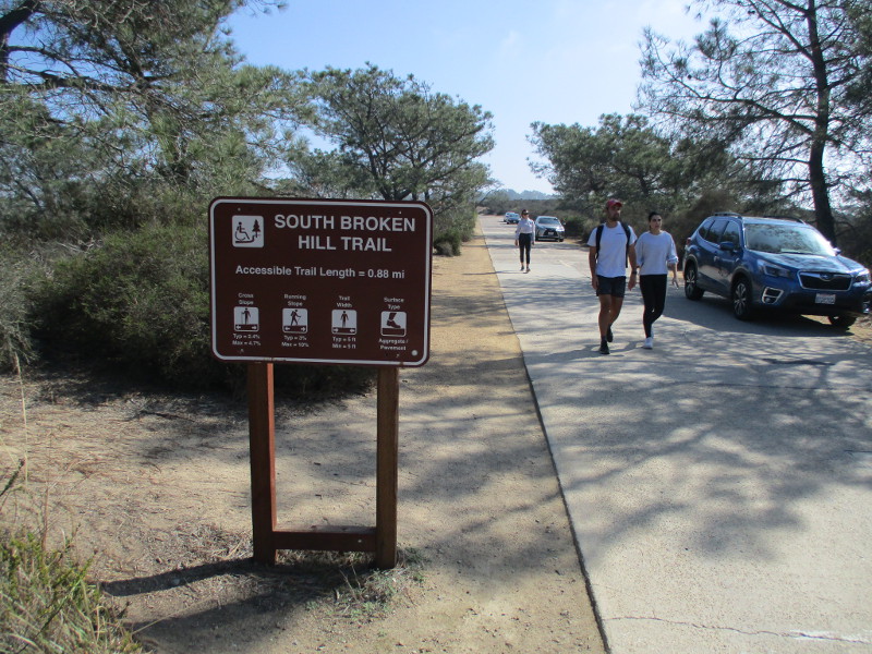
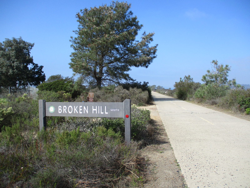
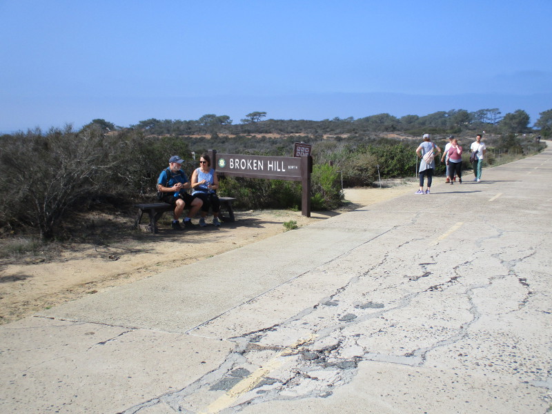
Last weekend I walked north along the paved trail, which a century ago was part of the main road from San Diego to Los Angeles. The following photographs begin near Torrey Pines Golf Course and end just short of the Visitor Center at Torrey Pines State Reserve’s old Lodge. The historic road, closed to vehicle traffic, is how hikers access Broken Hill Trail, which winds through a rugged landscape down to the beach.
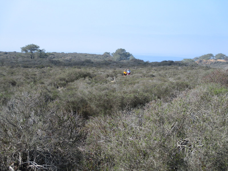
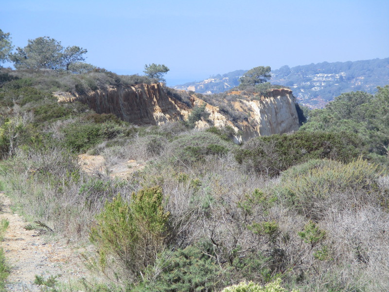
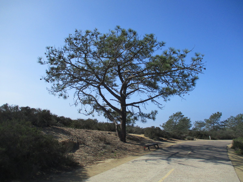
In my photos you’ll see native coastal sage scrub and chaparral plants, rare Torrey pine trees, the Pacific Ocean in the distance to the west and sandstone cliffs overlooking North Torrey Pines Road to the east. Signs along the way speak of the history of this place.
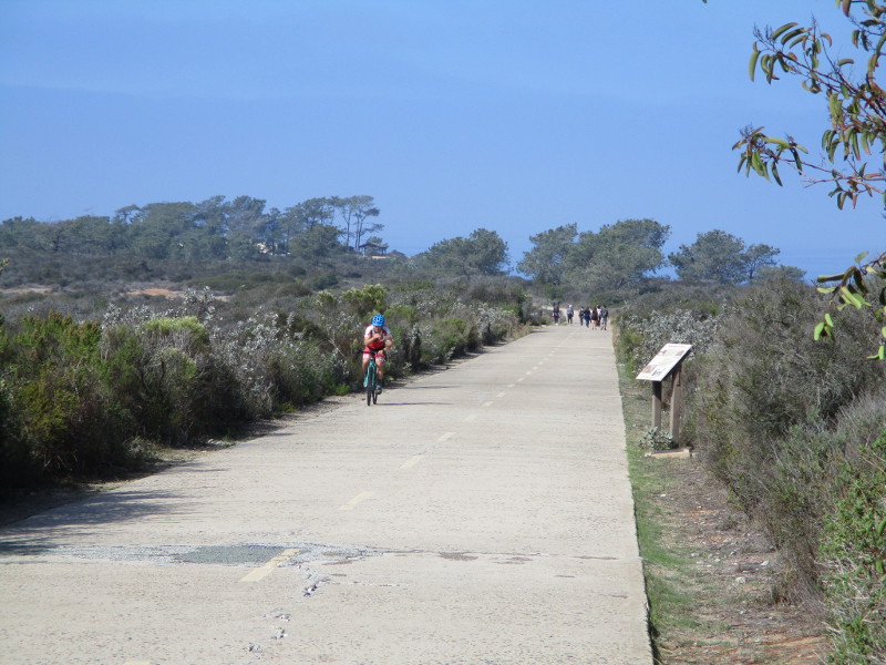
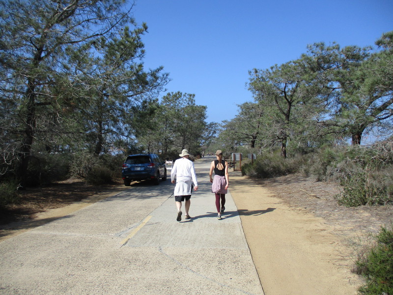
Come along as I walk down old Torrey Pines Park Road on a sunny November day!
Other walkers and bicyclists were also enjoying a fun adventure.
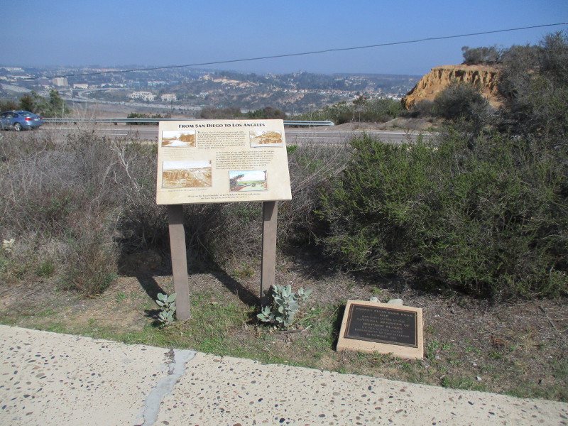
To the east beyond an information sign and historical marker one can see North Torrey Pines Road, Carmel Valley and Interstate 5.
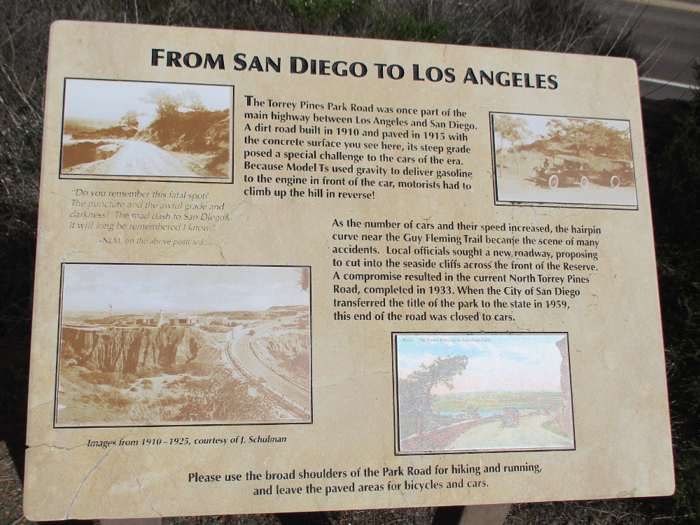
FROM SAN DIEGO TO LOS ANGELES
The Torrey Pines Park Road was once part of the main highway between Los Angeles and San Diego. A dirt road built in 1910 and paved in 1915 with the concrete surface you see here, its steep grade posed a special challenge to the cars of the era. Because Model Ts used gravity to deliver gasoline to the engine in front of the car, motorists had to climb up the hill in reverse.
As the number of cars and their speed increased, the hairpin curve near the Guy Fleming Trail became the scene of many accidents. Local officials sought a new roadway, proposing to cut into the seaside cliffs across the front of the Reserve. A compromise resulted in the current North Torrey Pines Road, completed in 1933. When the City of San Diego transferred the title of the park to the state in 1959, this end of the road was closed to cars.
The steep hill and its hairpin curves mentioned in the sign are north of the Lodge, beyond this particular walk. Cars entering the park still use it.
If you’d like to see past photos of the Guy Fleming Trail which is also referenced in the sign, click here!
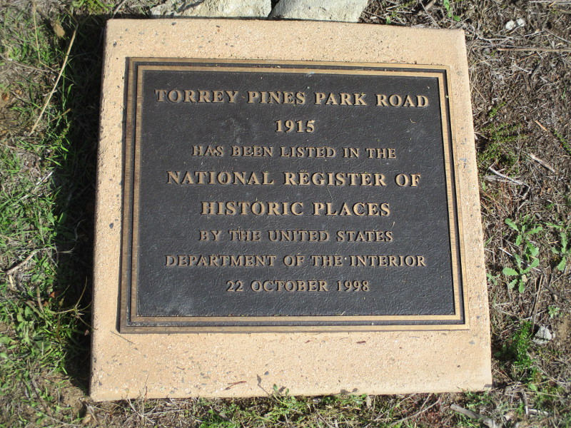
TORREY PINES PARK ROAD
1915
HAS BEEN LISTED IN THE NATIONAL REGISTER OF HISTORIC PLACES BY THE UNITED STATES DEPARTMENT OF THE INTERIOR
22 OCTOBER 1998
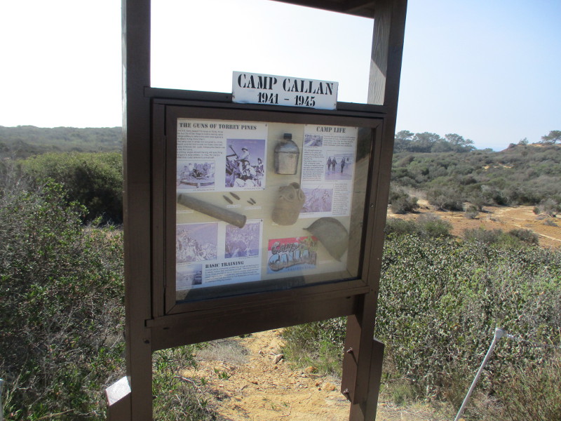
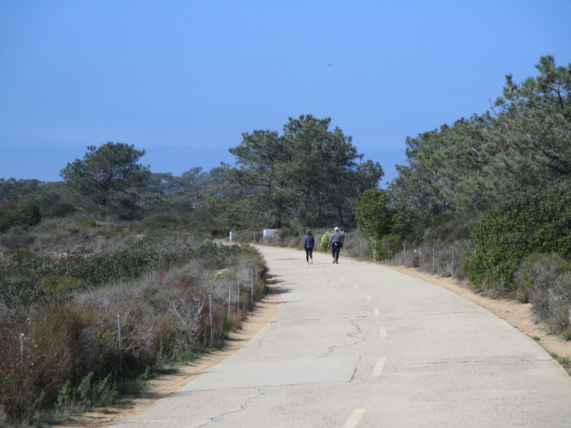
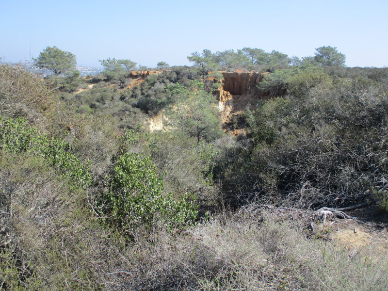
Hikers explore nature’s beauty.The North Fork Trailhead leads west to the Broken Hill Trail.Picturesque sandstone cliffs overlook North Torrey Pines Road (not visible) to the east.A sign details the history of Camp Callan, which was located here from 1941 to 1945.
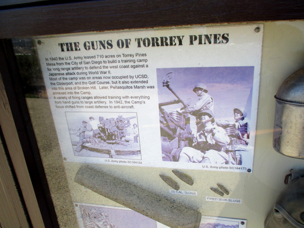
THE GUNS OF TORREY PINES
In 1940 the U.S. Army leased 710 acres on Torrey Pines Mesa from the City of San Diego to build a training camp for long range artillery to defend the west coast against a Japanese attack during World War II. Most of the camp was on areas now occupied by UCSD, the Gliderport, and the Golf Course, but it also extended into the area of Broken Hill. Later, Penasquitos Marsh was annexed into the Camp. A variety of firing ranges allowed training with everything from hand guns to large artillery. In 1942, the Camp’s focus shifted from coast defense to anti-aircraft.
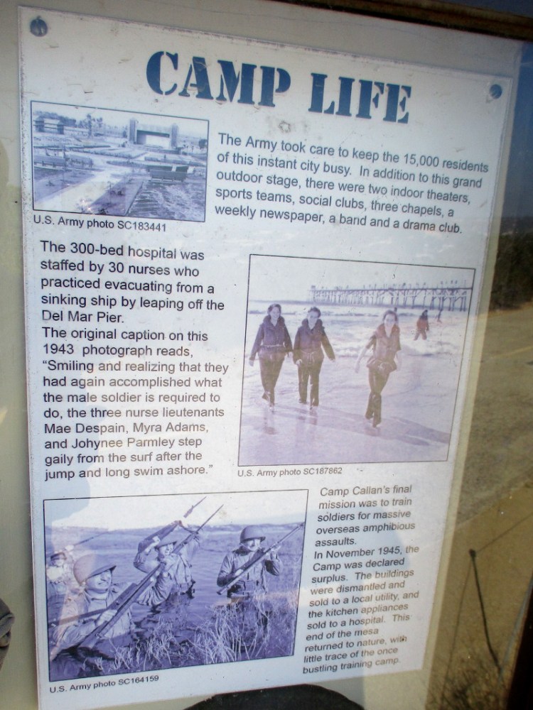
CAMP LIFE
The Army took care to keep the 15,000 residents of this instant city busy. In addition to this grand outdoor stage, there were two indoor theaters, sports teams, social clubs, three chapels, a weekly newspaper, a band and a drama club.
The 300-bed hospital was staffed by 30 nurses who practiced evacuating from a sinking ship by leaping off the Del Mar Pier. The original caption on the 1943 photograph reads, “Smiling and realizing that they had again accomplished what the male soldier is required to do, the three nurse lieutenants Mae Despain, Myra Adams, and Johynee Parmley step gaily from the surf after the jump and long swim ashore.”
Camp Callan’s final mission was to train soldiers for massive overseas amphibious assaults. In November 1945, the Camp was declared surplus. The buildings were dismantled and sold to a local utility, and the kitchen appliances sold to a hospital. This end of the mesa returned to nature, with little trace of the once bustling training camp.
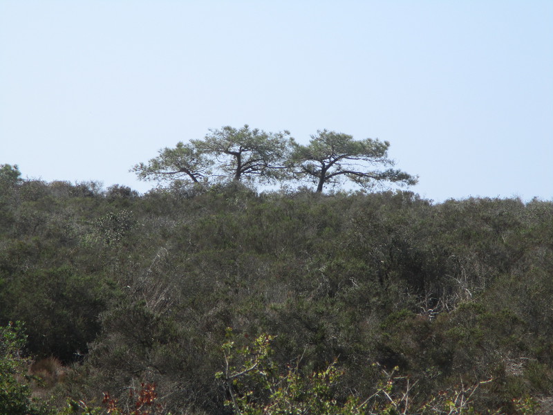
A postcard. Greetings from CAMP CALLAN CALIFORNIA.Torrey pine trees in the distance.More eroded sandstone to the east.Approaching a small parking lot at the Beach Trailhead near The Lodge.
…
This blog now features thousands of photos around San Diego! Are you curious? There’s lots of cool stuff to check out!
Here’s the Cool San Diego Sights main page, where you can read the most current blog posts. If you’re using a phone or small mobile device, click those three parallel lines up at the top–that opens up my website’s sidebar, where you’ll see the most popular posts, a search box, and more!
To enjoy future posts, you can also “like” Cool San Diego Sights on Facebook or follow me on Twitter.
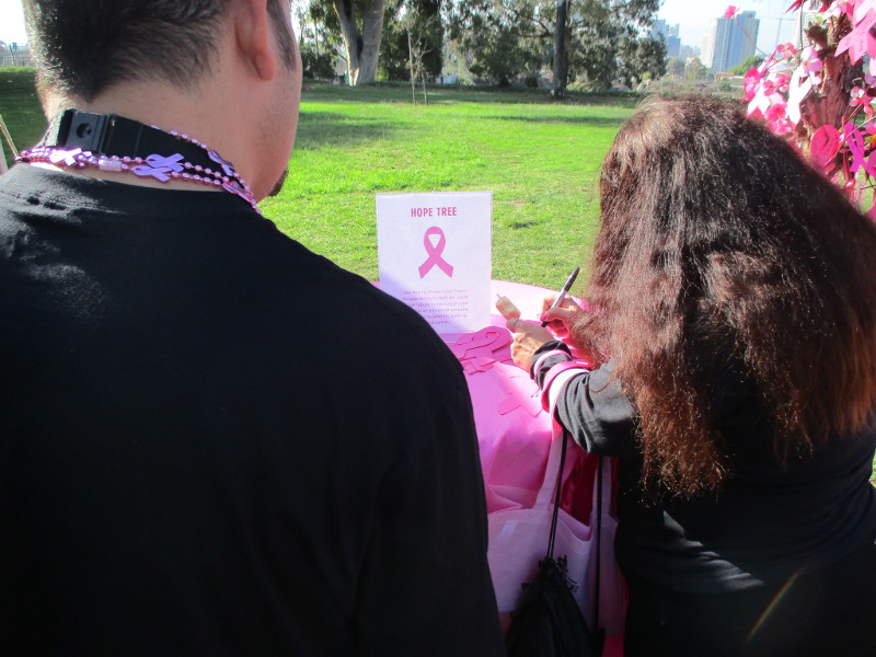
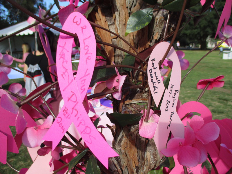
The Making Strides Hope Tree was blooming in San Diego this morning.
I walked into Balboa Park after the American Cancer Society’s Making Strides Against Breast Cancer event had come to a close.
Workers had begun to disassemble canopies. A few remaining participants were trickling out of the park.
But the Hope Tree remained.
The Making Strides Hope Tree is an opportunity to dedicate a pink ribbon tribute in memory of a lost loved one or in honor of someone who has or is currently battling breast cancer.
If you’d like to make a donation to fight breast cancer, click here.
…
I live in downtown San Diego and love to walk around with my camera! You can follow Cool San Diego Sights via Facebook or Twitter!
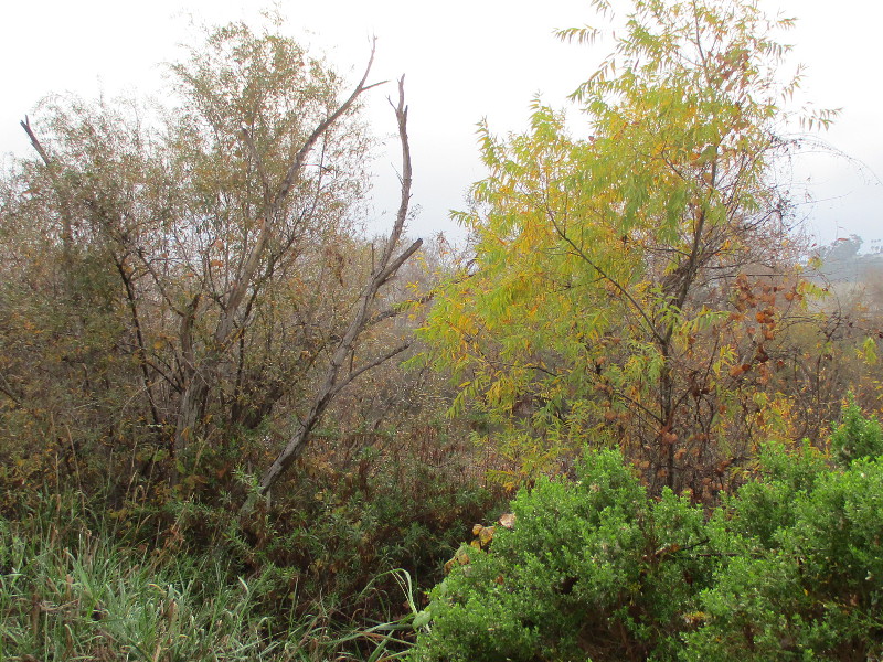
Today is the first day of Autumn. The days are becoming noticeably shorter.
A few leaves down by the San Diego River have already begun to turn. Even through the weather has been hot due to our current Santa Ana conditions, the trees know summer is over.
I took a couple photos of Fremont cottonwood leaves changing their color in Mission Valley this morning. Some yellow has begun showing in all the green.
…
I live in downtown San Diego and love to walk around with my camera! You can follow Cool San Diego Sights via Facebook or Twitter!