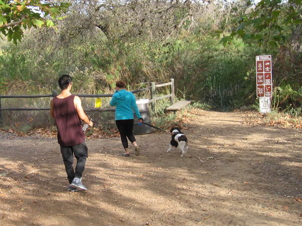
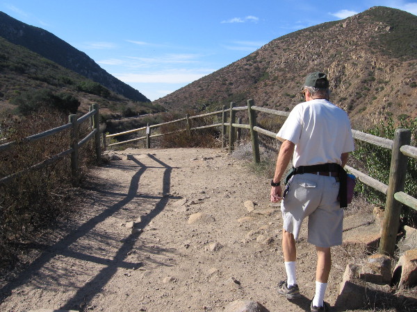
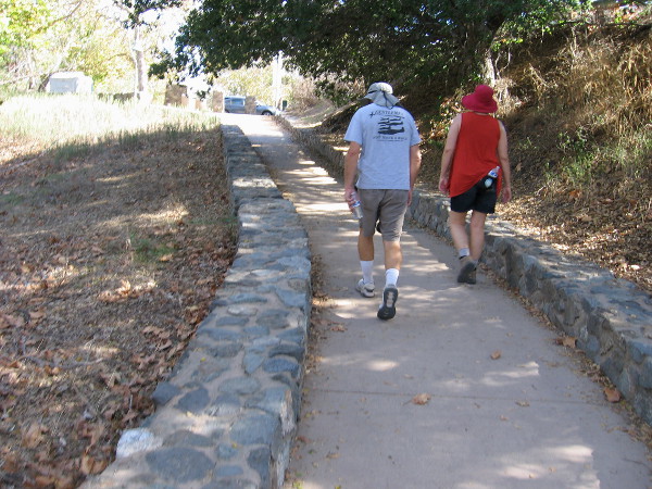
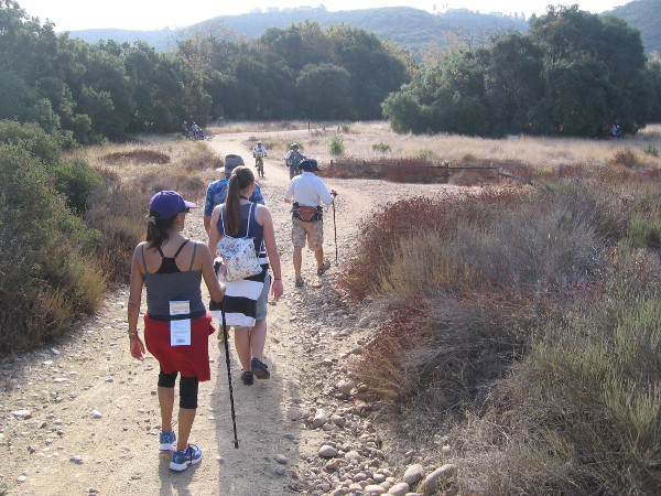
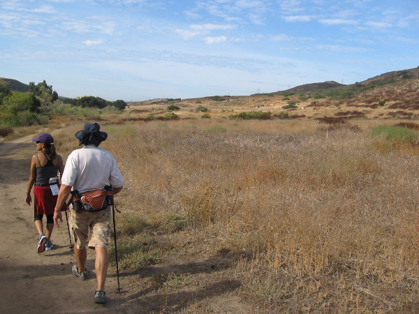
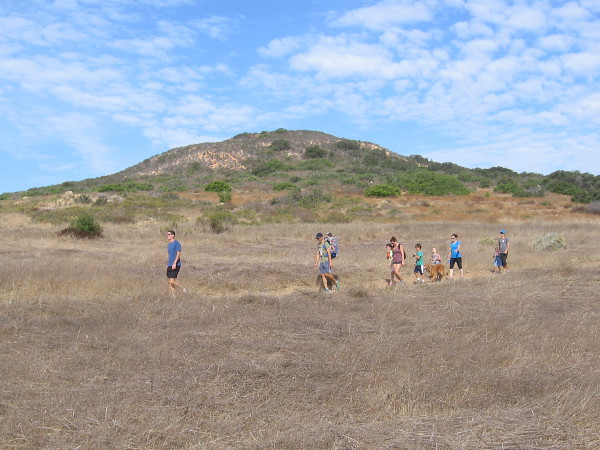
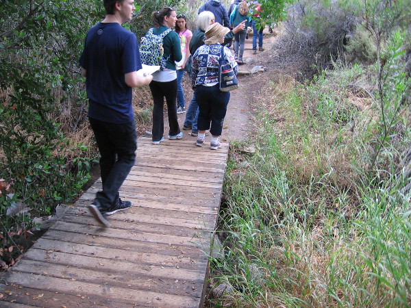
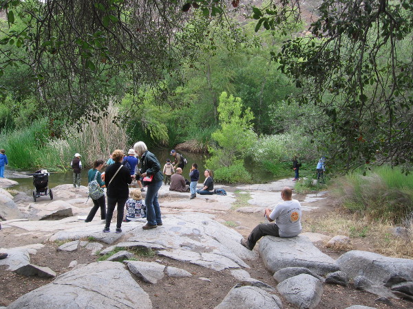
Hikers head from the Kumeyaay Campground at Mission Trails Regional Park toward a shady nature trail that runs beside Kumeyaay Lake.
I enjoyed an amazing walk last weekend at Mission Trails Regional Park. The guided hike met under the flagpoles of the Kumeyaay Campground, and started down a pleasant nature trail at nearby Kumeyaay Lake. The hike then proceeded at a leisurely, easy pace along several trails by the San Diego River, ending up at the Old Mission Dam.
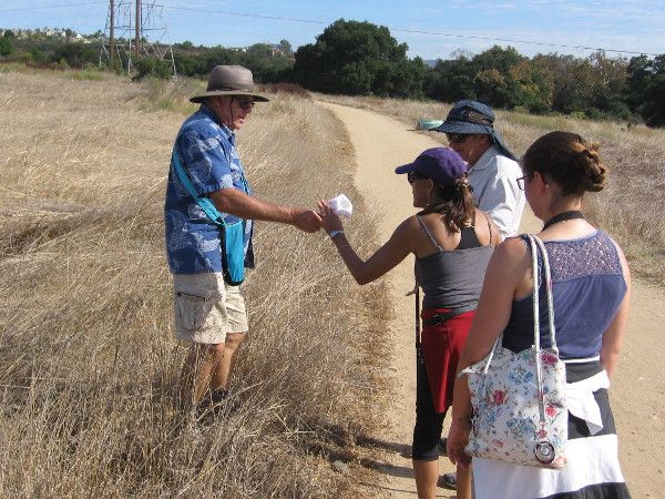
Every month, anyone can go on a variety of free interpretative nature walks at Mission Trails Regional Park. The walks are led by experienced trail guides, who point out the native flora and fauna, and relate the fascinating history of this mountainous wilderness in the city. To learn more check out the park’s website.
Please enjoy my photos and read the descriptive captions to join me on a virtual hike. Not only will you experience natural beauty, but you’ll learn a bit about early San Diego history!
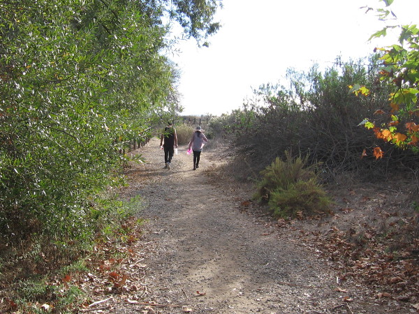
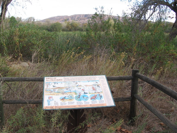
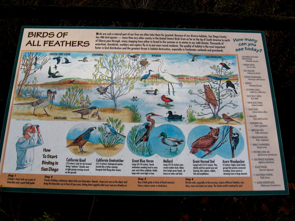
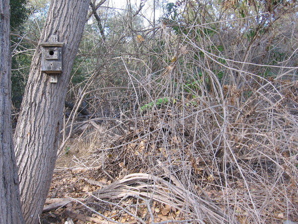
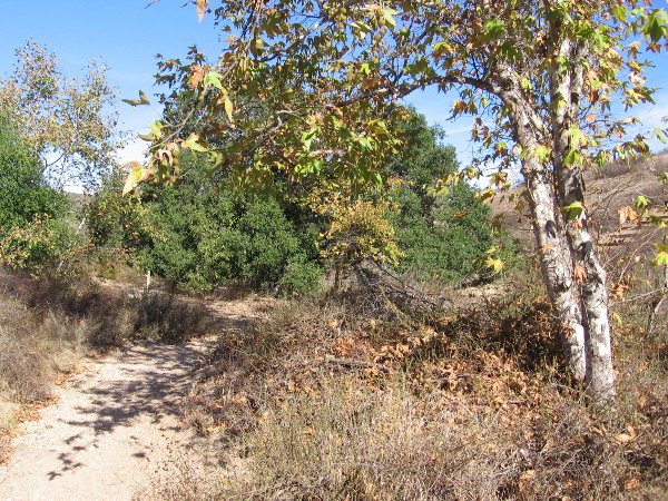
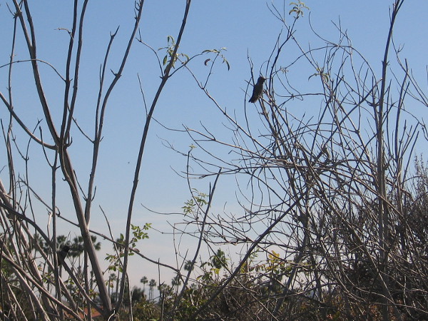
A couple walks slowly along the Kumeyaay Nature Trail, enjoying a beautiful November day.Signs along the nature trail include descriptions of wildlife that can be found around Kumeyaay Lake (once called Hollins Lake). Open water can be glimpsed beyond cattails.At Mission Trails Regional Park, birds of all feathers include quail, gnatcatchers, herons, egrets, ducks, woodpeckers, scrub jays, owls, and the endangered least Bell’s vireo!
The sign includes the following: “Because of our diverse habitats, San Diego County has 486 bird species–more than any other county in the United States! Birds from as far as the tip of South America to north of Siberia pass through, many stopping here either to breed in the summer or to winter in our mild climate.”
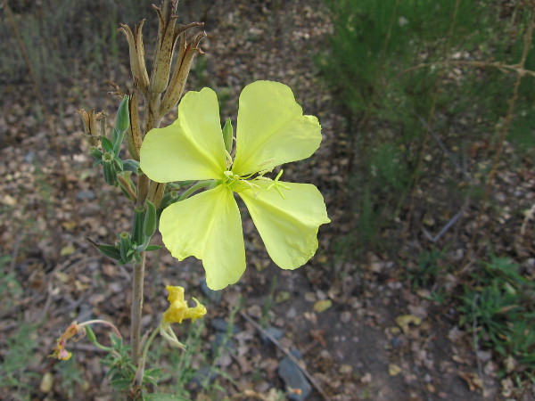
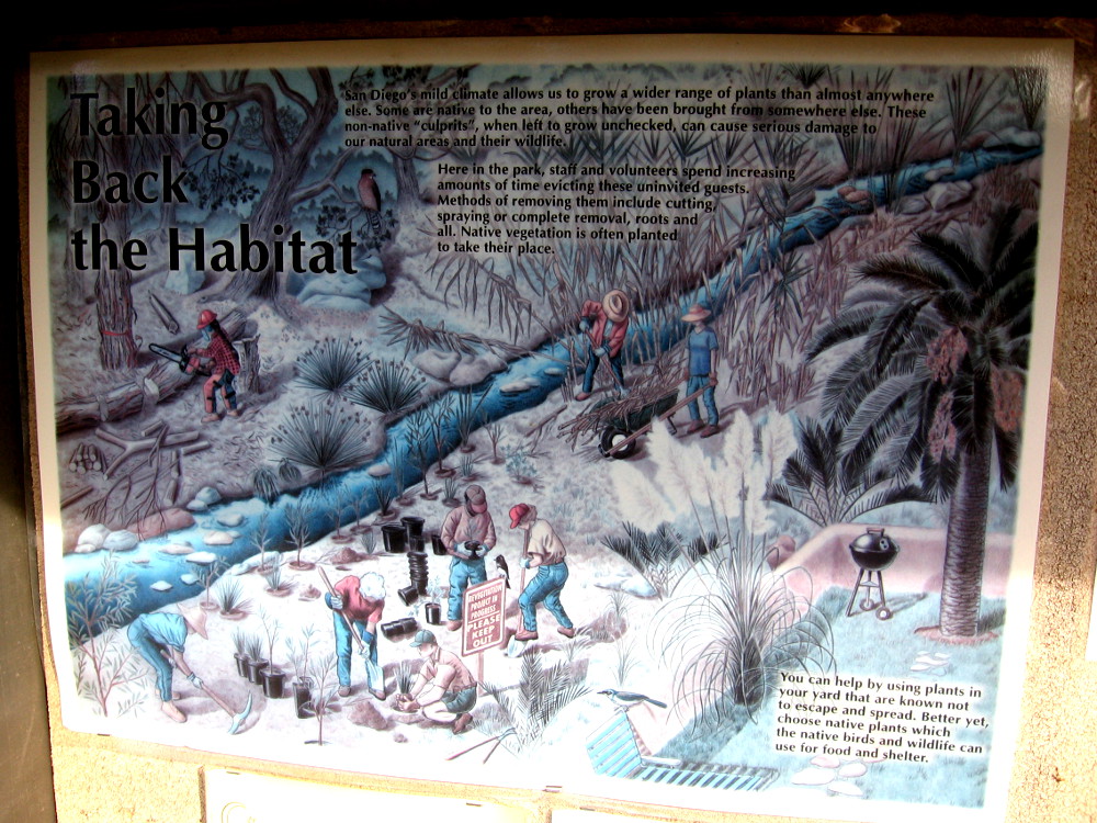
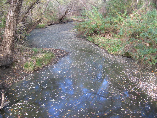
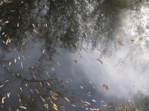
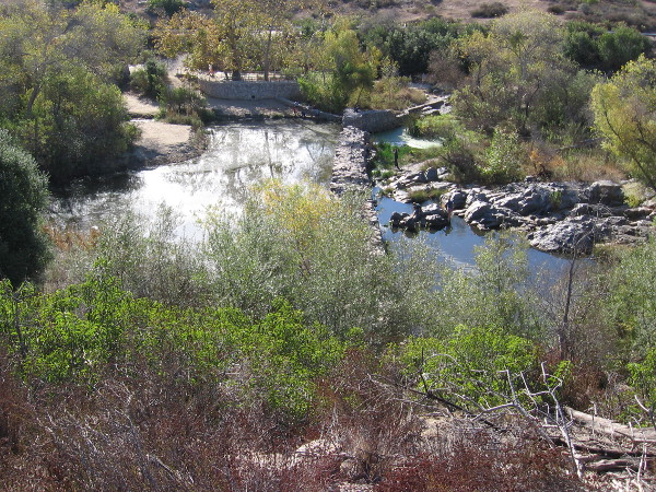
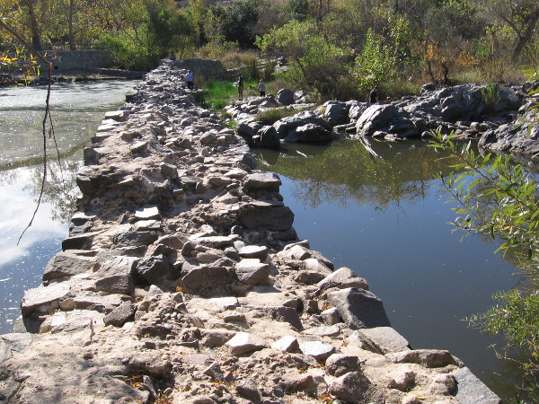
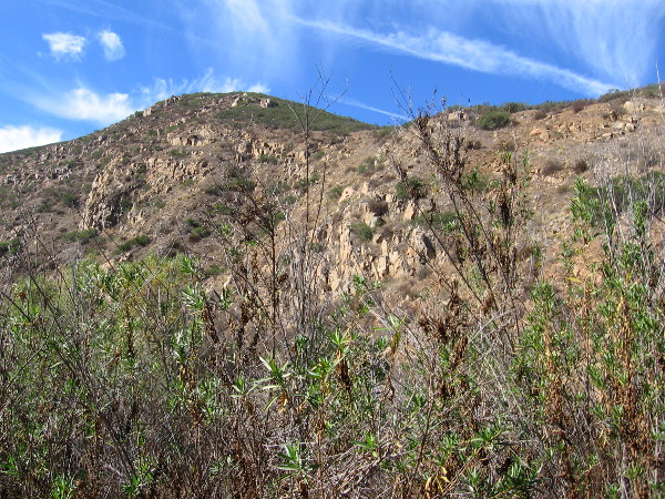
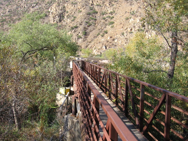
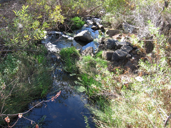
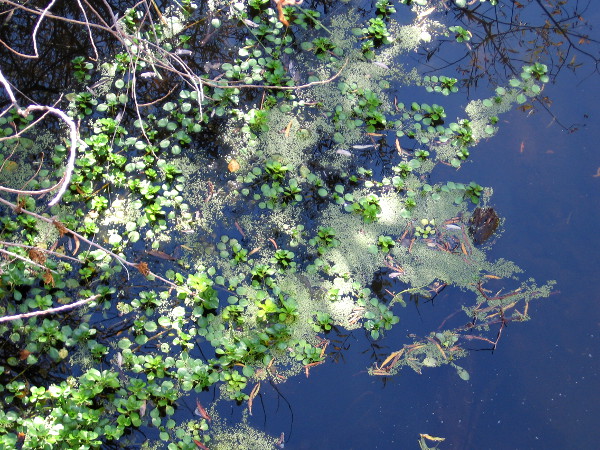
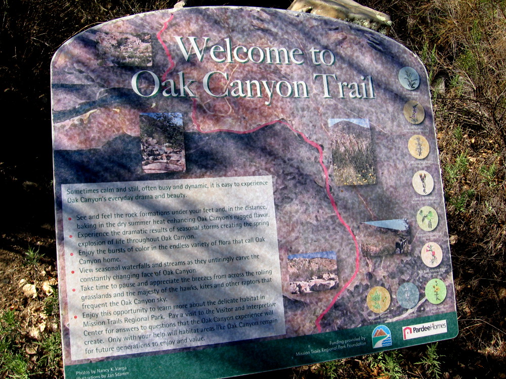
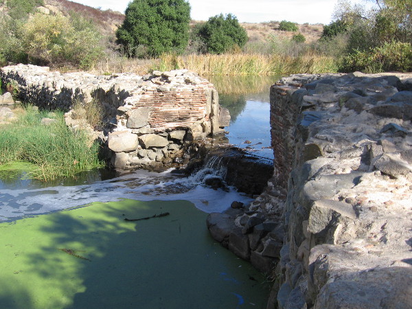
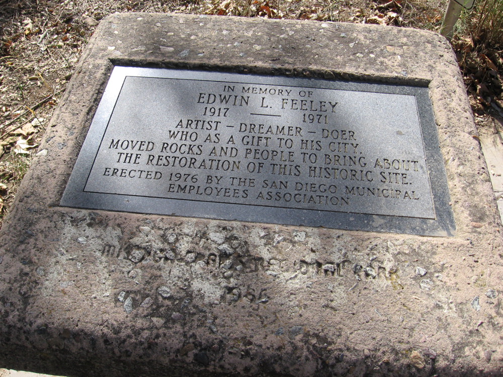
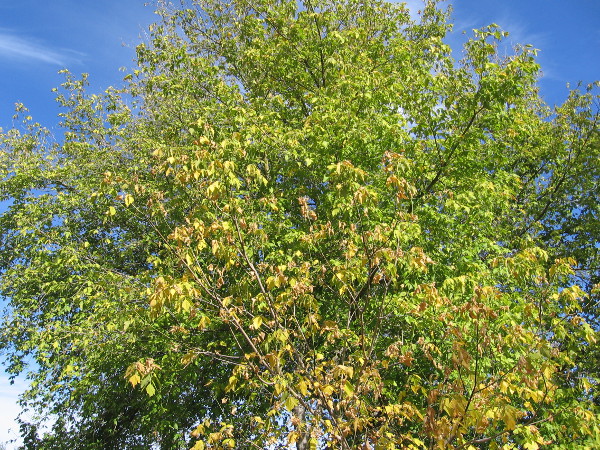
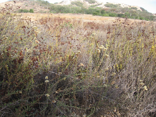
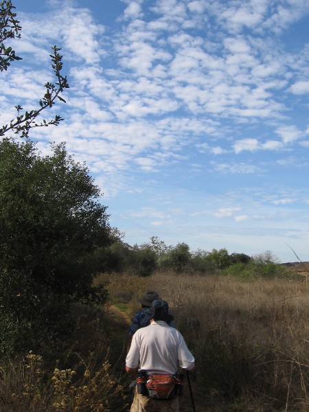
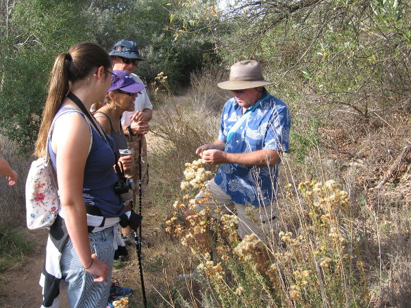
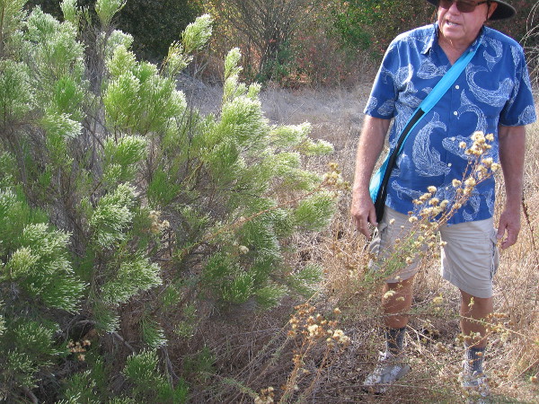
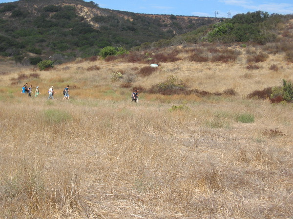
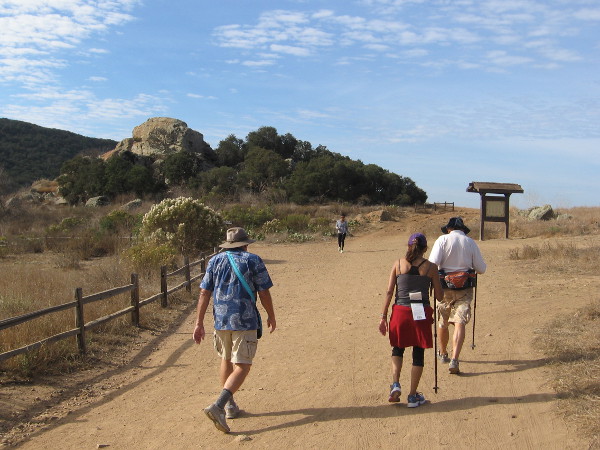
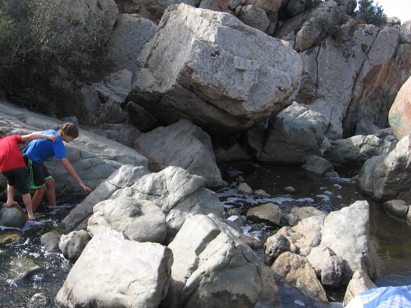
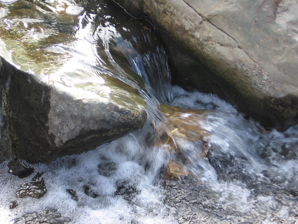
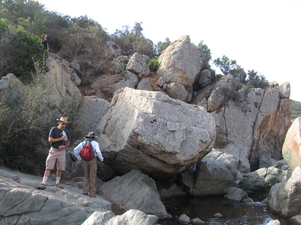
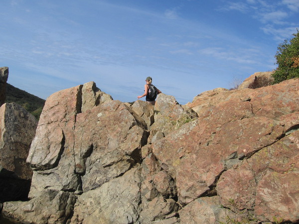
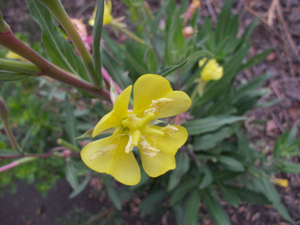
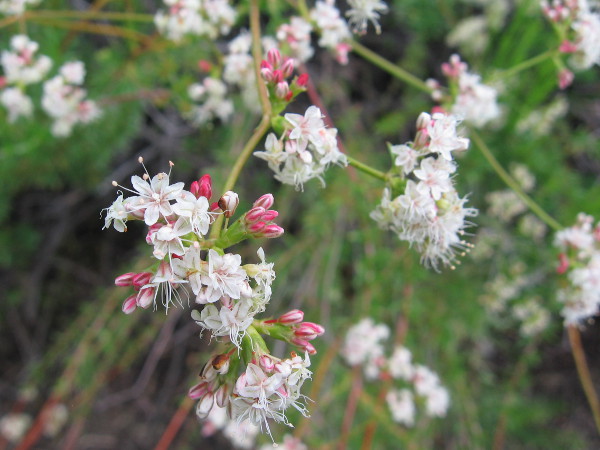
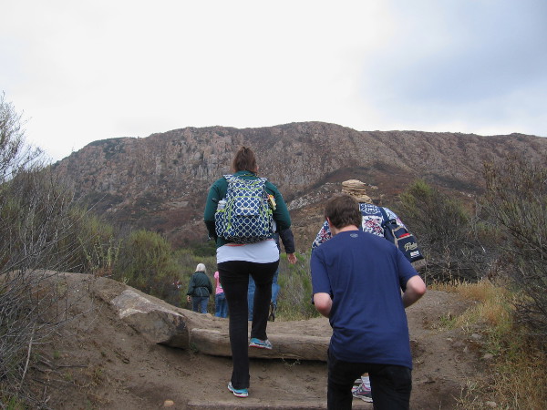
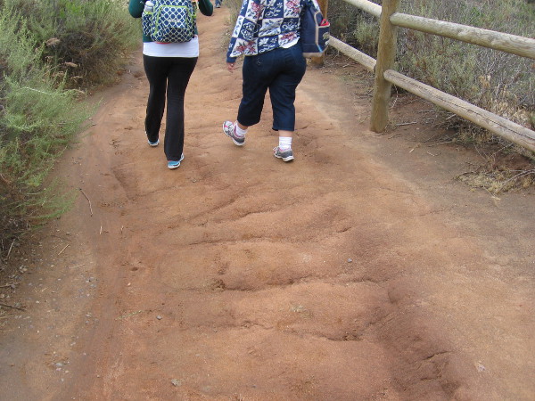
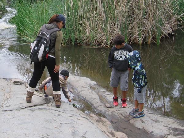
Photo of the San Diego River emerging from Kumeyaay Lake. This is near an outdoor amphitheater and fire pit. The park is a perfect place to learn about nature from rangers, and for stargazing at night!An Autumn wildflower at Mission Trails Regional Park.We head from the lake back toward the campground. Our pleasant hike has just begun.Non-native plants can cause serious damage to natural areas and wildlife. Park staff and volunteers work to protect the natural ecosystems.Hiking down the Grasslands Crossing Trail, my guide and I pass over the San Diego River. It has been a typically dry summer, and the pooled water here is still.Leaves and reflections of trees in the quiet water.We spied a wood rat’s nest of twigs and branches near the hiking trail. I learned these nests contain several rooms with different functions, not unlike a human home.Larry the trail guide showed me a photo of a wood rat.Now we are heading along the easy Grasslands Loop Trail, following the north bank of the San Diego River. Riparian trees such as willows, sycamores and cottonwoods thrive along the river.Mountain bikers enjoy a warm, sunny morning at Mission Trails Regional Park.Approaching an overlook of the Old Mission Dam.Photo of the Old Mission Dam from the north. The dam was built around 1813 and powered a water wheel that drove a grist mill. A tiled flume brought water to Mission San Diego de Alcala, about five miles away.Families play on the rocks near the Old Mission Dam at Mission Trails Regional Park.Lush trees along the San Diego River. Autumn leaves have yellowed a bit.We have descended onto Oak Canyon Trail, and are working our way down to the river and the historic dam.Standing on the north end of the Old Mission Dam. Materials used in constructing the dam include abundant volcanic rock found in this area.A slot in the dam wall where a water wheel was located. The river water, after driving the wheel, flowed along a tile-lined aqueduct south to the mission, where it was used to grow crops.Walking along the Oak Canyon Trail. Mission Trails Regional Park is like a small wilderness inside the city of San Diego. At 5,800 acres, it’s the largest city park in California.Riparian plants recover quickly after a fire because all are vigorous resprouters as long as they have a steady water supply.Granitic rocks seen along the trail.South Fortuna Mountain, elevation 1094 feet, rises to the south. Its sides are covered with native chaparral and sage scrub.Crossing the San Diego River via a steel footbridge.Looking down at the San Diego River. During rains, the river swells. The water runs down into Mission Valley and finally to the Pacific Ocean, sustaining an estuary near Mission Bay.Larry, my knowledgeable trail guide, informed me that the tiny green vegetation is duckweed, an aquatic plant that floats on the water’s surface.Sign at one end of the Oak Canyon Trail, near the Old Mission Dam.A cool 3-D model of the Old Mission Dam beside the trail. The dam was constructed from granite boulders and limestone mortar. At the gap there was a 12-foot wide floodgate.It’s possible to walk out onto the old dam, but one must be careful!A vertical groove in the dam wall shows where the floodgate used to exist. The dam was completed around 1813, and the long flume to Mission San Diego was completed several years later.Inscription in a boulder dated 1941, by the Daughters of the American Revolution. OLD MISSION DAM. Built 1813-1816. A part of the first permanent irrigation project by Padres and Indians in California.A plaque by the old dam. In memory of Edwin L. Feeley. 1917 – 1971. Artist – Dreamer – Doer who as a gift to his city, moved rocks and people to bring about the restoration of this historic site.Bright fluttering leaves of a river tree growing beside the Father Junipero Serra Trail, a road that leads past the Old Mission Dam.Walking to the parking lot by the Old Mission Dam, also called the Padre Dam.The site is a California historical landmark. A dam and flume system was finished between 1813 and 1816 by Indian laborers and Franciscan missionaries. It provided a reliable source of water for crops and livestock for Mission San Diego de Alcala. The system continued until 1831 when it fell into final disrepair.Beautiful hiking trails, and a fascinating look back at early San Diego and California history await at Mission Trails Regional Park.
…
I live in downtown San Diego and love to walk! You can follow Cool San Diego Sights via Facebook or Twitter!
You can easily explore Cool San Diego Sights by using the search box on my blog’s sidebar. Or click a tag! There are thousands upon thousands of fun photos for you to enjoy!
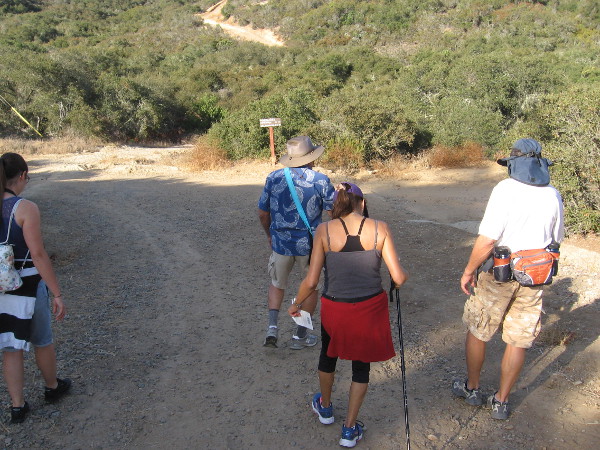
Naturalist Mike Kelly leads a small group of hikers into Los Peñasquitos Canyon Preserve from the Del Mar Mesa trailhead.
Free guided nature walks in the Los Peñasquitos Canyon Preserve introduce the public to unexpected wild beauty in the heart of San Diego. Yesterday I went on one of these easy walks.
Our guide, naturalist Mike Kelly, longtime member of the Friends of Los Peñasquitos Canyon Preserve, has been an advocate working to safeguard this beautiful and historic San Diego canyon for over three decades. He’s a friendly fellow whose knowledge of the canyon’s flora, fauna and fascinating history made for an extremely enjoyable hike.
Years ago, Mike and others fought to save Los Peñasquitos Canyon from development. Their efforts resulted in about half of the canyon being protected. Fortunately, the preserve is connected to other similar natural areas in San Diego through various corridors, allowing wildlife to move about and thrive. Owls, woodpeckers, hawks, raccoons, bobcats, coyotes, mule deer, even an occasional mountain lion make the canyon their home. Native trees, chaparral, grass and spring flowers are abundant and the source of endless enjoyment.
I learned there are also wildlife tracking hikes, plus night walks, when deer are frequently seen. There are also free guided tours of San Diego’s second oldest residence, which stands near the east end of the preserve, the Rancho Santa Maria de Los Peñasquitos adobe. To learn about all these wonderful adventures, which are ideal for families, click here.
To learn more about the Friends of Los Peñasquitos Canyon Preserve, click here! Perhaps you’d like to become a member!
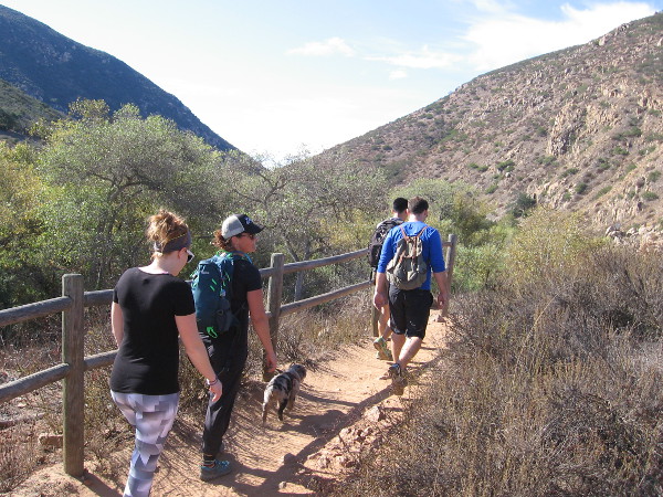
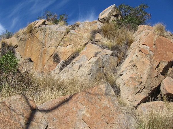
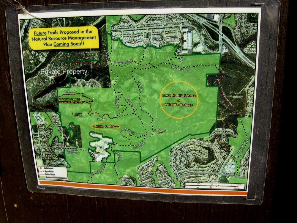
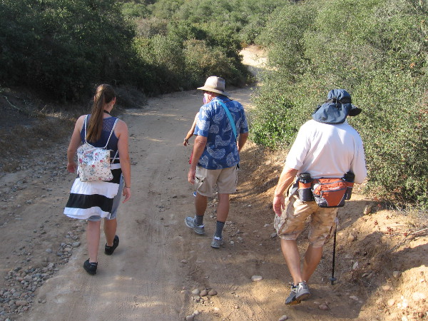
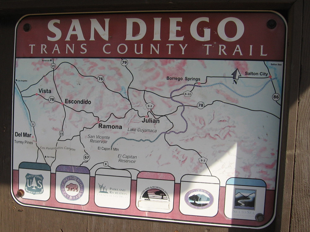
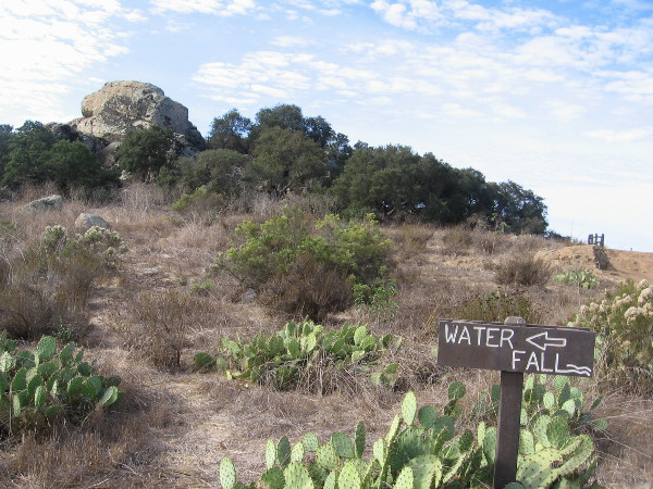
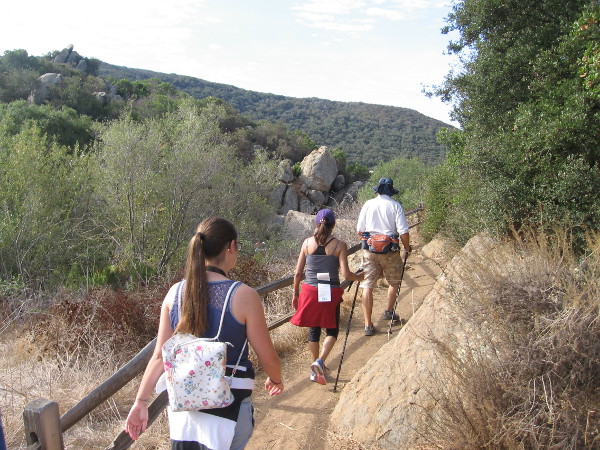
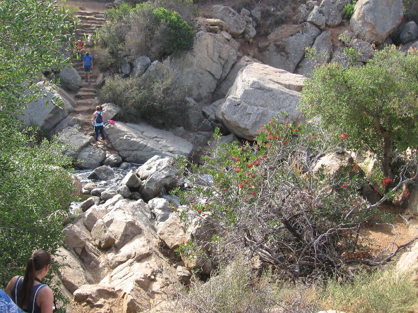
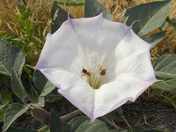
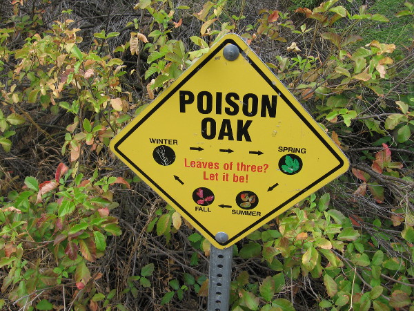
The Del Mar Mesa trailhead is located near suburban homes at the north edge of Los Peñasquitos Canyon.A sign posted at the trailhead shows future trails proposed in the Natural Resources Management Plan.Our small group of hikers heads down into the canyon through Coastal Sage Scrub habitat. We are passing California scrub oaks.We headed to Carson’s Crossing before checking out the popular waterfall.Approaching the central part of the long, narrow canyon, which runs from Poway west to Del Mar and the Pacific Ocean. Peñasquitos Creek lies beyond those coast live oaks in the distance.Carson’s Crossing is an historically important spot in Peñasquitos Canyon. Kit Carson crossed the creek here during the Mexican-American War. General Kearny’s US Army of the West was faced with formidable Californio lancers in San Pasqual, and the legendary frontiersman Kit Carson snuck away in the middle of the night to summon reinforcements from San Diego. He knew to come this way. The later 1857 Jackass Mail stagecoach line also ran through the canyon here enroute to San Diego.Heading west through the beautiful canyon in the shade of oaks, sycamores and willows. It’s an easy, pleasant hike.Looking north across a field in Los Peñasquitos Canyon Preserve in late October. Summers are very dry. Many leaves and flowers are now brown, awaiting winter rains.Walking slowly, senses alert. I smell the nearby sagebrush. I hear acorn woodpeckers and quail. I see beautiful clouds.Mike Kelly is a guide and activist whose knowledge of Peñasquitos is deep. Here he shows us some poison oak which is growing a short distance off the trail.A peaceful walk through nature. Over several decades, activists like Mike have worked hard to preserve the canyon and protect it from development. Today it is maintained by volunteers and both the City and County of San Diego.Mike Kelly shows us some California broom. Native American Kumeyaay and pioneers used the plant like a broom for sweeping.Los Peñasquitos Canyon Preserve is a very popular place for jogging, hiking and mountain biking. Even marathoners use it for training.Now we’re approaching a trail sign and a large rock outcropping, which I learned is volcanic.Sign shows proposed San Diego Trans County Trail, which when completed would run from the Pacific Ocean over the mountains east of San Diego and out to the Salton Sea in the desert.I see lots of prickly pear cacti. Now we are getting close to the popular waterfall!Approaching the Peñasquitos Creek waterfall from the east.Descending rough stone steps to the waterfall. I learned the steps were a project of an Eagle Boy Scout.The small waterfall and its rocky pools are located near the center of Los Peñasquitos Canyon. It is the destination of many hikes. A great place to relax, cool off, and listen to the soothing water.Water spills over rocks. It isn’t Niagara Falls, but it’s wonderful nonetheless.Hikers pause above a pool of water which is captured by large blocks of volcanic rock. When the creek crests, it can rise many feet and submerge this area.A hiker up above seems to walk in the sky.Families wander down a pleasant trail in Los Peñasquitos Canyon Preserve. There is much here to see and appreciate. So much to learn.Naturalist Mike Kelly shows us a poisonous flower of Datura. In nature, beauty and danger are often found together. One should be thoughtful when hiking, and be careful to wear sturdy footwear and bring water. We didn’t see any rattlesnakes or mountain lions!
…
This blog now features thousands of photos around San Diego! Are you curious? There’s lots of cool stuff to check out!
Here’s the Cool San Diego Sights main page, where you can read the most current blog posts. If you’re using a small mobile device, click those three parallel lines up at the top–that opens up my website’s sidebar, where you’ll see the most popular posts, a search box, and more!
To enjoy future posts, you can also “like” Cool San Diego Sights on Facebook or follow me on Twitter.
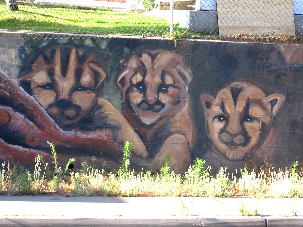
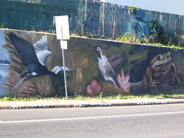
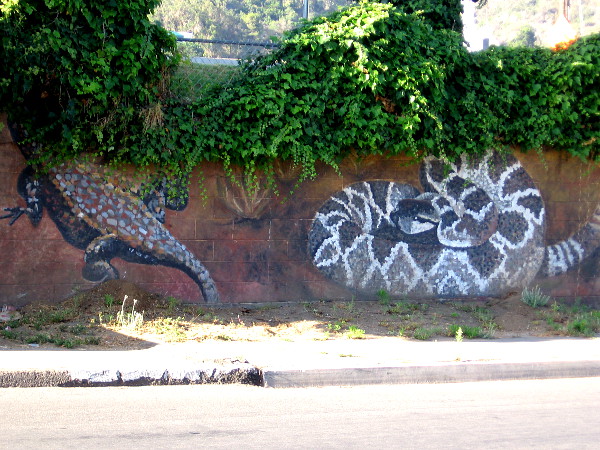
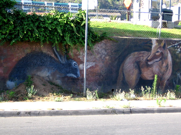
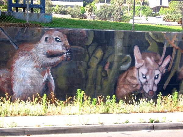
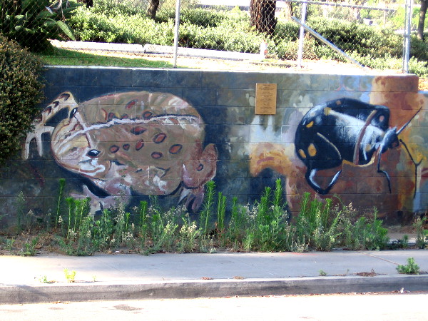
Faces peer from a wall near the San Diego River. The very long mural, titled River Life, contains images of wildlife one might find here–or have found here before urban development.
I love this mural in Mission Valley. I remember driving through the intersection at Qualcomm Way and Camino de la Reina years ago, and seeing a whole bunch of people painting wild river animals along the ugly low wall. A little research today tells me that memory was from late 2009.
“River Life” was completed by almost 200 volunteers over four days. The design came from artist Lori Escalera. It’s one of of six murals (so far) that the San Diego River Park Foundation has helped to create. I’ve featured others on my blog. Here are some links if you want to check out more of the beautiful San Diego River murals…
The left end of a long, colorful mural in Mission Valley. Birds of the air and water are featured here. The art was designed by Lori Escalera in 2009.A heron, hummingbird and frog. Down by the beautiful River Trail, just north of where we stand, many different birds can be spotted on the quiet surface of the San Diego River, and in thick reeds and overhanging tree branches.A butterfly, a fox (peeking from behind a transformer box on Camino de la Reina) and a raccoon.Some sort of lizard–perhaps a Gila monster–is half hidden by leaves, while a rattlesnake coils nearby!A jackrabbit and wild coyote.A skunk and perhaps kitten bobcats.I recognize a squirrel, but I’m not sure about the other animal whose eyes seem to be glowing in the dark.I believe that’s a Red-winged Blackbird and a moth.Looks to me like a toad and a beetle. If you can accurately identify these creatures, feel free to leave a quick comment!That looks to me like a turtle–or a tortoise! It’s obvious this blogger still has a whole lot to learn!
…
I live in downtown San Diego and love to walk! You can follow Cool San Diego Sights via Facebook or Twitter!
You can easily explore Cool San Diego Sights by using the search box on my blog’s sidebar. Or click a tag! There are thousands upon thousands of fun photos for you to enjoy!
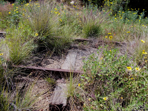
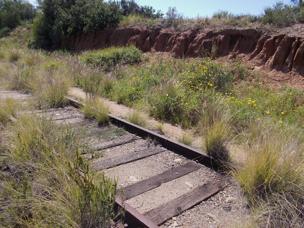
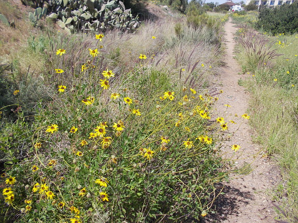
Rusty old train tracks are overgrown with wild vegetation, including many California bush sunflowers.
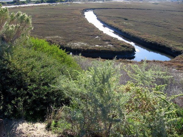
I made a cool discovery the other day. A little-known hiking path in San Diego’s South Bay provides a view of a beautiful natural wetland.
According to signs that I saw, the small estuary between Bay Marina Drive, Marina Way, Interstate 5 and the Sweetwater River is a protected wildlife refuge. I believe, after looking at Google Maps, that the water flows from Paradise Creek. But I’m not certain. Perhaps someone reading this knows.
Long-unused train tracks that are partially concealed by vegetation run along the edge of the wetland, and so does a narrow footpath. I didn’t see any signs naming the trail, or any that prohibited a short hike. So I walked down it a bit, enjoying the fresh air and peaceful surroundings.
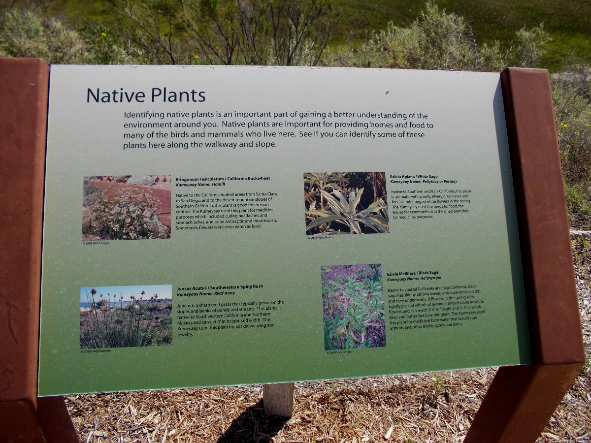
Information sign near edge of estuary identifies native plants. California Buckwheat, White Sage, Southwestern Spiny Rush, and Black Sage.View of National City wetland from observation area south of the Best Western Marina Gateway hotel parking lot.Beginning down the footpath on a sunny weekend day.Some eroded sandstone adds beauty to the scene.Prickly pear and chaparral yucca above a green estuary.Beyond the sign lies a fragile wetland where native plants and animals are protected. I saw some birds out in the wildlife refuge.I turned about after a short hike and headed on back to the hotel parking lot.
UPDATE!
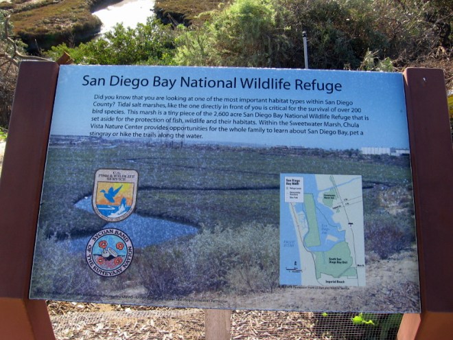
On a later visit I discovered additional signs beside the hotel parking lot. They contain more interesting information.
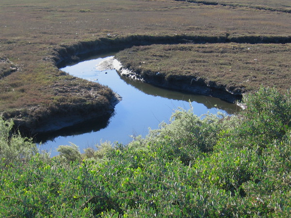
I learned this wetland is called Paradise Marsh. It’s an environmentally important tidal salt marsh that’s part of the much larger San Diego Bay National Wildlife Refuge.
Water reflects bright sunlight in National City’s Paradise Marsh.Paradise Marsh is a small part of the 2600 acre San Diego Bay National Wildlife RefugeThe birds of Paradise Marsh include the Willet, Mallard, American Avocet and the Great Blue Heron.For hundreds of years, Native American tribes such as the Kumeyaay, Iapi or Tipai made their homes around the estuaries of San Diego Bay.A beautiful tidal salt marsh wetland can be viewed in National City.
…
I live in downtown San Diego and love to walk! You can follow Cool San Diego Sights via Facebook or Twitter!
Bright yellow California sunflowers. San Diego has more botanical diversity than any other county in the continental United States.
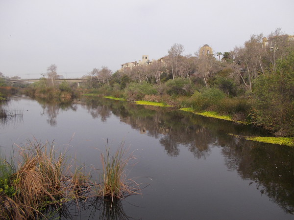
The San Diego River has always been a source of life. Ancient people flourished on its banks. It’s where European civilization began in California. That civilization today has grown to include freeways, shopping malls, industrial parks and immense residential complexes. Like a gleaming thread of silver, the river flows through it all, eternally, west to the Pacific Ocean.
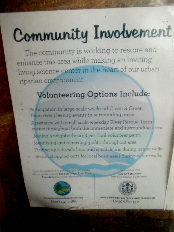
The health of this once-pristine river, crowded in many areas by human development, is threatened in challenging ways. Pollutants found in storm runoff, windblown litter, piles of garbage and human waste from homeless encampments, encroachment by non-native vegetation… These problems and others require the thoughtful involvement of the local community. Volunteers monitor the river; some help to pick up trash or report graffiti. Active, concerned residents attend special meetings to discuss improvements or make critical decisions.
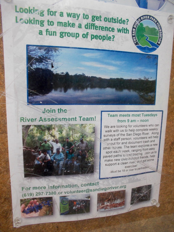
Would you like to become involved? Click here, or check out my two photos of posters that include contact information.
Our careful stewardship of the San Diego River will ensure the survival of an important riparian ecosystem, and will allow future generations to walk down trails of spirit-nourishing beauty.
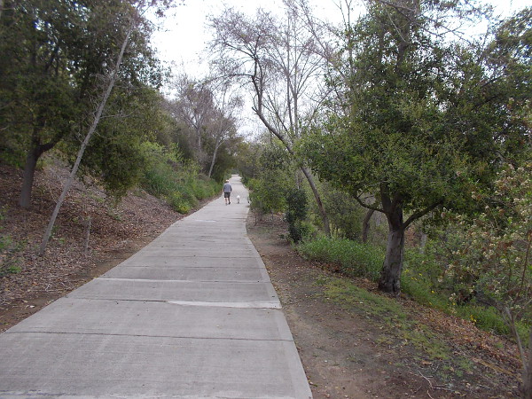
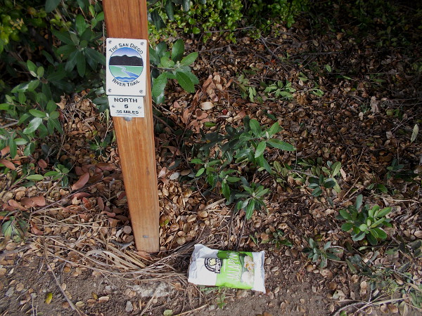
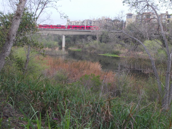
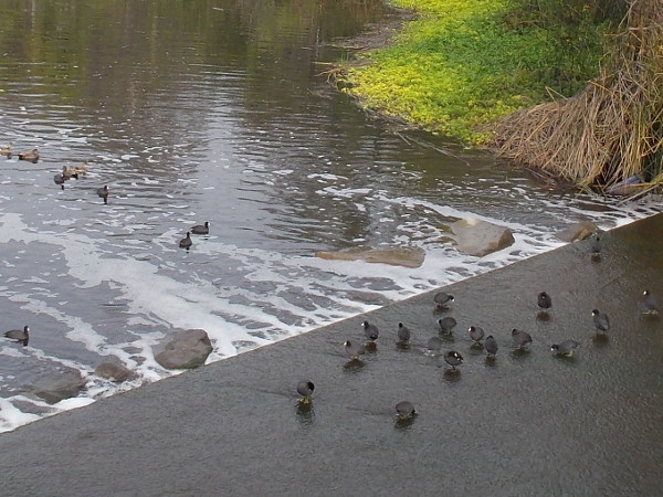
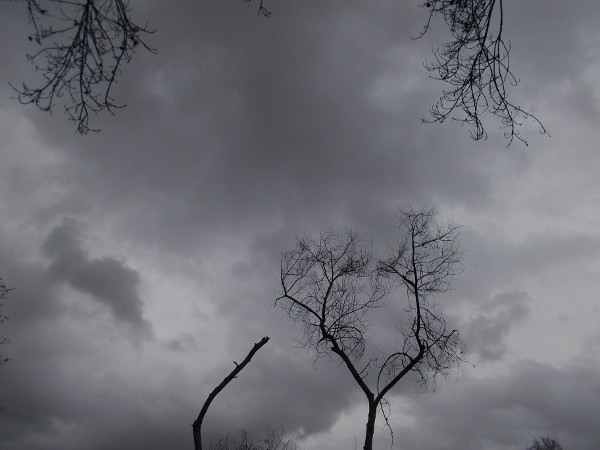
Gazing west along the San Diego River from Qualcomm Way.Bicycle and pedestrian paths follow the San Diego River through Mission Valley.Litter carelessly dropped near a mile marker for The San Diego River Trail. It was picked up.The community is working to restore and enhance this area while making an inviting living science center in the heart of our urban riparian environment. (Click image to enlarge.)Make a difference with a fun group of people. Join the River Assessment Team! Help support a clean river and get some exercise! (Click image to enlarge.)A red San Diego Trolley passes over the life-filled river as it approaches the Rio Vista station.A gathering of American coots (or mud hens) where the San Diego River passes beneath Camino del Este.Dark clouds and barren Fremont Cottonwoods minutes before a winter storm brings brief torrential rain.Beautiful flowers can be seen at almost any time of year during a nature walk along The San Diego River Trail.A couple of busy bees collect pollen in the morning.
…
I live in downtown San Diego and love to walk! You can follow Cool San Diego Sights via Facebook or Twitter!
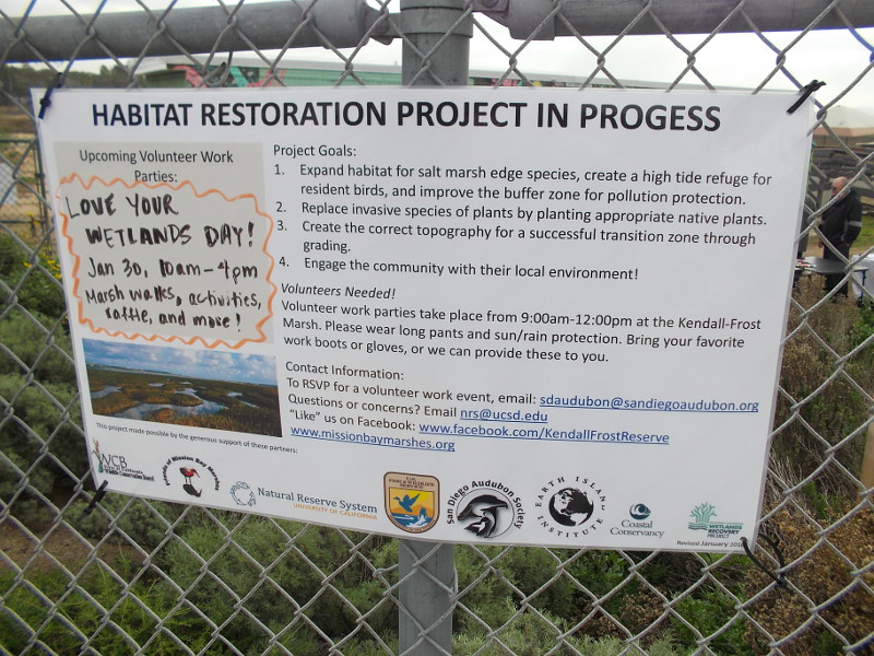
Volunteers needed! Volunteer work parties take place from 9am-12pm at the Kendall-Frost Marsh. Please wear long pants and sun or rain protection. Bring your favorite work boots or gloves, or we can provide these to you.
Yesterday I was privileged to watch citizens in San Diego teaming up to improve our environment. During the Love Your Wetlands Day event, a group of concerned people gathered together to help clean and restore the beautiful Kendall-Frost Marsh in Mission Bay.
Do you live in San Diego? Do you enjoy nature and being outdoors? Do you love seeing and protecting wildlife and birds? Do you have a bit of free time? Would you like to personally make a very big difference in this world?
Volunteers are needed to help restore San Diego wetlands! Spread the word! Find out more by contacting the San Diego Audubon Society from this page of their website! Or check out more info by clicking the above photo.
Volunteers help to restore wetlands in Mission Bay. Do you live in Pacific Beach or in greater San Diego? With a little elbow grease, you can actually make a big difference!
Car deep in the water. The flooded lower level of a Fashion Valley mall parking garage in San Diego’s Mission Valley.
Occasionally I post not-so-cool photos on my blog. Here are some that are noteworthy. I took these this morning while walking through a section of Mission Valley on my way to work. Because it lies right next to the San Diego River, the area is notorious for catastrophic flooding.
Yesterday we had a storm that brought intense rain to our region. It was the second winter storm of this El Nino year. Today we’re having our third storm, and it looks to be fairly rainy for many days to come.
Of course, after California’s long drought, we need the water. Unfortunately, the rain that falls in Mission Valley and many other parts of San Diego isn’t captured–it simply runs off into the ocean. I hope there isn’t too much damage caused this winter by El Nino. To my blog’s followers who are affected, take care!
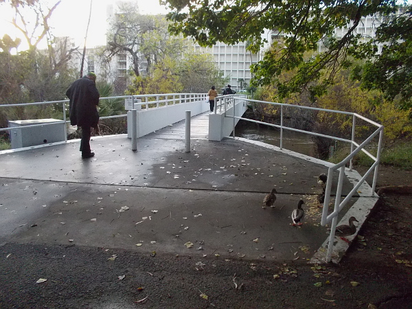
The morning after an early winter storm during an El Nino year. The sun is out as people cross the San Diego River near the Fashion Valley Transit Center.Areas along the San Diego River are notorious for flooding. Yesterday a long deluge raised the water to an unusually high level.A couple dozen cars were spotted flooded at the Fashion Valley shopping mall. This one was stranded not far from Macy’s, which also suffered some flooding inside the store.More cars abandoned in the flood. Many storms are in line to strike San Diego in the coming days during this El Nino year.The bike and pedestrian pathway beneath Highway 163 flooded and was impassable. The nearby river was swollen with the recent rain.A beautiful morning photo of the San Diego River taken from Mission Center Road. This spot floods during severe storms and traffic must be diverted.A barrier stands ready for the next storm. It looks to be a long, watery winter!
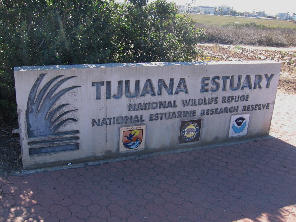
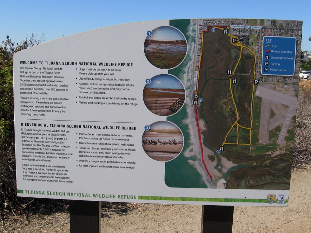
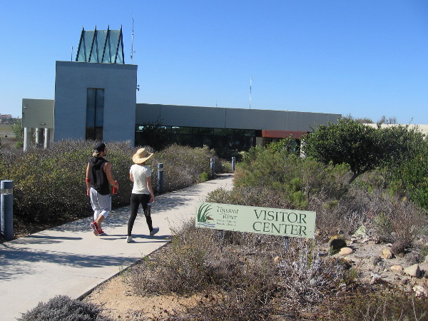
Sign near the entrance to Visitor Center of Tijuana Estuary, home of a National Wildlife Refuge and National Estuarine Research Reserve.
What place in North America officially contains the most plant and animal species? You don’t know? San Diego and the Northern Baja California region!
Yesterday I took a nature walk around and through the northern section of the Tijuana River Estuary. The large estuary, which is located at the extreme southwest corner of the continental United States, where the Tijuana River empties into the Pacific Ocean, contains abundant life which reflects San Diego’s amazing biodiversity and range of habitats.
The Tijuana Estuary is not only a place of tranquil beauty, but it’s a scientific laboratory, protective refuge, and outdoor classroom where the public can learn about our natural environment. It’s managed by several agencies, including the NOAA National Estuarine Research Reserve System, the California Department of Parks and Recreation, and the National Wildlife Refuge System under the U.S. Fish and Wildlife Service.
I absorbed so much information while walking about, reading signs, and listening to a volunteer guide during a short nature walk near the Visitor Center, that I couldn’t possibly convey it all on my blog. So I’ve selected some photos and have captioned them so you’ll get the gist of what I saw and learned. And hopefully you’ll want to visit, too!
Relatively few people partake of the scheduled weekend nature walks at the Tijuana Estuary Visitor Center. Joan, the plant expert, said that some days nobody shows up. What a shame. Because there’s so much beauty, so much to see.
I strongly encourage anyone who lives in the San Diego area to head down to Imperial Beach and take a long, leisurely walk where life thrives!
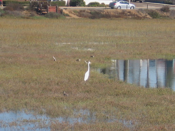
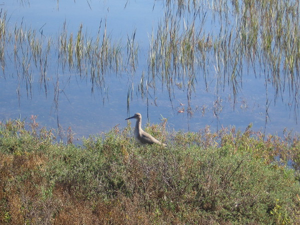
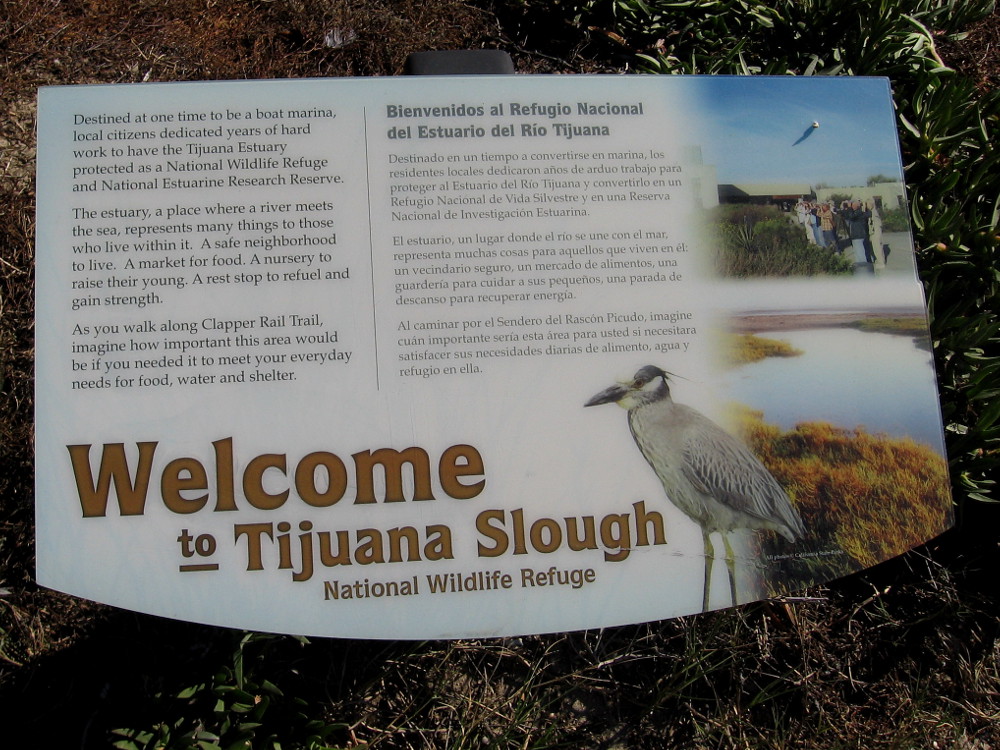
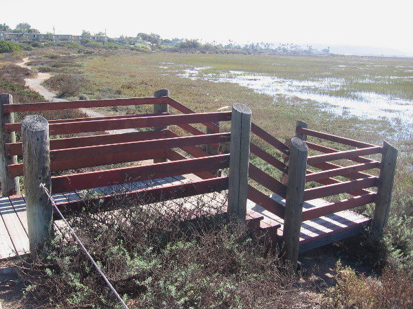
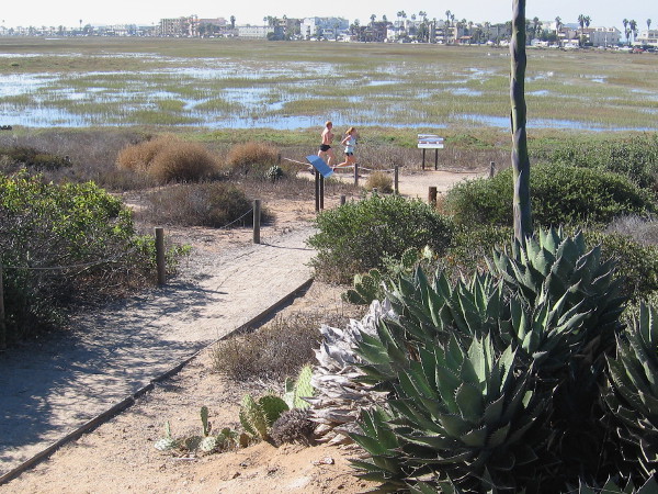
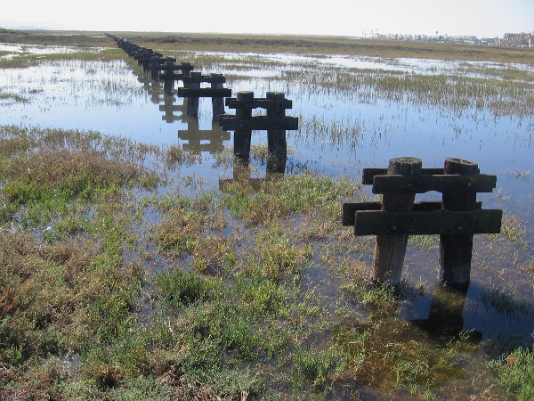
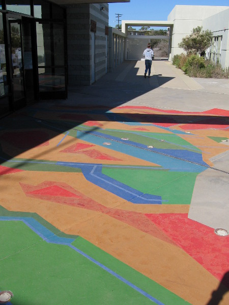
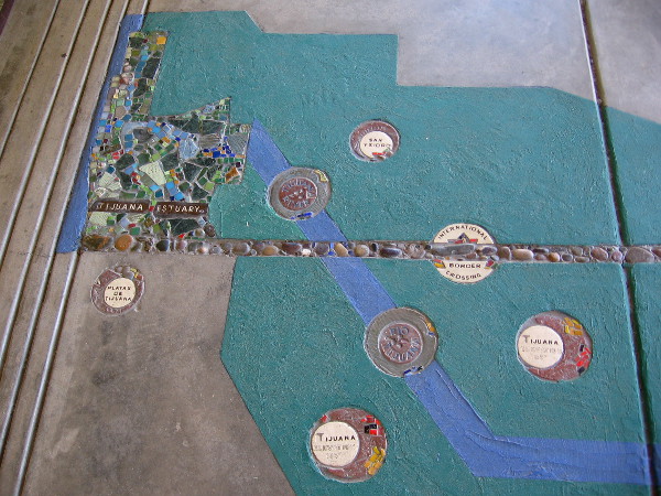
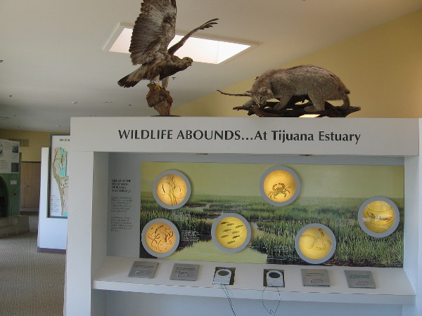
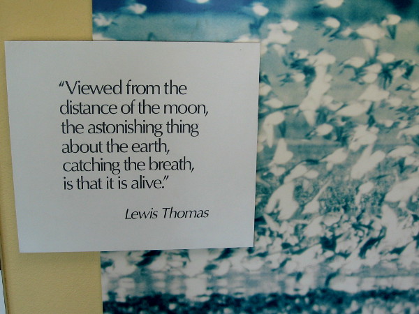
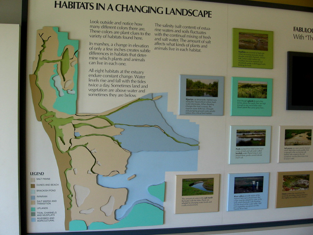
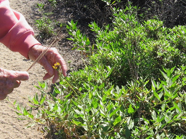
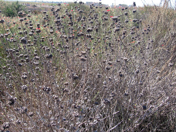
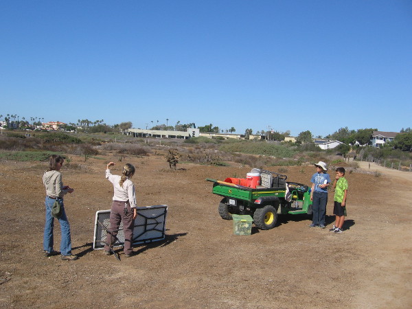
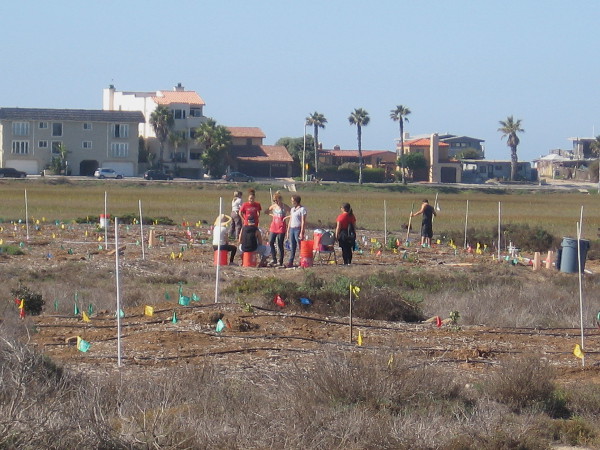
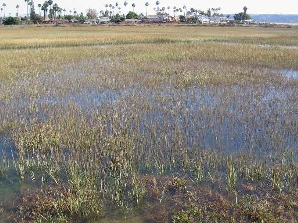
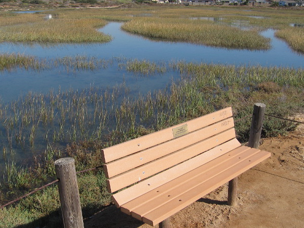
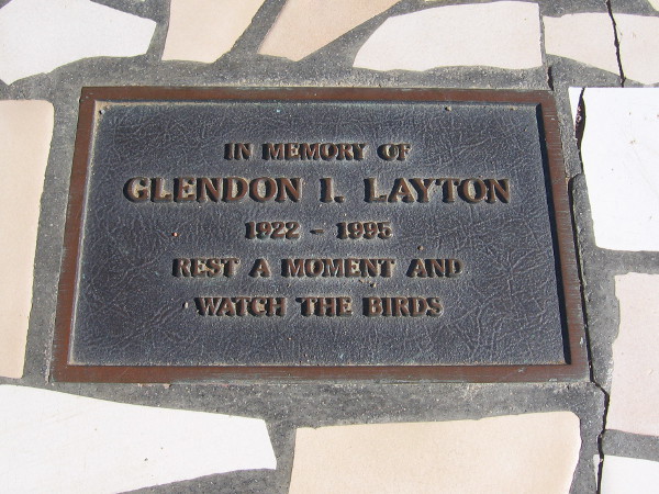
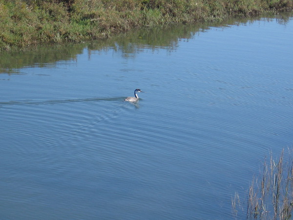
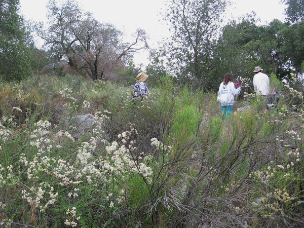
Ecoroute Bikeway and sidewalk along Seacoast Drive in Imperial Beach offers views of the north section of 2,500 acre Tijuana River Estuary.A white egret and other small birds enjoy the fertile, nutrient-rich environment created by this important coastal wetland.A shorebird equipped with a long bill, used to poke into sand and mudflats for food. Over 370 species of birds have been sighted in the wildlife reserve.Once a dump, and destined to be a boat marina, local citizens fought to have the Tijuana Estuary protected as a National Wildlife Refuge and National Estuarine Research Reserve.Steps lead down from Imperial Beach Boulevard to one of many trails in the fascinating, life-filled estuary.There are many habitats in the estuary including dune, salt panne, salt marsh, mudflat, brackish pond, riparian, coastal sage scrub, and vernal pool.Sign welcomes visitors to Tijuana Slough National Wildlife Refuge. Five endangered and two threatened species of birds are protected here in their natural habitat.I was told these old wooden pilings used to support a storm drain which ran out to the ocean.A Snowy Egret perches atop a post, perhaps watching the water for prey. Small fish, frogs, reptiles and insects are part of the food chain in a shallow river estuary.The path to the Tijuana Estuary Visitor Center passes through a garden of native plants often found along the coast of Southern California.This colorful abstract map at the Visitor Center entrance represents the 1,735 square mile watershed of the Tijuana River, reaching deep into Mexico.The edge of the map, inside the Visitor Center’s door, shows a part of San Diego and Tijuana. As it nears the Pacific Ocean, the Tijuana River crosses into the United States.One of many educational exhibits inside the cool Visitor Center. Wildlife abounds . . . at Tijuana Estuary!Viewed from the distance of the moon, the astonishing thing about the earth, catching the breath, is that it is alive.Habitats in a changing landscape. All eight habitats in the estuary endure constant change. Water levels rise and fall with the tides. Salinity of the water fluctuates.Visitors can jot notable sighting of birds on a board inside the Visitor Center. Buds and blooms are also listed.A few people out on a nature walk on a pleasant Saturday in November. The estuary is full of blooms, birds, and animal activity, even as winter approaches.Joan, a super nice park volunteer who is a plant expert (and author of a fun native plant book), shows us the yellow bloom of California bush sunflower.Even though the blue blooms of this pleasantly aromatic Cleveland Sage have dried, the seeds pods have a bluish tint.A tiny hummingbird is perched on the branch of a shrub.The Galvezia, or bush snapdragon, is common in Baja California. It has green stems, bright red tube flowers, and attracts hummingbirds.Hiking south down the North McCoy Trail in the Tijuana Estuary. Rising on the left horizon is Mexico. On the right horizon are the Coronado Islands in the Pacific Ocean.Ranger Debbie Good is super friendly. She answered a bunch of questions with a big smile. Here’s she’s putting away a table used to welcome volunteer workers.These volunteer students from SDSU are helping to plant native vegetation. Efforts to return the estuary to a natural state are ongoing. This area several decades ago was a dump.Looking across cordgrass and a beautiful wetland at the extreme southwest corner of the continental United States.A quiet bench on the North McCoy Trail invites walkers to relax and take in the sunshine and surrounding tranquility.Plaque on another bench at the south end of the trail. In memory of Glendon I. Layton. Rest a moment and watch the birds.The Tijuana River National Estuarine Research Reserve and Tijuana Slough National Wildlife Refuge is a place where amazing biodiversity and nature’s beauty thrive.
…
Follow this blog for more photos of cool stuff! Join me on Facebook or Twitter.
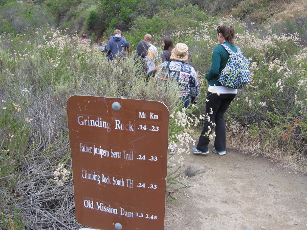
Visitors enjoying Explore Mission Trails Day head down Grinding Rock Trail.
About 60 miles of hiking trails through a wilderness environment can be found just 8 miles from downtown San Diego. Seriously!
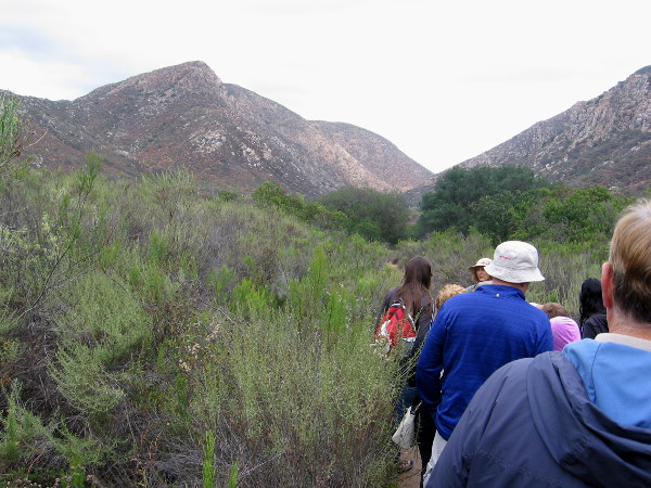
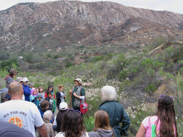
This morning I enjoyed a very short walk (about a mile) at Mission Trails Regional Park. I went on the occasion of Explore Mission Trails Day, an annual event that showcases this amazing, enormous urban park.
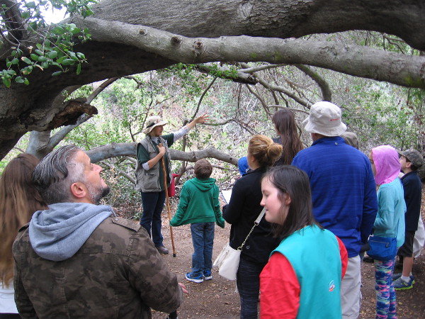
The relatively easy hike was from the Visitor and Interpretive Center to some grinding rocks on the banks of the San Diego River, then back. Led by our guide, Linda, a small group learned what life was like for the ancient Kumeyaay people, who’ve lived in this dry, rugged area of Southern California for thousands of years, long before Europeans arrived. The Kumeyaay lived off the land. The very land where we walked.
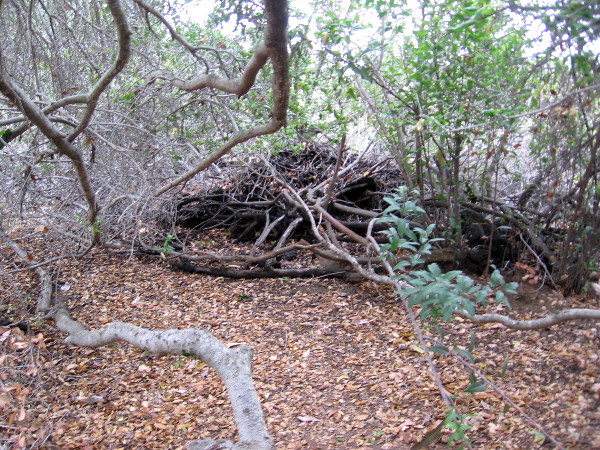
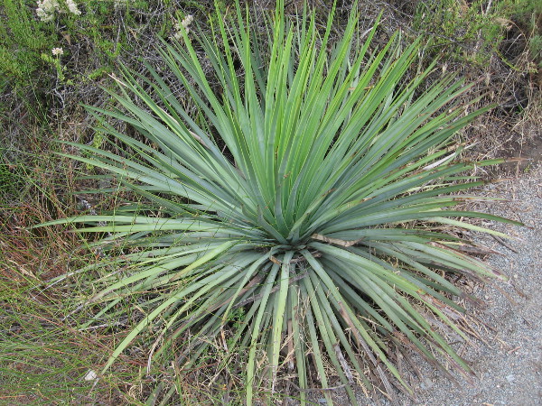
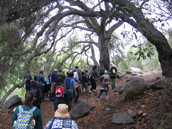
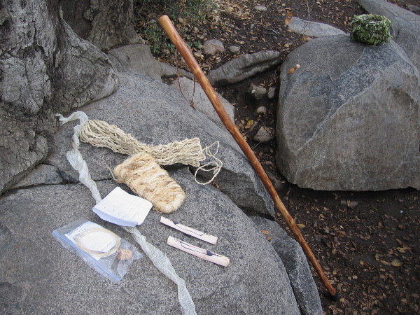
We gathered at the kiosk near the parking lot for an easy morning nature walk.Hiking through common, aromatic Southern California sagebrush toward a distinctive mountain, South Fortuna.We pause under a coast live oak, which produces acorns and shade valued by the native Kumeyaay.Large nest created by a woodrat (also known as pack rat). The Kumeyaay would bang a nest with a stick and hope to capture a snake, to eat.We cross a small wooden footbridge and take in nature’s sights and smells on a beautiful day.These tiny pinkish white flowers are flat-top buckwheat. Their tiny seeds are edible. The blooms attract butterflies.It’s easy to forget you are in the San Diego city limits in this open wilderness.Water erosion visible in the gradually descending dirt trail. As the morning was overcast and cool, no snakes were out sunning.Yucca fibers were used by the Kumeyaay to make nets, sandles, baskets and other useful things.Linda, our tour guide, talks about the ancient history of this region and its indigenous peoples. The Kumeyaay moved about depending on the season and availability of resources.Dodder is an orange colored parasitic plant. According to Kumeyaay legend, a woman who failed to guard a camp against invaders ran away, and some of her hair snagged in the bushes!A patch of poison oak! Leaves of three, let it be!We approach the San Diego River, but first pass beneath a large arching tree. If you see a native tree in San Diego, there’s probably water nearby!Smooth boulders on a bank of the San Diego River in Mission Trails Regional Park.Family investigates the life-giving water. The Kumeyaay at times would follow the river all the way to the coast, where some witnessed the landing of explorer Cabrillo.Many mortar-like holes in the nearby boulders are where Kumeyaay ground acorns, seeds, roots, herbs and other edible resources found in this arid environment.Walking stick leans up near some Yucca fiber creations brought by our guide. The basket on the right was made with willow branches. Natural salicylic acid found in willows kept out insects!Starting back up toward the Visitor Center during a very cool hike in San Diego! If you go for a hike, bring water and sturdy shoes!
…
To enjoy future posts, you can “like” Cool San Diego Sights on Facebook or follow me on Twitter.
The roots were almost completely torn out of the ground, but the stubborn tree in spring has green leaves!
Perhaps you read my blog post about the violent microburst that tore through San Diego’s Mission Valley on September 16, 2014. Along with photos of the aftermath, I described the tornado-like winds of the freak weather phenomenon.
A microburst is a localized downdraft of wind that can occur under unstable weather conditions. Several areas around San Diego were struck by a microburst that day, and the resulting damage was stunning. Small airplanes at an airport were tossed through the air. Along the banks of the San Diego River, hundreds of trees were torn to shreds and uprooted.
This morning, 7 months later, I walked along the river path where I had scrambled over thickly fallen trees right after the natural disaster.
Many of the uprooted trees were removed by crews with chainsaws in the days that followed the microburst. But some were not. Check out a few pics from my walk this spring morning! Like the famous quote from the movie Jurassic Park, life finds a way!
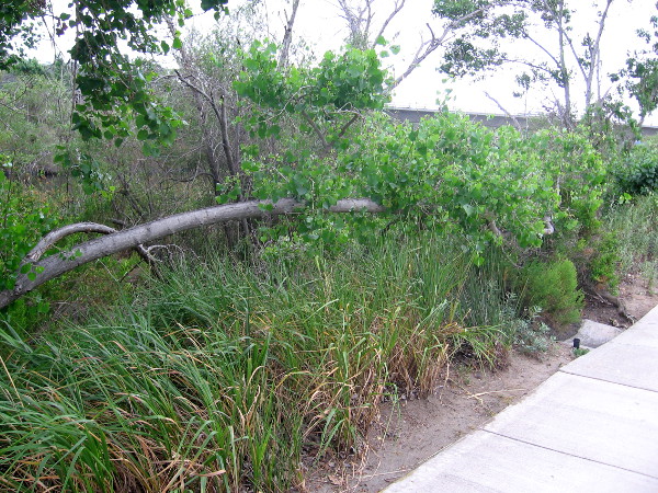
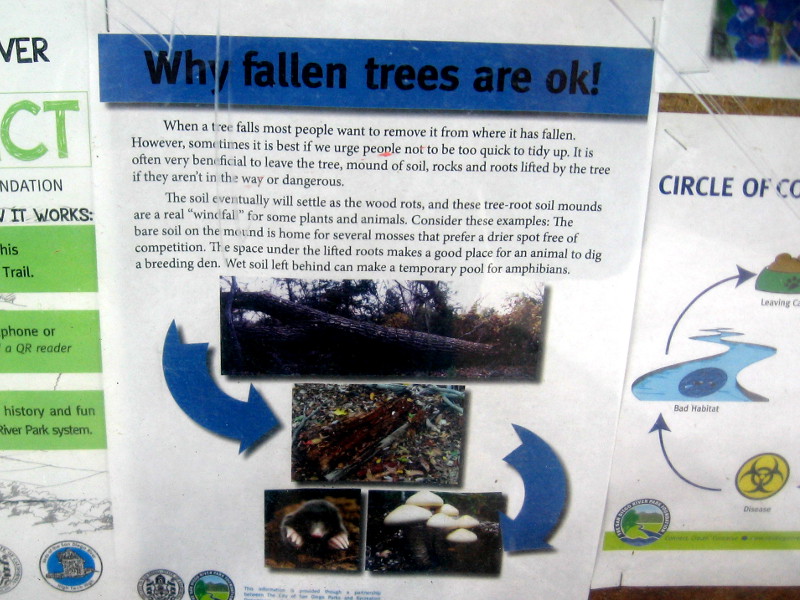
One of hundreds of trees that were uprooted during the super violent microburst last September. Amazingly, this one still flourishes!This fallen tree is now growing horizontally like a hedge along a Mission Valley sidewalk!Sign beside the San Diego River Trail. Why fallen trees are okay! There are important benefits to the soil, flora and fauna.
The sign reads:
When a tree falls most people want to remove it from where it has fallen. However, sometimes it is best if we urge people not to be too quick to tidy up. It is often very beneficial to leave the tree, mound of soil, rocks and roots lifted by the tree if they aren’t in the way or dangerous.
The soil eventually will settle as the wood rots, and these tree-root soil mounds are the real “windfall” for some plants and animals. Consider these examples: The bare soil on the mound is home for several mosses that prefer a drier spot free of competition. The space under the lifted roots makes a good place for an animal to dig a breeding den. Wet soil left behind can make a temporary pool for amphibians.
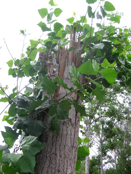
Green shoots look unusual on this violently torn tree trunk. I believe this is a Fremont Cottonwood.Life springs forth from a broken stump months after a devastating natural disaster.
…
To enjoy future posts, you can “like” Cool San Diego Sights on Facebook or follow me on Twitter.