A pole at south end of Rotary Lane in Vista expresses May Peace Prevail on Earth in many languages. By the World Peace Prayer Society, 2018.
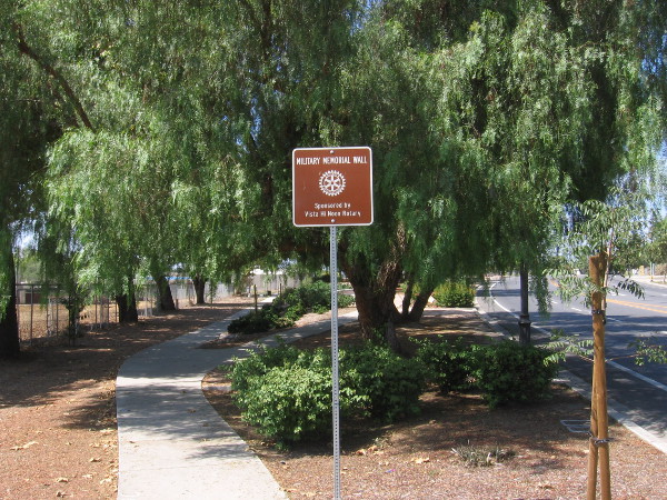
During my adventure in Vista last weekend, I found myself walking down a path through an old linear park. The park is located next to Vista Village Drive, near its intersection with Main Street. A plaque at either end of the park told me I had entered Rotary Lane.
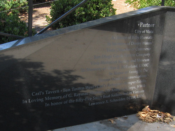
I soon caught sight of two works of art–one honoring peace and the other freedom–and a shining 60 feet long engraved black granite Military Memorial Wall.
I took these photographs. For those who are interested, the images and captions provide a little more information.
Rotary Lane. Established 1966.
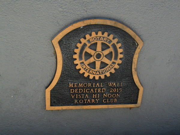
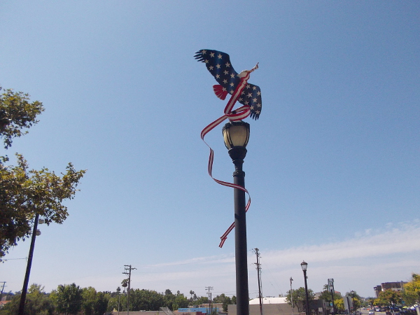
Branches of the United States Armed Services on a black marble memorial wall. In honor of all those who serve and protect . . . past, present and future.Purple Heart City. In honor of U.S. Armed Services men and women killed or wounded in combat. Designated by Vista City Council, June 12, 2013.Partners who made the Military Memorial Wall possible.A small plaque opposite the wall reads: Memorial Wall – Dedicated 2015 – Vista Hi Noon Rotary Club.Sculpture of a patriotic red, white and blue bald eagle high atop a lamp post at Rotary Lane.Freedom’s Struggle, by artist Winifred Meiser, 2016.
…
I live in downtown San Diego and love to walk around with my camera! You can follow Cool San Diego Sights via Facebook or Twitter!
You can easily explore Cool San Diego Sights by using the search box on my blog’s sidebar. Or click a tag! There are thousands upon thousands of photos for you to enjoy!
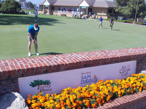
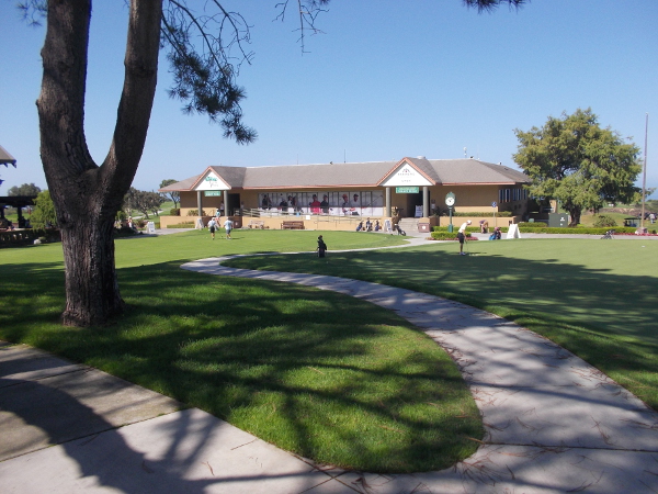
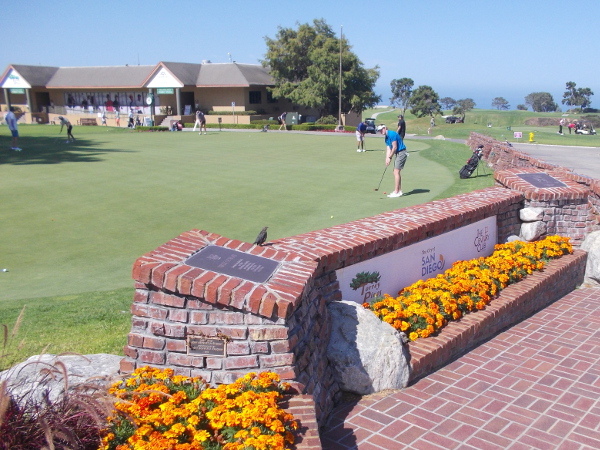
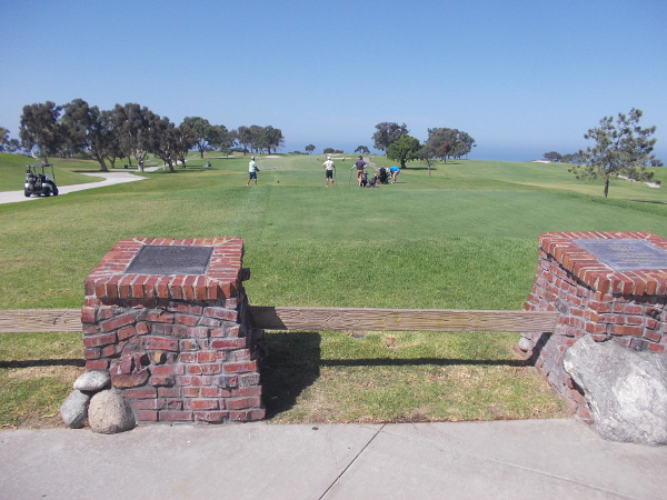
San Diego’s beloved Torrey Pines Golf Course is one of the most beautiful and famous golf courses in the world. It has a history of great competitions between the world’s top professional golfers.
Last weekend I walked a little around Torrey Pines Golf Course and took photos of outdoor plaques that honor notable past champions.
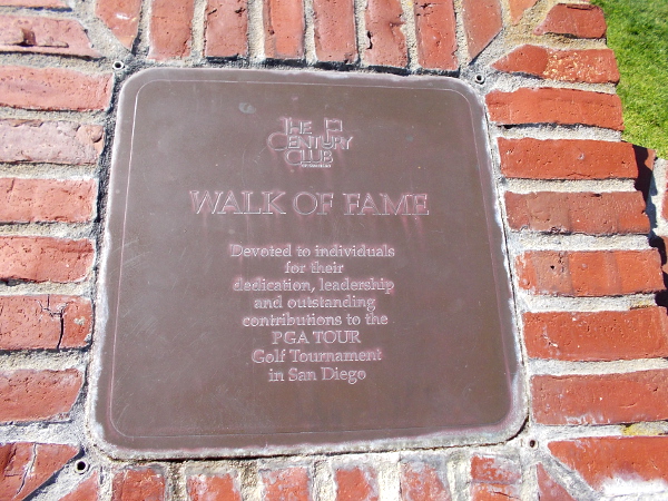
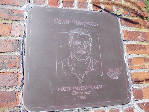
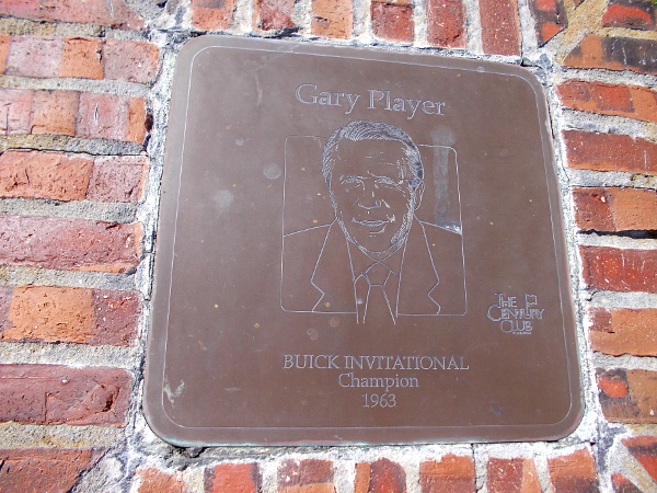
Plaques along one side of a practice putting green at Torrey Pines Golf Course.The Century Club WALK OF FAME.Arnold Palmer, San Diego Open Champion 1957, 1961.Billy Casper, San Diego Open Champion 1966.Gene Littler, San Diego Open Champion 1954.Tom Watson, San Diego Open Champion 1977, 1980.Craig Stadler, Buick Invitational Champion 1994.Jack Nicklaus, San Diego Open Champion 1969.Scott Simpson, Buick Invitational Champion 1998.Gary Player, Buick Invitational Champion 1963.
108th United States Open Championship, June 12-16, 2008. Champion Tiger Woods.
…
I live in downtown San Diego and love to walk around with my camera! You can follow Cool San Diego Sights via Facebook or Twitter!
You can easily explore Cool San Diego Sights by using the search box on my blog’s sidebar. Or click a tag! There are thousands upon thousands of photos for you to enjoy!
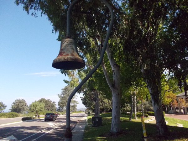
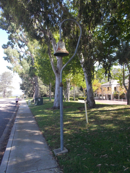
After finishing my walk along North Torrey Pines Road last weekend, I waited for a bus at a stop near the north end of the Torrey Pines Golf Course and the south end of Torrey Pines State Reserve. For a while I watched groups of bicyclists fly past. Then I noticed that an El Camino Real Bell rose from the nearby sidewalk!
I’ve taken photographs of various historic El Camino Real Bells all around San Diego over the years. You can revisit a few of my sightings by clicking here.
As I explained in that blog post: “Many of these guidepost bells were placed in 1906 by the California Federation of Women’s Clubs. They marked the primitive roads that connected the old Spanish missions in California. El Camino Real, which means the Royal Road or King’s Highway in Spanish, led to 21 missions in Alta California, plus a variety of sub-missions, presidios and pueblos. The bells stand on tall posts in the shape of a shepherd’s crook. In subsequent years, bells have been removed or added to the California landscape.”
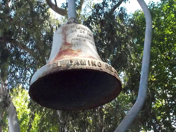
This bell appears similar to others I’ve come upon. An old plaque at the base of this one reads:
Donated by California Federation of Women’s Clubs Bostonia Woman’s Club
And, like other examples I’ve seen, this appears on the bell itself:
Loreto Oct 25 1697
Solano July 4 1823
According to the California State Parks website: “On October 25, 1697, Father Salvatierra founded the first permanent mission in the Californias on a sheltered plain opposite Isla Carmen. It was named Nuestra Señora de Loreto Concho…” (That original mission was built in what today is Baja California, Mexico.)
The 21st mission in Alta California (the present state of California) was established in San Francisco on July 4, 1823. It was the final and northernmost mission. It was named Mission San Francisco de Solano.
The name and founding date of both the first and last mission explains what is written on every El Camino Real Bell.
…
I live in downtown San Diego and love to walk around with my camera! You can follow Cool San Diego Sights via Facebook or Twitter!
You can easily explore Cool San Diego Sights by using the search box on my blog’s sidebar. Or click a tag! There are thousands upon thousands of photos for you to enjoy!
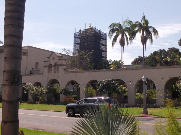
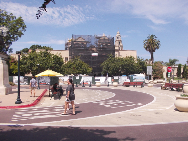
I passed through the sunny park about noontime today and noticed even more changes to San Diego’s crown jewel!
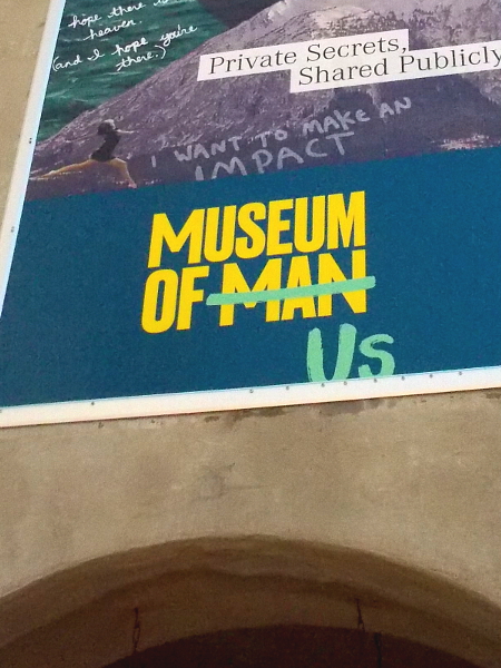
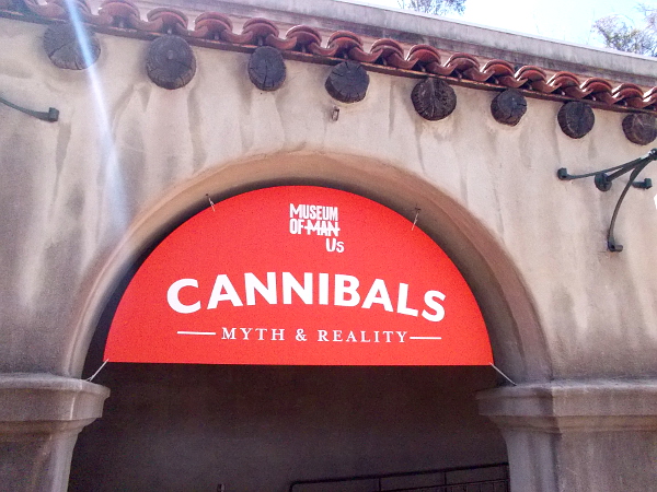
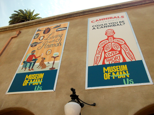
First, the Museum of Man has changed its name. It’s now the Museum of Us. Which not only sounds more inclusive, but it strikes me as less stodgy and more personally relatable. Various banners hung about the California Quadrangle reflect the anthropology museum’s recent name change.
Next, I noticed that scaffolding is now up around the House of Charm’s tower and in front of the historic building’s facade. The Mingei International Museum’s huge renovation and expansion continues!
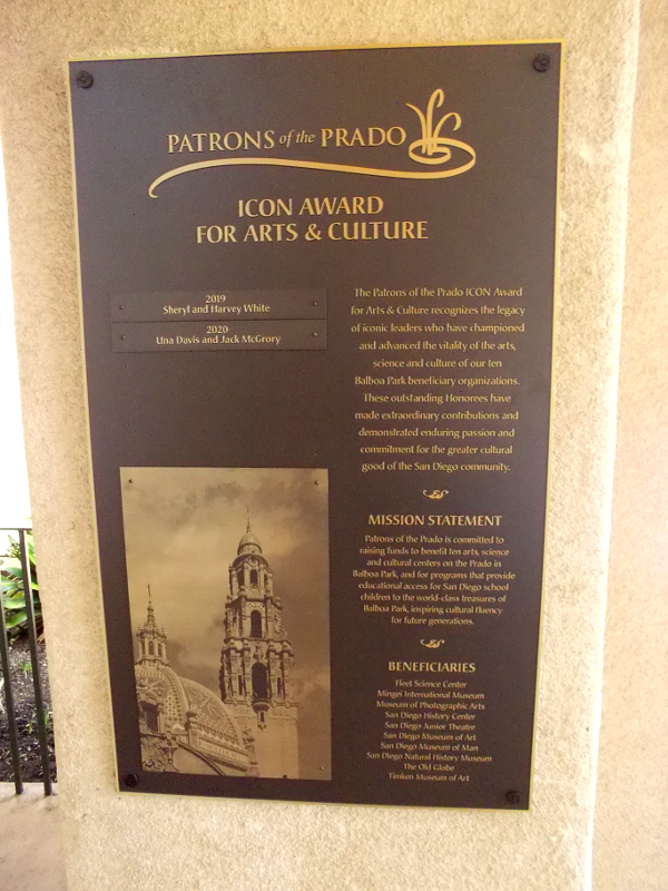
On the west side of the Plaza de Panama a new bronze plaque honors winners of the Patrons of the Prado ICON Award for Arts and Culture. Winners have greatly benefited many of San Diego’s leading cultural institutions.
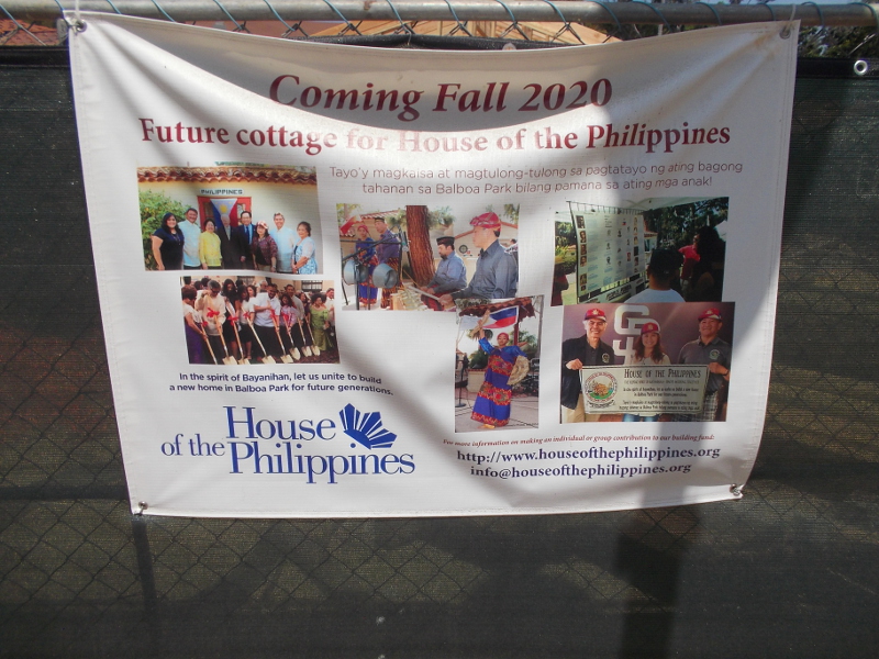
Then, as I headed through the park, I noticed a fifth new structure is finally rising at the International Cottages. This cottage, when finished, will be home to the House of the Philippines. I took a photo of an informative banner on the construction fence.
Lastly, I took photos of a small but beautiful change that occurred a couple of months ago. But until today I haven’t blogged about it.
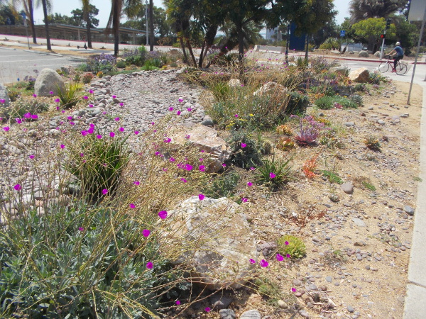
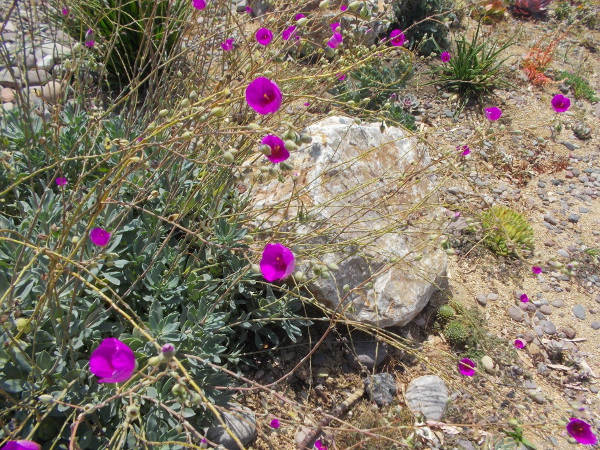
At the corner of Park Boulevard and Presidents Way, at the southwest corner of the Veterans Museum parking lot, a small flower-filled succulent garden has been created!
There are so many changes happening in Balboa Park, it’s hard to keep track of them all!
…
I live in downtown San Diego and love to walk around with my camera! You can follow Cool San Diego Sights via Facebook or Twitter!
You can easily explore Cool San Diego Sights by using the search box on my blog’s sidebar. Or click a tag! There are thousands upon thousands of photos for you to enjoy!
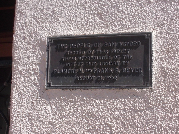
Front of the original San Ysidro Library, built in 1924.
The first public library in San Ysidro was built in 1924. It still stands on San Ysidro Boulevard, between West and East Park Avenue.
I happened to walk by it last weekend.
The building is small compared to the modern, much larger San Ysidro Library on Beyer Boulevard that opened a year ago. But the smaller scale of this original library provides much of it’s charm. The modest architecture with its graceful curves is also welcoming. Had this little library been open, I would’ve stepped right inside.
Instead, I walked around the outside and took a few photos.
THE PEOPLE OF SAN YSIDRO RECORD BY THIS TABLET THEIR APPRECIATION OF THE GIFT OF THIS LIBRARY BY BLANCHE H. AND FRANK B. BEYER – AUGUST 31, 1924An iconic El Camino Real Bell stands near the historic San Ysidro Library on San Ysidro Boulevard.Plaque at base of El CAMINO REAL BELL – Dedicated October 1, 2010.View of east side of the original San Ysidro Library.The graceful, welcoming front of the first San Ysidro Library.
UPDATE!
I’ve learned there once was a World War II Memorial in front of the old library, but it mysteriously disappeared! You can watch an episode of Ken Kramer’s KPBS show About San Diego titled San Ysidro Mystery by clicking here!
…
I live in downtown San Diego and love to walk around with my camera! You can follow Cool San Diego Sights via Facebook or Twitter!
You can easily explore Cool San Diego Sights by using the search box on my blog’s sidebar. Or click a tag! There are thousands upon thousands of photos for you to enjoy!
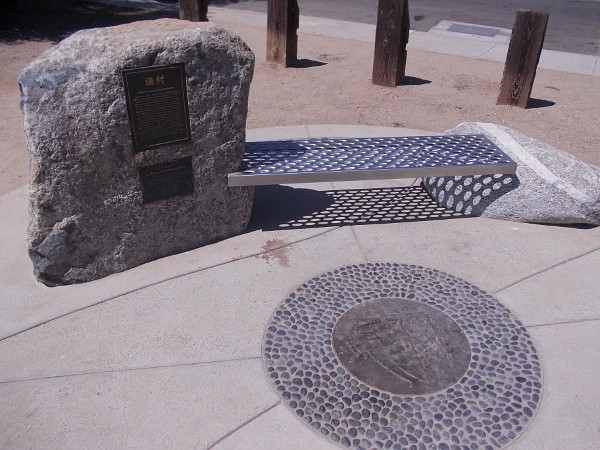
Historical plaque and artwork at east end of Point Loma’s Bessemer Path mark an old Chinese Fishing and Shipbuilding Site.
Today I went on a walk along Point Loma’s Bessemer Path, which stretches a short distance along San Diego Bay northwest of Shelter Island. The bayside path offers scenic views of the La Playa Anchorage. I’ll share pictures from this beautiful walk in a little bit.
At the east end of the Bessemer Path, near the intersection of Talbot Street and Anchorage Lane, there’s a bench and historical marker with a plaque, and some artwork in the sidewalk. Together they recall the Chinese village that once was located at this site, on the old La Playa Trail. (You can learn more about the La Playa Trail, the oldest commercial trail in the western United States, here.)
I photographed the plaque which you can read if you’re interested. Click the image and it will enlarge.
I learned that a shipbuilding facility was located at this old Chinese village, where fishing junks were constructed. According to the plaque: “The Sun Yun Lee, shown here, was the finest junk built in all of California. Launched in 1884 on this site, the vessel had three masts and measured 52 feet in length, and 18 feet wide. It was build of redwood with masts and rudders made of ironwood from China…”
You can a little learn more about the Sun Yun Lee and see an historical photo of the Chinese junk in San Diego Bay here.
Plaque describes Point Loma’s Chinese Fishing and Shipbuilding Site, located on the La Playa Trail. Around 1860 to the early 1890’s, the Chinese had a fishing village here.
Artwork in the sidewalk depicts the three-masted Chinese junk Sun Yun Lee, which was built on Point Loma in 1884.
…
I live in downtown San Diego and love to walk around with my camera! You can follow Cool San Diego Sights via Facebook or Twitter!
You can easily explore Cool San Diego Sights by using the search box on my blog’s sidebar. Or click a tag! There are thousands upon thousands of photos for you to enjoy!
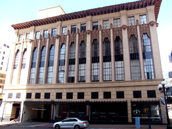
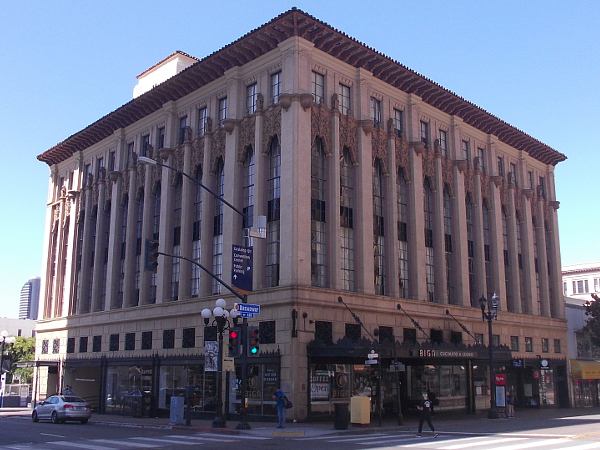
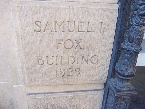
A very unique historic building stands at the southwest corner of Sixth Avenue and Broadway in downtown San Diego.
The Samuel I. Fox Building, built in 1929, always attracts my attention when I walk by. It’s earthy colors seem to change depending on the time of day, due to shifting sunlight and shadow.
The Samuel I. Fox Building was designed by renowned architect William Templeton Johnson, who also masterminded the San Diego Museum of Art and Natural History Museum buildings in Balboa Park, the Serra Museum in Presidio Park, and the La Jolla Athenaeum. He is one of several architects responsible for the San Diego County Administration Building.
He also designed the extraordinary San Diego Trust and Savings Bank Building, which stands directly to the north across Broadway. You can see photos of that building, where William Templeton Johnson kept his office, here.
A Gaslamp Quarter plaque near the Samuel I. Fox Building’s entrance describes its history:
Entrepreneur Samuel Fox built this four-story structure for a half of a million dollars. It was intended to accommodate his Lion Clothing Company, which was the sole tenant until 1984. It boasts 16-foot ceilings, antique oak wood paneling, heraldic lions in full relief, and an over-hanging tile roof. The building was recognized as an artistic masterpiece and a merchandising success.
A few days ago I took these exterior photos.
…
I live in downtown San Diego and love to walk around with my camera! You can follow Cool San Diego Sights via Facebook or Twitter!
You can easily explore Cool San Diego Sights by using the search box on my blog’s sidebar. Or click a tag! There are thousands upon thousands of photos for you to enjoy!
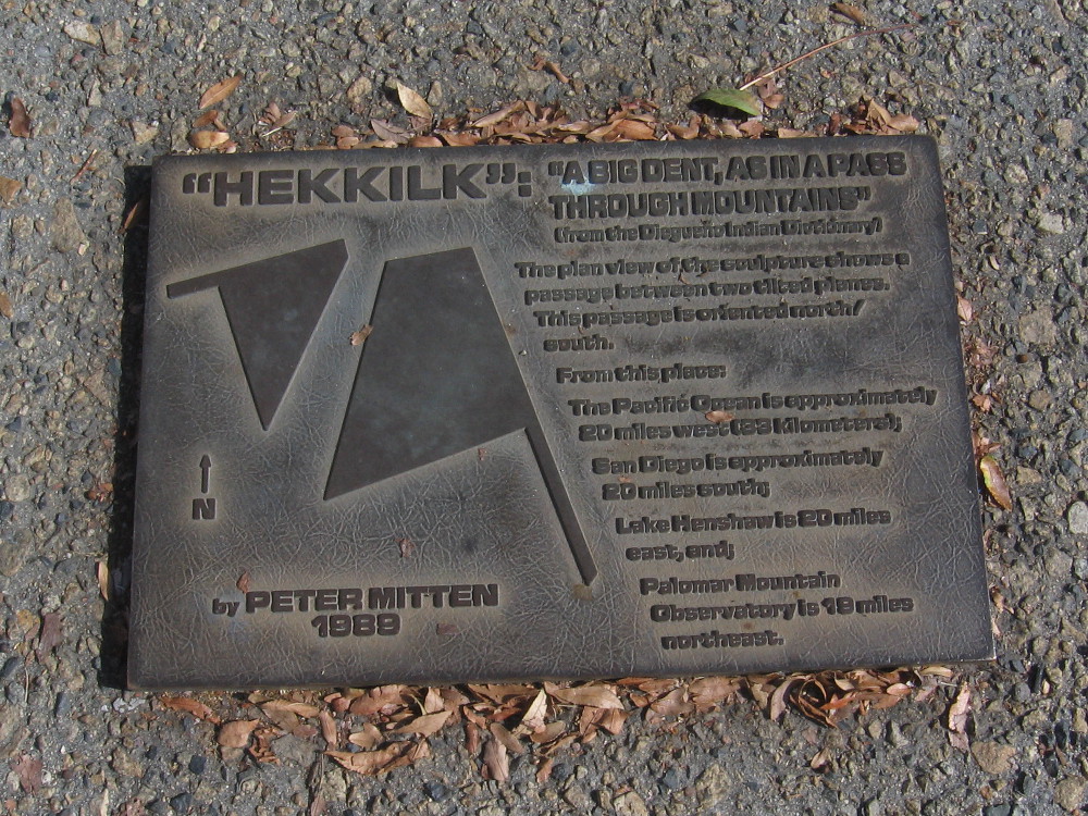
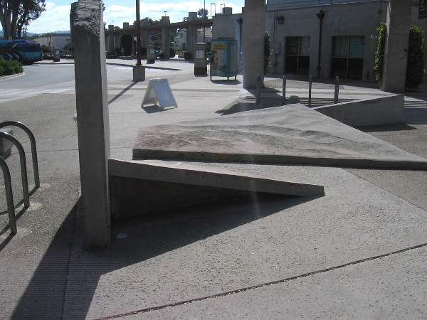
Unusual public art stands in the middle of the Escondido Transit Center. The abstract concrete sculpture is surrounded by North County Transit District bus stops.
Tilted concrete slabs, like geometric planes, form a narrow passage. The title of the sculpture is Hekkilk, and it was created by Peter Mitten in 1989. According to a nearby plaque, Hekkilk is a Diegueño Indian word that means “a big dent, as in a pass through mountains.”
The abstract concrete sculpture is apparently a representation of local geography.
The passage is oriented north/south. Approximate distances from the sculpture to various geographic points in San Diego County are noted on the plaque.
For several decades, those travelling through Escondido have been able to take a few steps through this “big dent” and contemplate the larger world around them.
…
I live in downtown San Diego and love to walk around with my camera! You can follow Cool San Diego Sights via Facebook or Twitter!
You can easily explore Cool San Diego Sights by using the search box on my blog’s sidebar. Or click a tag! There are thousands upon thousands of photos for you to enjoy!
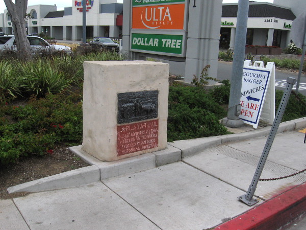
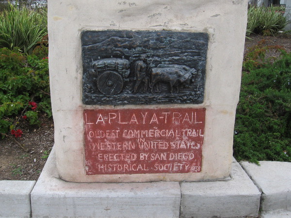
Historical marker recalls early San Diego’s La Playa Trail. This plaque can be found on Rosecrans Street near Midway Drive.
While walking around Point Loma this weekend, I came upon another historical marker with a plaque that commemorates San Diego’s famous old La Playa Trail. This marker stands in front of a shopping center near the corner of Midway Drive and Rosecrans Street. It features one of six similar plaques created back in the 1930s.
You can see a photo of another such plaque at the east end of the La Playa Trail, near Mission San Diego de Alcala, by clicking here. You can see a third plaque at the base of Presidio Hill and learn about the remaining three plaques (which I have yet to photograph) here.
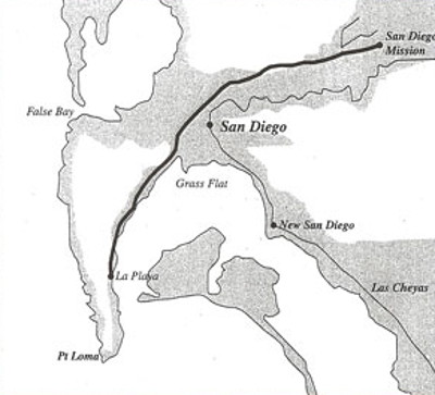
According to Wikipedia: “The La Playa Trail was a historic bayside trail in San Diego, connecting the settled inland areas to the commercial anchorage at Old La Playa on San Diego Bay…The trail was used during the Pre-Hispanic (Native American), Spanish, Mexican and American periods of San Diego history. Much of the length of the original trail corresponds to the current Rosecrans Street in the San Diego neighborhood of Point Loma…The trail was already established by the time the Spanish settlers arrived in 1769; the first inhabitants of the area, including the Kumeyaay tribe, used it to access the beaches of San Diego Bay. It was improved and extended during the Spanish colonization of the region, reaching Old Town San Diego and Mission San Diego de Alcalá in Mission Valley by the 1770s. Cargo which had been unloaded by ship at Ballast Point in Old La Playa was transported along the trail several miles inland to Old Town…”
US Boundary Survey of 1850 shows the La Playa Trail along San Diego Bay and the San Diego River. (New San Diego is where downtown is today.) Public domain image from Wikimedia Commons.
Have you read the classic of American Literature, Two Years Before the Mast? It’s one of my all-time favorite books. Richard Henry Dana Jr. wrote an account of a sailor’s life on the coast of California in the mid-1830s, and a good portion of his fascinating narrative describes San Diego.
La Playa (then a beach on Point Loma just inside San Diego Bay) is where merchant ship Pilgrim unloaded cattle hides that had been gathered by Dana and his shipmates up and down the California coast. When Dana rode on horseback from the hide houses on the beach to Old Town, or farther east to Mission San Diego, he followed the La Playa Trail!
La Playa Trail. Oldest commercial trail in western United States. Erected by San Diego Historical Society. 1938.
…
I live in downtown San Diego and love to walk around with my camera! You can follow Cool San Diego Sights via Facebook or Twitter!
You can easily explore Cool San Diego Sights by using the search box on my blog’s sidebar. Or click a tag! There are thousands upon thousands of photos for you to enjoy!
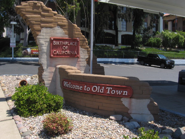
A familiar sign as drivers enter Old Town from Interstate 5. Welcome to Old Town. Birthplace of California.
I have more photos to post from my long walk yesterday. But first I’m going to share pics that I took during today’s walk from downtown San Diego to Old Town!
I didn’t pull out my camera until I was well past the airport, heading up Hancock Street. I passed very few people. My mind was far away. As you can see, I did capture a few amusing images!
After a brief detour to explore Witherby Street and the semi-decayed old bridges and underpasses leading to an entrance of the Marine Corps Recruit Depot, I passed over Interstate 5 and entered Old Town.
I took a look around the quiet streets as I headed up Jefferson Street and Congress Street. Making sure there were no signs posted saying I couldn’t enter, I quickly passed through Old Town San Diego State Historic Park, which was almost deserted. Then I headed back south down San Diego Avenue.
Most of the shops and restaurants in Old Town were closed due to the ongoing coronavirus pandemic. A few restaurants were offering take-out, but very few potential customers were anywhere to be seen…
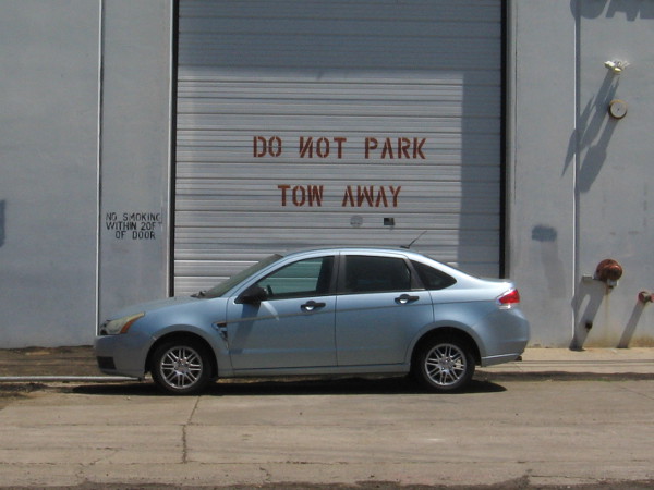
I’m heading up Hancock Street. If that’s not a NOT, can one legally park here?
This might be the coolest little free library I’ve come across!
A superhero who resembles Superman flies from what might be San Diego’s last phone booth.
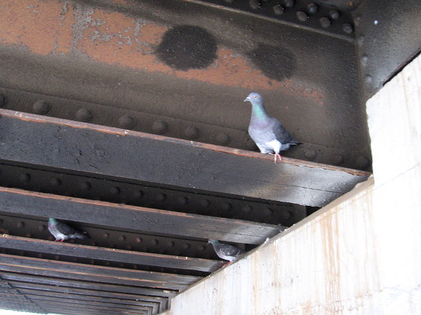
These pigeons regarded me as I walked along a gritty walkway under the Witherby Street train bridge.
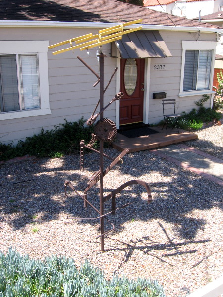
Now I’ve entered Old Town. Check out this cool sculpture in someone’s front yard!
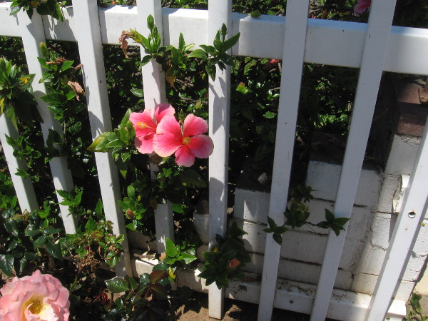
Flowers through a white fence.
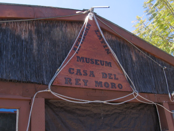
The African Latin Museum was closed. It’s on my list of things to do.
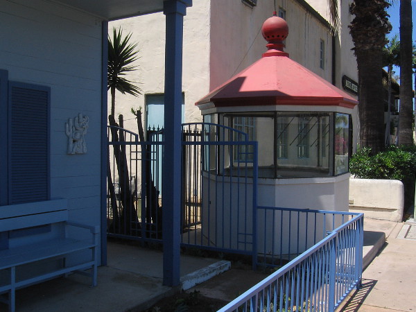
This was part of the 1890 Ballast Point Light Station on Point Loma!
To learn more about the history of this lighthouse, and why part of it is now sitting on a sidewalk in Old Town, click here!
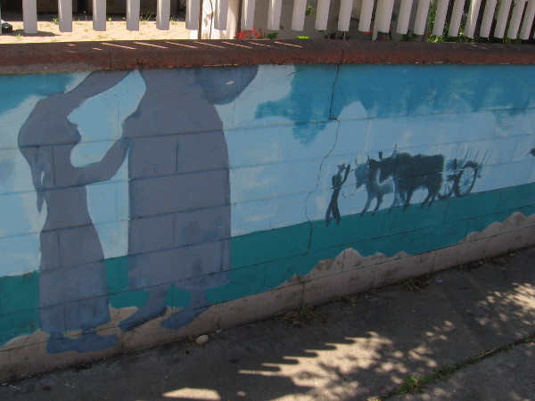
Mural in front of some small businesses on Congress Street depicts the early days of San Diego.
Right part of the mural.
Signs by the parking lot of Rockin’ Baja point to different distant destinations.
On the small island beneath the signs I spotted this plaque.
In Memory of Joe Flynn. 1902 – 1963. Joe loved Old Town and helped re-create Casa de Lopez. Old Town Chamber of Commerce.
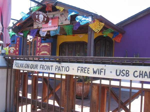
Mexican themed outdoor decor, but no customers at this eatery during the coronavirus pandemic.
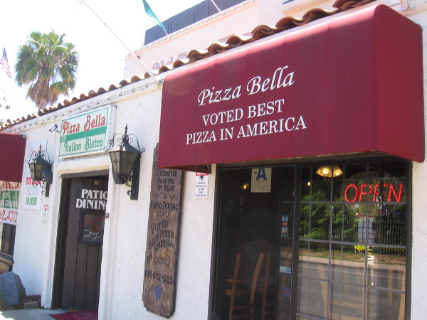
Voted best pizza in America! I gotta try a slice one day.
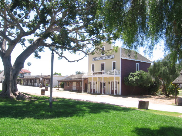
The plaza in the middle of Old Town San Diego State Historic Park is deserted. But the grass is long and green!
The many Old Town museums and attractions are all closed due to COVID-19.
On an ordinary Sunday, this photo would be filled with people.
Now I’m heading down San Diego Avenue. Another popular restaurant is temporarily closed.
But Cafe Coyote is open for take out! And I got two yummy handmade fresh tortillas to munch on as I walked!
…
I live in downtown San Diego and love to walk around with my camera! You can follow Cool San Diego Sights via Facebook or Twitter!
You can easily explore Cool San Diego Sights by using the search box on my blog’s sidebar. Or click a tag! There are thousands upon thousands of photos for you to enjoy!