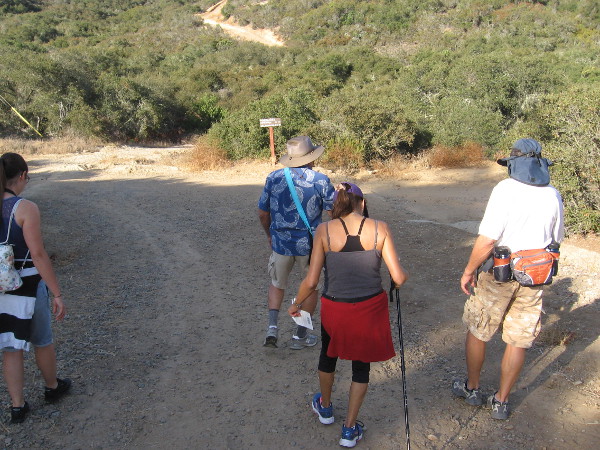
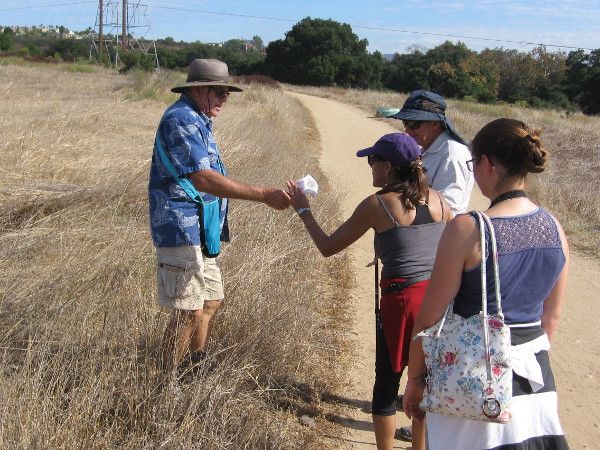
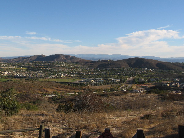
Naturalist Mike Kelly leads a small group of hikers into Los Peñasquitos Canyon Preserve from the Del Mar Mesa trailhead.
Free guided nature walks in the Los Peñasquitos Canyon Preserve introduce the public to unexpected wild beauty in the heart of San Diego. Yesterday I went on one of these easy walks.
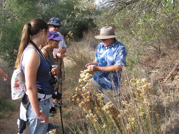
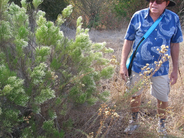
Our guide, naturalist Mike Kelly, longtime member of the Friends of Los Peñasquitos Canyon Preserve, has been an advocate working to safeguard this beautiful and historic San Diego canyon for over three decades. He’s a friendly fellow whose knowledge of the canyon’s flora, fauna and fascinating history made for an extremely enjoyable hike.
Years ago, Mike and others fought to save Los Peñasquitos Canyon from development. Their efforts resulted in about half of the canyon being protected. Fortunately, the preserve is connected to other similar natural areas in San Diego through various corridors, allowing wildlife to move about and thrive. Owls, woodpeckers, hawks, raccoons, bobcats, coyotes, mule deer, even an occasional mountain lion make the canyon their home. Native trees, chaparral, grass and spring flowers are abundant and the source of endless enjoyment.
I learned there are also wildlife tracking hikes, plus night walks, when deer are frequently seen. There are also free guided tours of San Diego’s second oldest residence, which stands near the east end of the preserve, the Rancho Santa Maria de Los Peñasquitos adobe. To learn about all these wonderful adventures, which are ideal for families, click here.
To learn more about the Friends of Los Peñasquitos Canyon Preserve, click here! Perhaps you’d like to become a member!
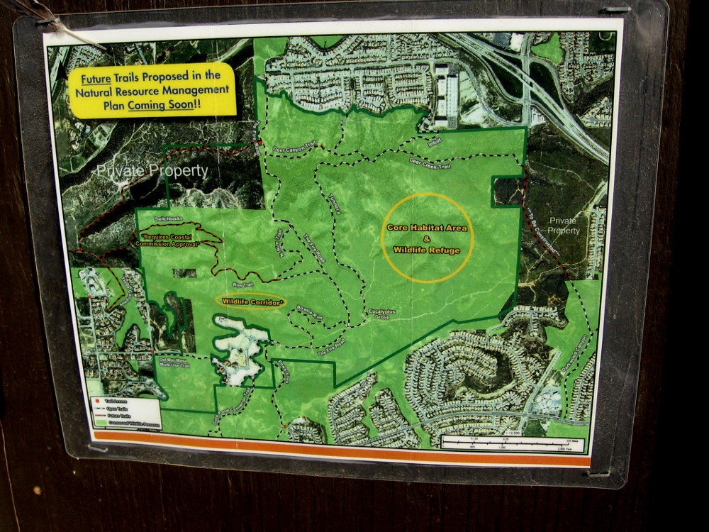
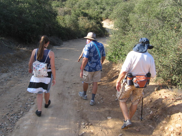
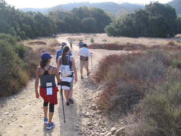
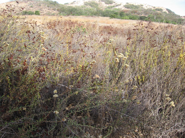
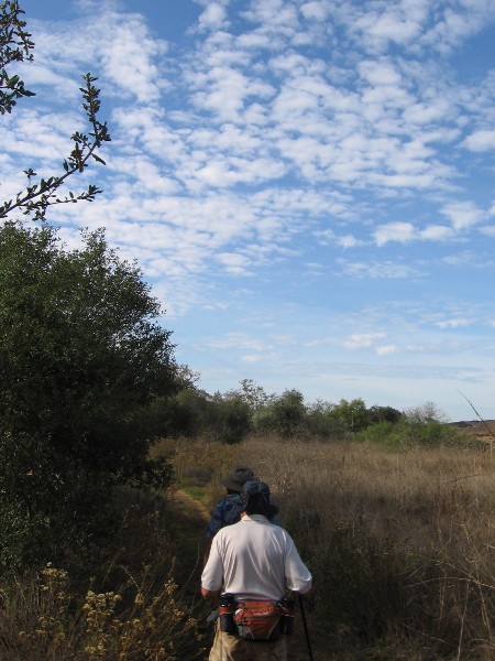
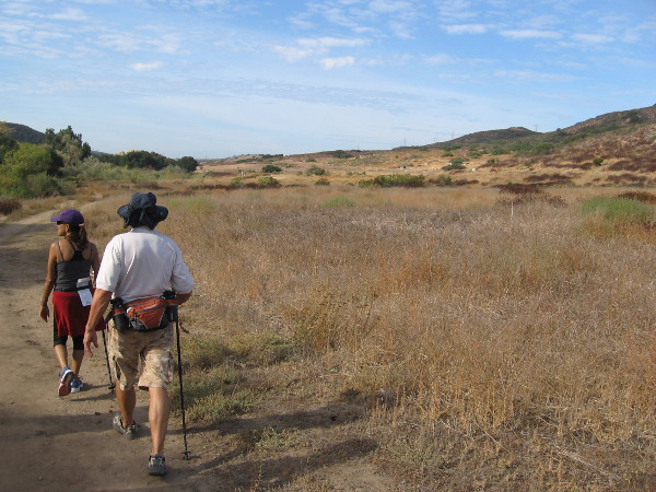
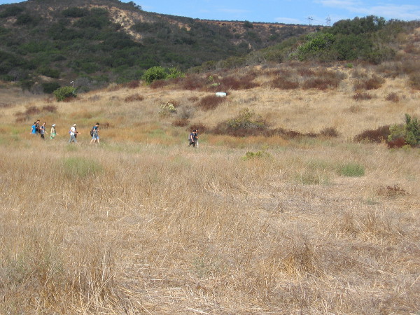
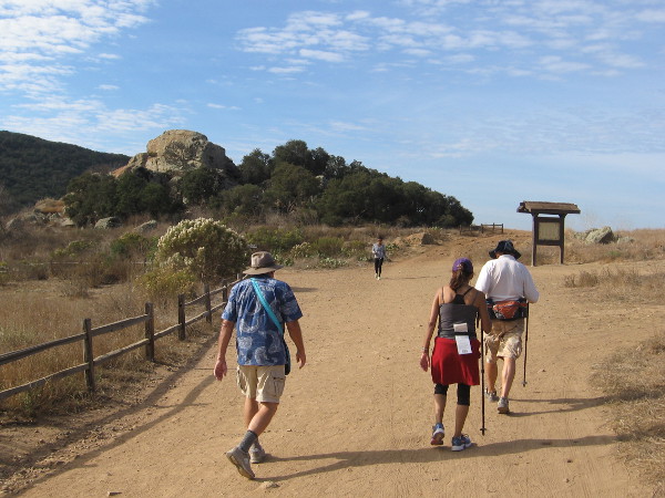
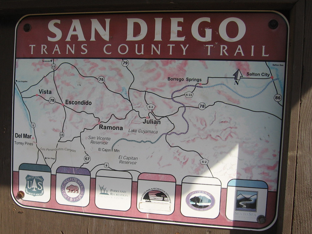
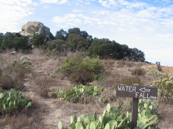
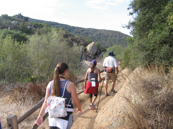
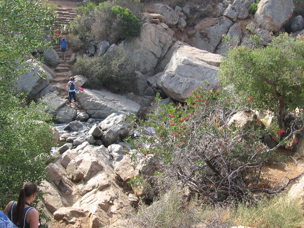
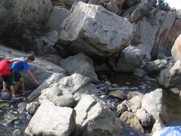
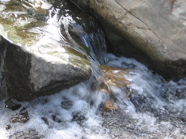
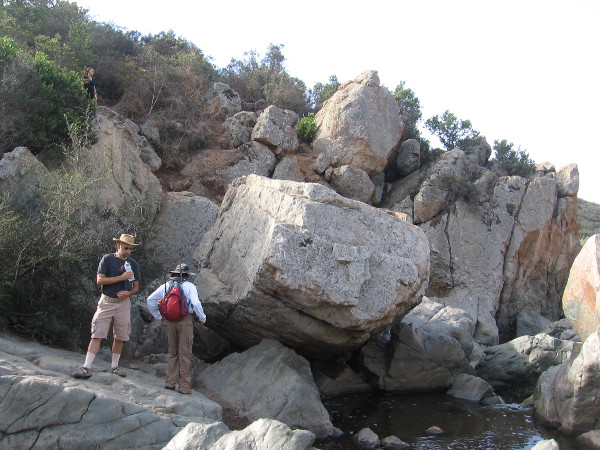
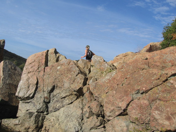
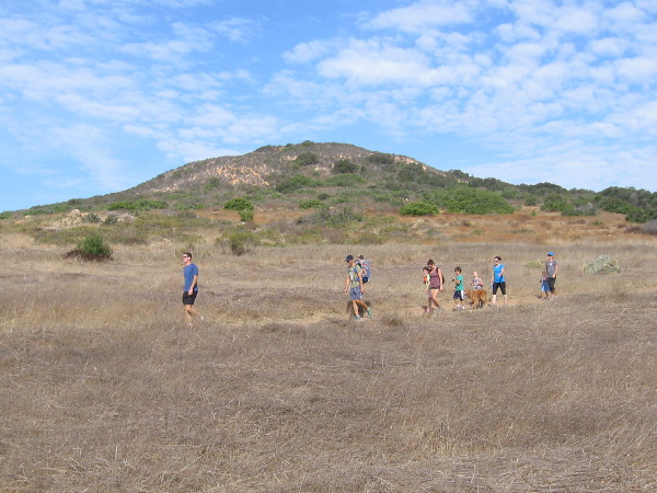
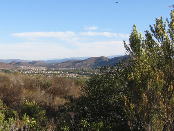
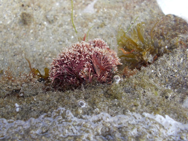
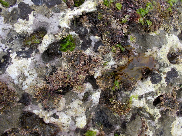
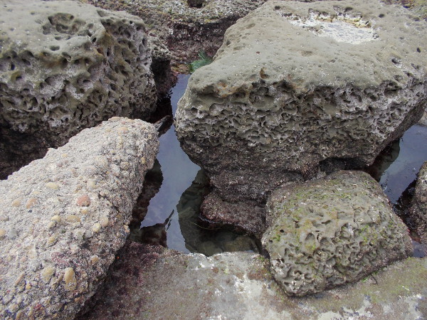
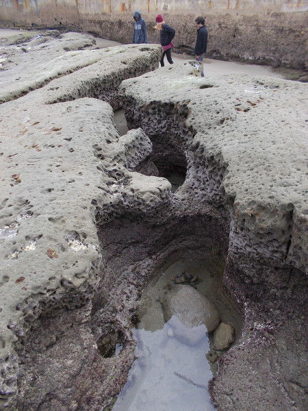
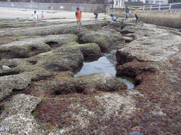
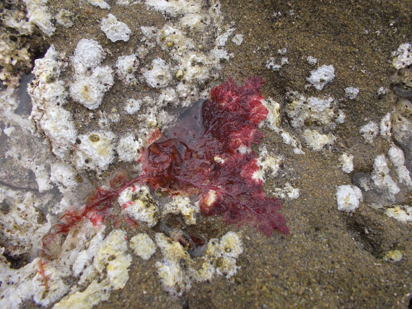
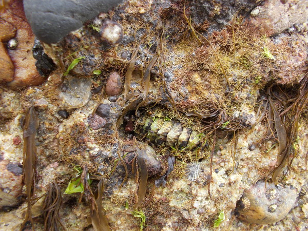
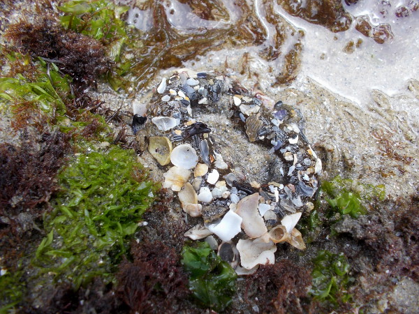
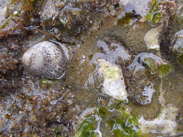
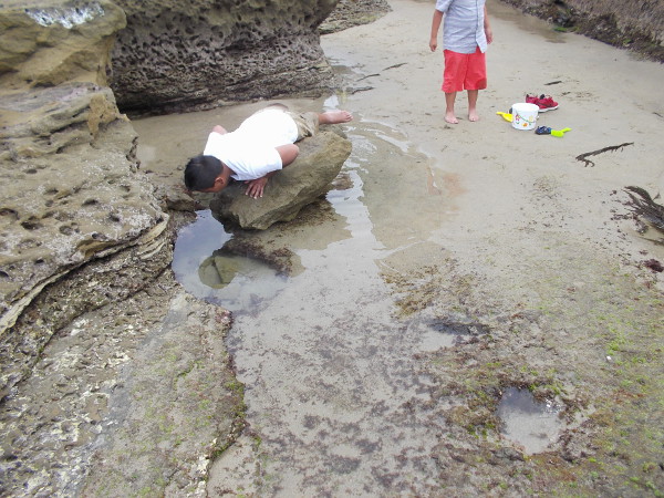
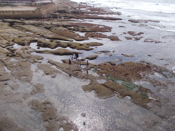
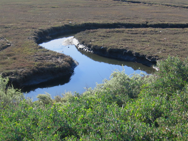
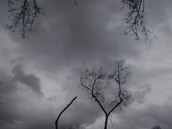
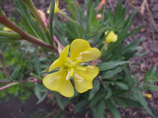
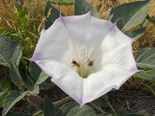
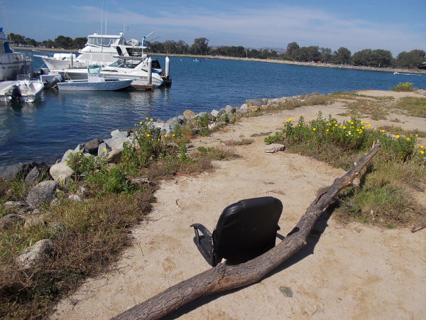
The Del Mar Mesa trailhead is located near suburban homes at the north edge of Los Peñasquitos Canyon.A sign posted at the trailhead shows future trails proposed in the Natural Resources Management Plan.Our small group of hikers heads down into the canyon through Coastal Sage Scrub habitat. We are passing California scrub oaks.We headed to Carson’s Crossing before checking out the popular waterfall.Approaching the central part of the long, narrow canyon, which runs from Poway west to Del Mar and the Pacific Ocean. Peñasquitos Creek lies beyond those coast live oaks in the distance.Carson’s Crossing is an historically important spot in Peñasquitos Canyon. Kit Carson crossed the creek here during the Mexican-American War. General Kearny’s US Army of the West was faced with formidable Californio lancers in San Pasqual, and the legendary frontiersman Kit Carson snuck away in the middle of the night to summon reinforcements from San Diego. He knew to come this way. The later 1857 Jackass Mail stagecoach line also ran through the canyon here enroute to San Diego.Heading west through the beautiful canyon in the shade of oaks, sycamores and willows. It’s an easy, pleasant hike.Looking north across a field in Los Peñasquitos Canyon Preserve in late October. Summers are very dry. Many leaves and flowers are now brown, awaiting winter rains.Walking slowly, senses alert. I smell the nearby sagebrush. I hear acorn woodpeckers and quail. I see beautiful clouds.Mike Kelly is a guide and activist whose knowledge of Peñasquitos is deep. Here he shows us some poison oak which is growing a short distance off the trail.A peaceful walk through nature. Over several decades, activists like Mike have worked hard to preserve the canyon and protect it from development. Today it is maintained by volunteers and both the City and County of San Diego.Mike Kelly shows us some California broom. Native American Kumeyaay and pioneers used the plant like a broom for sweeping.Los Peñasquitos Canyon Preserve is a very popular place for jogging, hiking and mountain biking. Even marathoners use it for training.Now we’re approaching a trail sign and a large rock outcropping, which I learned is volcanic.Sign shows proposed San Diego Trans County Trail, which when completed would run from the Pacific Ocean over the mountains east of San Diego and out to the Salton Sea in the desert.I see lots of prickly pear cacti. Now we are getting close to the popular waterfall!Approaching the Peñasquitos Creek waterfall from the east.Descending rough stone steps to the waterfall. I learned the steps were a project of an Eagle Boy Scout.The small waterfall and its rocky pools are located near the center of Los Peñasquitos Canyon. It is the destination of many hikes. A great place to relax, cool off, and listen to the soothing water.Water spills over rocks. It isn’t Niagara Falls, but it’s wonderful nonetheless.Hikers pause above a pool of water which is captured by large blocks of volcanic rock. When the creek crests, it can rise many feet and submerge this area.A hiker up above seems to walk in the sky.Families wander down a pleasant trail in Los Peñasquitos Canyon Preserve. There is much here to see and appreciate. So much to learn.Naturalist Mike Kelly shows us a poisonous flower of Datura. In nature, beauty and danger are often found together. One should be thoughtful when hiking, and be careful to wear sturdy footwear and bring water. We didn’t see any rattlesnakes or mountain lions!
…
This blog now features thousands of photos around San Diego! Are you curious? There’s lots of cool stuff to check out!
Here’s the Cool San Diego Sights main page, where you can read the most current blog posts. If you’re using a small mobile device, click those three parallel lines up at the top–that opens up my website’s sidebar, where you’ll see the most popular posts, a search box, and more!
To enjoy future posts, you can also “like” Cool San Diego Sights on Facebook or follow me on Twitter.
Wheelchairs are welcome on the beautiful Jas Arnold Trail For All People in Black Mountain Open Space Park.
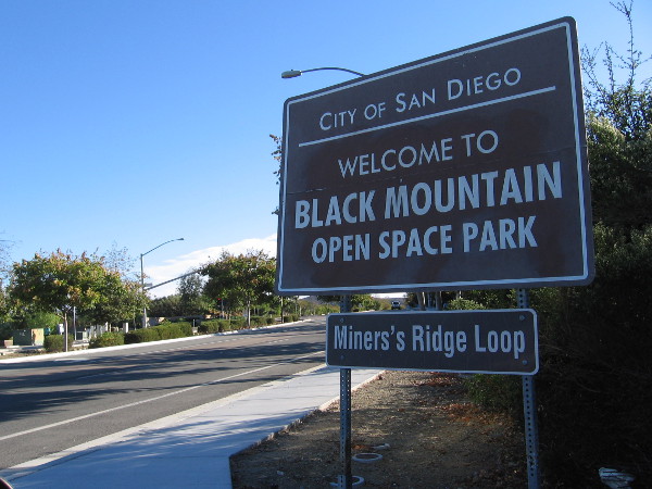
A hiking trail that welcomes wheelchairs recently opened in San Diego’s North County. It’s called the Jas Arnold Trail For All People, and it’s located in the Black Mountain Open Space Park.
This morning I walked the short loop for the first time.
What a wonderful place. Peaceful, a bit meandering, easily accessible, with pleasant views into the sunlit distance, fresh air, the scent of sage, the sound of birds–it’s a fine place that one can explore at a easy pace and just relax–a place to feel energized, spiritually whole and free.
Here are some photographs. To read the signs, click the images and they will enlarge. This morning I spotted a shy rabbit, a curious scrub jay and a cheerful young mockingbird. And a bunch of small flitting birds that I couldn’t identify.
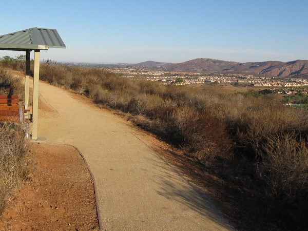
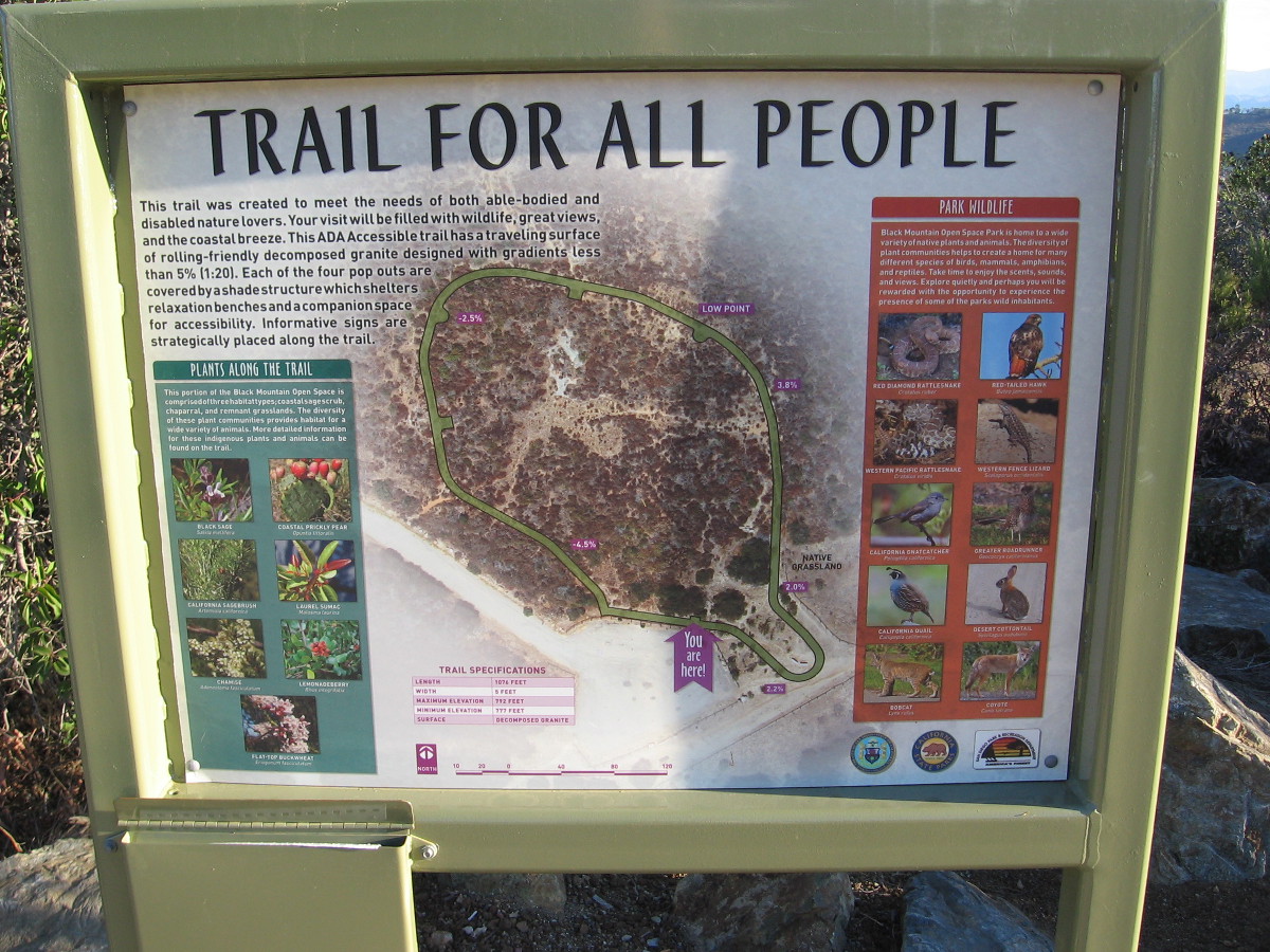
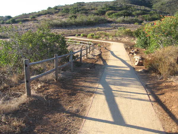
The Trail For All People is a 1076 feet long, nearly level loop. The elevation runs between 777 and 792 feet. The five foot wide hiking trail’s decomposed granite surface is very easily navigated on wheels or by foot. Those in a wheelchair who love nature and the outdoors should definitely check it out!
To reach the Trail For All People’s trailhead, drive up Carmel Valley Road and watch for the Black Mountain Open Space Park sign that mentions Miner’s Ridge Loop. You’ll spot it just south of the Valle Del Sur Court traffic light. Turn in to the narrow entrance and head up a slightly rough and winding paved road for about a half mile until you reach the trailhead parking lot. Once parked, it’s easy to spot the Trail For All People. (You might also see trailheads for the Miner’s Ridge Loop and Lilac Canyon Trail.)
On warm days, make sure to bring water! Enjoy!
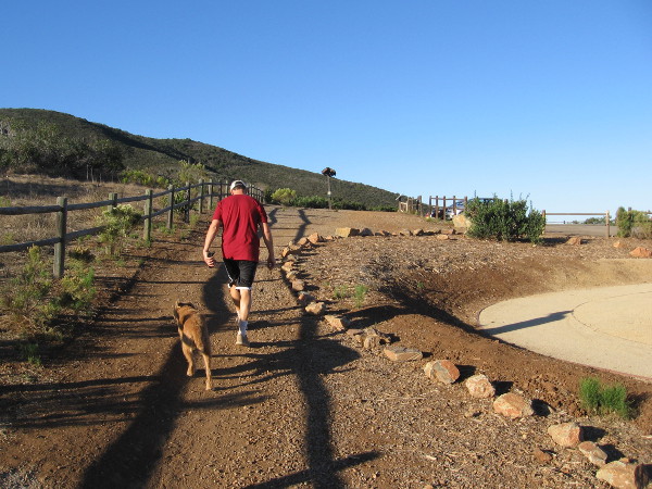
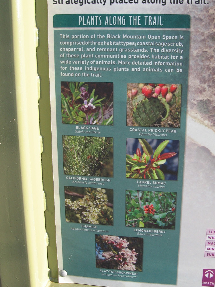
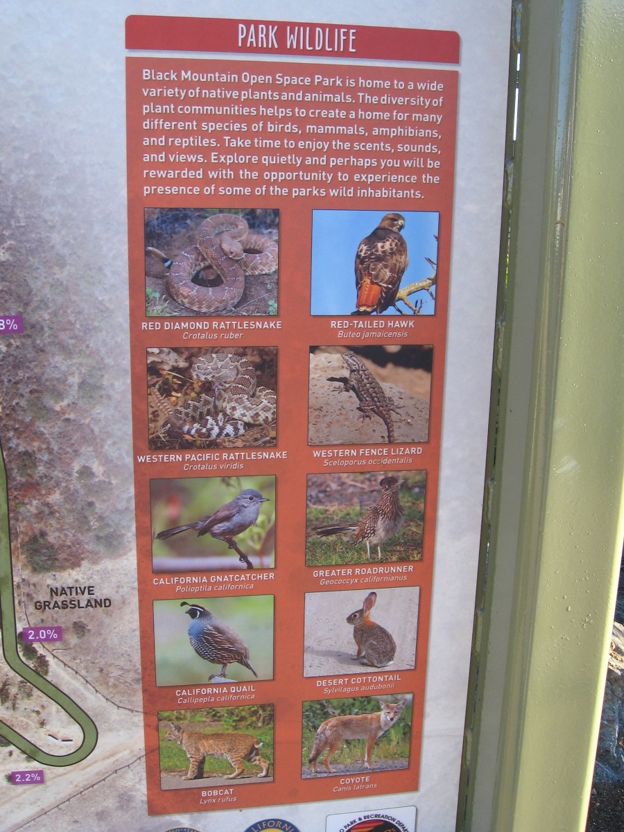
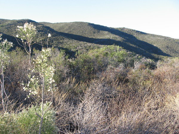
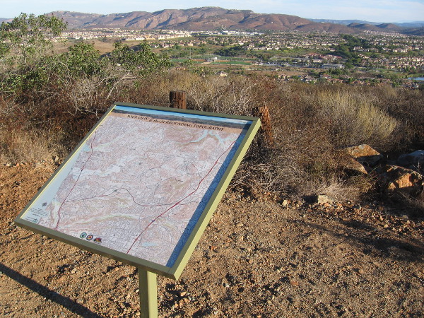
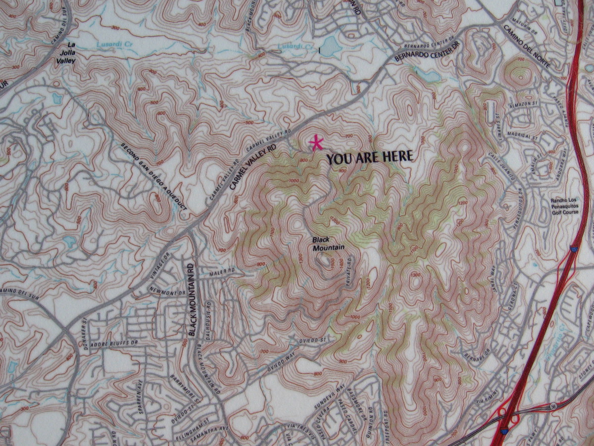
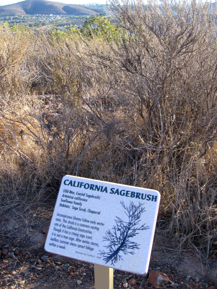
To find the trailhead for the Trail For All People, turn off of Carmel Valley Road at this sign, just south of the traffic light at Valle Del Sur Court.Early morning walker with dog on the Miner’s Ridge Loop Trail, across a parking lot from the Trail For All People.The Jas Arnold Trail For All People is an ADA Accessible loop composed of wheelchair-friendly decomposed granite. Four small shelters provide shade for those enjoying the views.Native plants along the trail include Black Sage, Coastal Prickly Pear, California Sagebrush, Laurel Sumac, Chamise, Lemonadeberry and Flat-top Buckwheat.Animals one might spot along the trail include rattlesnakes, Red-tailed Hawks, California Quail, Greater Roadrunners, Desert Cottontails, Bobcats and Coyotes.Here I’m hiking down the easy Jas Arnold Trail For All People on Black Mountain early one Saturday morning. The sun had just risen and very few people were about.One of the benches and shelters along the Trail For All People. Views to the north include mountains and nearby 4S Ranch.Looking southeast toward the chaparral-covered slopes of Black Mountain in north San Diego County.A topographical map shows the position of the Trail For All People in relation to its surroundings.The Jas Arnold Trail For All People was built on a small plateau in the Black Mountain Ranch Open Space Park.Another sign along the trail provides detailed information about some of the wildlife one might see.Another section of the relatively level Trail For All People. The easy loop is ideal for the mobility challenged and families with very small children. On warm days, bring water!One of many fascinating signs along the trail. The smell of sage adds a pleasant element to one’s invigorating journey through fresh open air.A pleasant view from the Jas Arnold Trail For All People on Black Mountain.The natural beauty, open spaces and sunlight make one feel happy and alive.
…
I live in downtown San Diego and love to walk! You can follow Cool San Diego Sights via Facebook or Twitter!
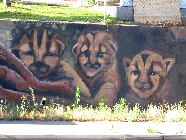
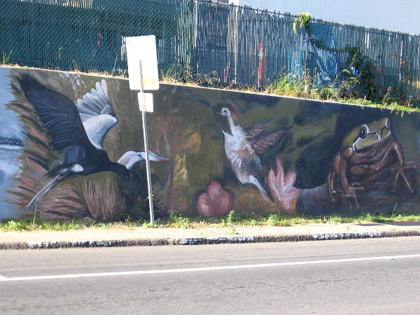
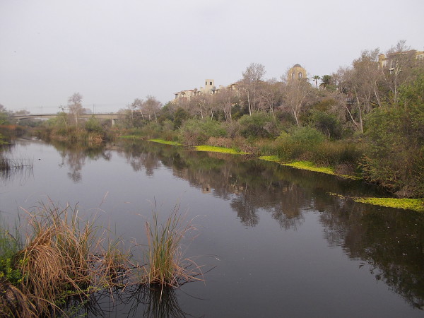
Faces peer from a wall near the San Diego River. The very long mural, titled River Life, contains images of wildlife one might find here–or have found here before urban development.
I love this mural in Mission Valley. I remember driving through the intersection at Qualcomm Way and Camino de la Reina years ago, and seeing a whole bunch of people painting wild river animals along the ugly low wall. A little research today tells me that memory was from late 2009.
“River Life” was completed by almost 200 volunteers over four days. The design came from artist Lori Escalera. It’s one of of six murals (so far) that the San Diego River Park Foundation has helped to create. I’ve featured others on my blog. Here are some links if you want to check out more of the beautiful San Diego River murals…
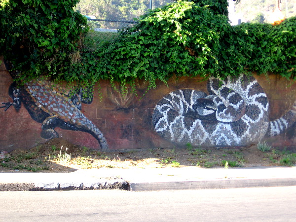
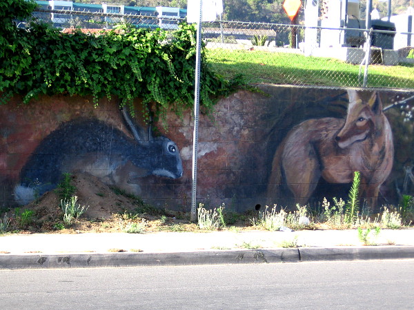
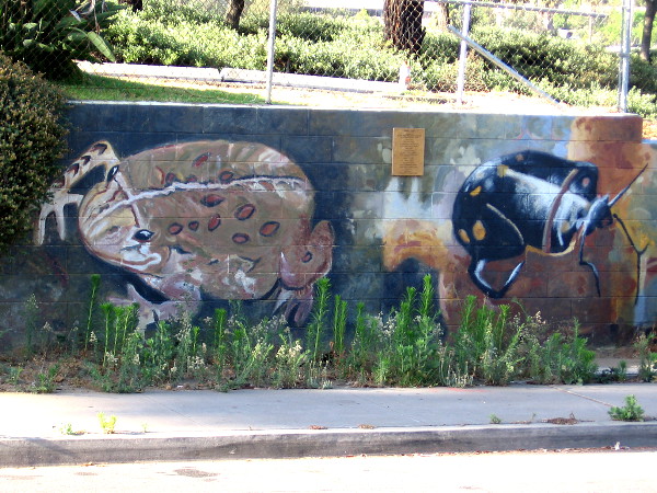
The left end of a long, colorful mural in Mission Valley. Birds of the air and water are featured here. The art was designed by Lori Escalera in 2009.A heron, hummingbird and frog. Down by the beautiful River Trail, just north of where we stand, many different birds can be spotted on the quiet surface of the San Diego River, and in thick reeds and overhanging tree branches.A butterfly, a fox (peeking from behind a transformer box on Camino de la Reina) and a raccoon.Some sort of lizard–perhaps a Gila monster–is half hidden by leaves, while a rattlesnake coils nearby!A jackrabbit and wild coyote.A skunk and perhaps kitten bobcats.I recognize a squirrel, but I’m not sure about the other animal whose eyes seem to be glowing in the dark.I believe that’s a Red-winged Blackbird and a moth.Looks to me like a toad and a beetle. If you can accurately identify these creatures, feel free to leave a quick comment!That looks to me like a turtle–or a tortoise! It’s obvious this blogger still has a whole lot to learn!
…
I live in downtown San Diego and love to walk! You can follow Cool San Diego Sights via Facebook or Twitter!
You can easily explore Cool San Diego Sights by using the search box on my blog’s sidebar. Or click a tag! There are thousands upon thousands of fun photos for you to enjoy!
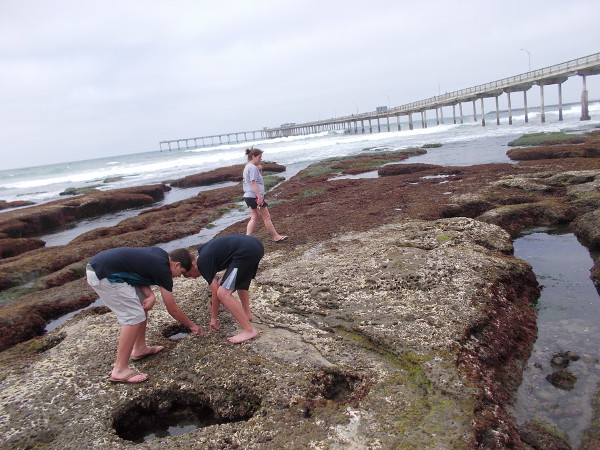
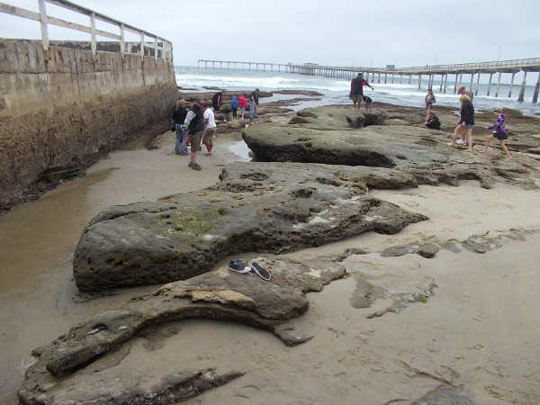
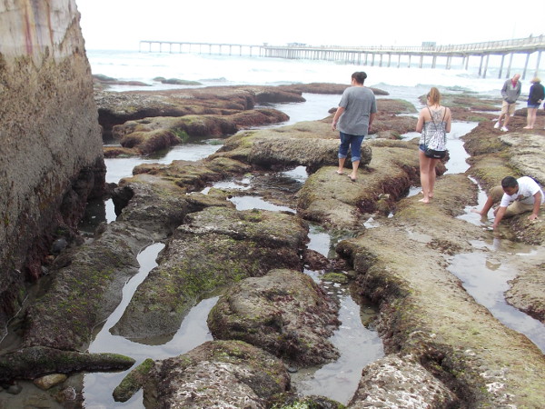
Carefree kids jump while exploring the tide pools just south of the Ocean Beach Pier.
On Sunday I headed to Ocean Beach, for no particular reason. I like to walk out on the pier.
My visit happened to coincide with low tide, so I took advantage of an opportunity to explore the tide pools near the base of the pier. What did I see? Amazing life. Amazing beauty.
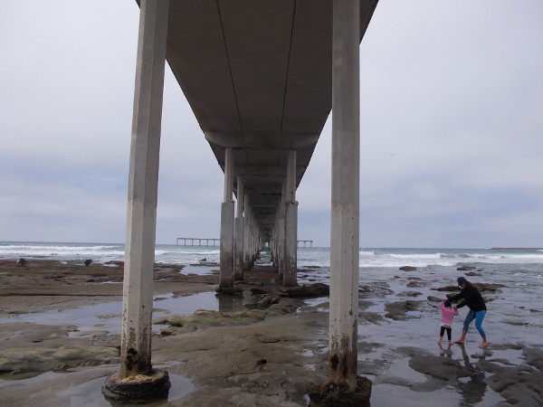
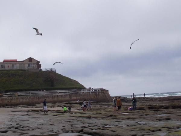
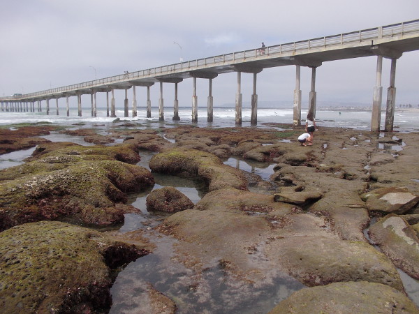
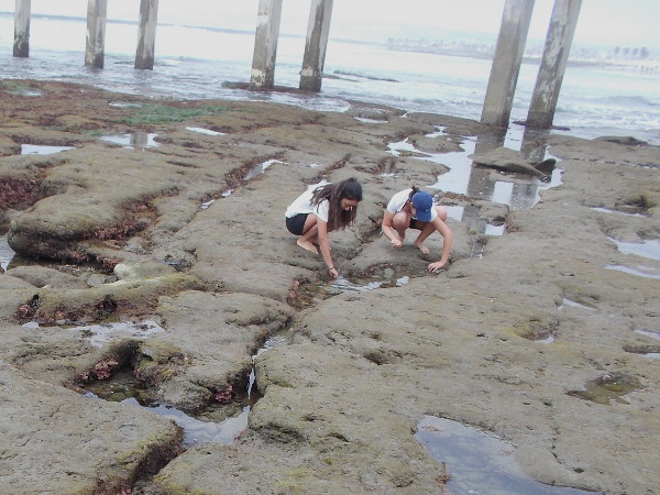
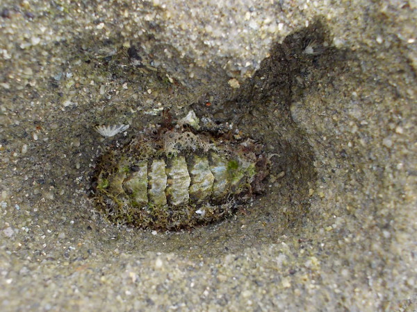
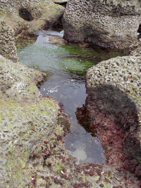
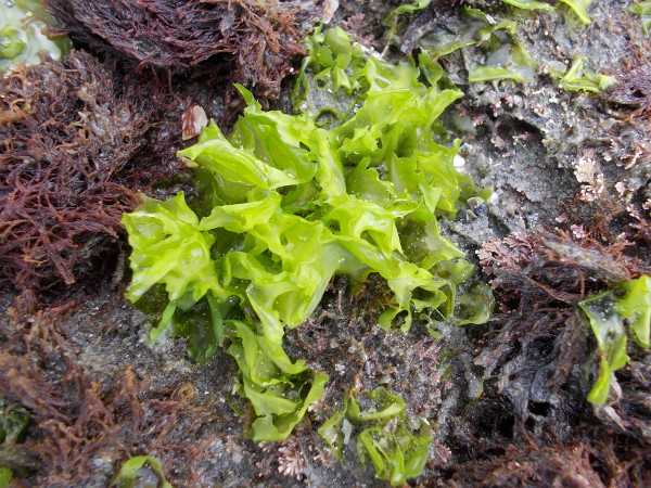
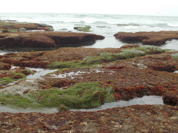
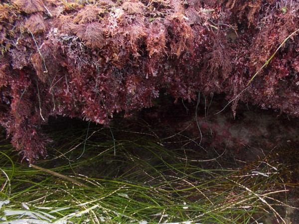
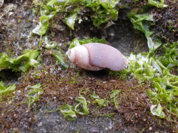
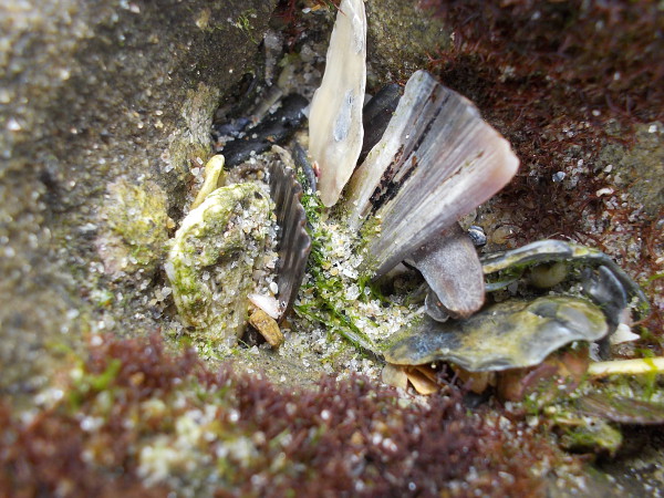
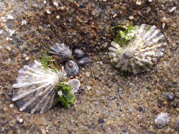
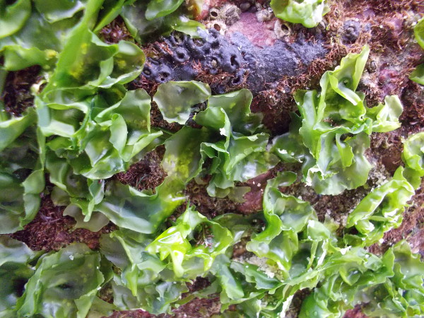
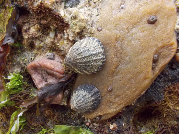
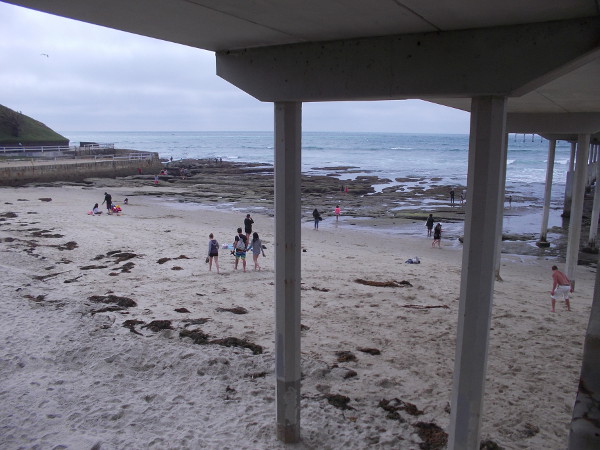
North of the Ocean Beach Pier there is a beautiful, very popular beach. Some rocks are exposed at low tide.Under the Ocean Beach Municipal Pier, which is the second longest pier on the West Coast.Seagulls circle above people who are searching for natural wonders in the intertidal zone.A view of the Ocean Beach Pier and nearby tide pools. An easily accessible place to explore the seashore and make small discoveries.People explore fascinating tide pools near the foot of the OB pier during low tide. The rocks can be very slippery.At low tide, the exposed sandstone rocks south of the pier contain many depressions, the home of algae and small sea creatures.There are many interesting photo opportunities at the tide pools. Down on hands and knees, you’re going to get a little slimy and wet!A complex, natural mosaic in the rock.Hidden channels and eroded surfaces in the irregular, pitted sandstone.Kids stand near the sea wall at the end of one water-sculpted, crevice-like channel.I believe this little guy is a troglodyte chiton. Thousands can be seen in their own tiny sandstone burrows in the intertidal rocks. They can live 20 years in the same spot!Lots of amazing discoveries to be made!One can see pink encrusting coralline algae and surfgrass in this saltwater-filled channel.I can see why this is called sea lettuce! It’s actually a type of green algae.Another view of the tide pools immediately south of the OB pier.Bright green surfgrass, reddish algae and blue ripples of incoming ocean surf make a strangely beautiful photograph.More pink coralline algae and surfgrass at the OB tidepools.A small empty shell among some sea lettuce.An unusual photo at the tide pools. Nature is an infinitely prolific artist.A cool photo composed of accumulated shell pieces.Limpets large and small on one rock form a beautiful pattern.Adventures in progress.Tiny miracles of nature in the soft sandstone.A sample of the surprising beauty you might encounter at these tide pools.A periwinkle, or sea snail.More beautifully patterned limpets, and I think I might see a few barnacles.Right up next to the sea wall. The tide pools continue a good distance to the south.A sea anemone covered with shell fragments, among sand and algae in one tide pool.An aggragating anemone, safely closed up at low tide so that it doesn’t dry out. Many small stones and shell bits have collected upon it.Another watery scene in a life-filled Ocean Beach tide pool.There’s a lot of exploring to do!Looking under the OB pier as I climb up its stairs for an overhead view of the tide pools.Looking down from atop Ocean Beach Pier at the nearby tide pools. People out on the rocks search for wonders in the intertidal zone.
…
I live in San Diego and love to walk all over the place! You can follow Cool San Diego Sights via Facebook or Twitter!
Do you like to read short pieces of thought-provoking fiction? You might enjoy checking out Short Stories by Richard.
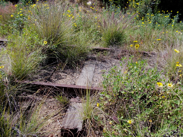
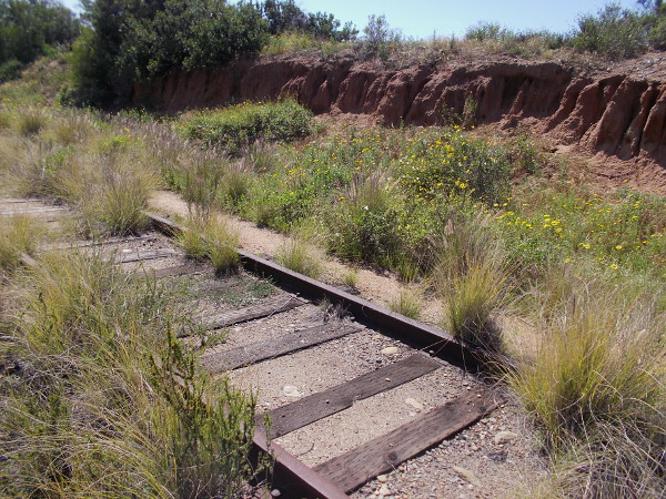
Rusty old train tracks are overgrown with wild vegetation, including many California bush sunflowers.
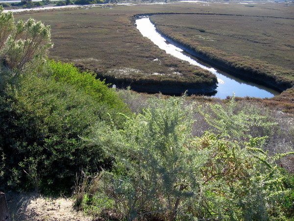
I made a cool discovery the other day. A little-known hiking path in San Diego’s South Bay provides a view of a beautiful natural wetland.
According to signs that I saw, the small estuary between Bay Marina Drive, Marina Way, Interstate 5 and the Sweetwater River is a protected wildlife refuge. I believe, after looking at Google Maps, that the water flows from Paradise Creek. But I’m not certain. Perhaps someone reading this knows.
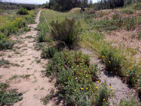
Long-unused train tracks that are partially concealed by vegetation run along the edge of the wetland, and so does a narrow footpath. I didn’t see any signs naming the trail, or any that prohibited a short hike. So I walked down it a bit, enjoying the fresh air and peaceful surroundings.
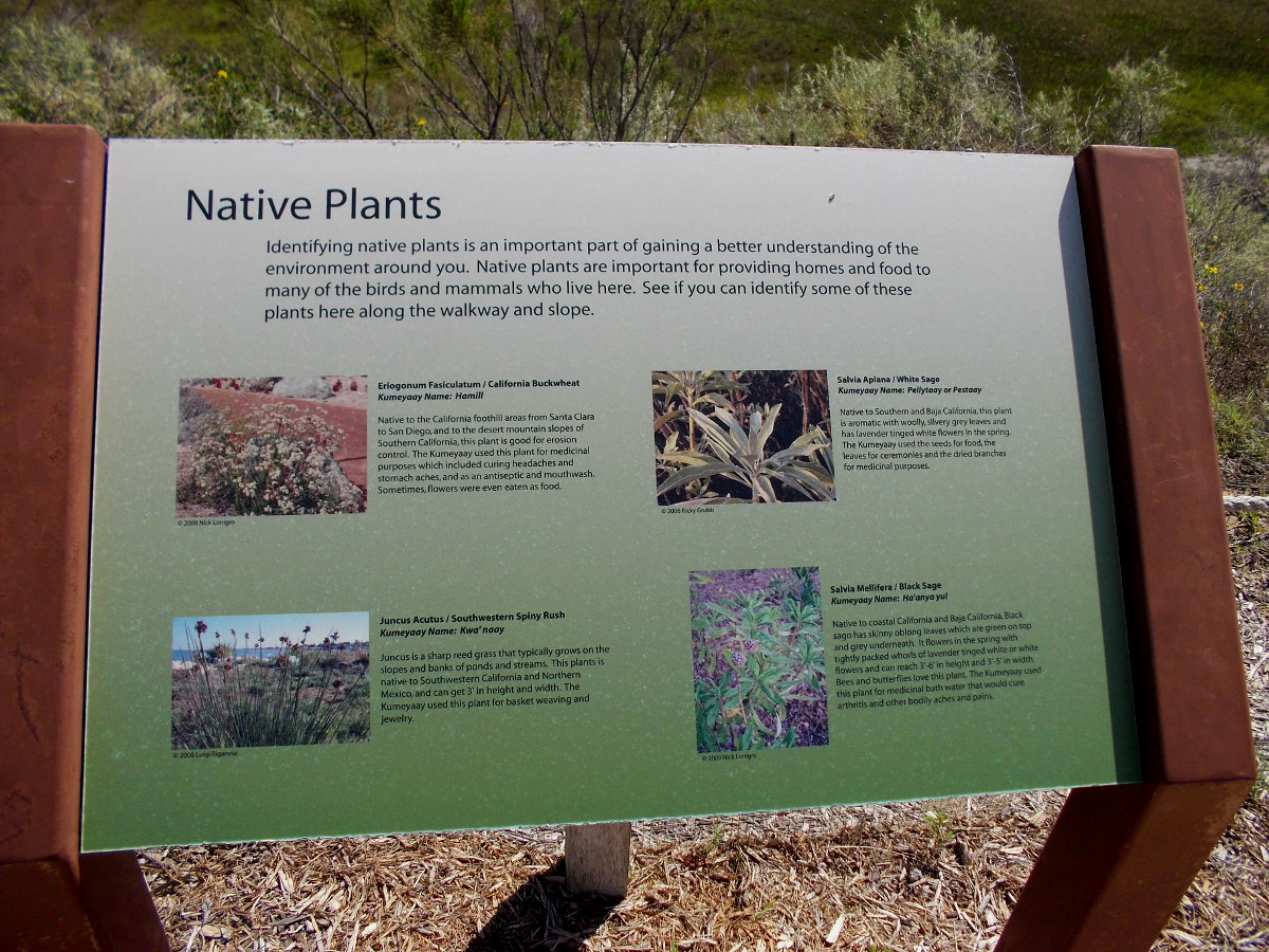
Information sign near edge of estuary identifies native plants. California Buckwheat, White Sage, Southwestern Spiny Rush, and Black Sage.View of National City wetland from observation area south of the Best Western Marina Gateway hotel parking lot.Beginning down the footpath on a sunny weekend day.Some eroded sandstone adds beauty to the scene.Prickly pear and chaparral yucca above a green estuary.Beyond the sign lies a fragile wetland where native plants and animals are protected. I saw some birds out in the wildlife refuge.I turned about after a short hike and headed on back to the hotel parking lot.
UPDATE!
On a later visit I discovered additional signs beside the hotel parking lot. They contain more interesting information.
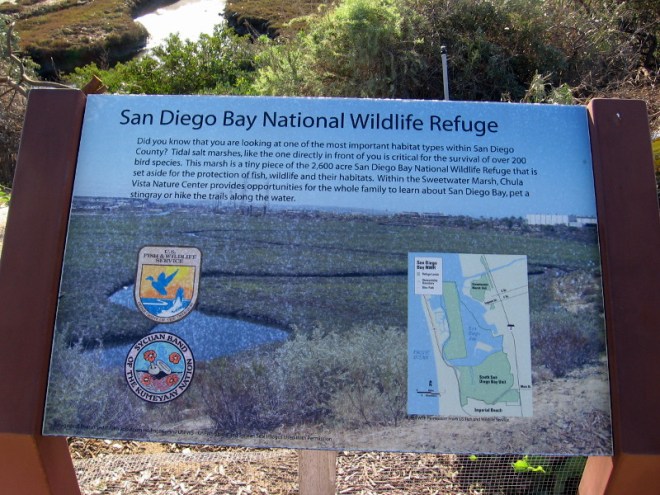
I learned this wetland is called Paradise Marsh. It’s an environmentally important tidal salt marsh that’s part of the much larger San Diego Bay National Wildlife Refuge.
Water reflects bright sunlight in National City’s Paradise Marsh.Paradise Marsh is a small part of the 2600 acre San Diego Bay National Wildlife RefugeThe birds of Paradise Marsh include the Willet, Mallard, American Avocet and the Great Blue Heron.For hundreds of years, Native American tribes such as the Kumeyaay, Iapi or Tipai made their homes around the estuaries of San Diego Bay.A beautiful tidal salt marsh wetland can be viewed in National City.
…
I live in downtown San Diego and love to walk! You can follow Cool San Diego Sights via Facebook or Twitter!
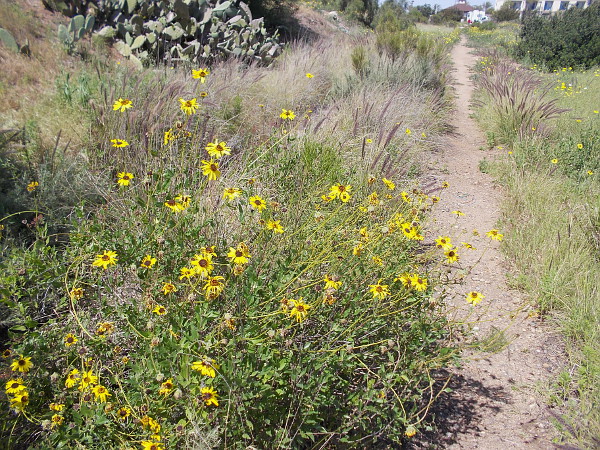
Bright yellow California sunflowers. San Diego has more botanical diversity than any other county in the continental United States.
The San Diego River has always been a source of life. Ancient people flourished on its banks. It’s where European civilization began in California. That civilization today has grown to include freeways, shopping malls, industrial parks and immense residential complexes. Like a gleaming thread of silver, the river flows through it all, eternally, west to the Pacific Ocean.
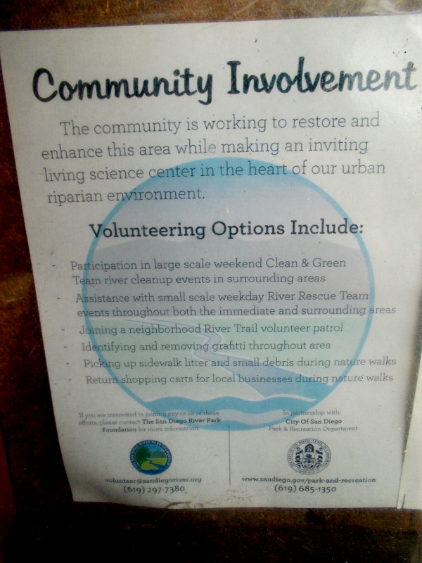
The health of this once-pristine river, crowded in many areas by human development, is threatened in challenging ways. Pollutants found in storm runoff, windblown litter, piles of garbage and human waste from homeless encampments, encroachment by non-native vegetation… These problems and others require the thoughtful involvement of the local community. Volunteers monitor the river; some help to pick up trash or report graffiti. Active, concerned residents attend special meetings to discuss improvements or make critical decisions.
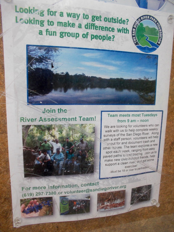
Would you like to become involved? Click here, or check out my two photos of posters that include contact information.
Our careful stewardship of the San Diego River will ensure the survival of an important riparian ecosystem, and will allow future generations to walk down trails of spirit-nourishing beauty.
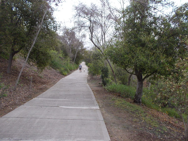
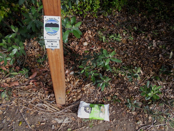
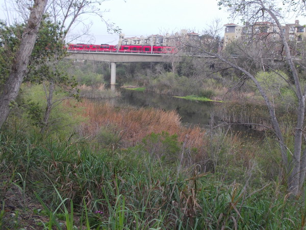
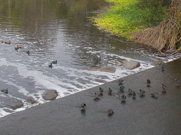
Gazing west along the San Diego River from Qualcomm Way.Bicycle and pedestrian paths follow the San Diego River through Mission Valley.Litter carelessly dropped near a mile marker for The San Diego River Trail. It was picked up.The community is working to restore and enhance this area while making an inviting living science center in the heart of our urban riparian environment. (Click image to enlarge.)Make a difference with a fun group of people. Join the River Assessment Team! Help support a clean river and get some exercise! (Click image to enlarge.)A red San Diego Trolley passes over the life-filled river as it approaches the Rio Vista station.A gathering of American coots (or mud hens) where the San Diego River passes beneath Camino del Este.Dark clouds and barren Fremont Cottonwoods minutes before a winter storm brings brief torrential rain.Beautiful flowers can be seen at almost any time of year during a nature walk along The San Diego River Trail.A couple of busy bees collect pollen in the morning.
…
I live in downtown San Diego and love to walk! You can follow Cool San Diego Sights via Facebook or Twitter!
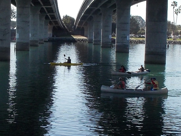
Many canoes and kayaks were passing under the Ingraham Street Bridge between South Cove and Perez Cove, not far from SeaWorld.
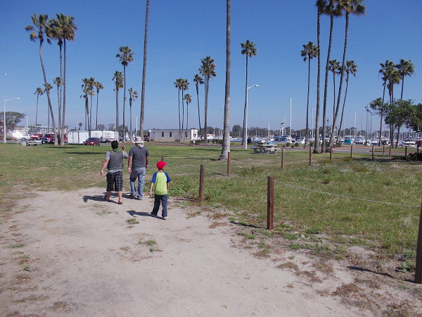
My long walk yesterday around Mission Bay yielded lots of photos. I started at Vacation Isle, then headed slowly and somewhat aimlessly to the jetty at the end of Hospitality Point. It was a journey through a tranquil San Diego paradise, on a warm winter day.
My photos feature relatively few people. But I can assure you thousands of folks were out enjoying the sunshine. They were fishing, boating, picnicking, reading, walking, playing sports on the grass… Mission Bay is a really big place.
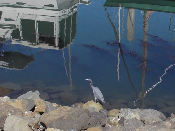
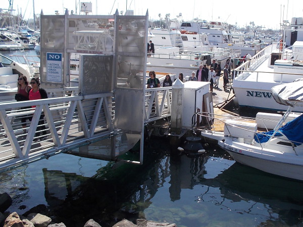
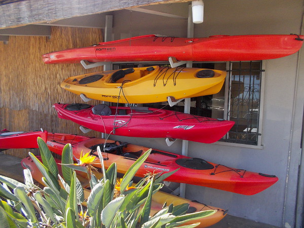
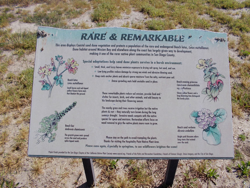
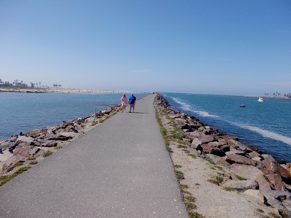
Radio control model sailboats cross the Model Boat Pond on Vacation Isle.These fire pits just north of Dana Landing have wood stacked ready for Saturday night.A casual seat on the dirt with great views.A heron on rocks, and reflections of boats at Dana Landing.Gazing from the West Mission Bay Drive Bridge down descending stairs toward Sunset Point.People return from an excursion out on the Pacific Ocean. The dock at Seaforth Sportfishing is always busy.Visitors walk through Marina Village on Mission Bay.A map by Quivira Basin shows areas off the coast that are protected. Conserving California’s Coastal Treasure.Kicking back with a best friend among boats on the blue water. In the distance you can see the Hyatt Regency Mission Bay Spa and Marina.Colorful kayaks await at Aqua Adventures.This tropical party shack seems long abandoned. It stands near an entrance to Mission Bay Marina.A dirt nature trail along the channel that connects the ocean and Mission Bay.Rare and Remarkable. This area displays Coastal sand dune vegetation. The native Beach lotus is endangered.Walking along the jetty west of Hospitality Point. This narrow strip of land separates the San Diego River, to the left, from the man-made channel into Mission Bay. One can see a sliver of Ocean Beach, on the left, and Mission Beach, on the right.A fisherman on land, and two on the water. Across the Entrance Channel lies very popular South Mission Beach.Bicycling along. Heading toward the end of the long jetty. It’s a beautiful day. One can see forever.
…
I wrote another short story! I penned it yesterday, during my walk along the bay.
It’s a bittersweet, philosophical, tiny piece of fiction. The sort of thing I like to write. There’s some sadness in the sunshine. The title is Light on the Restless and Small.
Native American Kumeyaay from the San Diego area work near the foot of an ewaa, a dome-shaped hut made of sycamore and oak tree branches.
Over two years ago, when Cool San Diego Sights was relatively new, I blogged about some amazing public art near the Santa Fe Depot in downtown San Diego. I provided just a brief glimpse, really.
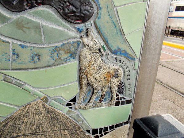
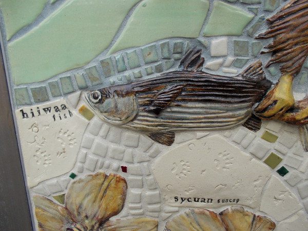
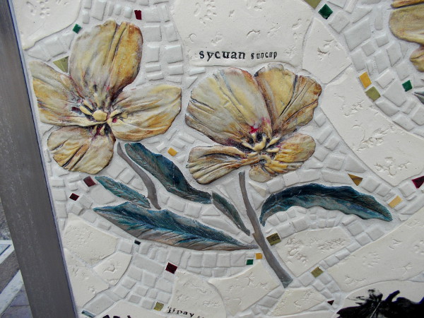
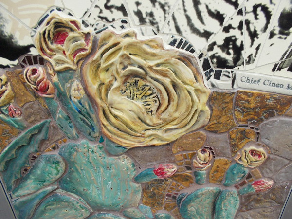
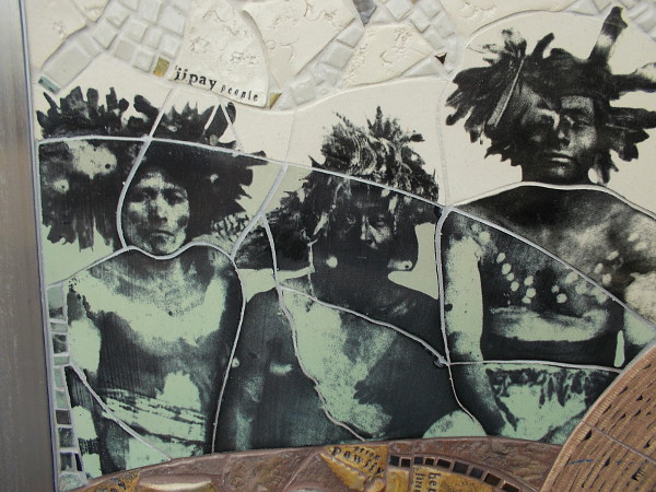
The artwork, titled The Tracks We Leave Behind, created by Betsy K. Schulz in 2008, is so utterly fantastic, so absorbing, I’ve decided to blog about it once again. Whenever I walk past (which is often), I like to pause an extra few seconds beside my favorite column, which features gorgeous mosaics that depict wild nature and the Native American Kumeyaay people, who have lived around San Diego for about 12,000 years.
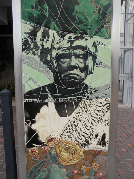
Living in this place we set fires to open the land and make the seeds grow. We fish all year, both near shore and deep. We walk to the canyons and the mountains–hunting, gathering food and trading . . .Public art titled The Tracks We Leave Behind, by Betsy K. Schulz, 2008, includes the image of a Kumeyaay hattepaa (coyote) howling.Beautiful handmade mosaic tiles form a Kumeyaay ispa (eagle) in flight.The bald eagle has captured a Kumeyaay hiiwaa (fish).Yellow Sycuan Suncups grace this gorgeous, detailed public artwork in downtown San Diego.The yellow bloom of a prickly pear. This sculpted tile mosaic is so phenomenal, you almost can’t remove your eyes from it!The native Kumeyaay people (also called Kumiai, Ipai-Iipay, Tipai-Tipay, Diegueño, Kamia) have lived in the San Diego region for around 12,000 years.Public art in San Diego depicts Cinon Duro Mataweer, spiritual leader (kuseyaay or tribal shaman) of the Ipai (formerly northern Diegueño) Native American Indian tribe.
…
Join me for many more Cool San Diego Sights on Facebook and Twitter!
It’s hard to believe, but this photo blog of San Diego now contains over 800 posts, and features a vast universe of wonderful art–not to mention other random cool stuff! Click some links that look interesting if you’d like to explore! Have fun!
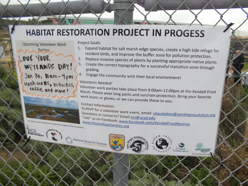
Volunteers needed! Volunteer work parties take place from 9am-12pm at the Kendall-Frost Marsh. Please wear long pants and sun or rain protection. Bring your favorite work boots or gloves, or we can provide these to you.
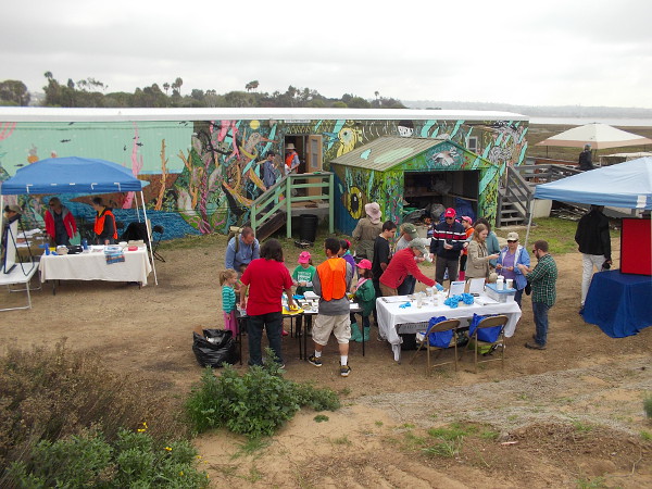
Yesterday I was privileged to watch citizens in San Diego teaming up to improve our environment. During the Love Your Wetlands Day event, a group of concerned people gathered together to help clean and restore the beautiful Kendall-Frost Marsh in Mission Bay.
Do you live in San Diego? Do you enjoy nature and being outdoors? Do you love seeing and protecting wildlife and birds? Do you have a bit of free time? Would you like to personally make a very big difference in this world?
Volunteers are needed to help restore San Diego wetlands! Spread the word! Find out more by contacting the San Diego Audubon Society from this page of their website! Or check out more info by clicking the above photo.
Volunteers help to restore wetlands in Mission Bay. Do you live in Pacific Beach or in greater San Diego? With a little elbow grease, you can actually make a big difference!
Love Your Wetlands Day took place in Pacific Beach at north Mission Bay’s small Kendall-Frost Marsh.
Late this morning I headed up to Pacific Beach to experience Love Your Wetlands Day. The annual event provides a once-a-year opportunity for the public to visit the protected Kendall-Frost Marsh, which lies in the north part of Mission Bay.
I was really impressed by the efforts underway by the San Diego Audubon Society and the UC Natural Reserve System to restore this wetland, and by all the people who showed up for the event. Hopefully my blog will help raise awareness about this very important project.
I definitely learned a lot! Please read the photo captions . . .
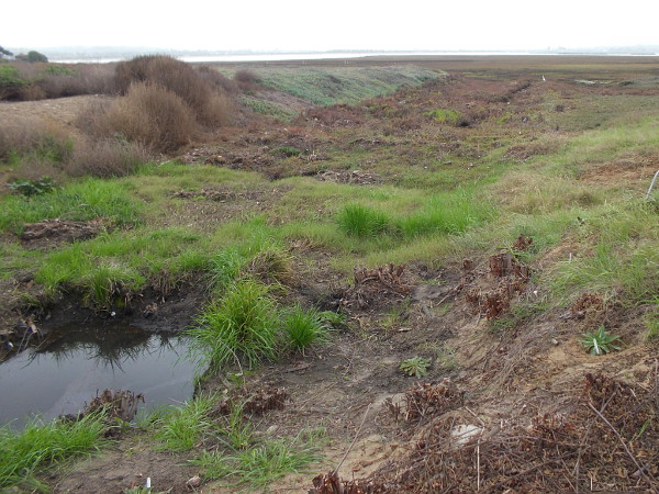
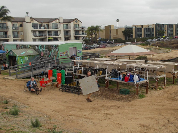
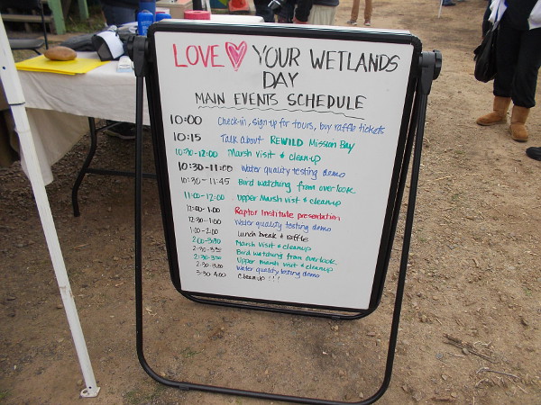
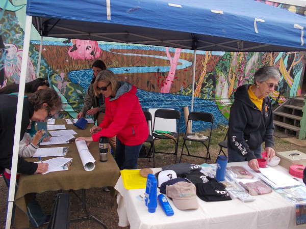
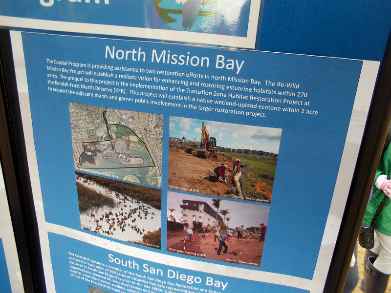
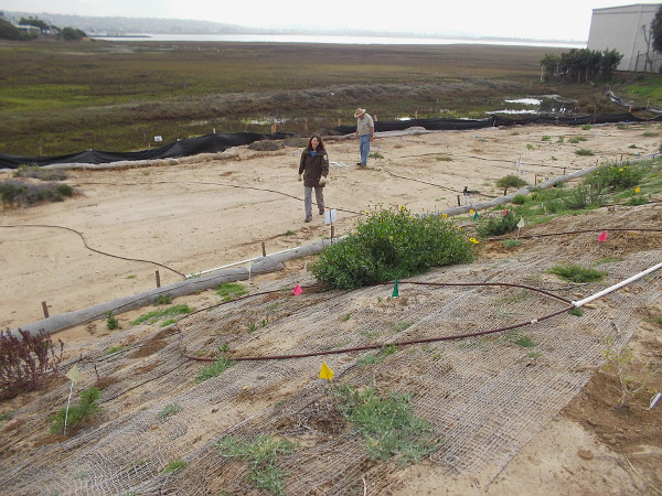
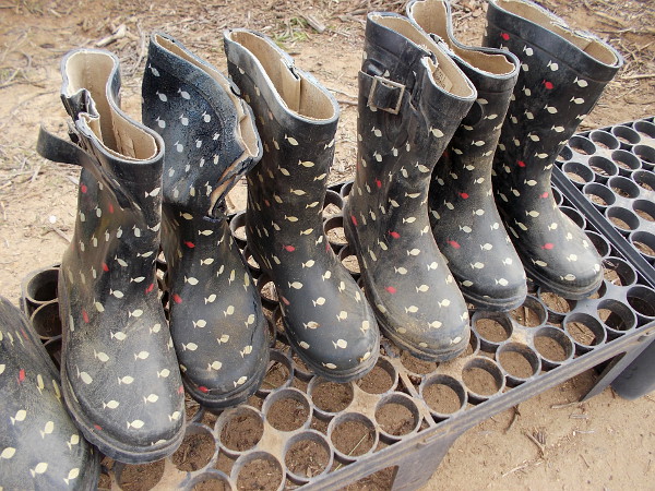
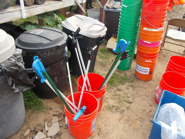
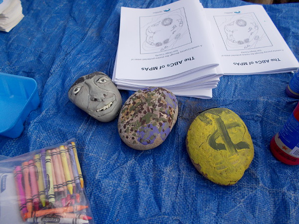
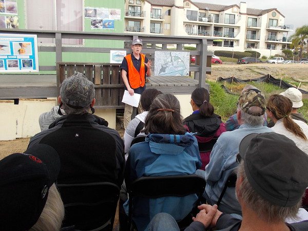
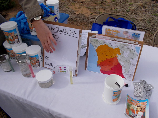
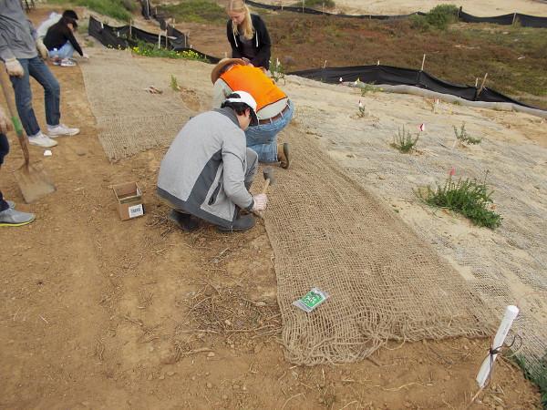
The Kendall-Frost Marsh is being restored into a healthy wetland by the San Diego Audubon Society and the UC Natural Reserve System with the help of volunteers.The slough is a prime location for birdlife. Many different birds can be spotted in this protected wildlife refuge, which is usually off-limits to the public.Photos of bird sightings on the surrounding fence.I arrived a bit early to the event, and watched from the nearby street as last-minute preparations took place.A sign welcomes visitors to Love Your Wetlands Day. Lots of activities included bird watching, a water quality testing demo, and a marsh clean-up.People sign in to the event. A few lucky attendees won raffle prizes!The San Diego Audubon Society had a table at the special outdoor event.Information at the U.S. Fish and Wildlife Service Coastal Program exhibit shows the marsh boundaries and restoration efforts.This super cool volunteer at a fun kids activity table gave me the thumbs up!A nearby area where native vegetation is being carefully restored.These plants will eventually be transplanted into the marsh.A look across the marsh southward, toward the greater part of Mission Bay, a large urban recreational park in San Diego.As the event gets underway, many energetic people arrive.Fun nature mural on side of the Kendall-Frost Reserve Trailer in Pacific Beach!Many photos around the exterior of the trailer show insects, flowers, birds and other wildlife that make the marsh their home.A row of waterproof boots awaits volunteers.Putting on some boots before heading out into the muddy, mucky marsh!Tools that are used to remove trash from the environmentally sensitive marshland.A fun art project for kids involved creatively decorating stones!Speaker describes how the ReWild project of the San Diego Audubon Society is working to restore important wetlands in the northeast corner of Mission Bay.A chart at one table shows types of pollutants found on the beaches of San Diego.Water quality tests include monitoring pH, temperature, oxygen content and turbidity.Folks are heading every which way, learning about the marsh and setting about to help restore it!Walking over to collect a water sample. The Kendall-Frost Mission Bay Marsh Reserve habitats include coastal sage scrub, south coastal salt marsh, tidal channels, salt flats and mudflats.Water from a storm drain is collected by volunteers for testing.After putting on boots and grabbing buckets, a gang of volunteers is out in the marsh seeing it up close and removing unwanted debris.Netting is laid down by more volunteers to help prevent erosion during rain. A big storm is coming tomorrow!Love Your Wetlands Day was a great opportunity for the public to help preserve and enhance the Kendall-Frost Marsh!