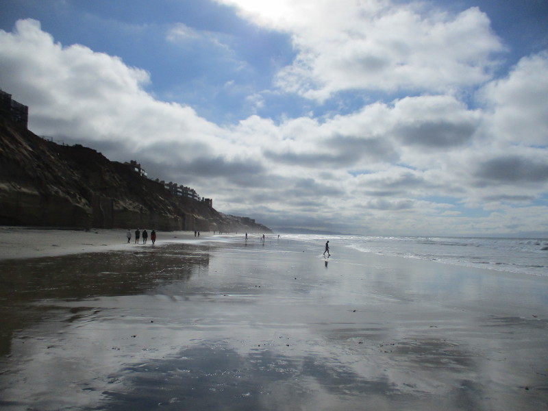
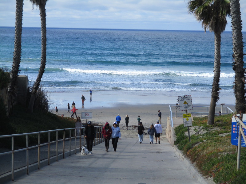
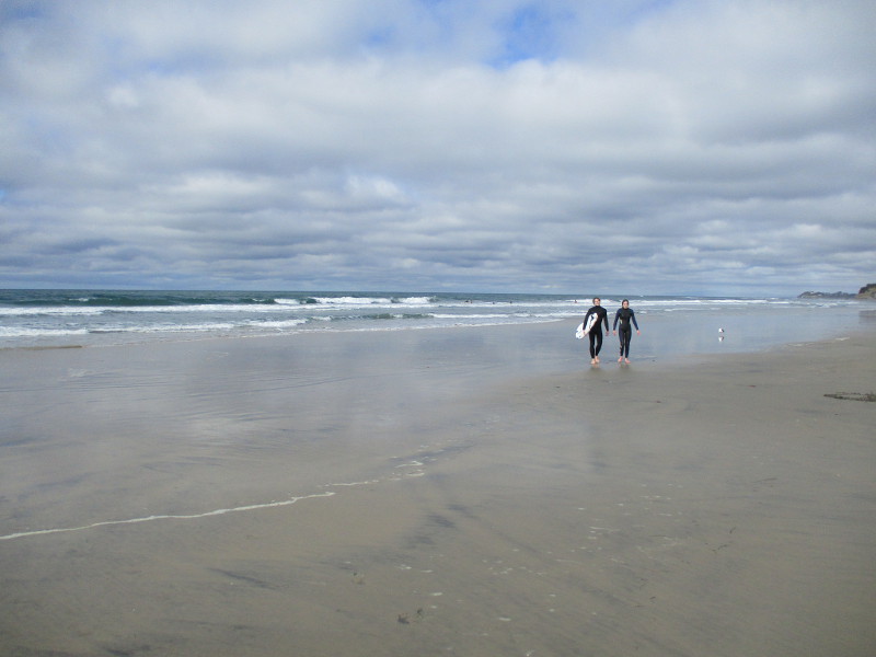
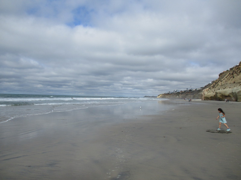
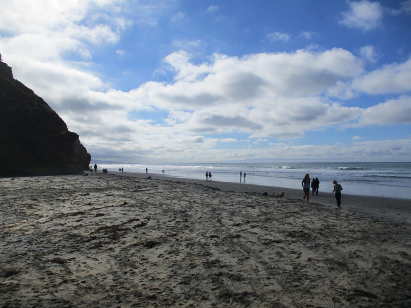
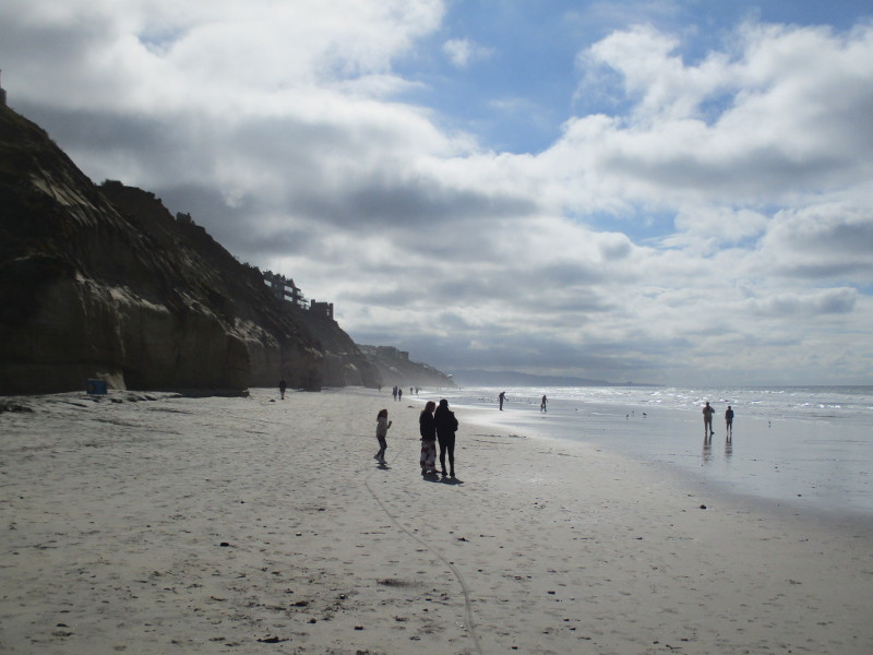
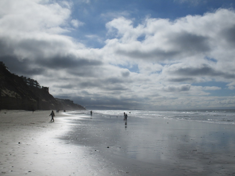
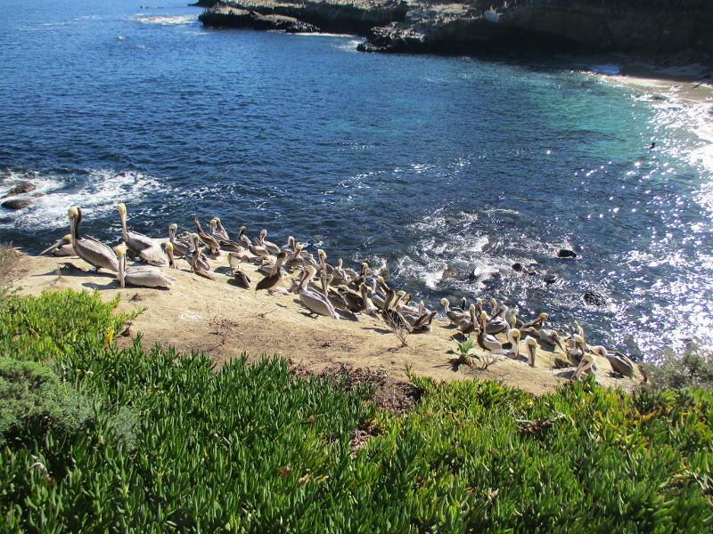
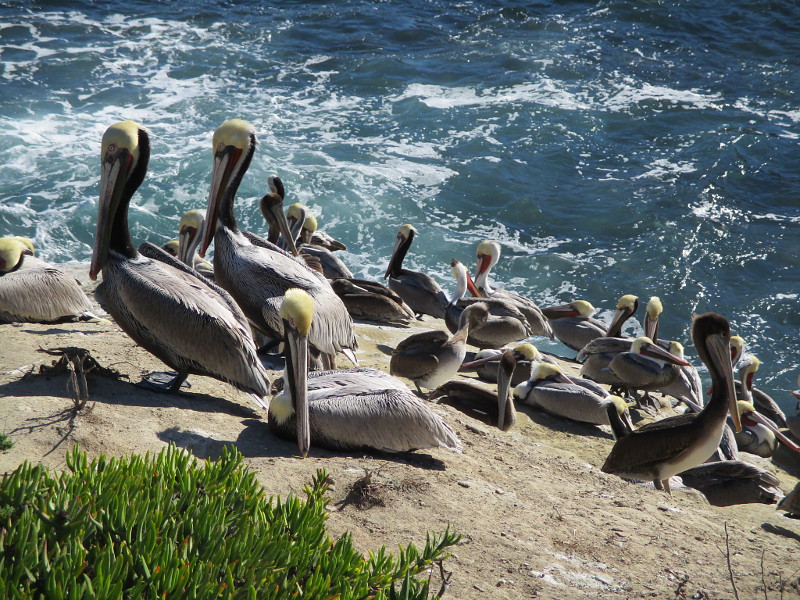
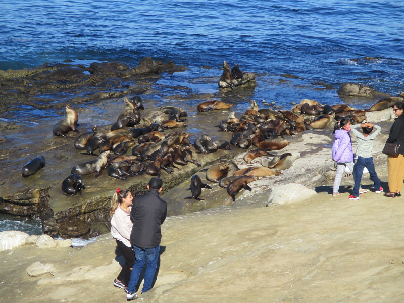
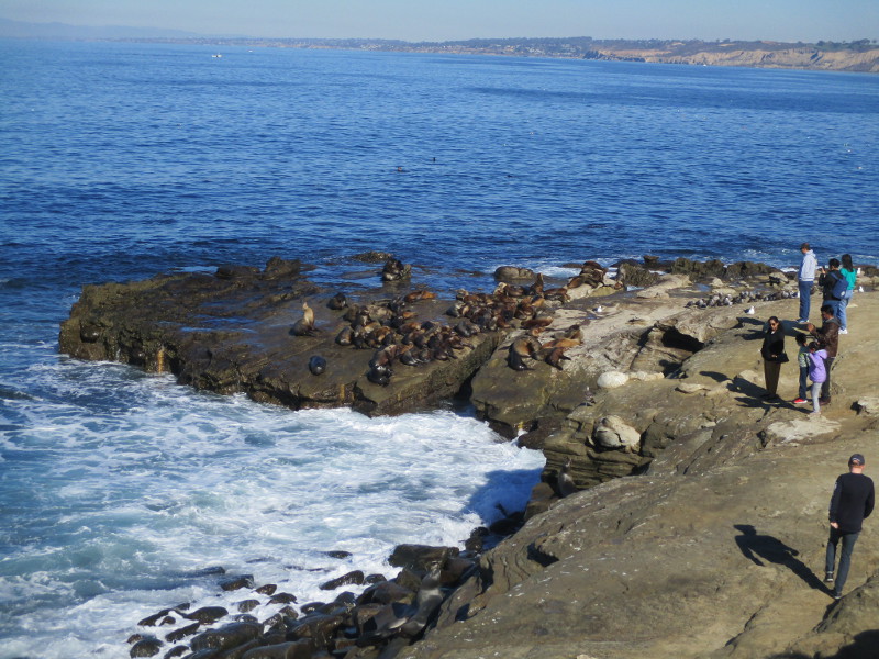
Many beaches in San Diego County will cause you to simply stare. They are that beautiful. The beach at Fletcher Cove in Solana Beach is no exception.
I enjoyed a long walk in Solana Beach today. I photographed some incredible public art (as you’ll see in the next few days), but how does an artist compete with nature’s complex, sublime, and inexhaustible beauty?
That blue sky and clouds reflecting from silvery wet sand were captured with a mere press of a camera button. Then, standing near the ocean’s edge, I turned right and left and pressed the button a few more times…
…
I live in downtown San Diego and love to walk around with my camera! You can follow Cool San Diego Sights via Facebook or Twitter!
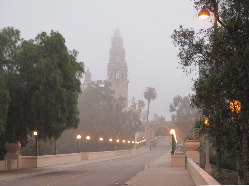
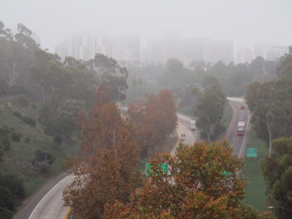
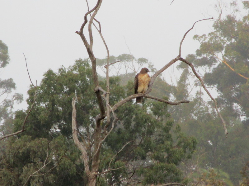
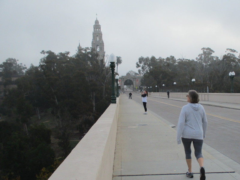
This morning I walked from downtown San Diego to Balboa Park, hoping to capture some interesting fog photographs.
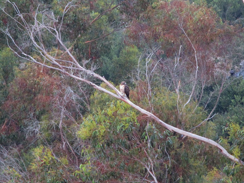
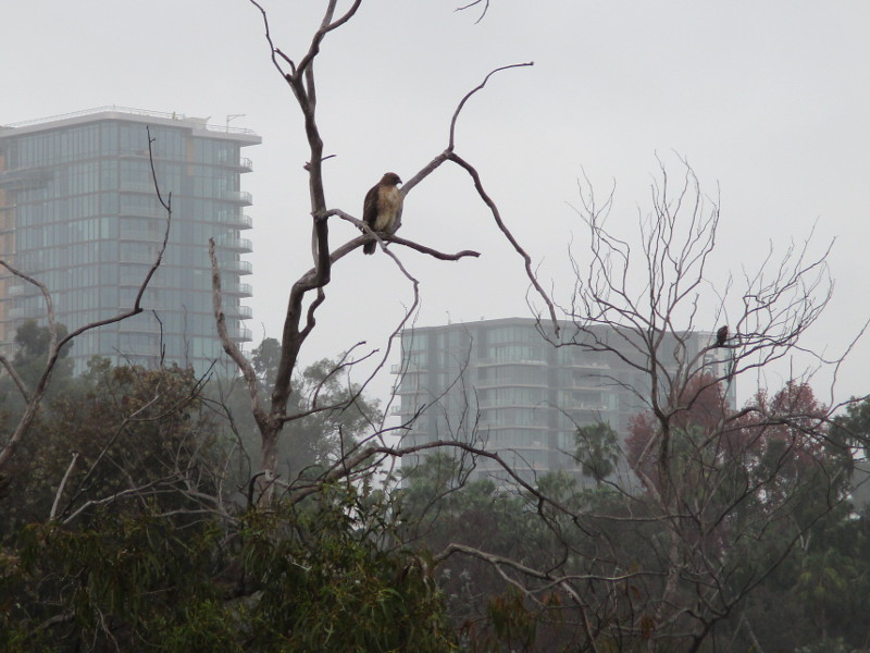
As it turned out, most of my photos were of red-tailed hawks!
I observed three of them from the Cabrillo Bridge.
Anyone who walks into Balboa Park from the west side should keep their eyes peeled for hawks. They like to perch in the trees above the archery range or the slope of the West Mesa overlooking State Route 163.
I often hear the distinctive cry of red-tailed hawks near the eucalyptus trees west of the California Tower. Once or twice in the past I’ve seen them perched on the tower!
I managed to get a few decent photos with my little camera. You can see two hawks in the final image!
From the Cabrillo Bridge I also took a photograph of foggy downtown San Diego in the distance.
…
I live in downtown San Diego and love to walk around with my camera! You can follow Cool San Diego Sights via Facebook or Twitter!
Today I headed out to Warner Springs in northern San Diego County. I wanted to experience an authentic stagecoach ride at the historic Warner-Carrillo Ranch House.
I arrived too early, so I drove a few miles further up State Route 79 to the Eagle Rock Trailhead, near the Warner Springs fire station. There I parked under some shady oak trees and began a slow hike south along the Pacific Crest Trail.
The short (perhaps half mile) segment of the PCT that I walked followed a dry creek bed. It passed through several swinging gates, but I encountered no grazing livestock.
In addition to many ancient oaks, I saw the autumn yellows of a few riparian trees–mostly willows it seemed. A couple sycamores I noticed had lost most of their leaves.
I also spotted interesting rock outcroppings and a distant woodpecker. And only a few hikers.
Had I time, I might have continued all the way to Eagle Rock–an impressive outcropping three miles from the trailhead that looks exactly like an bird with spread wings. I’ll do that some other day.
Enjoy these photos of autumn beauty along a very small part of the Pacific Crest Trail…
…
I live in downtown San Diego and love to walk around with my camera! You can follow Cool San Diego Sights via Facebook or Twitter!
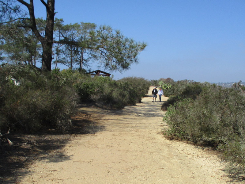
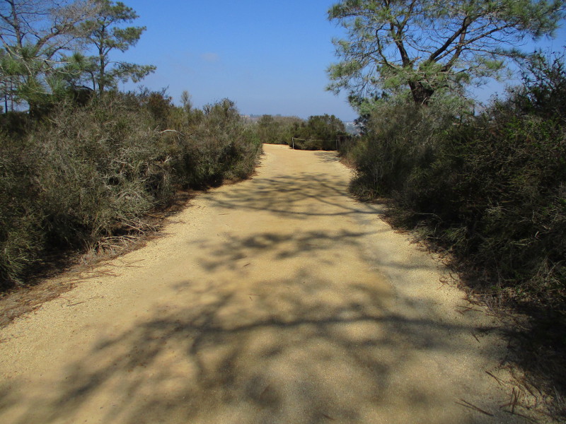
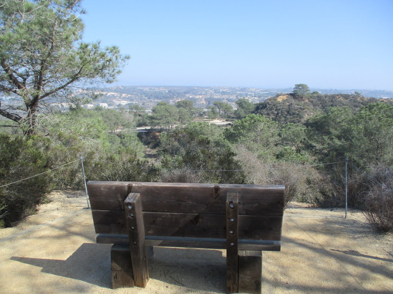
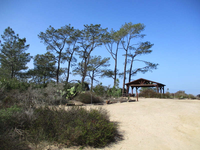
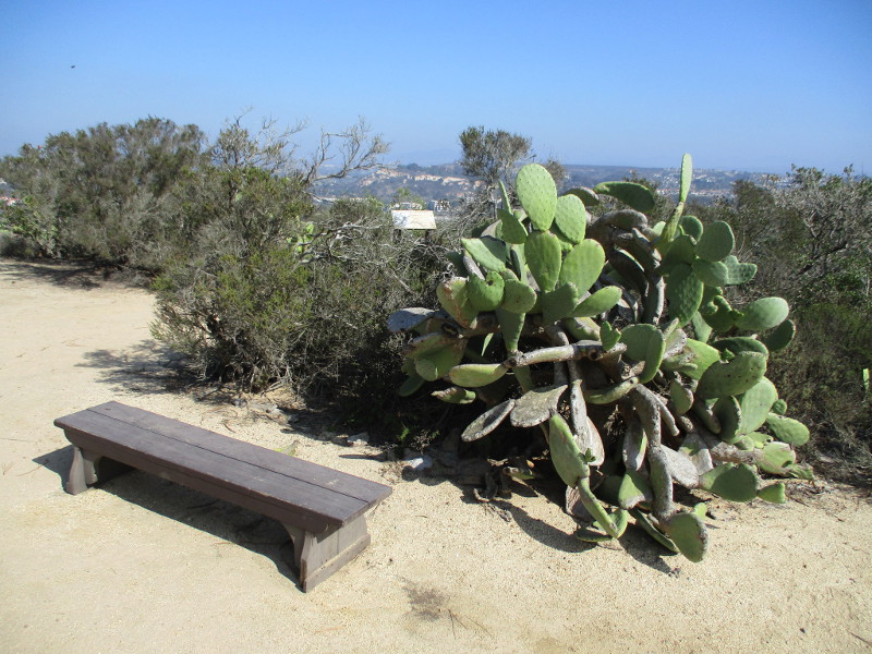
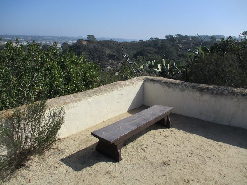
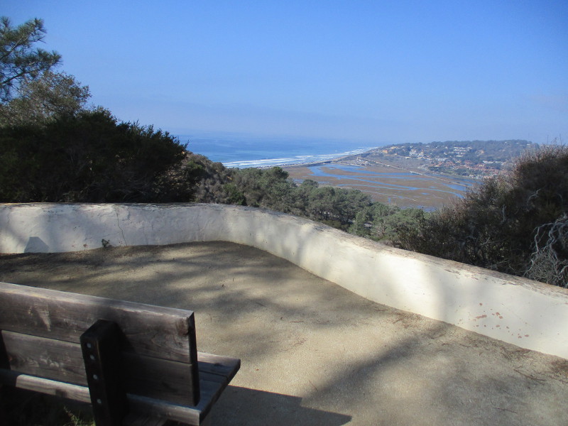
The very easy Discovery Trail at Torrey Pines State Natural Reserve is a fine place to walk or sit on a bench, while drinking in nature’s beauty.
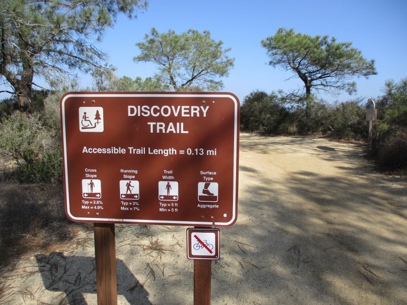
The short .13 mile highly accessible trail follows the edge of a bluff just east of the historic Lodge (the park’s Visitor Center) and its parking lot.
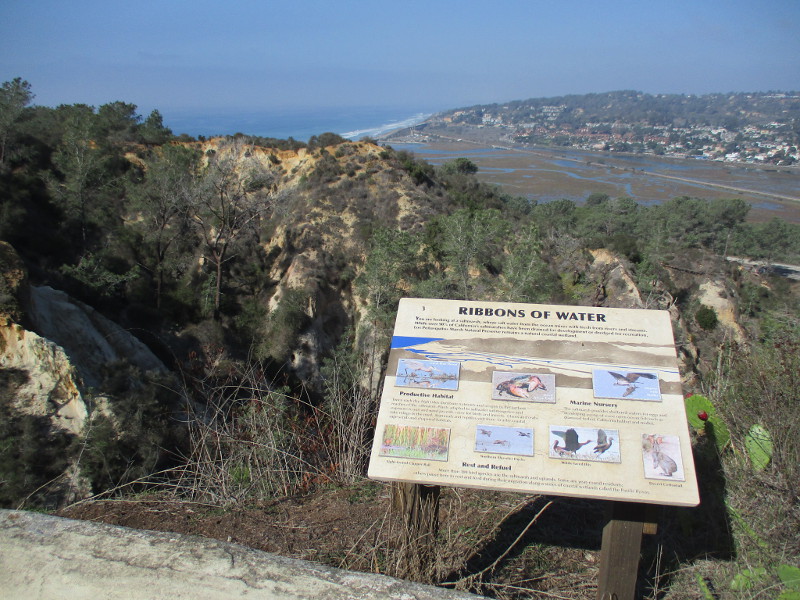
There are scenic overlooks with views of Carmel Valley, Los Peñasquitos Lagoon and even the Pacific Ocean. Signs describe many of the natural marvels around you. Native plants along the way are identified with information plaques.
Last weekend I slowly walked north along the Discovery Trail.
I began at Torrey Pines Park Road across from the Beach Trailhead parking lot. That’s where I saw the sign pictured below. I then headed north until I reached the rear of the old Lodge.
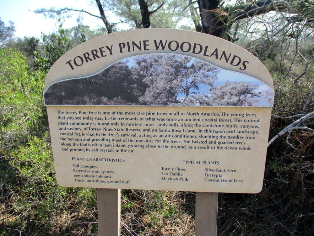
TORREY PINE WOODLANDS. The Torrey Pine tree is one of the most rare pine trees in all of North America. The young trees that you see today may be the remnants of what was once an ancient coastal forest. This natural plant community is found only in nutrient-poor sandy soils, along the sandstone bluffs, canyons, and ravines of Torrey Pines State Reserve and on Santa Rosa Island…
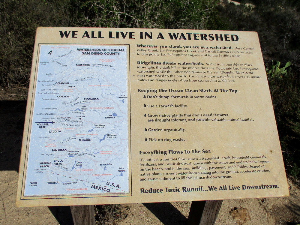
Wherever you stand, you are in a watershed. Here Carmel Valley Creek, Los Peñasquitos Creek and Carroll Canyon Creek all drain to one point: Los Peñasquitos Lagoon’s exit to the Pacific Ocean…
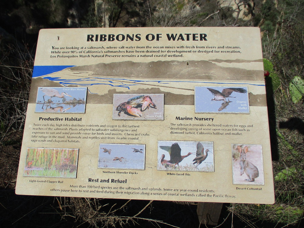
You are looking at a saltmarsh, where salt water from the ocean mixes with fresh from rivers and streams…Los Peñasquitos Marsh Natural Preserve remains a natural coastal wetland.
…
I live in downtown San Diego and love to walk around with my camera! You can follow Cool San Diego Sights via Facebook or Twitter!
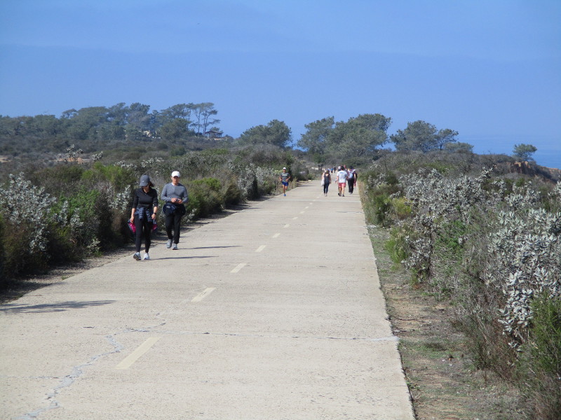
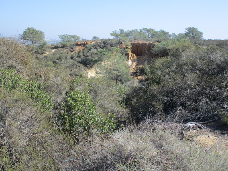
Explore the south end of Torrey Pines Park Road at Torrey Pines State Natural Reserve and you’ll discover breathtaking beauty and fascinating history.
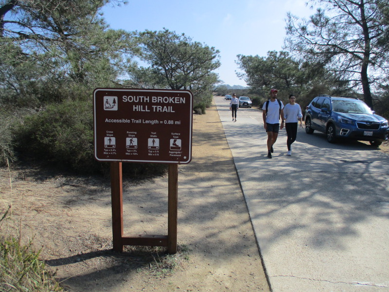
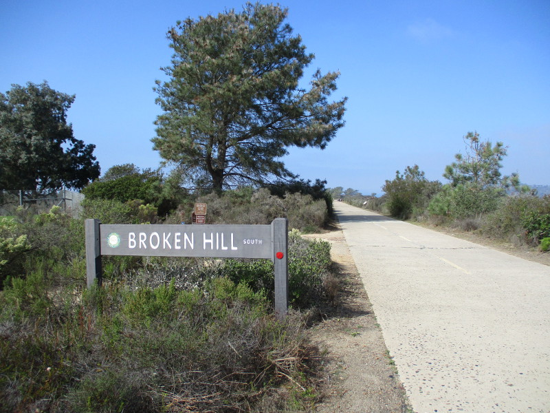
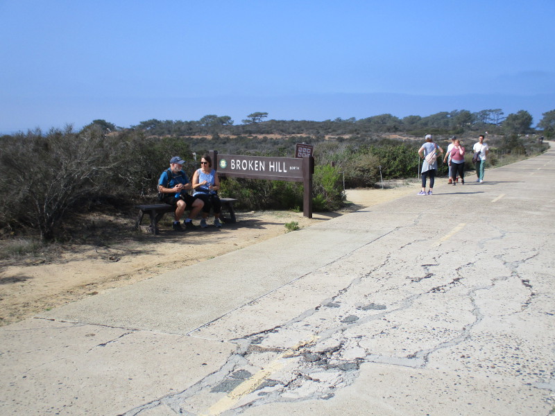
Last weekend I walked north along the paved trail, which a century ago was part of the main road from San Diego to Los Angeles. The following photographs begin near Torrey Pines Golf Course and end just short of the Visitor Center at Torrey Pines State Reserve’s old Lodge. The historic road, closed to vehicle traffic, is how hikers access Broken Hill Trail, which winds through a rugged landscape down to the beach.
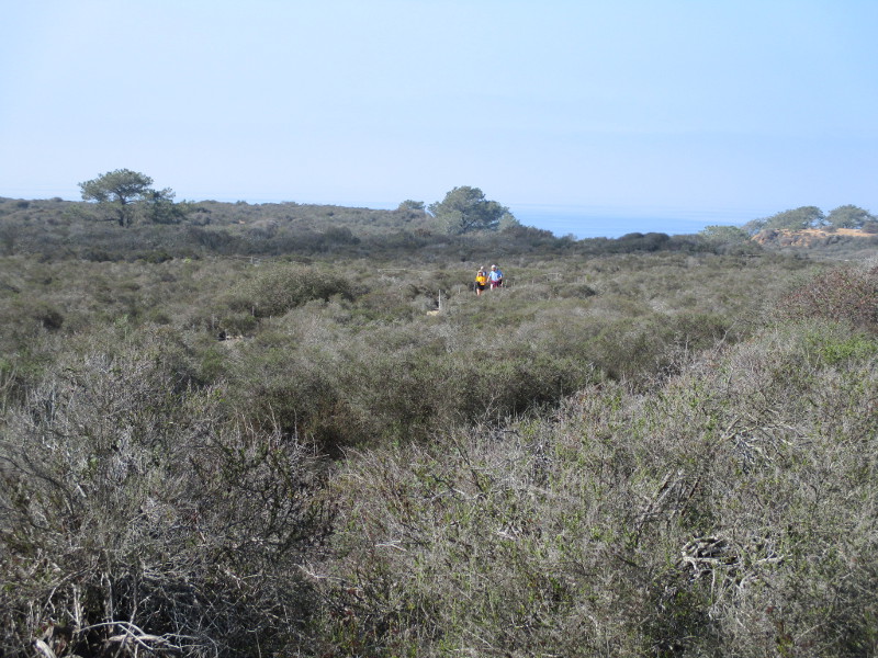
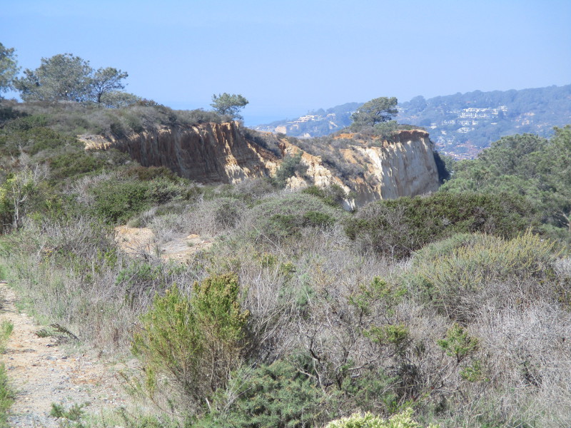
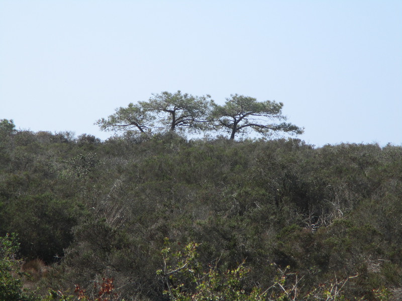
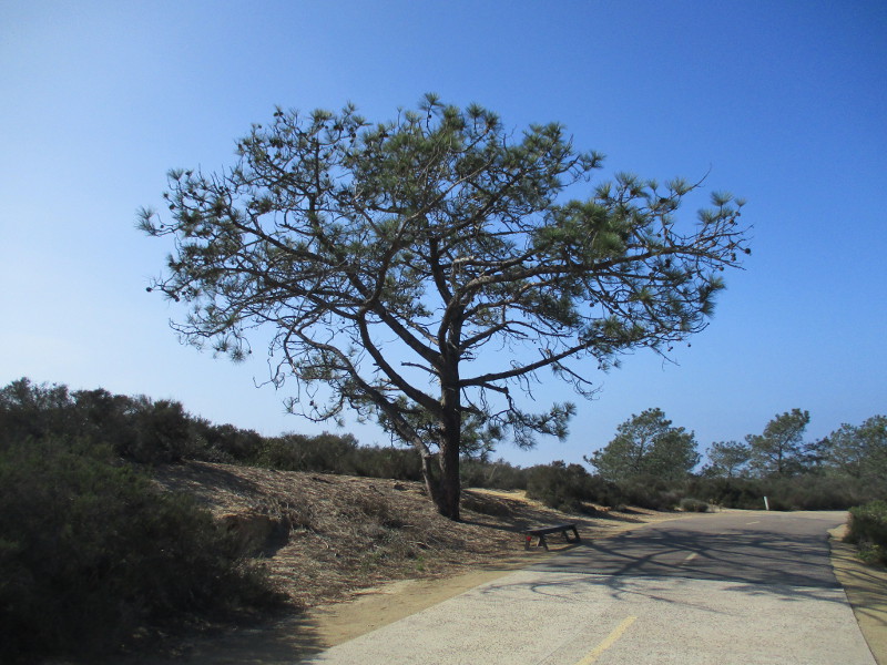
In my photos you’ll see native coastal sage scrub and chaparral plants, rare Torrey pine trees, the Pacific Ocean in the distance to the west and sandstone cliffs overlooking North Torrey Pines Road to the east. Signs along the way speak of the history of this place.
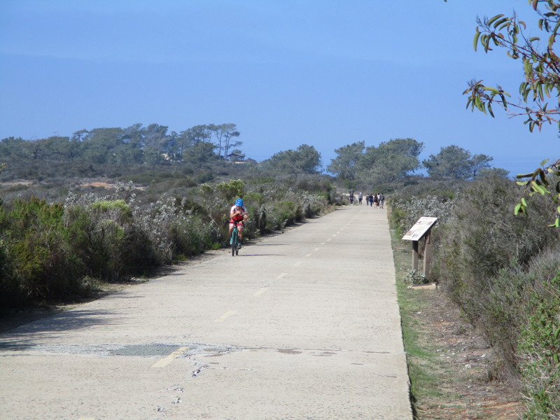
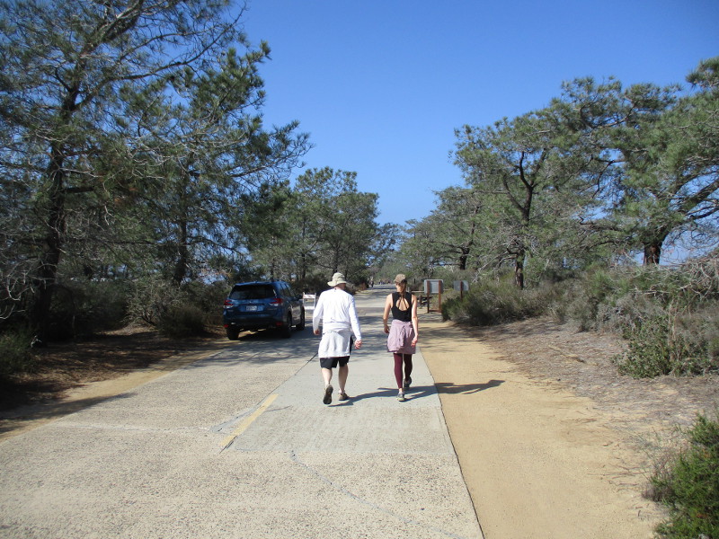
Come along as I walk down old Torrey Pines Park Road on a sunny November day!
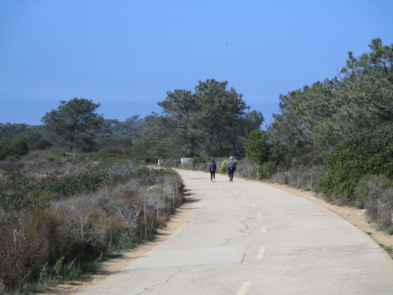
Other walkers and bicyclists were also enjoying a fun adventure.
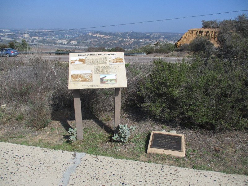
To the east beyond an information sign and historical marker one can see North Torrey Pines Road, Carmel Valley and Interstate 5.
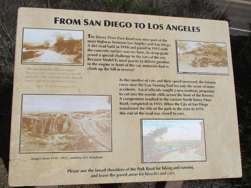
FROM SAN DIEGO TO LOS ANGELES
The Torrey Pines Park Road was once part of the main highway between Los Angeles and San Diego. A dirt road built in 1910 and paved in 1915 with the concrete surface you see here, its steep grade posed a special challenge to the cars of the era. Because Model Ts used gravity to deliver gasoline to the engine in front of the car, motorists had to climb up the hill in reverse.
As the number of cars and their speed increased, the hairpin curve near the Guy Fleming Trail became the scene of many accidents. Local officials sought a new roadway, proposing to cut into the seaside cliffs across the front of the Reserve. A compromise resulted in the current North Torrey Pines Road, completed in 1933. When the City of San Diego transferred the title of the park to the state in 1959, this end of the road was closed to cars.
The steep hill and its hairpin curves mentioned in the sign are north of the Lodge, beyond this particular walk. Cars entering the park still use it.
If you’d like to see past photos of the Guy Fleming Trail which is also referenced in the sign, click here!
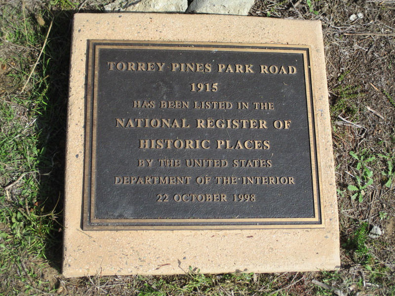
TORREY PINES PARK ROAD
1915
HAS BEEN LISTED IN THE NATIONAL REGISTER OF HISTORIC PLACES BY THE UNITED STATES DEPARTMENT OF THE INTERIOR
22 OCTOBER 1998
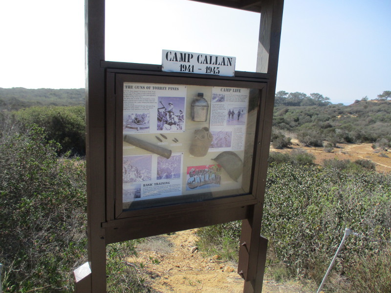
Hikers explore nature’s beauty.The North Fork Trailhead leads west to the Broken Hill Trail.Picturesque sandstone cliffs overlook North Torrey Pines Road (not visible) to the east.A sign details the history of Camp Callan, which was located here from 1941 to 1945.
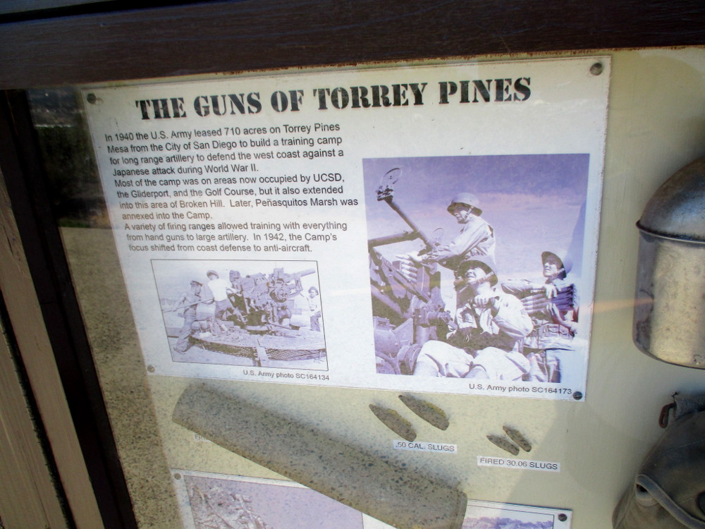
THE GUNS OF TORREY PINES
In 1940 the U.S. Army leased 710 acres on Torrey Pines Mesa from the City of San Diego to build a training camp for long range artillery to defend the west coast against a Japanese attack during World War II. Most of the camp was on areas now occupied by UCSD, the Gliderport, and the Golf Course, but it also extended into the area of Broken Hill. Later, Penasquitos Marsh was annexed into the Camp. A variety of firing ranges allowed training with everything from hand guns to large artillery. In 1942, the Camp’s focus shifted from coast defense to anti-aircraft.
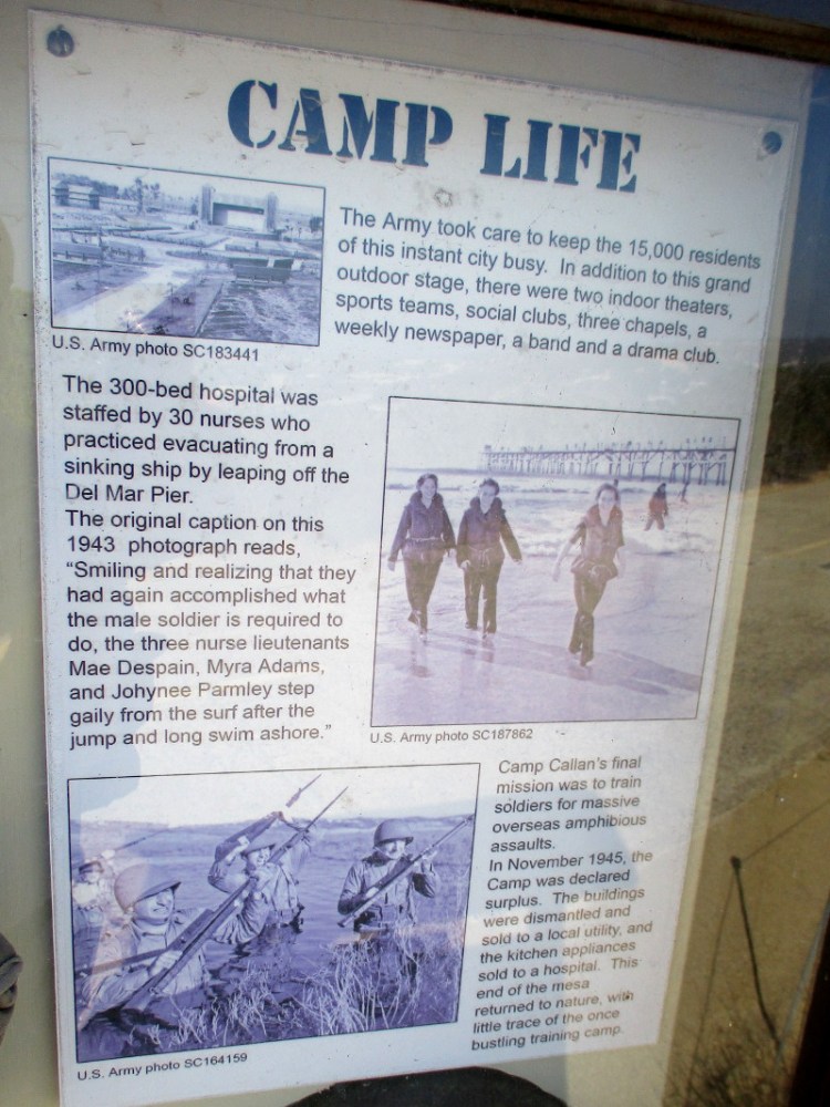
CAMP LIFE
The Army took care to keep the 15,000 residents of this instant city busy. In addition to this grand outdoor stage, there were two indoor theaters, sports teams, social clubs, three chapels, a weekly newspaper, a band and a drama club.
The 300-bed hospital was staffed by 30 nurses who practiced evacuating from a sinking ship by leaping off the Del Mar Pier. The original caption on the 1943 photograph reads, “Smiling and realizing that they had again accomplished what the male soldier is required to do, the three nurse lieutenants Mae Despain, Myra Adams, and Johynee Parmley step gaily from the surf after the jump and long swim ashore.”
Camp Callan’s final mission was to train soldiers for massive overseas amphibious assaults. In November 1945, the Camp was declared surplus. The buildings were dismantled and sold to a local utility, and the kitchen appliances sold to a hospital. This end of the mesa returned to nature, with little trace of the once bustling training camp.
A postcard. Greetings from CAMP CALLAN CALIFORNIA.Torrey pine trees in the distance.More eroded sandstone to the east.Approaching a small parking lot at the Beach Trailhead near The Lodge.
…
This blog now features thousands of photos around San Diego! Are you curious? There’s lots of cool stuff to check out!
Here’s the Cool San Diego Sights main page, where you can read the most current blog posts. If you’re using a phone or small mobile device, click those three parallel lines up at the top–that opens up my website’s sidebar, where you’ll see the most popular posts, a search box, and more!
To enjoy future posts, you can also “like” Cool San Diego Sights on Facebook or follow me on Twitter.
The San Diego County Orchid Society had one of their flower shows in Balboa Park today. As I walked near the Casa del Prado, I noticed the Fall Show event sign, and my feet turned toward amazing natural beauty.
I love the many different gardening, art and craft shows that are held nearly every weekend in Balboa Park. But the Orchid Society‘s shows might be my favorite.
Want to know why?
Simply look at these photos from the 2021 “Orchids in the Park” Fall Show!
…
I live in downtown San Diego and love to walk around with my camera! You can follow Cool San Diego Sights via Facebook or Twitter!
You can easily explore Cool San Diego Sights by using the search box on my blog’s sidebar. Or click a tag! There are thousands upon thousands of photos for you to enjoy!
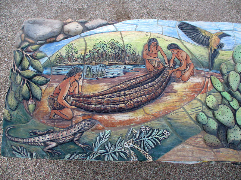
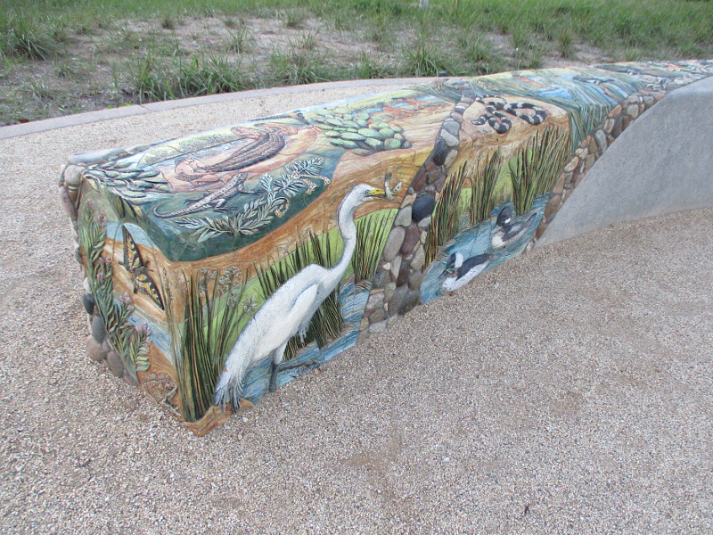
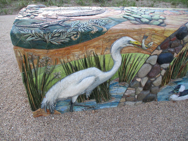
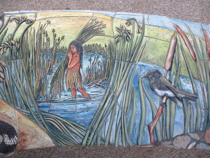
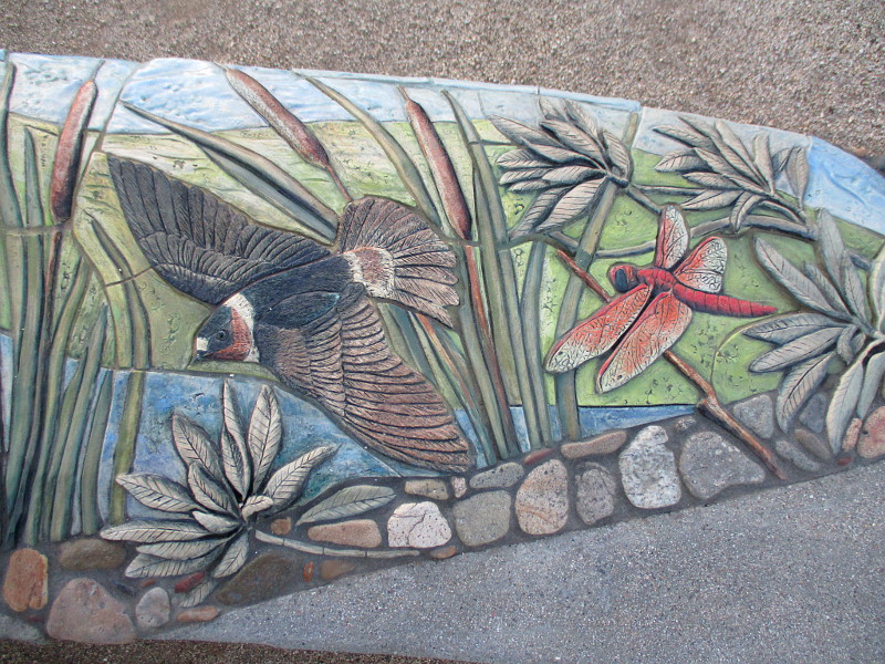
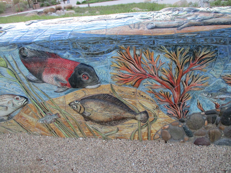
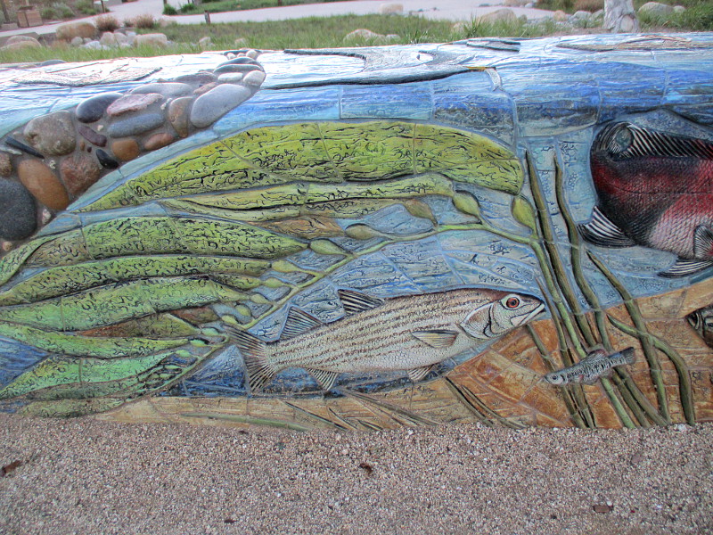
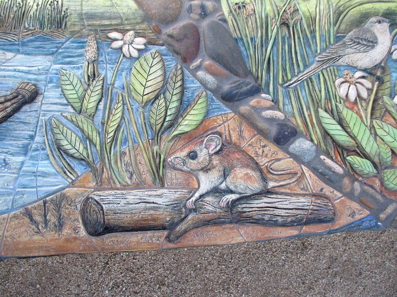
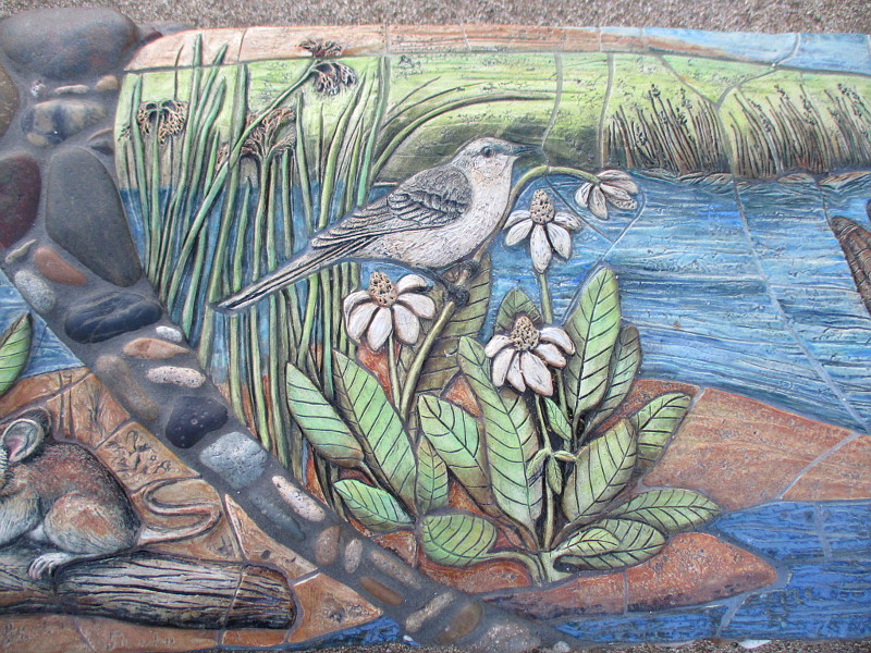
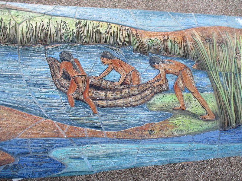
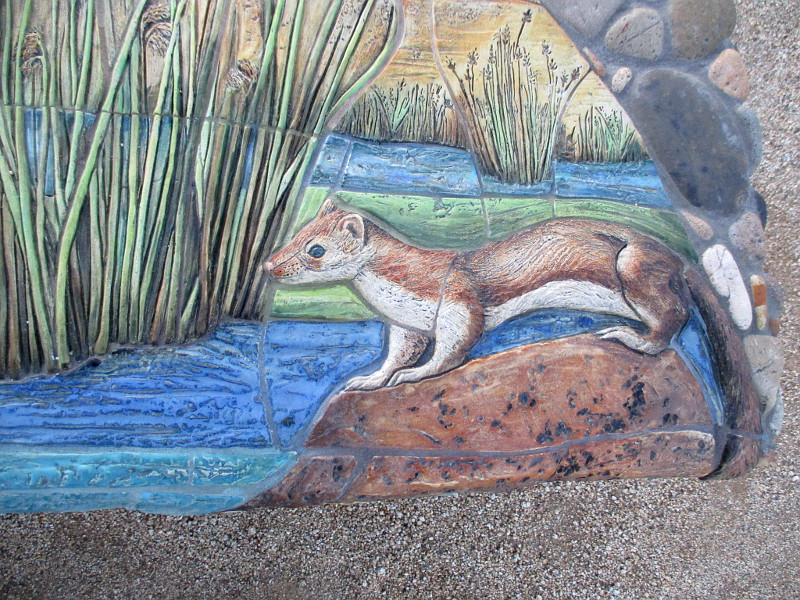
Extraordinary new public art has been unveiled in Old Town San Diego State Historic Park!
Two benches in the park’s recently opened outdoor expansion, which is called Land of the First People, feature beautiful mosaics that honor the Native American Kumeyaay and the world of nature.
Once you look at the following photographs, you’ll likely agree these ceramic mosaics are exceptional. They were created by local artist Betsy K. Schulz.
The two interpretive benches contain images of the Kumeyaay people in our region, fishing, collecting reeds, paddling boats and living by a river, among birds, fish and other native wildlife.
If you’d like to see more stunning public art around San Diego that was created by Betsy K. Schulz, click here.
These images were captured yesterday evening just before nightfall. I took additional photographs of this newly opened area of Old Town San Diego State Historic Park, and posted them here.
…
I live in downtown San Diego and love to walk around with my camera! You can follow Cool San Diego Sights via Facebook or Twitter!
You can easily explore Cool San Diego Sights by using the search box on my blog’s sidebar. Or click a tag! There are thousands upon thousands of photos for you to enjoy!
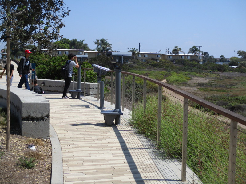
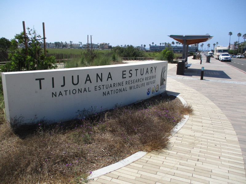
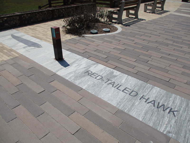
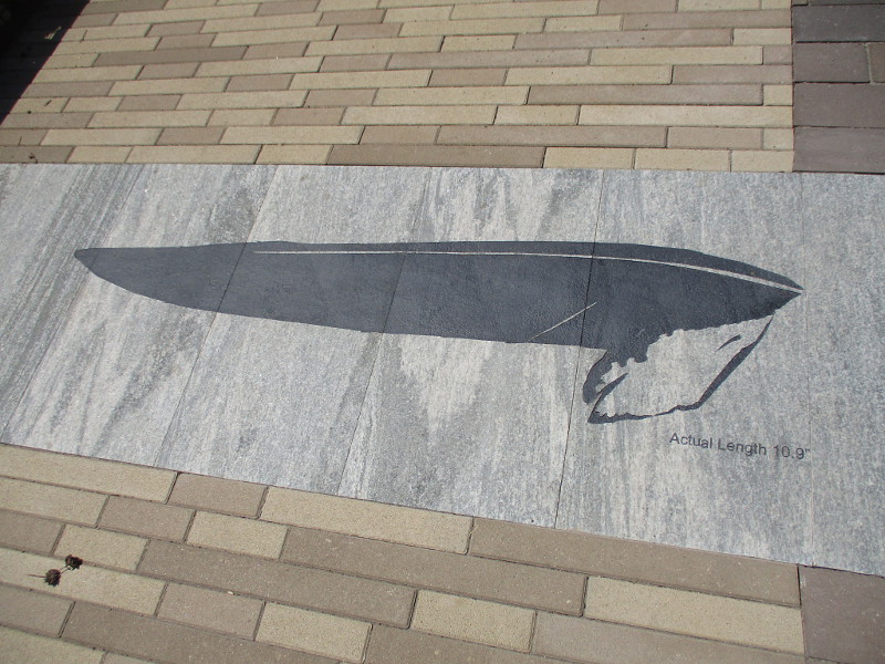
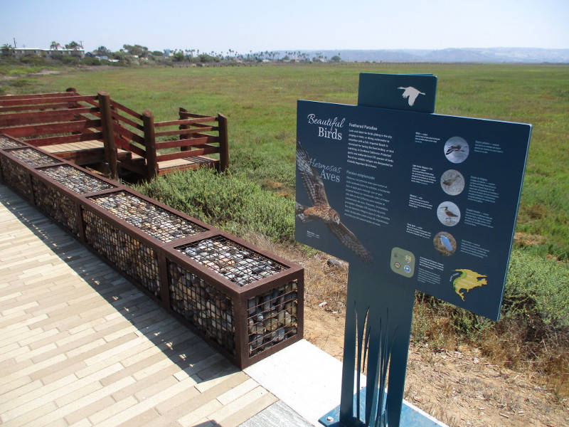
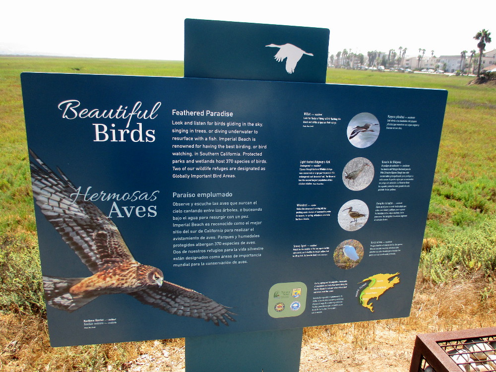
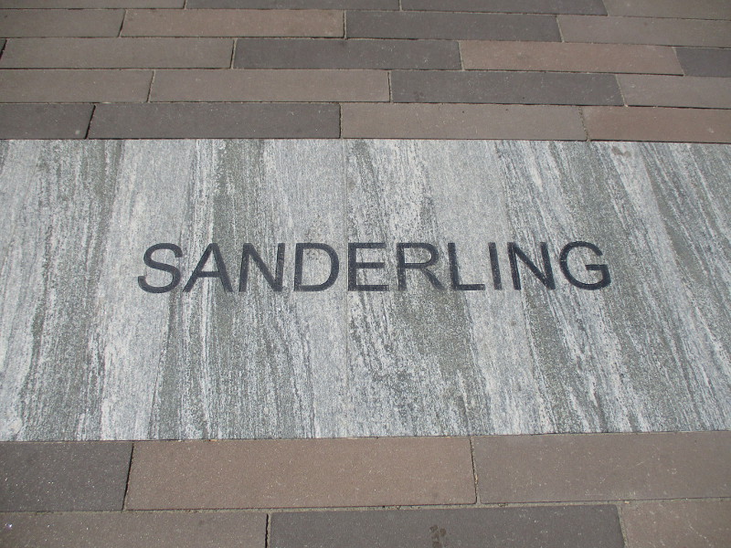
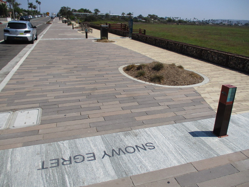
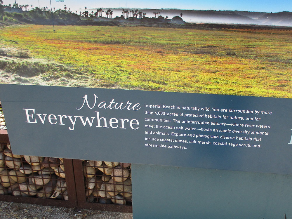
Walk down the recently improved Tijuana Estuary boardwalk in Imperial Beach and you’re certain to see birds. You’ll find many down at your feet!
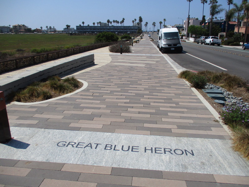
The widened, beautified boardwalk along Imperial Beach Avenue, west of 3rd Street, now includes the names of many birds that make Tijuana Slough National Wildlife Refuge their home.
Next to the bird names you’ll also find images of outstretched wings. The wings are to scale, providing an idea of how different species of birds compare.
During my last walking adventure in IB, about a month or so ago, I was surprised and delighted to find this improved boardwalk. There are new benches, and information signs at scenic Tijuana River estuary overlooks, and even a great bus stop shelter that I used.
It’s about time I shared these photos!
Great Blue Heron.Red-Tailed Hawk.Beautiful birds.Sanderling.Snowy Egret.Nature everywhere. Imperial Beach is naturally wild.
…
I live in downtown San Diego and love to walk around with my camera! You can follow Cool San Diego Sights via Facebook or Twitter!
You can easily explore Cool San Diego Sights by using the search box on my blog’s sidebar. Or click a tag! There are thousands upon thousands of photos for you to enjoy!
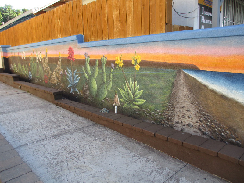
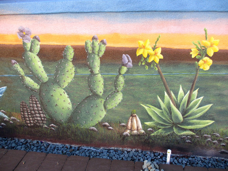
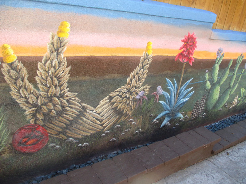
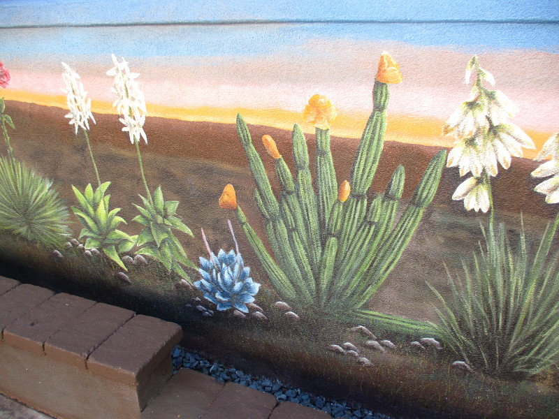
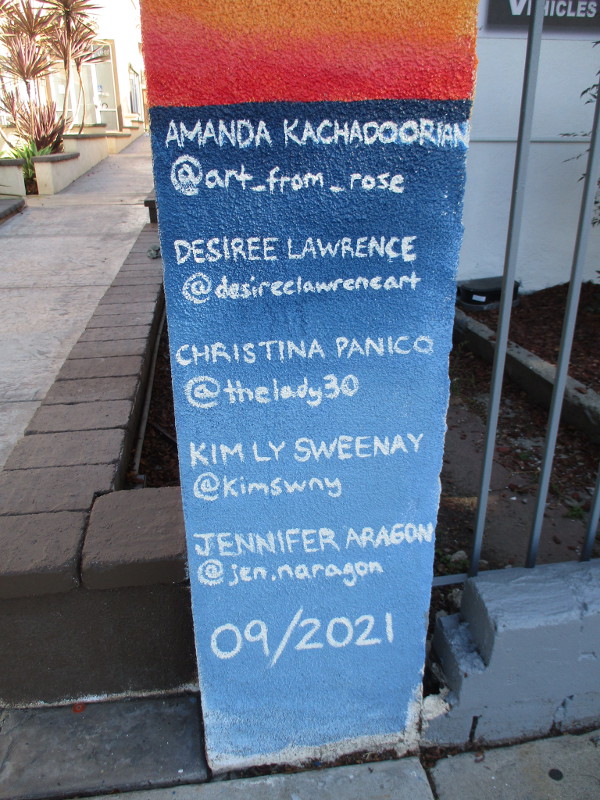
A mural was recently completed in San Ysidro to raise awareness for the 4th Annual California Clean Air Day, which took place last Wednesday.
Today I headed down to Casa Familiar’s new Environmental Justice office at 161 San Ysidro Boulevard to see the mural, which was painted by Amanda Kachadoorian and other artists along a low wall nearby.
My photos show just how gorgeous the artwork is!
According to information I received concerning it, the “mural represents the fight for clean air by elevating conservation and restoration of natural habitats. The mural focuses on the Tijuana River Valley depicting a natural landscape with native plants…”
San Ysidro is home to the world’s busiest land border crossing. This San Diego South Bay community experiences a disproportionate amount of air pollution. The high level of pollution comes from 60,000 idling cars every day as motorists wait at the border.
The beautiful mural was commissioned by the community organization Casa Familiar in collaboration with Coalition for Clean Air.
You can learn more about a past Air Pollution Study in San Ysidro here.
…
I live in downtown San Diego and love to walk around with my camera! You can follow Cool San Diego Sights via Facebook or Twitter!
You can easily explore Cool San Diego Sights by using the search box on my blog’s sidebar. Or click a tag! There are thousands upon thousands of photos for you to enjoy!