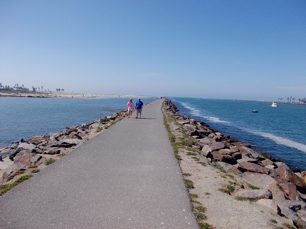
Debris has been washed by the ocean under the Los Peñasquitos Lagoon bridge at Torrey Pines State Beach.
This morning, the day after a severe winter storm, I visited Torrey Pines State Beach and the ocean inlet to Los Peñasquitos Lagoon. Arriving at high tide, I found myself astonished by the incredible power of nature. Turbulent waves were crashing onto the pedestrian walkway under the North Torrey Pines Road bridge.
I spent some time exploring near the state park’s North Parking Lot and its entrance. I then headed north along a path at the edge of sandstone cliffs overlooking the Pacific Ocean. I took many photographs, striving to capture nature’s awesome power and beauty.
And more winter storms are on the way!
Please read the photo captions to learn a bit more about this special place.
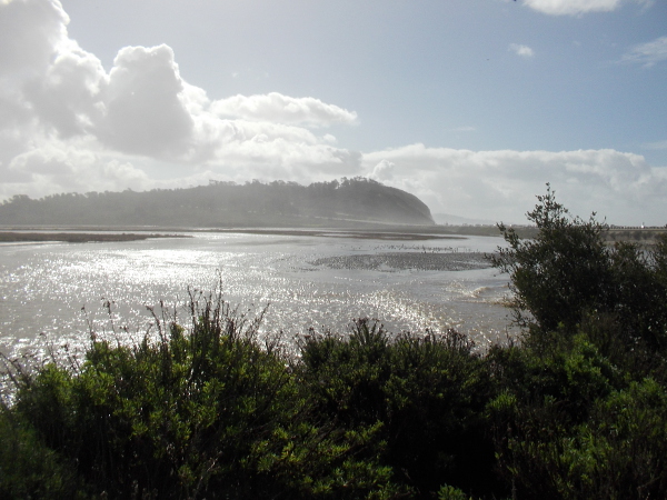
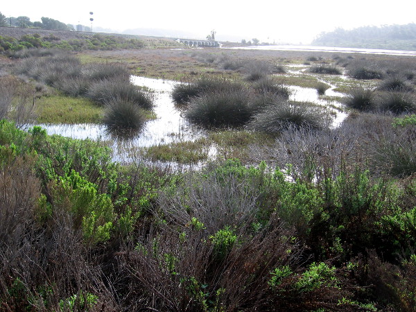
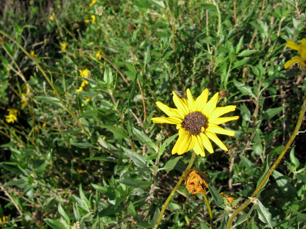
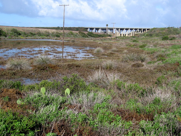
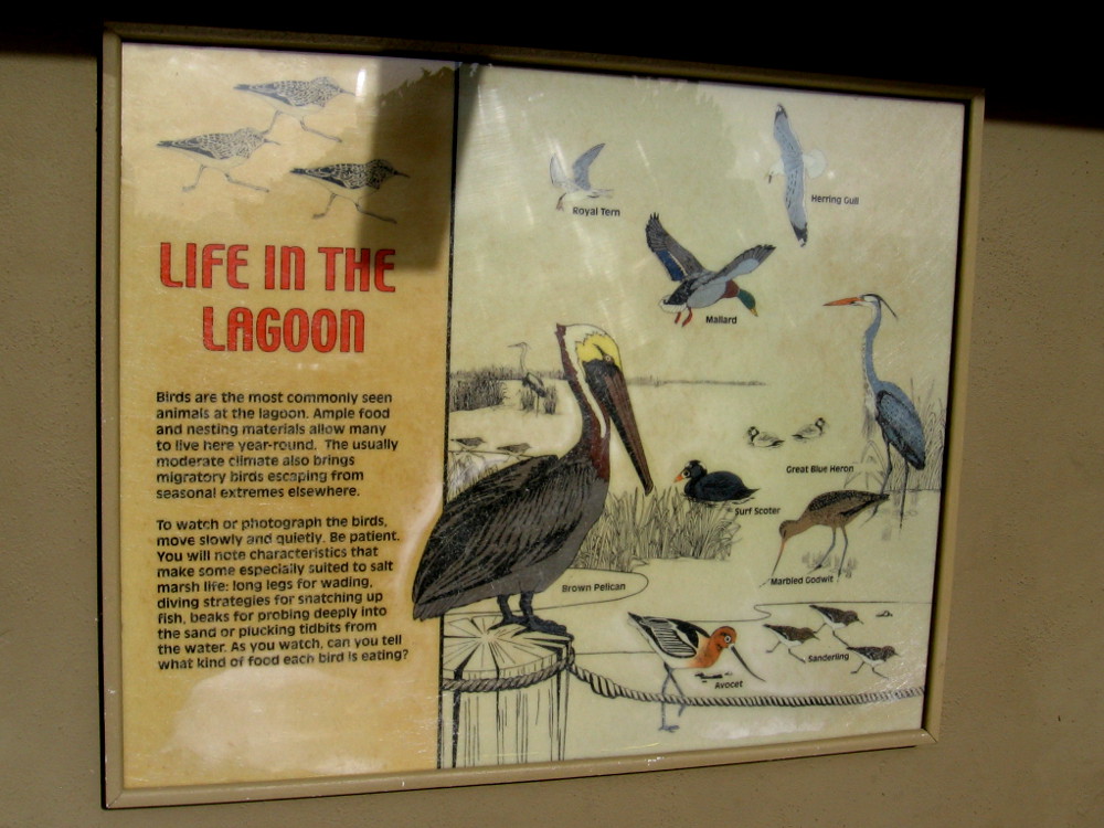
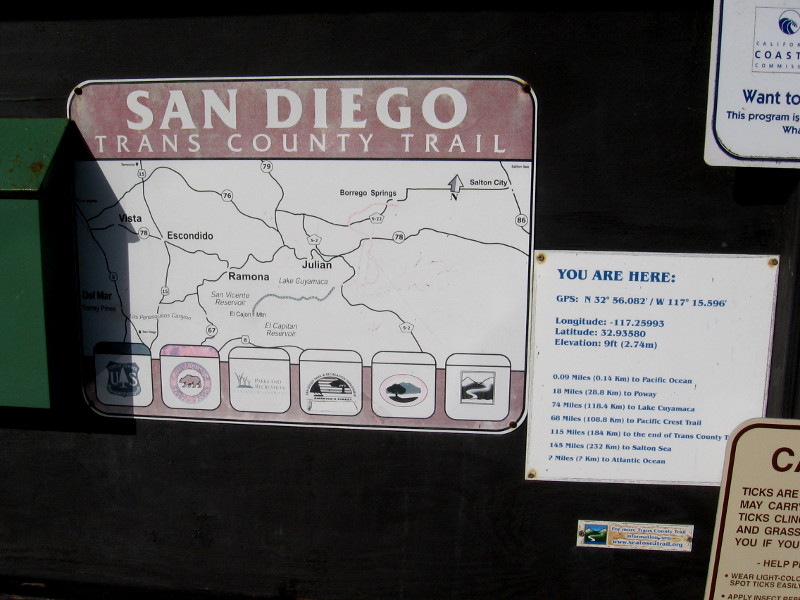
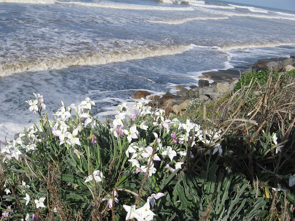
A lifeguard keeps an eye on wild surf at Torrey Pines State Beach.The friendly lifeguard said that waves can wash over the walkway during high tide at this time of the year.The bridge over the lagoon inlet during a very high tide. The storm-disturbed water appeared very muddy.An information sign was pushed over by high winds from yesterday’s storm. The power of nature is displayed.Open to the Ocean. Over time, the lagoon mouth has filled in and reopened, changed shape and relocated many times.Across the lagoon to the south rises beautiful Torrey Pines State Reserve, home of the endangered Torrey pine, rarest pine tree in North America.Looking west along Los Peñasquitos Lagoon. Light shines on a sheet of water swollen by high tide.This coastal marsh in San Diego’s North County is a special place where wildlife is abundant.The sandy beaches, sand dunes, sandstone cliffs and bluffs, provides the habitat for the Coastal Strand plant community.A cheerful yellow bush sunflower.Looking across the wetland toward the train bridge near the beach.Life in the Lagoon. Birds are the most commonly seen animals in the lagoon. Ample food and nesting materials allow many to live here year-round.A great egret stands in Los Peñasquitos Lagoon, patiently watching for fish in the water.People walk west from Carmel Valley Road into the North Beach Lot of Torrey Pines State Beach.Sign includes map of the San Diego Trans County Trail, which runs east from the ocean along Peñasquitos Creek, through Los Peñasquitos Canyon.Closed lifeguard Tower 5 at Torrey Pines State Beach is splashed by wild winter waves during high tide.Gazing down at incoming Pacific Ocean surf on a winter day between storms.Coaster train moves along tracks north of Torrey Pines State Beach, heading atop scenic sandstone cliffs into Del Mar.A line of bicyclists head down Pacific Coast Highway from Del Mar toward Torrey Pines State Beach.Ocean waves crash toward the North Torrey Pines Road bridge over the entrance to Los Peñasquitos Lagoon.Mud and debris under the bridge. The result of a strong winter storm and the mighty ocean.
…
This blog now features thousands of photos around San Diego! Are you curious? There’s lots of cool stuff to check out!
Here’s the Cool San Diego Sights main page, where you can read the most current blog posts. If you’re using a phone or small mobile device, click those three parallel lines up at the top–that opens up my website’s sidebar, where you’ll see the most popular posts, a search box, and more!
To enjoy future posts, you can also “like” Cool San Diego Sights on Facebook or follow me on Twitter.
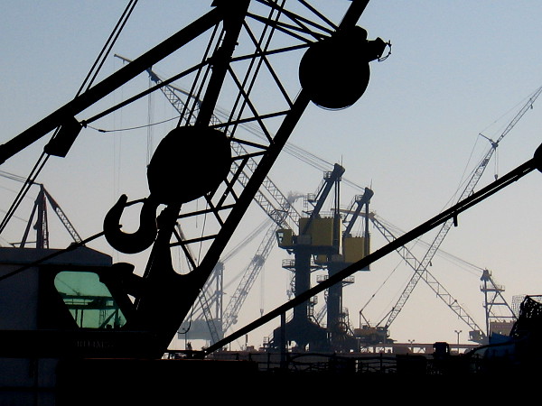
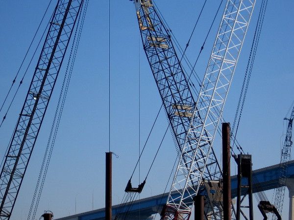
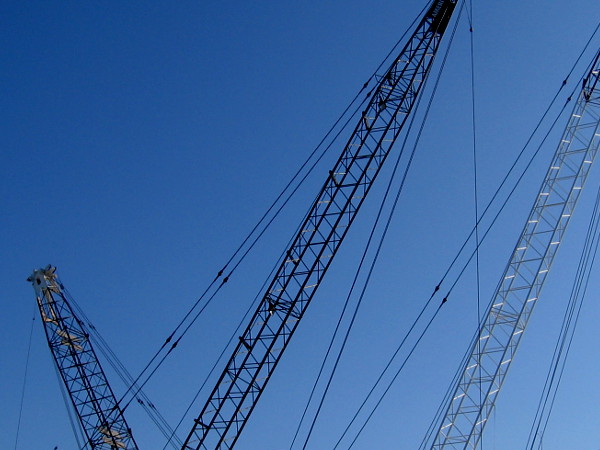
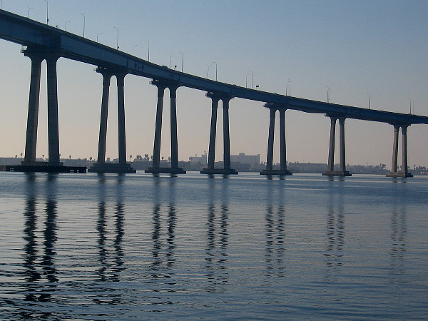
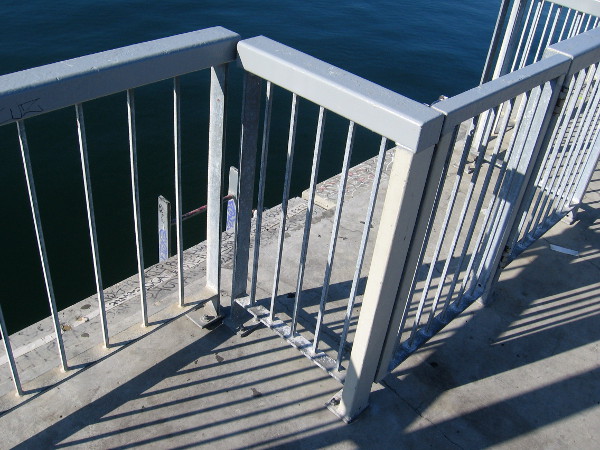
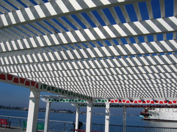
During a recent walk out onto the pier at Cesar Chavez Park, my eyes were dazzled by the surrounding complexity.
The cranes of nearby barges and distant shipyards . . . the curving San Diego-Coronado Bridge . . . the various structures, rails and benches on the pier . . . all of these elements combined with reflections and shadows to create interesting geometric patterns.
I cropped and altered the contrast of many photos to make them even more visually abstract and thought-provoking.
…
I live in downtown San Diego and love to walk around with my camera! You can follow Cool San Diego Sights via Facebook or Twitter!
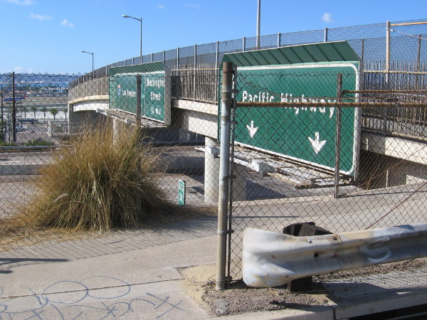
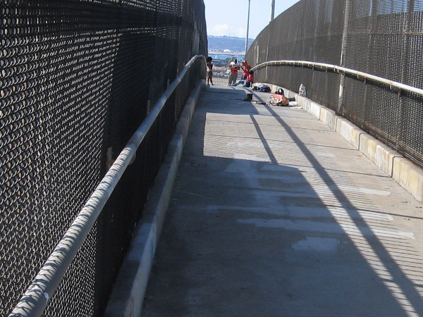
The gritty Interstate 5 pedestrian overpass at Palm Street connects India Street to Kettner Boulevard. It is little used. The homeless sometimes make it their home.
Just a few quick urban photos.
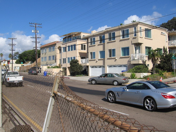
My long walk today included a stretch along India Street in San Diego’s Middletown neighborhood. I sauntered up India Street from Palm Street to Vine Street, in order to check out something indescribably cool that I will soon blog about. I then turned about and returned to the pedestrian freeway overpass, where I crossed over to Kettner Boulevard and made my way to the nearby Middletown trolley station.
The road here is in constant motion, with loads of traffic to and from Interstate 5. As I headed up the sidewalk I passed a number of small businesses in plain, mostly unremarkable buildings. Looking eastward I observed a jumble of modest but colorful houses climbing the steep hill. From busy India Street, residential streets ascend a short distance toward the top of Bankers Hill, and Mission Hills to the north.
Stay tuned! I have many more photos coming from today’s adventure! There’s a good chance you’ll really enjoy the aforementioned super cool sight!
In addition, before I headed up India Street, I checked out a new park in Bankers Hill and learned about some incredible, little known San Diego history!
I also swung by Balboa Park. I’ll be posting those photos later on my other blog, Beautiful Balboa Park!
I hope you all are having a great weekend!
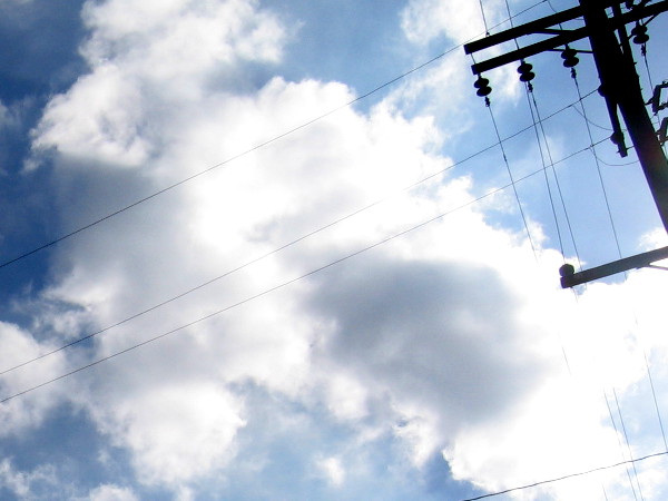
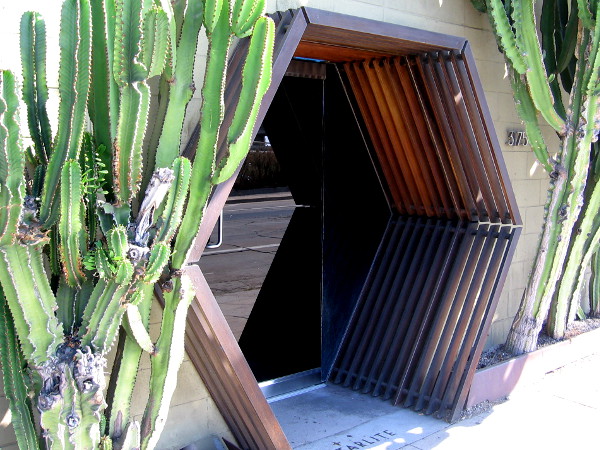
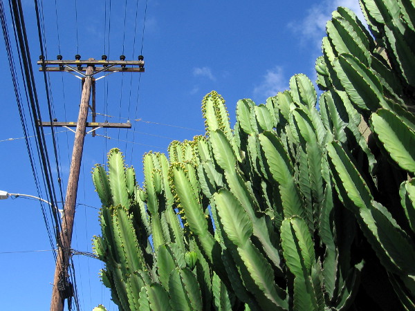
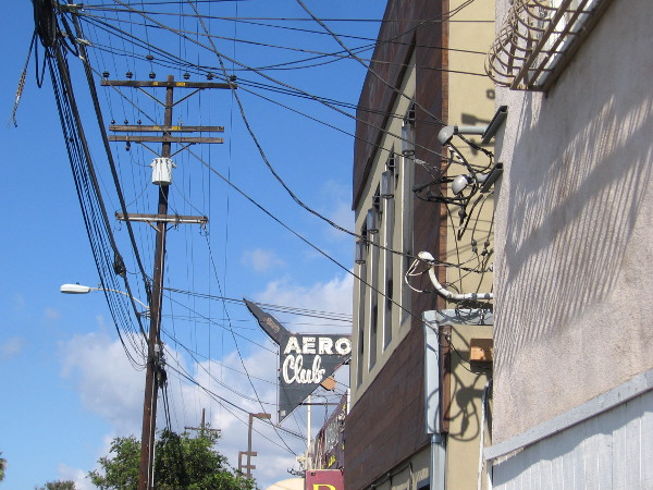
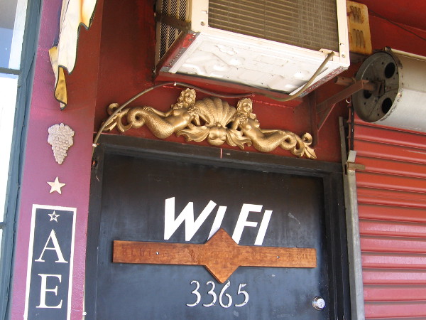
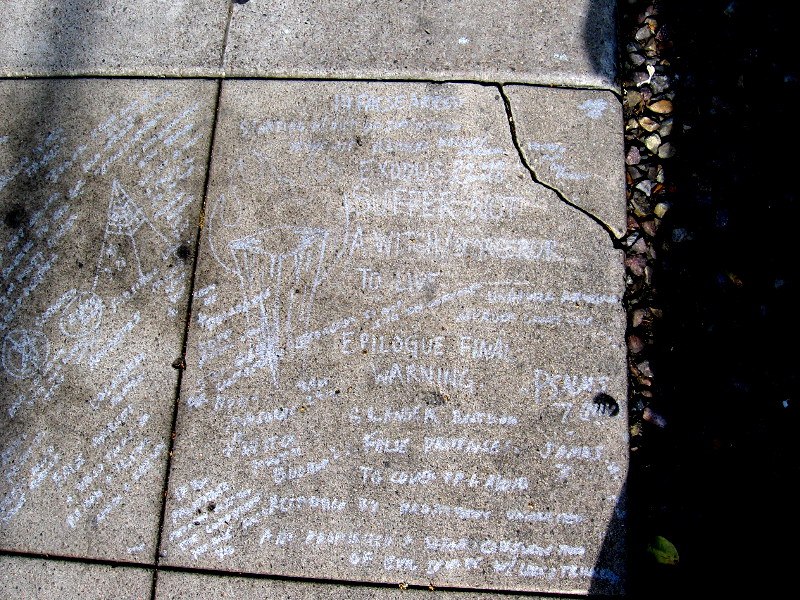
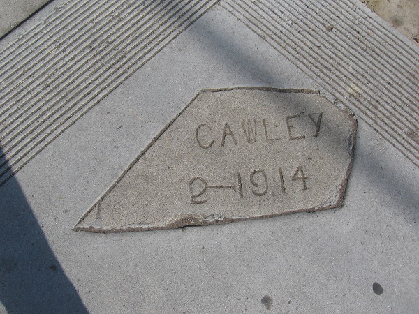
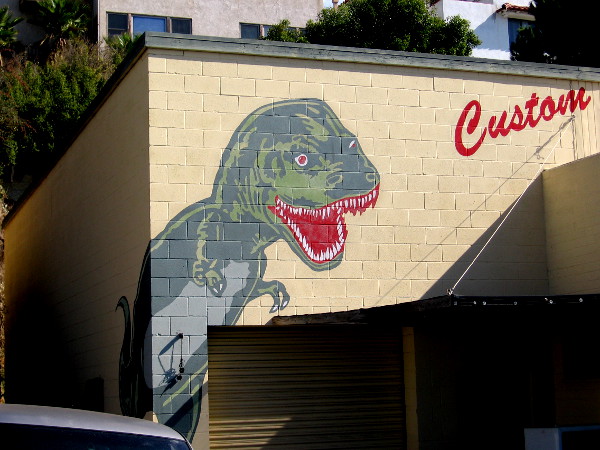
At first glance I thought some people were just hanging out above the freeway–but I was wrong! They were taking urban photographs with a model.A stretch of India Street looking north from the overpass. Cars speed along continuously. As I proceeded up the opposite sidewalk for many blocks, I saw no other walkers.Bright clouds in an urban setting.An interesting doorway beckons customers from India Street into the Starlite eatery.Cacti rise beneath electrical wires.I’m approaching the Aero Club. It seems my camera was aimed upward quite a bit today.Bold graphics on the white wall by the bar’s parking lot.Two golden mermaids above the front door of the Aero Club.Someone scratched many warnings, symbols, concerns and thoughts on a section of the sidewalk. Where is that person now?A fragment of sidewalk remains from 1914.A colorful dinosaur on the building of Dyno Brand custom t-shirts!
…
I live in downtown San Diego and love to walk around with my camera! You can follow Cool San Diego Sights via Facebook or Twitter!
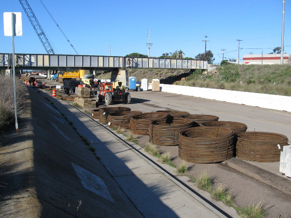
A crane and huge pipes on Friars Road near the site of the San Diego River Double Track (SDRDT) project.
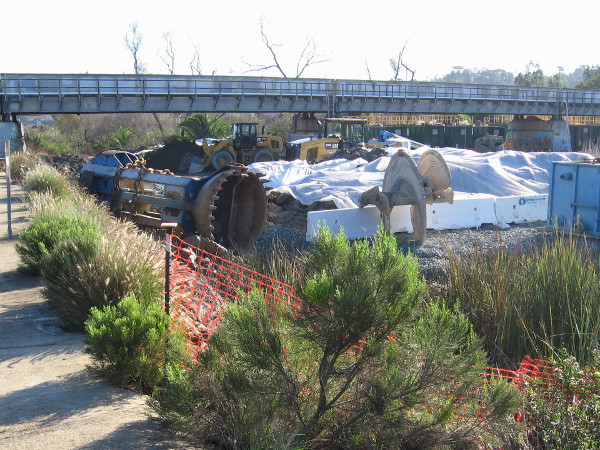
Here are some interesting photos! A new railroad bridge is being installed across the San Diego River just north of the Old Town Transit Station, allowing the Coaster and Pacific Surfliner trains to run faster and more reliably. This work is called the San Diego River Double Track (SDRDT) project. I’ve watched the progress for several months during my daily trolley commute. This construction is being done ahead of another project to install trolley tracks across the river for the Mid-Coast Trolley Project, which will extend Blue Line service up to UCSD and University Towne Center (UTC) in La Jolla.
I took these photos last Saturday during my walk along Friars Road approaching the San Diego River Estuary. I’m no expert on this construction–I’m just an ordinary citizen who was fascinated by what I saw!
A series of three big storms is beginning in San Diego as I post this. Hopefully the flooding in Mission Valley where I work doesn’t get completely out of hand! I might post photos!
I noticed these huge green tanks along Friars Road.I also saw these huge coils of steel cable.A big pile of dirt by the railroad bridge over the San Diego River where the double track work is taking place.I believe new train tracks will be on the other side of the existing bridge you see in this photo.Passing under the train tracks as I walk along a raised area beside Friars Road.Now I’m looking east at all sorts of construction equipment, gravel and other material.This thing looks like a huge drill! Perhaps its used for boring through the ground, but I’m not sure. If you know anything, leave a comment!
…
I live in downtown San Diego and love to walk around with my camera! You can follow Cool San Diego Sights via Facebook or Twitter!
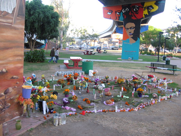
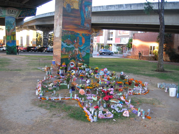
A large memorial remains in Chicano Park, almost four weeks after a tragic accident here took the lives of four people.
Almost a month after a tragic accident in Chicano Park, a large, spontaneously created memorial remains. It was created by many hands and hearts in the Barrio Logan community.
The memorial contains flowers, candles and other tokens of love, along with photographs of the deceased. Four were killed on October 14 when an automobile driven by a drunk driver plummeted from the Coronado Bay Bridge. Remembered are Annamarie Contreras, Cruz Elias Contreras, Andre Christopher Banks and Francine Denise Jimenez. Also remembered is Ramon “Chunky” Sanchez, who recently passed away. He was a beloved musician and inspiring leader in the local Chicano community.
Many candles are kept lit.
Candles, flowers and other powerful expressions of love stand beside a Chicano Park mural. They memorialize Annamarie Contreras, Cruz Elias Contreras, Andre Christopher Banks, Francine Denise Jimenez and Ramon “Chunky” Sanchez.Traditional symbols of love, grief and memory.
…
I live in downtown San Diego and love to walk! You can follow Cool San Diego Sights via Facebook or Twitter!
The Coronado Bay Bridge has seen far too many tragic suicides.
Would you please consider signing a very important online petition? The Coronado San Diego Bridge Collaborative For Suicide Prevention has begun a petition to help prevent Coronado Bay Bridge suicides.
Tragically, in the past 47 years, about 370 souls have jumped from the bridge. Most of these people felt driven to end their own lives because of deep depression. All could have been helped. The petition, addressed to the California Department of Transportation, asks that a suicide barrier be installed on the San Diego–Coronado Bridge. It would be similar to a intelligently-designed device now being installed on the Golden Gate Bridge in San Francisco, which is a unique type of a net that is configured to safely catch jumpers and arrest them until help arrives.
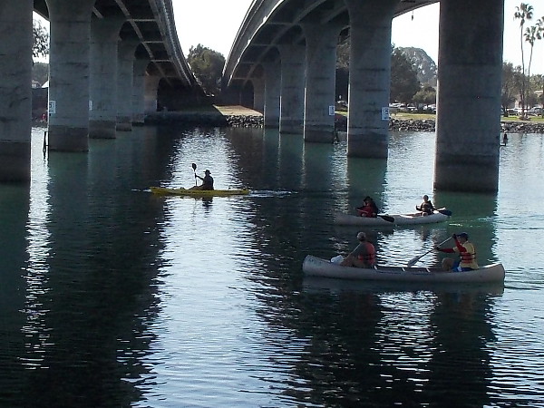
Many canoes and kayaks were passing under the Ingraham Street Bridge between South Cove and Perez Cove, not far from SeaWorld.
My long walk yesterday around Mission Bay yielded lots of photos. I started at Vacation Isle, then headed slowly and somewhat aimlessly to the jetty at the end of Hospitality Point. It was a journey through a tranquil San Diego paradise, on a warm winter day.
My photos feature relatively few people. But I can assure you thousands of folks were out enjoying the sunshine. They were fishing, boating, picnicking, reading, walking, playing sports on the grass… Mission Bay is a really big place.
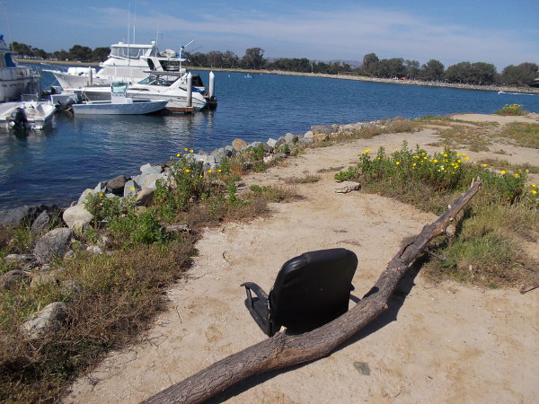
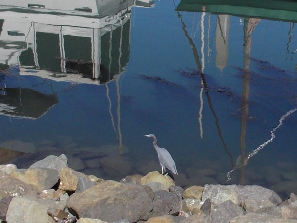
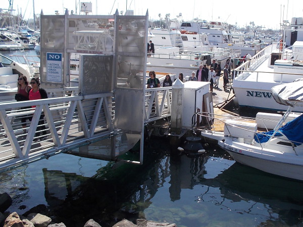
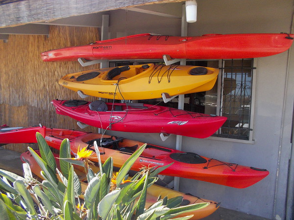
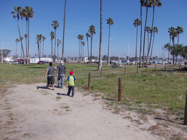
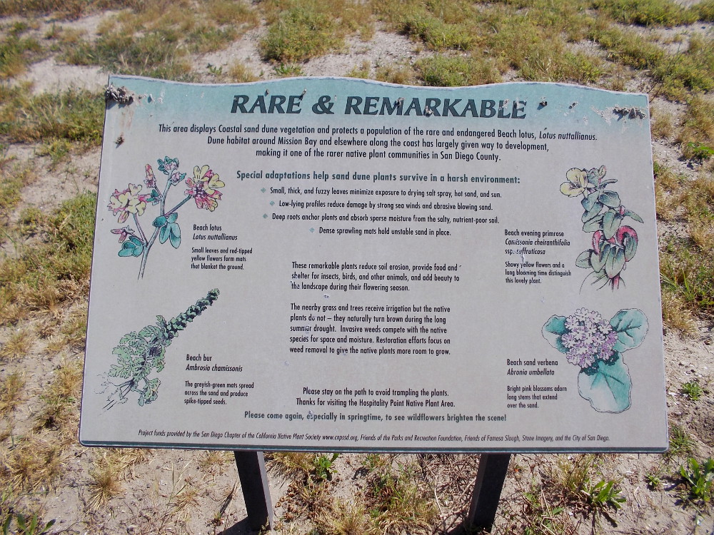
Radio control model sailboats cross the Model Boat Pond on Vacation Isle.These fire pits just north of Dana Landing have wood stacked ready for Saturday night.A casual seat on the dirt with great views.A heron on rocks, and reflections of boats at Dana Landing.Gazing from the West Mission Bay Drive Bridge down descending stairs toward Sunset Point.People return from an excursion out on the Pacific Ocean. The dock at Seaforth Sportfishing is always busy.Visitors walk through Marina Village on Mission Bay.A map by Quivira Basin shows areas off the coast that are protected. Conserving California’s Coastal Treasure.Kicking back with a best friend among boats on the blue water. In the distance you can see the Hyatt Regency Mission Bay Spa and Marina.Colorful kayaks await at Aqua Adventures.This tropical party shack seems long abandoned. It stands near an entrance to Mission Bay Marina.A dirt nature trail along the channel that connects the ocean and Mission Bay.Rare and Remarkable. This area displays Coastal sand dune vegetation. The native Beach lotus is endangered.Walking along the jetty west of Hospitality Point. This narrow strip of land separates the San Diego River, to the left, from the man-made channel into Mission Bay. One can see a sliver of Ocean Beach, on the left, and Mission Beach, on the right.A fisherman on land, and two on the water. Across the Entrance Channel lies very popular South Mission Beach.Bicycling along. Heading toward the end of the long jetty. It’s a beautiful day. One can see forever.
…
I wrote another short story! I penned it yesterday, during my walk along the bay.
It’s a bittersweet, philosophical, tiny piece of fiction. The sort of thing I like to write. There’s some sadness in the sunshine. The title is Light on the Restless and Small.
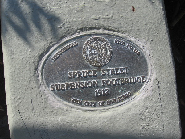
The classic Spruce Street Suspension Bridge is located just west of First Avenue and crosses narrow Kate Sessions Canyon. It’s an amazing, breathtaking 375 feet long! Steel cables support a gently swaying passage through and above treetops, and a walk along its length feels like a small, romantic adventure. The bridge was designed by Edwin Capps, the city engineer who was also responsible for plans to dredge San Diego Bay, and who would go on to be elected mayor. (It was Capps who hired the rainmaker Charley Hatfield, the central character in one of San Diego’s most legendary tales! Perhaps I’ll blog about it one day…)
Built in 1912, the purpose of the Spruce Street Suspension Bridge was to provide easy access for those who lived to the west to trolley lines on Fourth and Fifth Avenue.
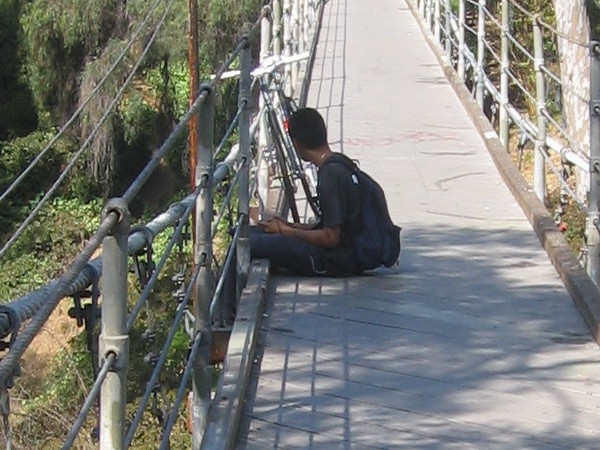
The Spruce Street steel cable suspension footbridge, engineered by Edwin Capps, was erected in 1912.Wouldn’t you like to walk out on this bridge?The swaying suspension bridge is a unique, historic structure just north of downtown San Diego.Lots of people love this hidden bridge. You feel like you’re crossing through a wilderness of treetops!Bicyclists enjoy a dirt trail 70 feet below.Boy sits thoughtfully on the Spruce Street Suspension Bridge in Bankers Hill.
…
To enjoy future posts, you can “like” Cool San Diego Sights on Facebook or follow me on Twitter.
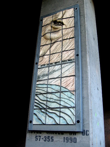
A human heart hovers above the Serra Museum atop nearby Presidio Hill in this extremely unique ceramic artwork.
There’s some fascinating public art in Mission Valley that few people see. It’s located in the deep shadows beneath Interstate 8 where the freeway passes over Hotel Circle. Eyes are adjusting to darkness as motorists, turning a corner, quickly pass five ceramic panels high on drab concrete pillars. The one sidewalk is located on the opposite side of the street. To really appreciate the artwork, you have to cross traffic dangerously and stand in a narrow band of dirt right up close.
Today I walked to work past the darkly obscured art and decided to finally get a closer look.
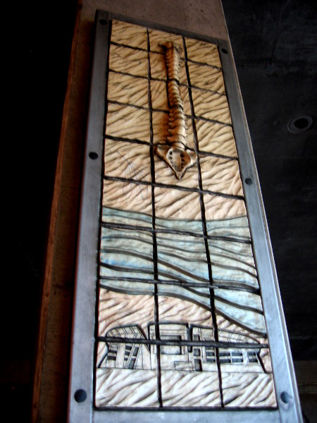
Vital Parts, installed in 1999, was created by local San Diego artist Joanne Hayakawa. The pieces seem to be stratified, crumbling and sculpted by time and memory. They seem to blend with the dirt beneath the bare bridge.
The very dark Interstate 8 underpass at Hotel Circle features seldom appreciated public art.Vital Parts, by artist Joanne Hayakawa, was installed on five pillars of a Mission Valley freeway bridge in 1999.Mysterious fossil-like hand hovers above nearby San Diego River and what I believe are Native American structures.Human brain, made golden by underpass light, crowns image of old Mission San Diego and the ever-present blue river.Spine rises over what I believe is modern Qualcomm Stadium. This earthy art is very unusual and evocative.Chin and silent mouth seem like a timeless clay mask beside the eternally flowing river.
…
To enjoy future posts, you can “like” Cool San Diego Sights on Facebook. or follow me on Twitter.
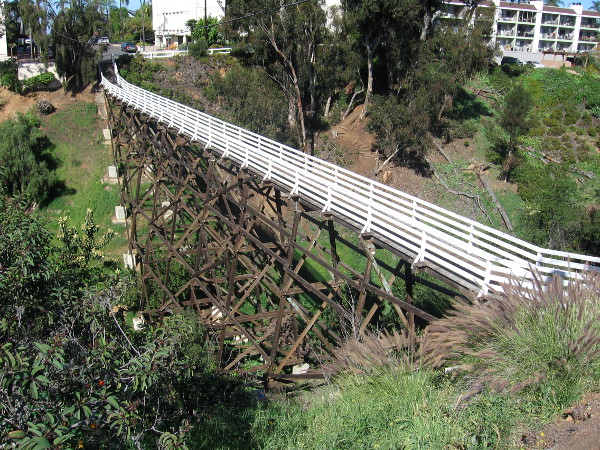
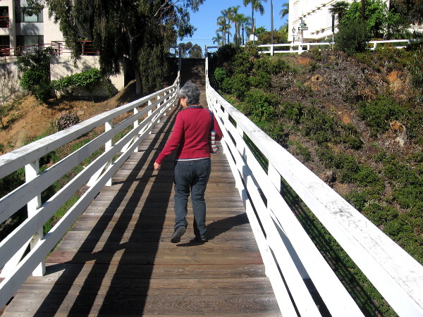
View of the Quince Street Trestle from a spot on Fourth Avenue.
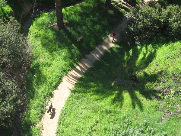
Many nature hikes can be enjoyed in Balboa Park. But there’s another beautiful, quiet hike through date palms and eucalyptus trees and bright spring flowers that anyone can enjoy just a few blocks north of downtown San Diego.
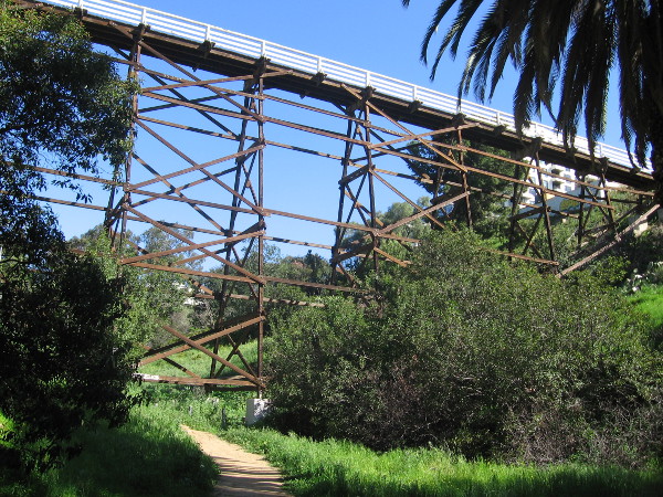
The Maple Canyon Trail stretches from a trailhead near Quince Street and Third Avenue on Bankers Hill to a second trailhead at Maple Street and Dove Street in Middletown. It often seems that the only people who use the trail are dog walkers and joggers who live nearby. Those who haven’t hiked this easy trail are missing out on a unique experience. The Maple Canyon Trail passes under two cool historic bridges!
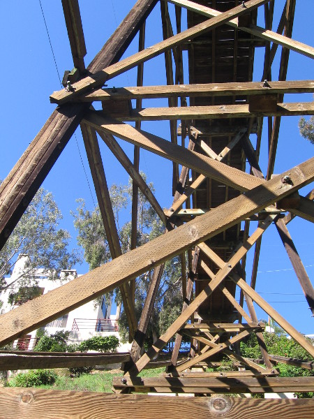
The Quince Street Trestle is a visually interesting wooden footbridge that was built in 1905. Back then streetcars ran up Fourth Avenue, and the trestle allowed pedestrians to cross the steep canyon from the west. A quarter century ago the bridge, weakened by termites and rot, was closed and almost demolished. Local residents took up the cause of saving the bridge, which was finally declared a historic site.
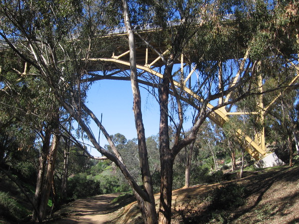
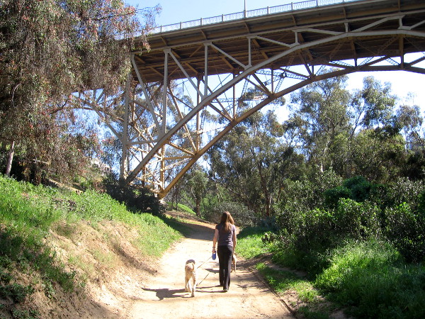
The Maple Canyon Trail also passes beneath the impressive First Avenue Bridge. The arched steel bridge was built in 1931 and was originally known as the Peoples Bridge. Its astonishing height above the trail is a reminder of San Diego’s unique geology. Southern California’s coastal region is crisscrossed in many places by deep, narrow canyons, which often serve as undeveloped habitat for native species of plant and animal life.
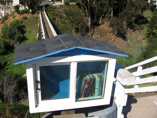
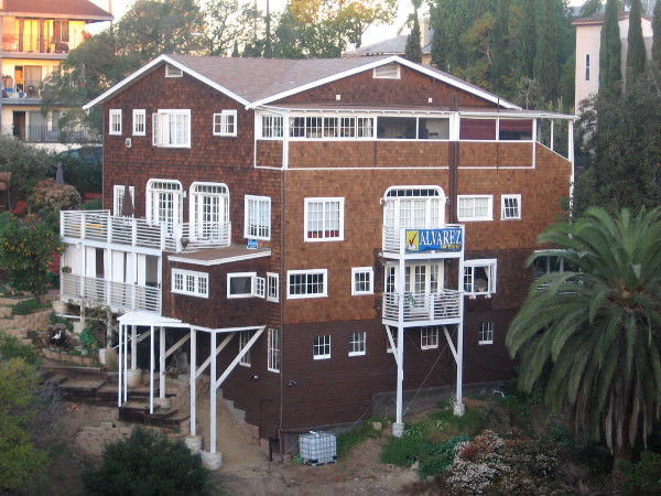
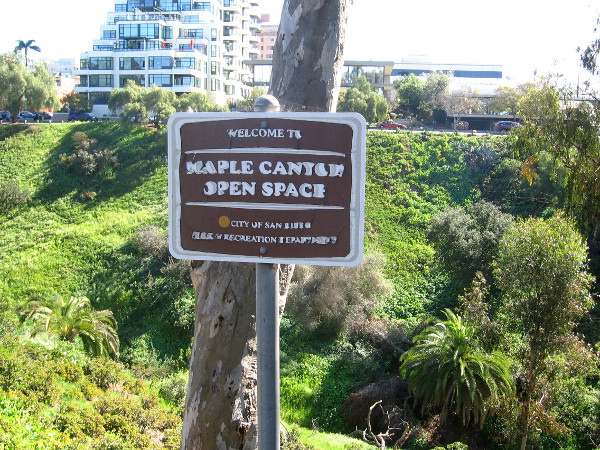
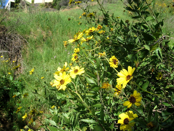
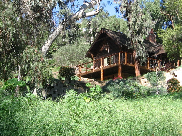
Small cabinet at end of footbridge contains books that people can freely borrow!Walking across the very cool historic trestle on Bankers Hill.Looking down from trestle at dogs and walker passing through the canyon below.This super cool condo is located near the Third Avenue trailhead.Maple Canyon Open Space sign near trailhead on Bankers Hill.Looking up at the wooden footbridge from the quiet footpath on a sunny day.Wood beams compose the high trestle.Grass and spring flowers line the Maple Canyon Trail.Some interesting houses can be seen up on the hillsides.Here comes the First Avenue Bridge beyond a eucalyptus tree.This elegant old steel bridge has very limited motor traffic.
…
To enjoy future posts, you can “like” Cool San Diego Sights on Facebook or follow me on Twitter.