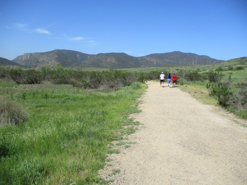
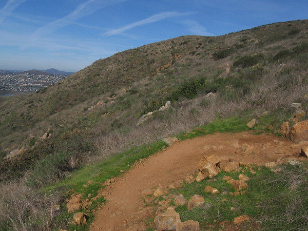
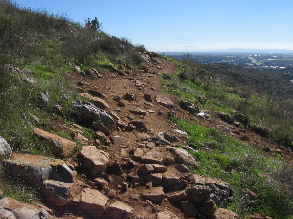
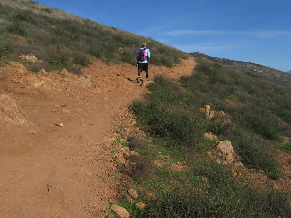
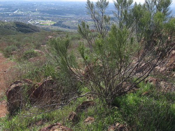
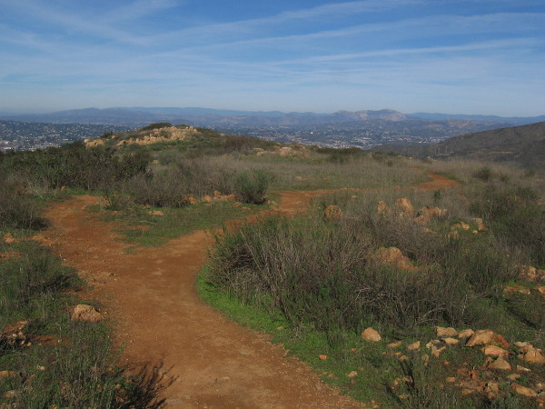
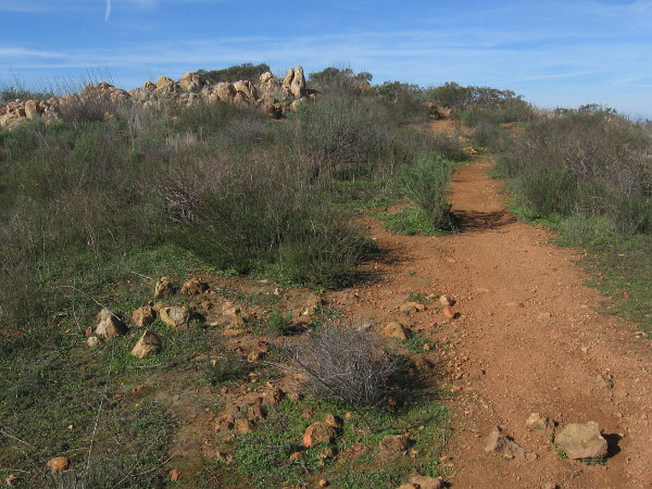
Yesterday, as part of a much longer walk in urban Santee, I enjoyed a very short, easy hike in the northeast corner of 7,220-acre Mission Trails Regional Park.
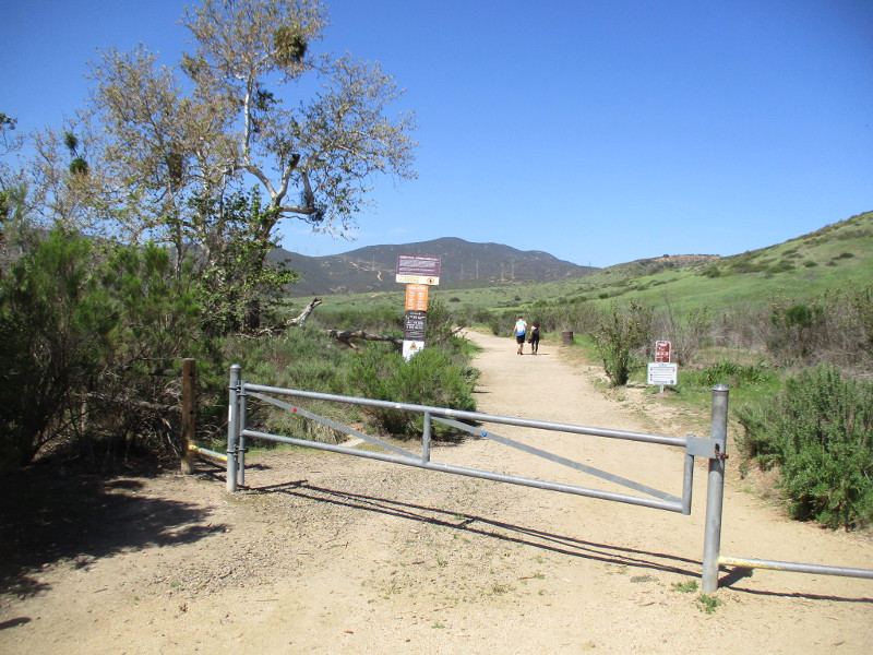
I started at the East Fortuna Staging Area and proceeded from the Equestrian Circle Trailhead west a quarter mile or so, just to enjoy the beautiful natural scenery.
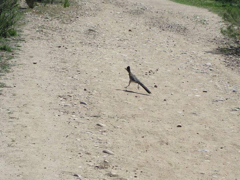
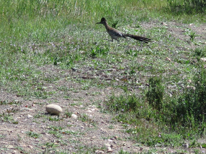
Imagine my surprise when I quickly spotted a roadrunner!
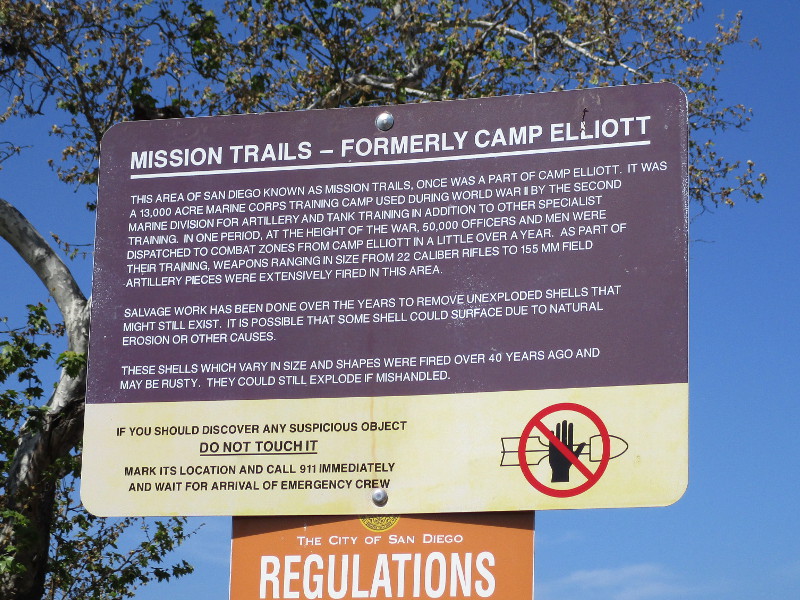
The City of San Diego’s wild, rugged Mission Trails area, during World War II, was used to train members of the 2nd Marine Division. Camp Elliott is where they learned to fire artillery and operate tanks. According to the above sign posted near the trailhead: “At the height of the war, 50,000 officers and men were dispatched to combat zones from Camp Elliott in a little over a year.”
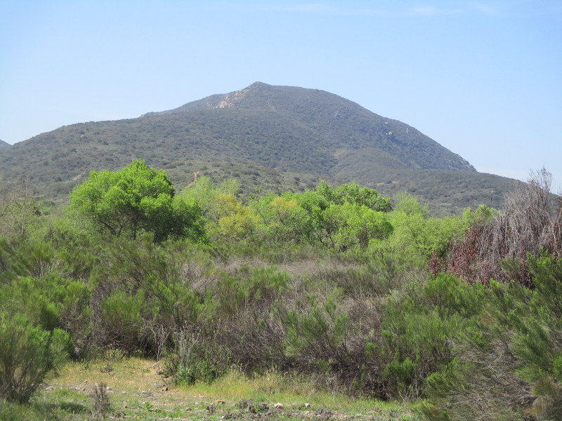
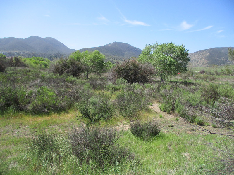
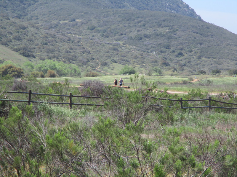
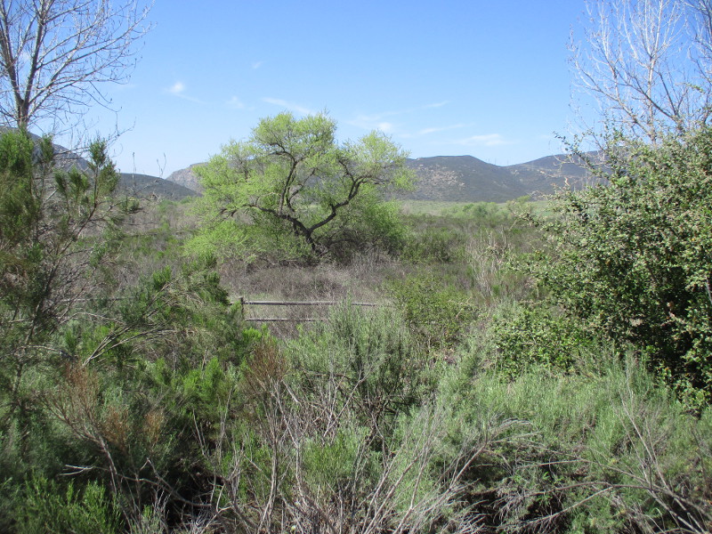
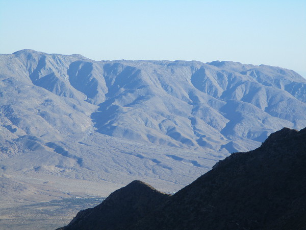
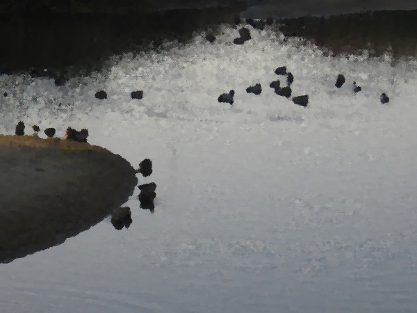
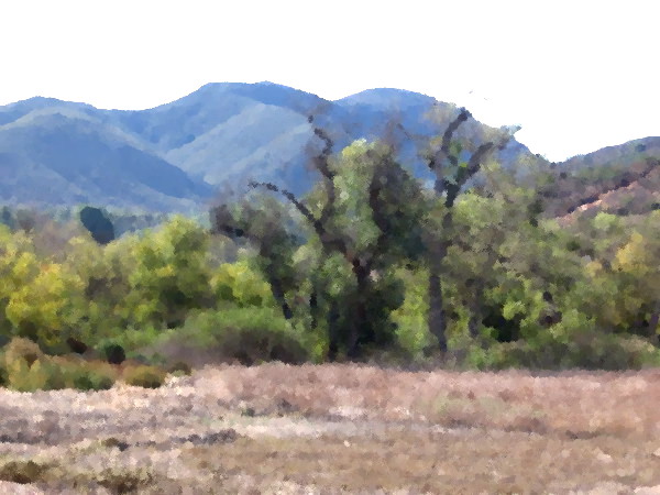
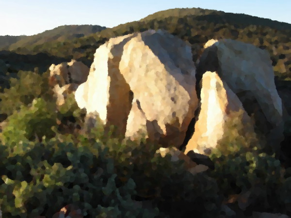
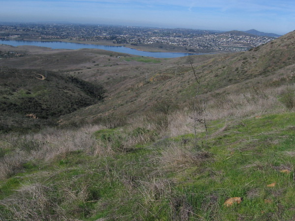
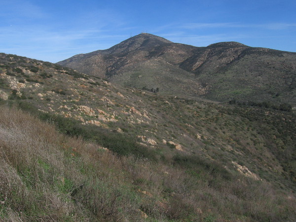
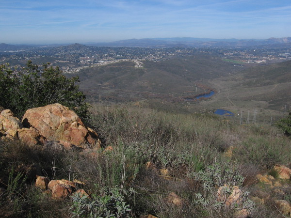
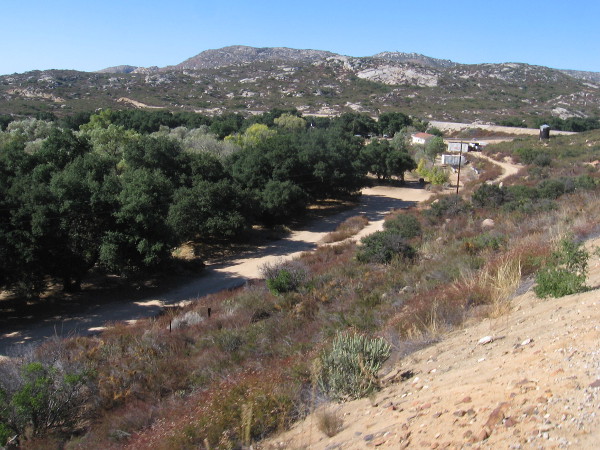
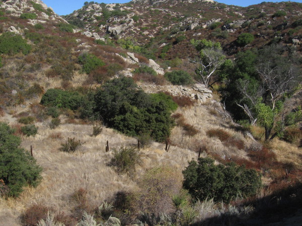
The canyons, mountains and grasslands of Mission Trails are now home to abundant wildlife and natural beauty.
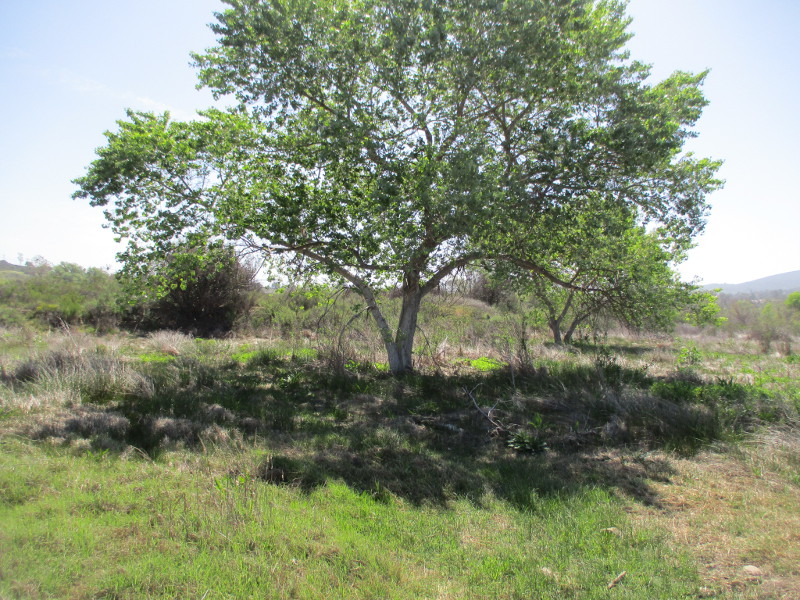
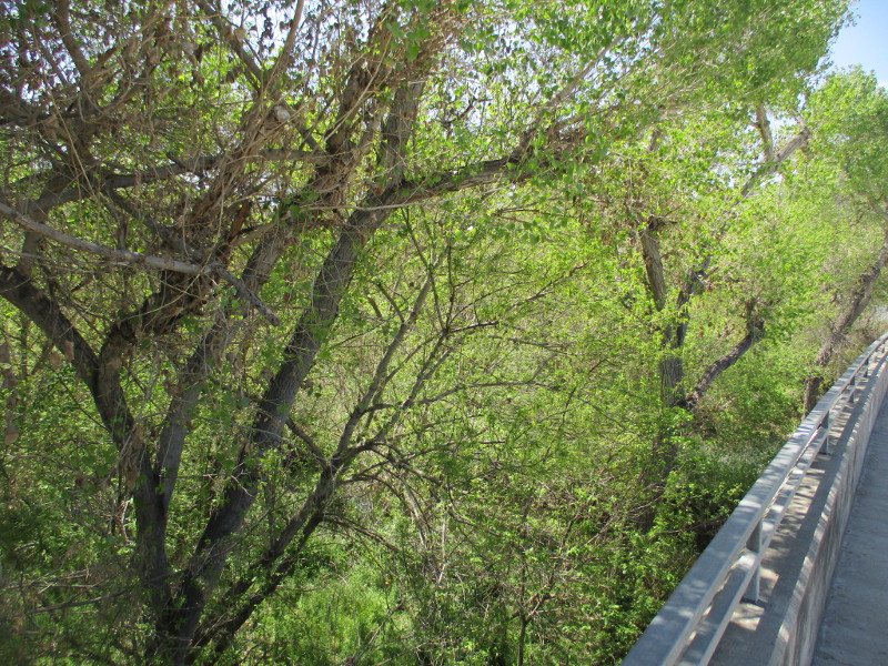
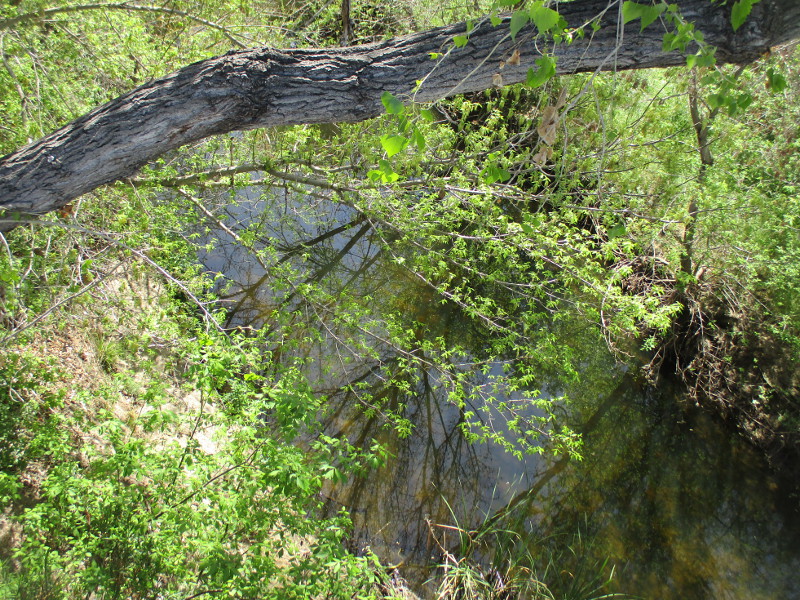
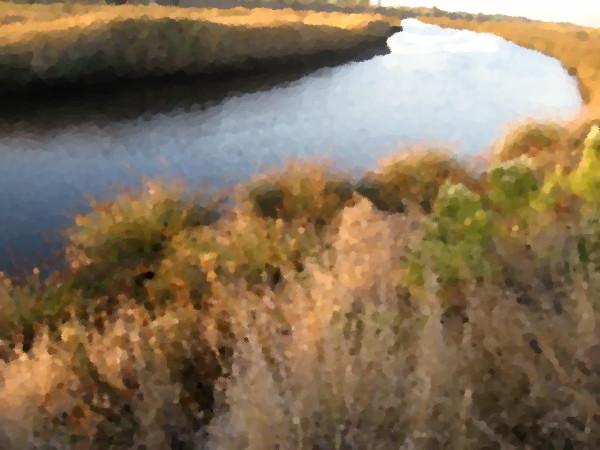
Trees in the distance line the San Diego River where its life giving water flows through the park.
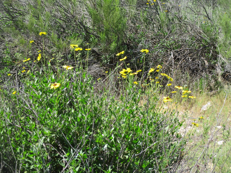
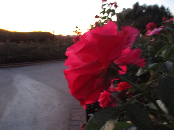
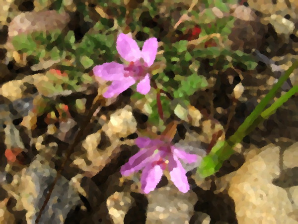
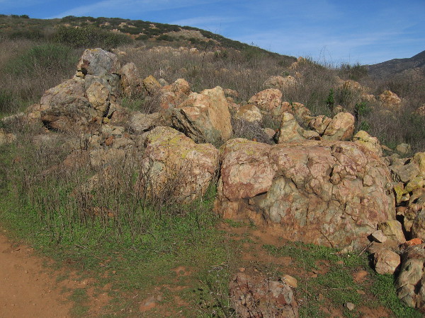
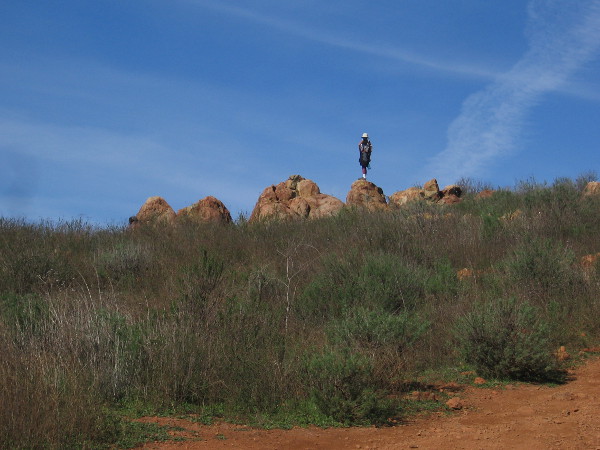
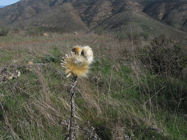
Some bright California bush sunflowers near the trail…
…
I live in downtown San Diego and love to walk around with my camera! You can follow Cool San Diego Sights via Facebook or Twitter!
I took the following photographs today during a long looping walk around the west half of Santee.
From the Santee Trolley Square transit station I headed north up Cuyamaca Street, then west along Mast Boulevard to the East Fortuna Staging Area at Mission Trails Regional Park. After taking a short hike in the park, I headed south down West Hills Parkway and back east to the trolley station via Mission Gorge Road.
During the walk through Santee I snapped these photographs. Much of the walk was past homes, schools and businesses, but there were also these glimpses of natural beauty. (Additional photos that I’ll post in the next day or two include my short Mission Trails hike, an unusual historical monument, and very unique public artwork.)
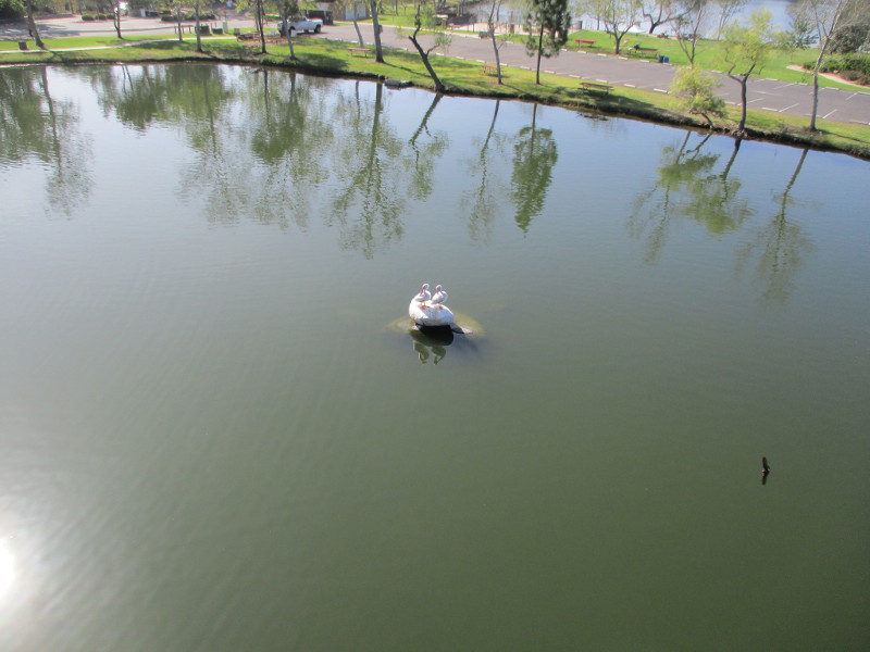
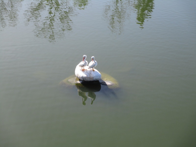
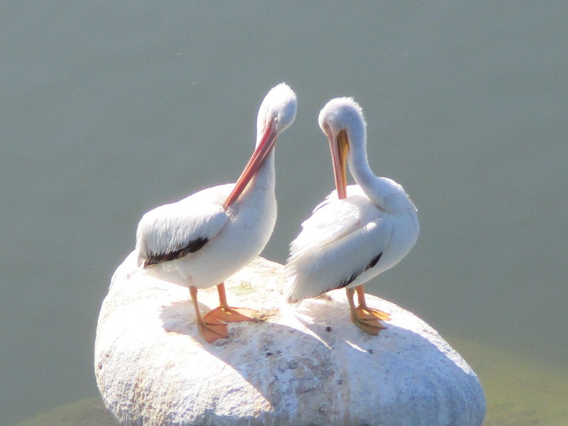
The following three photos were taken as I walked down Mast Boulevard over Santee Lakes Recreation Preserve. Far below, in the middle of Lake 2, two white pelicans were standing on a rock. I also saw dozens of swallows flying out from beneath the bridge, but the tiny birds darted about so swiftly I was unable to capture a good photograph of them. You can see one swallow zipping by in this first photo…
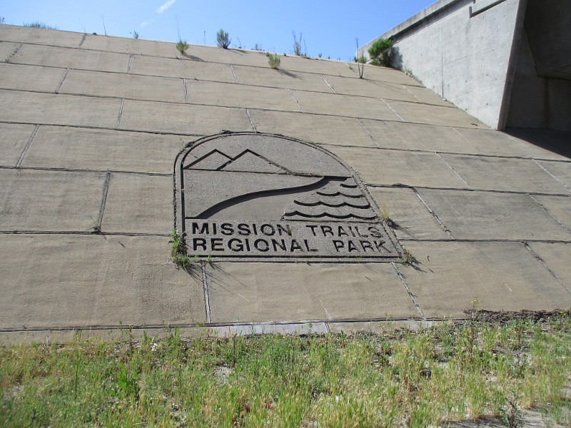
As I walked down Mast Boulevard under State Route 52, I saw an indication that I had almost reached Mission Trails Regional Park.
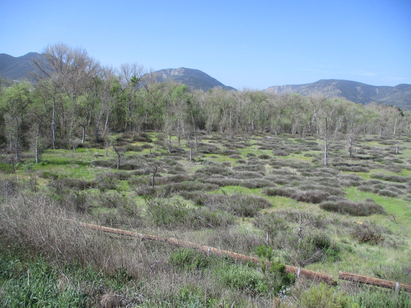
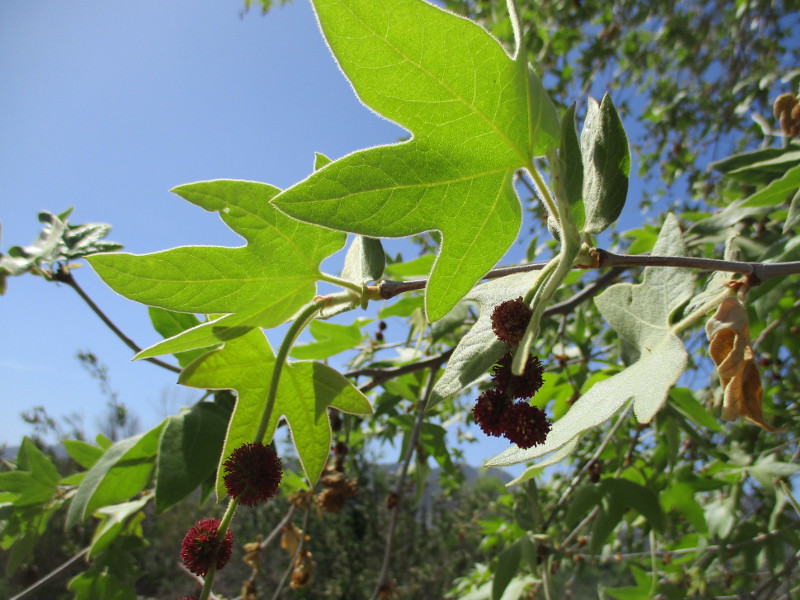
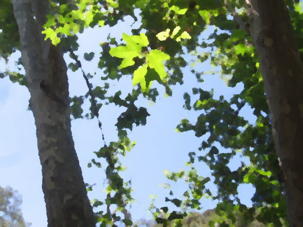
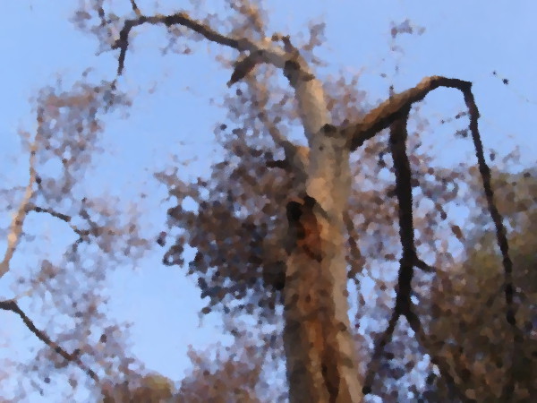
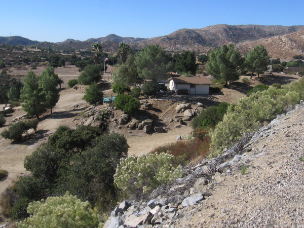
Then I headed into the East Fortuna Staging Area. From the entrance driveway and parking lot I took photographs of the mountains beyond trees lining the San Diego River, and some sycamore leaves.
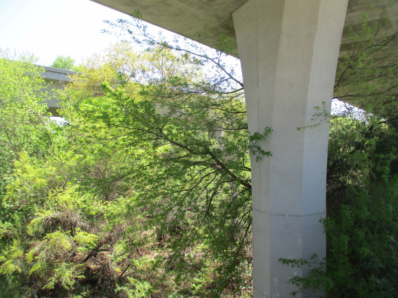
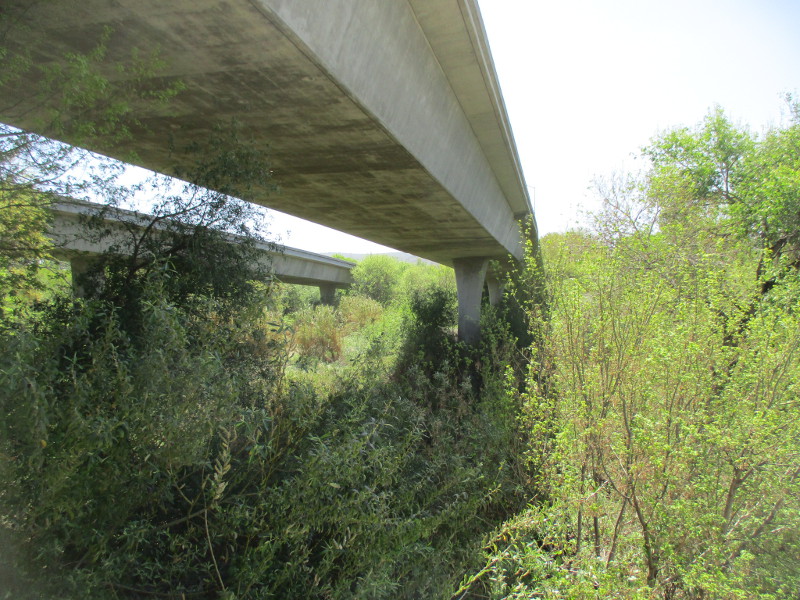
Walking south down West Hills Parkway took me to the place where State Route 52 passes over the San Diego River…
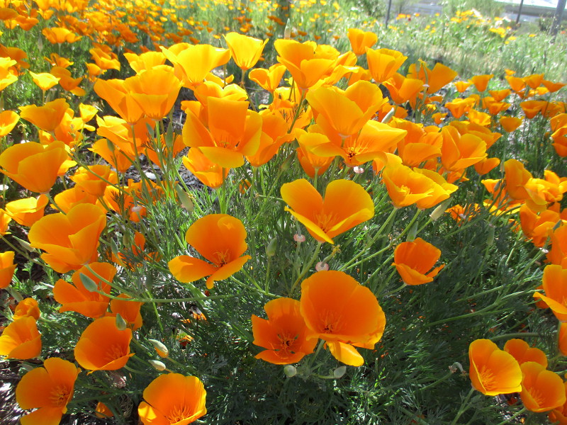
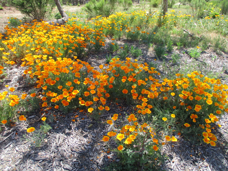
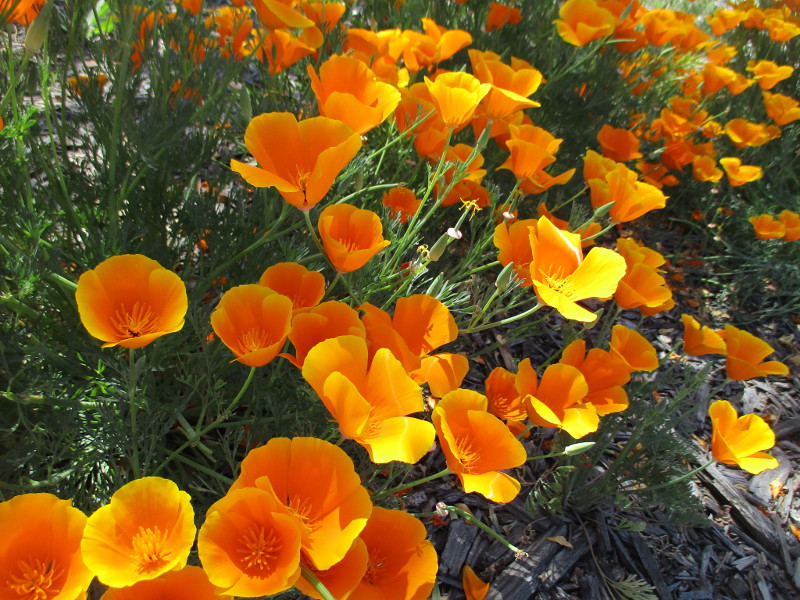
Finally, where State Route 125 meets Mission Gorge Road, I was surprised to find a beautiful golden patch of California’s State Flower: the California poppy.
(Incidentally, last Tuesday, April 6 was officially California Poppy Day!)
…
I live in downtown San Diego and love to walk around with my camera! You can follow Cool San Diego Sights via Facebook or Twitter!
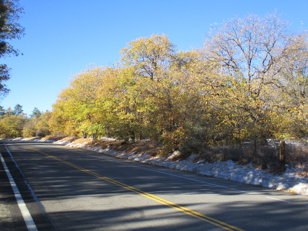
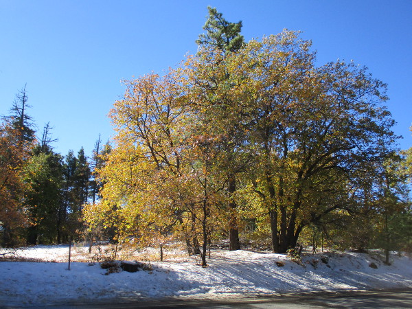
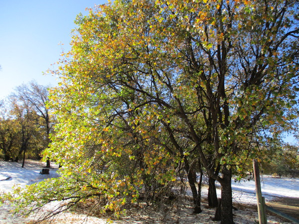
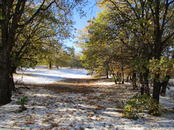
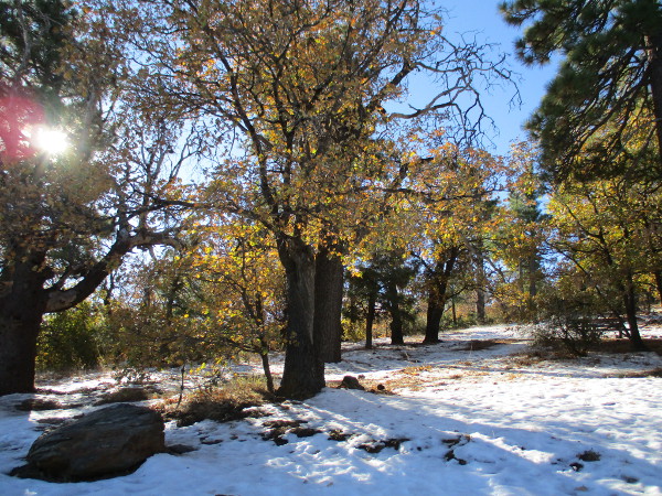
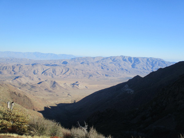
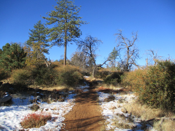
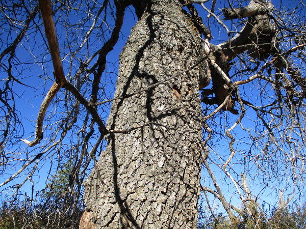
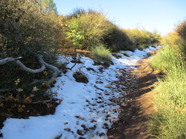
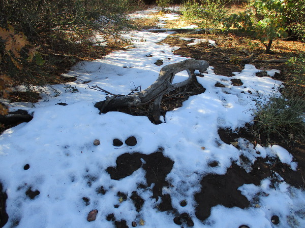
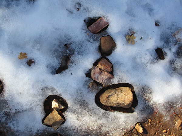
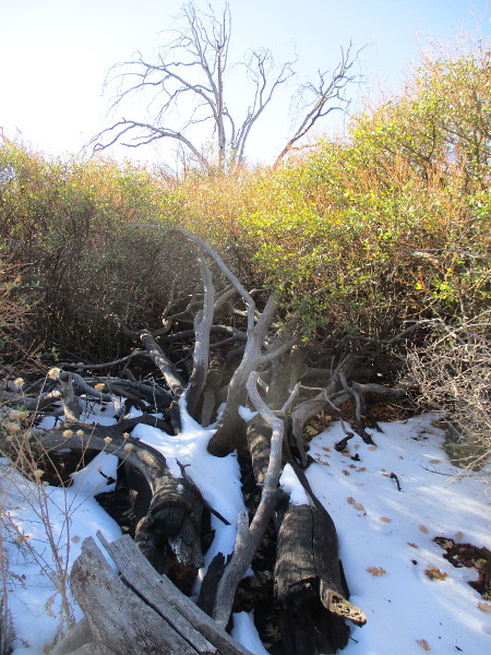
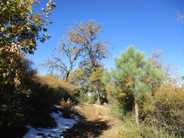
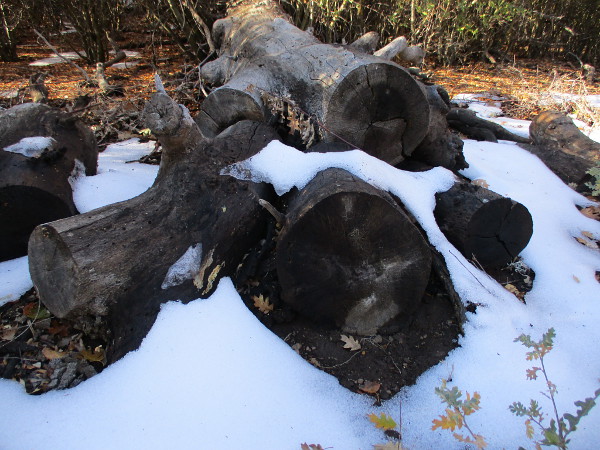
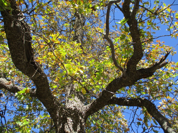
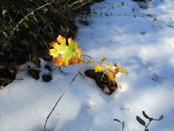
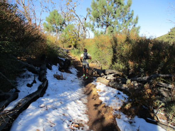
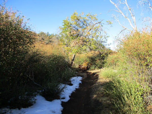
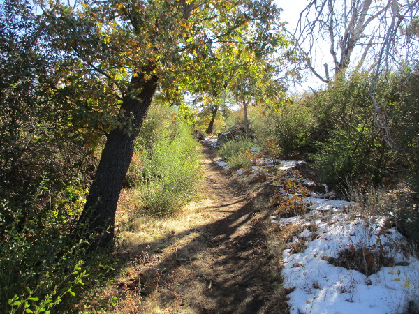
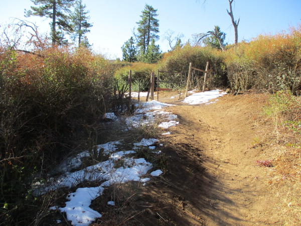
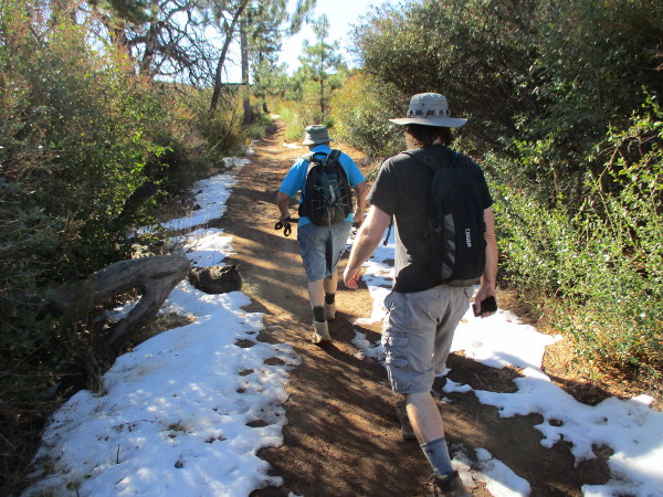
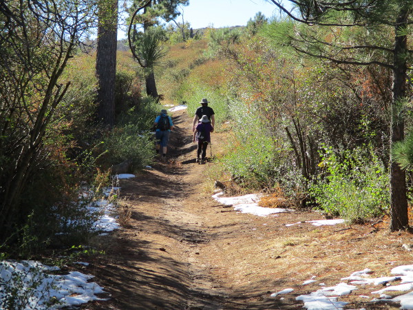
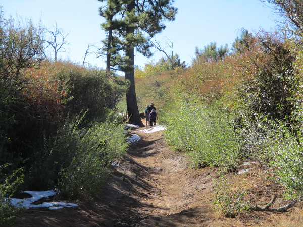
It’s autumn on Mount Laguna, and the natural beauty this morning was breathtaking.
The leaves of oak trees are turning. Yellows shine brightly under the mountain sunlight. White snow lingers on the ground from past storms.
The sky is blue, the air is dry and chilly, the sunshine is warm.
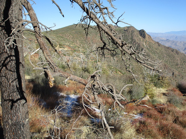
I headed east on Interstate 8 from downtown San Diego shortly after the crack of dawn. The November sun was climbing well above the eastern horizon as I drove north up the winding Sunrise Highway. Seeking a little quiet, I arrived well ahead of most weekend visitors.
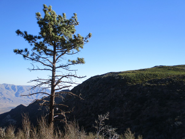
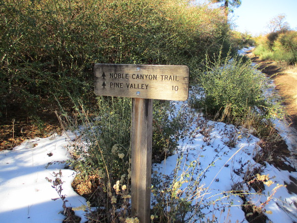
I pulled over at several turnouts as I gained elevation, just to look around me. I eventually arrived at Penny Pines, parked, put on a light jacket, and started a short distance down the Noble Canyon Trail. Then I turned about and slowly hiked a short distance up the Big Laguna Trail.
No particular destination.
Come with me…
…
I live in downtown San Diego and love to walk around with my camera! You can follow Cool San Diego Sights via Facebook or Twitter!
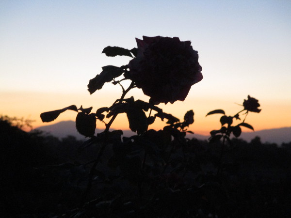
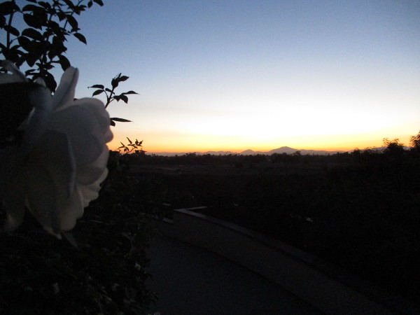
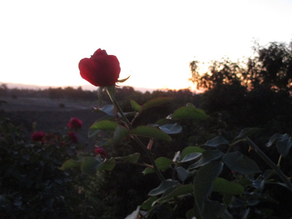
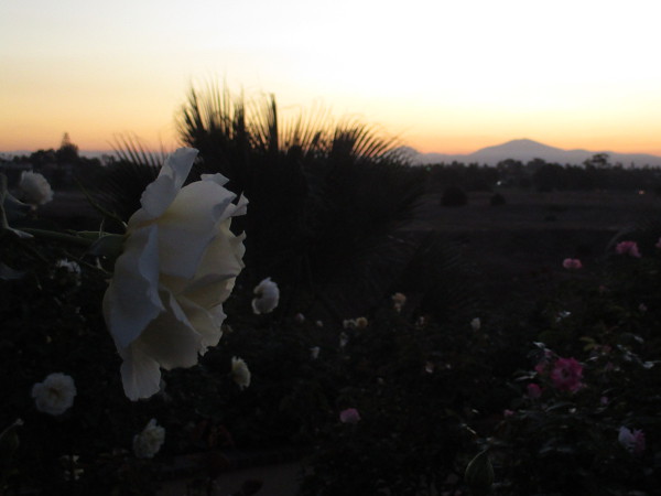
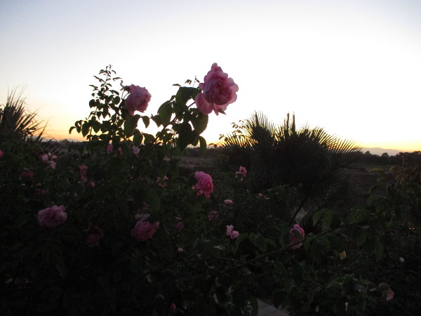
Early yesterday morning I took photographs of the sunrise from Balboa Park’s beautiful Inez Grant Parker Memorial Rose Garden.
This world-class rose garden overlooks Florida Canyon and offers views of San Diego’s mountains in East County.
Should you ever visit Balboa Park, look for the many flowers next to Park Boulevard. This small bit of heaven can be enjoyed south of the pedestrian bridge at the east end of El Prado.
…
I live in downtown San Diego and love to walk around with my camera! You can follow Cool San Diego Sights via Facebook or Twitter!
It’s going to be hot this weekend. So I’m planning on taking it easy–do some reading by the water, perhaps write something.
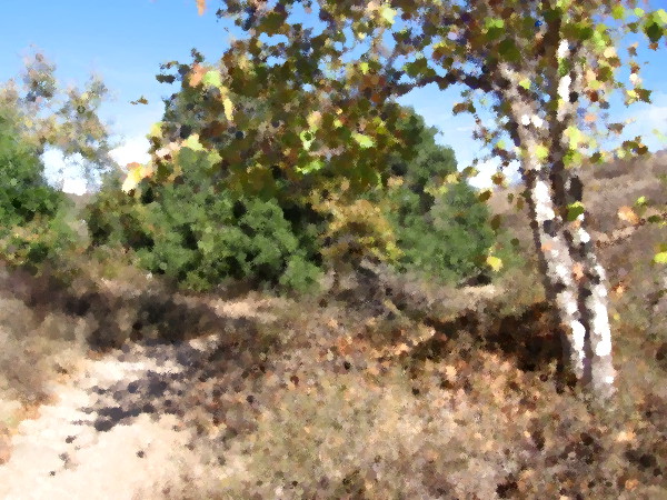
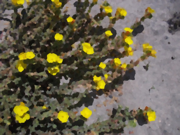
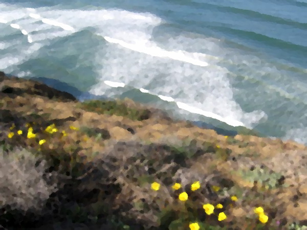
Meanwhile, I thought it would be fun to create even more digital oil paintings!
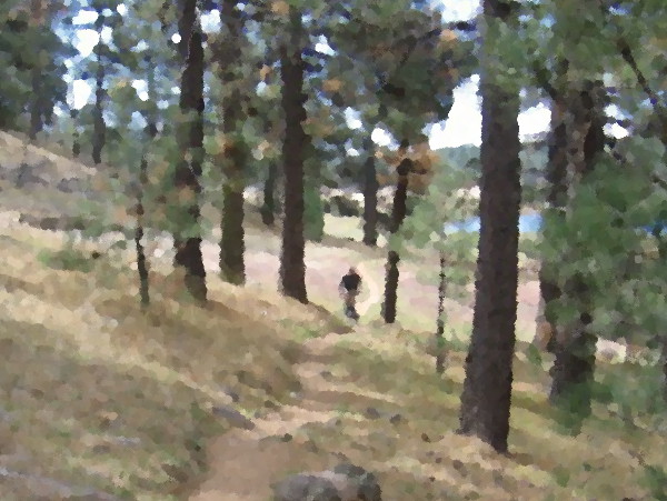
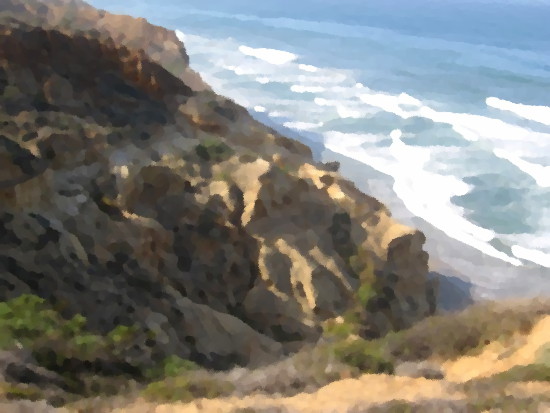
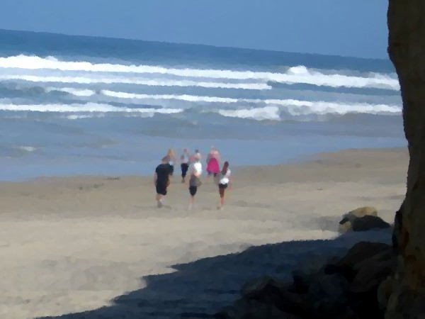
My recent walk in San Clemente Canyon has inspired me to select a few past photos of nature’s beauty, and transform them into “paintings” with GIMP’s graphic Oilify filter.
If you think you recognize the ocean at Torrey Pines State Reserve, the San Diego River, Mount Laguna, snow at Cuyamaca Rancho State Park, and Mission Trails Regional Park–in no particular order–you’d be correct!
…
I live in downtown San Diego and love to walk around with my camera! You can follow Cool San Diego Sights via Facebook or Twitter!
You can easily explore Cool San Diego Sights by using the search box on my blog’s sidebar. Or click a tag! There are thousands upon thousands of photos for you to enjoy!
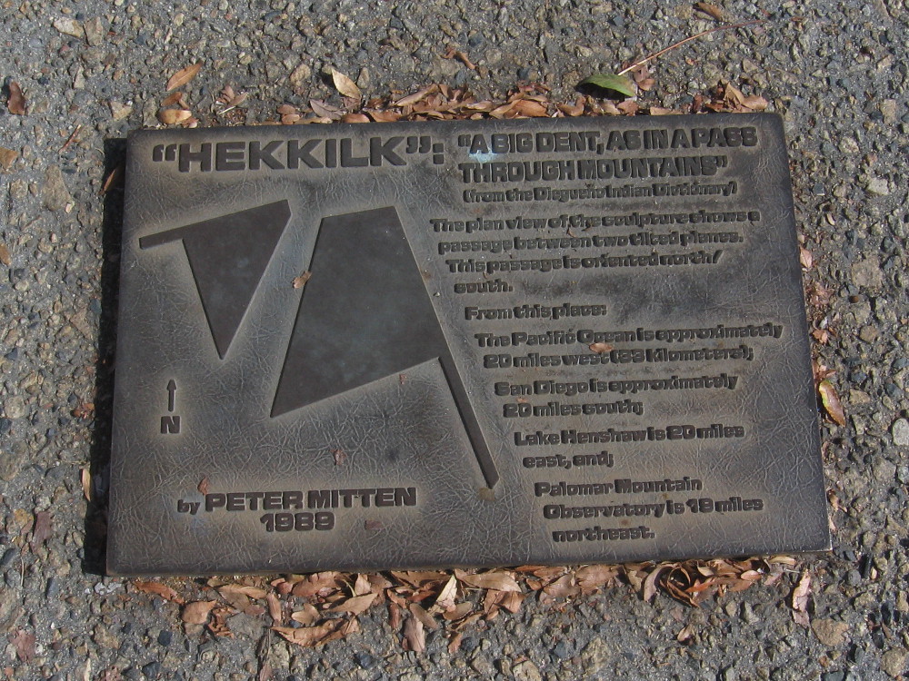
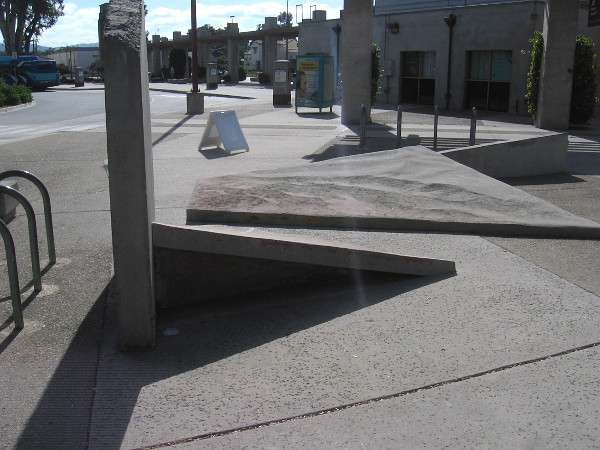
Unusual public art stands in the middle of the Escondido Transit Center. The abstract concrete sculpture is surrounded by North County Transit District bus stops.
Tilted concrete slabs, like geometric planes, form a narrow passage. The title of the sculpture is Hekkilk, and it was created by Peter Mitten in 1989. According to a nearby plaque, Hekkilk is a Diegueño Indian word that means “a big dent, as in a pass through mountains.”
The abstract concrete sculpture is apparently a representation of local geography.
The passage is oriented north/south. Approximate distances from the sculpture to various geographic points in San Diego County are noted on the plaque.
For several decades, those travelling through Escondido have been able to take a few steps through this “big dent” and contemplate the larger world around them.
…
I live in downtown San Diego and love to walk around with my camera! You can follow Cool San Diego Sights via Facebook or Twitter!
You can easily explore Cool San Diego Sights by using the search box on my blog’s sidebar. Or click a tag! There are thousands upon thousands of photos for you to enjoy!
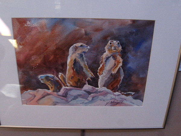
Prairie Dogs on Alert, watercolor by artist Jami Wright.
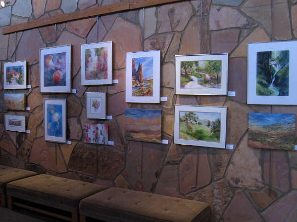
Artwork depicting nature’s awesome beauty can now be enjoyed inside the Visitor Center at Mission Trails Regional Park. The exhibition is appropriately titled: Isn’t it Amazing.
Dozens of pieces by award-winning artists Pat Dispenziere, Elaine Harvey, Otto Kruse, Victoria Alexander Marquez and Jami Wright are displayed on several walls of the Visitor Center. Through the use of watercolor, mixed media and photography, the artists have framed and realized scenes of natural beauty.
This morning, after finishing an extraordinary wildlife tracking walk (which I’ll blog about shortly), I stepped into the Visitor Center to admire the artwork. I took a few photos to provide a small taste.
Are you in San Diego? Do you appreciate excellent art? All of these pieces are available for purchase!
And guess what? Take home some collectible artwork and a portion of the sale will benefit the Mission Trails Regional Park Foundation!
Isn’t it Amazing is open free to the public and runs through February 14, 2020.
Colorful artwork depicting nature’s beauty on display in the art gallery at the Mission Trails Regional Park Visitor Center.
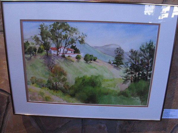
High Valley, watercolor by artist Pat Dispenziere.
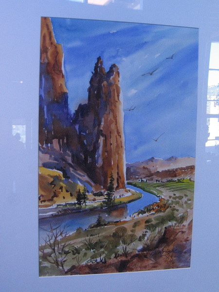
Smith Rock, Central Oregon, watercolor by artist Jami Wright.
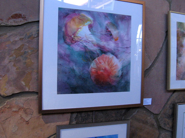
Dances With Waves, watercolor by artist Elaine Harvey.
Sycamore Sun, watercolor by artist Elaine Harvey.
In the Forest Deep, watercolor by artist Jami Wright.
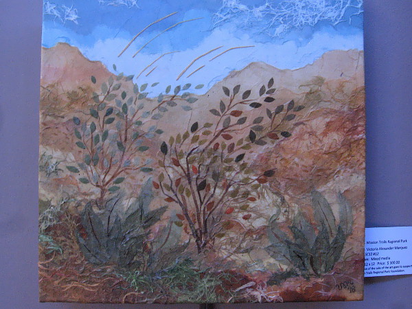
SC12 #12, mixed media by artist Victoria Alexander Marquez.
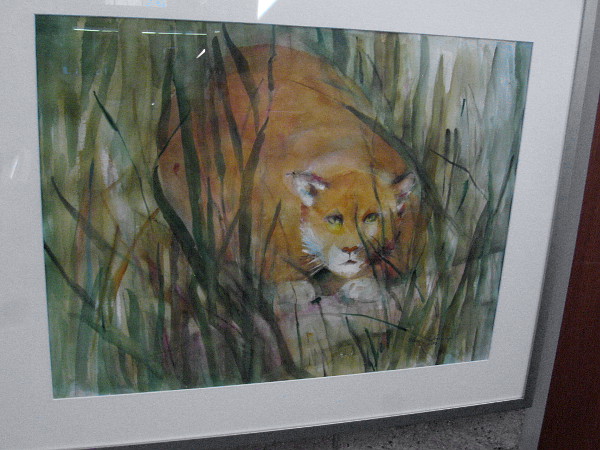
Seldom Seen, watercolor by artist Elaine Harvey.
…
I live in downtown San Diego and love to walk around with my camera! You can follow Cool San Diego Sights via Facebook or Twitter!
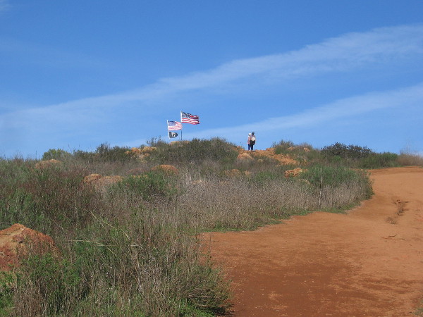
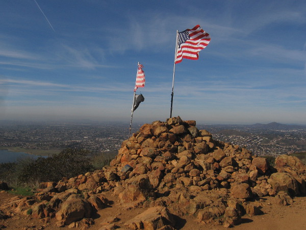
At the top of Mother Miguel Mountain you’ll find the Rock House and its flags, and a view of nearby San Miguel Mountain.
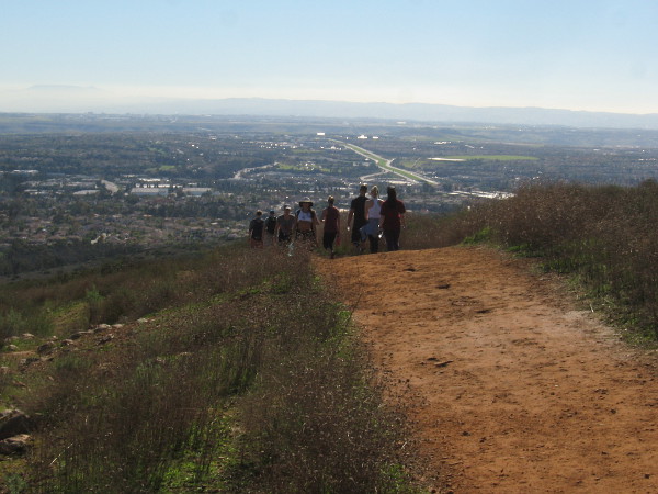
Today I enjoyed a hike to the top of Mother Miguel Mountain, just northeast of Chula Vista. While not as high as nearby San Miguel Mountain, the views of the southern part of San Diego from Mother Miguel Mountain are pretty amazing.
On a clear day you can see Mexico, San Diego Bay, Coronado, downtown, Point Loma, and various peaks including Otay Mountain, Mount Soledad, Cowles Mountain and Mt. Helix. Looking down to the south you can see Salt Creek Golf Course, which was closed a couple of years ago and will undergo future development.
Fortunately it wasn’t very hot today, being early January. I just wore jeans, a simple shirt and some good shoes. Should you hike this steep rocky trail on a hot day, make sure to bring lots of water. There are virtually no trees and no shade. And it’s a constant very rocky climb. Pay attention to where you step and wear boots or shoes with a good grip!
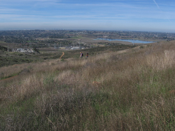
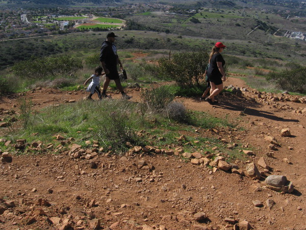
In addition to a fair number of other hikers and some mountain bikers, I saw half a dozen ravens circling above and below, a few cacti, lots of sagebrush and wild grass, and many crumbled rock outcroppings. To the northwest one can look down at Sweetwater Reservoir. And of course, there’s impressive nearby San Miguel Mountain, rising not far to the northeast.
I started at the trailhead at the corner of Paseo Veracruz and Paseo Los Gatos and started up the Rock House Trail for the peak! It’s a moderately difficult 4.3 miles round trip with a 1,171 feet elevation gain. Follow the designated trail, which has many switchbacks.
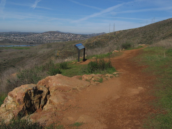
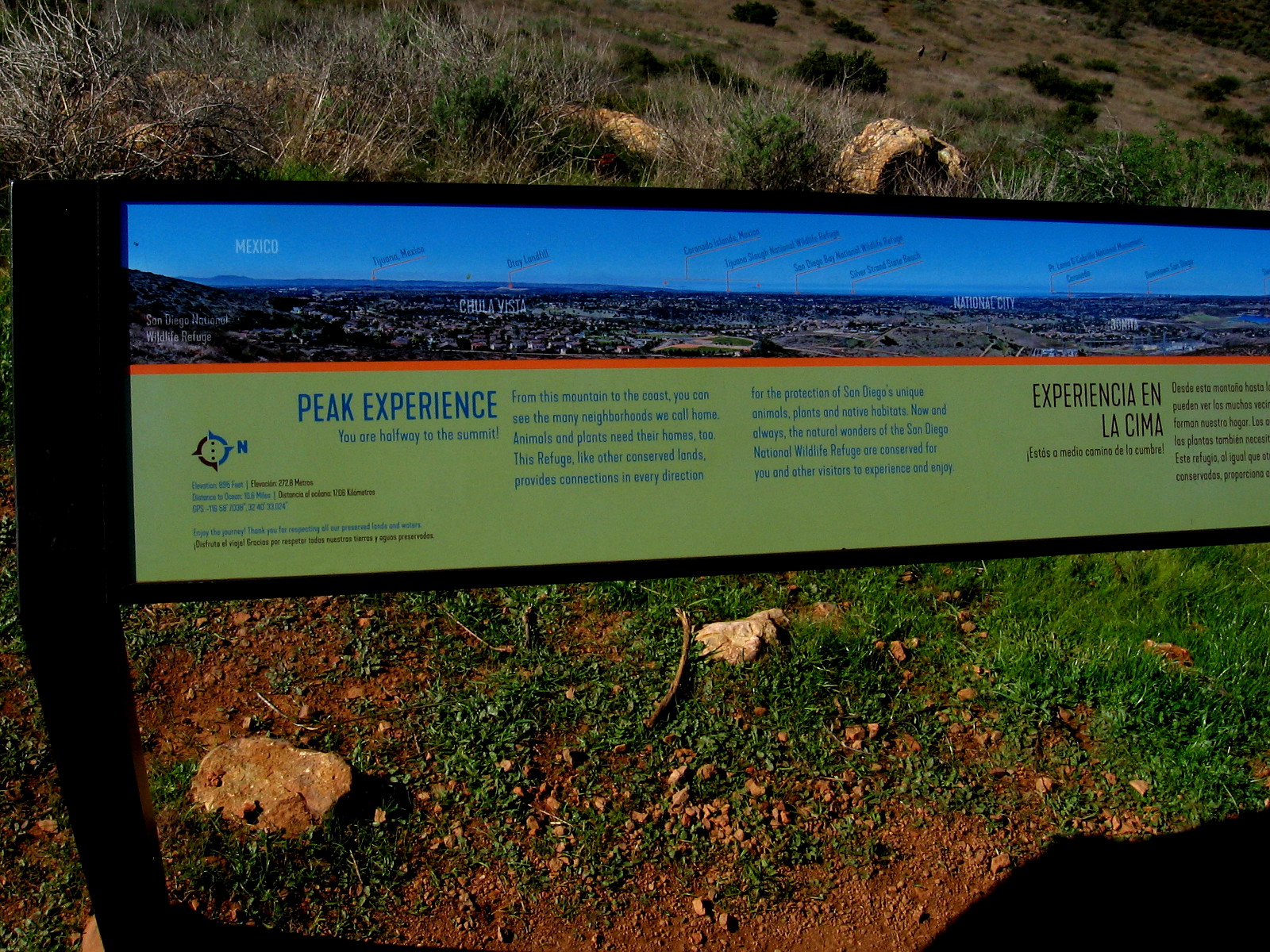
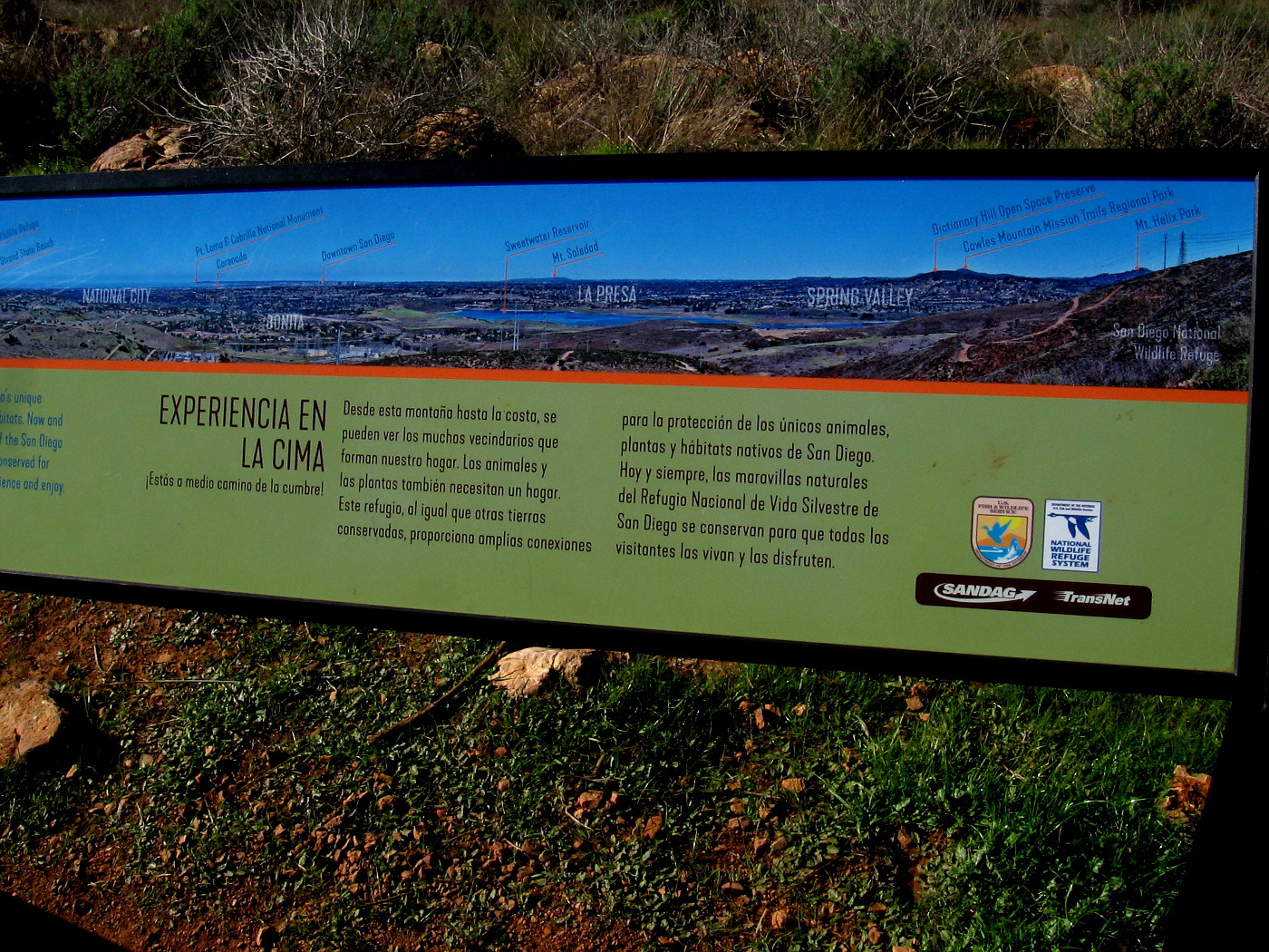
Halfway up you find a sign which points out and names many of the distant sights that are visible. From there, the trail gets steeper. (Those airplanes flying overhead are making their approach to San Diego International Airport which is near downtown!)
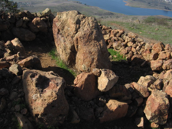
At the top of Mother Miguel Mountain is the Rock House: a large mound of rocks with several flags and an adjacent low stone open shelter. On all sides are scenic views. If you proceed a little beyond the Rock House, there’s a large outcropping and nearby crude wood bench with a small plaque. From it you can look toward the northeast and see distant El Cajon Mountain, often called El Capitan.
If you want to read the photos of signs, click the images and they will expand for easy reading.
Now come along with me and get a taste of this rewarding hike!
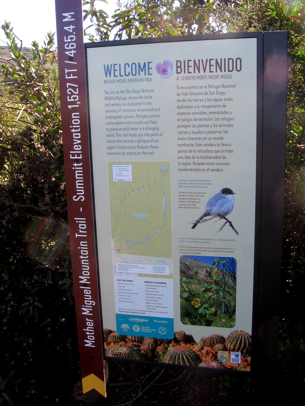
The Mother Miguel Trail Head Bulletin Board contains useful information and a topographic map for hikers.
The Mother Miguel Mountain Trail is inside the San Diego National Wildlife Refuge. Stay on the designated trail to protect the habitat of many animal and plants species, some of which are endangered.
Starting up the trail, which was muddy in spots. This winter it has been rainy in San Diego.
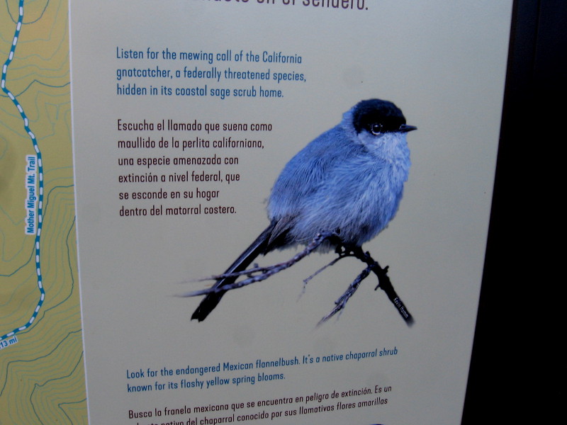
One of two information signs, on opposite sides of a very small bridge spanning a tiny creek.
Sign describes this part of San Diego National Wildlife Refuge and protecting natural biodiversity.
The small California gnatcatcher makes its home on Mother Miguel Mountain.
Second sign describes the Quino checkerspot butterfly, which is listed under the federal Endangered Species Act.
A section of very rocky trail.
Looking down after climbing for a bit. I could see downtown San Diego and Point Loma in the far distance.
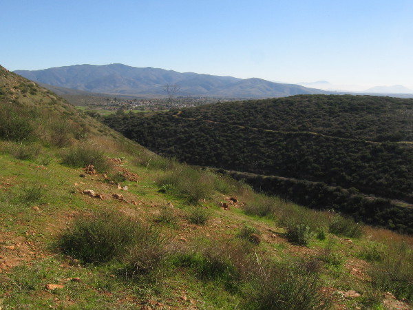
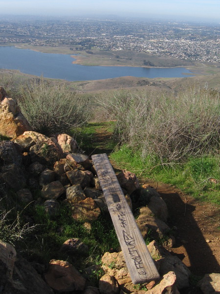
Sweetwater Reservoir appears below.
Another sign ahead.
Left part of long sign, showing peaks and features from Mexico northward.
Right part of sign shows sights to the northwest, as far away as Mount Soledad in La Jolla.
Looking southward toward the San Ysidro Mountains and Mexico.
Looking back down the trail, you can see green Mount San Miguel Park with its sports fields, not far from the trailhead.
The view of Sweetwater Reservoir keeps getting better as we climb.
You can see some of the now closed Salt Creek Golf Course to the southeast.
San Miguel Mountain rises to the northeast.
Someone stands on an outcropping just below the summit of Mother Miguel Mountain.
Mount San Miguel Park is now far below.
Flags show we’ve almost reached the Rock House atop Mother Miguel Mountain.
We made it!
A couple of hikers brought a blanket to rest on the grass beneath the sky.
This rocky enclosure at the Rock House might provide a little bit of shelter on a windy day.
Continuing along, we approach another rock outcropping atop Mother Miguel Mountain.
The view to the northeast includes part of the Cuyamaca Mountains.
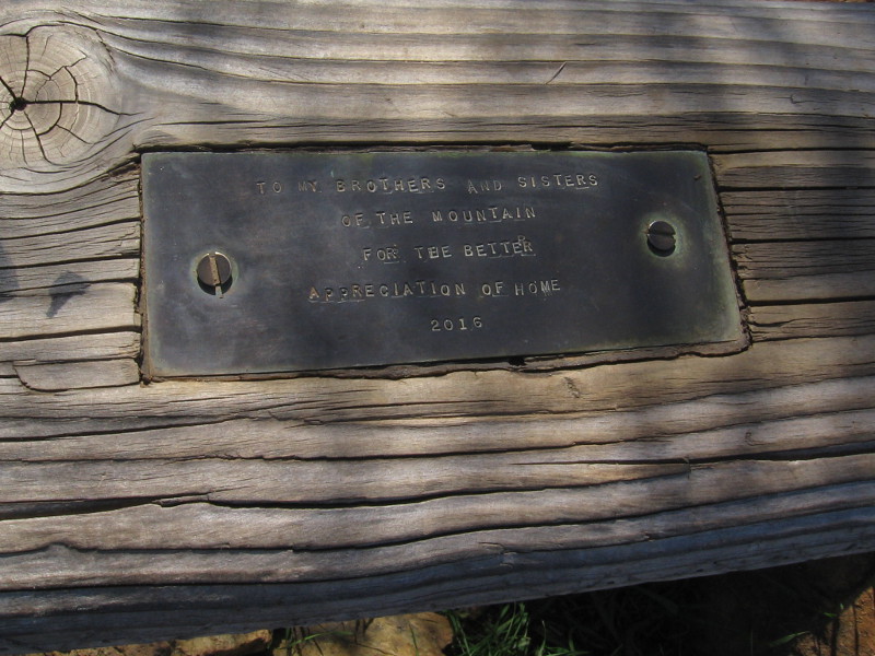
A simple wood plank serves as a bench. I was surprised to see it has a plaque.
TO MY BROTHERS AND SISTERS OF THE MOUNTAIN FOR THE BETTER APPRECIATION OF HOME — 2016
…
I live in downtown San Diego and love to walk around with my camera! You can follow Cool San Diego Sights via Facebook or Twitter!
You can easily explore Cool San Diego Sights by using the search box on my blog’s sidebar. Or click a tag! There are thousands upon thousands of photos for you to enjoy!
Yes, winter does come to San Diego. It begins in about one week. Winters in coastal Southern California are generally mild, due to our arid climate, and the moderating influence of the nearby Pacific Ocean.
Winter storms tend to be short-lived, gray and drizzly. In San Diego, if you want to see occasional snow, you need to head to the mountains of East County, and even then the returning sun and dry desert winds melt it in a day or two. Temperatures at the lower elevations almost never reach freezing.
However, winter storms in San Diego have been known to provide drama!
There have been unusually violent windstorms, huge surf and flooding. A few of those memories have been preserved in photographs on this blog. And so have examples of winter’s unique beauty!
To see photos from past winters, click the following links:
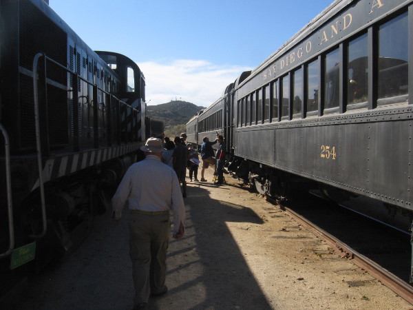
Today I took a wonderful ride aboard an historic train!
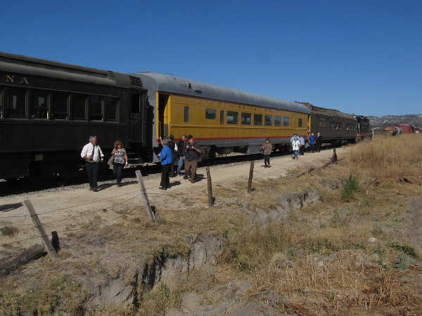
In the morning I drove out to the Pacific Southwest Railway Museum in Campo, about an hour east of downtown San Diego, in order experience the 100th Anniversary celebration of the San Diego & Arizona Railway.
Before the gold spike reenactment ceremony took place, I wandered about the extensive museum grounds, enjoying all sorts of nostalgic entertainment and attractions, then boarded an old passenger train at the depot for a short but very scenic excursion!
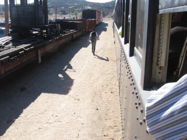
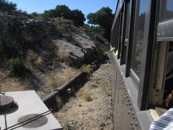
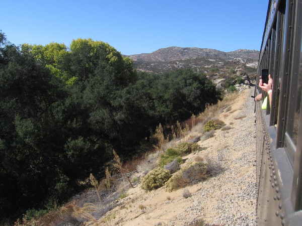
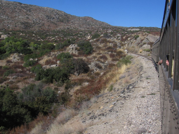
I took photos as I rode the route of the Golden State west several miles through rocky terrain. The San Diego & Arizona Railway, founded by San Diego entrepreneur and philanthropist John D. Spreckels, earned the name of The Impossible Railroad because of the logistical difficulty of routing a train through this very rugged countryside.
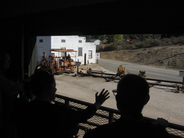
The train’s cars were all packed on this special day, and we were rolling past other old locomotives and railroad cars belonging to the Pacific Southwest Railway Museum before the conductor came down the aisle to collect our round-trip tickets. As you might imagine, kids and families were super excited!
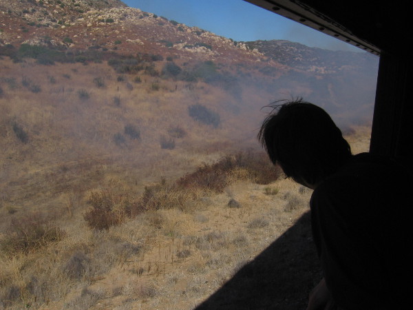
On the way out, I sat in one of the seats on the south side of a coach car. Because my long legs were a bit cramped, and I wanted to see the countryside to the north, I went to the observation car during the return trip. You can see some smoke coming from the diesel locomotive in a couple of my photographs.
Too soon we were once again passing the Gaskill Brothers Stone Store Museum (the distinctive building you see in one photo), crossing over Highway 94, and back at the museum. We continued past the old depot and stopped near the place where the San Diego & Arizona Railway centennial gold spike ceremony would be staged. (I’ll blog about the fantastic event in my next post!)
Should you ever visit the Pacific Southwest Railway Museum in Campo, make sure to enjoy a cool train ride!
…
I live in downtown San Diego and love to walk around with my camera! You can follow Cool San Diego Sights via Facebook or Twitter!
You can easily explore Cool San Diego Sights by using the search box on my blog’s sidebar. Or click a tag! There are thousands upon thousands of photos for you to enjoy!