For the past several weeks, a gigantic jaguar has been spotted in Barrio Logan! It lurks right next to Interstate 5, just south of the ramps to the Coronado Bay Bridge.
Have you seen it yet?
The giant Jaguar mural was recently painted on the side of a building by the artists of Ground Floor Murals.
I took the San Diego Trolley to Barrio Logan early this morning to see the big cat myself, and to take these photos from across the freeway.
Enjoy!
…
I live in downtown San Diego and love to walk around with my camera! You can follow Cool San Diego Sights via Facebook or Twitter!
You can easily explore Cool San Diego Sights by using the search box on my blog’s sidebar. Or click a tag! There are thousands upon thousands of photos for you to enjoy!
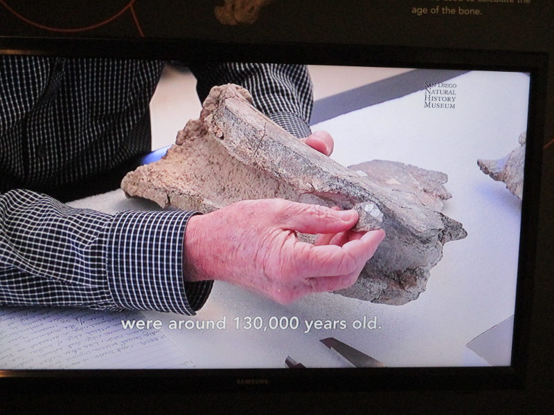
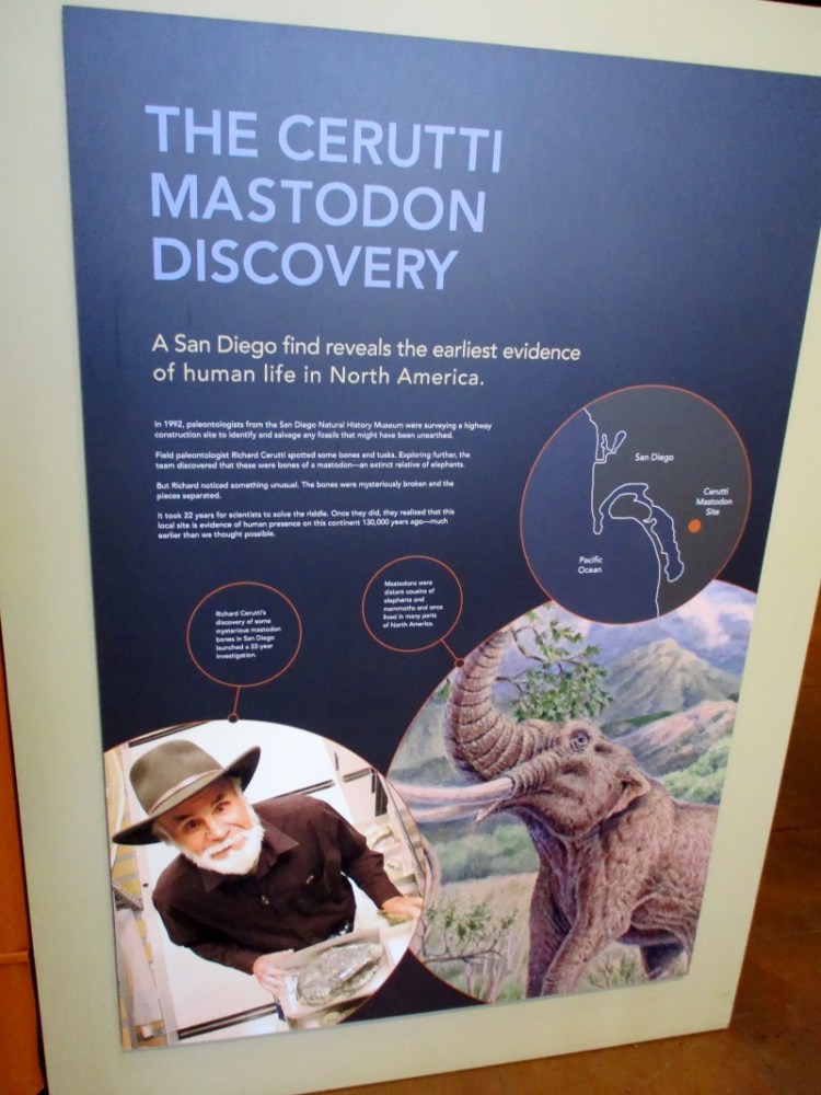
Did you know humans might have been living in your neighborhood 130,000 years ago?
I was visiting the San Diego Natural History Museum when my eyes fell upon an interesting display concerning the Cerutti Mastodon site.
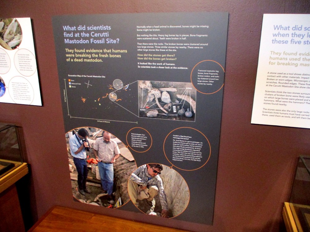
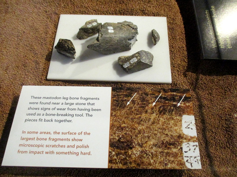
Thirty years ago, during the expansion of State Route 54 in the South Bay, a team of researchers from the San Diego Natural History Museum discovered mastodon bones among cobbles. The bones appeared to have been intentionally broken. It was believed the stones, which had impact marks, had been used by humans to fracture the mastodon bones to extract marrow.
Using radiometric dating, the bones were found to be about 130,000 years old. If, indeed, early humans had worked these bones, that would mean humans were in North America about 100,000 years earlier than previously thought!
Many experts asserted the bones were broken due to the heavy machinery used for freeway construction. Two years ago, however, more evidence was obtained. Bone micro-residues were observed on the cobbles, which seems to confirm that ancient inhabitants of San Diego did indeed hammer at fresh, tasty mastodon bones!
If all of this excites your curiosity, the Wikipedia article concerning San Diego’s scientifically important Cerutti Mastodon site can be found here.
And here’s a detailed article about the discovery written in 2017.
…
I live in downtown San Diego and love to walk around with my camera! You can follow Cool San Diego Sights via Facebook or Twitter!
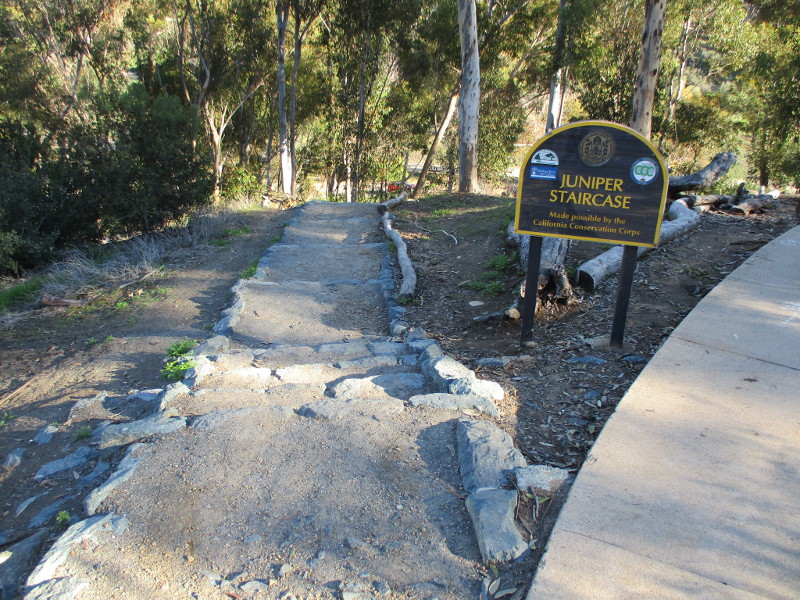
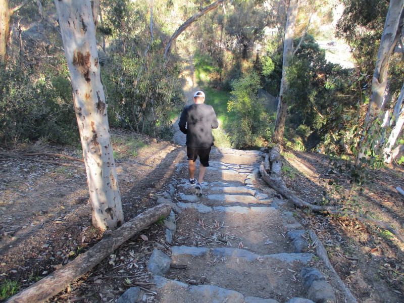
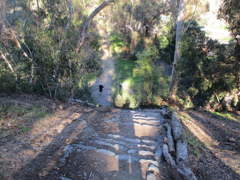
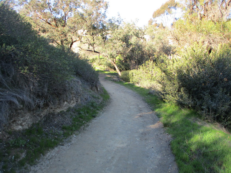
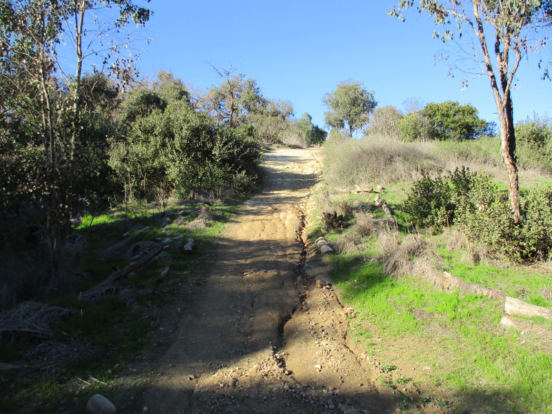
The Juniper Staircase is located near the southwest corner of Balboa Park, just north of Marston Point. The rugged “staircase” descends toward a dirt trail that runs through Cabrillo Canyon along the west side of State Route 163.
Ninety eight stone steps that were built by the California Conservation Corps descend from a paved pathway that winds through trees on Balboa Park’s West Mesa. Google Maps refers to the several paths in Cabrillo Canyon as Bridle Trail.
You can locate the curving stairs on a map if you follow the line of Juniper Street east past the intersection of Balboa Drive and 8th Avenue.
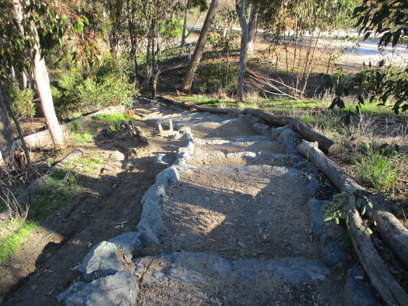
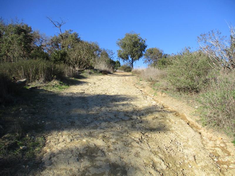
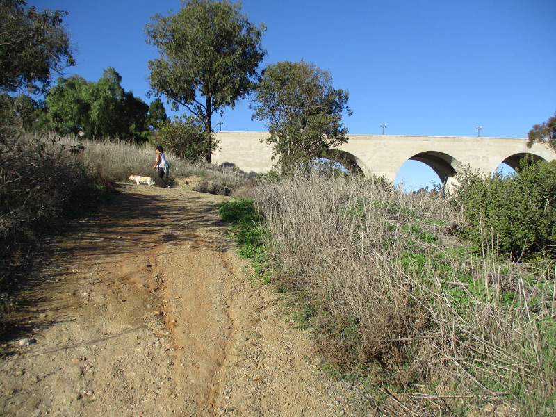
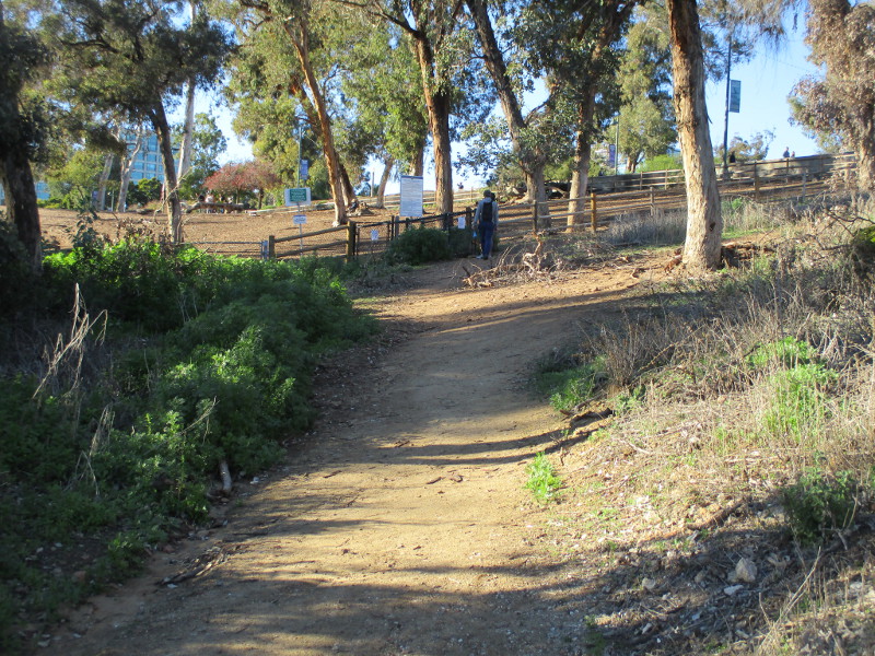
I took these photographs walking down the rocky steps. I continued north along the dirt trail by the freeway and passed the place where one can turn to walk under the historic Cabrillo Bridge. I then completed this relatively short and easy hike at Nate’s Point Dog Park, on El Prado, just west of the bridge.
If you’re curious to see what it looks like standing directly under the Cabrillo Bridge, I took some really interesting photographs one day and posted them here!
Be sure to watch your step! The loose dirt and leaves can be slippery.
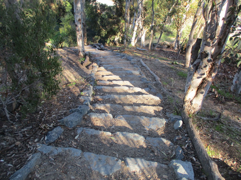
The Juniper Staircase is a destination for local joggers and runners seeking a workout.
A very peaceful spot, if it weren’t for the noise of nearby freeway traffic.
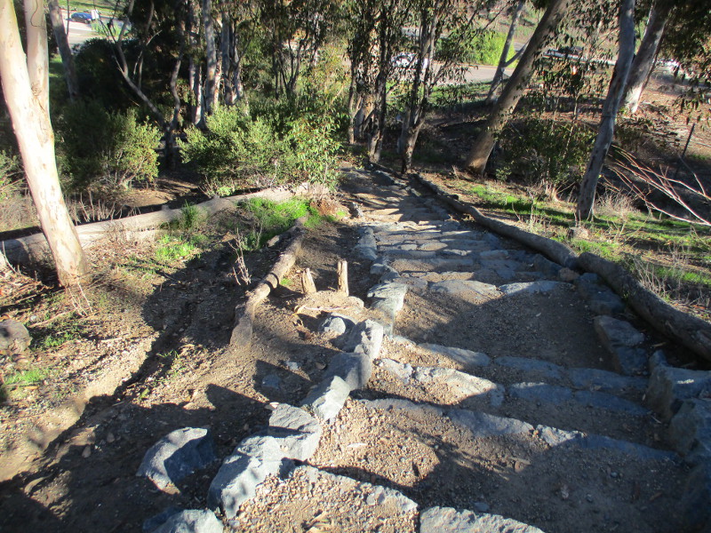
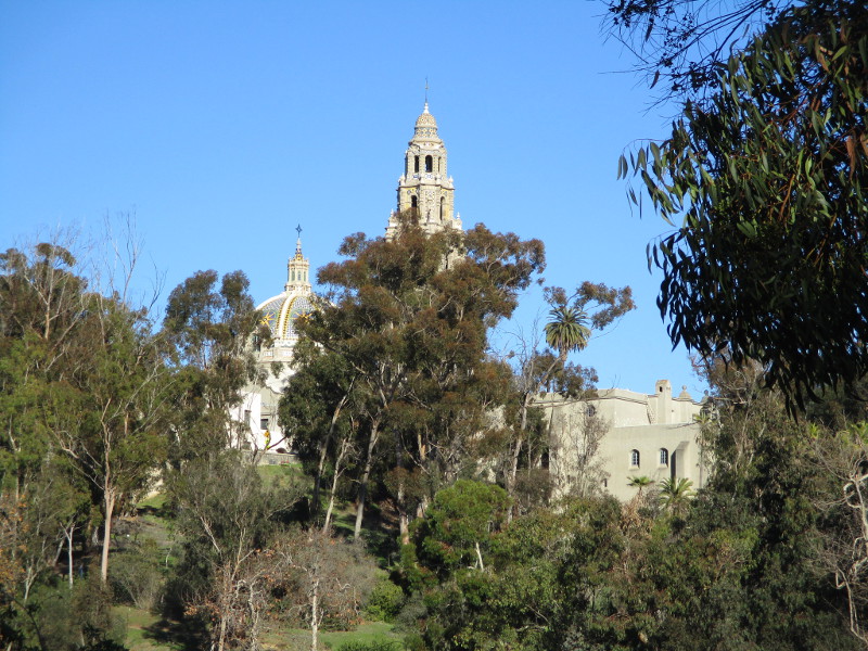
Looking northeast across Cabrillo Canyon, one can see Balboa Park’s iconic California Tower!
Make sure to wear good shoes. The trail is rough and eroded in spots.
Approaching a split in the trail, where one can walk down under the Cabrillo Bridge.
I was tempted to walk under the bridge again, but decided against it the particular day I took these photos.
Soon arriving at the fence around Nate’s Point Dog Park where happy dog’s can run freely off leash.
El Prado, the road that crosses the Cabrillo Bridge into Balboa Park, is to the right, just a short distance up the hill!
…
I live in downtown San Diego and love to walk around with my camera! You can follow Cool San Diego Sights via Facebook or Twitter!
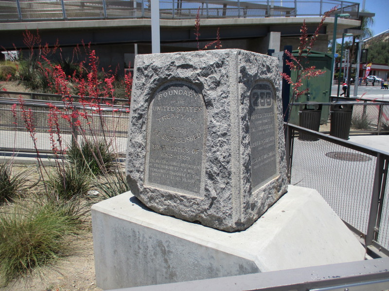
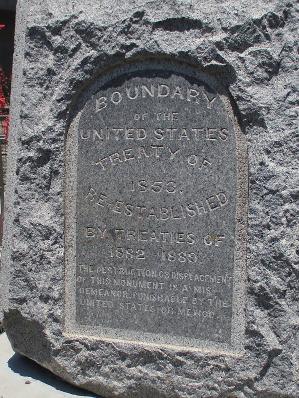
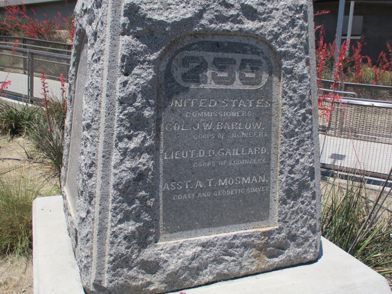
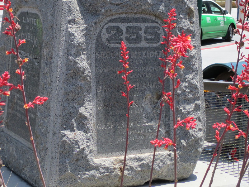
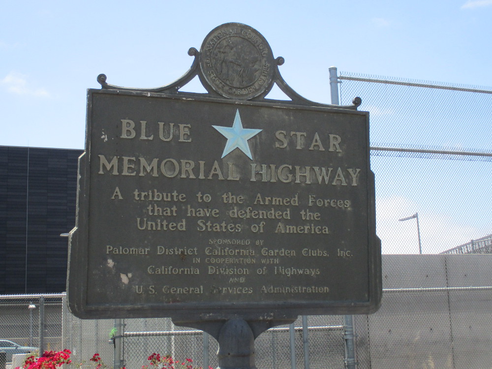
Two historical markers can be seen just north of the San Ysidro Port of Entry border crossing. They stand near the entrance to the pedestrian bridge that crosses over Interstate 5 to Camino de la Plaza. I spotted them during my last walk around San Ysidro and took photographs.
A granite monument, marker number 255, reads Boundary of the United States–Treaty of 1853–Re-Established by Treaties of 1882-1889. The opposite side contains the same information in Spanish. The monument’s two other sides show the principal names from the international commission that precisely determined the previously disputed boundary with Mexico in 1892 to 1896. It was one of 258 markers placed along 689 miles of border.
The fascinating story of this particular marker includes a flood, a replacement duplicate, and the original marker’s rediscovery and relocation to this spot. Read more about its complicated history here.
Behind the granite boundary monument, a historical sign on a post marks the Blue Star Memorial Highway. The sign describes the highway as A tribute to the Armed Forces that have defended the United States of America.
Perhaps you’ve seen these signs elsewhere across the United States. Read more about the Blue Star Memorial Highway (which is in fact numerous highways) here.
…
I live in downtown San Diego and love to walk around with my camera! You can follow Cool San Diego Sights via Facebook or Twitter!
You can easily explore Cool San Diego Sights by using the search box on my blog’s sidebar. Or click a tag! There are thousands upon thousands of photos for you to enjoy!
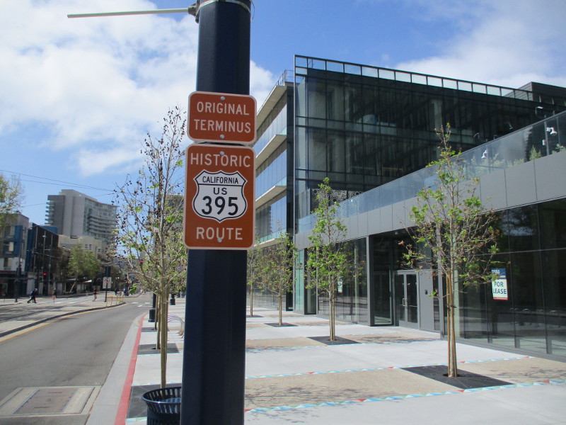
A sign marks the original southern terminus of historic U.S. Route 395 in downtown San Diego. I spotted the sign for the very first time this weekend, as I walked down Park Boulevard just north of Market Street.
I believe the sign is fairly new–either that or I simply haven’t noticed it before.
According to Wikipedia: “US Highway 395 once extended to 11th and Ash in downtown San Diego…From Murrieta the old route follows Interstate 15 again to east of Fallbrook where the original US 395 still exists as a frontage road. ‘Old US 395’ can be followed from north of State Route 76 through Escondido where it meets Interstate 15 again. Finally, State Route 163, the old routing of US 395, splits off Interstate 15 at the south end of Miramar and follows the Cabrillo Freeway into downtown San Diego.”
The historic route into San Diego existed until 1964. Around that time large Southern California stretches were replaced by modern freeways.
Today, the existing U.S. 395 runs from British Columbia, Canada down to the Mojave Desert at Interstate 15 near Hesperia.
…
I live in downtown San Diego and love to walk around with my camera! You can follow Cool San Diego Sights via Facebook or Twitter!
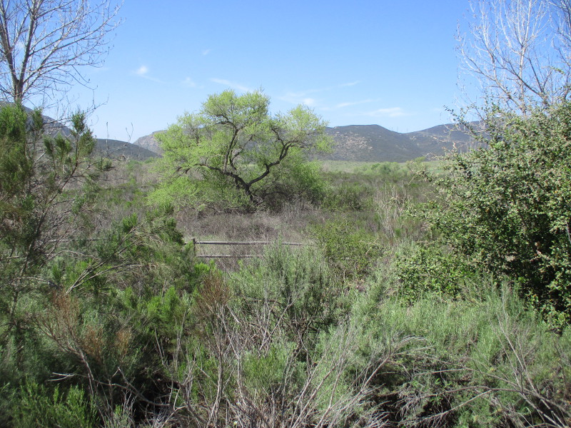
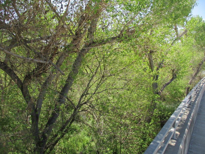
I took the following photographs today during a long looping walk around the west half of Santee.
From the Santee Trolley Square transit station I headed north up Cuyamaca Street, then west along Mast Boulevard to the East Fortuna Staging Area at Mission Trails Regional Park. After taking a short hike in the park, I headed south down West Hills Parkway and back east to the trolley station via Mission Gorge Road.
During the walk through Santee I snapped these photographs. Much of the walk was past homes, schools and businesses, but there were also these glimpses of natural beauty. (Additional photos that I’ll post in the next day or two include my short Mission Trails hike, an unusual historical monument, and very unique public artwork.)
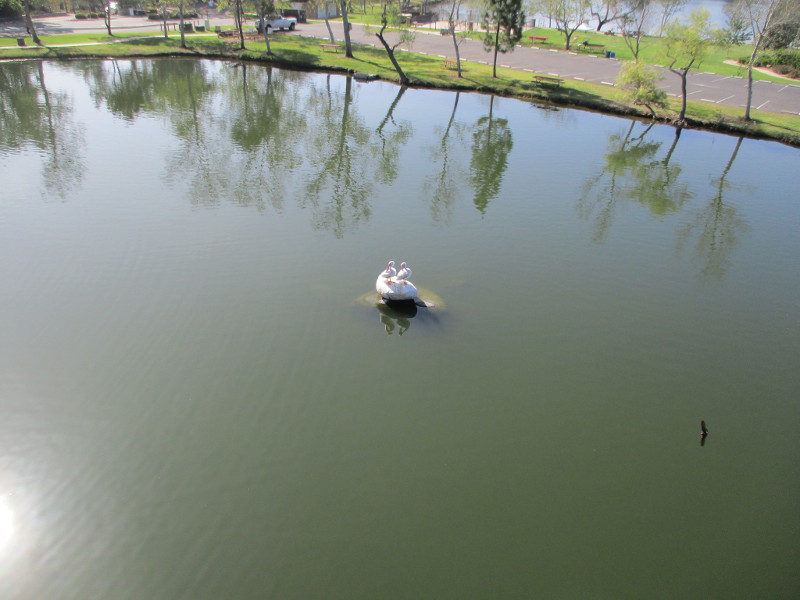
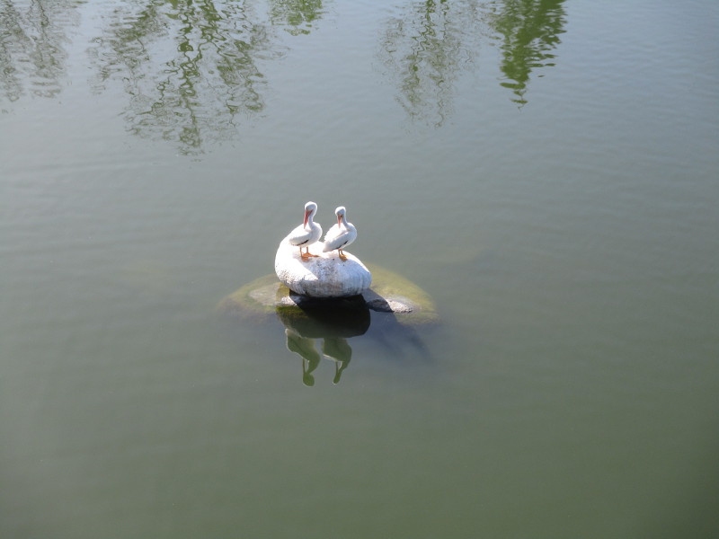
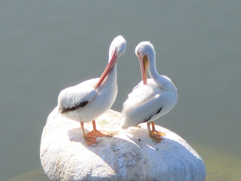
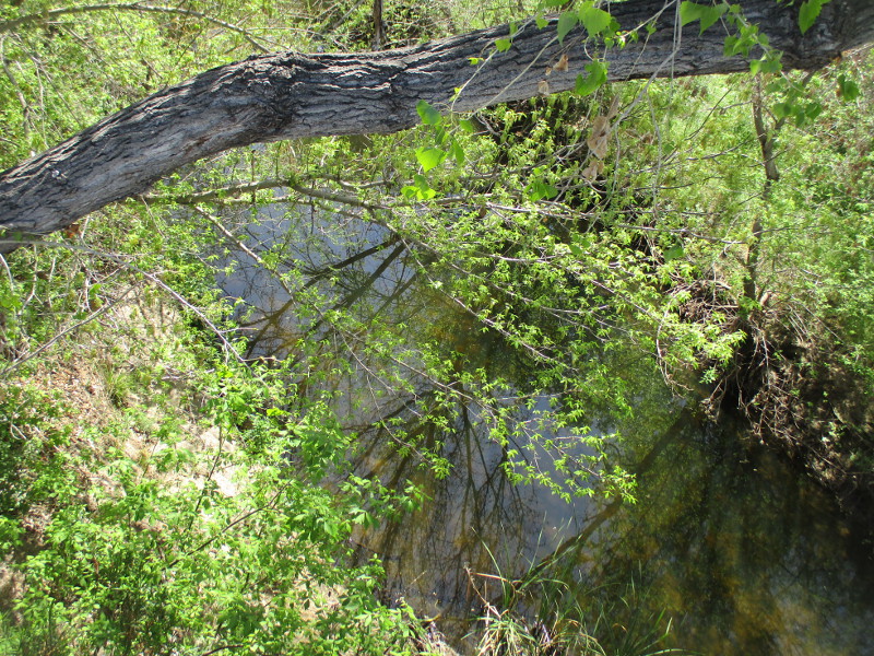
The following three photos were taken as I walked down Mast Boulevard over Santee Lakes Recreation Preserve. Far below, in the middle of Lake 2, two white pelicans were standing on a rock. I also saw dozens of swallows flying out from beneath the bridge, but the tiny birds darted about so swiftly I was unable to capture a good photograph of them. You can see one swallow zipping by in this first photo…
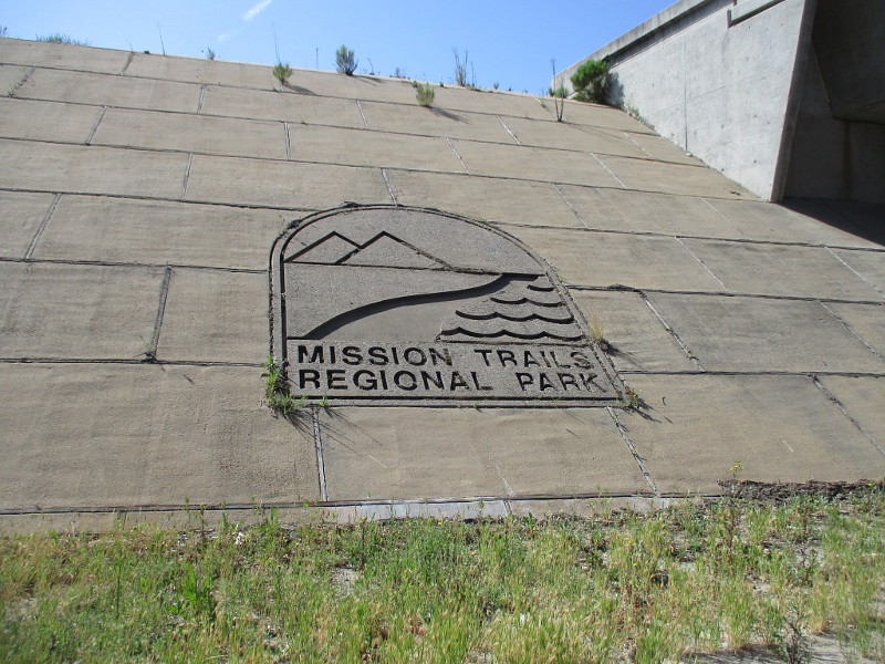
As I walked down Mast Boulevard under State Route 52, I saw an indication that I had almost reached Mission Trails Regional Park.
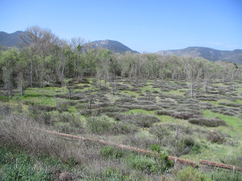
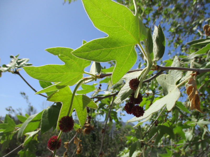
Then I headed into the East Fortuna Staging Area. From the entrance driveway and parking lot I took photographs of the mountains beyond trees lining the San Diego River, and some sycamore leaves.
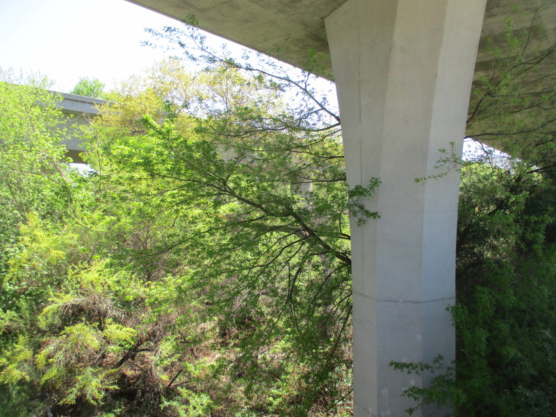
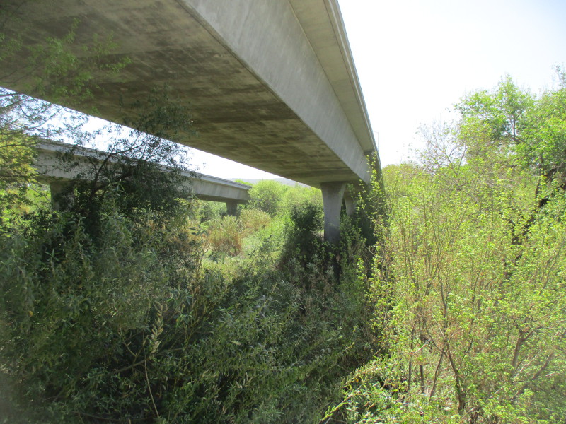
Walking south down West Hills Parkway took me to the place where State Route 52 passes over the San Diego River…
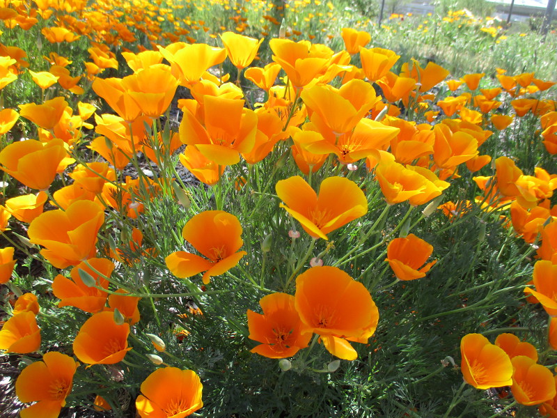
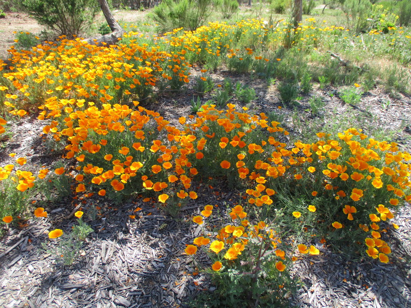
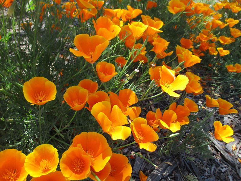
Finally, where State Route 125 meets Mission Gorge Road, I was surprised to find a beautiful golden patch of California’s State Flower: the California poppy.
(Incidentally, last Tuesday, April 6 was officially California Poppy Day!)
…
I live in downtown San Diego and love to walk around with my camera! You can follow Cool San Diego Sights via Facebook or Twitter!
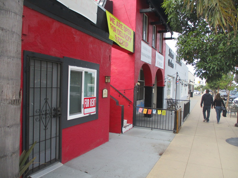
Walk along Highway 101 in Solana Beach and you might notice a series of plaques describing historical buildings.
During my most recent adventure in Solana Beach, I took photos of several buildings and plaques immediately south and north of Plaza Street/Lomas Santa Fe Drive. This stretch of highway was the coastal town’s main street a century ago.
To learn more about these and other historical buildings, and to view a variety of interesting old photographs, visit this page of the Solana Beach Civic And Historical Society. They’re the ones who created the plaques.
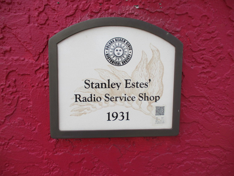
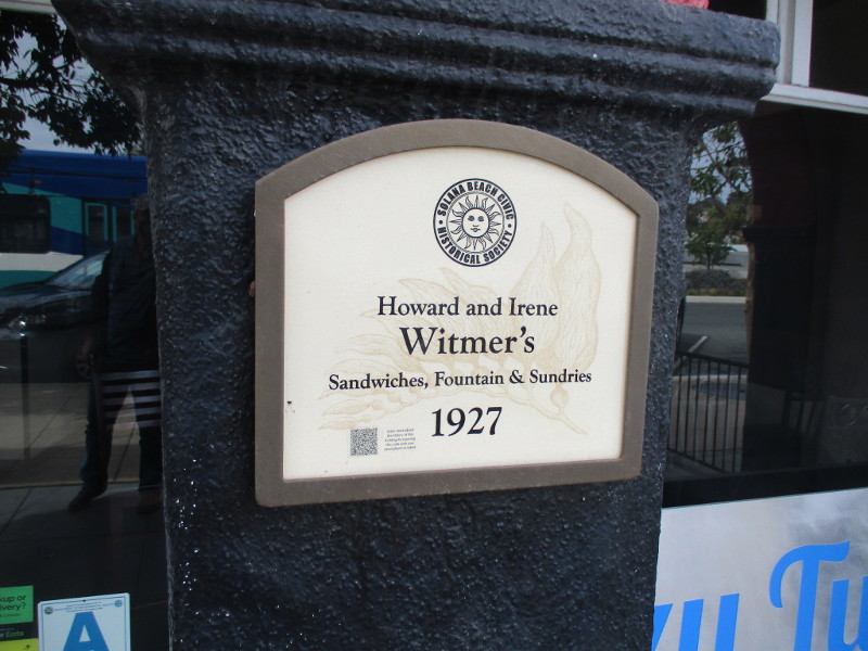
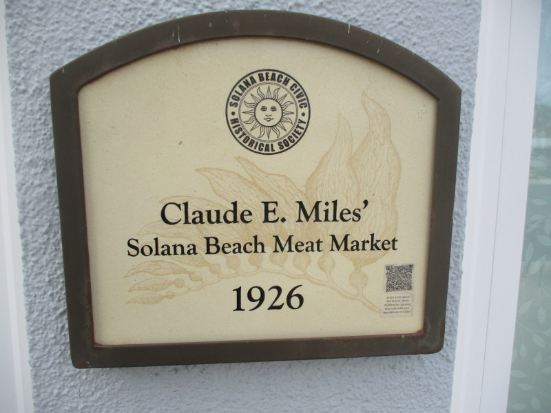
This first batch of photos is from the 100 south block of Highway 101. All of these small, modest buildings are now home to local businesses, including an eatery and salon.
Stanley Estes’ Radio Service Shop, 1931.Howard and Irene Witmer’s Sandwiches, Fountain and Sundries, 1927.Ira E. Conner’s Meats, Groceries, Hardware and Dry Goods, 1925.Claude E. Miles’ Solana Beach Meat Market, 1926.William and Angie Kurtz’s Solana Beach Drug Store, 1928.
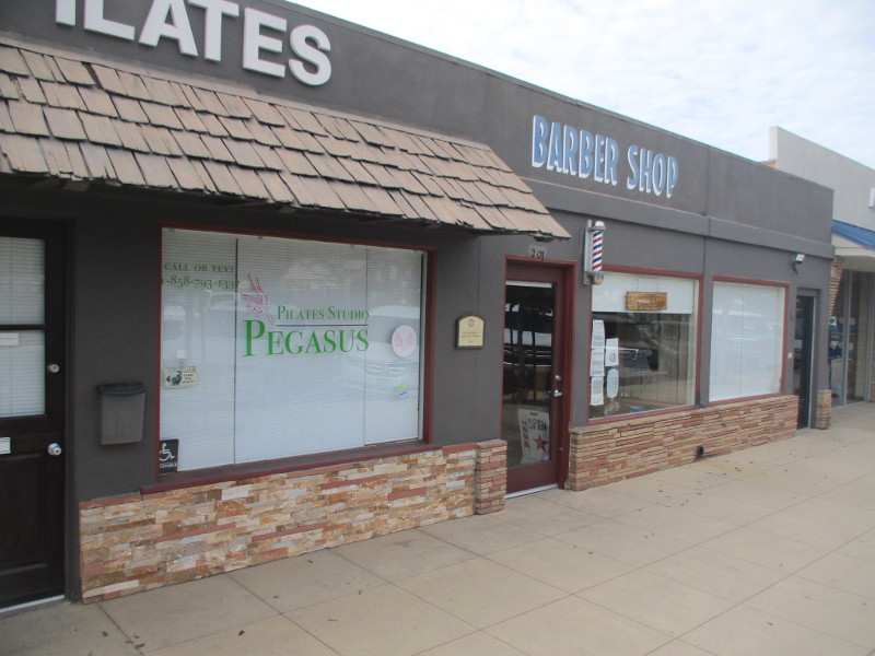
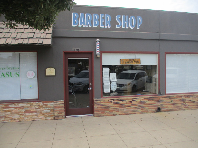
The next three photographs were taken on the 200 north block of Highway 101…
Ray Hobberlin’s Barber Shop and Residence, 1948.
…
I live in downtown San Diego and love to walk around with my camera! You can follow Cool San Diego Sights via Facebook or Twitter!
You can easily explore Cool San Diego Sights by using the search box on my blog’s sidebar. Or click a tag! There are thousands upon thousands of photos for you to enjoy!
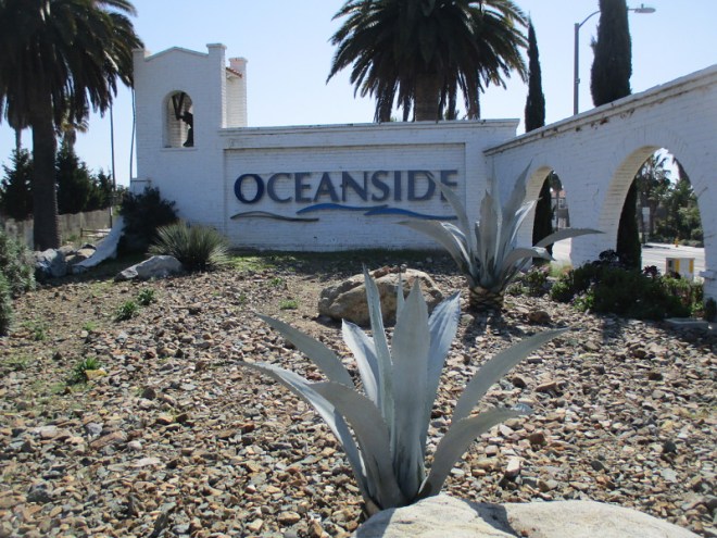
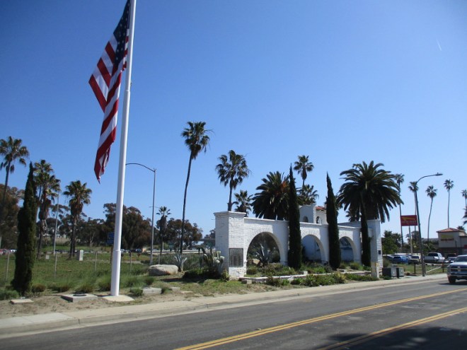
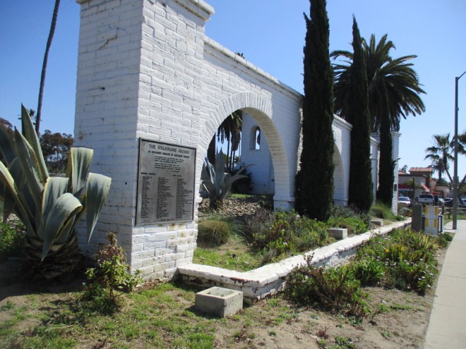
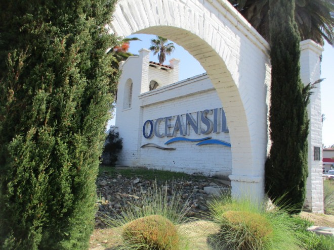
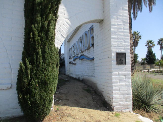
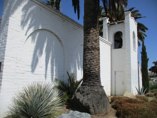
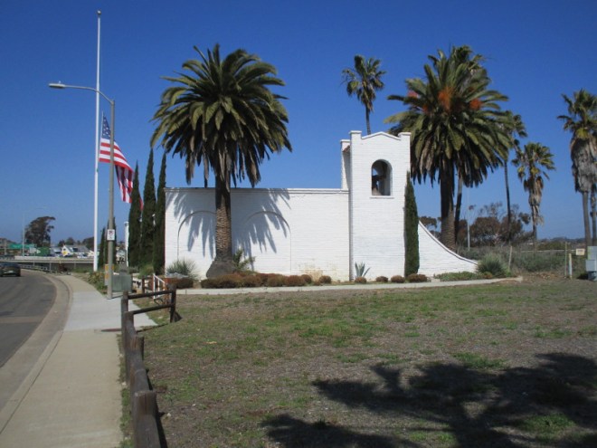
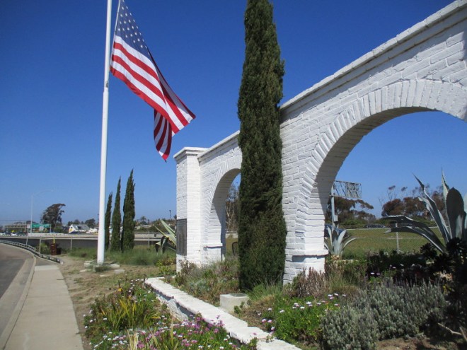
The Welcoming Arches and the Welcome Bell greet motorists driving south on Interstate 5 as they enter Oceanside, California. The arches and bell stand just beyond a large American flag and beside the parking lot of an In-N-Out Burger.
I passed by the California Mission inspired structure last weekend as I walked down the Coast Highway.
Mission San Luis Rey, founded in 1798, is located about four miles east-northeast of these bright white adobe mission-style arches.
The Welcoming Arches were designed by noted Southern California architect George M. Adams in 1978 and dedicated in 1982.
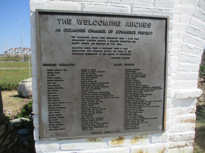
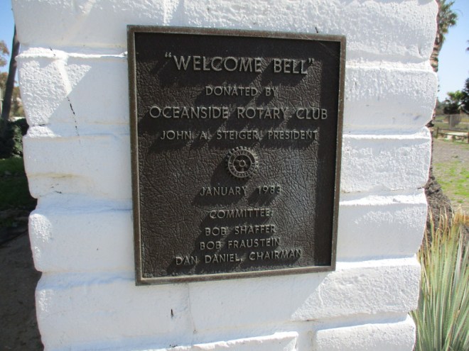
The first part of the above plaque reads:
THE WELCOMING ARCHES
AN OCEANSIDE CHAMBER OF COMMERCE PROJECT
“THE WELCOMING ARCHES WERE CONCEIVED FROM A WISH THAT OCEANSIDES’ VISITORS RECEIVE A WELCOME REFLECTING THE BEAUTY, BOUNTY AND HERITAGE OF THIS AREA.
REALIZING WHERE THERE IS PRIVILEGE THERE IS ALSO OBLIGATION, THIS ENTRANCE EDIFICE WAS BUILT BY THE VOLUNTARY GENEROSITY OF THE PEOPLE OF OCEANSIDE”
..LORRAINE SHAFFER
Part of this smaller plaque reads:
“WELCOME BELL” DONATED BY OCEANSIDE ROTARY CLUB JOHN A. STEIGER, PRESIDENT JANUARY 1983
…
I live in downtown San Diego and love to walk around with my camera! You can follow Cool San Diego Sights via Facebook or Twitter!
You can easily explore Cool San Diego Sights by using the search box on my blog’s sidebar. Or click a tag! There are thousands upon thousands of photos for you to enjoy!
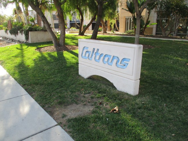
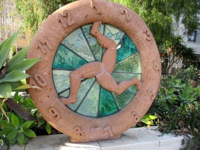
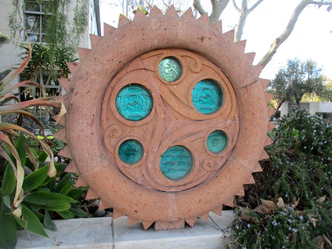
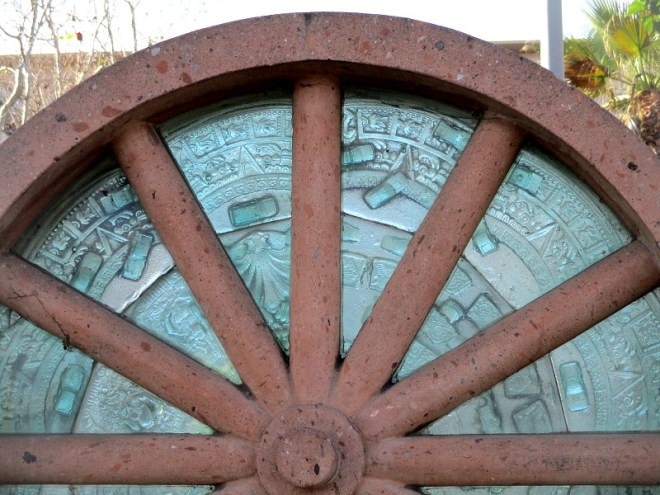
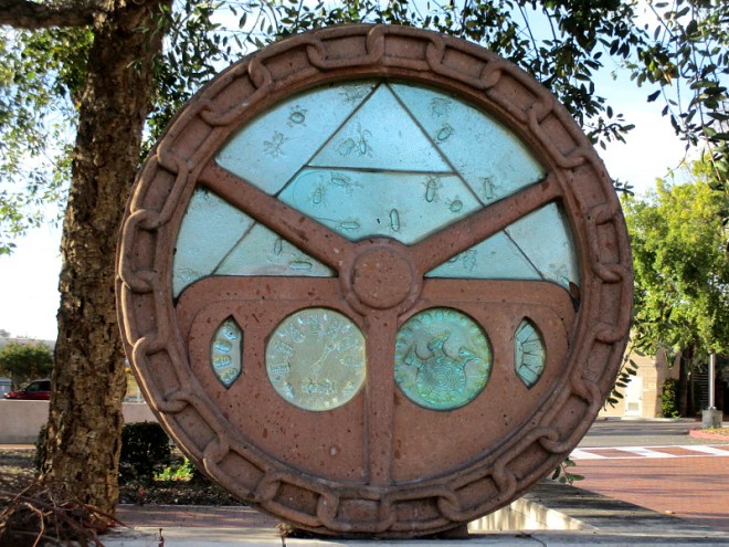
If you driven down Taylor Street past Old Town San Diego State Historic Park, you’ve probably seen the big Caltrans building across the street. And you might have observed five sculpted wheels mounted atop a low wall by the sidewalk.
The five wheels together are titled Rodoviaria, and they made their first public appearance in 2006 when the new District 11 Caltrans Office Complex (also known as the Wadie P. Deddeh State Office Building) was dedicated.
Rodoviaria was created by two highly accomplished artists who are brothers: Einar and Jamex De La Torre. Their website describes this public art as: 2005. Rodoviaria, five 50” cantera stone wheels with sand cast glass inclusions, Caltrans District 11 New Campus Facility, San Diego, CA.
Look closely at the glass inclusions and you’ll see not only tiny cars, but all sorts of interesting imagery mixed in. I believe I see beetles, pre-Columbian motifs, masks, hands, abstract human figures…
A plaque on the wall beneath one of the wheels reads:
Einar and Jamex de la Torre Rodoviaria, 2006
Transportation provides the mobility that enables cultural exchanges that in turn lead to the creations of new and dynamic cultural hybrids, most evident in California’s border towns and immigrant communities.
The first wave of sustained migration into California was made possible by the wagon wheel. Since then, many wheels have made the mobility and progress possible coupled with an ever changing and richly diverse culture.
Several years ago I posted photos of another example of inventive public art by these Mexican-born brothers. You might recall that big fun robot on Commercial Street. See it again here!
They also created the playful “dioramas” you see as you ride the main glass elevator at the San Diego Central Library. I hope to take photos of that one day, too!
…
I live in downtown San Diego and love to walk around with my camera! You can follow Cool San Diego Sights via Facebook or Twitter!
You can easily explore Cool San Diego Sights by using the search box on my blog’s sidebar. Or click a tag! There are thousands upon thousands of photos for you to enjoy!
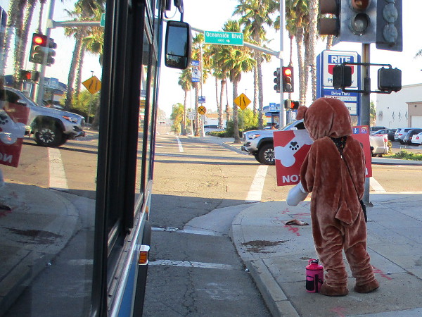
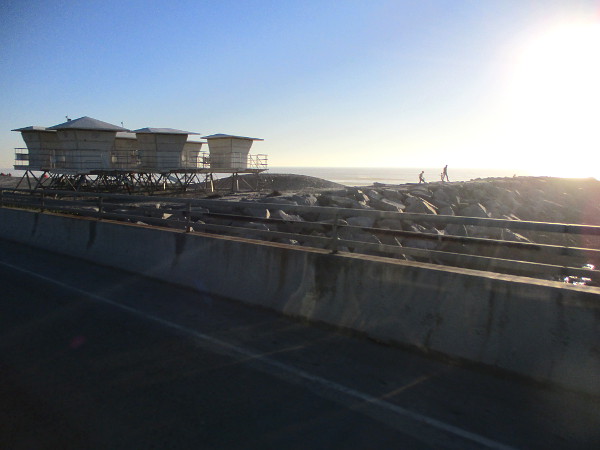
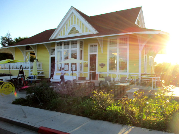
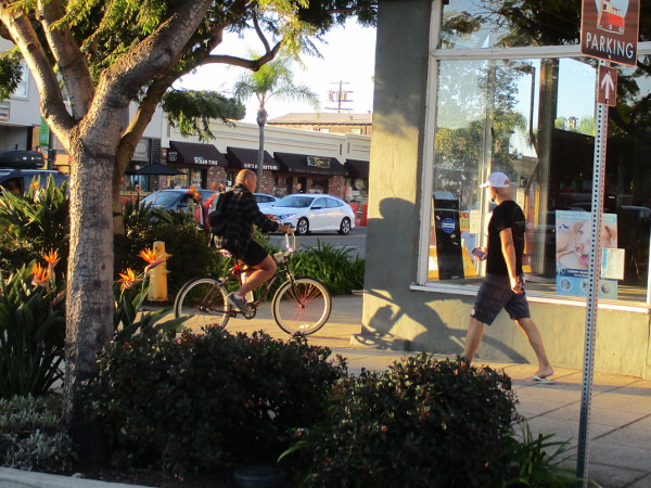
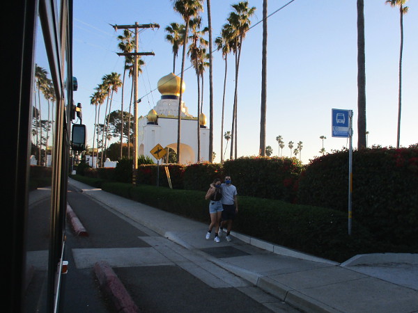
Without a doubt, the most scenic public bus route in the San Diego region is North County Transit District’s Route 101. It runs up the California coast north of San Diego.
Riders on bus Route 101 are treated to views of La Jolla (beautiful Torrey Pines), Del Mar, Solana Beach, Cardiff-by-the-Sea, Encinitas, Leucadia, Carlsbad and Oceanside.
It’s a long run with many stops–almost 30 miles and, depending on traffic, somewhere between one and a half to two hours–but you pass beach after beach, and you travel along historic Coast Highway 101 through some of Southern California’s most amazing and colorful beach cities.
Near the end of my last adventure in North County, I rode the bus south from the Oceanside Transit Center late in the afternoon. I was fortunate to have an “ocean side” seat with a window that cracked open a few inches. And my camera’s battery had some life left in it!
It’s hard to get good photographs through a barely cracked open window on a rapidly moving bus, but I got a few decent shots. They provide a brief glimpse of all I saw.
What follows are images taken as I rode from Oceanside to Encinitas. After the last photograph near the Golden Lotus Towers of the Self-Realization Fellowship ashram in Encinitas, my camera’s battery was exhausted.
If you ever plan to travel along San Diego’s beautiful northern coast, are in no big hurry, and would like to experience what the happy, laid-back, sometimes nostalgic Southern California beach scene is all about, consider riding bus Route 101.
You can meet some rather interesting people, too!
(There’s usually a surfboard or two in the aisle!)
…
This blog now features thousands of photos around San Diego! Are you curious? There’s lots of cool stuff to check out!
Here’s the Cool San Diego Sights main page, where you can read the most current blog posts. If you’re using a phone or small mobile device, click those three parallel lines up at the top–that opens up my website’s sidebar, where you’ll see the most popular posts, a search box, and more!
To enjoy future posts, you can also “like” Cool San Diego Sights on Facebook or follow me on Twitter.