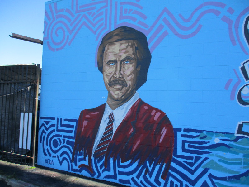
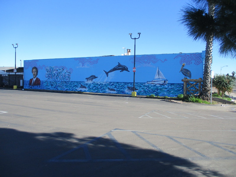
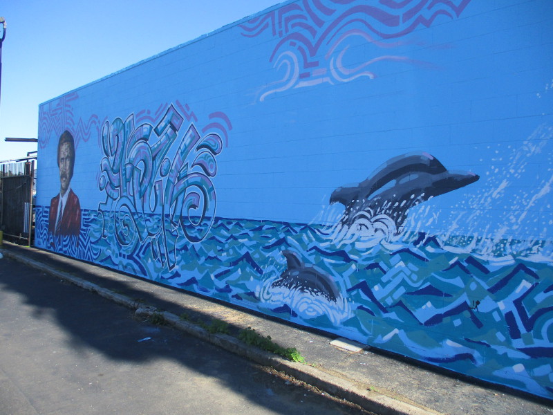
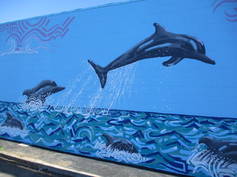
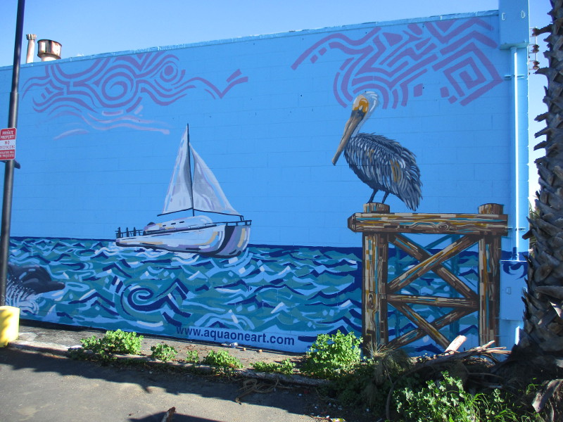
Famous anchorman Ron Burgundy has surfaced in San Diego! His perfectly coiffed hair has risen from the deep . . . among dolphins!
Why did he jump into the water? Perhaps diving into the ocean seemed more heroic than leaping into a bear pen at the zoo. Fortunately his hair remains intact.
This fun mural can be found in Point Loma. Perhaps you’ve seen it on Midway Drive, south of Rosecrans Street, on the side of Hi Auto Repair. It was painted last September by AQUA ONE ART!
Those who say Ron Burgundy is all wet are proven correct.
…
Thanks for visiting Cool San Diego Sights!
I post new blogs pretty often. If you like discovering new things, bookmark coolsandiegosights.com and swing on by occasionally!
I live in downtown San Diego and love to walk around with my camera! You can follow Cool San Diego Sights via Facebook or Twitter!
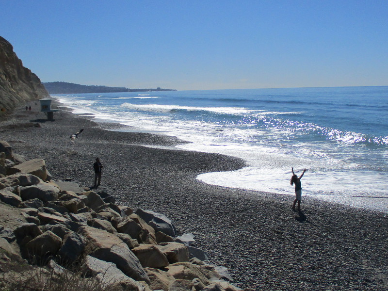
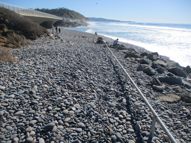
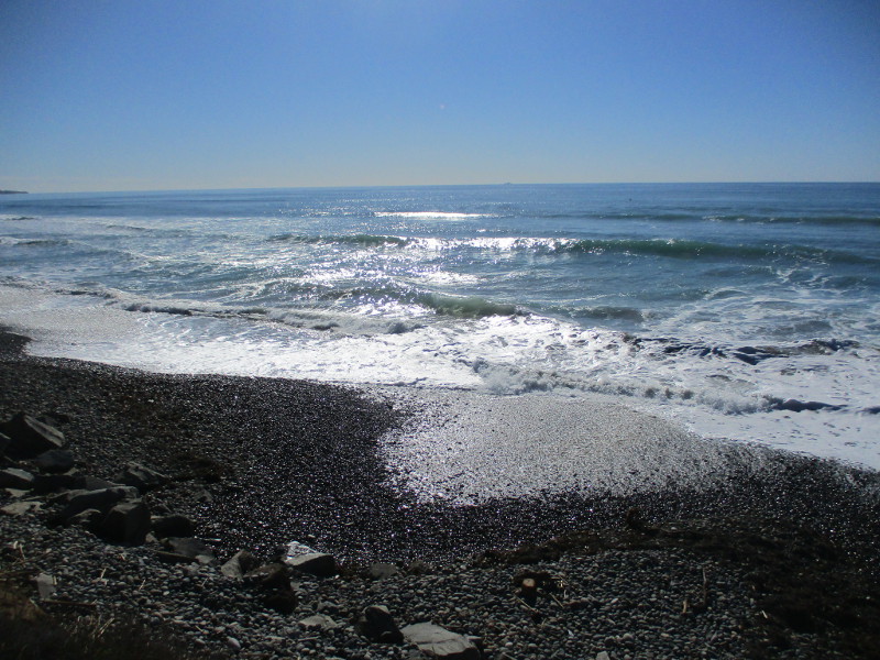
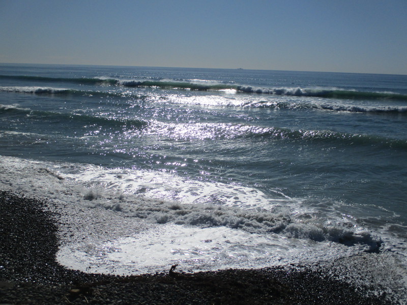
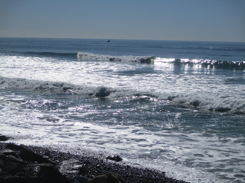
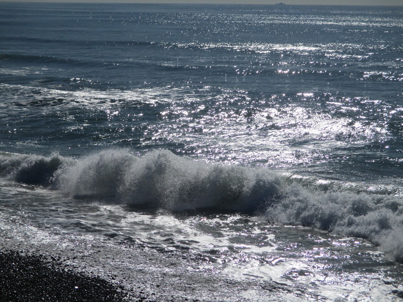
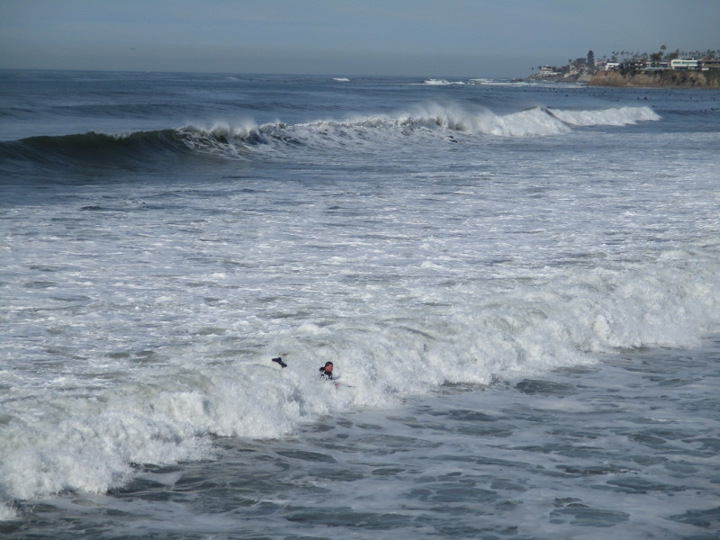
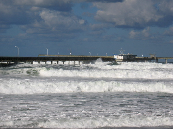
Our recent winter storms in San Diego thrust small stones high up onto the beach in places. At Torrey Pines State Beach, smooth stones covered much of the pedestrian pathway that runs down to and under the bridge near the north parking lot.
The stones, combined with a high tide and descending sun, made for some silvery photographs this afternoon! Bands of reflected light approached the shore with every crashing wave. Newly wetted stones gleamed like magic.
…
Thanks for visiting Cool San Diego Sights!
I post new blogs pretty often. If you like discovering new things, bookmark coolsandiegosights.com and swing on by occasionally!
I live in downtown San Diego and love to walk around with my camera! You can follow Cool San Diego Sights via Facebook or Twitter!
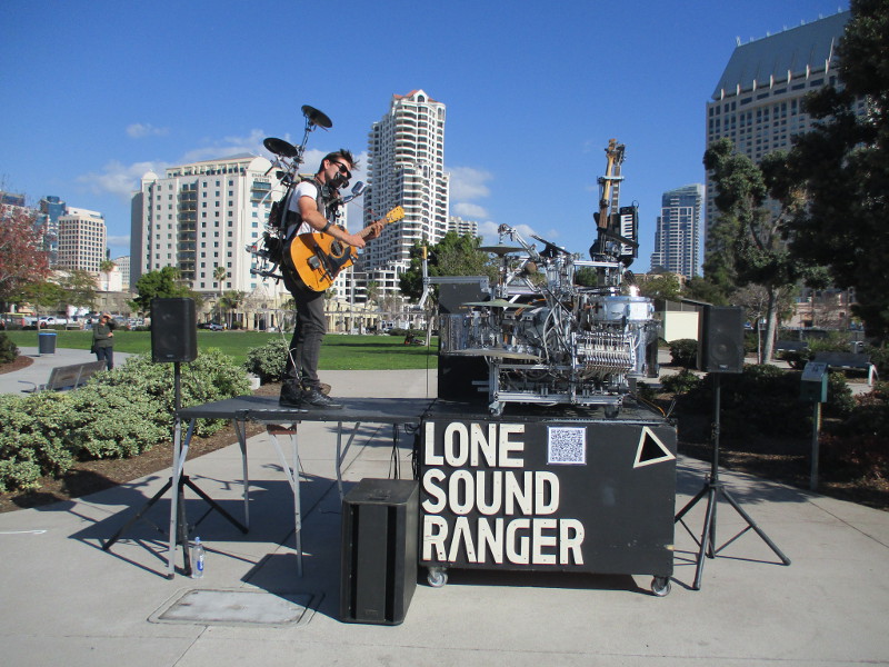
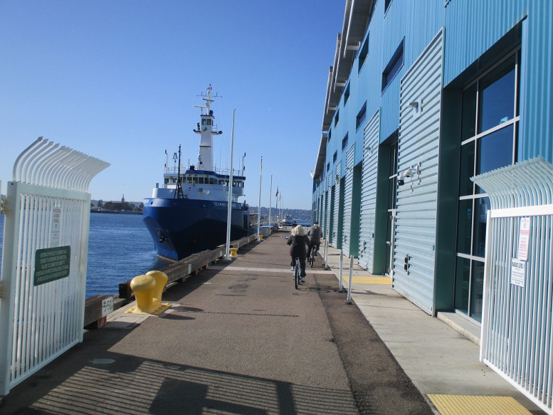
I spent a couple hours today reading by the water and strolling along San Diego’s sunny Embarcadero. When I reached Ruocco Park, I was entertained by the above Lone Sound Ranger and decided–what the heck–I’ll continue to take photographs.
Nothing too unusual here. Just a typical day along San Diego’s waterfront.
Bay views . . . boats . . . street entertainers . . . vendor carts . . . monuments . . . downtown buildings rising to one side. It’s mid-January, so no huge crowds.
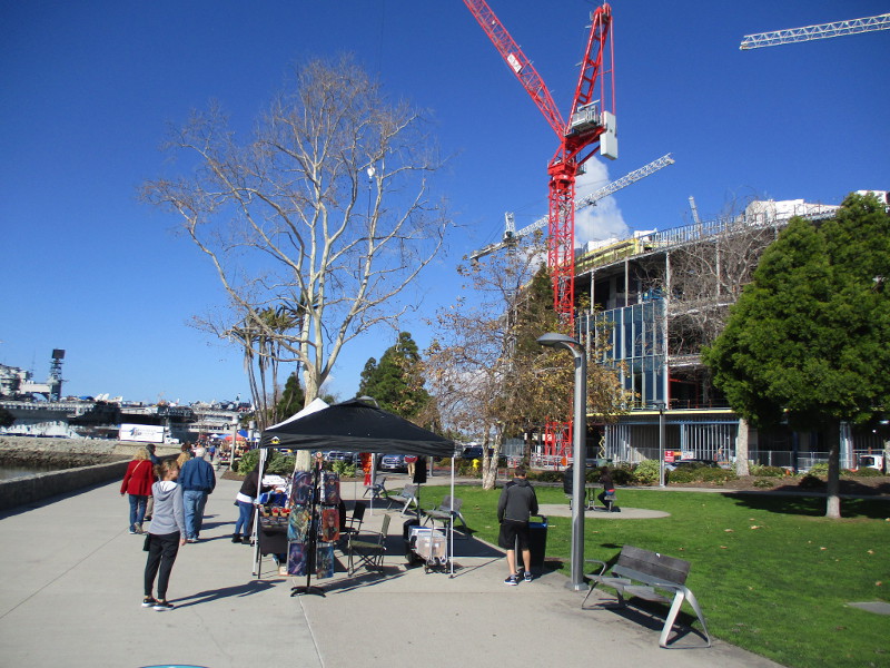
These photos were taken as I continued my way north, past Tuna Harbor and the USS Midway. You’ll probably recognize the Embracing Peace “kiss” statue.
My final shots were taken out on Broadway Pier, and then a few steps north of it where another street musician was singing with a big smile.
…
Thanks for visiting Cool San Diego Sights!
I post new blogs pretty often. If you like discovering new things, bookmark coolsandiegosights.com and swing on by occasionally!
I live in downtown San Diego and love to walk around with my camera! You can follow Cool San Diego Sights via Facebook or Twitter!
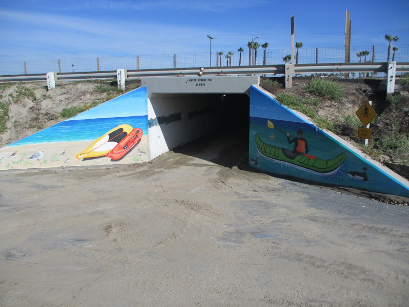
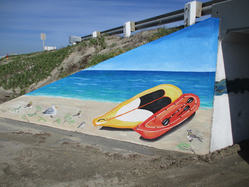
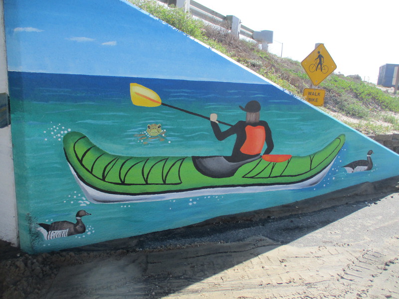
Back in 2020, I posted photos of a long two-sided mural depicting sea life. The artwork was painted many years ago inside a pedestrian tunnel that passes under California State Route 75 at Silver Strand State Beach.
Today I went down to the Silver Strand for a walk and I noticed a new mural had been painted in 2021 at the west end of the same tunnel!
The mural presents images of boats, beach, ocean and birds. Both sides of the tunnel entrance were painted by Imperial Beach artist Esmeralda Robles.
…
Thanks for visiting Cool San Diego Sights!
I post new blogs pretty often. If you like discovering new things, bookmark coolsandiegosights.com and swing on by occasionally!
I live in downtown San Diego and love to walk around with my camera! You can follow Cool San Diego Sights via Facebook or Twitter!
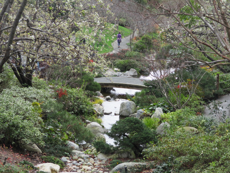
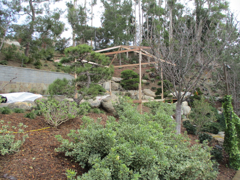
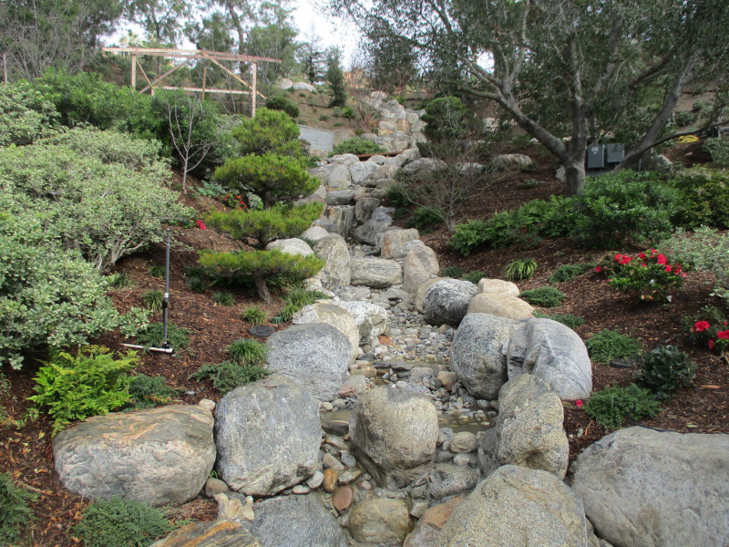
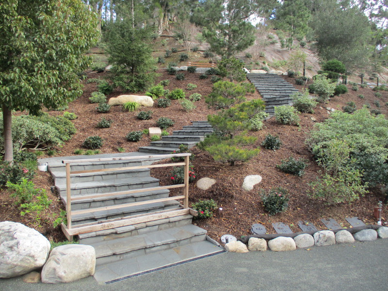
The Japanese Friendship Garden in Balboa Park is always beautiful. Even between winter showers.
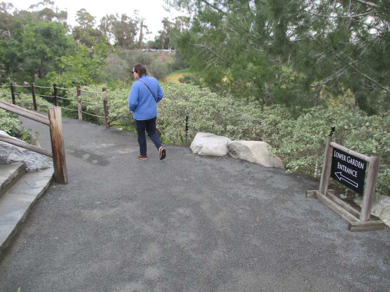
As I walked down into the Lower Garden today, I noticed great progress has been made on JFG’s big new waterfall.
I spied other construction, too! A special space is now being built where outdoor weddings can be held among all the natural beauty.
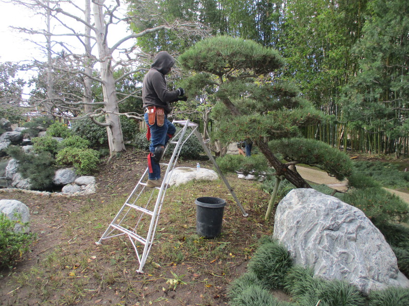
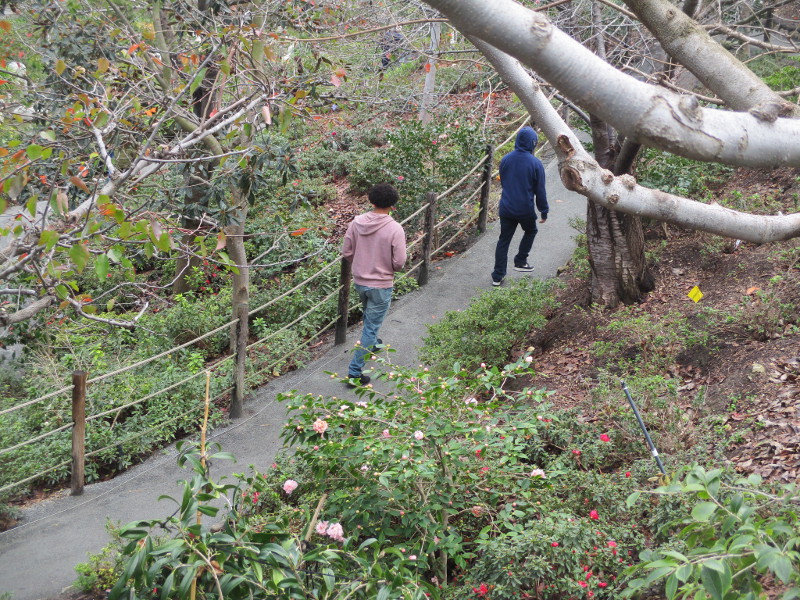
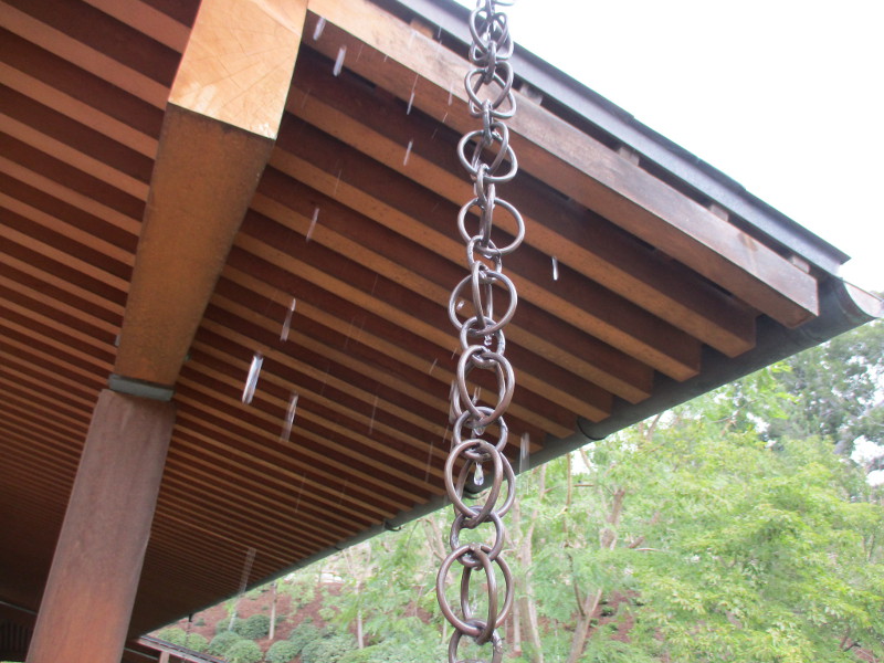
Expert, artistic pruning in the Upper Garden.Naked branches during winter. Grays among greens.Today is JFG’s “free entry for residents” third Tuesday. Several folks were setting up on the patio, including the garden’s long-time beekeeper! She showed me this wood home constructed for native bees.Heading into the Lower Garden a few minutes after the Japanese Friendship Garden opened.Looking across the canyon, I could see how the big new waterfall appears just about finished.Walking down one of the garden’s special paths.I was surprised to see a new area under construction. A worker told me this little plaza will be for outdoor weddings.This path leading up to the new waterfall is still closed.A structure near the new waterfall. I was told special events will be held up there.I can’t wait for the new waterfall to be activated!These stairs will allow visitors to climb toward the top of the waterfall.Beauty is abundant down in the Lower Garden.A rain chain at one corner of the Inamori Pavilion is dripping! After taking this photo, I hurriedly put my camera under my jacket.
…
Thanks for visiting Cool San Diego Sights!
I post new blogs pretty often. If you like discovering new things, bookmark coolsandiegosights.com and swing on by occasionally!
I live in downtown San Diego and love to walk around with my camera! You can follow Cool San Diego Sights via Facebook or Twitter!
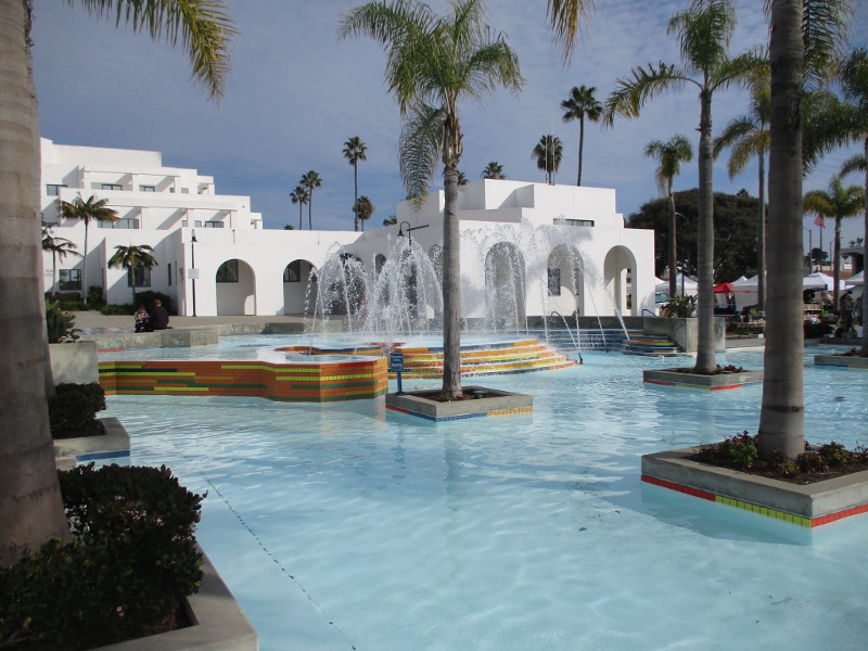
The beautiful fountain splashing in the Oceanside Civic Center plaza has special symbolism that is revealed on a nearby plaque. The plaque, commemorating Andrew Jackson Myers, founder of Oceanside, can be found on a wall just north of the fountain, near the entrance to the Civic Center library.
As the plaque explains, not only was Andrew Jackson Myers the founder of Oceanside, but he created the Oceanside Water Company, critical to the city’s early development. And the fountain where water flows and splashes is the site of his homestead!
The colorful tiles leading down to the fountain represent the San Luis Rey River, which was the original source of Oceanside’s water supply.
(Here’s a great article concerning Oceanside’s water history.)
…
Thanks for visiting Cool San Diego Sights!
I post new blogs pretty often. If you like discovering new things, bookmark coolsandiegosights.com and swing on by occasionally!
I live in downtown San Diego and love to walk around with my camera! You can follow Cool San Diego Sights via Facebook or Twitter!
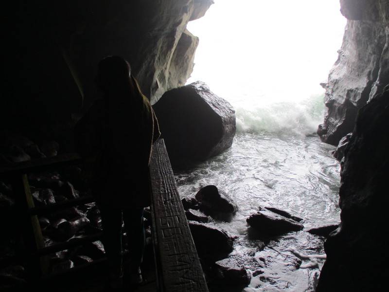
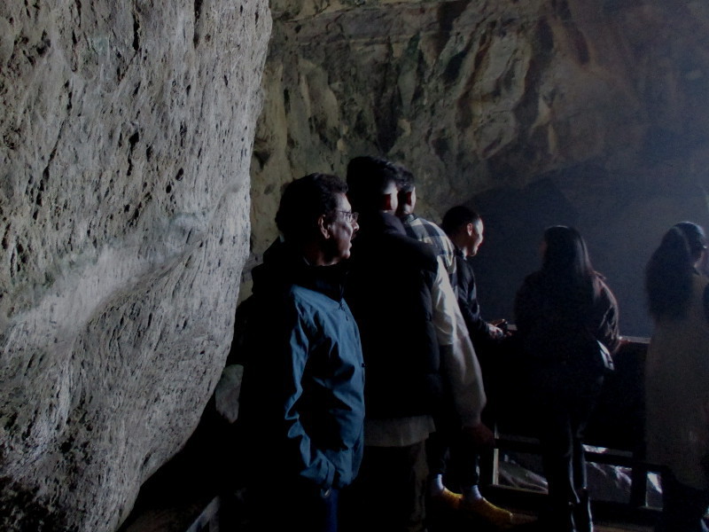
For over a hundred years, curious visitors have descended into Sunny Jim Cave in La Jolla. I recently ventured down into the sea cave for my very first time! And I’m glad I did!
What was this small adventure like?
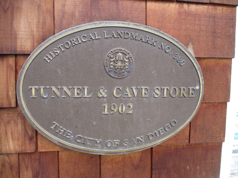
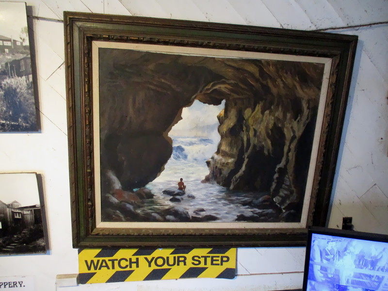
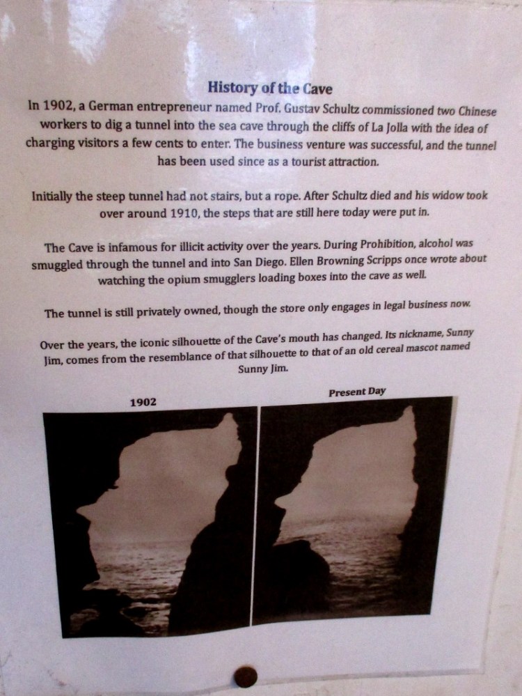
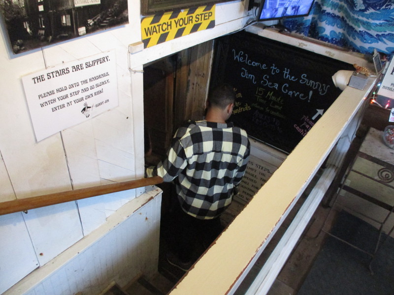
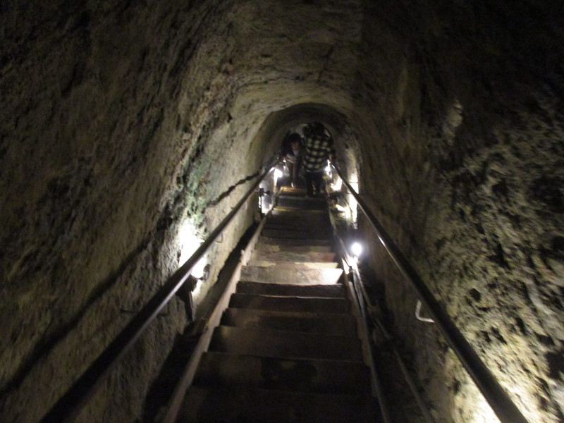
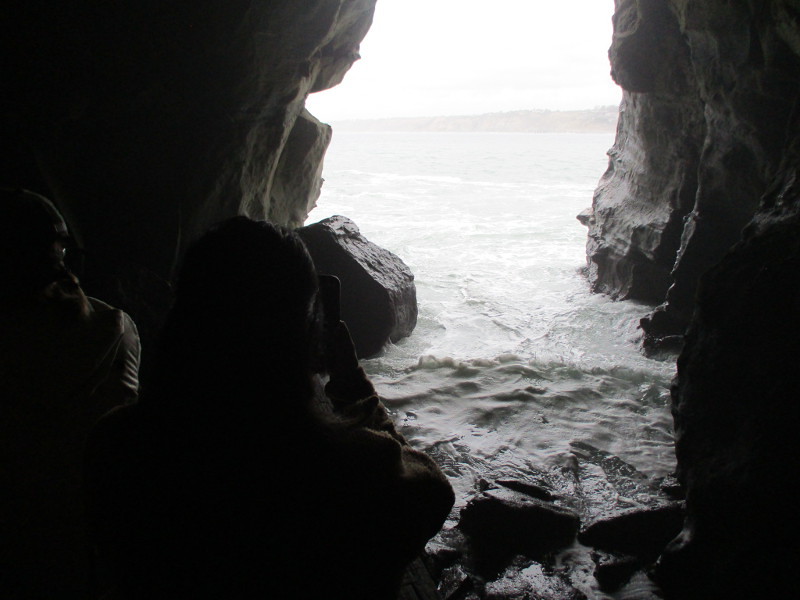
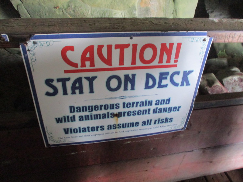
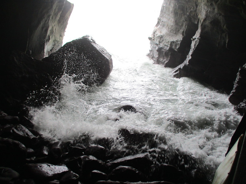
North of La Jolla Cove is a series of sea caves, with entrances that can be approached by water. One of the openings is to Sunny Jim Cave.Visitors to The Cave Store can descend via tunnel into famous Sunny Jim Cave.Historical Landmark No. 380. Tunnel & Cave Store – 1902. The City of San Diego.Artwork in the Cave Store depicts someone sitting on a rock inside Sunny Jim Cave.History of the Cave. In 1902, a German entrepreneur named Prof. Gustav Schultz commissioned two Chinese workers to dig a tunnel into the sea cave through the cliffs of La Jolla with the idea of charging visitors a few cents to enter…During Prohibition, alcohol was smuggled through the tunnel and into San Diego…Its nickname, Sunny Jim, comes from the resemblance of (its) silhouette to that of an old cereal mascot named Sunny Jim.Starting down narrow stairs into the steeply sloping tunnel.145 steps…All persons entering this cave do so at their own risk.Here we go!I’ve been inside mines, and this experience feels similar.The stairs descend around several turns. In places the ceiling is rather low, and I had to stoop while carefully holding onto the railing.When people pass in the narrow tunnel, it’s a tight squeeze! The wooden steps become more wet and slippery the farther down we go…Almost there. The rock above and around is very damp now.Walking out onto the wooden deck just inside Sunny Jim Cave.The profile of Sunny Jim becomes apparent.Several people were already on the deck, gazing out at ocean waves surging into the cave.Sea lions sometimes hang out in the cave, but there were none when I visited.
The cave’s name Sunny Jim was suggested by Wizard of Oz author L. Frank Baum. Sunny Jim was the prominent-nosed mascot for Force, the first commercially successful wheat flake breakfast cereal!
Today is the Winter Solstice. The shortest day and longest night. The first day of winter.
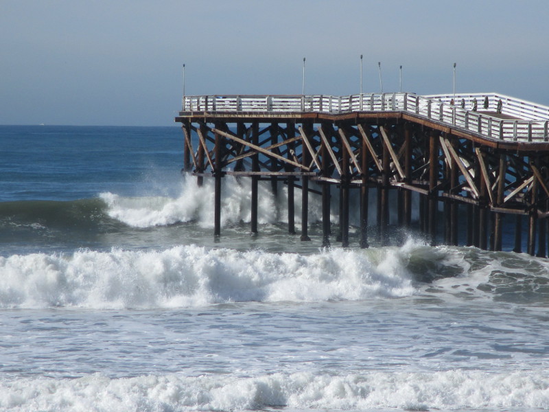
I’ve taken many winter photographs around San Diego over the years. My camera has captured wild storms and their aftermath, high winds and crashing waves, snow in the mountains, umbrellas in the city, and the unique beauty of winter in nature.
Would you like to see some of these photos? Click the upcoming links and you’ll be transported back in time…
Click the following links to explore past winters…