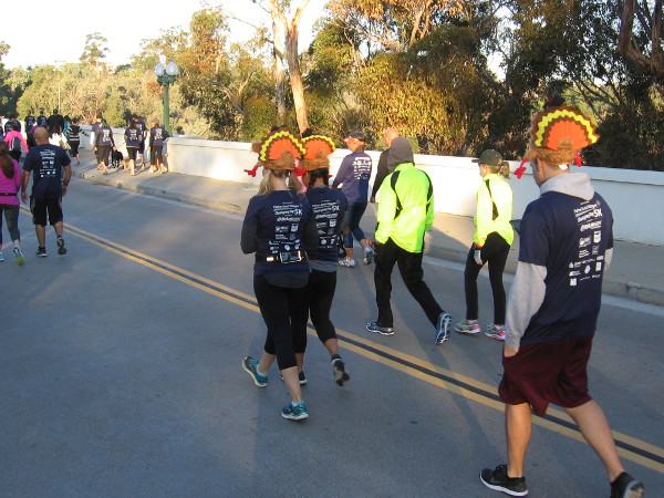
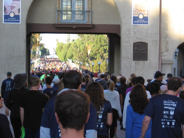
Turkey hats on runners preparing for the Father Joe’s Villages Thanksgiving Day 5K, an annual event to help San Diego’s homeless.
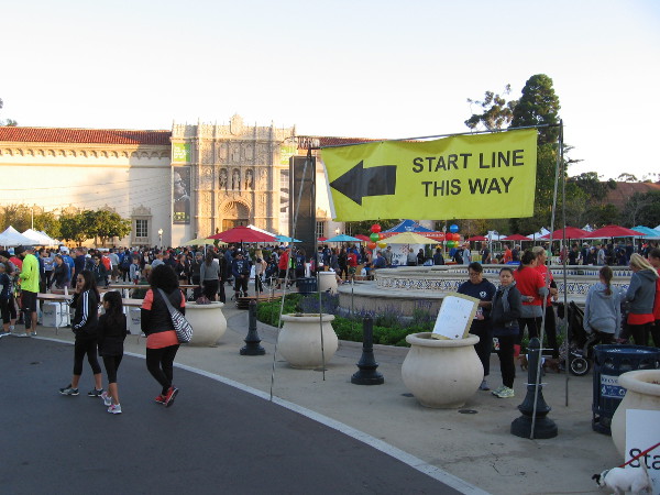
This morning thousands gathered in Balboa Park to participate in the Father Joe’s Villages Thanksgiving Day 5K run and walk. Money raised during the annual event helps Father Joe’s Villages provide food, shelter, medical care, employment training and hope for many of San Diego’s homeless.
If you’d like to donate to Father Joe’s, or learn more about what they do, here’s their website.
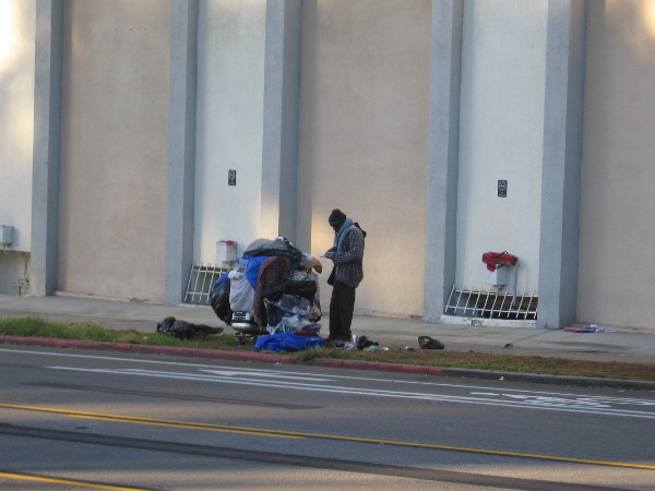
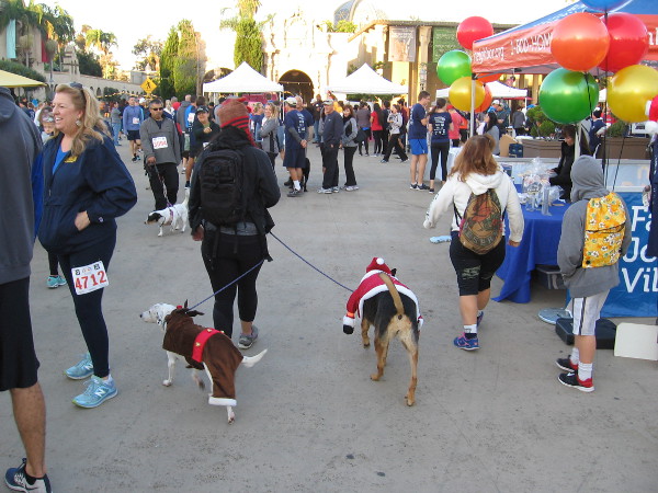
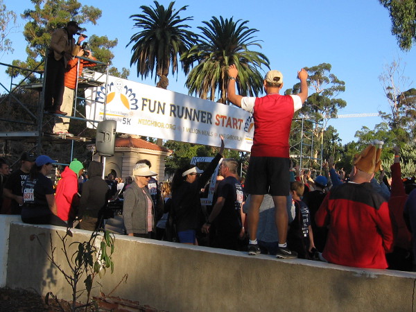
Homeless man on Sixth Avenue, across the street from Balboa Park.Thousands gather in Balboa Park’s Plaza de Panama before the start of Father Joe’s Villages Thanksgiving Day 5K run and walk.Many Thanksgiving-themed costumes and hats could be spotted among the participants. These dogs are already in the Christmas spirit!Energy-providing fruit slices are prepared for the 5K participants before the beginning of the race.The Knights of Columbus had a pancake breakfast in Balboa Park during the Father Joe’s Villages Thanksgiving Day 5K.Catholic priests perform a religious service in the Plaza de Panama for the faithful before the Thanksgiving race to help the homeless.Runners and walkers head toward the start line in Balboa Park. Morning sun shines on the iconic California Tower.Thousands of participants pass over the Cabrillo Bridge, just prior to beginning the Father Joe’s Villages Thanksgiving Day 5K.This family is dressed like a Pilgrim and a turkey dinner!People get enthused a few minutes before the fun run begins.Homeless person alone on the sunlit grass in a corner of Balboa Park.Getting ready to start a competitive 5K run on Thanksgiving morning. Money raised helps provide food and shelter for the homeless in San Diego.
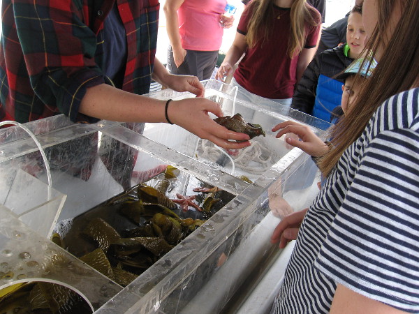
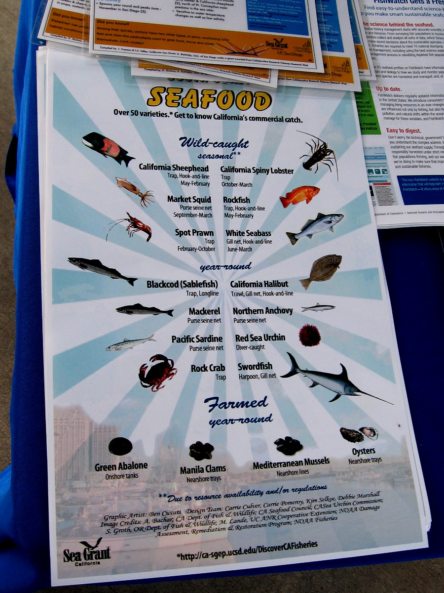
Shoppers at the Tuna Harbor Dockside Market learn about whelks and other food from the sea.
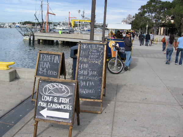
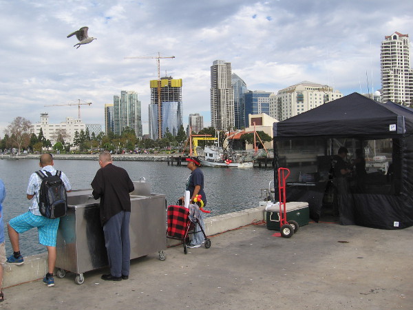
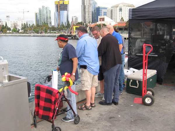
Late yesterday morning I revisited the Tuna Harbor Dockside Market. It’s a place whirling with human activity, fascinating sights, and fishy, oceany smells. The fresh seafood market spontaneously appears on the pier between Seaport Village and Tuna Harbor every Saturday morning. It features the catch of local fishermen. And lots of shoppers, should you arrive early.
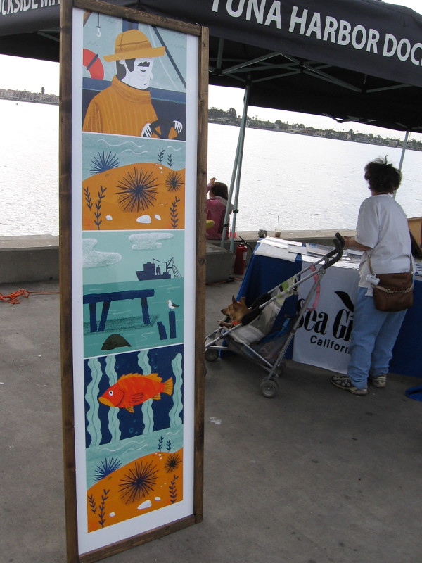
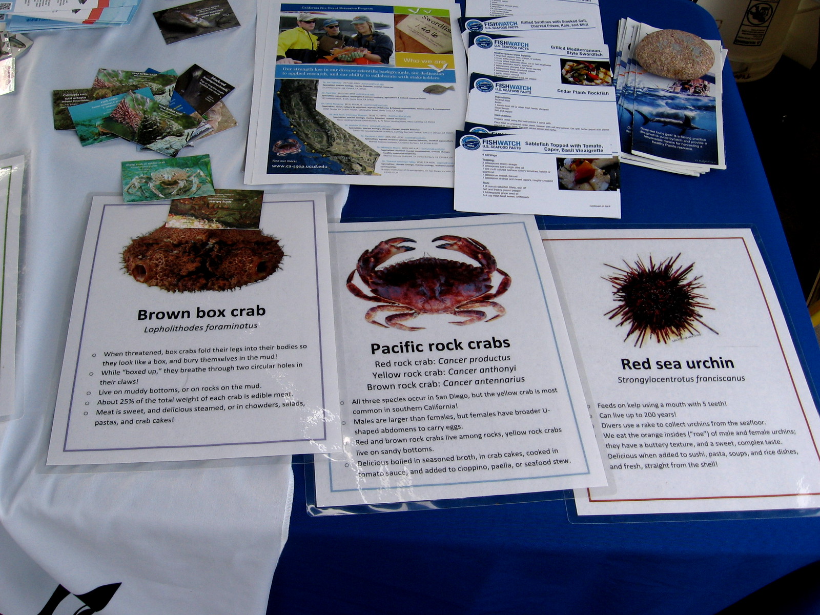
During my casual visit I noticed some interesting information on a table that described what our local fishermen catch. So I took some pics. I also enjoyed being shown various species of edible sea creatures by a few of the friendly vendors, though I’m afraid I purchased nothing. My cooking skills amount to pushing buttons on the microwave. I admit it.
If you’d like to read some of the literature I spotted on a table, click the images.
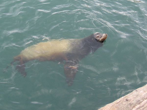
Sidewalk signs try to lure people out onto a pier near Seaport Village. Fresh seafood caught by local fishermen is sold here every Saturday morning.I arrived at the Tuna Harbor Dockside Market at about eleven o’clock, after the usual early morning crowd of fresh fish shoppers had departed.Some freshly caught silvery Pacific bluefin tuna on ice for sale. That’s a lot of eating!I noticed people by the edge of the pier looking across the water toward downtown San Diego.Something below in the water has caught their attention…It’s a sea lion just hanging out, probably hoping for a handout!The Mary Beth docked nearby appears equipped and ready to go out for more fish.Some colorful artwork at the fresh fish market depicts a fisherman and scenes from above and beneath the ocean.Meet your meal! At one table I discovered some interesting photos and literature, including a diagram of deep-set buoy gear used to catch swordfish.This poster shows the most common seafood commercially harvested in California. Many of these species can be purchased at Tuna Harbor Dockside Market.More info on the table describes the wavy turban snail and Kellet’s whelk, which I’m told make for good eating.I believe I’ve seen brown box crabs, Pacific rock crabs, and red sea urchins at this very market! The latter can live up to 200 years, and is considered a delicacy.Some guys cut up a huge fish, making steaks. Customers can have their purchase cleaned on the pier.A big pile of whelks. To cook these, boil!Look at all the seafood one can choose from at this one tent. The Tuna Harbor Dockside Market continues to grow and now occupies about half of the pier.Fresh fish! Lots of tuna!I’m shown a spiky sea urchin. The kelp and starfish are just for show–they aren’t normally eaten!
…
I live in downtown San Diego and love to walk! You can follow Cool San Diego Sights via Facebook or Twitter!
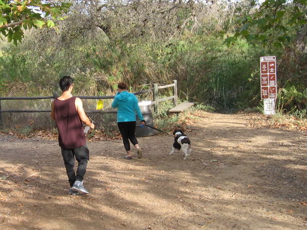
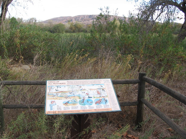
Hikers head from the Kumeyaay Campground at Mission Trails Regional Park toward a shady nature trail that runs beside Kumeyaay Lake.
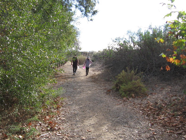
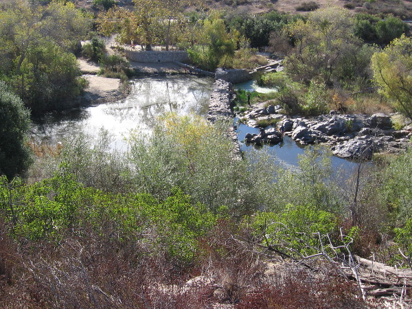
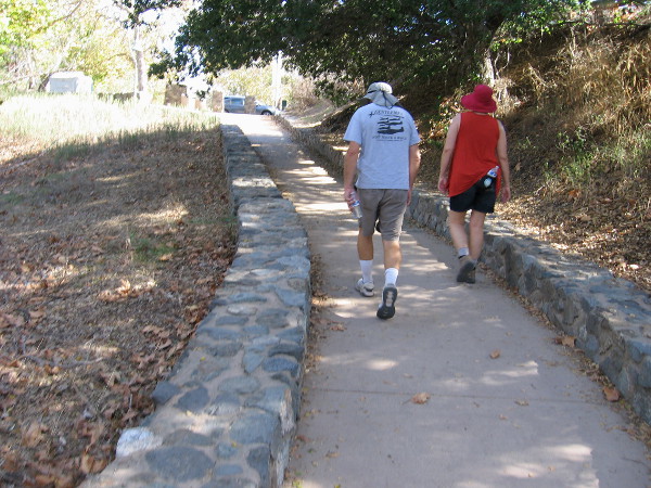
I enjoyed an amazing walk last weekend at Mission Trails Regional Park. The guided hike met under the flagpoles of the Kumeyaay Campground, and started down a pleasant nature trail at nearby Kumeyaay Lake. The hike then proceeded at a leisurely, easy pace along several trails by the San Diego River, ending up at the Old Mission Dam.
Every month, anyone can go on a variety of free interpretative nature walks at Mission Trails Regional Park. The walks are led by experienced trail guides, who point out the native flora and fauna, and relate the fascinating history of this mountainous wilderness in the city. To learn more check out the park’s website.
Please enjoy my photos and read the descriptive captions to join me on a virtual hike. Not only will you experience natural beauty, but you’ll learn a bit about early San Diego history!
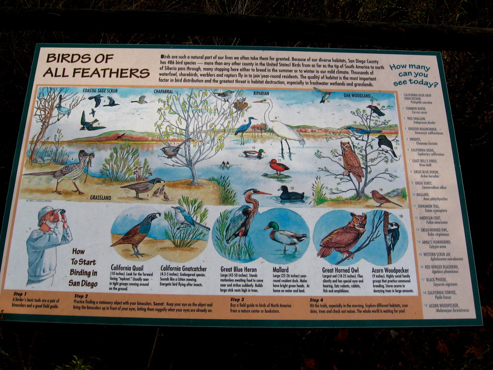
A couple walks slowly along the Kumeyaay Nature Trail, enjoying a beautiful November day.Signs along the nature trail include descriptions of wildlife that can be found around Kumeyaay Lake (once called Hollins Lake). Open water can be glimpsed beyond cattails.At Mission Trails Regional Park, birds of all feathers include quail, gnatcatchers, herons, egrets, ducks, woodpeckers, scrub jays, owls, and the endangered least Bell’s vireo!
The sign includes the following: “Because of our diverse habitats, San Diego County has 486 bird species–more than any other county in the United States! Birds from as far as the tip of South America to north of Siberia pass through, many stopping here either to breed in the summer or to winter in our mild climate.”
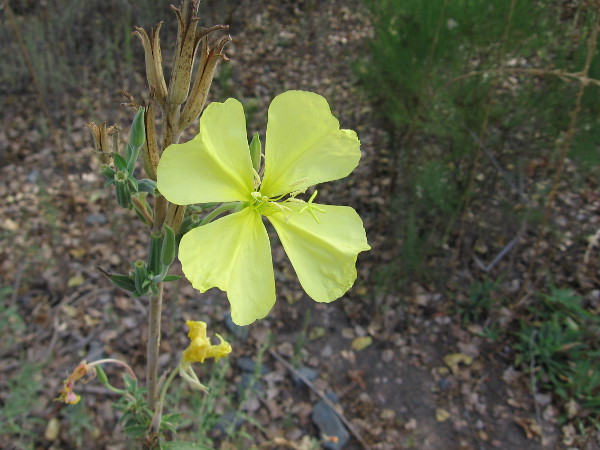
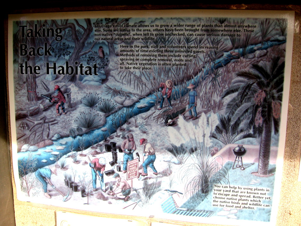
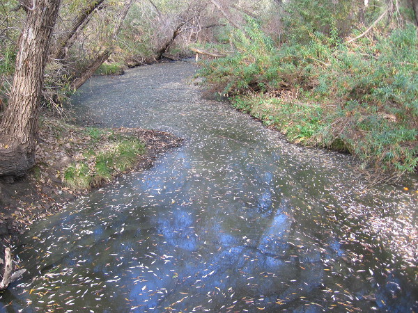
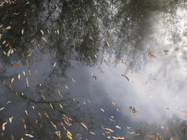
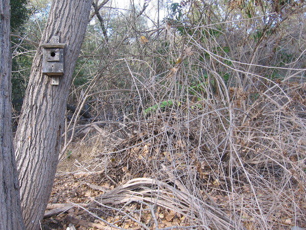
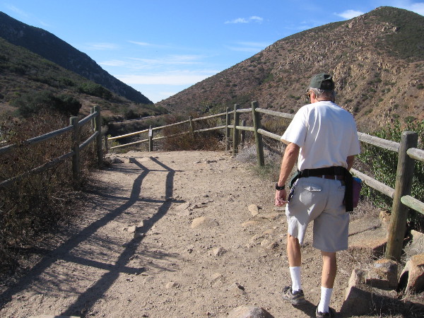
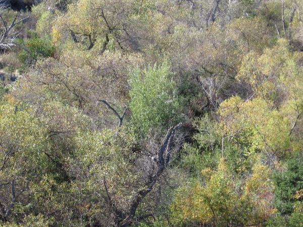
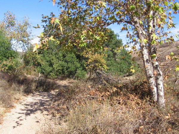
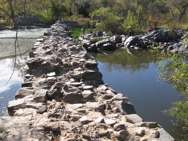
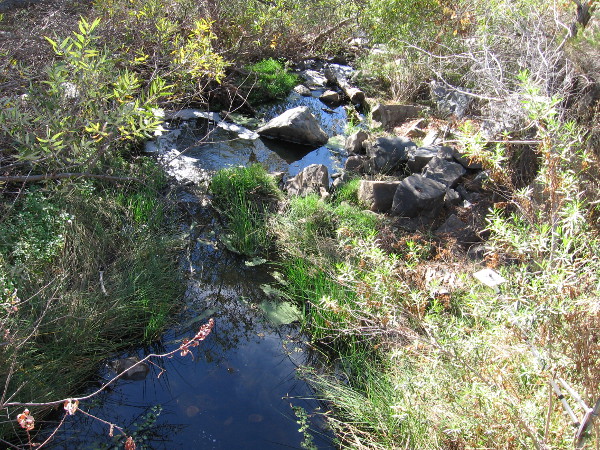
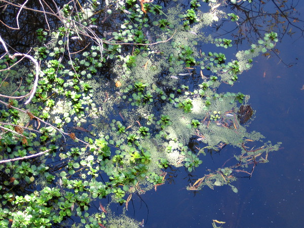
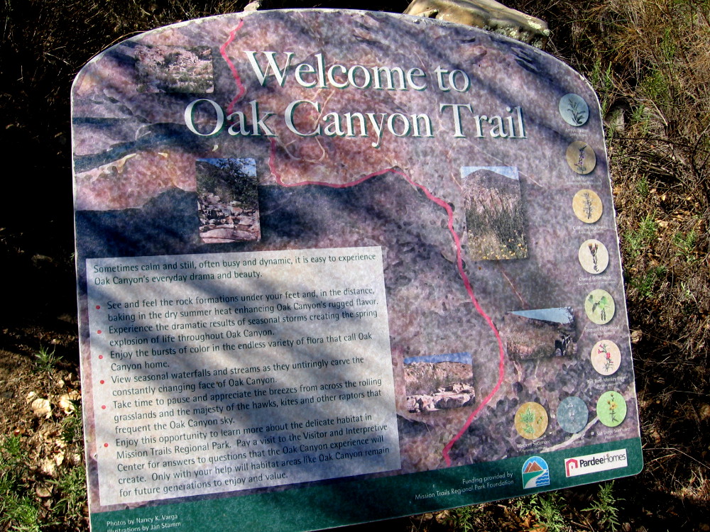
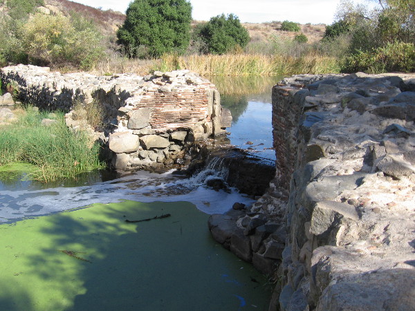
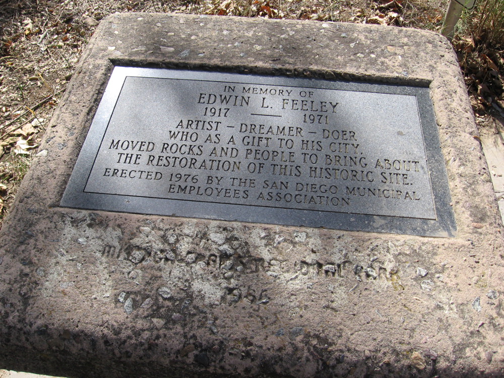
Photo of the San Diego River emerging from Kumeyaay Lake. This is near an outdoor amphitheater and fire pit. The park is a perfect place to learn about nature from rangers, and for stargazing at night!An Autumn wildflower at Mission Trails Regional Park.We head from the lake back toward the campground. Our pleasant hike has just begun.Non-native plants can cause serious damage to natural areas and wildlife. Park staff and volunteers work to protect the natural ecosystems.Hiking down the Grasslands Crossing Trail, my guide and I pass over the San Diego River. It has been a typically dry summer, and the pooled water here is still.Leaves and reflections of trees in the quiet water.We spied a wood rat’s nest of twigs and branches near the hiking trail. I learned these nests contain several rooms with different functions, not unlike a human home.Larry the trail guide showed me a photo of a wood rat.Now we are heading along the easy Grasslands Loop Trail, following the north bank of the San Diego River. Riparian trees such as willows, sycamores and cottonwoods thrive along the river.Mountain bikers enjoy a warm, sunny morning at Mission Trails Regional Park.Approaching an overlook of the Old Mission Dam.Photo of the Old Mission Dam from the north. The dam was built around 1813 and powered a water wheel that drove a grist mill. A tiled flume brought water to Mission San Diego de Alcala, about five miles away.Families play on the rocks near the Old Mission Dam at Mission Trails Regional Park.Lush trees along the San Diego River. Autumn leaves have yellowed a bit.We have descended onto Oak Canyon Trail, and are working our way down to the river and the historic dam.Standing on the north end of the Old Mission Dam. Materials used in constructing the dam include abundant volcanic rock found in this area.A slot in the dam wall where a water wheel was located. The river water, after driving the wheel, flowed along a tile-lined aqueduct south to the mission, where it was used to grow crops.Walking along the Oak Canyon Trail. Mission Trails Regional Park is like a small wilderness inside the city of San Diego. At 5,800 acres, it’s the largest city park in California.Riparian plants recover quickly after a fire because all are vigorous resprouters as long as they have a steady water supply.Granitic rocks seen along the trail.South Fortuna Mountain, elevation 1094 feet, rises to the south. Its sides are covered with native chaparral and sage scrub.Crossing the San Diego River via a steel footbridge.Looking down at the San Diego River. During rains, the river swells. The water runs down into Mission Valley and finally to the Pacific Ocean, sustaining an estuary near Mission Bay.Larry, my knowledgeable trail guide, informed me that the tiny green vegetation is duckweed, an aquatic plant that floats on the water’s surface.Sign at one end of the Oak Canyon Trail, near the Old Mission Dam.A cool 3-D model of the Old Mission Dam beside the trail. The dam was constructed from granite boulders and limestone mortar. At the gap there was a 12-foot wide floodgate.It’s possible to walk out onto the old dam, but one must be careful!A vertical groove in the dam wall shows where the floodgate used to exist. The dam was completed around 1813, and the long flume to Mission San Diego was completed several years later.Inscription in a boulder dated 1941, by the Daughters of the American Revolution. OLD MISSION DAM. Built 1813-1816. A part of the first permanent irrigation project by Padres and Indians in California.A plaque by the old dam. In memory of Edwin L. Feeley. 1917 – 1971. Artist – Dreamer – Doer who as a gift to his city, moved rocks and people to bring about the restoration of this historic site.Bright fluttering leaves of a river tree growing beside the Father Junipero Serra Trail, a road that leads past the Old Mission Dam.Walking to the parking lot by the Old Mission Dam, also called the Padre Dam.The site is a California historical landmark. A dam and flume system was finished between 1813 and 1816 by Indian laborers and Franciscan missionaries. It provided a reliable source of water for crops and livestock for Mission San Diego de Alcala. The system continued until 1831 when it fell into final disrepair.Beautiful hiking trails, and a fascinating look back at early San Diego and California history await at Mission Trails Regional Park.
…
I live in downtown San Diego and love to walk! You can follow Cool San Diego Sights via Facebook or Twitter!
You can easily explore Cool San Diego Sights by using the search box on my blog’s sidebar. Or click a tag! There are thousands upon thousands of fun photos for you to enjoy!
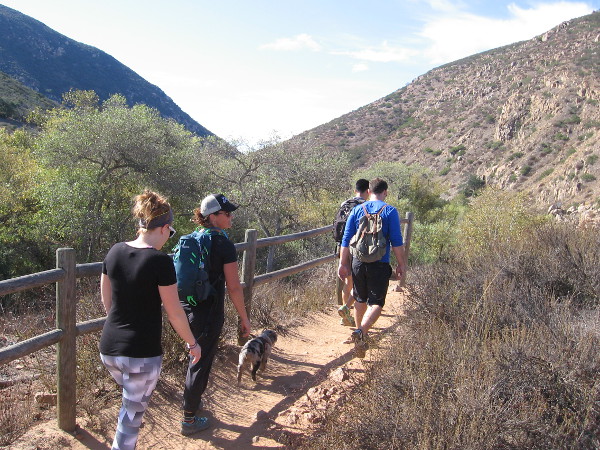
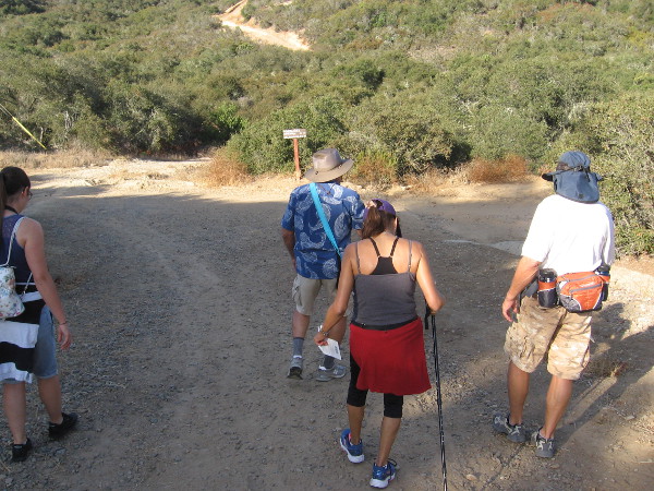
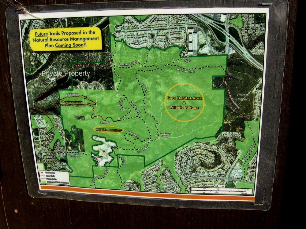
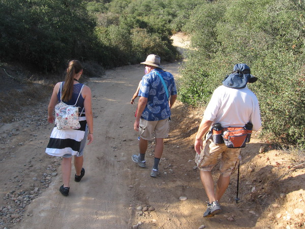
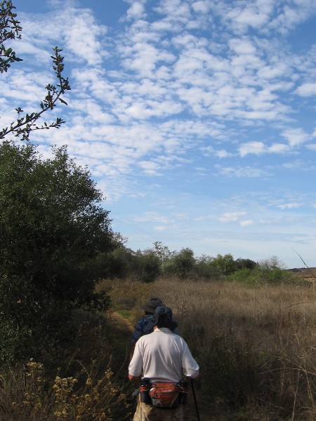
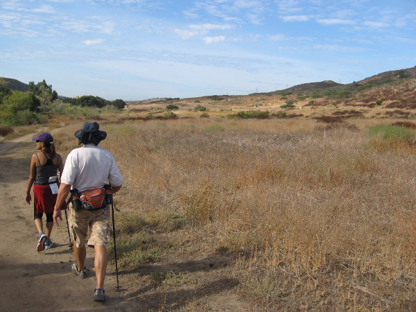
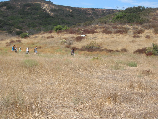
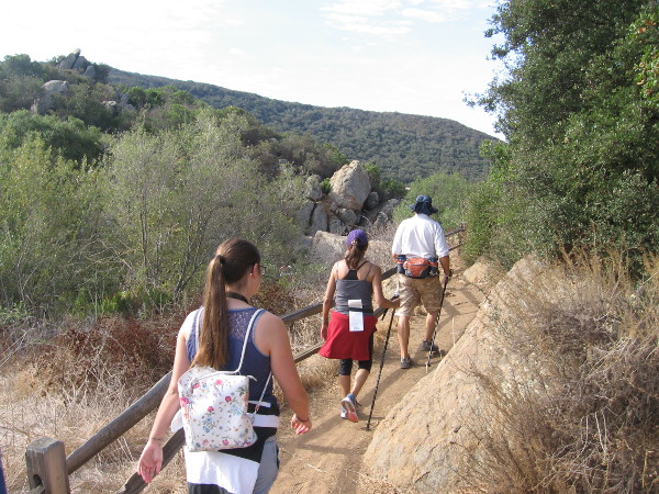
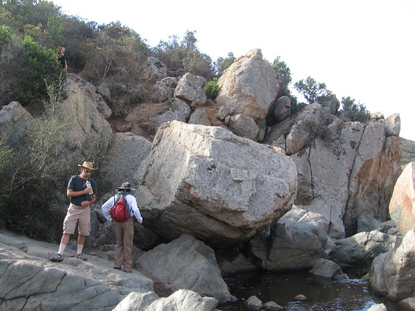
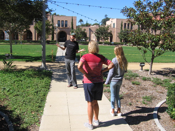
Naturalist Mike Kelly leads a small group of hikers into Los Peñasquitos Canyon Preserve from the Del Mar Mesa trailhead.
Free guided nature walks in the Los Peñasquitos Canyon Preserve introduce the public to unexpected wild beauty in the heart of San Diego. Yesterday I went on one of these easy walks.
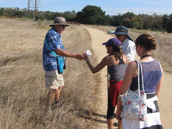
Our guide, naturalist Mike Kelly, longtime member of the Friends of Los Peñasquitos Canyon Preserve, has been an advocate working to safeguard this beautiful and historic San Diego canyon for over three decades. He’s a friendly fellow whose knowledge of the canyon’s flora, fauna and fascinating history made for an extremely enjoyable hike.
Years ago, Mike and others fought to save Los Peñasquitos Canyon from development. Their efforts resulted in about half of the canyon being protected. Fortunately, the preserve is connected to other similar natural areas in San Diego through various corridors, allowing wildlife to move about and thrive. Owls, woodpeckers, hawks, raccoons, bobcats, coyotes, mule deer, even an occasional mountain lion make the canyon their home. Native trees, chaparral, grass and spring flowers are abundant and the source of endless enjoyment.
I learned there are also wildlife tracking hikes, plus night walks, when deer are frequently seen. There are also free guided tours of San Diego’s second oldest residence, which stands near the east end of the preserve, the Rancho Santa Maria de Los Peñasquitos adobe. To learn about all these wonderful adventures, which are ideal for families, click here.
To learn more about the Friends of Los Peñasquitos Canyon Preserve, click here! Perhaps you’d like to become a member!
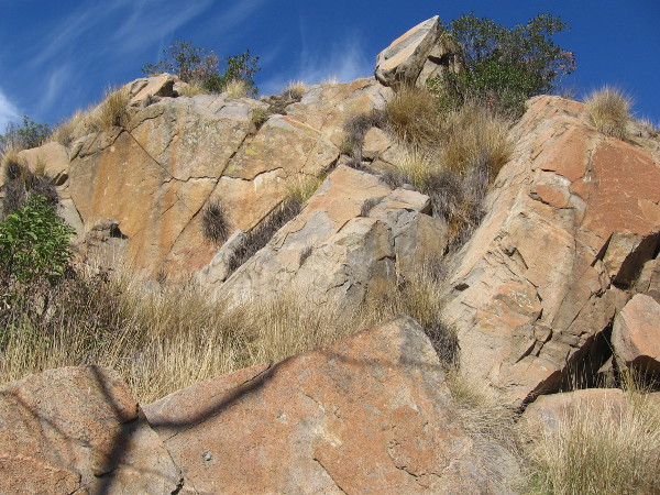
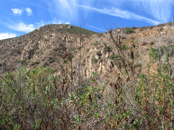
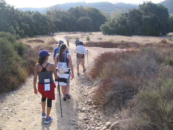
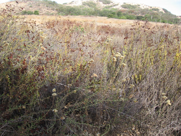
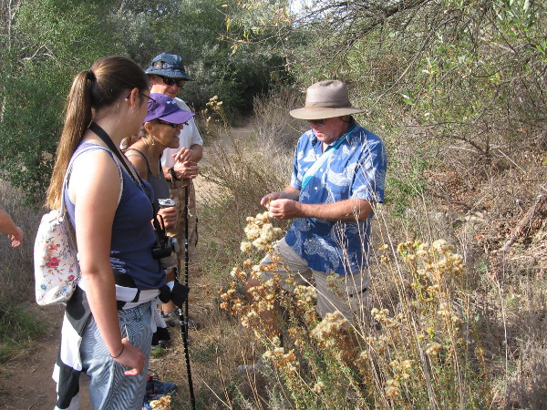
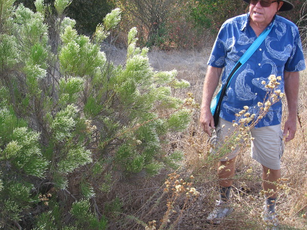
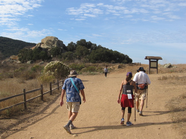
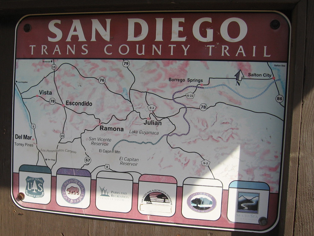
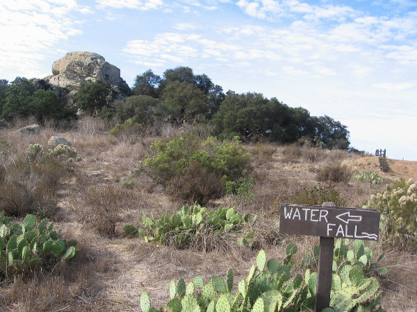
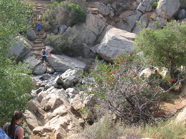
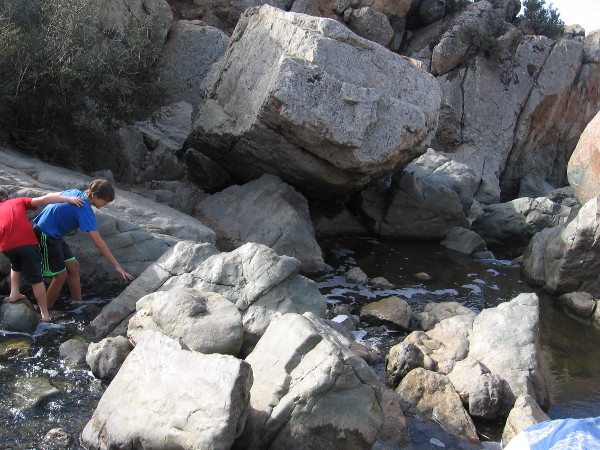
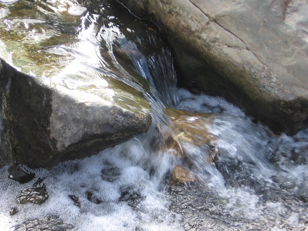
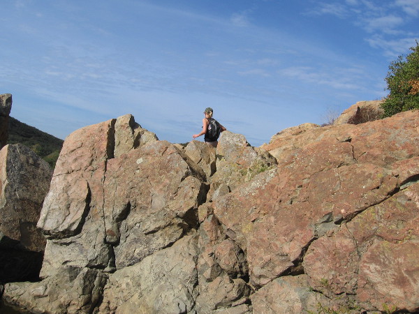
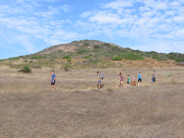
The Del Mar Mesa trailhead is located near suburban homes at the north edge of Los Peñasquitos Canyon.A sign posted at the trailhead shows future trails proposed in the Natural Resources Management Plan.Our small group of hikers heads down into the canyon through Coastal Sage Scrub habitat. We are passing California scrub oaks.We headed to Carson’s Crossing before checking out the popular waterfall.Approaching the central part of the long, narrow canyon, which runs from Poway west to Del Mar and the Pacific Ocean. Peñasquitos Creek lies beyond those coast live oaks in the distance.Carson’s Crossing is an historically important spot in Peñasquitos Canyon. Kit Carson crossed the creek here during the Mexican-American War. General Kearny’s US Army of the West was faced with formidable Californio lancers in San Pasqual, and the legendary frontiersman Kit Carson snuck away in the middle of the night to summon reinforcements from San Diego. He knew to come this way. The later 1857 Jackass Mail stagecoach line also ran through the canyon here enroute to San Diego.Heading west through the beautiful canyon in the shade of oaks, sycamores and willows. It’s an easy, pleasant hike.Looking north across a field in Los Peñasquitos Canyon Preserve in late October. Summers are very dry. Many leaves and flowers are now brown, awaiting winter rains.Walking slowly, senses alert. I smell the nearby sagebrush. I hear acorn woodpeckers and quail. I see beautiful clouds.Mike Kelly is a guide and activist whose knowledge of Peñasquitos is deep. Here he shows us some poison oak which is growing a short distance off the trail.A peaceful walk through nature. Over several decades, activists like Mike have worked hard to preserve the canyon and protect it from development. Today it is maintained by volunteers and both the City and County of San Diego.Mike Kelly shows us some California broom. Native American Kumeyaay and pioneers used the plant like a broom for sweeping.Los Peñasquitos Canyon Preserve is a very popular place for jogging, hiking and mountain biking. Even marathoners use it for training.Now we’re approaching a trail sign and a large rock outcropping, which I learned is volcanic.Sign shows proposed San Diego Trans County Trail, which when completed would run from the Pacific Ocean over the mountains east of San Diego and out to the Salton Sea in the desert.I see lots of prickly pear cacti. Now we are getting close to the popular waterfall!Approaching the Peñasquitos Creek waterfall from the east.Descending rough stone steps to the waterfall. I learned the steps were a project of an Eagle Boy Scout.The small waterfall and its rocky pools are located near the center of Los Peñasquitos Canyon. It is the destination of many hikes. A great place to relax, cool off, and listen to the soothing water.Water spills over rocks. It isn’t Niagara Falls, but it’s wonderful nonetheless.Hikers pause above a pool of water which is captured by large blocks of volcanic rock. When the creek crests, it can rise many feet and submerge this area.A hiker up above seems to walk in the sky.Families wander down a pleasant trail in Los Peñasquitos Canyon Preserve. There is much here to see and appreciate. So much to learn.Naturalist Mike Kelly shows us a poisonous flower of Datura. In nature, beauty and danger are often found together. One should be thoughtful when hiking, and be careful to wear sturdy footwear and bring water. We didn’t see any rattlesnakes or mountain lions!
…
This blog now features thousands of photos around San Diego! Are you curious? There’s lots of cool stuff to check out!
Here’s the Cool San Diego Sights main page, where you can read the most current blog posts. If you’re using a small mobile device, click those three parallel lines up at the top–that opens up my website’s sidebar, where you’ll see the most popular posts, a search box, and more!
To enjoy future posts, you can also “like” Cool San Diego Sights on Facebook or follow me on Twitter.
Wile E. Coyote in a business suit disguise. He secretly peers out of a window at the Chuck Jones Gallery. He’s hoping The Road Runner might zoom on by.
Wile E. Coyote was spotted this morning peering secretly from a window in downtown San Diego. Dressed in business attire, which was almost certainly a clever disguise, the patient cartoon character seemed to be waiting for his breakfast: The Road Runner.
As I walked down Fifth Avenue by the window in question Wile E. Coyote remained perfectly still. Like a cat. He appeared ready to activate another of his diabolical schemes. For a moment I hesitated with vague fear, searching the sidewalk and building above for a dangling anvil, a rocket or a large spring. Nothing.
And so, breathing a sigh of relief, I safely walked past the Chuck Jones Gallery in San Diego’s Gaslamp Quarter.
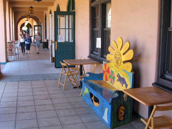
A walk through Liberty Station in Point Loma is always pleasurable. A photographer can find scenes of art, fun and life!
My walk yesterday took me to one of my favorite places in San Diego . . . Liberty Station! The historic old Naval Training Center San Diego in Point Loma has been converted into beautiful courtyards, shops, museums, art studios and more. It’s a lively but leisurely place where one can simply sit on a bench in a park and enjoy people, fountains, flowers and sunshine. It’s also a perfect place to walk randomly about to make new discoveries.
Here are a few fun photos my camera captured!
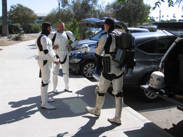
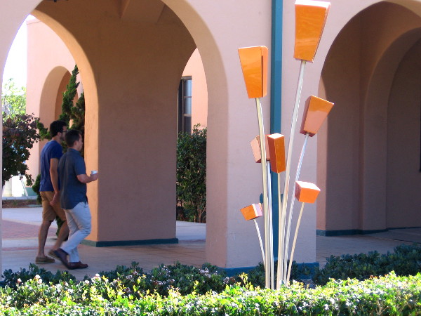
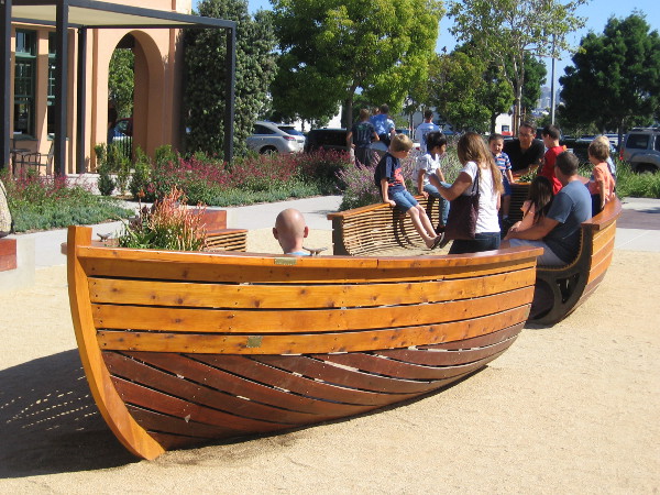
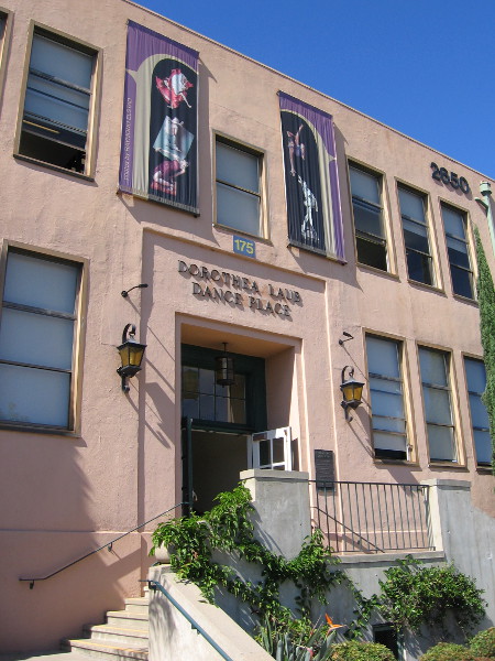
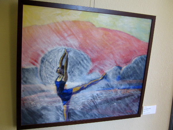
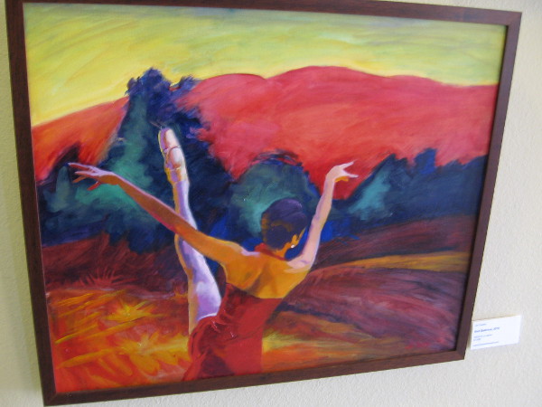
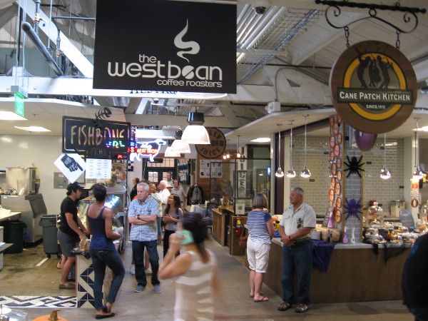
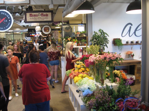
Two people on the North Promenade in the middle of the Arts District at Liberty Station learn how to take great photos from a personal instructor.These Star Wars stormtroopers were caught near a parking lot without their helmets. They appear to be quite human and friendly! I believe they were getting ready to provide entertainment for a special event in the big grassy NTC Park.Colorful banner outside the San Diego Watercolor Society Gallery. Their amazing International Exhibition is underway and will be open to the public through October 31.A small collection of paintings can be enjoyed inside the entrance to the old Naval Training Center San Diego’s command building.Art displayed in the NTC Command Center was created by artists who have studios inside several old barracks at Liberty Station.Window into one artist’s studio. Artists, museums and cultural attractions now occupy many of the historic Navy barracks at Liberty Station.A fun sculpture graces the North Promenade at Liberty Station. Flowers, by John Dupree.Families and kids love the small USS Brave boat bench at Liberty Station. Wood art by Jonathan Allen.Photo of entrance to the Dorothea Laub Dance Place building in Liberty Station.Lavendar Ballerina by Jori Owens, one of many paintings on display in the main hallway of the Dance Place San Diego at Liberty Station.Blue Ballerina, a painting by Jori Owens.Red Ballerina, a painting by Jori Owens.A busy Saturday at the new and very popular indoor Liberty Public Market.Flowers add color and life to Liberty Public Market, one of many places to visit at Liberty Station.
…
I live in downtown San Diego and love to walk! You can follow Cool San Diego Sights via Facebook or Twitter!
You can easily explore Cool San Diego Sights by using the search box on my blog’s sidebar. Or click a tag! There are thousands upon thousands of fun photos for you to enjoy!
A new esplanade is almost ready to open on the east side of the boat channel at Liberty Station. I took this photo from the Nimitz pedestrian bridge.
A new public park will be opening soon at Liberty Station!
I love parks. So a discovery I made yesterday made me very happy. A completely new esplanade is being created at Liberty Station! The narrow park will run along the east shore of the boat channel, allowing visitors to walk, recreate or just relax on either side of the water. The shady trees and green grass appear ready to go! Three new hotels are also being built near the esplanade, at the site of the old Wally Park airport parking lot.
Here are some photos I took during yesterday’s walk. You can see the progress being made and a couple of informative signs.
Sign declares: Coming Soon – Public Esplanade and Coastal Access. Sketches show people enjoying the beautiful new park.Green grass and trees appear ready on the east side of the boat channel.A difficult-to-read sign at Liberty Station shows the narrow new esplanade. I had to enhance the photo to make out details. The three dark forms in the upper right corner, I believe, will be new hotels.Looking eastward from the west side of the boat channel. A new park will soon open across the water!
…
I live in downtown San Diego and love to walk! You can follow Cool San Diego Sights via Facebook or Twitter!
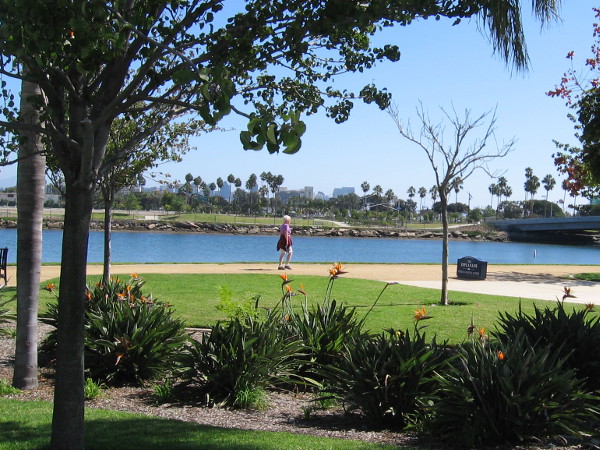
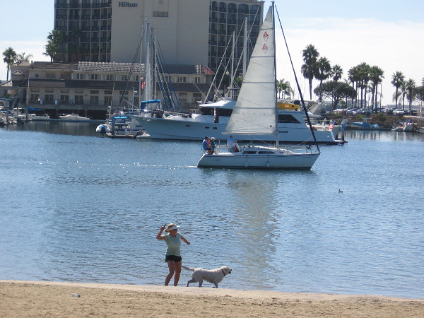
Playing catch with a dog on the small beach at Spanish Landing Park. A sailboat moves through Harbor Island’s West Basin, heading out to San Diego Bay.
A wide path for walkers and bicyclists runs from San Diego’s Embarcadero to Spanish Landing. While the portion between the Coast Guard station and Harbor Island Drive isn’t terribly scenic (it’s located right next to Harbor Drive and a lot of airport traffic), the section that meanders through Spanish Landing Park provides a peaceful, pleasant stroll. And a chance to learn a bit about San Diego’s history!
Today I took a long walk up the sunny path. Here are some photos. I pulled out my camera near Lindbergh Field and kept snapping pics all the way to the west end of Spanish Landing Park. (And beyond, as you’ll see in coming blog posts!)
As usual, please refer to the captions. You might note that Spanish Landing received its name because the 1769 expedition by Spanish explorer Gaspar de Portolá anchored in San Diego Bay near this place. The bay was much different back then–in modern times it has been extensively dredged and expanded. Indeed, Harbor Island, which you see in some photos, was originally a sandbank! Harbor Island today is composed of dredge spoils.
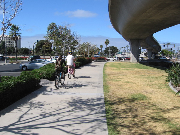
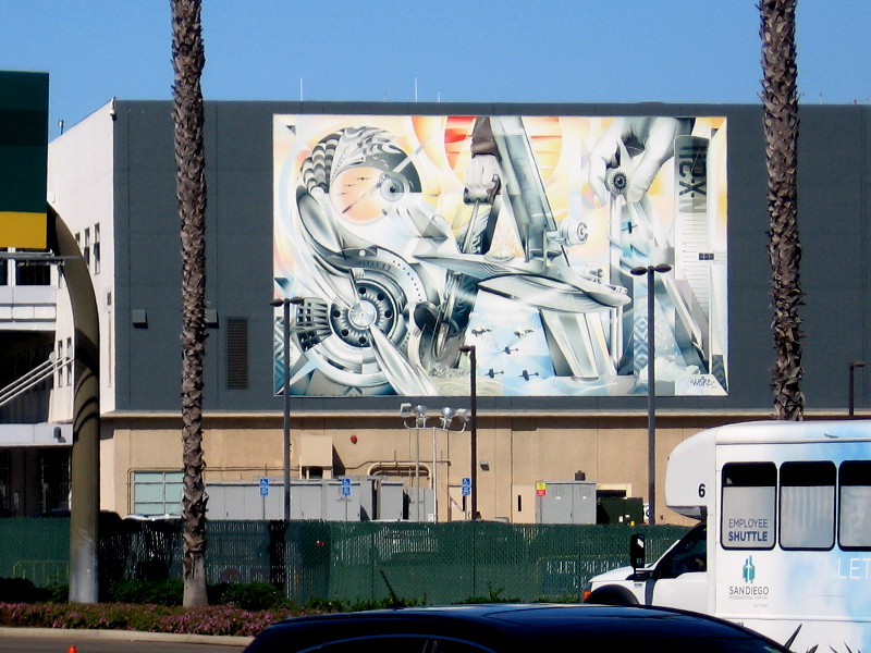
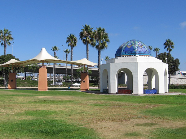
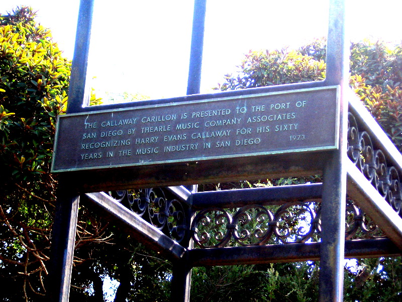
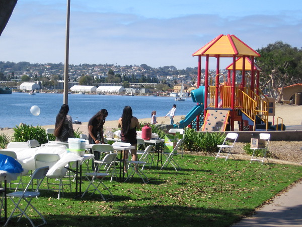
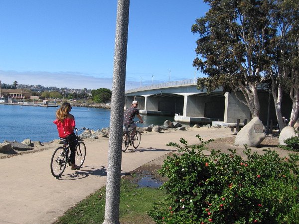
A long path along Harbor Drive runs from the Embarcadero in downtown San Diego to Spanish Landing. Bicyclists head up the path on a sunny weekend.This mural can be spotted across Harbor Drive as one approaches Lindbergh Field. Painted on the commuter terminal by Jari “Werc” Alvarez, it spells SAN, the code for San Diego International Airport.The path, near the edge of San Diego Bay, is part of the California Coastal Trail. It’s ideal for walking or biking from downtown to Spanish Landing Park, and beyond.A photo with my camera lifted toward the sky on a fine Saturday in mid-October.A quick photo of Cancer Survivors Park, on the east end of Spanish Landing Park. I’ve blogged about this special place a couple of times.Kayak heads across the water toward boats docked at a Harbor Island marina. Hotels on Harbor Island are resting on soil dredged up from the bay.I remember hearing the Callaway Carillon bell tower near the center of Spanish Landing Park when I was a child. I believe it no longer works. I hope I’m wrong.Plaque near base of the electronic bell tower. The Callaway Carillon is presented to the Port of San Diego by Thearle Music Company Associates . . . 1973Walkers pause on the path through Spanish Landing to read a California Historical Landmark plaque near the water.Spanish Landing. Near this point, sea and land parties of the Portola-Serra Expedition met. Two ships, the San Antonio and San Carlos, anchored on May 4-5, 1769.A bit further up the path is a playground and a popular spot for parties and celebrations on the nearby grass.Bronze artwork near the path through Spanish Landing honors those who lost their lives, during the sea journey by Gaspar de Portolá up the coast, two and a half centuries ago.Dedicated to the heroic Spaniards who gave their lives and were buried near this site in 1769-70, after accompanying Gaspar de Portolá, the first Governor of California, in the exploration of California from San Diego to San Francisco.Many benches along Spanish Landing Park provide views of the peaceful water and nearby Harbor Island.Bicyclists near the west end of Spanish Landing Park. By crossing the North Harbor Drive Bridge, one can enter Point Loma.The North Harbor Drive Bridge was dedicated in June 1980.Paddleboarders float down the boat channel, between North Harbor Drive Bridge and the adjacent Nimitz Bridge, which is now used by pedestrians. The grass in the distance is part of the Liberty Station Esplanade.People rest on a bench at the west end of Spanish Landing Park, gazing out at a beautiful scene.Sailboats, paddleboards and boats of every type out on blue San Diego Bay. The Pacific Ocean lies just beyond the peninsula of Point Loma, in the distance.
…
I live in downtown San Diego and love to walk! You can follow Cool San Diego Sights via Facebook or Twitter!
You can easily explore Cool San Diego Sights by using the search box on my blog’s sidebar. Or click a tag! There are thousands upon thousands of fun photos for you to enjoy!
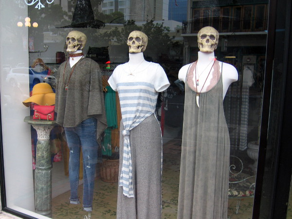
Scary skulls on mannequins, gazing out from a Gaslamp shop window. Halloween must be approaching!
I was frightened out of my wits (and amused) this morning during my walk through the Gaslamp Quarter. Halloween must be coming to downtown San Diego!
For Halloween, Hillary Clinton and Donald Trump have become skeletons in this store window. Does anyone need a costume? Trick or treat!And here we have some happy scarecrows and a pumpkin. Autumn has come to downtown San Diego!
…
I live in downtown San Diego and love to walk! You can follow Cool San Diego Sights via Facebook or Twitter!