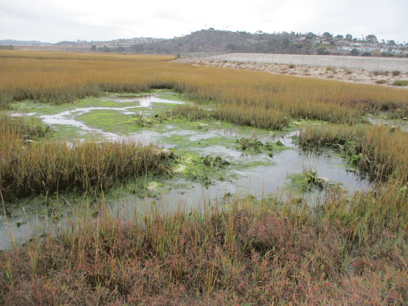
Do you love Cabrillo National Monument? Would you like to help build a spectacular hiking trail that will connect the whale watching overlook to the tide pools 400 feet below?
You can become a trailblazer!
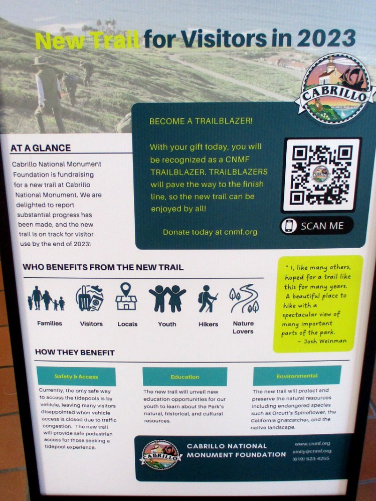
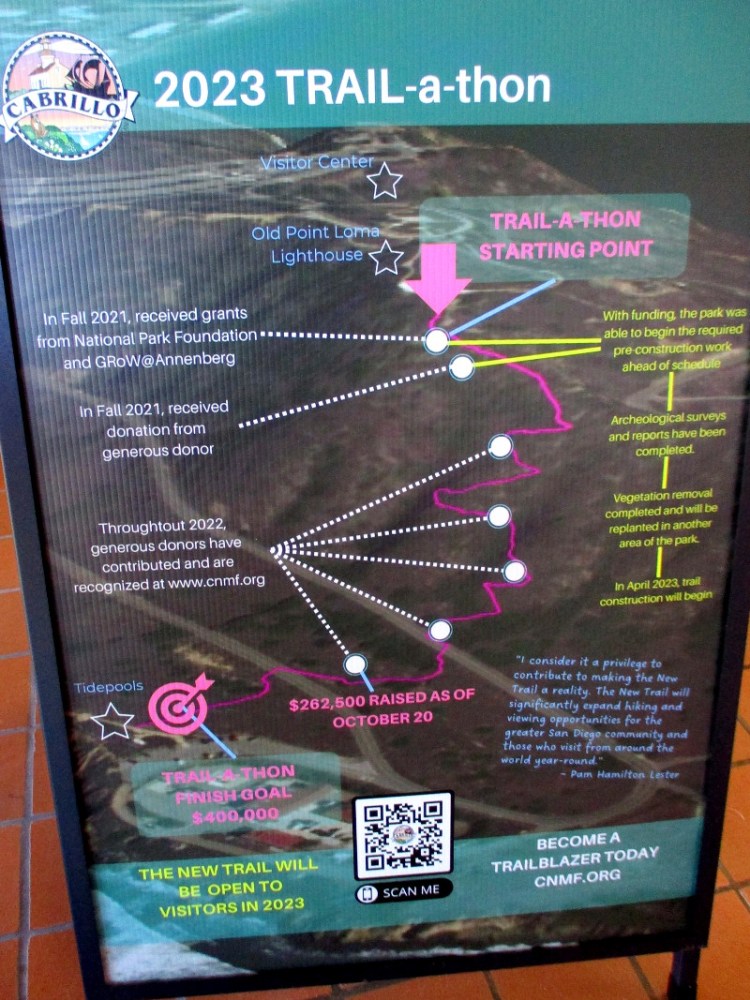
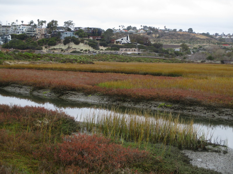
The trail’s construction has begun, but there’s more to do. And additional donations are necessary. As you can see from an information sign inside the Visitor Center, quite a lot of money had been raised by the Cabrillo National Monument Foundation already.
I asked a park ranger about this project. Several phases are completed, including archaeological surveys and removal of vegetation that will be replanted elsewhere in the park.
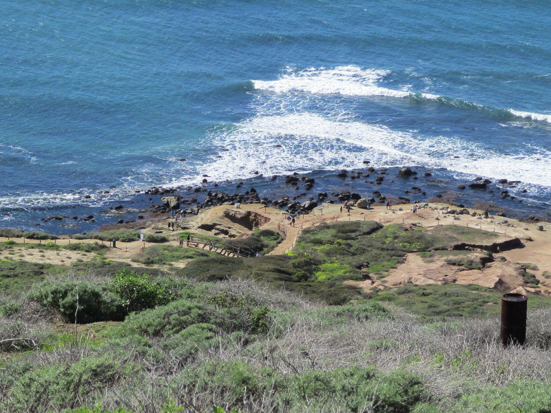
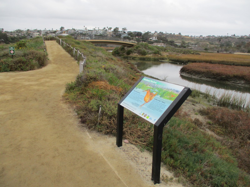
The next photo shows where the new trail will begin, just beyond the whale watching overlook. It will branch off from the short existing trail that leads down to a pair of World War II bunkers.
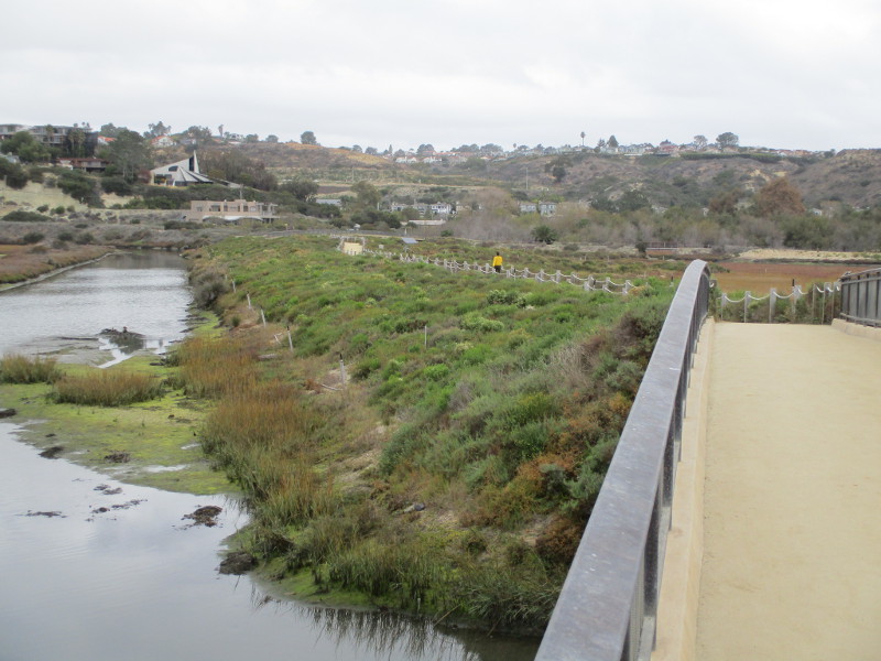
And my final photo shows the new trail’s destination: the Cabrillo National Monument tide pools!
…
Thanks for visiting Cool San Diego Sights!
I post new blogs pretty often. If you like discovering new things, bookmark coolsandiegosights.com and swing on by occasionally!
I live in downtown San Diego and love to walk around with my camera! You can follow Cool San Diego Sights via Facebook or Twitter!
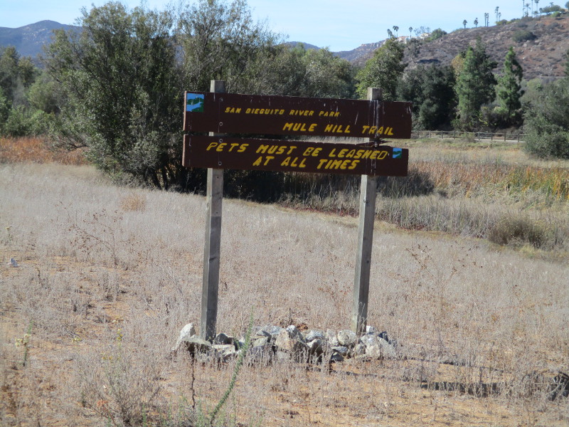
Walk down Mule Hill Trail at the south end of Escondido and you’ll find yourself stepping into history.
A while back I blogged about the forgotten town of Bernardo. A hundred years ago it was located in farmland near this trail, prior to the creation of Lake Hodges.
Down this same trail information signs mark the location of Mule Hill, where a skirmish took place during the Mexican-American War.
Seeking shelter among rocky outcroppings, General Kearny established a defensive position against pursuing Californios, as his U.S. Dragoons retreated toward San Diego after the Battle of San Pasqual.
The precise location of this skirmish was in debate for many years. Here are some interestingarticles.
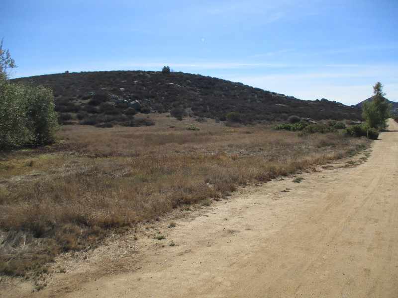
Today, after a short, easy walk south down Mule Hill Trail, you’ll see the outcroppings rising above several signs. You can find the wide dirt trail just east of Interstate 15, off Bear Valley Parkway, before Beethoven Drive.
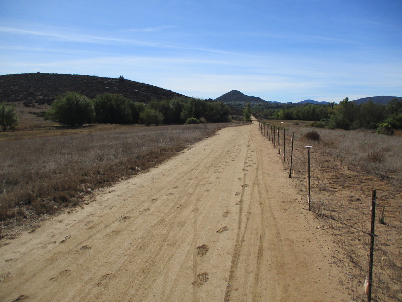
Beginning south down Mule Hill Trail, part of the San Dieguito River Park.
Off to the right near river trees, a solitary sign beckons.
Start of the Engagement, December 7, 1846
“Late in the evening, when we had arrived within about four hundred yards of the water where we intended to camp, they charged us, coming on in two bodies and compelling us to retreat to a pile of rocks about two hundred yards away on our left . . . ” source–Kit Carson’s Autobiography
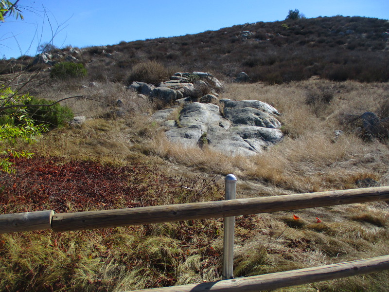
Continuing our walk south. Jumbled boulders can be seen on the hill to our left.
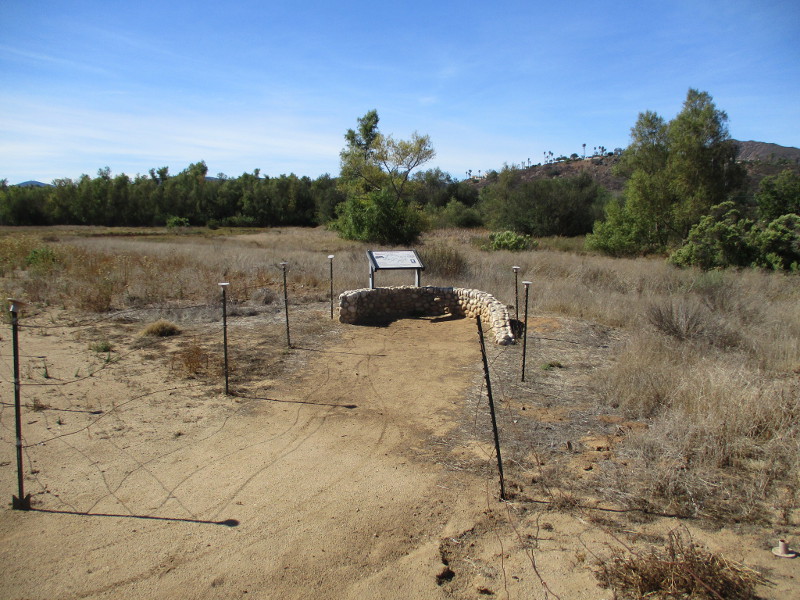
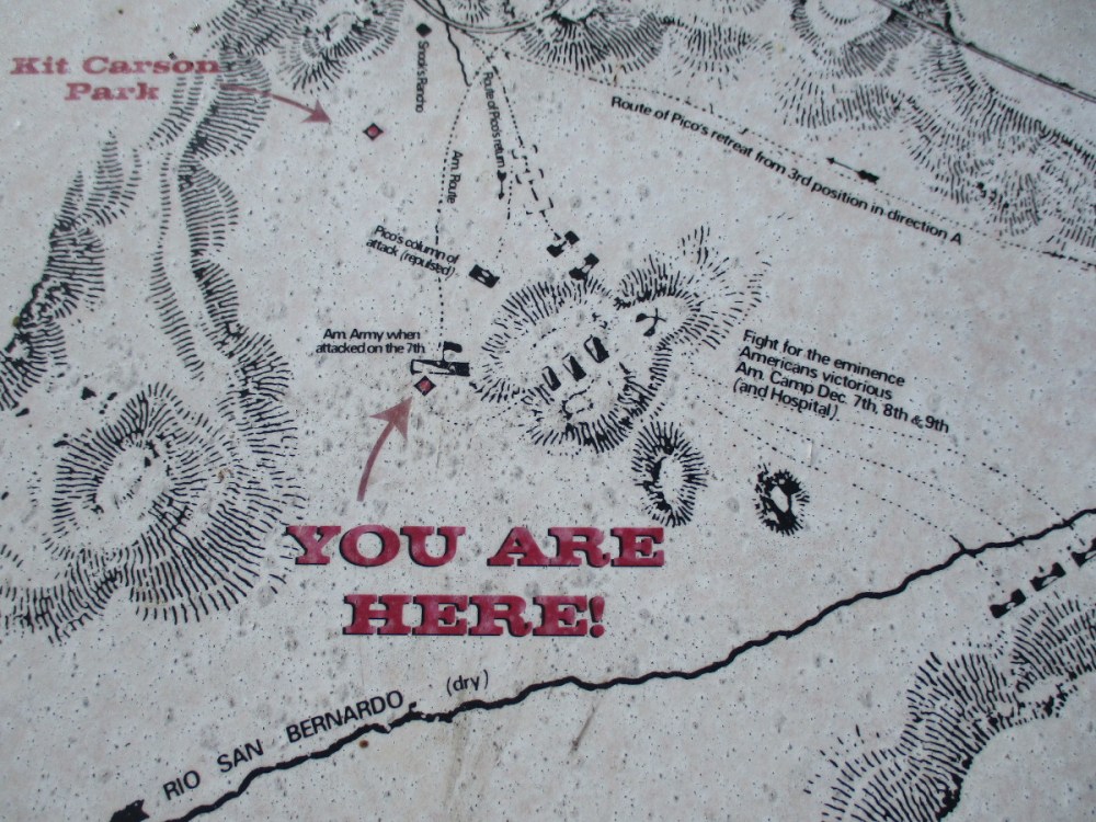
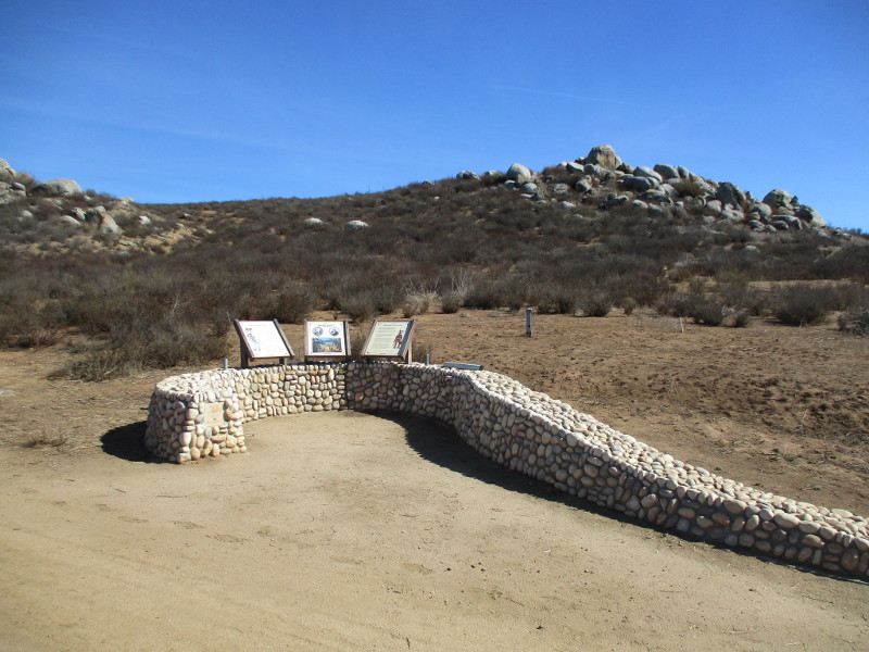
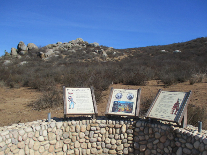
We’ve arrived at three signs near a pair of rock outcroppings that figure in the early history of San Diego. The signs explain what happened here at Mule Hill.
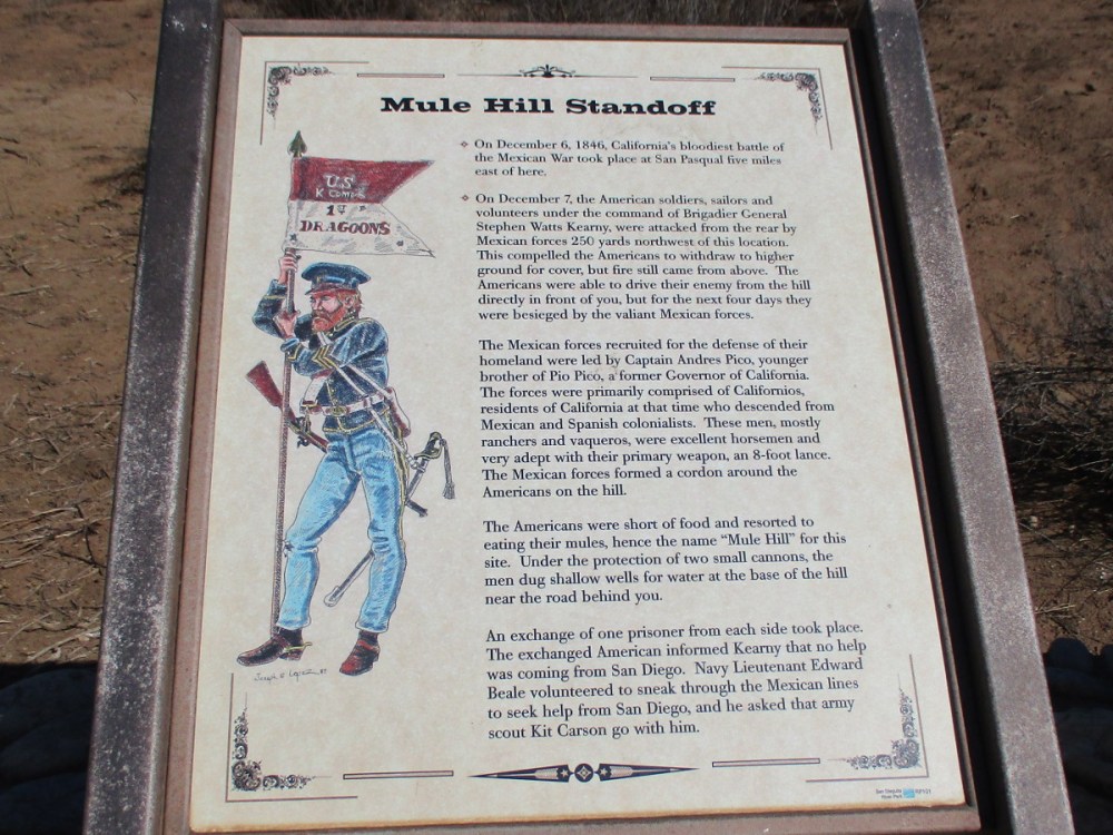
Mule Hill Standoff
On December 7, the American soldiers, sailors and volunteers under command of Brigadier General Stephen Watts Kearny, were attacked from the rear by Mexican forces 250 yards northwest of this location…
The Mexican forces recruited for the defense of their homeland were led by Captain Andres Pico . . . The forces were primarily comprised of Californios, residents of California at that time who descended from Mexican and Spanish colonialists…
The Americans were short of food and resorted to eating their mules, hence the name “Mule Hill” for this site…
…Navy Lieutenant Edward Beale volunteered to sneak through the Mexican lines to seek help from San Diego, and he asked that army scout Kit Carson go with him.
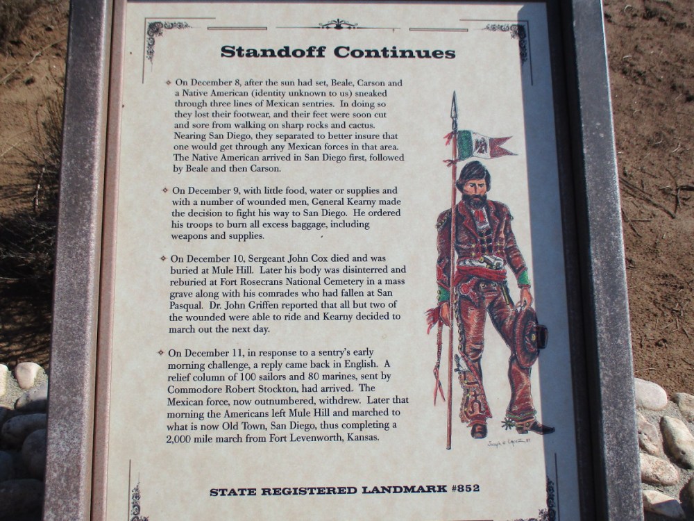
Standoff Continues
On December 8, after the sun had set, Beale, Carson and a Native American (identity unknown to us) sneaked through three lines of Mexican sentries…Nearing San Diego, they separated…The Native American arrived in San Diego first…
On December 9, with little food, water or supplies and a number of wounded men, General Kearny made the decision to fight his way to San Diego…
On December 10, Sergeant John Cox died and was buried at Mule Hill…
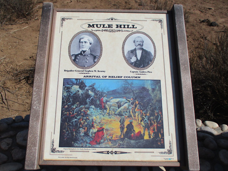
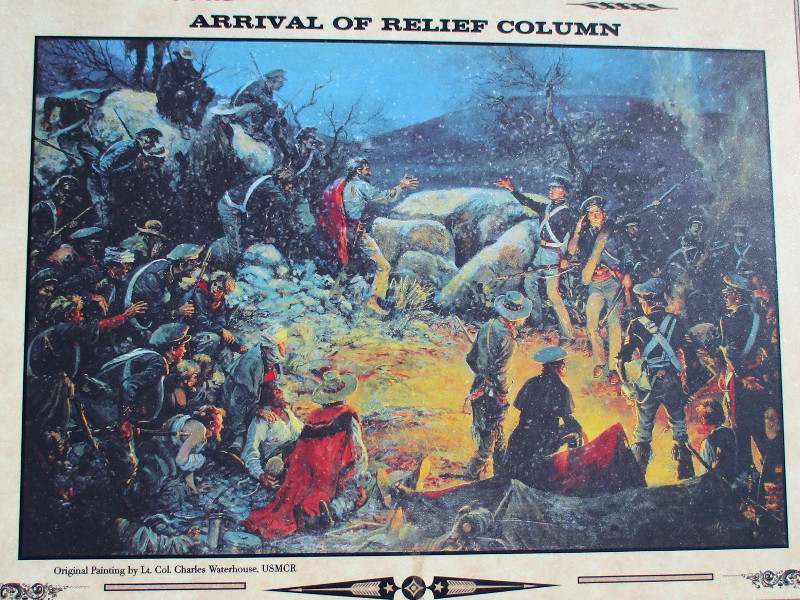
On December 11… A relief column of 100 sailors and 80 marines, sent by Commodore Robert Stockton, had arrived. The Mexican force, now outnumbered, withdrew. Later that morning the Americans left Mule Hill and marched to what is now Old Town, San Diego, thus completing a 2,000 mile march from Fort Leavenworth, Kansas.
…
Thanks for visiting Cool San Diego Sights!
I post new blogs pretty often. If you like discovering new things, bookmark coolsandiegosights.com and swing on by occasionally!
I live in downtown San Diego and love to walk around with my camera! You can follow Cool San Diego Sights via Facebook or Twitter!
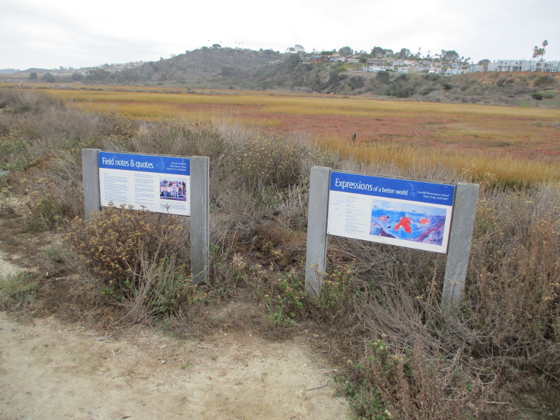
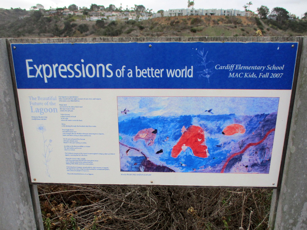
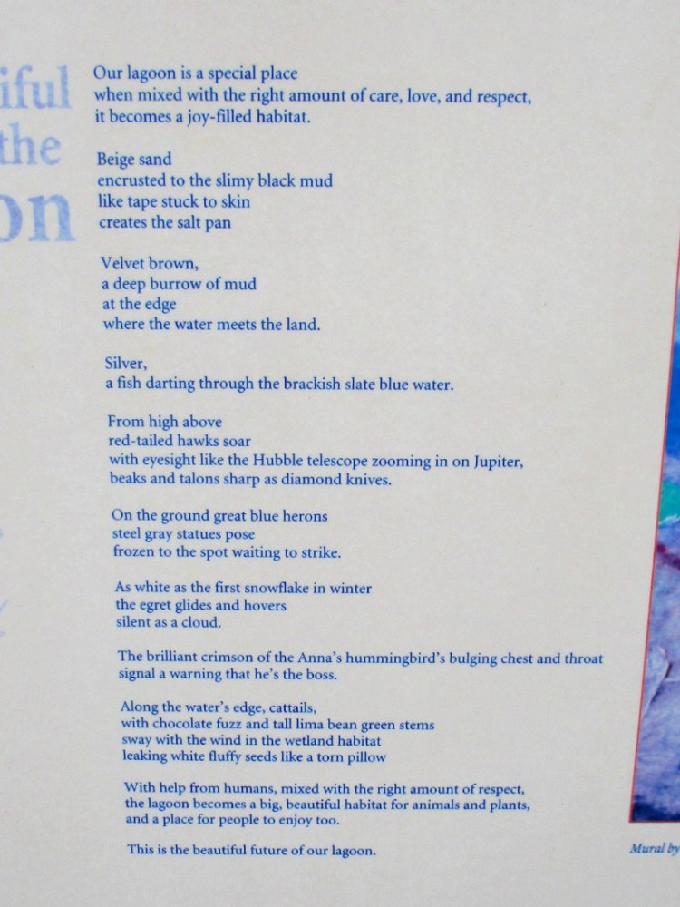
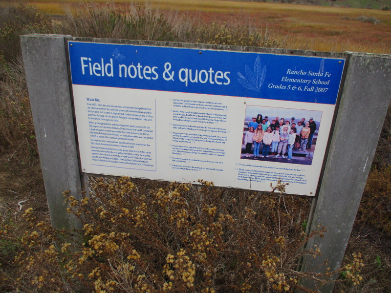
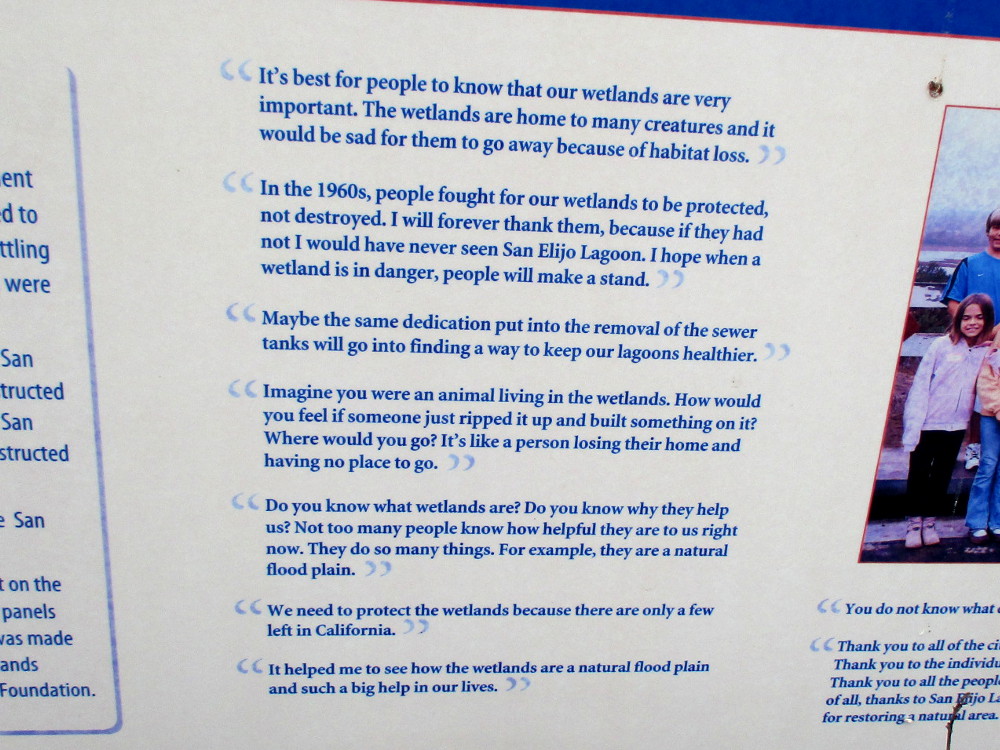
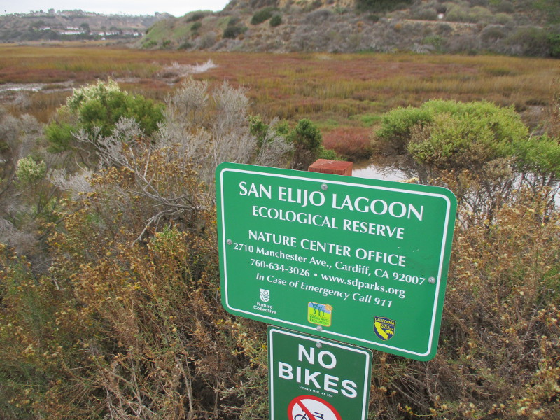
Three signs at San Elijo Lagoon Ecological Reserve contain the wisdom of local school kids. I noticed the signs during a walk up the Pole Trail. They are a bit distant from the trail, but easily spotted.
On one sign you’ll see Images of a better world; on another, Expressions of a better world. More words from young people who care about the world they live in can be read on the third sign.
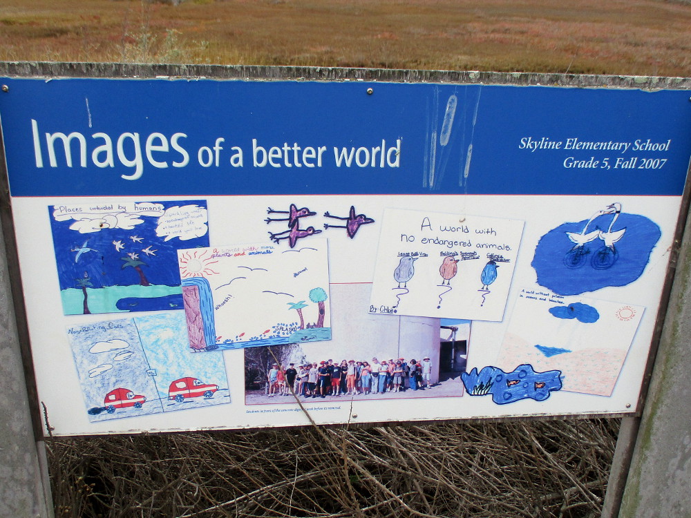
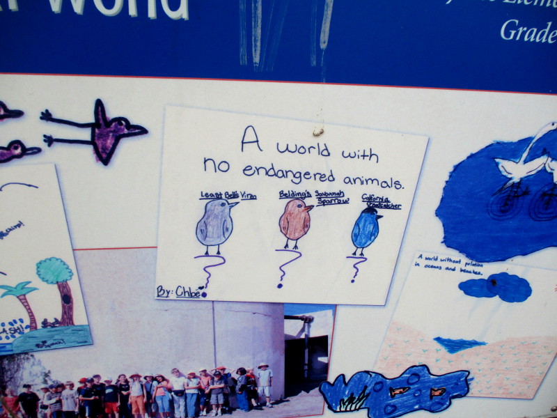
Images of a better world. Skyline Elementary School, Grade 5, Fall 2007.A world with no endangered animals.Expressions of a better world. Cardiff Elementary School, MAC Kids, Fall 2007.…With help from humans, mixed with the right amount of respect, the lagoon becomes a big, beautiful habitat for animals and plants, and a place for people to enjoy too…Field notes and quotes. Rancho Santa Fe Elementary School, Grades 5 and 6, Fall 2007.It’s best for people to know that our wetlands are very important. The wetlands are home to many creatures and it would be sad for them to go away because of habitat loss…
…
Thanks for visiting Cool San Diego Sights!
I post new blogs pretty often. If you like discovering new things, bookmark coolsandiegosights.com and swing on by occasionally!
I live in downtown San Diego and love to walk around with my camera! You can follow Cool San Diego Sights via Facebook or Twitter!
Several weeks ago I enjoyed a fine, very easy nature walk.
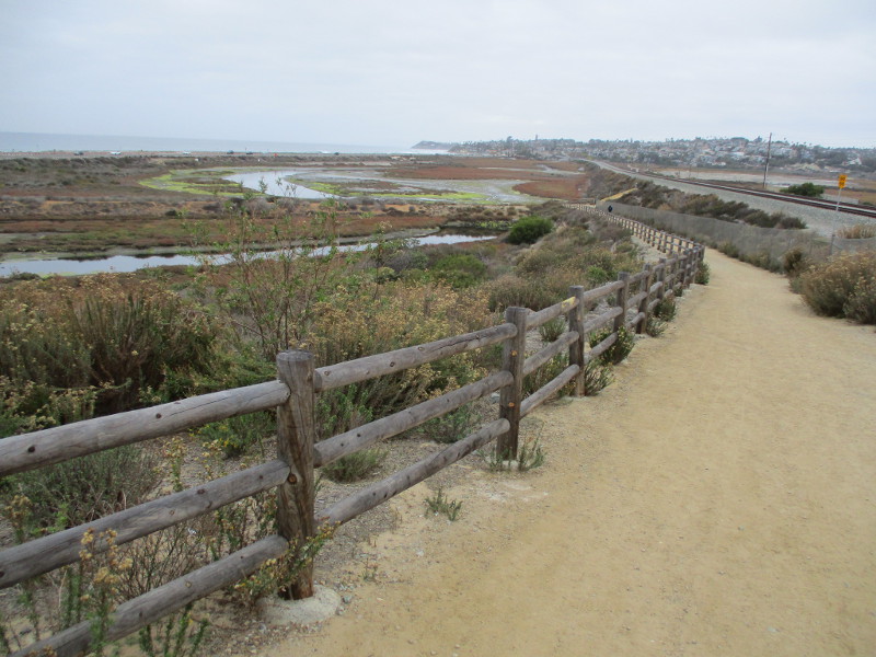
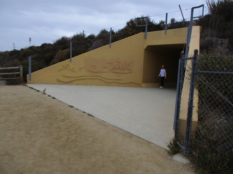
I proceeded from the murals at Harbaugh Seaside Trails (near Highway 101 at the north end of Solana Beach) down the main dirt trail. The trail turned, passed through a tunnel under the railroad tracks, and entered San Elijo Lagoon Ecological Reserve.
I then proceeded north up the Pole Trail (which runs parallel to the train tracks), crossed a couple of bridges, and ended at the San Elijo Lagoon Nature Center at the south end of Cardiff-by-the-Sea.
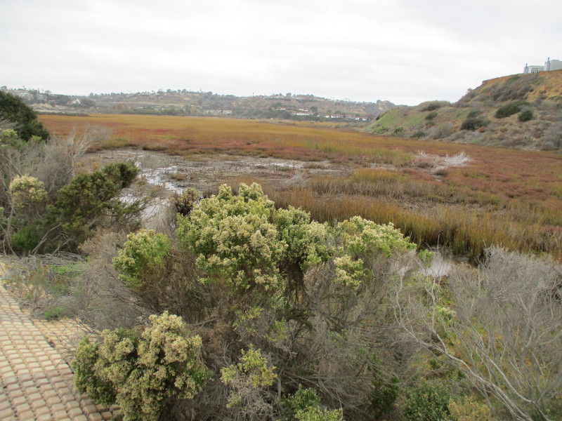
Come along with me as we look at these protected wetlands and watch for birds and other native wildlife…
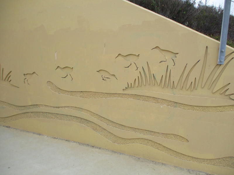
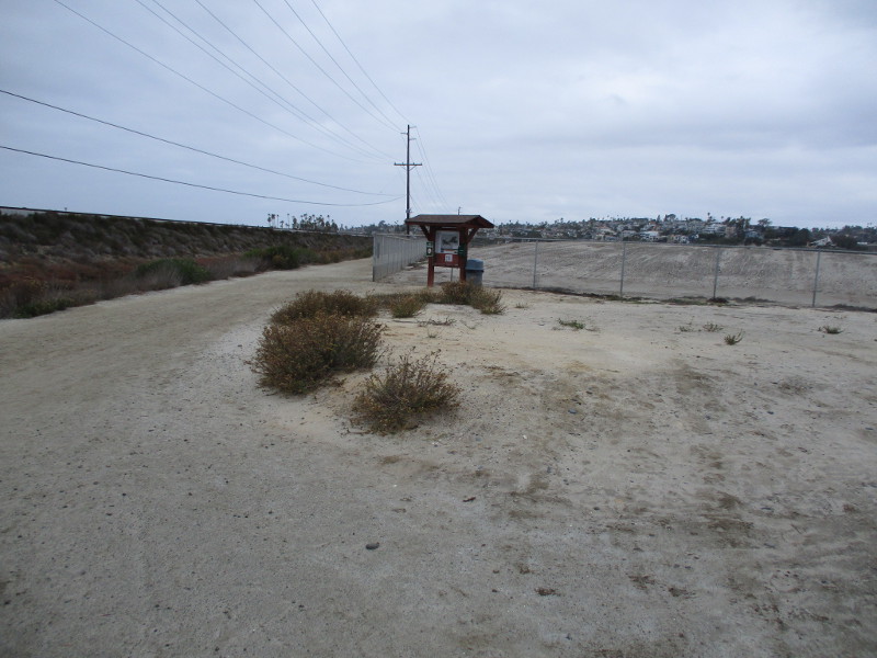
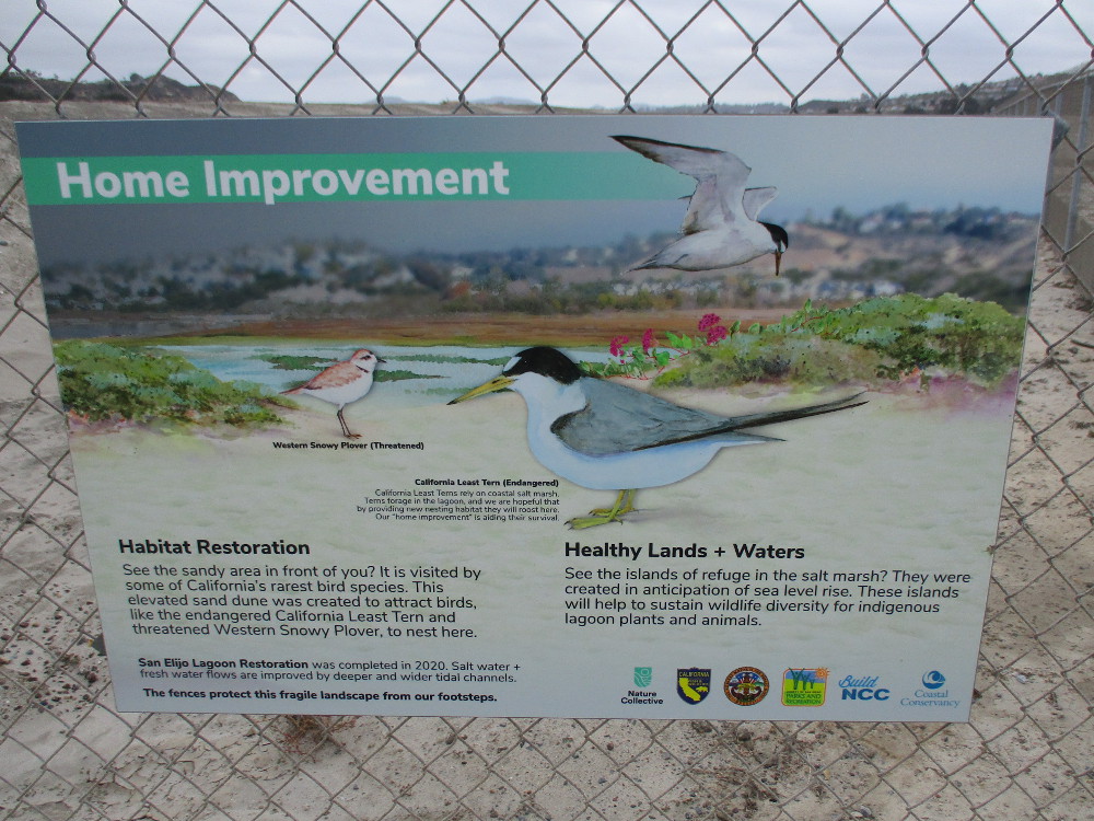
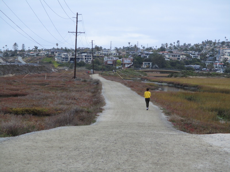
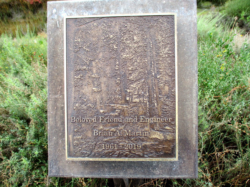
Sign at Harbaugh Seaside Trails at start of my walk.These trails were made possible by Nature Collective.Beautiful words a short distance from the Harbaugh Seaside Trails murals. Annie’s Bench.Nearby overlook with views of the Pacific Ocean off to the west.Beginning our walk in earnest.Here’s the railroad tunnel.Artwork at the tunnel entrance depicts birds.We are looking across San Elijo Lagoon Ecological Reserve.San Elijo Lagoon in the winter.Pools of water support much life.Heading north we encounter a fenced area and sign.Map of the reserve. To the east there are additional trails to be explored.A big mound of soil behind this fence.Sign explains the sandy habitat restoration. The elevated sand dune attracts endangered birds, like the California Least Tern and Western Snowy Plover.Continuing north.Vegetated and shallow channels are home to rare indigenous plant and animal species. Birds include Ridgway’s Rail and Belding’s Savannah Sparrow.Here comes the first bridge!A profusion of native sunflowers.That interesting building up and to the left is the Nature Center.A plaque along the way memorializes Beloved Friend and Engineer Brian A. Martin.Another footbridge spans a channel of water.Plaque describes The Buhr Nature Bridge. Gabriel Buhr’s forward-thinking, planning and vision helped make the restoration of the San Elijo Lagoon possible.Almost to the San Elijo Lagoon Nature Center!
…
Thanks for visiting Cool San Diego Sights!
I post new blogs pretty often. If you like discovering new things, bookmark coolsandiegosights.com and swing on by occasionally!
I live in downtown San Diego and love to walk around with my camera! You can follow Cool San Diego Sights via Facebook or Twitter!
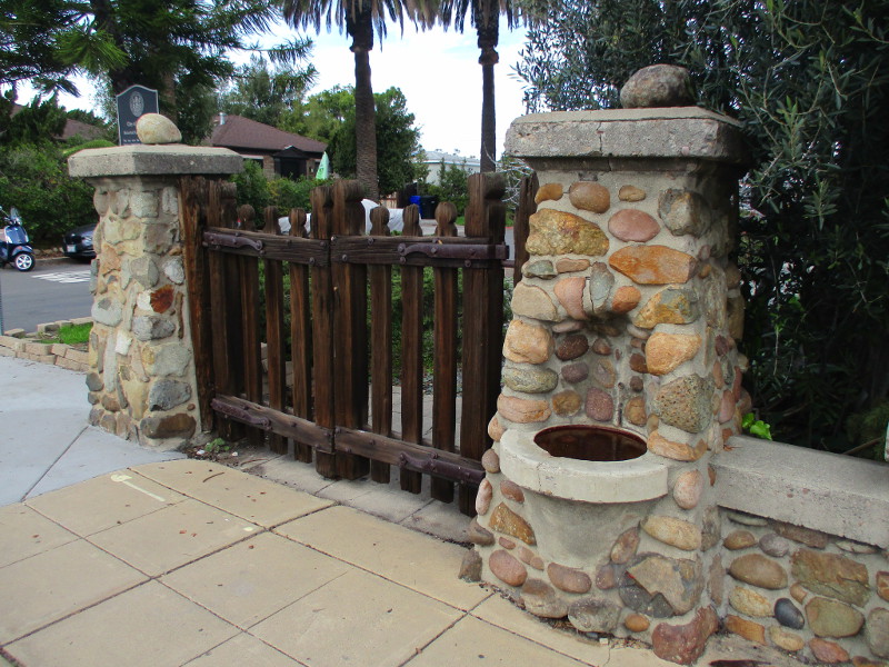
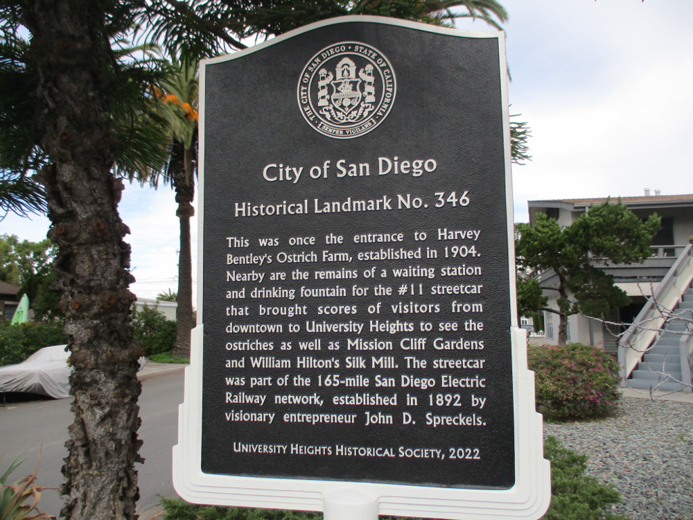
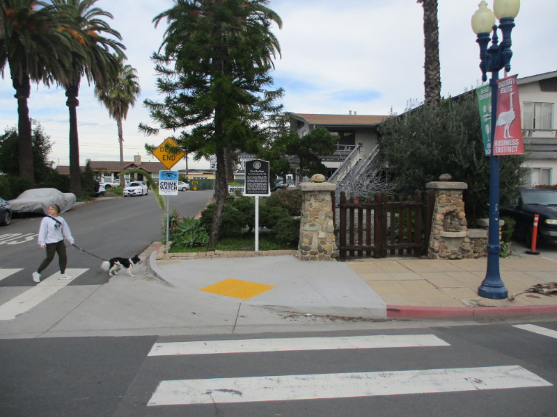
In 2022, the University Heights Historical Society placed a historical marker at the intersection of Park Boulevard and Adams Avenue. The sign stands near the remains of the entrance to the long-vanished Harvey Bentley’s Ostrich Farm!
The City of San Diego describes Historical Landmark No. 346 as: Mission Cliff Gardens Cobblestone Wall and Related Features.
One can see similar stone posts a couple blocks to the east at Trolley Barn Park. Cobblestones structures (and images of ostriches) are frequently seen throughout University Heights!
The sign explains:
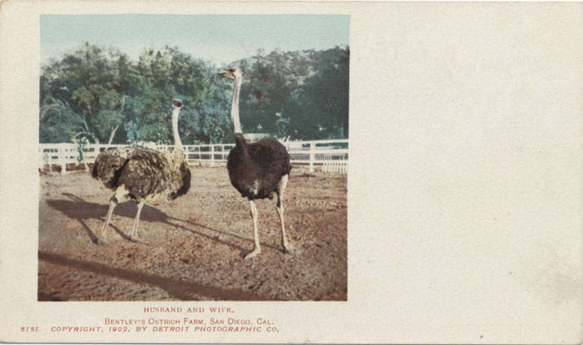
This was once the entrance to Harvey Bentley’s Ostrich Farm, established in 1904. Nearby are the remains of a waiting station and drinking fountain for the #11 streetcar that brought scores of visitors from downtown to University Heights to see the ostriches as well as Mission Cliff Gardens and William Hilton’s Silk Mill. The streetcar was part of the 165-mile San Diego Electric Railway network, established in 1892 by visionary entrepreneur John D. Spreckels.
Here are two public domain images of the ostrich farm…
Just for fun, I photographed an ostrich painted at Yipao Coffee, a short distance south on Park Boulevard…
…
Thanks for visiting Cool San Diego Sights!
I post new blogs pretty often. If you like discovering new things, bookmark coolsandiegosights.com and swing on by occasionally!
I live in downtown San Diego and love to walk around with my camera! You can follow Cool San Diego Sights via Facebook or Twitter!
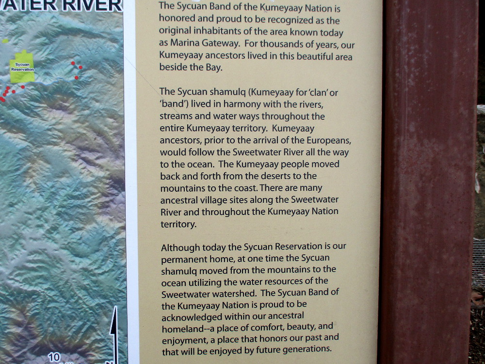
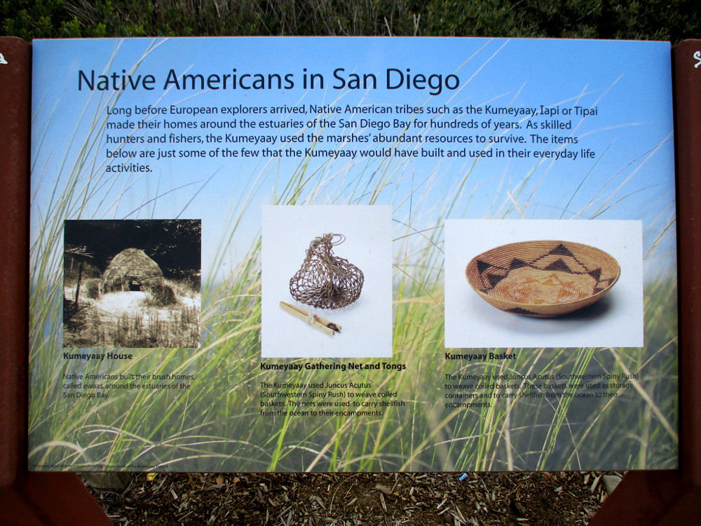
The Marina Gateway in National City contains a small cluster of buildings located at the intersection of Bay Marina Drive and Marina Way. On the south side of the Marina Gateway parking lot, a walkway and outdoor plaza overlook Paradise Creek. The creek flows through a marsh into nearby Sweetwater River. Two signs at the edge of Paradise Marsh concern the history of the Native American Kumeyaay.
The Sycuan Band of the Kumeyaay Nation owns property at the Marina Gateway, and I believe this plaza was built since my last visit almost seven years ago. The same plant and wildlife information signs remain, but, if I recall correctly, back then there was no plaza and the overlook was less developed.
One sign I didn’t spot years ago features a topographical map showing Kumeyaay ancestral village sites within 1000 feet of the Sweetwater River. It also describes how the Kumeyaay would move up and down the river as they traveled between desert, mountain, and coast.
The Kumeyaay people lived here for thousands of years, long before European explorers and settlers arrived. It is their ancestral homeland–a place of comfort, beauty, and enjoyment, a place that honors our past and that will be enjoyed by future generations.
…
Thanks for visiting Cool San Diego Sights!
I post new blogs pretty often. If you like discovering new things, bookmark coolsandiegosights.com and swing on by occasionally!
I live in downtown San Diego and love to walk around with my camera! You can follow Cool San Diego Sights via Facebook or Twitter!
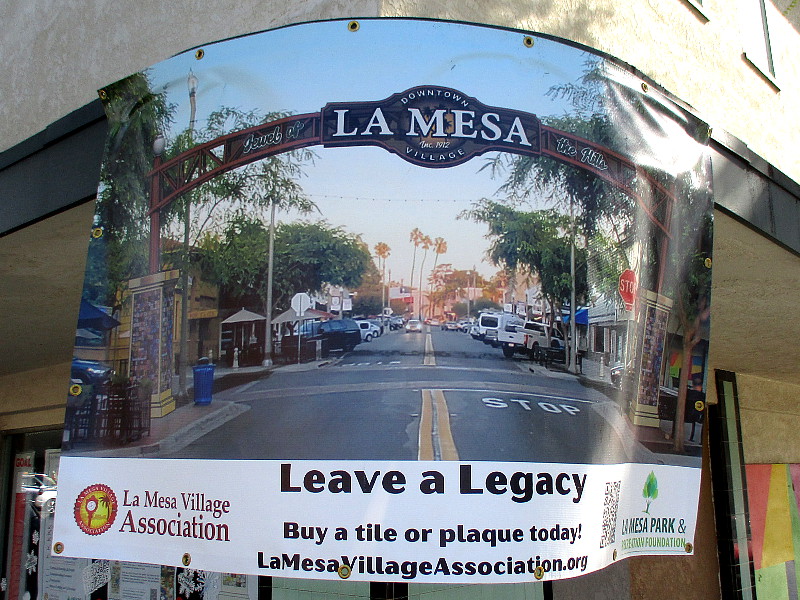
Plans are underway to create a landmark sign in La Mesa’s downtown Village!
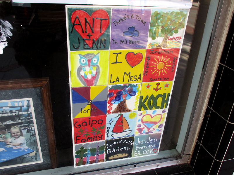
La Mesa families are preparing painted tiles that will decorate the columns of the archway sign!
The “La Mesa Village District Sign” will span La Mesa Boulevard at Palm Avenue. It will resemble the distinctive gateway signs in other San Diego neighborhoods and cities in the county.
I knew nothing about this project until I walked past a banner and posters in windows at the intersection where the sign will be erected.
The ongoing “Leave a Legacy Tile” fundraiser will eventually produce a “Community Quilt” installed on the base of each column!
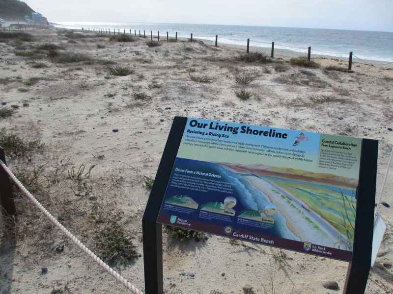
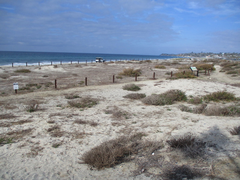
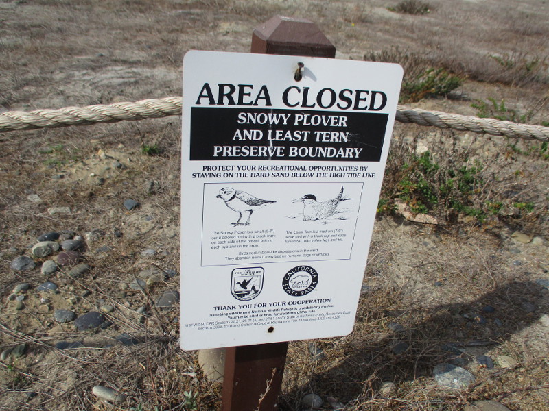
At Cardiff State Beach, in San Diego’s North County, restored coastal dunes are roped off, protecting fragile habitat from human feet.
Signs posted on the perimeter explain the “constructed dunes” and Our Living Shoreline.
One sign explains that coastal dunes provide a natural buffer against waves, tides and storms in winter.
Made resilient with native vegetation, the dunes provide important wildlife habitat and protect San Elijo Lagoon from flooding.
The roped dunes at Cardiff State Beach constitute a snowy plover and least tern preserve. These birds have decreasing populations, largely due to development, recreation and other human activity. The birds nest in vulnerable bowl-like depressions in the sand.
A second Our Living Shoreline sign concerns native coastal scrub and dune plants. Among these are sand-verbena, beach evening-primrose and woolly-heads.
The plants provide cover and food for native and migrating birds.
This colorful information sign, near the entrance to South Cardiff State Beach, concerns California’s kelp forests.
The underwater “Hidden Forest, Rich with Life” can be viewed from the shoreline as floating brown-green patches of seaweed.
The kelp plants hold to the ocean floor and stretch up 100 feet or more. They support an unseen world teeming with life, including diverse fish, marine mammals, sea slugs, sea stars, sea anemones and spiny sea urchins.
…
Thanks for visiting Cool San Diego Sights!
I post new blogs pretty often. If you like discovering new things, bookmark coolsandiegosights.com and swing on by occasionally!
I live in downtown San Diego and love to walk around with my camera! You can follow Cool San Diego Sights via Facebook or Twitter!
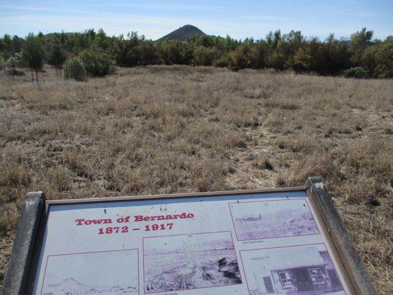
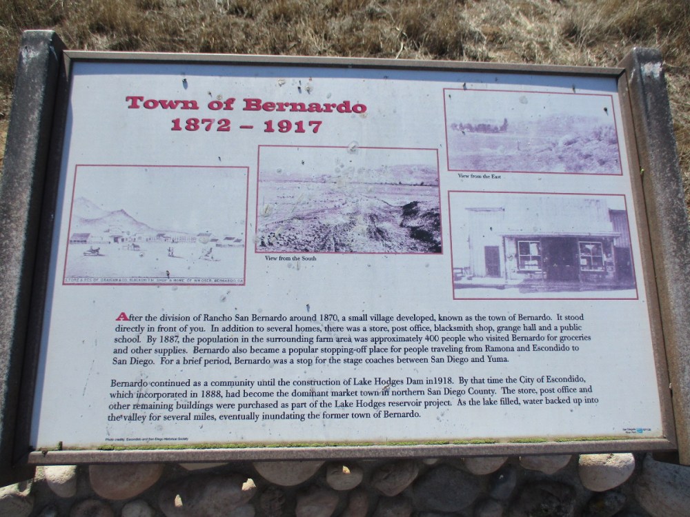
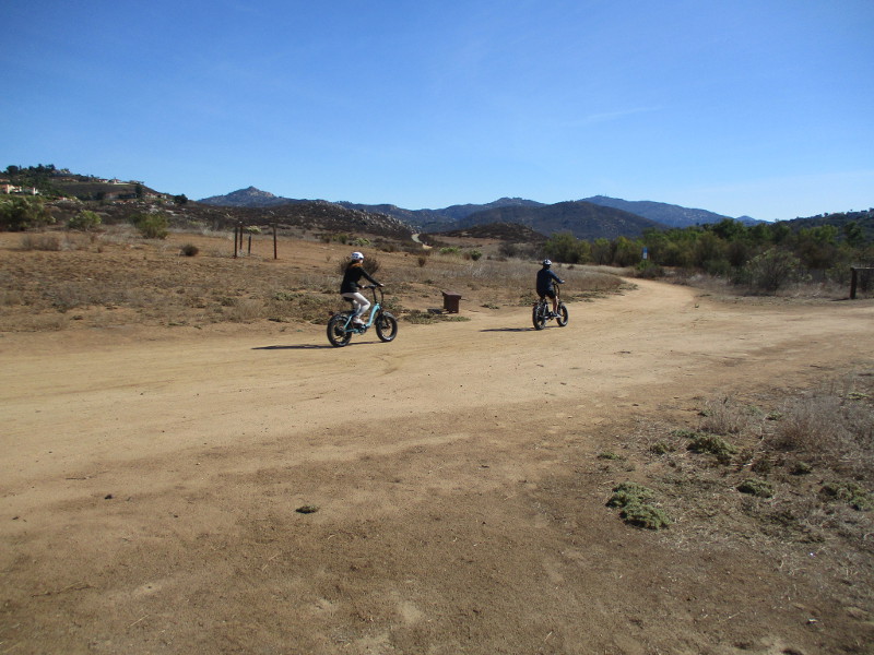
Did you know there used to be a town named Bernardo in what is now San Diego’s North County?
Bernardo was a tiny town between Escondido and Rancho Bernardo, where Lake Hodges is located today.
The creation of Lake Hodges in 1918, accomplished by damming the Bernardo River (now called San Dieguito River), put a definite end to little Bernardo. But today people hiking the Mule Hill Trail can see several information signs that recall the history of the now vanished town.
If you’d like to walk down the Mule Hill Trail yourself, take Interstate 15 to Bear Valley Parkway at the south end of Escondido. The wide dirt trail can be found about a quarter mile east of the freeway, leading south. (You’ll see it right before Beethoven Drive.)
Before reaching the site of old Bernardo, this very easy trail passes Mule Hill, where a skirmish took place during the Mexican-American War. I’ll be blogging about that coming up.
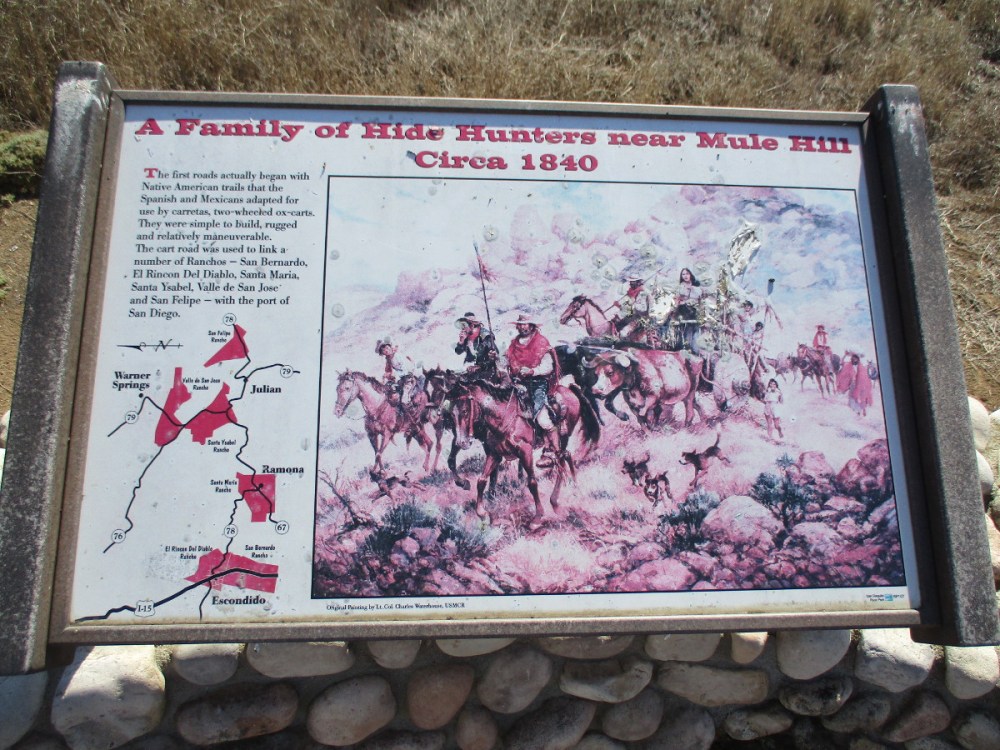
Cart roads used by the Spanish and Mexicans before the appearance of Bernardo linked a number of Ranchos–San Bernardo, El Rincon, Del Diablo, Santa Maria, Santa Ysabel, Valle de San Jose and San Felipe–with the port of San Diego.
After the division of Rancho San Bernardo around 1870, a small village developed, known as the town of Bernardo. In addition to several houses, there was a store, post office, blacksmith shop, grange hall and public school. By 1887, the population in the surrounding farm area was approximately 400 people…
For a brief period, Bernardo was a stop for the stagecoaches between San Diego and Yuma.
The San Diego to Yuma Road was an overland trail in the mid-1800s. It was used by the Army of the West in 1846 and gold rush immigrants from 1848 through 1851. It passed through tiny Bernardo as it led northeast from Peñasquitos to Ramona, eventually connecting with the Butterfield Stage Route at Warner Springs.
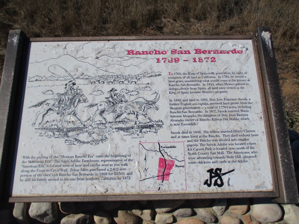
The history of Rancho San Bernardo began in the late 18th century when the King of Spain took possession of all land in California. In 1823, when Mexico gained its independence, the land became Mexico’s property. Don Jose Francisco Snook, a former English sea captain, received land grants from the Mexican government, including Rancho San Bernardo…
With the passing of the Mexican rancho era came the beginning of the American era, which is represented by the nearby Sikes Adobe Farmhouse. The restored farmhouse is a historic site that one can visit a short distance down the Coast to Crest Trail. (The Mule Hill Trail is a segment of the Coast to Crest Trail.)
…
Thanks for visiting Cool San Diego Sights!
I post new blogs pretty often. If you like discovering new things, bookmark coolsandiegosights.com and swing on by occasionally!
I live in downtown San Diego and love to walk around with my camera! You can follow Cool San Diego Sights via Facebook or Twitter!