Osprey guards nest high above Shelter Island!

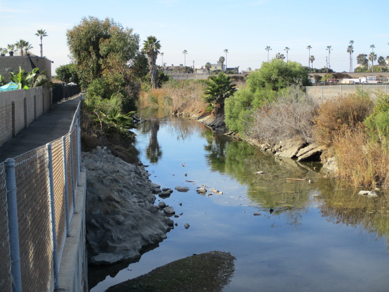
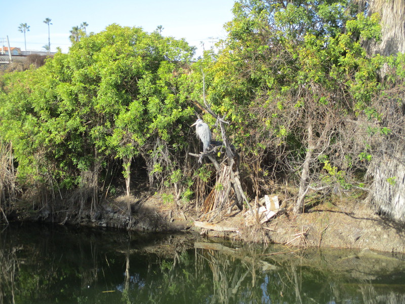
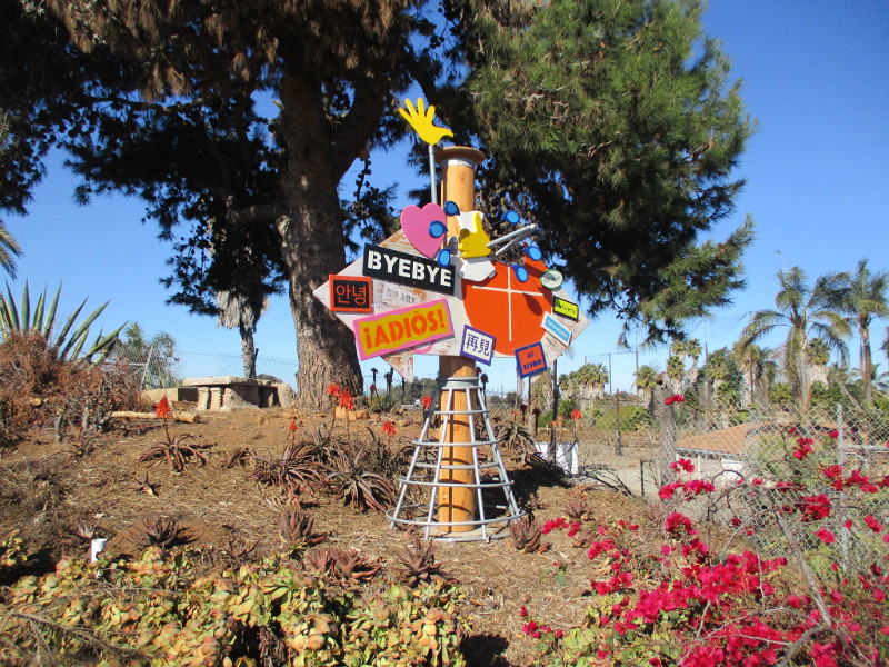
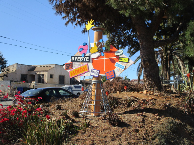
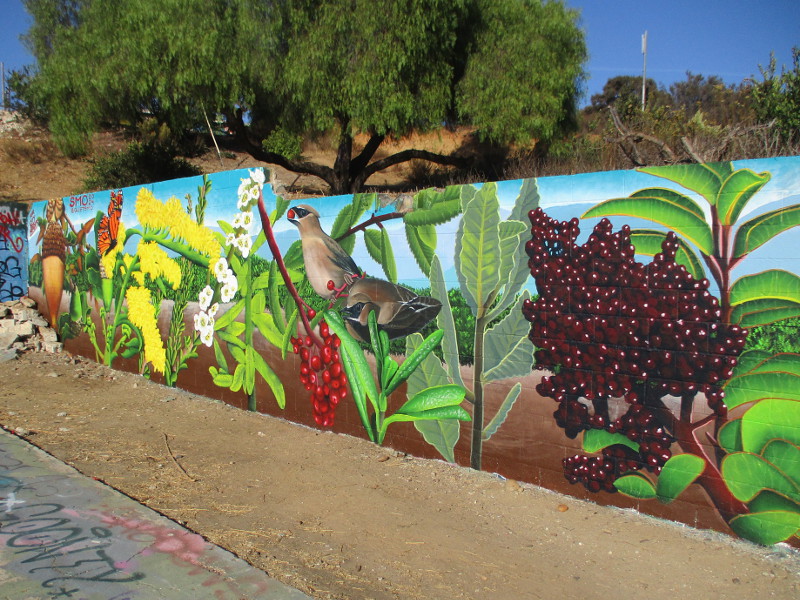
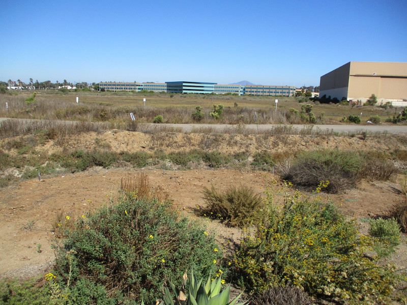
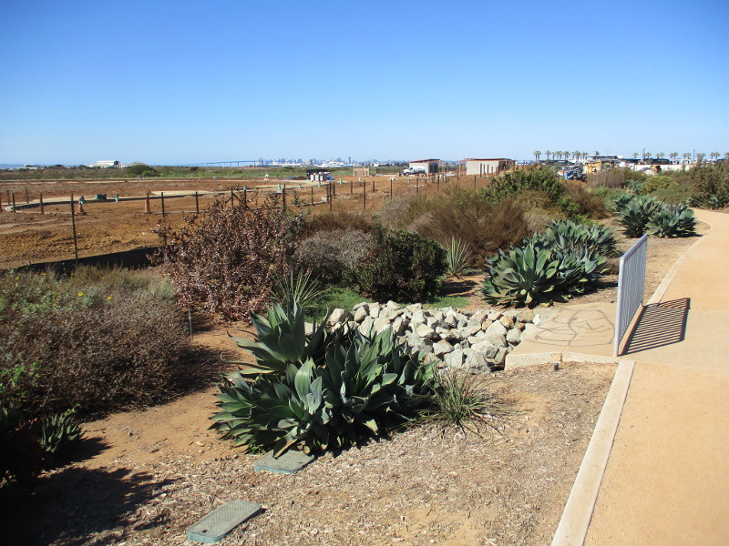
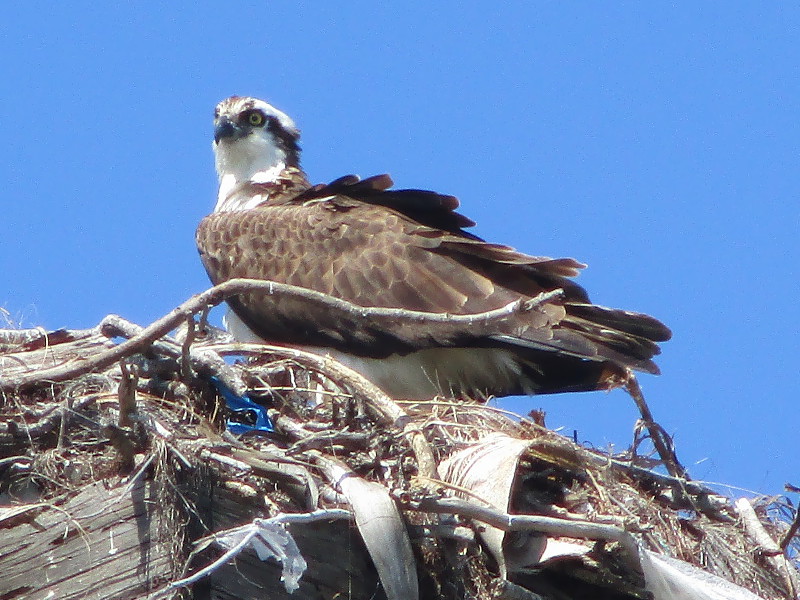
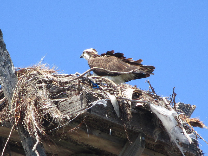
A magnificent Osprey stood guard upon its large nest high above Shelter Island. It was turning its head, watching the world below and all around. That’s what I observed the last time I walked along Shelter Island, a short distance from the Japanese Friendship Bell.

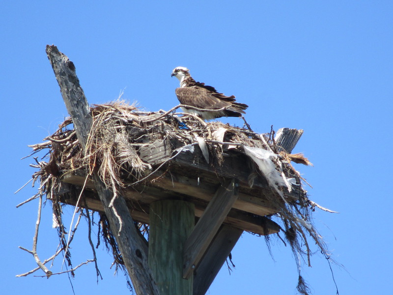
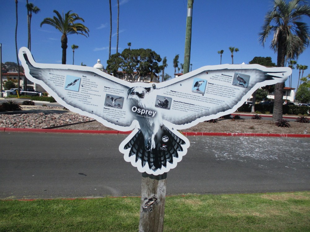
A sign across the street from the high nest-supporting platform provides interesting facts concerning the Osprey (Pandion haliaetus) and its nest. Included:

In flight, Ospreys wings are angled slightly backwards. They have drooping “hands” giving them a gull-like appearance.

Ospreys collect sticks to build large nests in high trees and on rocky outcrops and poles.

Ospreys are year-round residents of San Diego Bay. This medium-large raptor is particularly well adapted to diving for fish, with reversible outer toes, closable nostrils to keep out water during dives, and backwards facing scale on the talons which act as barbs to help hold its catch.

Board of Port Commissioners and their Environmental Advisory Committee funded construction of this nesting platform for the Osprey.

I post new blogs pretty often. If you like discovering new things, bookmark coolsandiegosights.com and swing on by occasionally!

I live in downtown San Diego and love to walk around with my camera! You can follow Cool San Diego Sights via Facebook or X.

Feel free to share!

Historic pergola returning to Balboa Park!

San Diego is going to be made even more beautiful!

A shady pergola that once stood near Balboa Park’s Botanical Building during the 1915 Panama-California Exposition is to be rebuilt!

The construction of the pergola is part of a larger Botanical Building and Gardens revitalization project. The Botanical Building’s amazing restoration has been completed, so it’s on to Phase 2, which includes bringing back into existence this historic pergola.

I noticed a sign on a patch of grass during my most recent visit to Balboa Park. It indicates the future site of the Botanical Building Historical Pergola.

You can learn more about the project by visiting Forever Balboa Park’s website here.

The pergola site is beside the west fountain in the front of the Botanical Building. The next photo provides an idea. (Behind it you can see the San Diego Museum of Art.)

I post new blogs pretty often. If you like discovering new things, bookmark coolsandiegosights.com and swing on by occasionally!

I live in downtown San Diego and love to walk around with my camera! You can follow Cool San Diego Sights via Facebook or X.

Feel free to share this!

The new Carlsbad archway sign–ten years later.

Until I read a plaque attached to the Carlsbad archway sign, I hadn’t realized the “new” sign was already ten years old.

Starting in the 1930s, people have passed under a Carlsbad sign while traveling through this coastal city. In 2015 the original sign was replaced with a replica–the one you see in my photographs.

The landmark sign straddles Carlsbad Boulevard at Carlsbad Village Drive.

During previous walks, I hadn’t noticed two bronze plaques describing the sign. The plaques are identical. They’re attached to the posts that support the sign on either side of Carlsbad Boulevard.

These photos were taken a week ago.

This sign is a gift from TaylorMade and the Carlsbad Chamber of Commerce to celebrate the important role business has played in the City of Carlsbad’s success. It is a replica of the iconic Carlsbad sign installed in the ’30s.

DEDICATED ON JANUARY 8, 2015

(Leading sports equipment manufacturer TaylorMade has its corporate headquarters in Carlsbad.)

I post new blogs pretty often. If you like discovering new things, bookmark coolsandiegosights.com and swing on by occasionally!

I live in downtown San Diego and love to walk around with my camera! You can follow Cool San Diego Sights via Facebook or X.

Thank you for sharing!

Loma Alta Creek Nature Trail in Oceanside.

The Loma Alta Creek Nature Trail is a short, easy path in Oceanside where people in the city can see many birds.

Also known as the Loma Alta Marsh Footpath, the urban nature trail extends west from South Coast Highway (just north of Paradise by the Sea Beach RV Resort) to Buccaneer Park. The distance is about one quarter mile.

I walked the nature trail several days ago and took these photographs. I began at South Coast Highway where it passes over Loma Alta Creek. You’ll see the following sign at the trailhead.

As part of the Pacific Flyway bird migration route, the Loma Alta Creek and Watershed makes up part of the northern section of the Carlsbad Hydrologic Unit. Gathering water runoff as far as 7 miles inland and following much of Oceanside Boulevard, this watershed provides a habitat for seabirds, waterfowl, and shorebirds that migrate to its outlet at Buccaneer Beach. A vast array of salt marsh plant species flourish in the tidal area near the coast to provide nesting and foraging for birds.

Following the trailhead from South Coast Highway toward Buccaneer Beach, you will find many wonderful and diverse species that depend on you to keep their Coastal Wetland Habitat clean and free from pollution.

I observed a Great Blue Heron perched in a tree across the water. My camera on its automatic setting didn’t take such a great picture, unfortunately.

An old sign (I increased the image contrast) indicates that bird species one might see while walking along the Loma Alta Nature Trail include Snowy Egret, Great Blue Heron, American Coot and Black-Necked Stilt.

The trail passes under railroad tracks.

A northbound Coaster train rumbles by…

There are two beautiful murals painted under the railroad bridge. You can glimpse part of one in the next photograph. To see both murals, click here!

In the next photo, I continue to head west toward grassy Buccaneer Park, a popular spot for families. That bridge in the distance is where South Pacific Street passes over the creek. On the other side is Buccaneer Beach.

Lots of birds on the rocks!

I post new blogs pretty often. If you like discovering new things, bookmark coolsandiegosights.com and swing on by occasionally!

I live in downtown San Diego and love to walk around with my camera! You can follow Cool San Diego Sights via Facebook or X.

Thank you for sharing!

Mysterious sculpture at Hollister and Conifer!

Do you know anything about this mysterious sculpture in San Diego’s South Bay, at the intersection of Hollister Street and Conifer Avenue? It’s a few blocks north of the Palm Avenue trolley station.

I haven’t walked this way in a long time, so I don’t know when the sculpture appeared. I took these photos last weekend.

Who created this fun artwork? Why are farewells painted in various languages? Why, on its back, is there a seemingly contradictory message Please No Art?

Two yellow hands on the mysterious sculpture appear to be cleaning while splashing drops of water. Could this have been a sign that once stood at the exit of a carwash? I’m racking my brain for an explanation.

Leave a comment if you happen to know anything!

I post new blogs pretty often. If you like discovering new things, bookmark coolsandiegosights.com and swing on by occasionally!

I live in downtown San Diego and love to walk around with my camera! You can follow Cool San Diego Sights via Facebook or X.

Thank you for sharing!

Navy SEAL display at America Plaza trolley station!

An eye-catching display concerning the U.S. Navy SEALs was recently installed at the America Plaza trolley station in downtown San Diego. Informative signs and historic artifacts behind panes of glass can be observed from a passenger platform.

Next year, the new 10,000 square foot Navy SEAL Museum San Diego will open at the One America Plaza building. It will occupy the two-story space that rises behind stairs on the west side of the trolley tracks–it’s where the San Diego Museum of Contemporary Art once had a gallery at 1001 Kettner Boulevard. (The windows of the future museum are now covered with Navy SEAL graphics.)

I was extremely fortunate to enjoy a tour of the museum’s interior construction this afternoon and look forward to blogging about the museum as time rolls on! I can assure you, from what I saw and was told, it’s going to be amazing!

Meanwhile, passengers waiting for the trolley at America Plaza can view the life-size “Gill-man” and the shining BUD/S Bell. The significance of both are explained by nearby signs.

(Sorry, but I had trouble photographing the Creature From the Black Lagoon-like “Gill-man” through the reflecting glass. Head over to the trolley station to see it yourself!)

So you want to be a Frogman? Photographs of Navy SEAL recruits with “Gill-man.” They meet the amphibious creature at the beginning of their Basic Underwater Demolition/SEAL (BUD/S) Training and during their successful graduation. The life-size creature was a gift from Class 63 who procured it from a store in Tijuana, Mexico!

The Basic Underwater Demolition/SEAL Training Bell is a large brass bell positioned in the center of the training area. Trainees ring the bell three times if they wish to quit. I learned about 20-25% of Navy Seal recruits complete the physically demanding training. Success requires sheer determination.

I post new blogs pretty often. If you like discovering new things, bookmark coolsandiegosights.com and swing on by occasionally!

I live in downtown San Diego and love to walk around with my camera! You can follow Cool San Diego Sights via Facebook or X.

Thank you for sharing!

San Diego’s newest gateway sign debuts in Old Town!

The installation of San Diego’s newest neighborhood gateway sign was completed today. It welcomes visitors to Old Town San Diego!

Both sides of this new gateway arch (which straddles San Diego Avenue at Twiggs Street) contain the words: The Birthplace of California – Historic Old Town San Diego. The arch stands at the edge of Old Town San Diego State Historic Park and in front of the historic Immaculate Conception Catholic Church.

Images incorporated in this new landmark arch, as I understand it, represent three different stages of San Diego history. Hawks represent the Native American Kumeyaay and the wild, unspoiled land they inhabited. Mission bells represent the Spanish and Mexican, or Californio, period. Wagon wheels represent the early American period.

Several days ago I noted how the two columns that support the sign had been erected. That blog post can be found here. Yes, the beautiful sign itself was installed quickly!

I’ve learned the arching gateway sign was designed by Robert Barros who works with the Old Town San Diego Chamber of Commerce. He is publisher of Old Town San Diego Guide and owner of Visual Media Group.

Check it out! A little more history has been made!

I post new blogs pretty often. If you like discovering new things, bookmark coolsandiegosights.com and swing on by occasionally!

I live in downtown San Diego and love to walk around with my camera! You can follow Cool San Diego Sights via Facebook or X.

Thank you for sharing!

Gateway sign rises in Old Town San Diego!

Old Town San Diego will soon have its own landmark gateway sign! Two high columns that will support the sign were recently erected, and, according to a shopkeeper I spoke to today, the sign itself will be soon installed–he said next week!

Those who drive through different parts of San Diego know many neighborhoods have their own distinctive gateway sign. Soon Old Town will join them!

This new landmark archway will be located over San Diego Avenue at Twiggs Street, at the southeast end of Old Town San Diego State Historic Park, next to the Immaculate Conception Catholic Church.

An article from earlier this year explains the project. It states: The sign’s design will reflect the unique architectural and cultural heritage of Old Town San Diego, incorporating elements that pay homage to its Kumeyaay, Mexican, and early American roots…

Very exciting! I’ll post an update when I finally photograph the new sign!

UPDATE!

The sign’s installation was completed four days later. I took photos. See them by clicking here!

I post new blogs pretty often. If you like discovering new things, bookmark coolsandiegosights.com and swing on by occasionally!

I live in downtown San Diego and love to walk around with my camera! You can follow Cool San Diego Sights via Facebook or X.

Thank you for sharing!

Walking through Swan Canyon in City Heights.

For a small adventure, hike down into Swan Canyon from the streets of City Heights.

The long, narrow canyon is one of several in this San Diego neighborhood. Like other nearby canyons, it features trails for nature walks in a mostly urban environment.

I enjoyed a short, easy hike last weekend in Swan Canyon. My aim was to photograph a newly painted mural on an old concrete foundation down in the canyon. If you’d like to see those photographs, click here.

There are several ways to enter the canyon. The trailhead I used is at the intersection of Olive Street and Highland Avenue, a couple blocks east of Fairmount Avenue. I headed east down the Olive Street Trail to the bottom of the canyon. You can see several trails on Google Maps if you perform a search.

At the bottom of the canyon, there’s a sign showing where the Olive Street Trail and Quince Street Trail cross. From the Olive Street Trail, I turned left and headed north up the Quince Street trail.

After a short distance of upward climbing, I noticed a definite but unmarked trail to the left. It led to the mural.

It’s hard to get lost in the narrow canyon. Just keep looking around.

Once I reached the mural, I easily retraced my steps. You could venture down another trail or in a different direction if you’d like to conduct your own voyage of discovery!

The trails I walked down were fairly well maintained, but wear good shoes and bring water on a warm day. You can see a few hollows in the shrubbery where homeless people might live, and graffiti in places, particularly near the mural–so be aware of that.

The above sign stands at the trailhead.

The sign contains information about wildlife and plants in our city’s canyons, and is provided by the organization San Diego Canyonlands. See their website here. You’ll find loads of useful information!

Did I come across any wildlife during my walk? The canyon did smell fresh and wild. I observed no coyotes, raccoons or red-tailed hawks, but I did spot a squirrel, and a few small birds in some trees.

Looking down from the trailhead…

Here we go! Watch your step…

Thanks for visiting Cool San Diego Sights!

I post new blogs pretty often. If you like discovering new things, bookmark coolsandiegosights.com and swing on by occasionally!

I live in downtown San Diego and love to walk around with my camera! You can follow Cool San Diego Sights via Facebook or X.

Views of future Sweetwater Park in Chula Vista!

Sweetwater Park is a large recreational park now being developed in Chula Vista, next to San Diego Bay. It extends between G Street and E Street. When completed, the 21-acre park will feature trails, picnic areas, nature and adventure play areas, and scenic overlooks to the bay.

Yesterday I discovered that one wide dirt trail is already open. It parallels the paved Bayshore Bikeway, with which it sometimes coincides. The trail begins at the north end of Chula Vista’s Bayside Park next to Marine Group Boat Works, and extends up to Sweetwater Park’s future entrance and parking lot, which is located across E Street from the Sun Outdoors RV Resort.

Walking north up the trail, I peered over construction fences to view Sweetwater Park’s progress. In upcoming photos you’ll see connecting trails that aren’t yet completed.

As I got started, I turned south for a moment. That huge structure in the next photo is the parking garage for the big Gaylord Pacific Resort and Conference Center now under construction.

Okay, now I’m heading north. I saw this sign concerning native coastal and salt marsh plants here near San Diego Bay.

Come along on my sunny Sunday walk…

A sign on the fence includes images of how the finished Sweetwater Park will appear.

Looking at the overall site plan, my walk north proceeded from right to left. I’m now at the park entrance and parking lot.

Embedded in the trail at its north end is a circular plaque:

Funding for this path provided by the Urban Greening Grant awarded in 2017 by the California Natural Resources Agency. Port of San Diego Waterfront of Opportunity.

Learn more about future Sweetwater Park by visiting the Port of San Diego website here. You’ll also see a plan for Chula Vista’s Bayside Park to nearly double in size and become Harbor Park!

Thanks for visiting Cool San Diego Sights!

I post new blogs pretty often. If you like discovering new things, bookmark coolsandiegosights.com and swing on by occasionally!

I live in downtown San Diego and love to walk around with my camera! You can follow Cool San Diego Sights via Facebook or X.