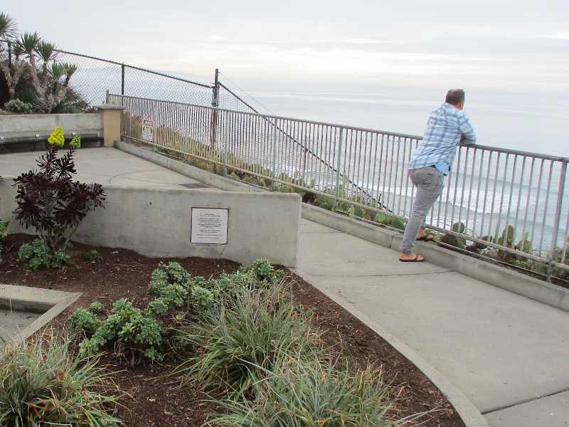
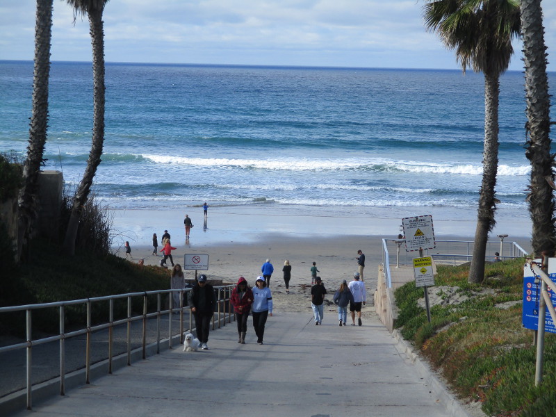
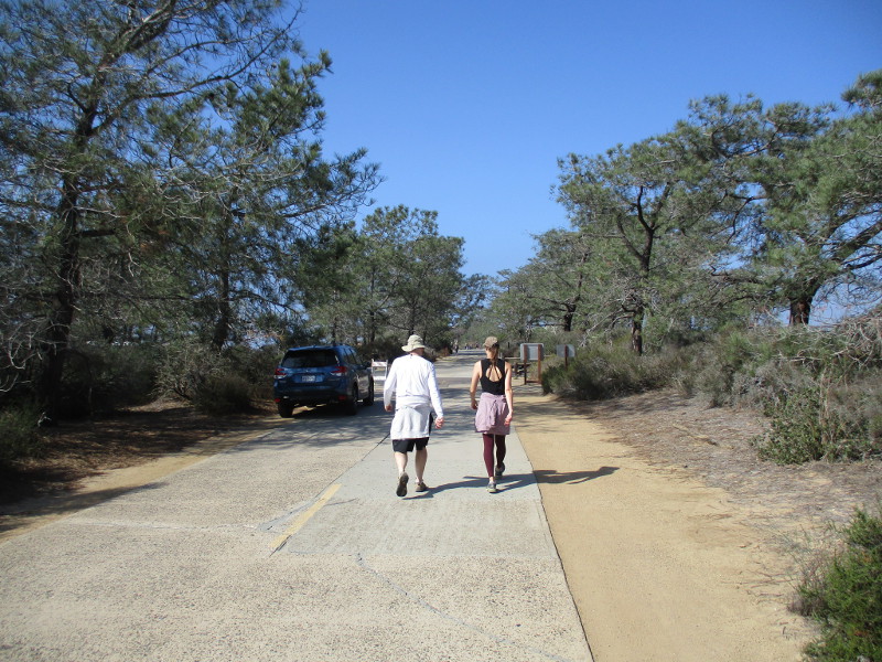
Head west through Encinitas along J Street. When you reach the end, climb the stairs to the J Street Viewpoint.
You’ll discover beautiful views of the Pacific Ocean, unexpected works of public art . . . and a small plaque.
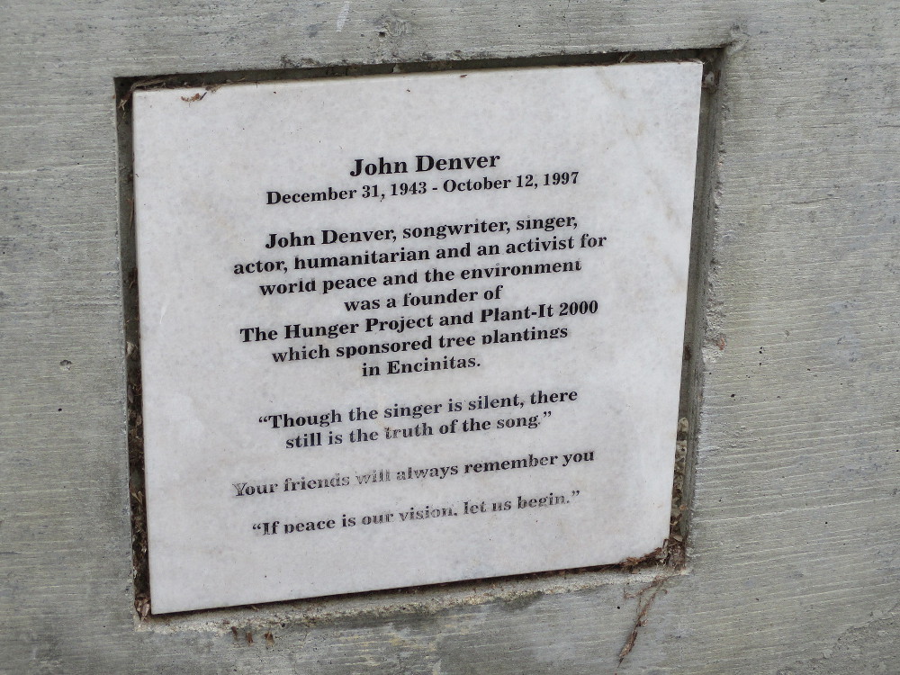
John Denver
December 31, 1943 – October 12, 1997
John Denver, songwriter, singer, actor, humanitarian and an activist for world peace and the environment was a founder of The Hunger Project and Plant-It 2000 which sponsored tree plantings in Encinitas.
“Though the singer is silent, there still is the truth of the song.”
Your friends will always remember you.
“If peace is our vision, let us begin.”
…
I live in downtown San Diego and love to walk around with my camera! You can follow Cool San Diego Sights via Facebook or Twitter!
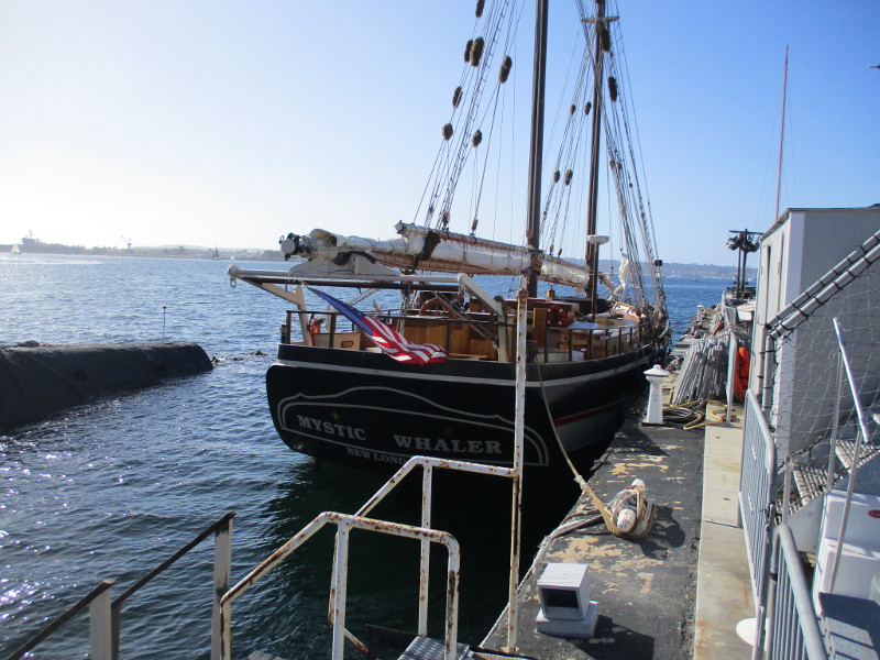
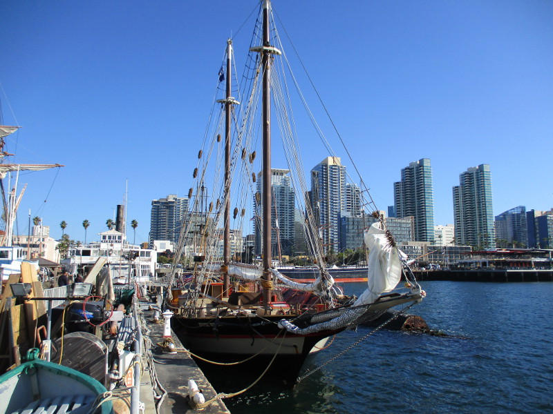
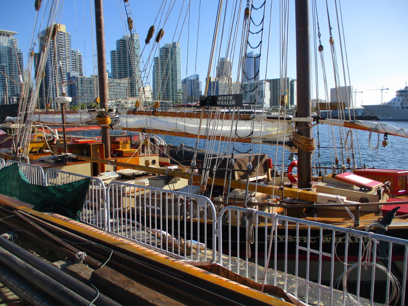
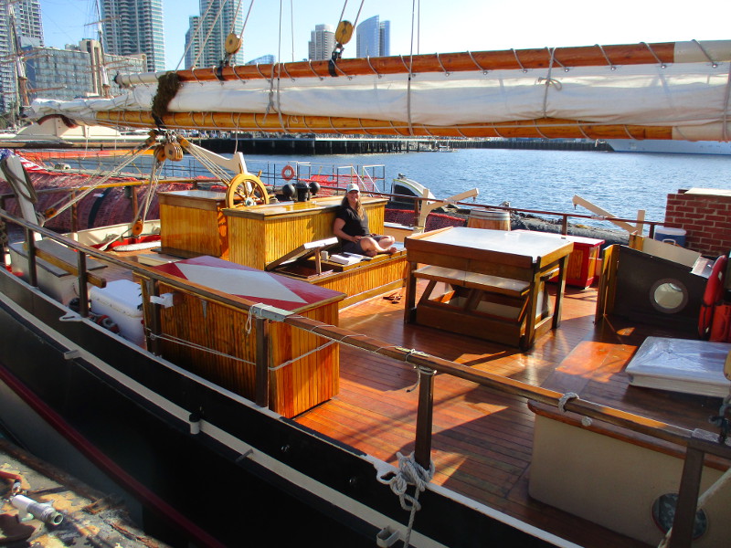
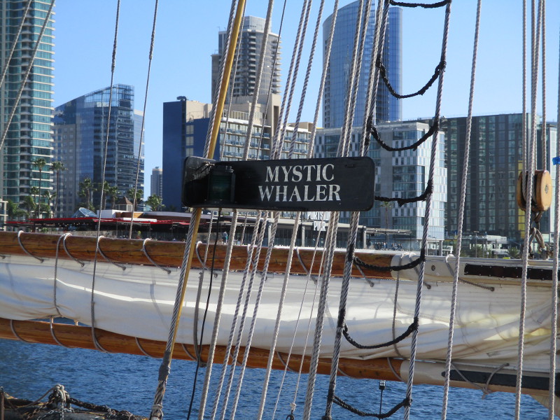
The Mystic Whaler is visiting San Diego. I saw it docked at the Maritime Museum of San Diego this afternoon.
With a name like Mystic Whaler, you might think this tall ship is circling the globe searching for the elusive Moby Dick.
Wrong!
The beautiful ship is from Connecticut, and after a passage through the Panama Canal, it’s making its way up the West Coast. Mystic Whaler’s ultimate destination is the Channel Islands, where it will serve as an educational ship for the Santa Barbara Maritime Museum. A bunch of school kids are in for a real adventure!
The 83-foot-long Mystic Whaler is a reproduction of a late 19th-century coastal cargo schooner. You can read a great article concerning its history and future here.
The crewmember I spoke to was super nice. Good luck!
…
I live in downtown San Diego and love to walk around with my camera! You can follow Cool San Diego Sights via Facebook or Twitter!
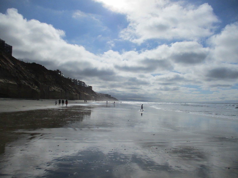
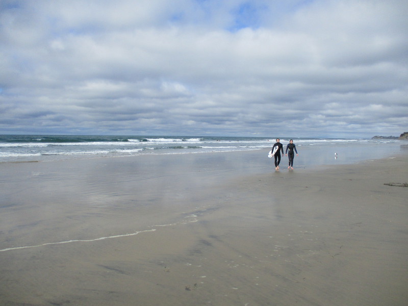
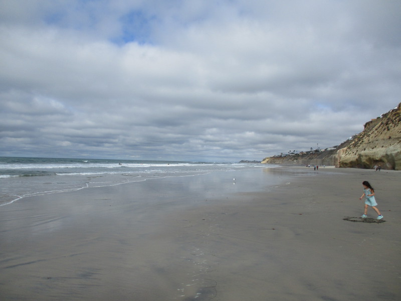
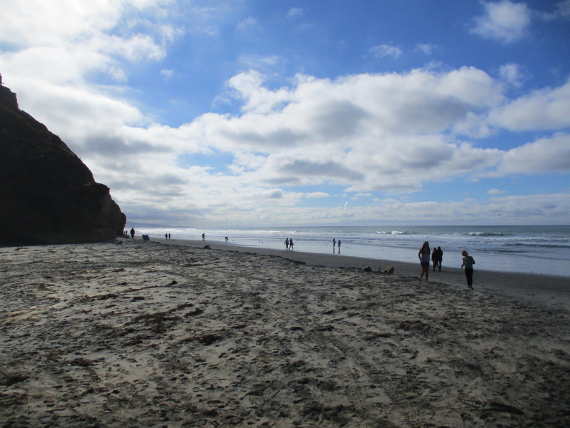
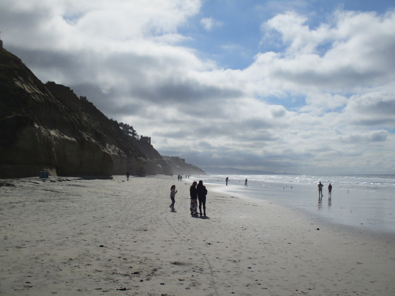
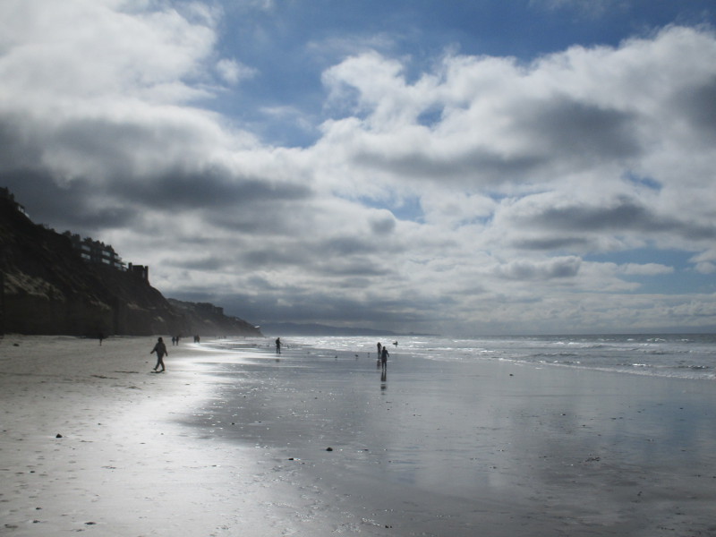
Many beaches in San Diego County will cause you to simply stare. They are that beautiful. The beach at Fletcher Cove in Solana Beach is no exception.
I enjoyed a long walk in Solana Beach today. I photographed some incredible public art (as you’ll see in the next few days), but how does an artist compete with nature’s complex, sublime, and inexhaustible beauty?
That blue sky and clouds reflecting from silvery wet sand were captured with a mere press of a camera button. Then, standing near the ocean’s edge, I turned right and left and pressed the button a few more times…
…
I live in downtown San Diego and love to walk around with my camera! You can follow Cool San Diego Sights via Facebook or Twitter!
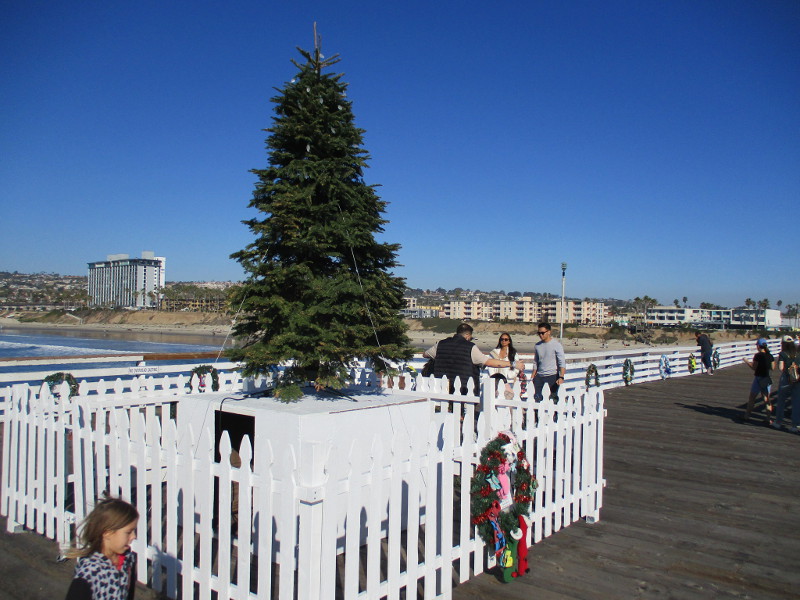
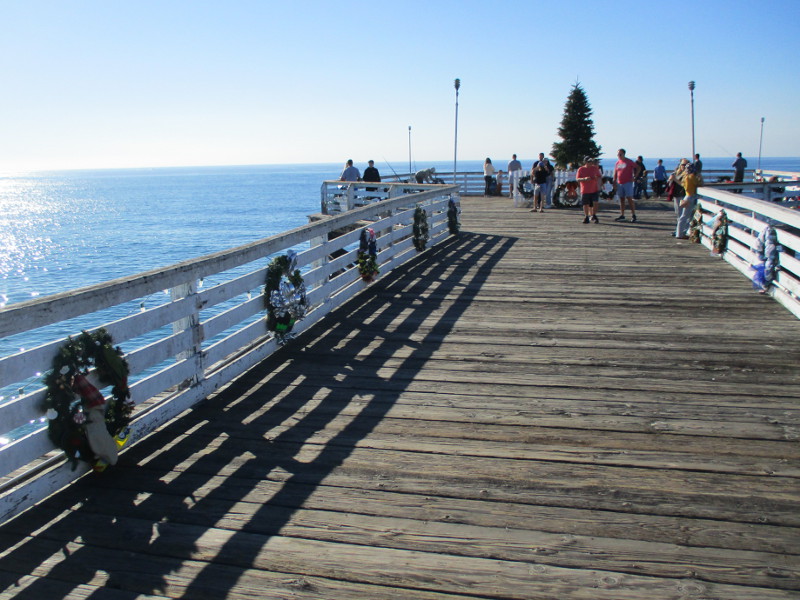
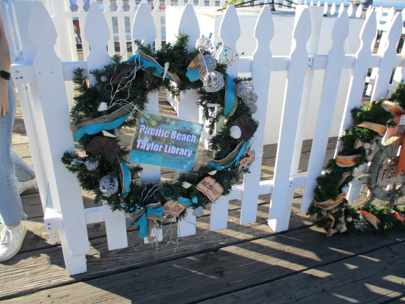
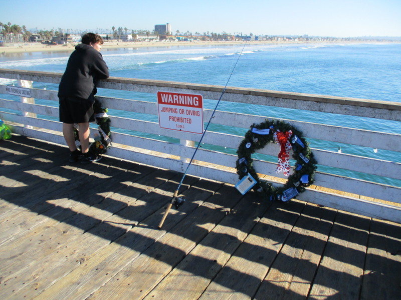
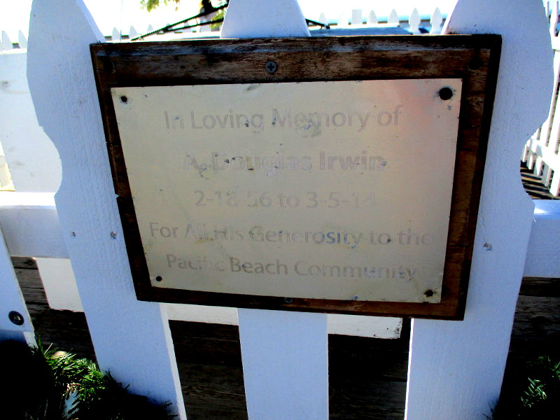
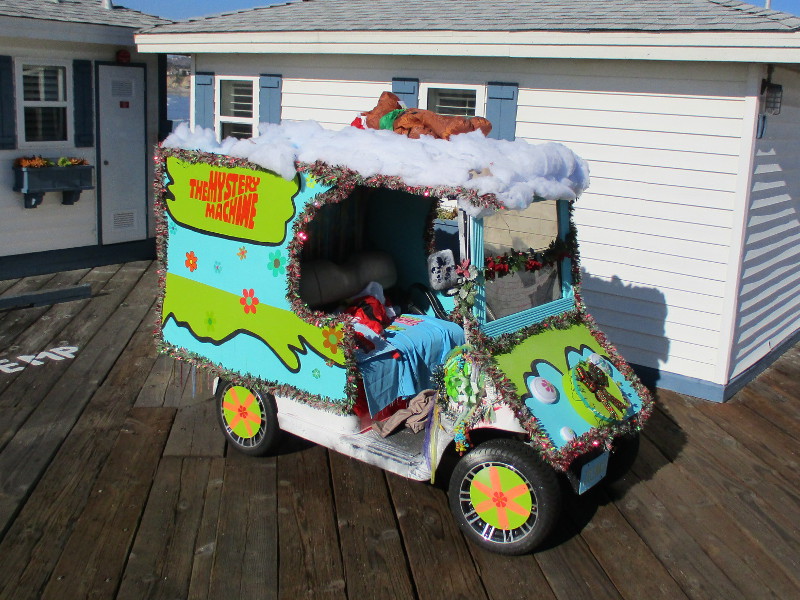
The holiday season in Pacific Beach is so overflowing with “good tidings” that decorations extend over the ocean!
Perhaps this post should be titled “Christmas tree, wreaths, and the Scooby Doo Mystery Machine on Crystal Pier” because that’s what I saw this afternoon!
(I learned The Mystery Machine golf cart, decked with tinsel and Christmas ornaments, is utilized by the operator of the Crystal Pier Bait and Tackle store. The vehicle has won awards in many parades!)
…
I live in downtown San Diego and love to walk around with my camera! You can follow Cool San Diego Sights via Facebook or Twitter!
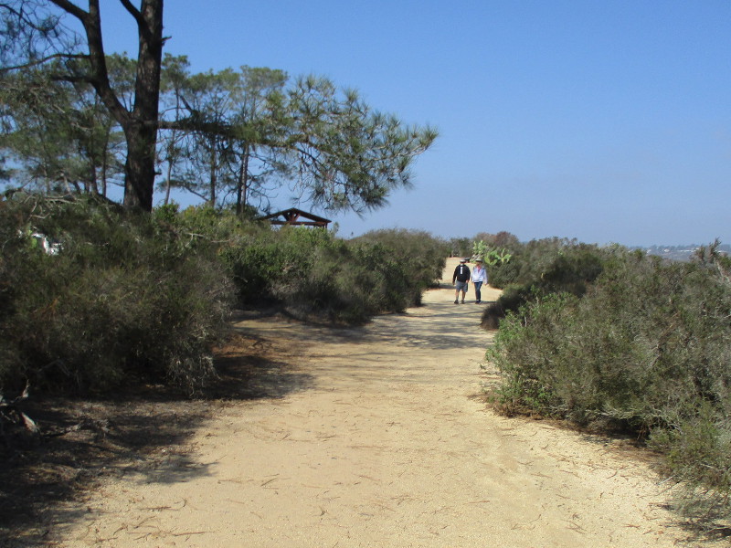
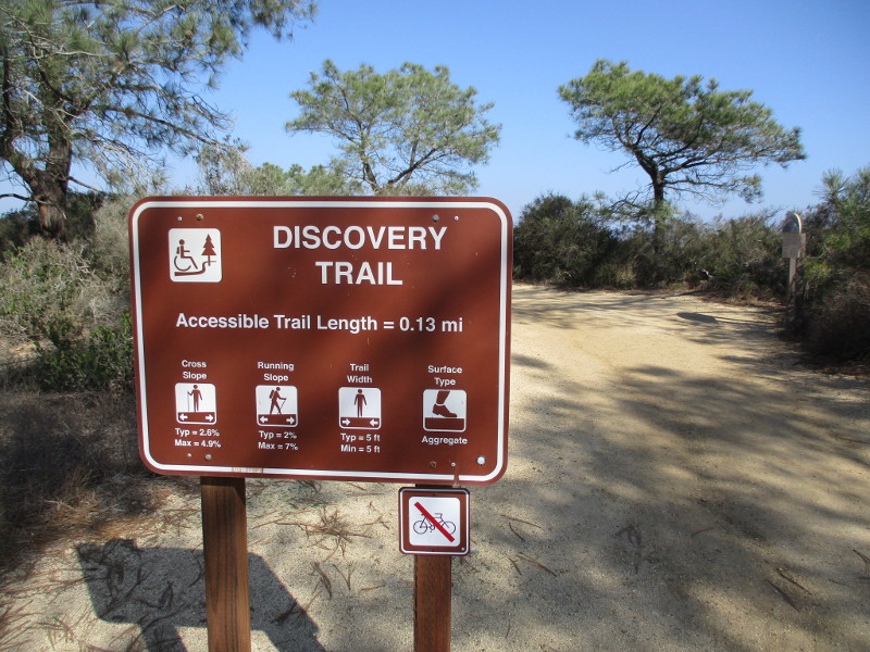
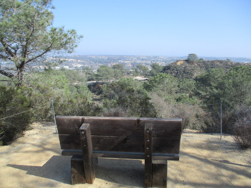
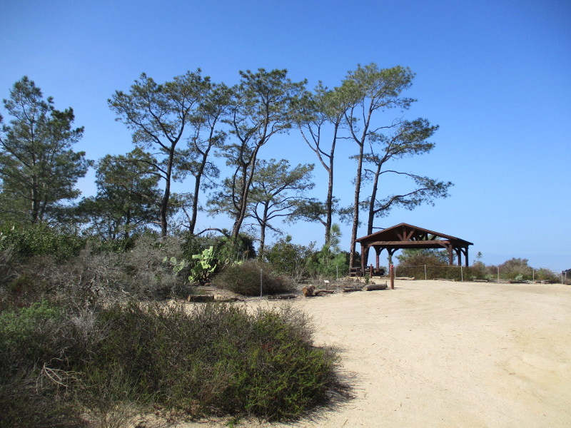
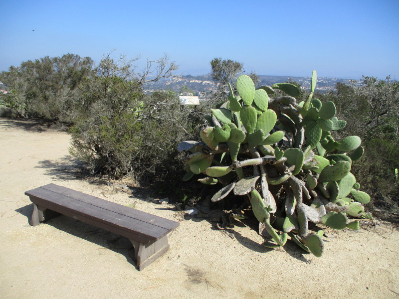
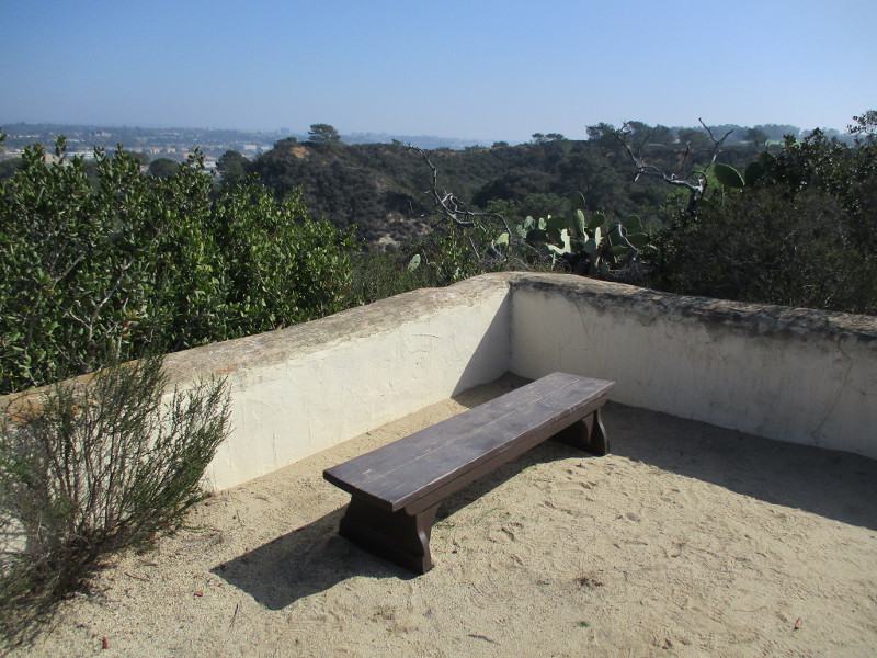
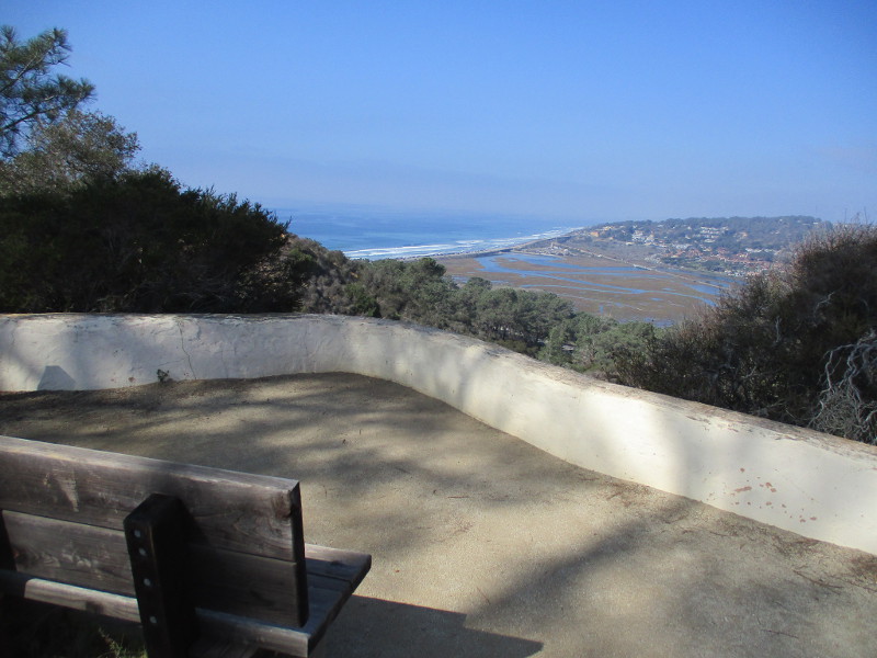
The very easy Discovery Trail at Torrey Pines State Natural Reserve is a fine place to walk or sit on a bench, while drinking in nature’s beauty.
The short .13 mile highly accessible trail follows the edge of a bluff just east of the historic Lodge (the park’s Visitor Center) and its parking lot.
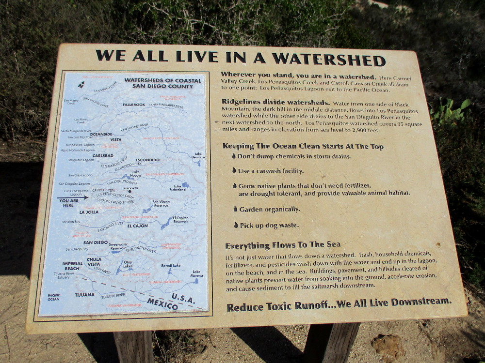
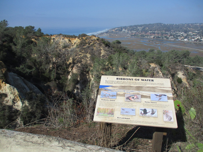
There are scenic overlooks with views of Carmel Valley, Los Peñasquitos Lagoon and even the Pacific Ocean. Signs describe many of the natural marvels around you. Native plants along the way are identified with information plaques.
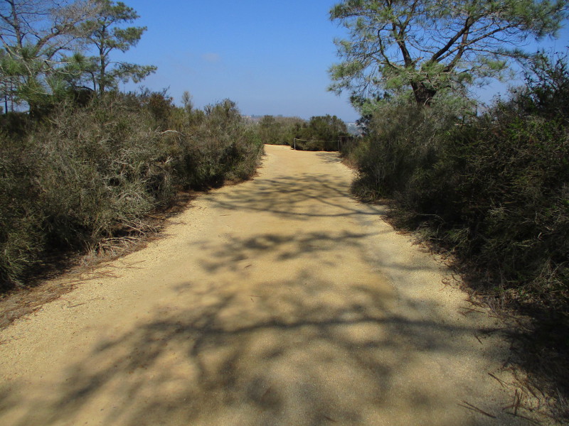
Last weekend I slowly walked north along the Discovery Trail.
I began at Torrey Pines Park Road across from the Beach Trailhead parking lot. That’s where I saw the sign pictured below. I then headed north until I reached the rear of the old Lodge.
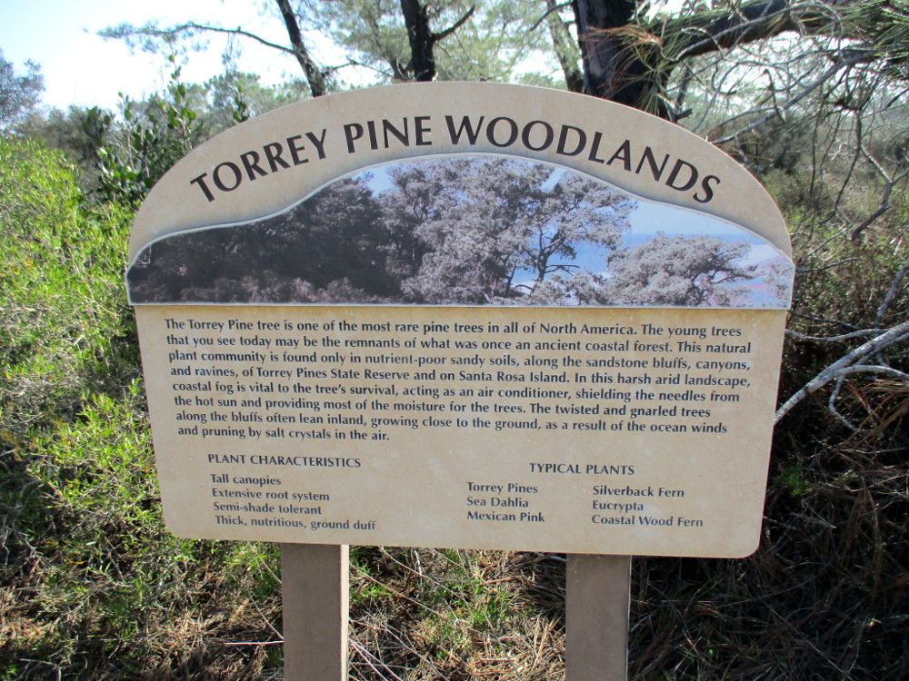
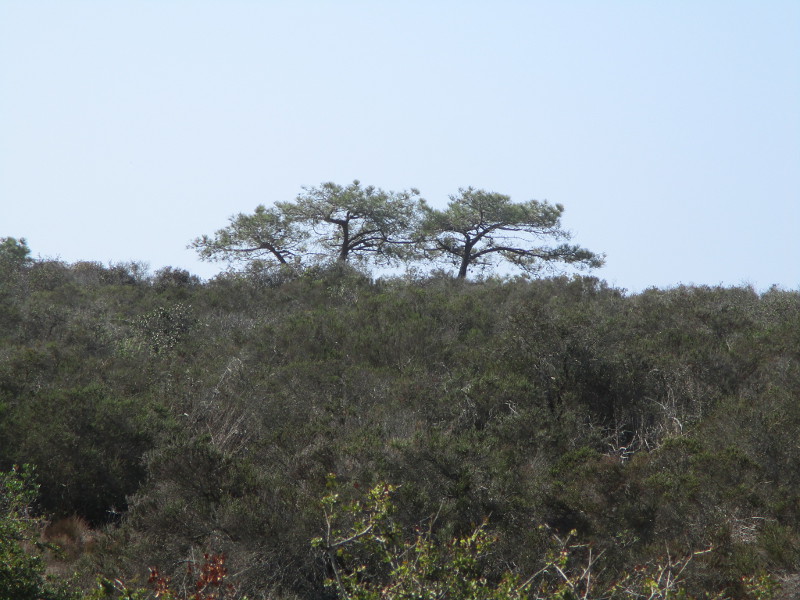
TORREY PINE WOODLANDS. The Torrey Pine tree is one of the most rare pine trees in all of North America. The young trees that you see today may be the remnants of what was once an ancient coastal forest. This natural plant community is found only in nutrient-poor sandy soils, along the sandstone bluffs, canyons, and ravines of Torrey Pines State Reserve and on Santa Rosa Island…
Wherever you stand, you are in a watershed. Here Carmel Valley Creek, Los Peñasquitos Creek and Carroll Canyon Creek all drain to one point: Los Peñasquitos Lagoon’s exit to the Pacific Ocean…
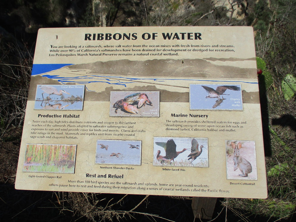
You are looking at a saltmarsh, where salt water from the ocean mixes with fresh from rivers and streams…Los Peñasquitos Marsh Natural Preserve remains a natural coastal wetland.
…
I live in downtown San Diego and love to walk around with my camera! You can follow Cool San Diego Sights via Facebook or Twitter!
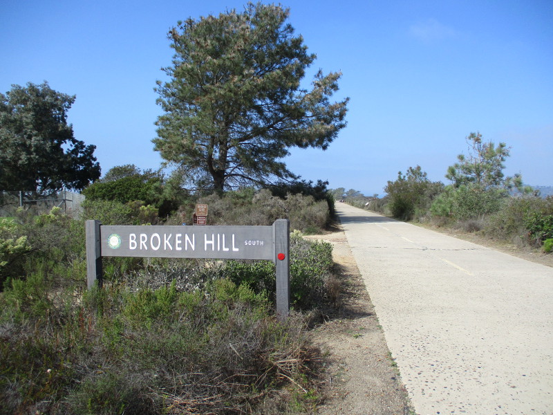
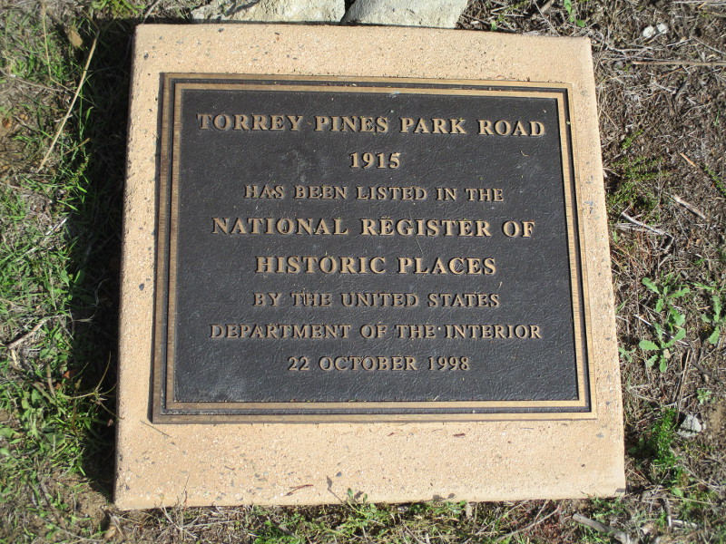
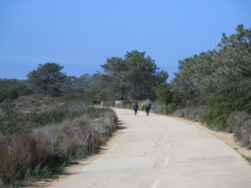
Explore the south end of Torrey Pines Park Road at Torrey Pines State Natural Reserve and you’ll discover breathtaking beauty and fascinating history.
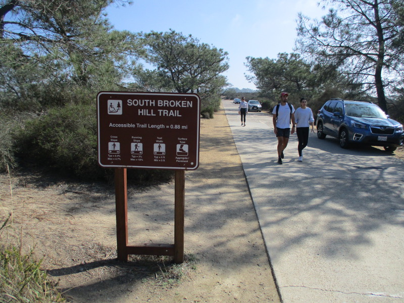
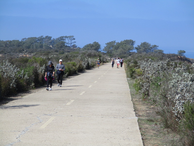
Last weekend I walked north along the paved trail, which a century ago was part of the main road from San Diego to Los Angeles. The following photographs begin near Torrey Pines Golf Course and end just short of the Visitor Center at Torrey Pines State Reserve’s old Lodge. The historic road, closed to vehicle traffic, is how hikers access Broken Hill Trail, which winds through a rugged landscape down to the beach.
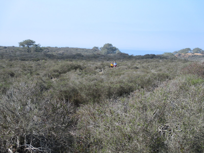
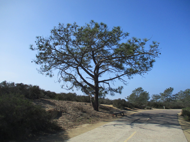
In my photos you’ll see native coastal sage scrub and chaparral plants, rare Torrey pine trees, the Pacific Ocean in the distance to the west and sandstone cliffs overlooking North Torrey Pines Road to the east. Signs along the way speak of the history of this place.
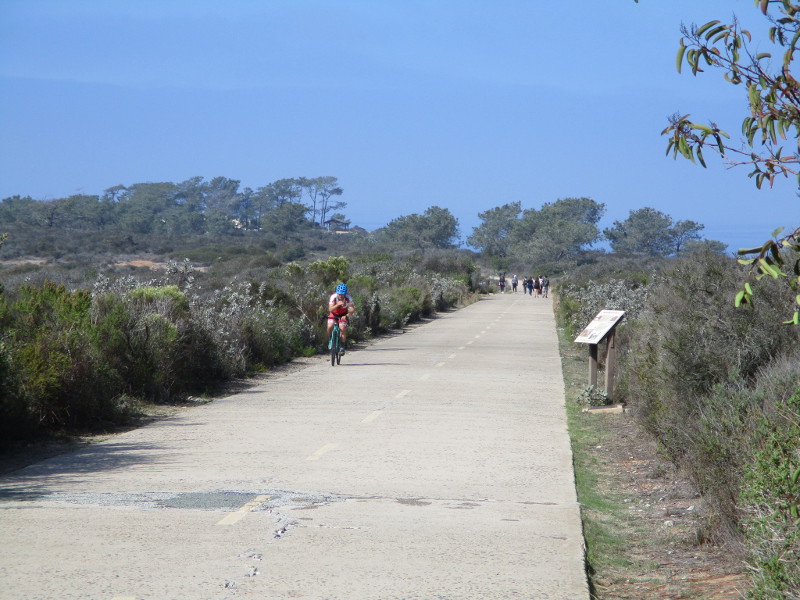
Come along as I walk down old Torrey Pines Park Road on a sunny November day!
Other walkers and bicyclists were also enjoying a fun adventure.
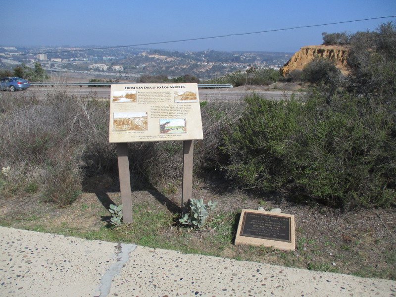
To the east beyond an information sign and historical marker one can see North Torrey Pines Road, Carmel Valley and Interstate 5.
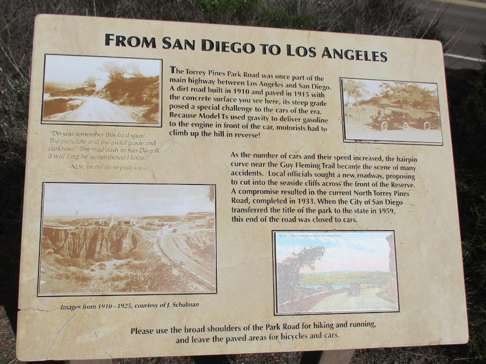
FROM SAN DIEGO TO LOS ANGELES
The Torrey Pines Park Road was once part of the main highway between Los Angeles and San Diego. A dirt road built in 1910 and paved in 1915 with the concrete surface you see here, its steep grade posed a special challenge to the cars of the era. Because Model Ts used gravity to deliver gasoline to the engine in front of the car, motorists had to climb up the hill in reverse.
As the number of cars and their speed increased, the hairpin curve near the Guy Fleming Trail became the scene of many accidents. Local officials sought a new roadway, proposing to cut into the seaside cliffs across the front of the Reserve. A compromise resulted in the current North Torrey Pines Road, completed in 1933. When the City of San Diego transferred the title of the park to the state in 1959, this end of the road was closed to cars.
The steep hill and its hairpin curves mentioned in the sign are north of the Lodge, beyond this particular walk. Cars entering the park still use it.
If you’d like to see past photos of the Guy Fleming Trail which is also referenced in the sign, click here!
TORREY PINES PARK ROAD
1915
HAS BEEN LISTED IN THE NATIONAL REGISTER OF HISTORIC PLACES BY THE UNITED STATES DEPARTMENT OF THE INTERIOR
22 OCTOBER 1998
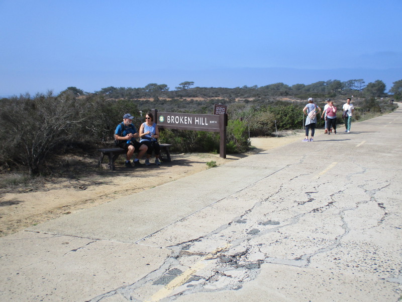
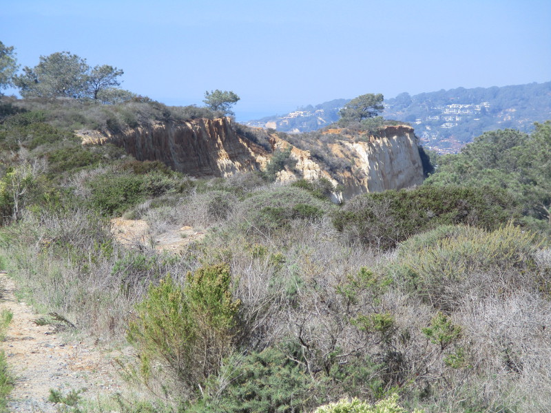
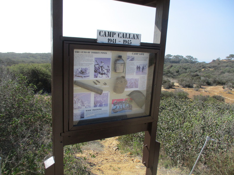
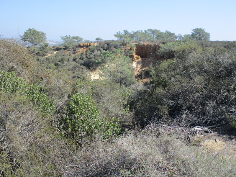
Hikers explore nature’s beauty.The North Fork Trailhead leads west to the Broken Hill Trail.Picturesque sandstone cliffs overlook North Torrey Pines Road (not visible) to the east.A sign details the history of Camp Callan, which was located here from 1941 to 1945.
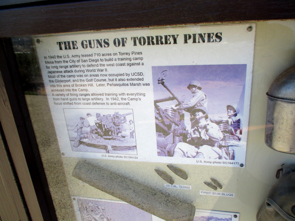
THE GUNS OF TORREY PINES
In 1940 the U.S. Army leased 710 acres on Torrey Pines Mesa from the City of San Diego to build a training camp for long range artillery to defend the west coast against a Japanese attack during World War II. Most of the camp was on areas now occupied by UCSD, the Gliderport, and the Golf Course, but it also extended into the area of Broken Hill. Later, Penasquitos Marsh was annexed into the Camp. A variety of firing ranges allowed training with everything from hand guns to large artillery. In 1942, the Camp’s focus shifted from coast defense to anti-aircraft.
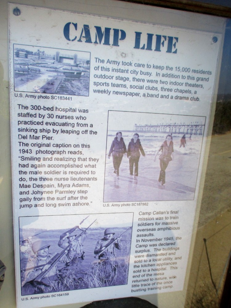
CAMP LIFE
The Army took care to keep the 15,000 residents of this instant city busy. In addition to this grand outdoor stage, there were two indoor theaters, sports teams, social clubs, three chapels, a weekly newspaper, a band and a drama club.
The 300-bed hospital was staffed by 30 nurses who practiced evacuating from a sinking ship by leaping off the Del Mar Pier. The original caption on the 1943 photograph reads, “Smiling and realizing that they had again accomplished what the male soldier is required to do, the three nurse lieutenants Mae Despain, Myra Adams, and Johynee Parmley step gaily from the surf after the jump and long swim ashore.”
Camp Callan’s final mission was to train soldiers for massive overseas amphibious assaults. In November 1945, the Camp was declared surplus. The buildings were dismantled and sold to a local utility, and the kitchen appliances sold to a hospital. This end of the mesa returned to nature, with little trace of the once bustling training camp.
A postcard. Greetings from CAMP CALLAN CALIFORNIA.Torrey pine trees in the distance.More eroded sandstone to the east.Approaching a small parking lot at the Beach Trailhead near The Lodge.
…
This blog now features thousands of photos around San Diego! Are you curious? There’s lots of cool stuff to check out!
Here’s the Cool San Diego Sights main page, where you can read the most current blog posts. If you’re using a phone or small mobile device, click those three parallel lines up at the top–that opens up my website’s sidebar, where you’ll see the most popular posts, a search box, and more!
To enjoy future posts, you can also “like” Cool San Diego Sights on Facebook or follow me on Twitter.
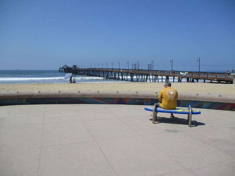
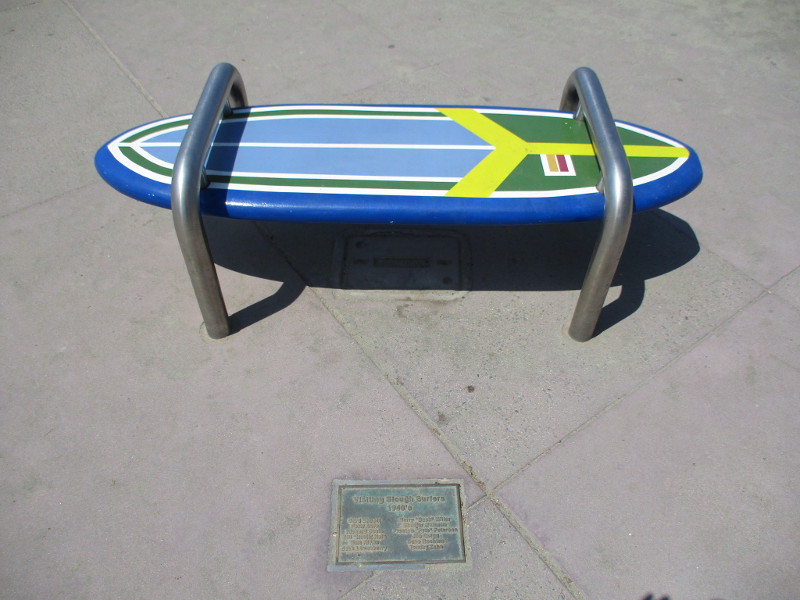
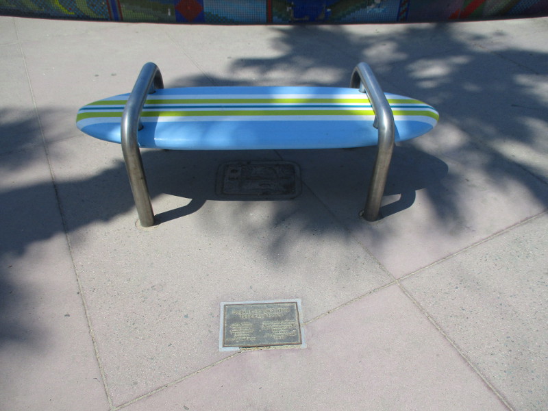
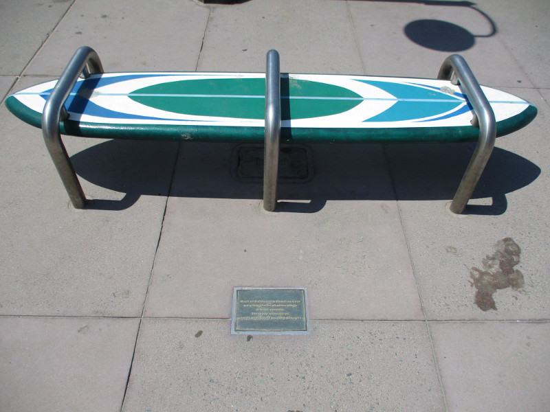
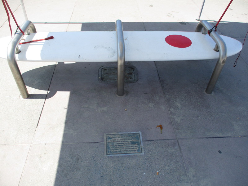
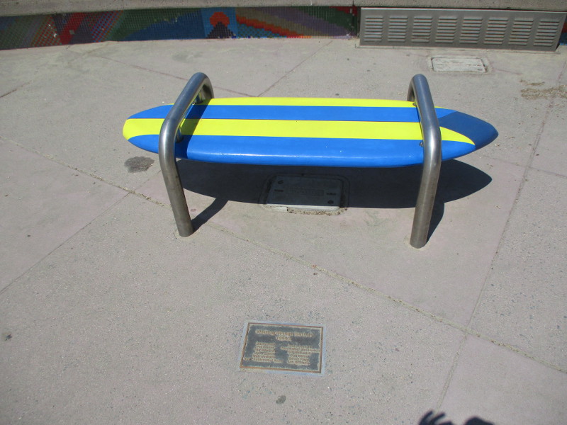
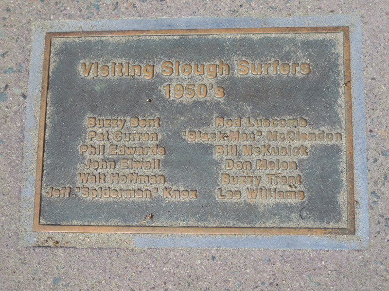
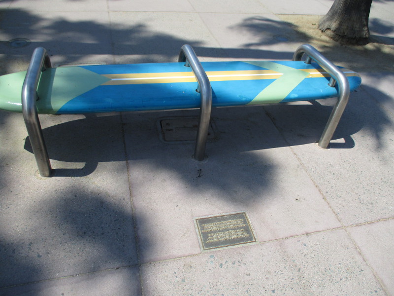
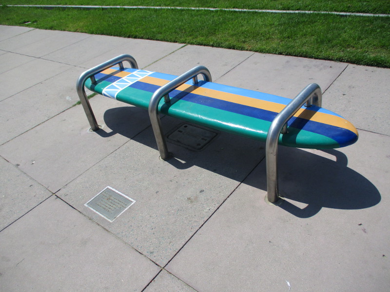
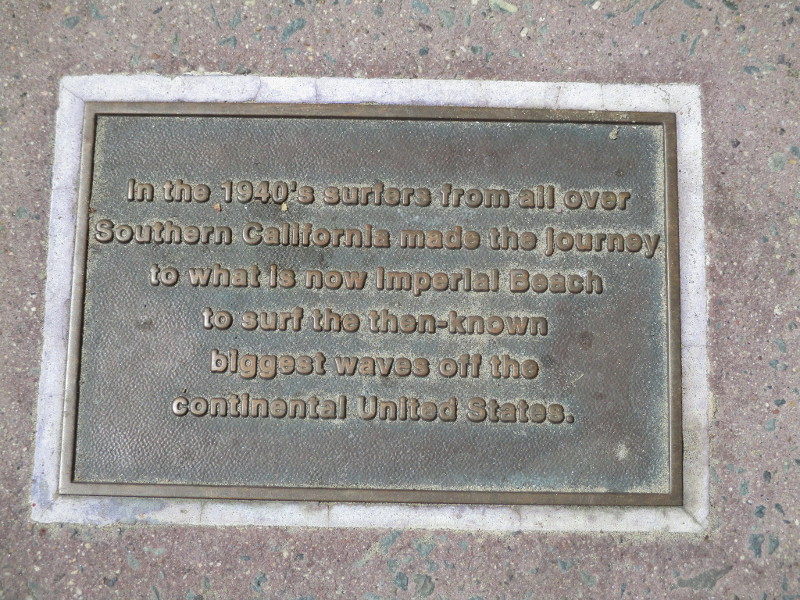
Bronze plaques near the foot of the Imperial Beach Pier recall the legendary slough surfers who once trekked from far and wide to the Tijuana Sloughs, where the Tijuana River meets the Pacific Ocean, just north of the Mexican border.
During much of the 20th century, the Tijuana Sloughs was considered the preeminent big surf break in California. There’s a great article concerning the history and geology of the Sloughs here.
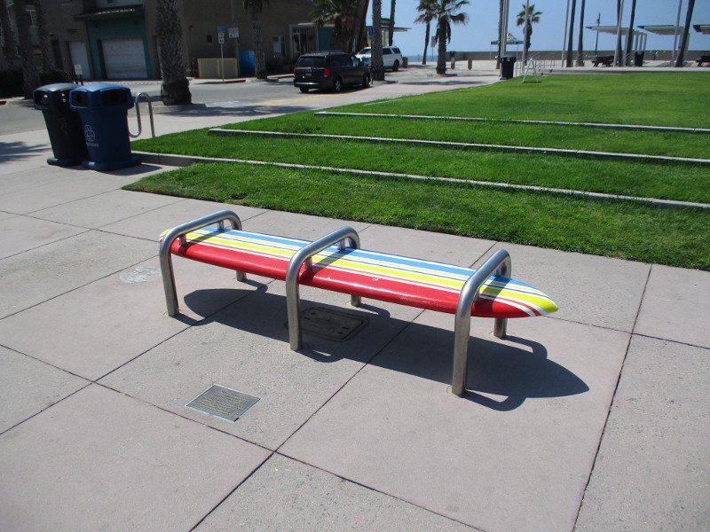
If you walk around Portwood Pier Plaza at the foot of the IB Pier, you’ll see a bunch of colorful surfboard benches where you can rest and gaze out across the beach. Look down and you’ll discover plaques next to each bench.
The plaques recall those who rode the big waves at the Tijuana Sloughs and honor bits of Imperial Beach surfing history.
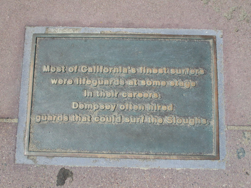
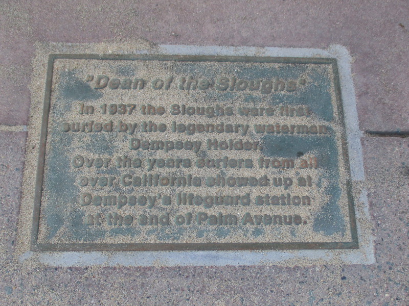
Surfhenge public art welcomes people to the Imperial Beach Pier and Portwood Pier Plaza. The plaza is located next to the beach between Surfhenge and the lifeguard tower to the south.Visiting slough surfers 1940’s.Regular slough surfers 1940’s and 1950’s.Most of California’s finest surfers were lifeguards at some stage in their careers…Dean of the Sloughs. In 1937 the Sloughs were first surfed by the legendary waterman Dempsey Holder. Over the years surfers from all over California showed up at Dempsey’s lifeguard station at the end of Palm Avenue.Visiting slough surfers 1950’s.Father of the Modern Surfboard. In the 1940’s Bob Simmons applied the principles of hydrodynamics to surfboard design and forever changed the sport of surfing. In 1950 he moved to Imperial Beach.…From 1930 to 1950 the total number of California surfers grew from under 70 to over 1500.In the 1940’s surfers from all over Southern California made the journey to what is now Imperial Beach to surf the then-known biggest waves off the continental United States.The Tijuana Sloughs became the testing ground for mainlanders going to Hawai’i. Before Malibu, San Onofre and Windansea groups surfed Makaha and the North Shore of O’ahu, they experienced the thrill and fear of big waves at the Sloughs.
…
I live in downtown San Diego and love to walk around with my camera! You can follow Cool San Diego Sights via Facebook or Twitter!
You can easily explore Cool San Diego Sights by using the search box on my blog’s sidebar. Or click a tag! There are thousands upon thousands of photos for you to enjoy!
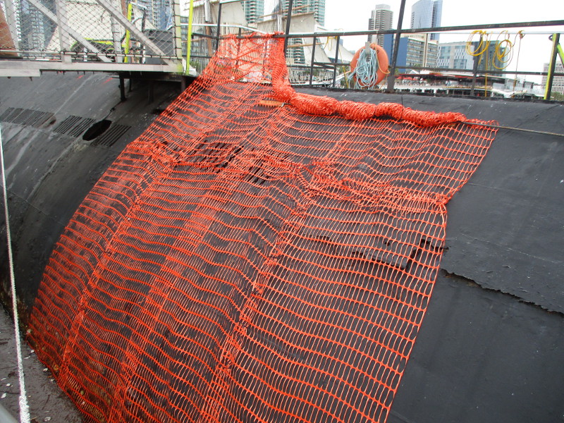
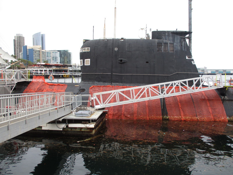
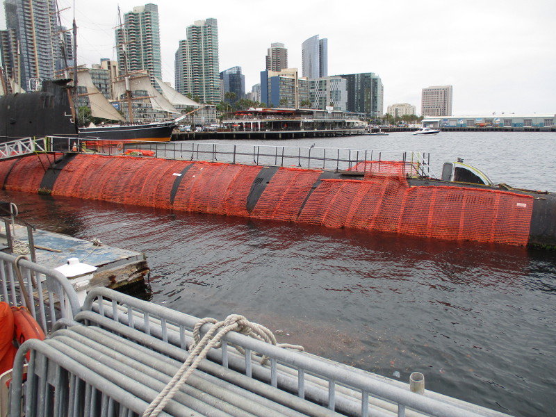
I was walking along the Embarcadero past the Maritime Museum of San Diego when I noticed the hull of their badly rusting old Soviet Foxtrot-class submarine, B-39, was partially wrapped with orange material. I asked at the ticket booth for the latest news concerning this historic Russian sub, and I was told it’s being prepared for one last journey. It is to be towed away from the museum next month.
During the Cold War this particular diesel electric submarine, which was commissioned in the 1970’s, might have lurked at times off the West Coast, tracking United States Navy ships. Its final destination will be the Pacific Ocean off Ensenada, Mexico. There it will be sunk to create a new underwater reef!
UPDATE!
Oh, the perils of a blogger whose website, through mysterious algorithms, is considered by some a news site. I make a lousy journalist!
The gentleman I relied on for the preceding information was only partially correct–and very wrong concerning the main matter. The submarine will indeed be towed to Ensenada (at an as yet unknown time) to be disassembled for its valuable metal components. But will it become a reef? I’m told, no.
I heard this a couple days later from a much more reliable source during another visit to the Maritime Museum.
I also took the following photographs. You can see strips of orange safety fence wrapped around a portion of the rusted outer hull.
…
I live in downtown San Diego and love to walk around with my camera! You can follow Cool San Diego Sights via Facebook or Twitter!
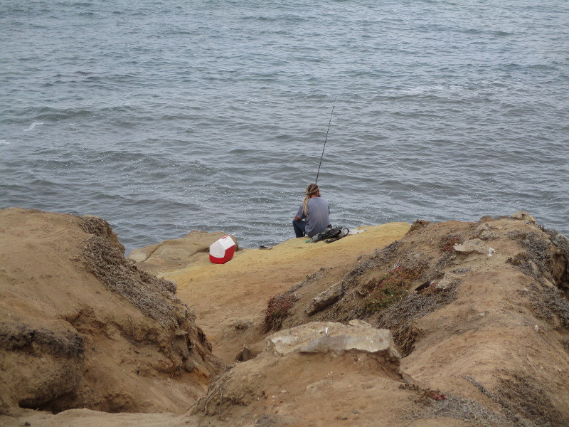
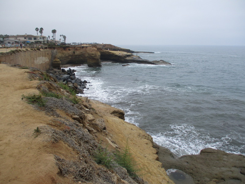
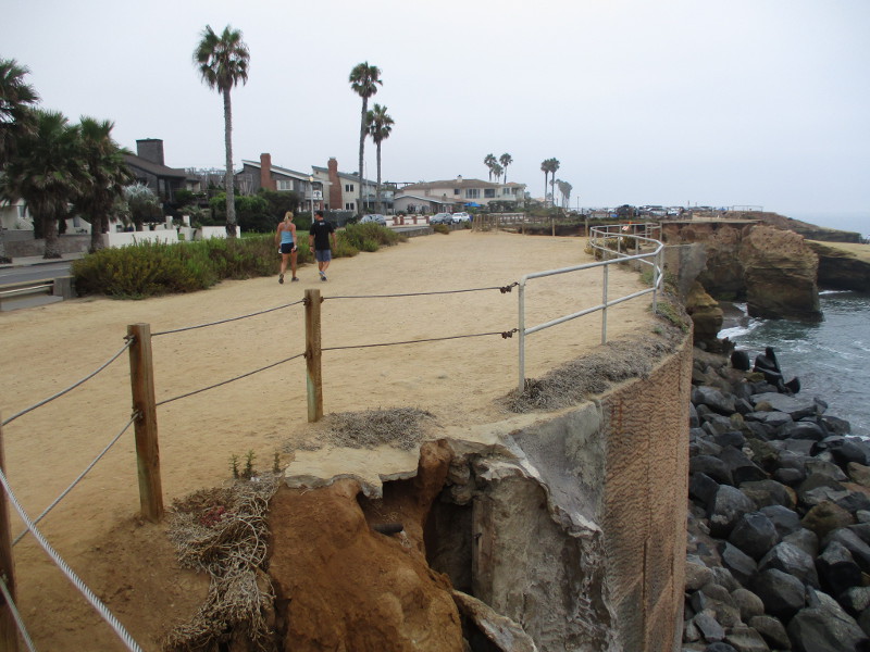
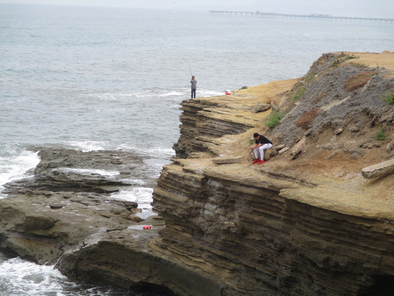
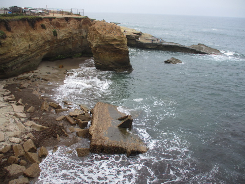
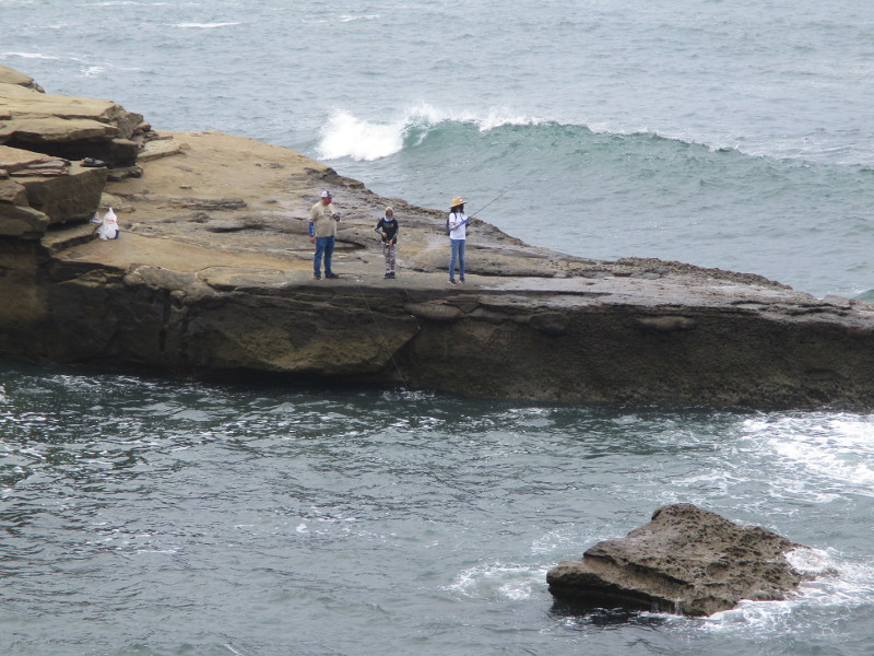
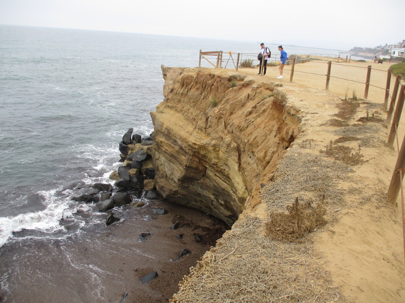
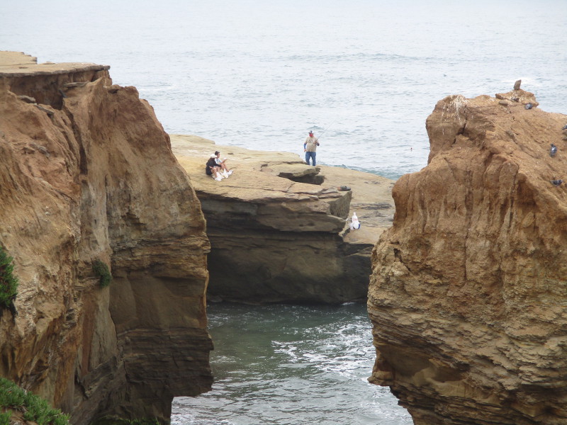
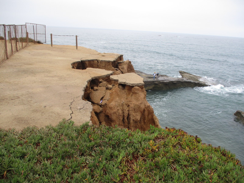
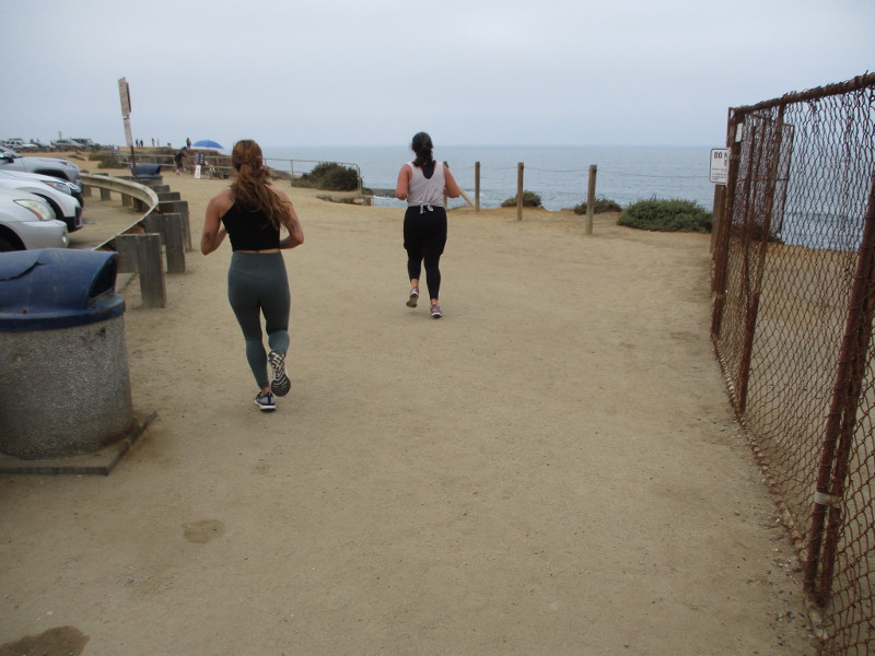
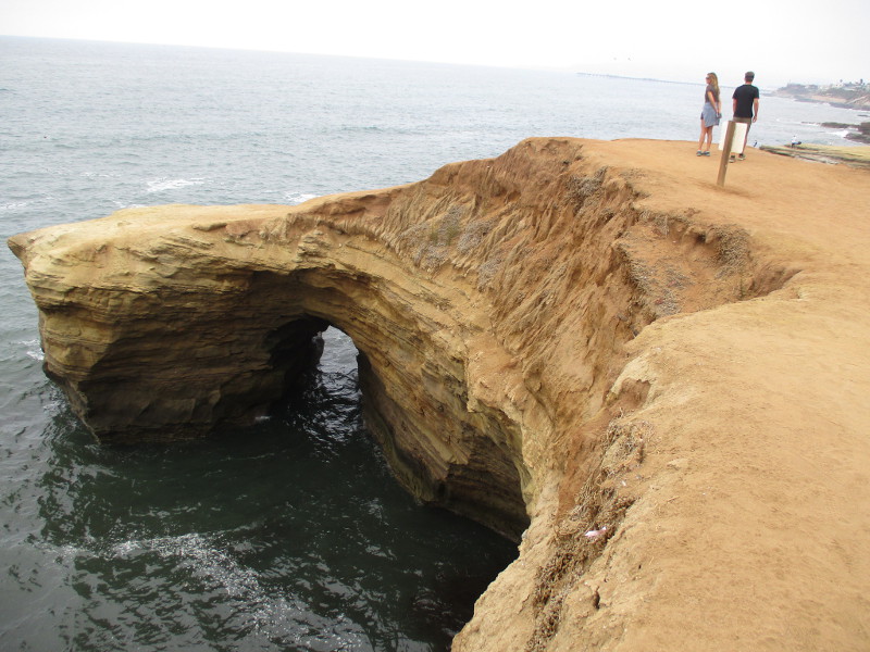
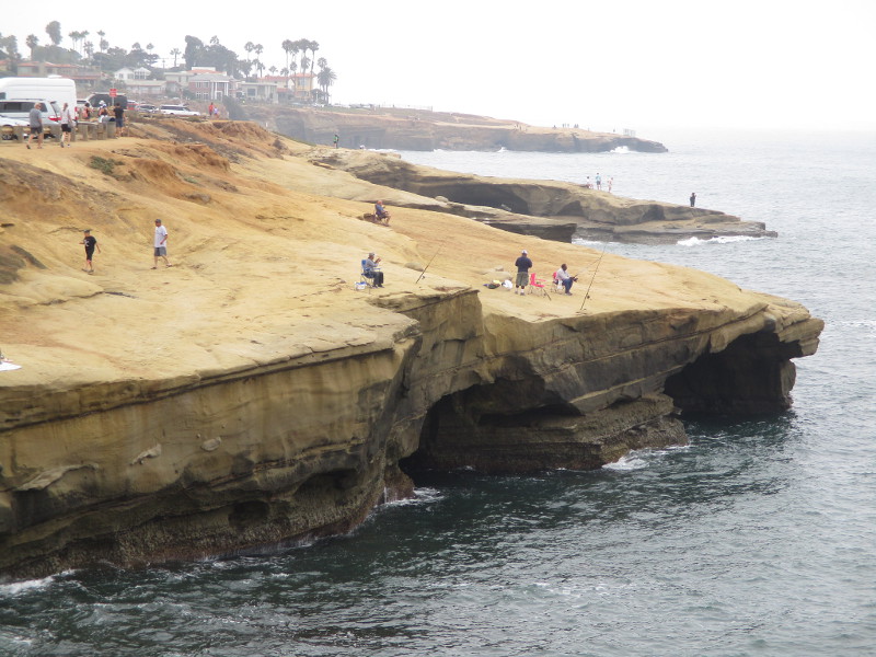
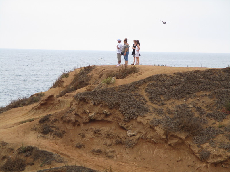
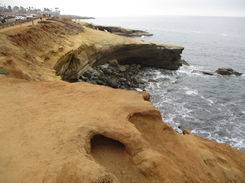
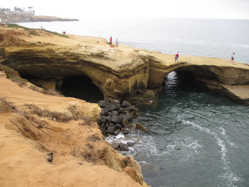
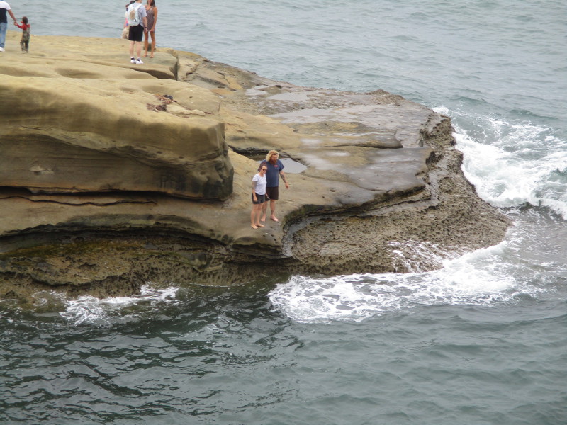
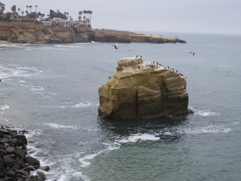
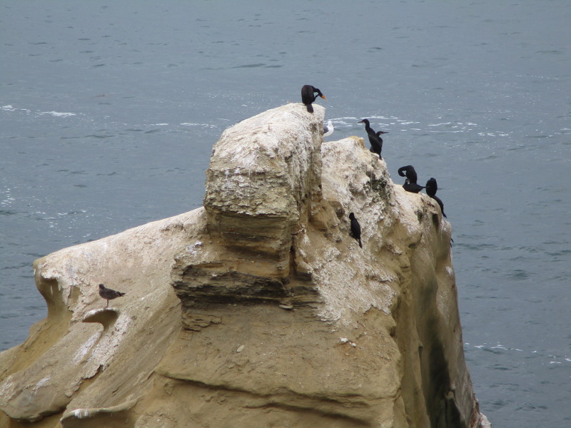
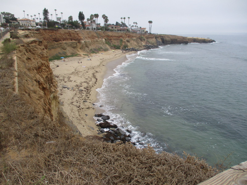
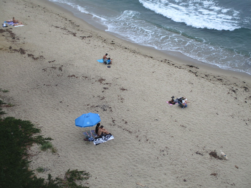
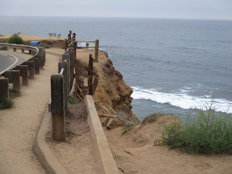
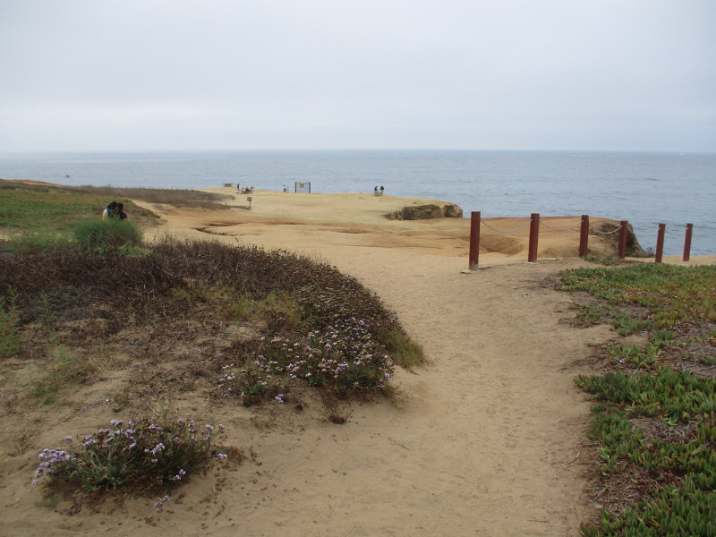
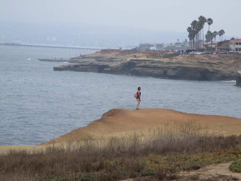
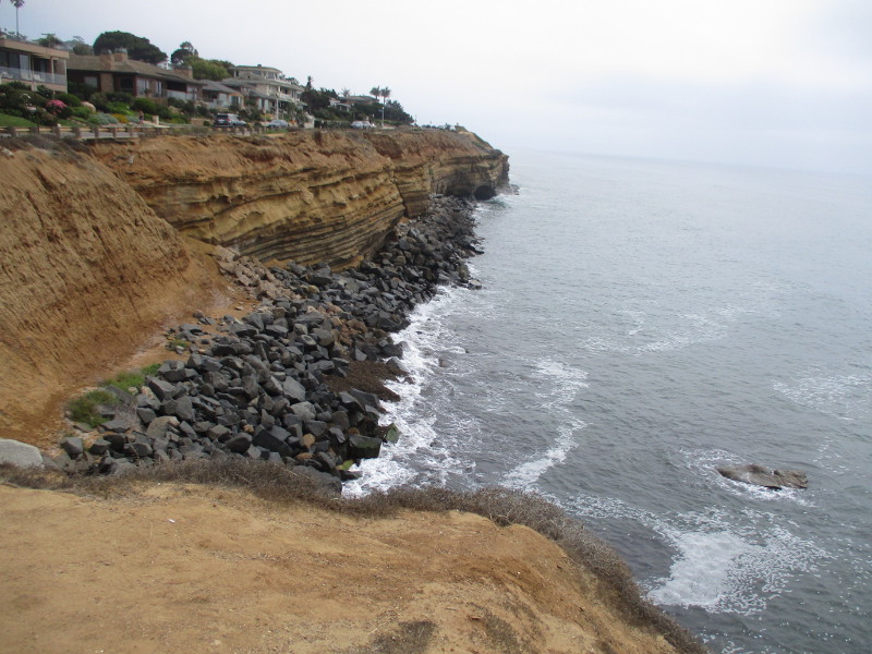
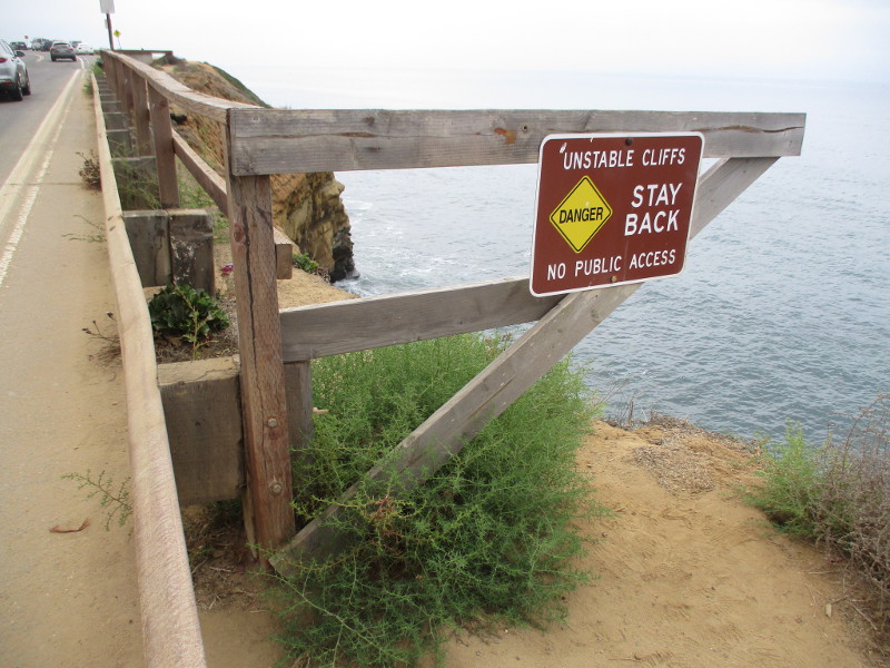
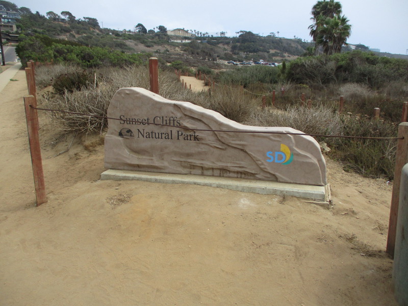
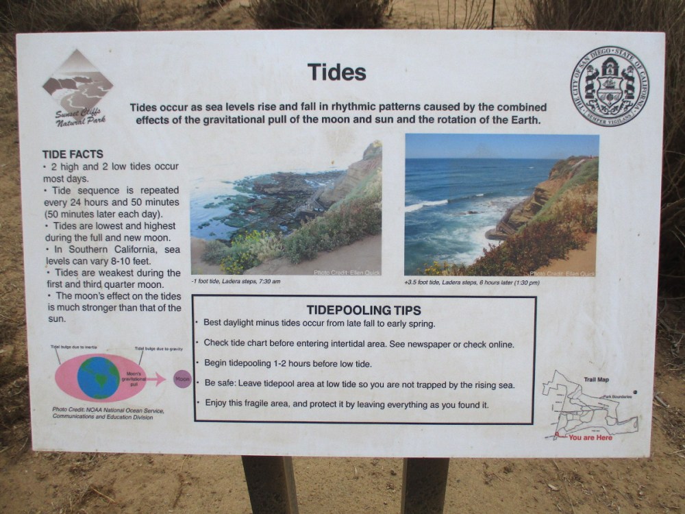
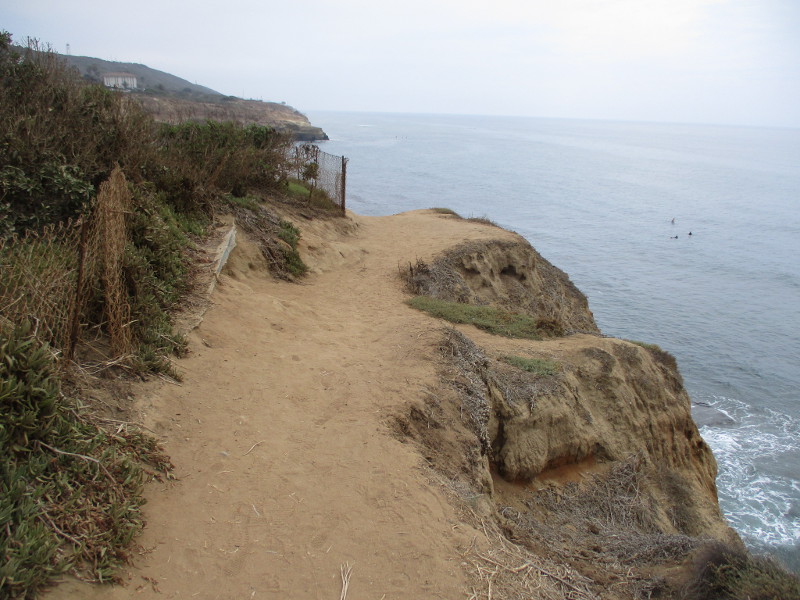
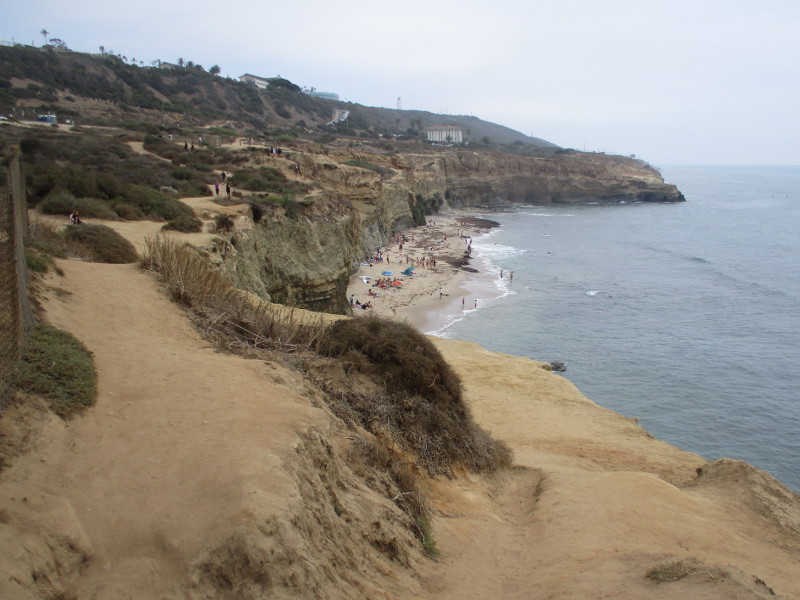
One of San Diego’s most amazing, scenic walks is along Sunset Cliffs in Point Loma.
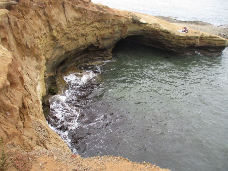
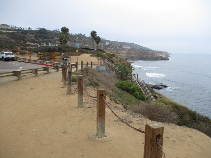
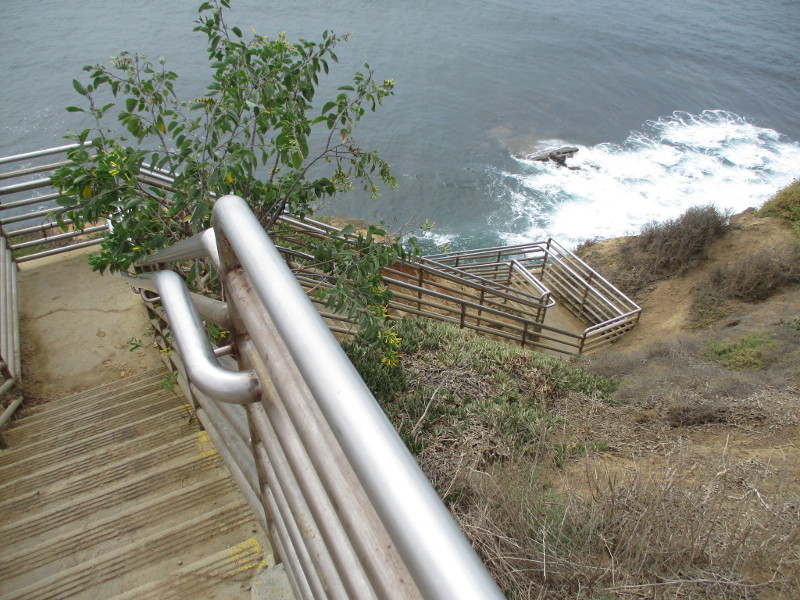
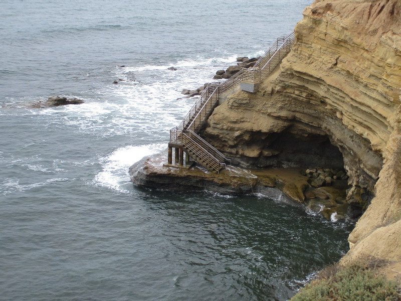
Yesterday I walked along the length of Sunset Cliffs Natural Park, which stretches for about 1.5 miles beside the Pacific Ocean. I started near the intersection of Sunset Cliffs Boulevard and Adair Street and headed south to Ladera Street, where there’s a popular beach, nature trails and stairs down to a small cave and rocky tide pools.
The August summer day was perfect for a long walk. The sun didn’t break through the coastal marine layer until the very end of my adventure, and the sea breeze was pleasantly cool.
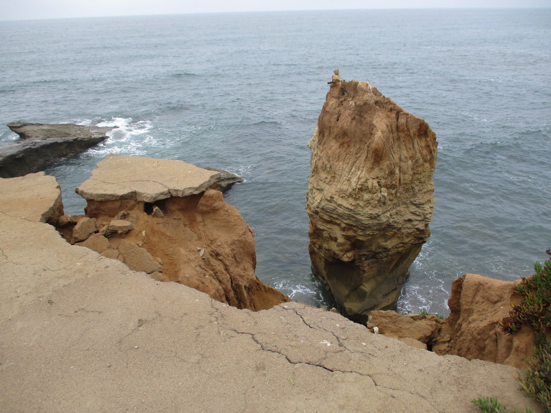
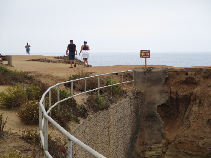
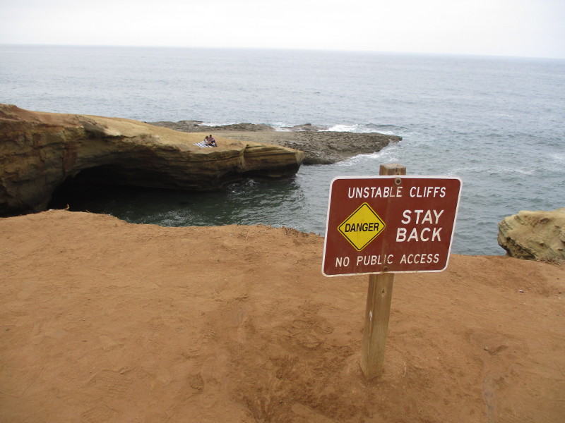
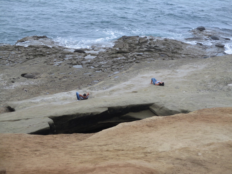
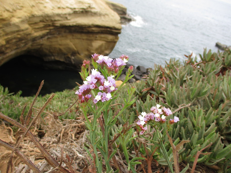
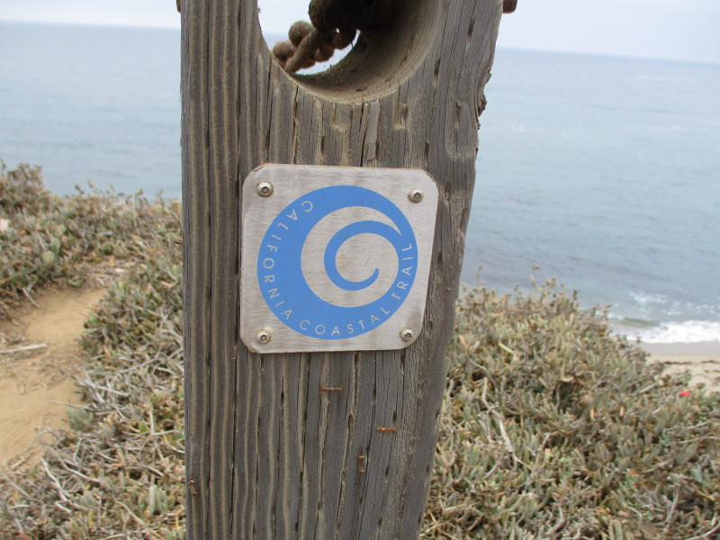
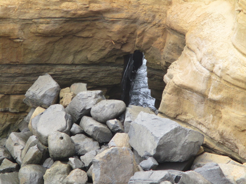
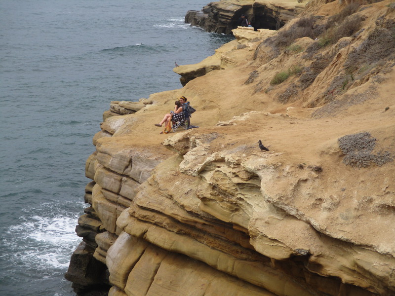
Views of the Pacific Ocean crashing against the steep, rugged cliffs seemed endless. The mostly dirt Coastal Trail I followed wound above the high eroded bluffs, past a few pocket beaches and past sea caves and picturesque sandstone arches.
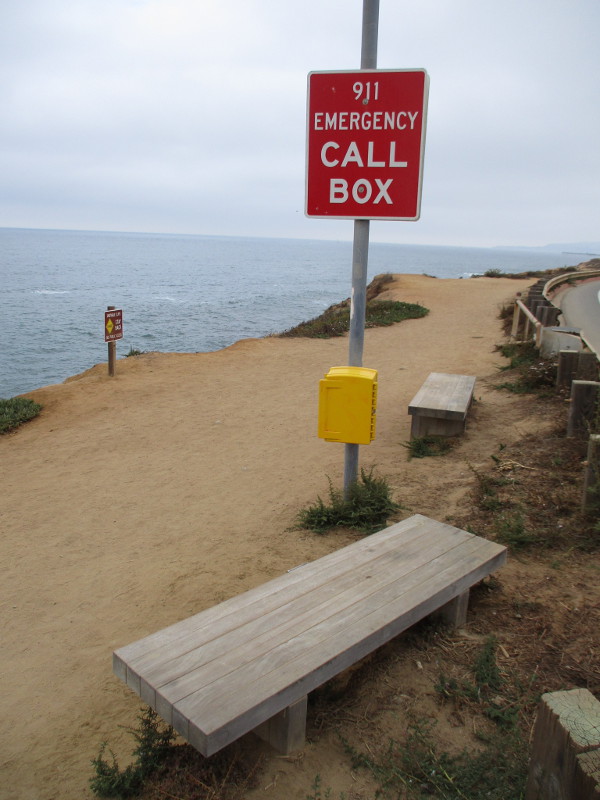
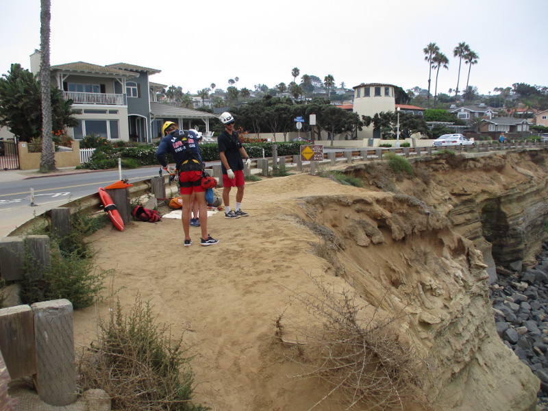
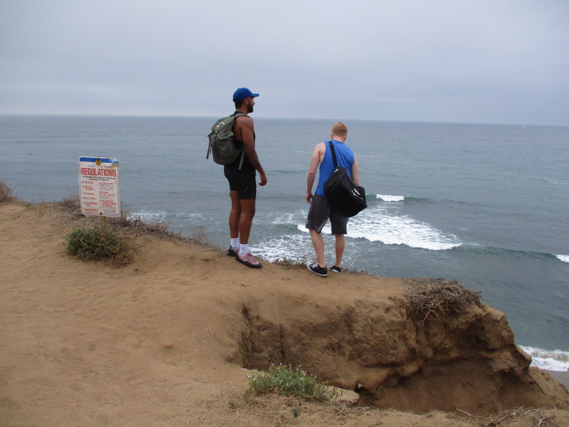
In places the cliffs have collapsed from the constant powerful action of tides and incoming waves. Many signs warn people away from the edge of the unstable cliffs.
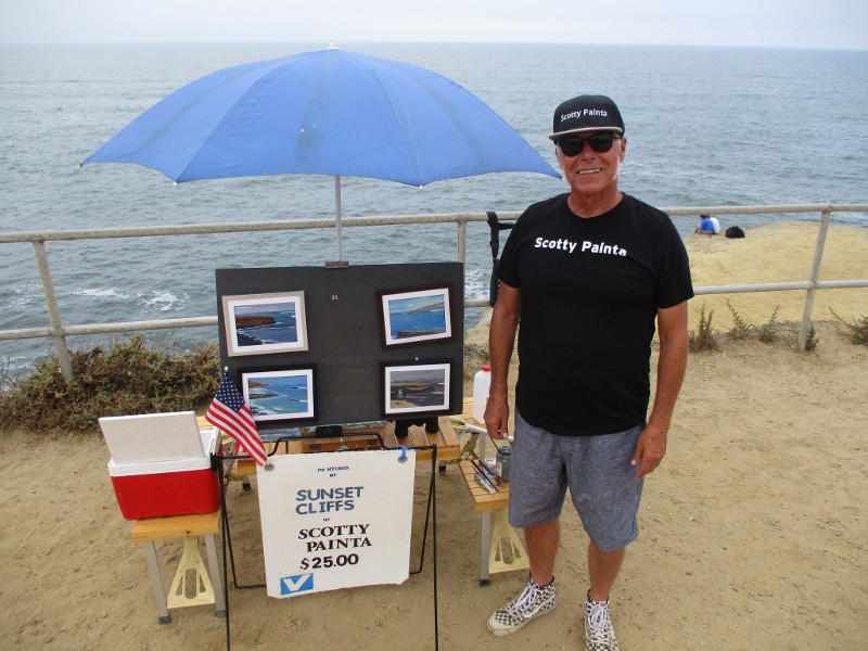
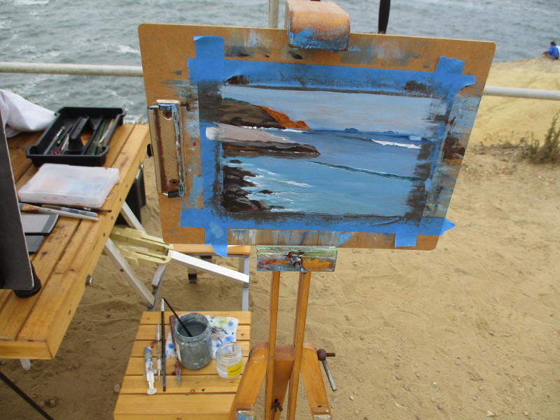
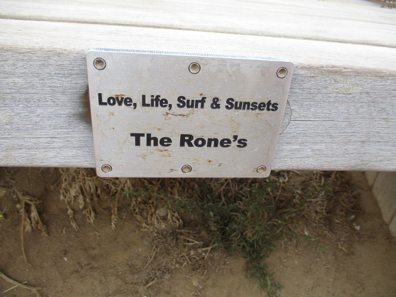
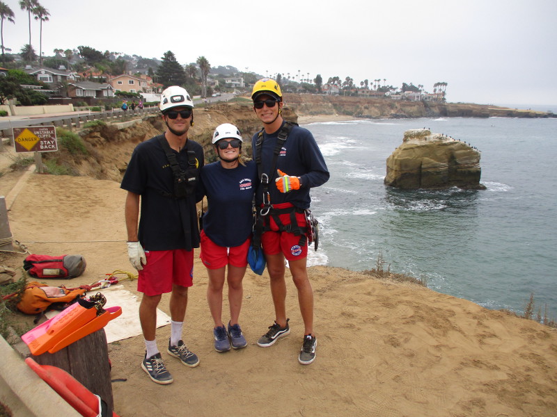
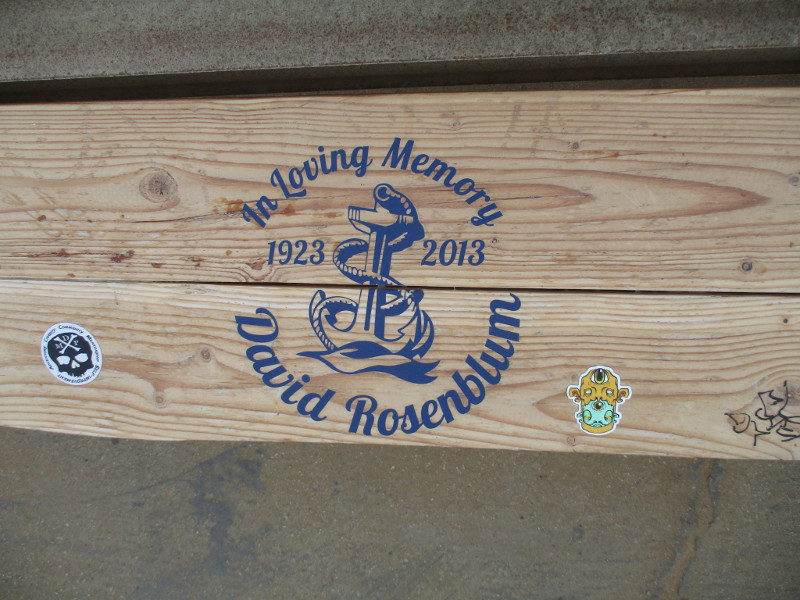
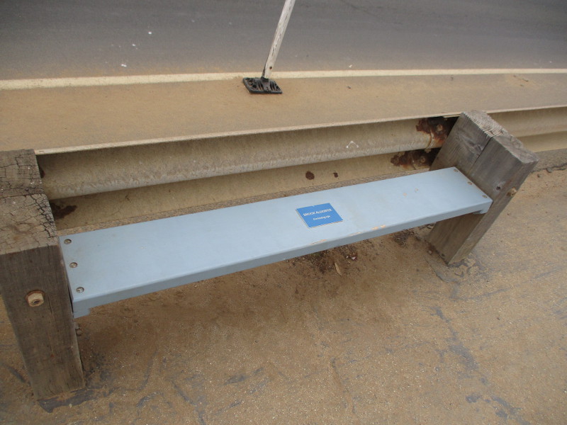
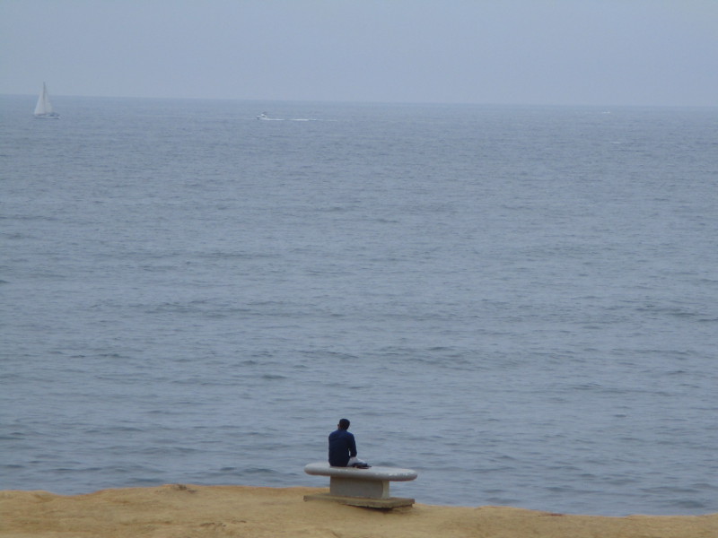
I met a painter. I met friendly lifeguards training for cliff rescues. I saw benches along the path dedicated to lost loved ones and sunsets. Many were standing and sitting at the ocean’s edge, peering at eternity with silent wonder.
As you can see from my photographs, nature’s hand creates beauty everywhere it moves.
If you like to stretch your legs and spirit, and you happen to be in San Diego, it’s likely you’ll love this walk, too.
Looking north for a moment. You can see the Ocean Beach pier in the distance.
As I walked along, I met Scotty Painta. He paints beautiful small scenes from Sunset Cliffs. We had a friendly chat and my day was enriched.
I met three lifeguards. They had slender ropes dangling down an almost vertical bluff. They were practicing cliff rescues. Jake told me a little about what they do. Thank you.
…
This blog now features thousands of photos around San Diego! Are you curious? There’s lots of cool stuff to check out!
Here’s the Cool San Diego Sights main page, where you can read the most current blog posts. If you’re using a phone or small mobile device, click those three parallel lines up at the top–that opens up my website’s sidebar, where you’ll see the most popular posts, a search box, and more!
To enjoy future posts, you can also “like” Cool San Diego Sights on Facebook or follow me on Twitter.