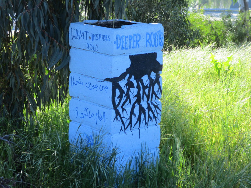
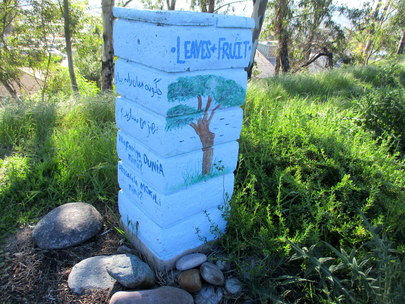
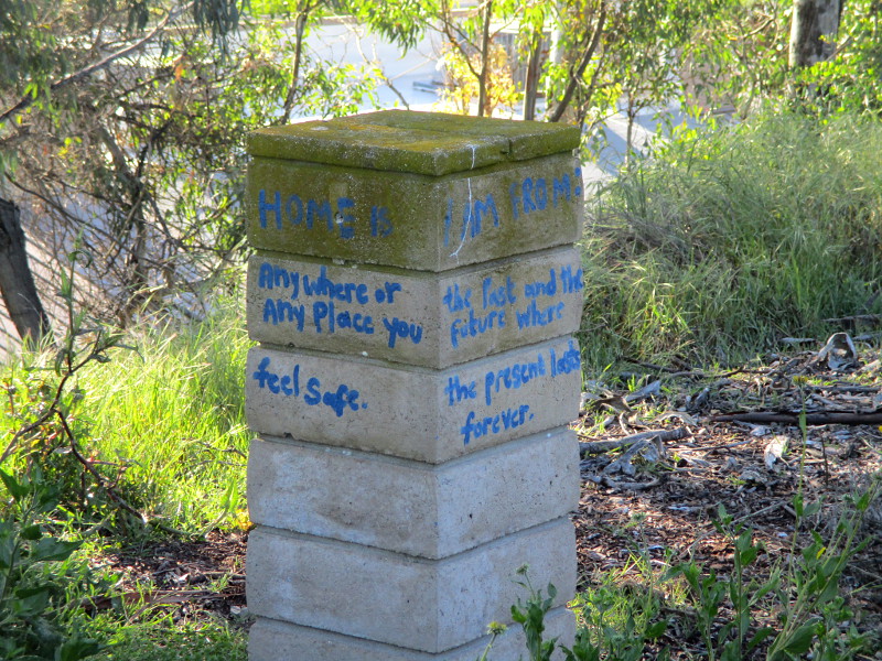
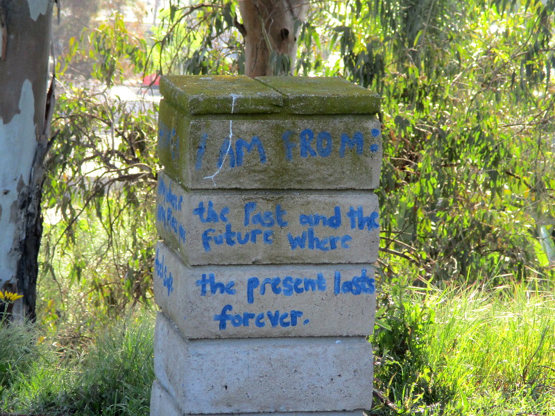
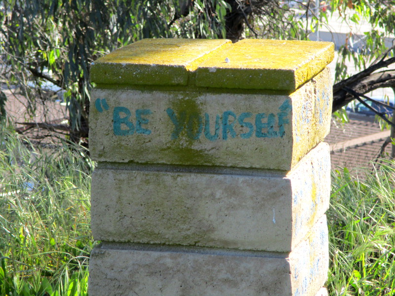
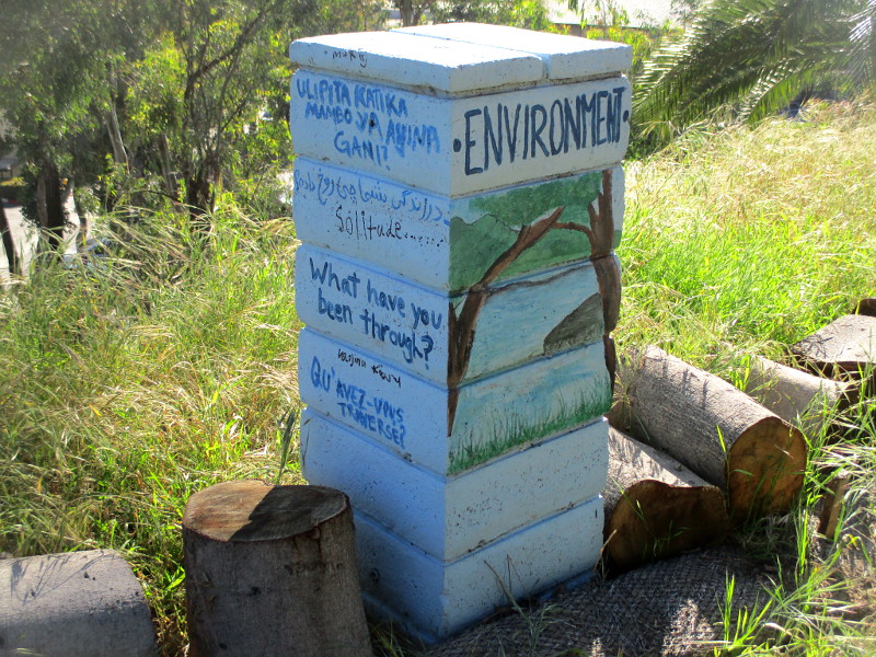
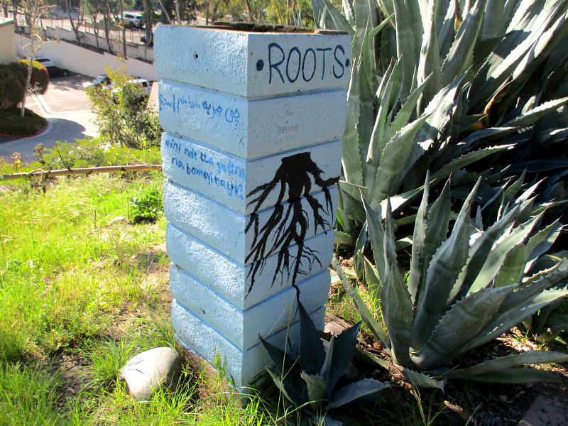
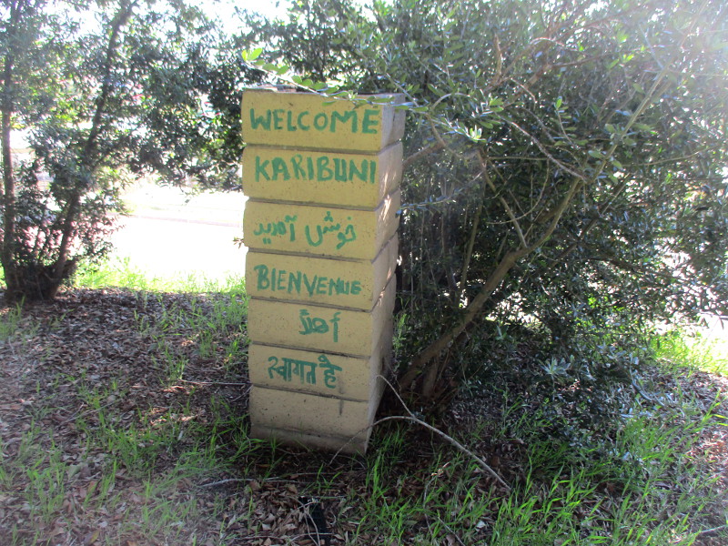
Should you walk through the park-like space just outside the New Roots Fresh Farm Community Garden in El Cajon, you might spy several instances of weathered art.
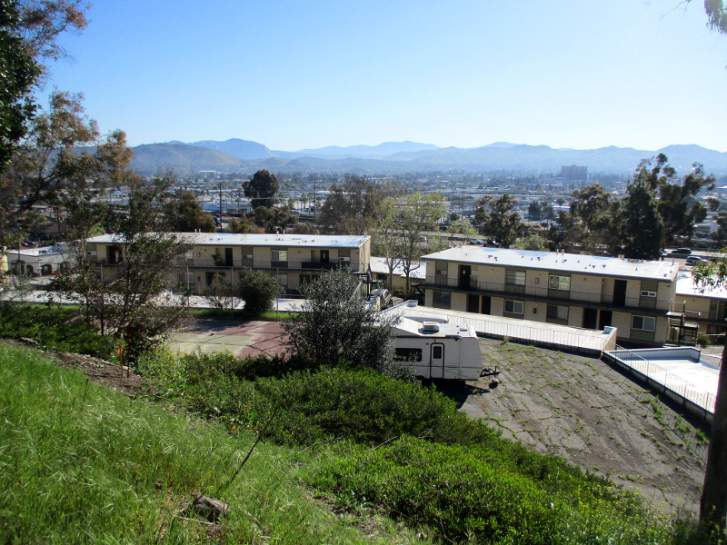
Post-like structures overlooking El Cajon and distant mountains in East County contain messages of welcome and belonging. Most of the nearby garden plots are tended by refugees. Many of these refugees are Iraqis who’ve fled persecution. By selling fresh vegetables at local farmers markets, a little extra income might be obtained.
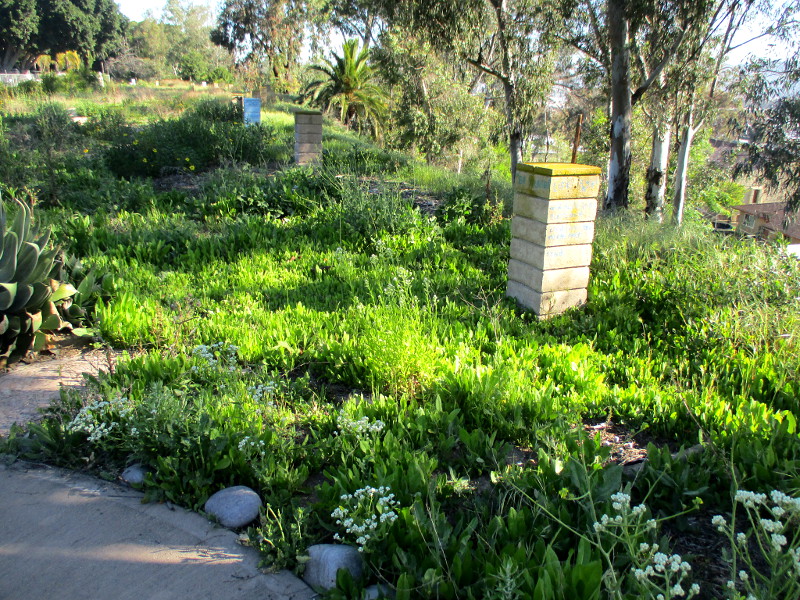
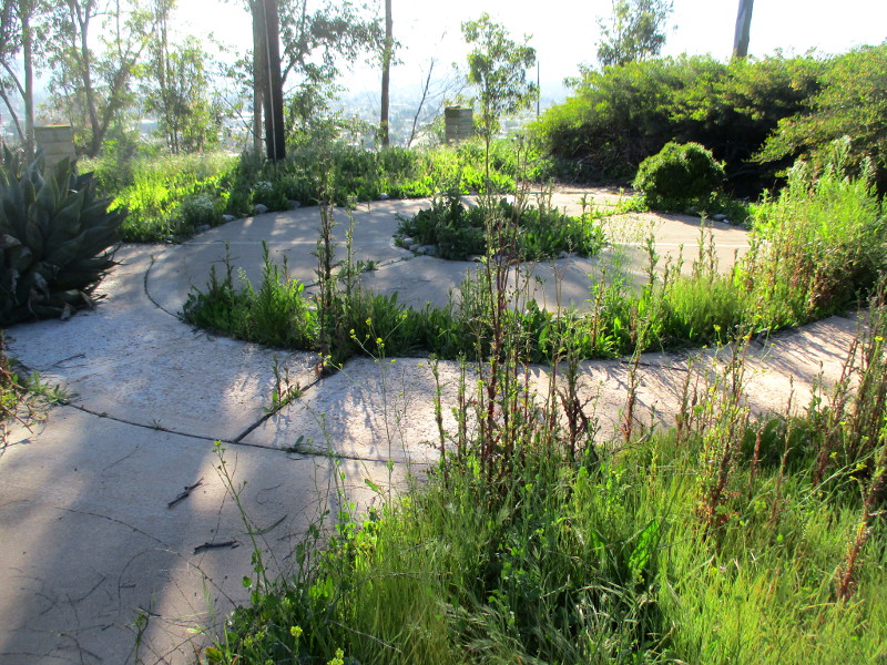
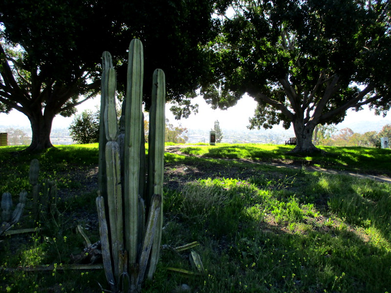
The park-like space where this art is painted was empty when I walked down its overgrown path a couple days ago. I saw places to sit. It would be a good place to find quiet and fresh air.
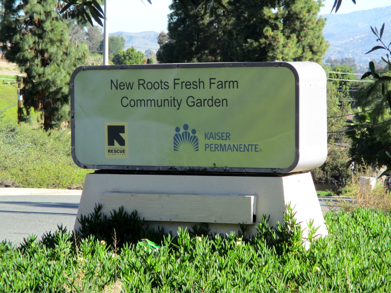
The land occupied by the New Roots Fresh Farm Community Garden was provided by Kaiser Permanente a little over ten years ago. The project was completed in partnership with El Cajon’s local International Rescue Committee.
Leaves and Fruit.Home is anywhere or any place you feel safe.I am from: the past and the future where the present lasts forever.Be yourself.Environment. What have you been through?Roots.Welcome.
…
Thanks for visiting Cool San Diego Sights!
I post new blogs pretty often. If you like discovering new things, bookmark coolsandiegosights.com and swing on by occasionally!
I live in downtown San Diego and love to walk around with my camera! You can follow Cool San Diego Sights via Facebook or X (formerly known as Twitter)!
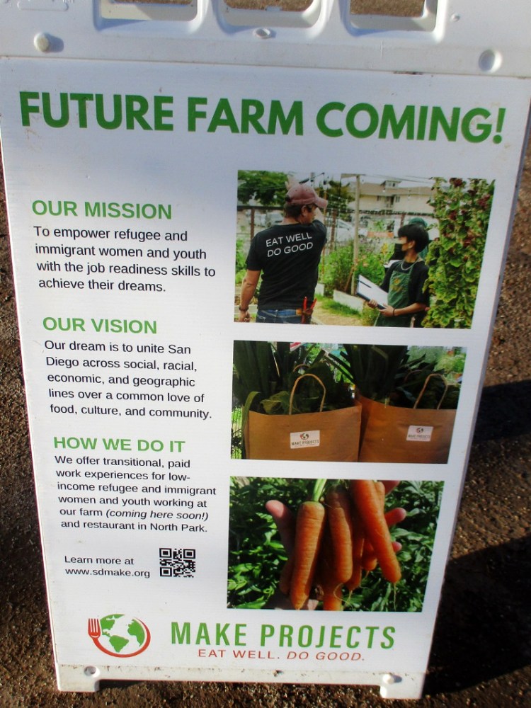
Believe it or not, a farm is being created at SDSU Mission Valley!
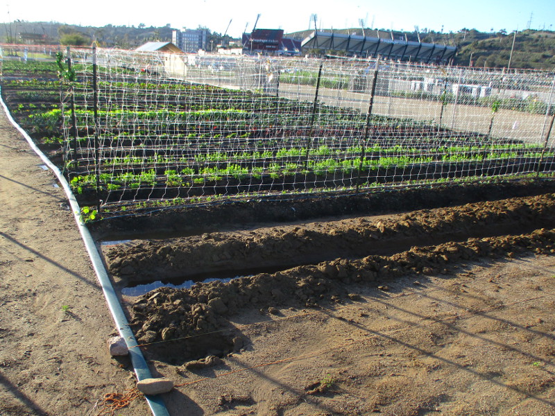
The future farm is located between the parking lot of Snapdragon Stadium and the SDSU Mission Valley river park. The above photo shows how produce is now growing a short distance east of the Stadium trolley station, where I made the unexpected discovery this afternoon.
Refugee and immigrant women and youth will be working the farm. They will gain work experience, and the produce they grow will be used at a restaurant in North Park, at 2920 University Avenue.
The undertaking is called Community Supported Agriculture. This farm is the creation of Make Project. As their website explains: The 30th Street farm has moved to a bigger, longer-term location at SDSU Mission Valley.
In 2017 I blogged about the previous farm in North Park here.
(It’s interesting to recall that before Mission Valley was developed–before shopping malls and freeways–this land along the San Diego River supported many farms–primarily dairy farms.)
A huge flock of crows was hovering around the new SDSU Mission Valley farm late this afternoon. Hopefully the coming crops are safe!
…
Thanks for visiting Cool San Diego Sights!
I post new blogs pretty often. If you like discovering new things, bookmark coolsandiegosights.com and swing on by occasionally!
I live in downtown San Diego and love to walk around with my camera! You can follow Cool San Diego Sights via Facebook or X (formerly known as Twitter)!
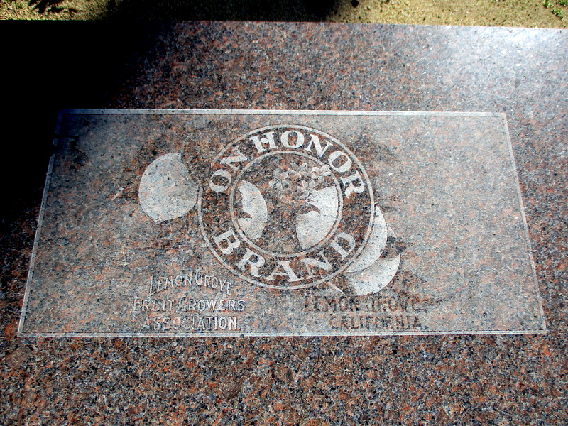
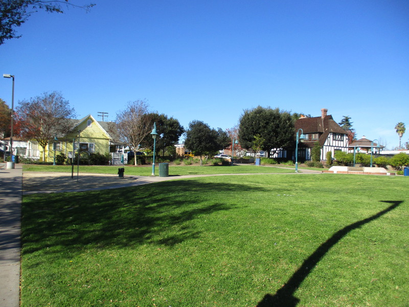
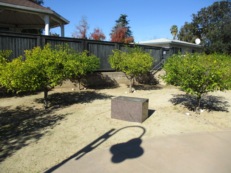
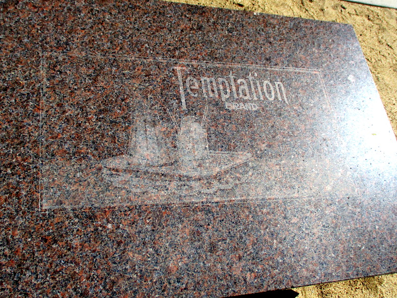
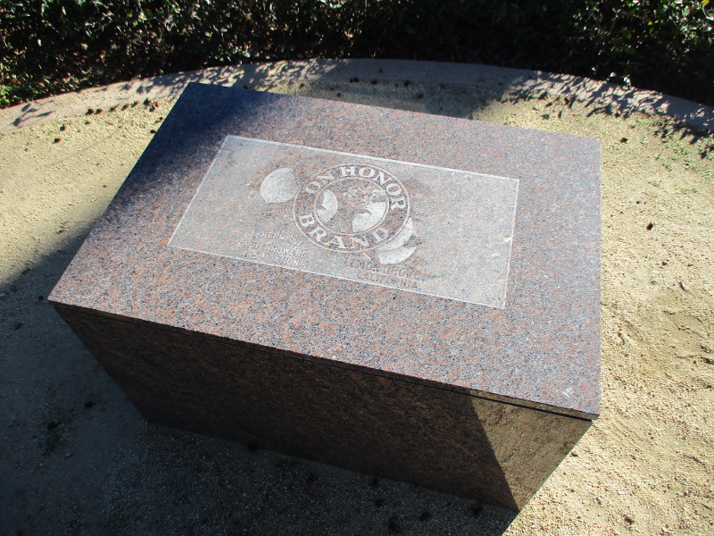
Take a look at this mysterious public art. You can find it by wandering around Treganza Heritage Park in Lemon Grove.
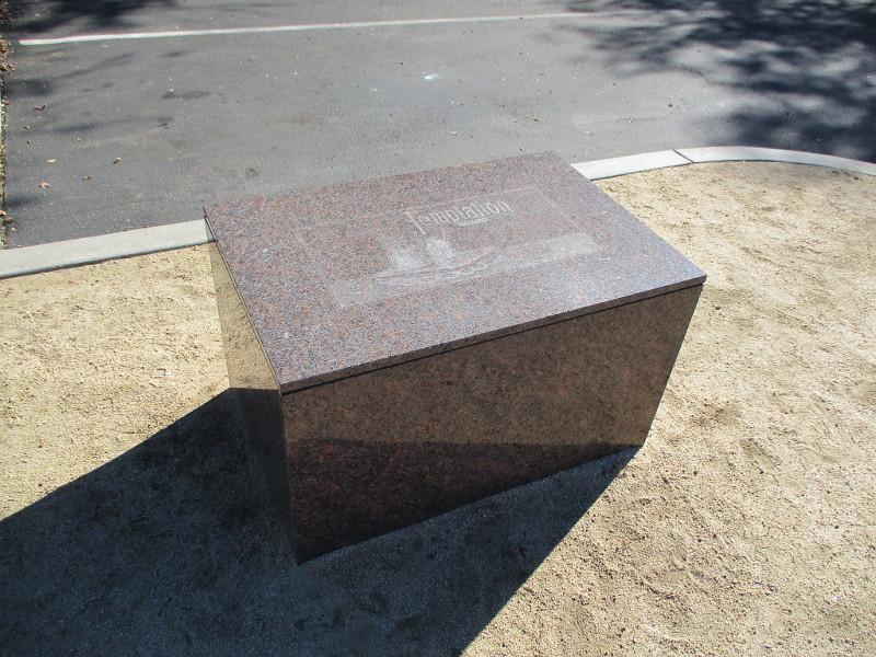
Three simple structures (that I found) seem to have been constructed for seating. Each resembles a fruit packing crate made of marble, and each features a unique lemon growers brand label. Two brands that are recognizable are On Honor Brand and Temptation Brand.
Somebody out there must know the history of these very unique seats! If you do, please leave a comment.
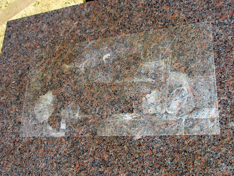
The three different label images are faded, and, as you can see, one is now unreadable. I’ve added a lot of contrast to my photographs to bring out as much detail as possible.
This beautiful park was established in 2003 as Civic Center Park. It was renamed Treganza Heritage Park in 2020.
…
Thanks for visiting Cool San Diego Sights!
I post new blogs pretty often. If you like discovering new things, bookmark coolsandiegosights.com and swing on by occasionally!
I live in downtown San Diego and love to walk around with my camera! You can follow Cool San Diego Sights via Facebook or X (formerly known as Twitter)!
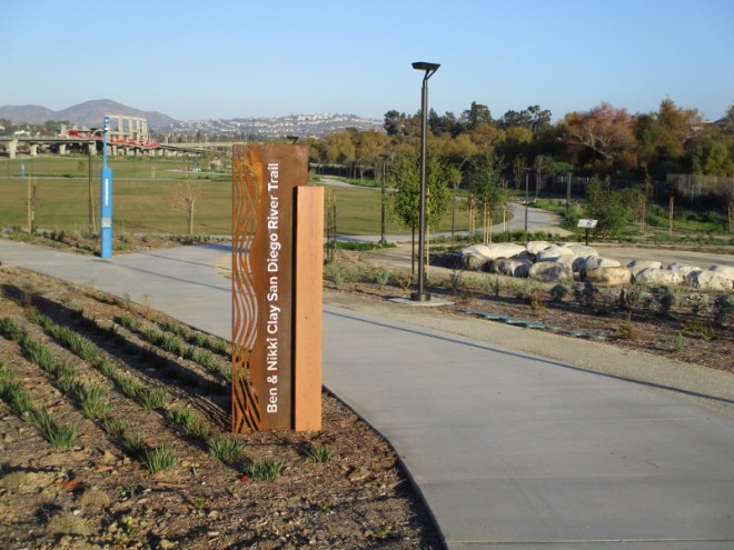
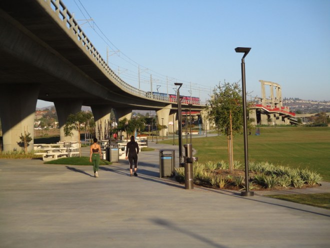
History is being made in Mission Valley. Two massive projects are being developed along the San Diego River: SDSU Mission Valley and Riverwalk San Diego.
The river park at SDSU Mission Valley is mostly complete, and large areas are now accessible to the public during its soft opening.
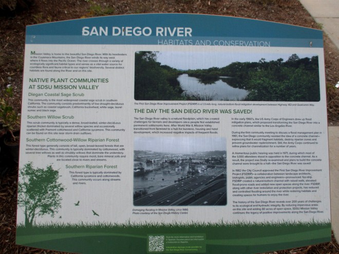
I walked around the river park the other day and found a number of fascinating information signs. One shows birds that might be found along the San Diego River. Another concerns stormwater management and the creation of bioretention basins. The largest such basin is located near the Stadium trolley station.
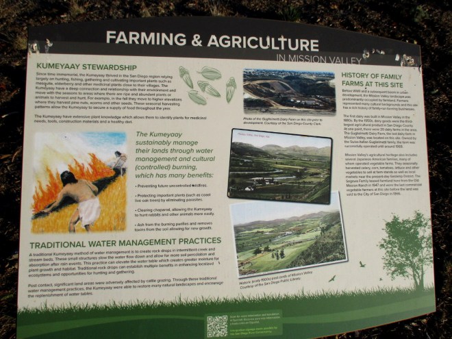
The signs that interested me most concern the history of Mission Valley and the San Diego River.
I took photos of several signs, which you can enlarge for easier reading…
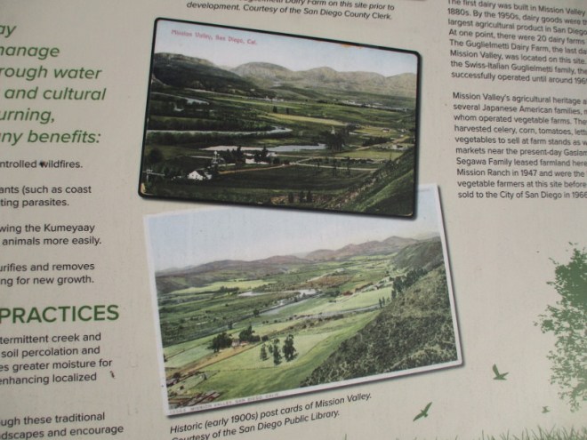
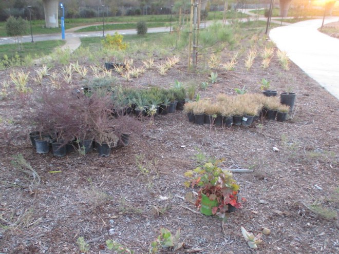
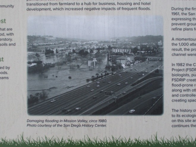
The Native American Kumeyaay historically used plants along the river for food, tools and construction materials. They sustainably managed the land. Before World War II and the subsequent boom in urban development, Mission Valley was largely farmland. At one point there were 20 dairy farms in Mission Valley. Several Japanese American families operated vegetable farms.Early 1900s postcards of Mission Valley show large areas of green farmland on either side of the San Diego River.New plants for the new river park at SDSU Mission Valley.The San Diego River begins in the Cuyamaca Mountains and flows west to the Pacific Ocean. It is the source of important biodiversity. In 1971, plans to replace the sometimes flooding river with a concrete channel were thwarted by intense public opposition. The vision of a more natural San Diego River, with innovative safeguards against flooding, would eventually prevail.Photo of damaging flooding in Mission Valley circa 1980, before the adoption in 1982 of FSDRIP–the First San Diego River Improvement Project.The Kumeyaay were the first people to live in this region. This sign explains they understood the importance of caring for the land, water, flora and fauna that are all a part of this intricate ecological system that relates and sustains all life in balance and harmony. A map of Kumeyaay territory includes San Diego County and the northern portion of Baja California.A field without farms–playing soccer near Snapdragon Stadium at SDSU Mission Valley.
…
Thanks for visiting Cool San Diego Sights!
I post new blogs pretty often. If you like discovering new things, bookmark coolsandiegosights.com and swing on by occasionally!
I live in downtown San Diego and love to walk around with my camera! You can follow Cool San Diego Sights via Facebook or X (formerly known as Twitter)!
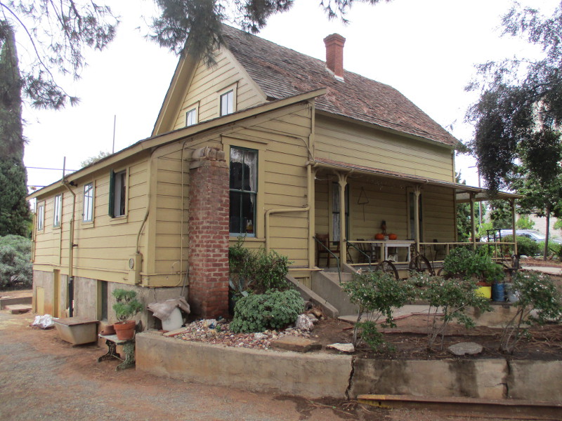
I published a blog post in early 2021 that included photographs from the street of the farm’s exterior. I detailed the history of the Stein family. Their farm dates from the early 1900s. You can read what I wrote by clicking here.
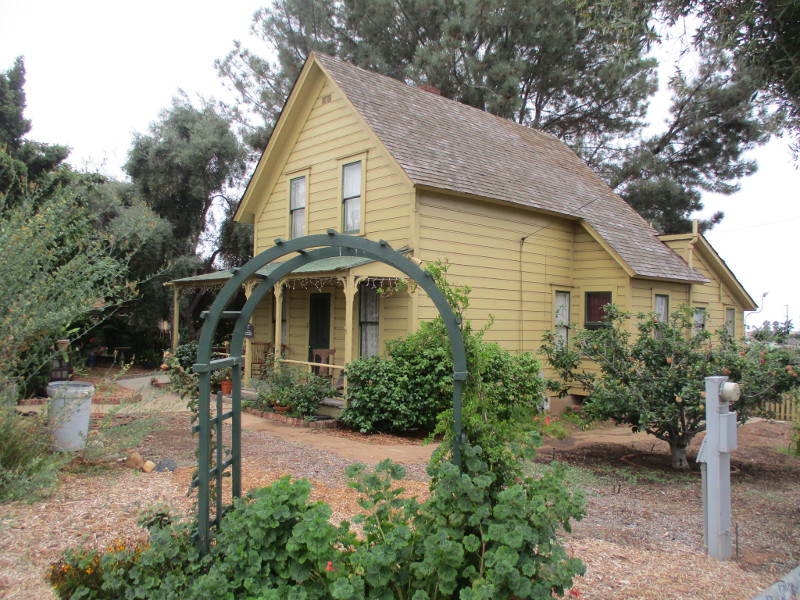
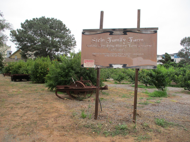
The farm is presently owned by the Community Development Commission of the City of National City and operated by the National City Living History Farm Preserve. Visitors to the old farm can see what rural National City was like many years ago.
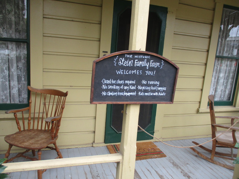
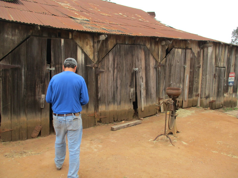
Last Saturday I stepped through the front gate of the Stein Family Farm and received an amazing tour by historian and caretaker Christopher Pro.
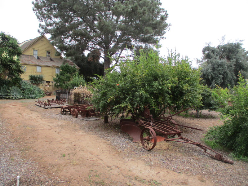
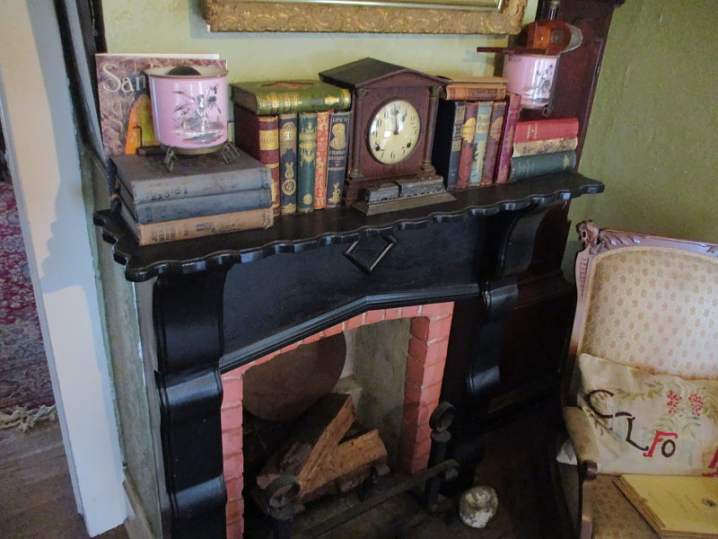
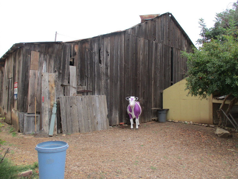
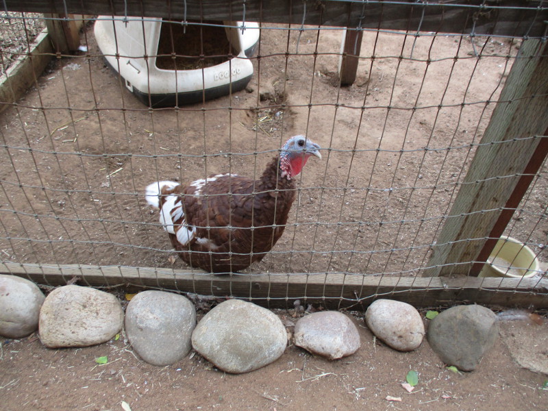
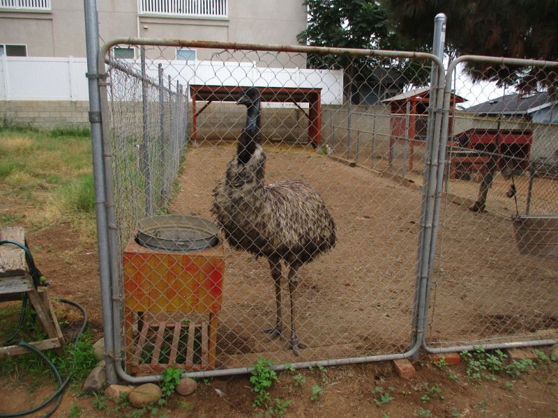
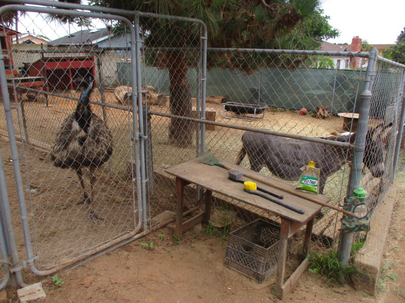
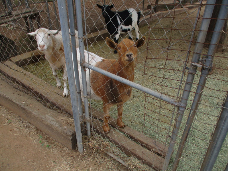
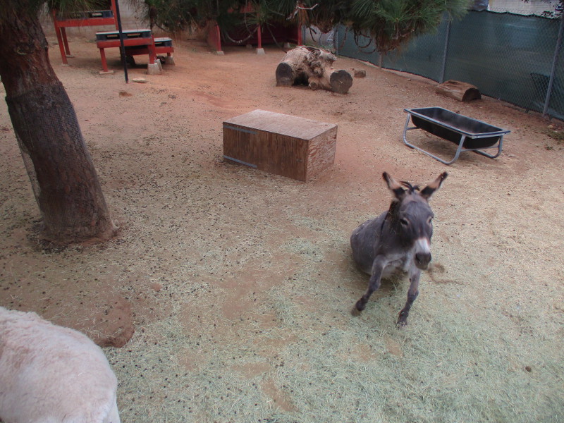
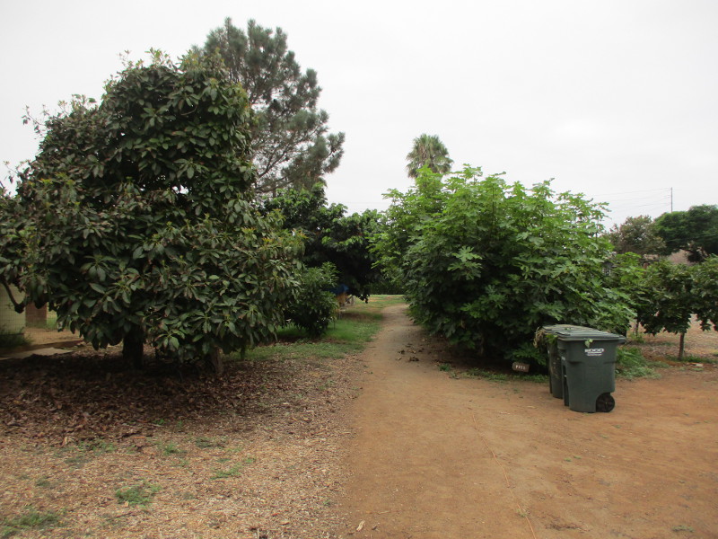
We walked through the farmhouse and I learned about its antique furnishings. We peered into the old barn at a horse-driven carriage. We walked through the property and met a surprising variety of domesticated animals that seemed pleased to meet visitors, then we took a look at the farm’s orchard where many different fruit trees provide a living classroom for student arborists.
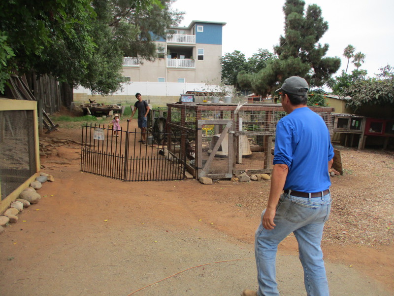
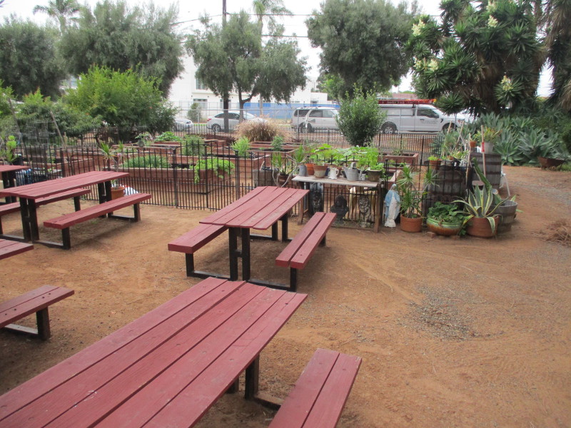
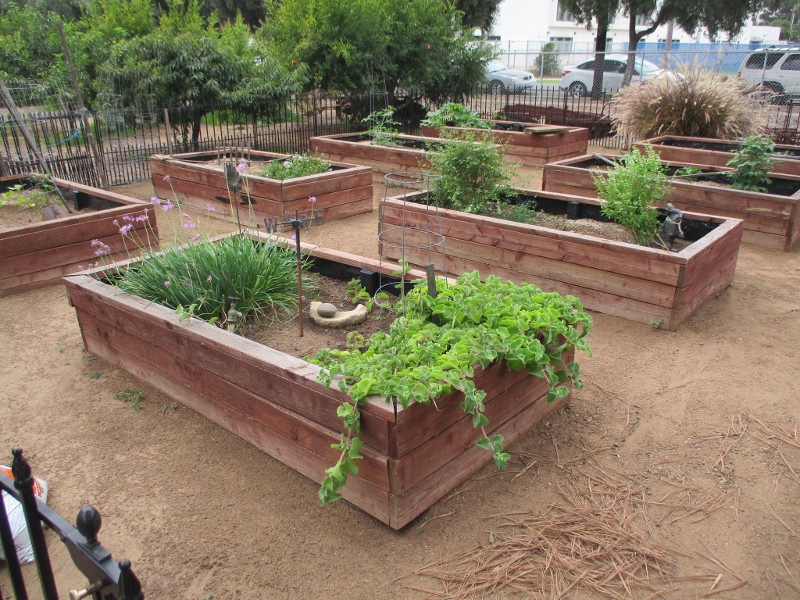
I saw parents with young kids rambling around the grounds, enjoying the animals and an inviting butterfly garden. One family soaked in the Southern California sunshine while sitting at the picnic benches near a big vegetable garden.
A visit to the Stein Family Farm is free, although donations are welcome. The farm is located at 1808 F Avenue in National City. It’s open every Saturday, from 10 am to 2 pm.
Do you love animals and/or gardening? They welcome new volunteers!
I should have written down notes during my amazing tour. I’ve tried to remember a few tidbits of interesting information, so read my photo captions. I welcome comments, as usual!
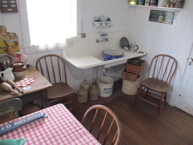
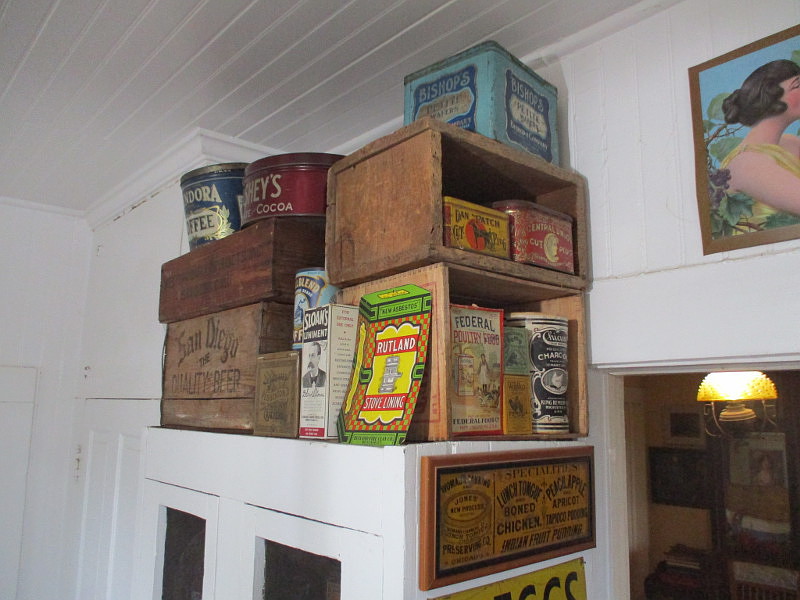
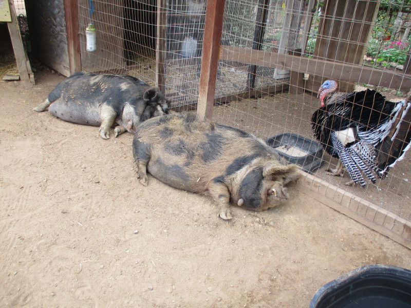
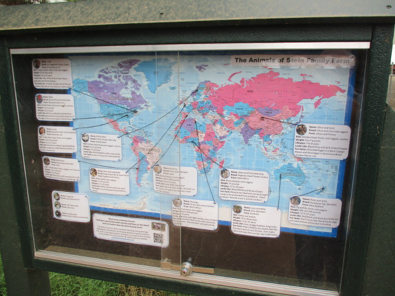
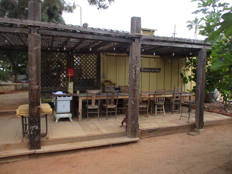
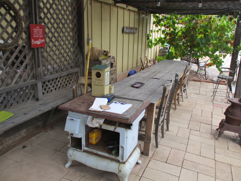
Look for this sign!Some old farm machinery parked near the orchard.The front of the Stein farmhouse.The front porch.Inside the farmhouse. Portraits of Charles and Bertha Stein on their wedding day.School kids visiting the Stein Family Farm on field trips can see what life was like a century ago.I learned this was Charles Stein’s saddle. Some of the antique furnishings aren’t originally from the farmhouse.Looking back from the dining room, which was a bit too dark for taking sharp photos with my old camera.In the early 1900s, fancy teacups probably arrived from the east by train.A look at the Stein farmhouse kitchen. That green thing is a breadbox.I turn my camera to the right.I learned some of these tins and boxes represent local businesses from the past.The farmhouse’s original stove. On top I see an iron, washboard and sausage maker.Porch on the south side of the farmhouse appears very inviting!We walk a short distance to the old barn.The hand-cranked device on the left is for sheep shearing. On the right is an antique device for separating cream.An old carriage inside the barn.That strange cow near the barn once stood at the Purple Cow Dairy Store.Heading toward the many farm animals!A turkey wonders who I am.We pass a beautiful little butterfly garden. School kids like it, too.Butterfly knowledge on a sign.Yes, it’s an emu!Two pigs digesting their breakfast.Hello!All the animals are very friendly.This chart shows the animals of the Stein Family Farm. Each has been given a name. A Polish Chicken with a crazy hairdo is named Phyllis Diller! The different animal breeds have origins around the world.Gazing west toward the lush orchard. Many different fruit trees were mentioned.A fun stage or photo backdrop. Weddings are sometimes held here.Lots of inviting picnic tables.A well-tended vegetable garden.Looking back toward the old farmhouse. That big tree on the right is a Torrey pine.A great place for meetings. Scouts and local clubs often gather here.An Eagle Scout project resulted in this long, rustic table.Tour’s almost over.
…
Thanks for visiting Cool San Diego Sights!
I post new blogs pretty often. If you like discovering new things, bookmark coolsandiegosights.com and swing on by occasionally!
I live in downtown San Diego and love to walk around with my camera! You can follow Cool San Diego Sights via Facebook or X (formerly known as Twitter)!
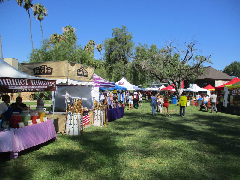
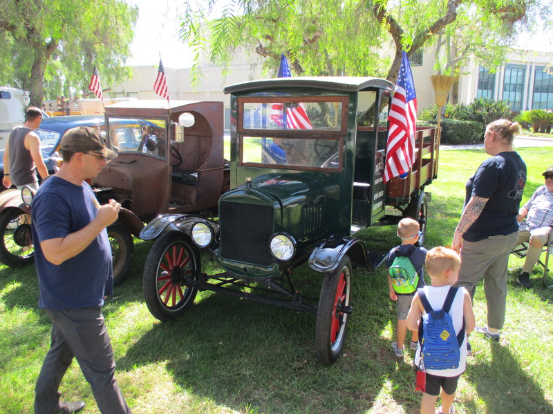
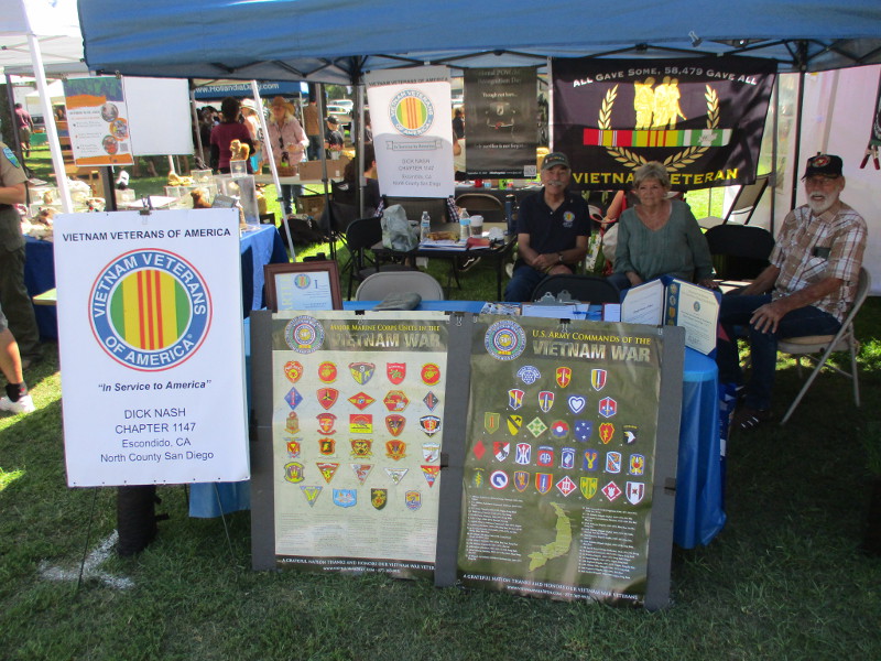
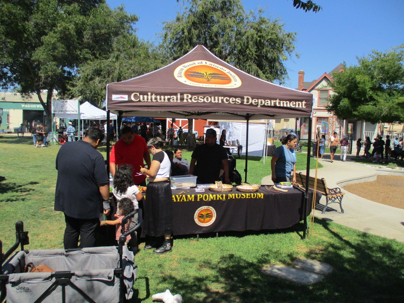
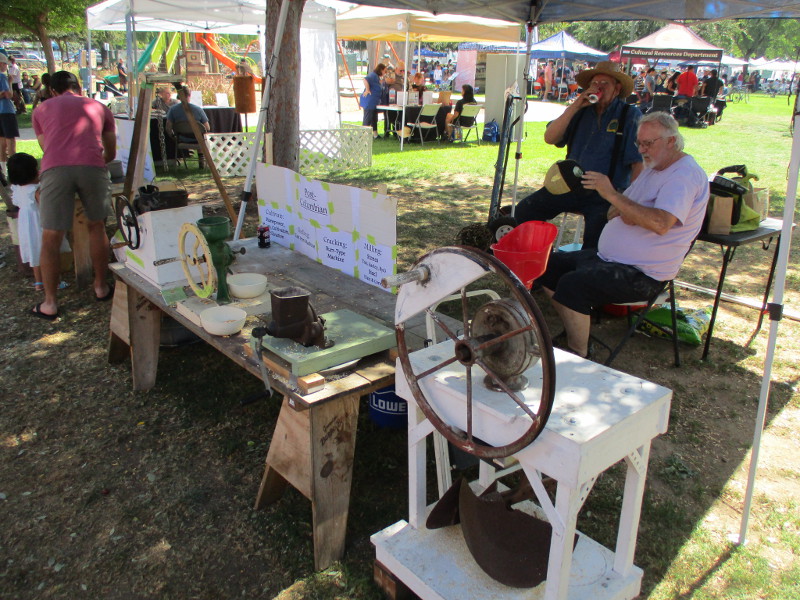
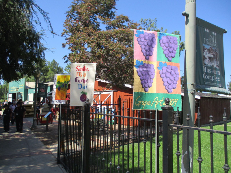
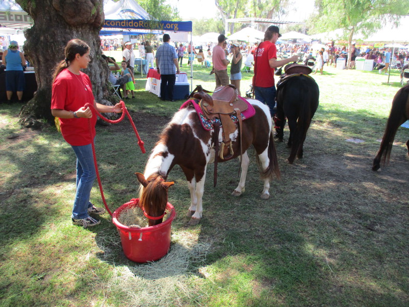
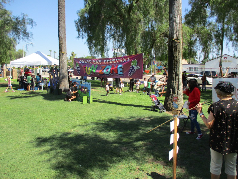
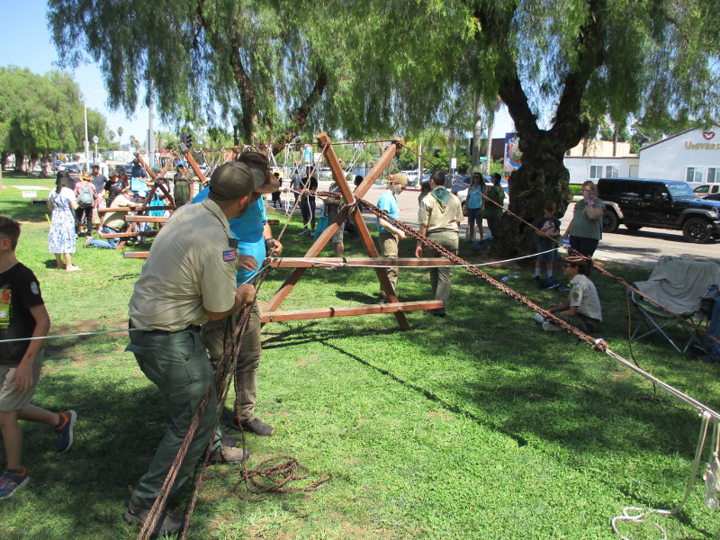
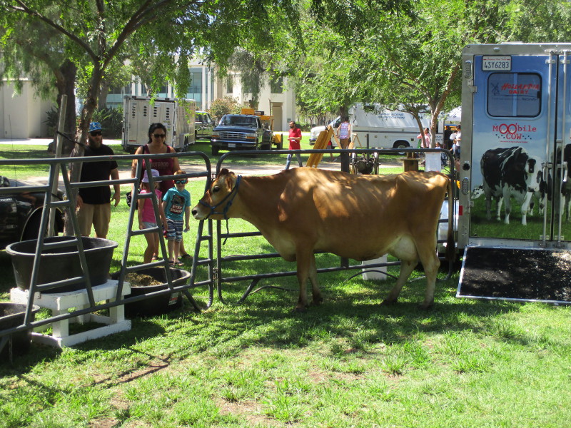
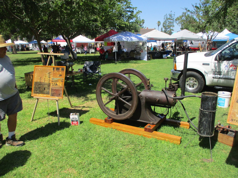
Enjoy this fun collection of photographs taken during yesterday’s big Grape Day Festival in Escondido!
The family-friendly event, which is held in downtown’s grassy Grape Day Park, celebrates Escondido history and this North County city’s reputation for grape growing. The festival originated way back in 1908 and for the first half of the 20th century it rivaled Pasadena’s Festival of Roses in popularity.
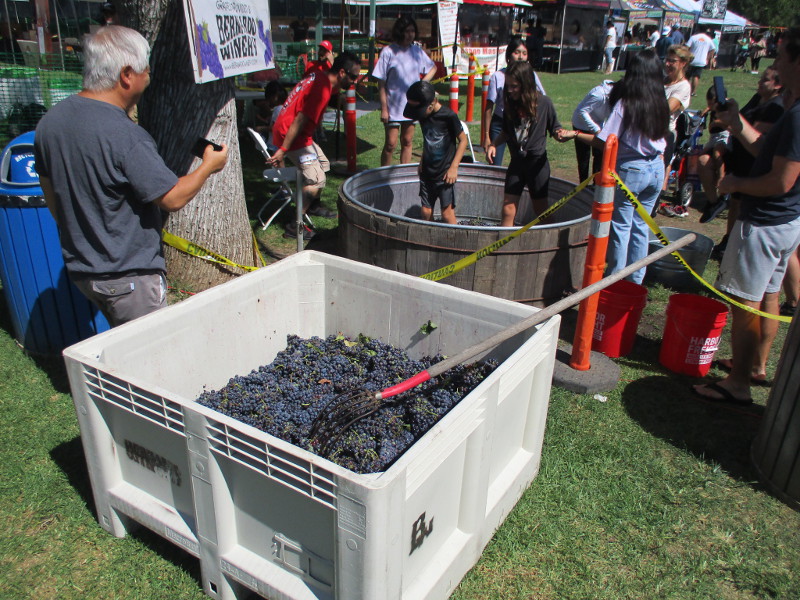
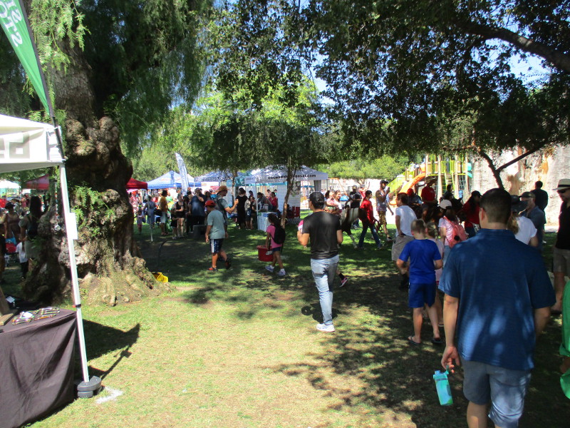
Following the COVID pandemic of a few years ago, the Grape Day Festival is now back in full swing, with a large crowd enjoying grape stomping, historical displays and lots of old-fashioned entertainment!
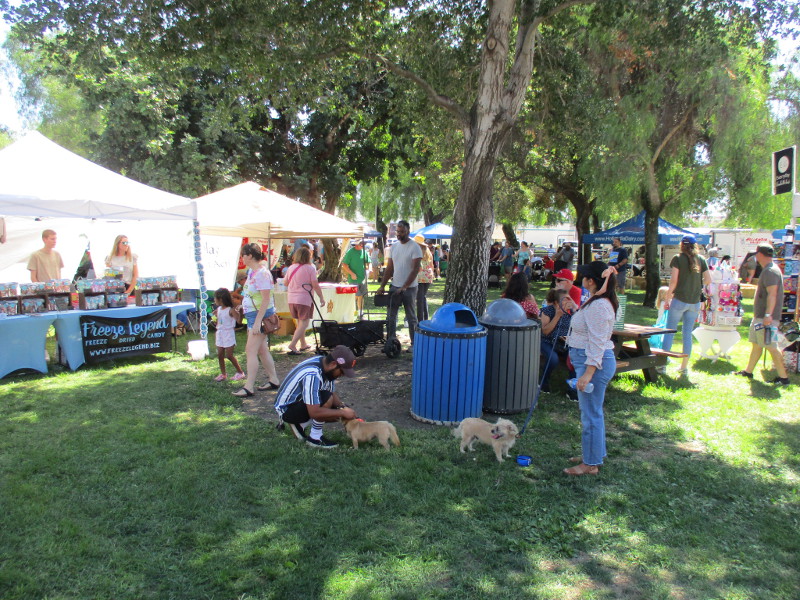
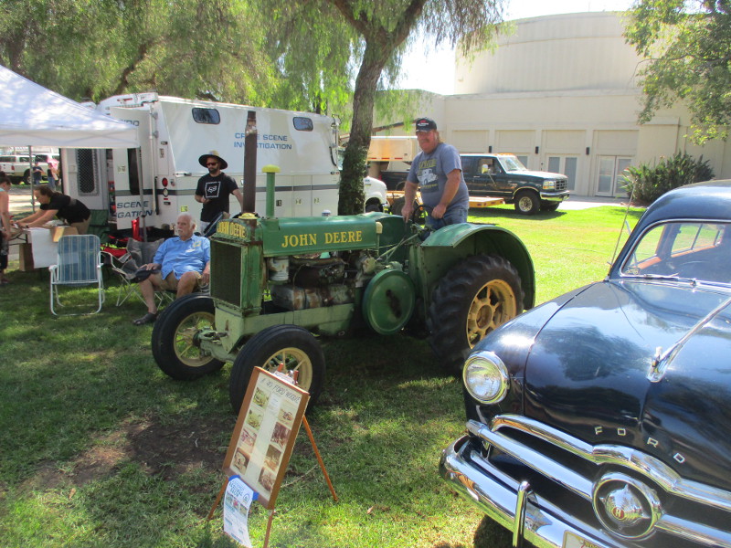
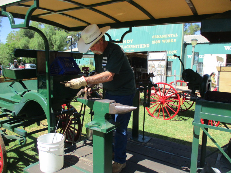
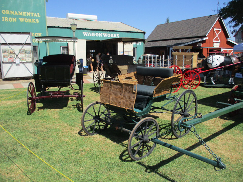
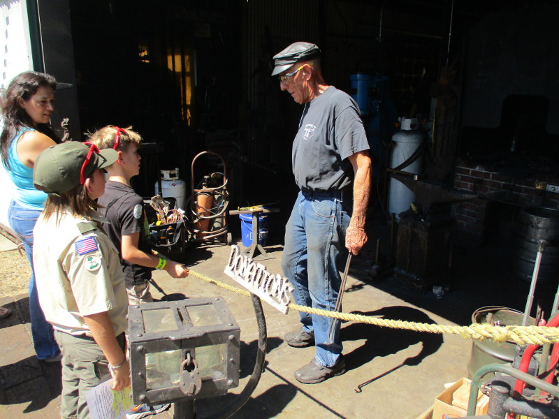
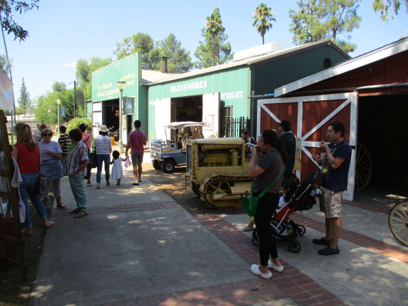
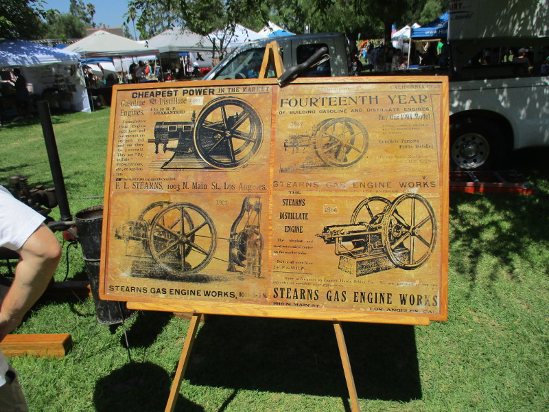
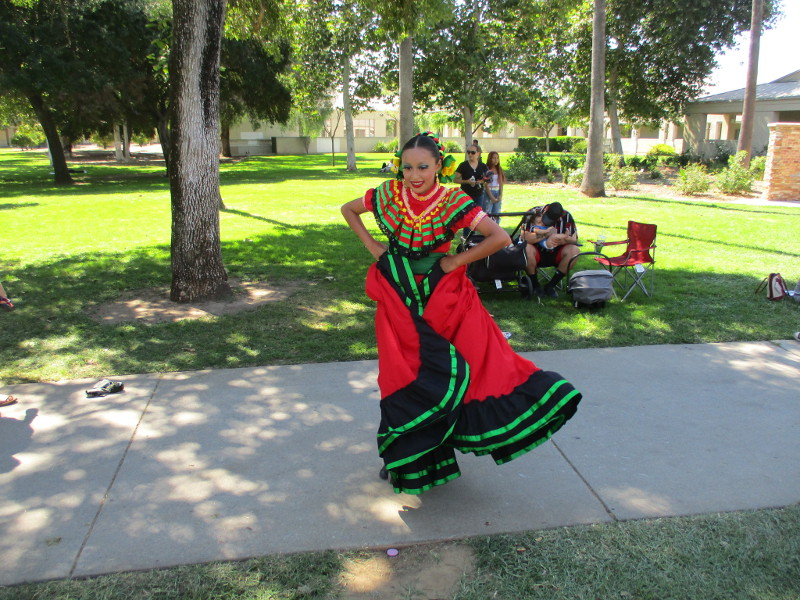
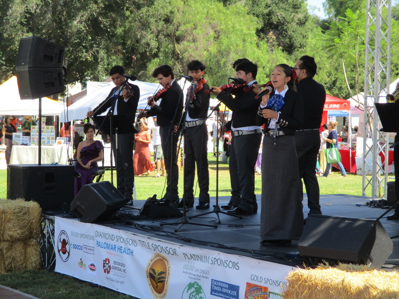
I wandered about taking it all in. One could listen to jazz, bluegrass and mariachi music, explore exhibits along the park’s History Center, check out old vehicles and farm machinery, observe a milking demonstration, and meet lots of cool people who are involved throughout the community! Plenty of tasty food and games for kids and pony rides, too!
If you love nostalgia and a generous slice of Americana, this festival is for you!
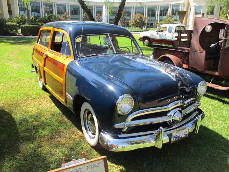
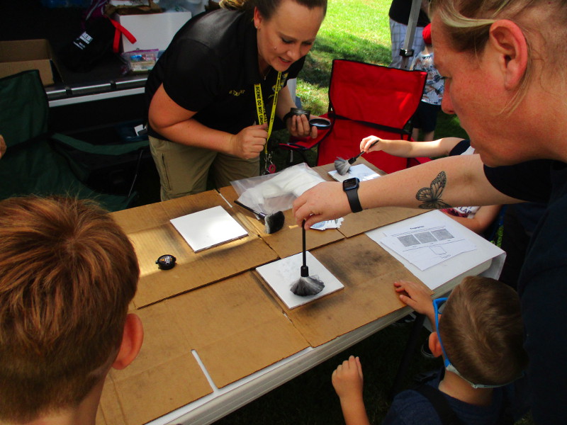
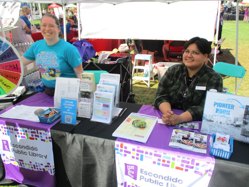
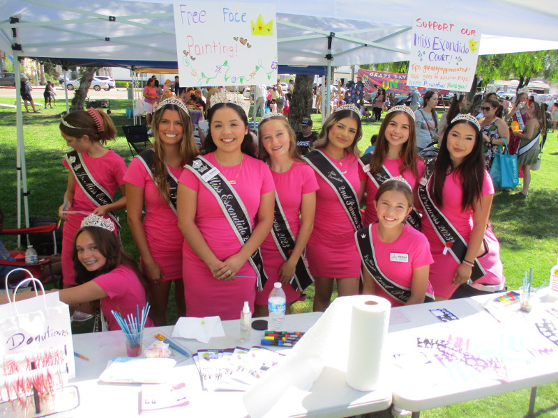
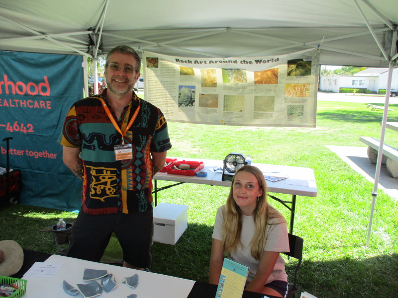
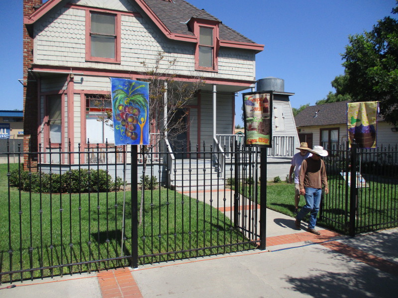
Anybody could stomp some grapes provided by the Bernardo Winery.Yummy food by the Wine and Beer Tasting Garden!I learned there is an Old Escondido Historic District. It is the only residential Historic District in North San Diego County. Visit their website here.Several antique vehicles on display.A very cool 1949 Ford woodie.Kids learn how to dust for fingerprints behind a Crime Scene Investigation vehicle.Smiles at the Vietnam Veterans of America booth.Kids learn about native snakes at the San Dieguito River Park booth.The Escondido Public Library features a Pioneer Room, where anyone can search a local history archive for old documents, photographs and more. Go to their website here.Brightly smiling Escondido royalty pose for a photo.The San Diego Archaeological Center was on hand for the festival. I still haven’t visited their museum in nearby San Pasqual Valley. Check out their website here.The Wa$xayam Pomki Museum of the Rincon Band of Luiseño Indians had cultural displays at their booth. They are one of the Grape Day Festival sponsors. Their website is here.Lots of demonstrations could be viewed along the Escondido History Center’s Heritage Walk.A family learning about blacksmithing at the Tom Bandy Blacksmith Shop.Pre-Columbian methods for preparing corn.Antique machines used to grind corn.I placed a dried corn cob in here and turned the crank!Grape Day banners on the fence in front of the History Center’s Victorian House.Hollandia dairy, based in San Diego’s North County, brought two cows and a goat for milking demonstrations.Beautiful color at a wonderful community festival.
…
Thanks for visiting Cool San Diego Sights!
I post new blogs pretty often. If you like discovering new things, bookmark coolsandiegosights.com and swing on by occasionally!
I live in downtown San Diego and love to walk around with my camera! You can follow Cool San Diego Sights via Facebook or X (formerly known as Twitter)!
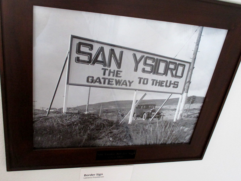
Border Sign, circa 1920. San Ysidro The Gateway to the U.S.
Those interested in the history of San Diego should visit the San Ysidro Library. Inside the library’s community room, fascinating historical photographs of San Ysidro (one of San Diego’s southernmost districts) can be viewed.
I visited the library yesterday. I wanted to check out the old photos and visualize how San Ysidro appeared long ago.
I learned how this border community began as the Little Landers colony, a family farming cooperative created by agricultural reformer, journalist and writer William E. Smythe in 1908. The motto of Little Landers was “A little land and a living surely is better than desperate struggle and wealth possibly.” It was one of the nation’s first communes. The colony was named San Ysidro, probably after the patron saint of farmers, Isidore the Laborer, and was formally inaugurated on January 11, 1909.
I was also surprised to learn San Ysidro had a Pony Express station!
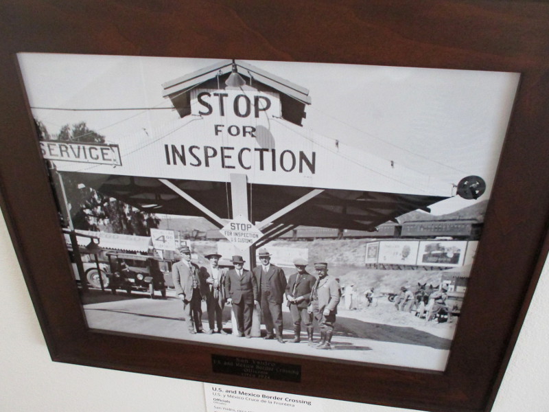
Here are just a few of the photographs you will see should you visit the library…
Little Landers Colony School, circa 1907. The schoolhouse was located on East San Ysidro Boulevard (old Tia Juana Boulevard) where I-805 is today.Little Landers Colony Sign by San Ysidro Post Office, circa 1913.U.S. and Mexico Border Crossing officials, circa 1924. Looking north from Tijuana toward San Ysidro. The train in the background is on the San Diego Arizona Eastern Railway built by John D. Spreckels.Pony Express Station, circa 1916. Refugees from the Great Flood of 1916, worst natural disaster in the history of the South Bay.San Ysidro Library, circa 1930. The original 1924 library–first Branch Library owned by the County of San Diego. It was the only library in the country with a smoking room for men!
I took outside photos of the old 1924 library several years ago. See them here!
…
Thanks for visiting Cool San Diego Sights!
I post new blogs pretty often. If you like discovering new things, bookmark coolsandiegosights.com and swing on by occasionally!
I live in downtown San Diego and love to walk around with my camera! You can follow Cool San Diego Sights via Facebook or Twitter!
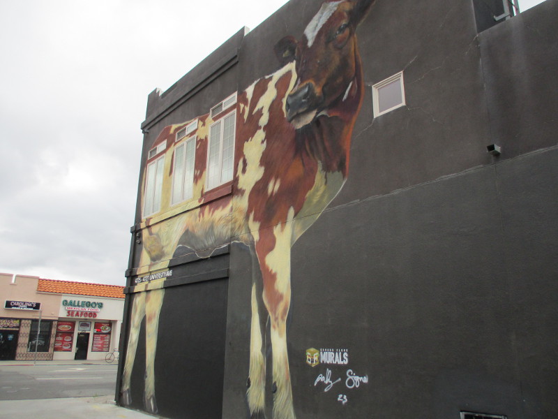
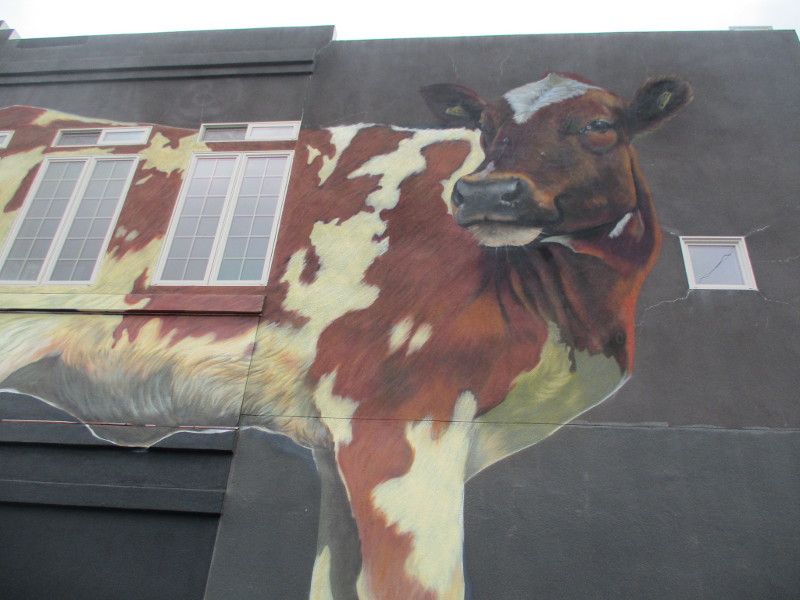
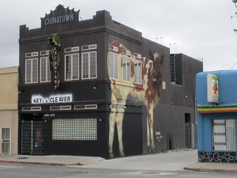
A gigantic cow wandered into City Heights a couple weeks ago. Drivers heading down University Avenue, a block west of the Euclid Tower, might spot the enormous bovine standing against the old Chinatown Bar building!
The cow mural was painted by Ground Floor Murals (@groundfloormurals). You can see the artists creating this eye-catching artwork on their Instagram page here.
The building is now home to Key and Cleaver, a sustainable farm-to-table burger restaurant. I can see why that gigantic cow is cautiously watching its back!
…
Thanks for visiting Cool San Diego Sights!
I post new blogs pretty often. If you like discovering new things, bookmark coolsandiegosights.com and swing on by occasionally!
I live in downtown San Diego and love to walk around with my camera! You can follow Cool San Diego Sights via Facebook or Twitter!
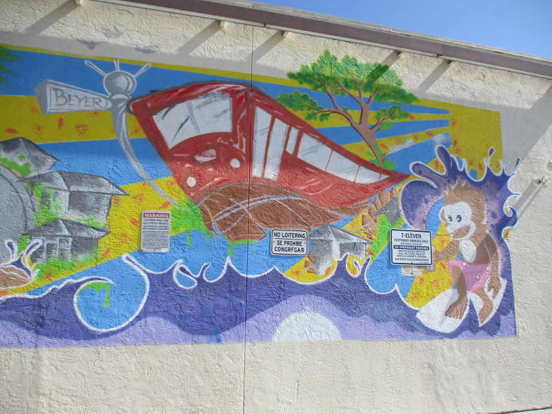
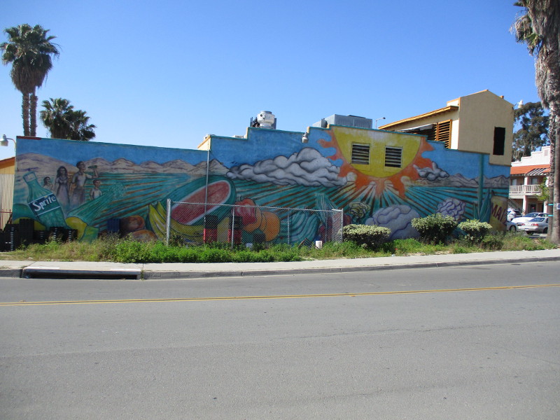
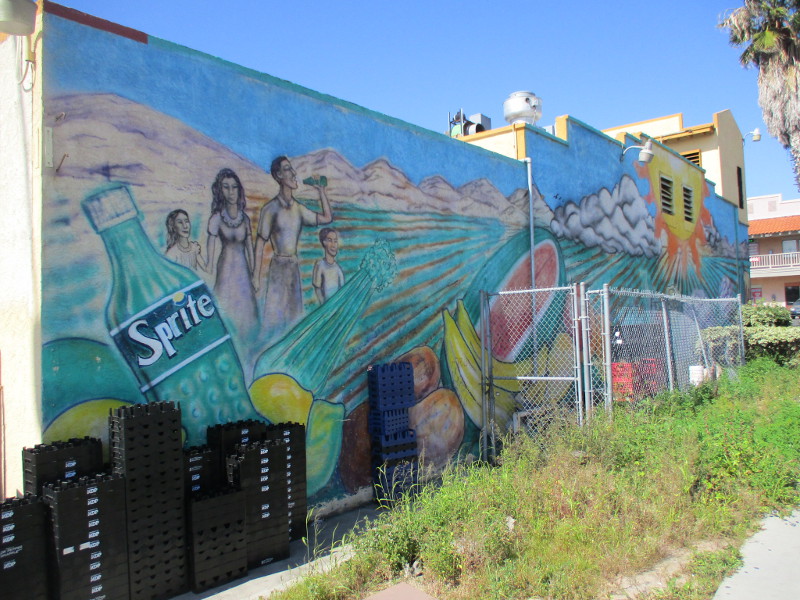
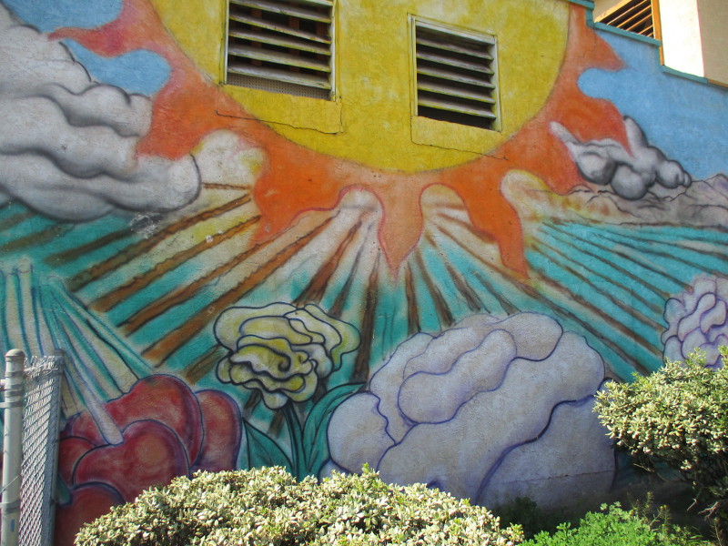
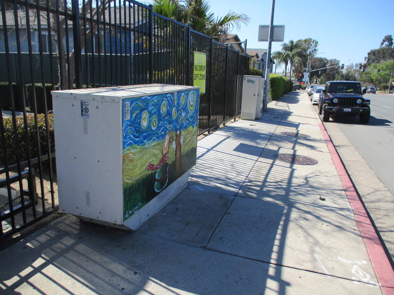
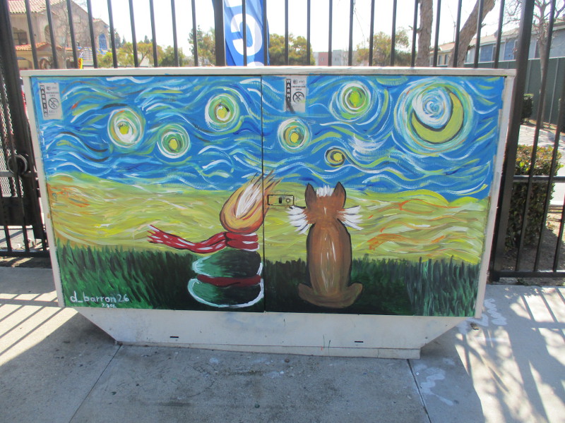
Colorful mural painted on side of 7-Eleven on Beyer Boulevard, not far from a trolley station.No al Racismo! No to Racism! By @Yvette_RomanLarge agricultural mural on the side of La Bodeguita Food Store.Cat street art under a starry, starry night. By @d_barron26 in 2022.
…
Thanks for visiting Cool San Diego Sights!
I post new blogs pretty often. If you like discovering new things, bookmark coolsandiegosights.com and swing on by occasionally!
I live in downtown San Diego and love to walk around with my camera! You can follow Cool San Diego Sights via Facebook or Twitter!
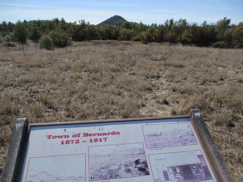
Did you know there used to be a town named Bernardo in what is now San Diego’s North County?
Bernardo was a tiny town between Escondido and Rancho Bernardo, where Lake Hodges is located today.
The creation of Lake Hodges in 1918, accomplished by damming the Bernardo River (now called San Dieguito River), put a definite end to little Bernardo. But today people hiking the Mule Hill Trail can see several information signs that recall the history of the now vanished town.
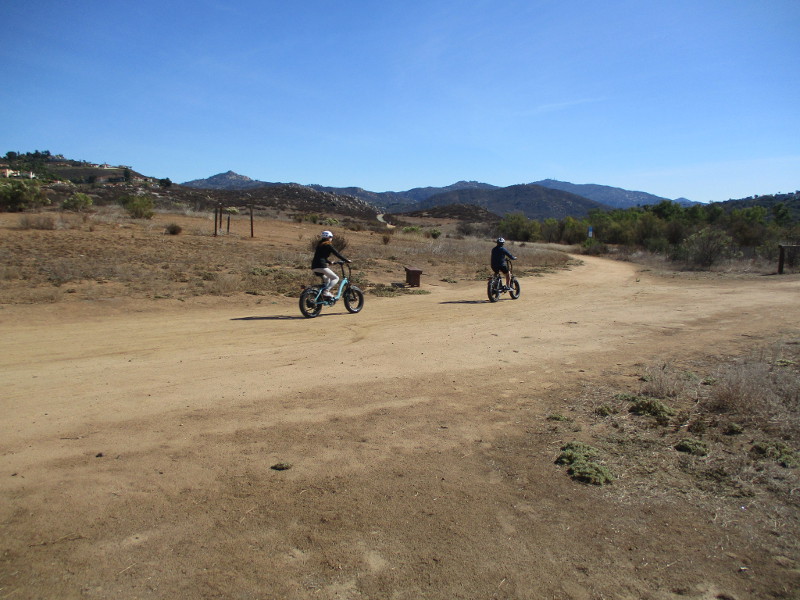
If you’d like to walk down the Mule Hill Trail yourself, take Interstate 15 to Bear Valley Parkway at the south end of Escondido. The wide dirt trail can be found about a quarter mile east of the freeway, leading south. (You’ll see it right before Beethoven Drive.)
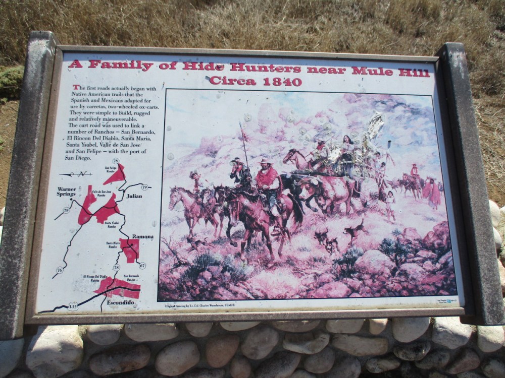
Before reaching the site of old Bernardo, this very easy trail passes Mule Hill, where a skirmish took place during the Mexican-American War. I’ll be blogging about that coming up.
Cart roads used by the Spanish and Mexicans before the appearance of Bernardo linked a number of Ranchos–San Bernardo, El Rincon, Del Diablo, Santa Maria, Santa Ysabel, Valle de San Jose and San Felipe–with the port of San Diego.
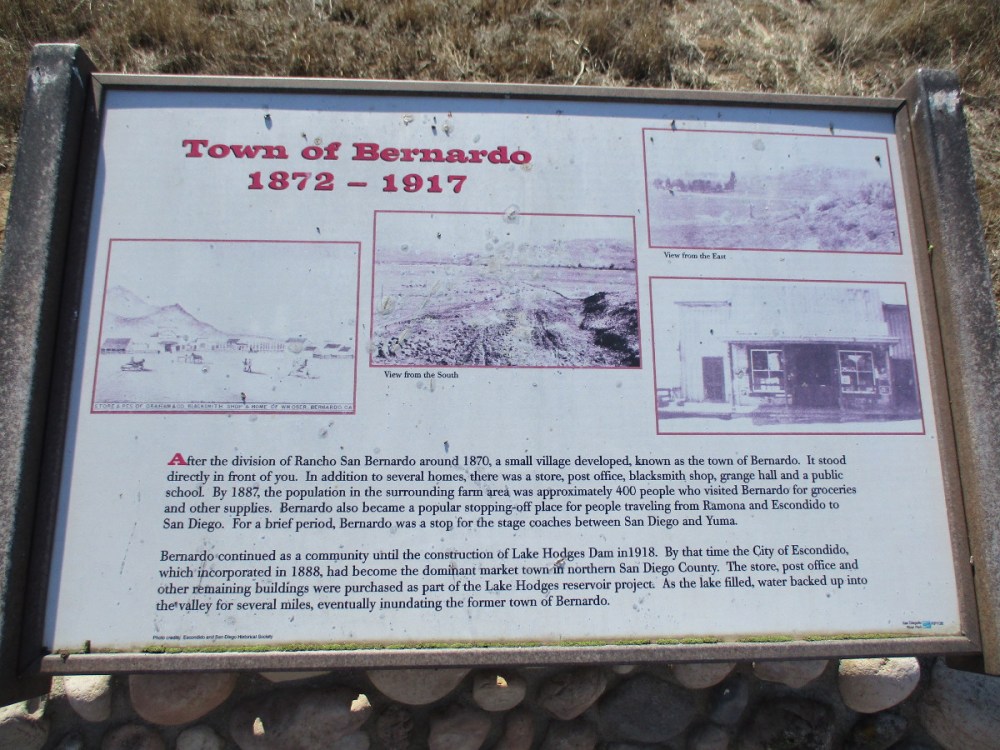
After the division of Rancho San Bernardo around 1870, a small village developed, known as the town of Bernardo. In addition to several houses, there was a store, post office, blacksmith shop, grange hall and public school. By 1887, the population in the surrounding farm area was approximately 400 people…
For a brief period, Bernardo was a stop for the stagecoaches between San Diego and Yuma.
The San Diego to Yuma Road was an overland trail in the mid-1800s. It was used by the Army of the West in 1846 and gold rush immigrants from 1848 through 1851. It passed through tiny Bernardo as it led northeast from Peñasquitos to Ramona, eventually connecting with the Butterfield Stage Route at Warner Springs.
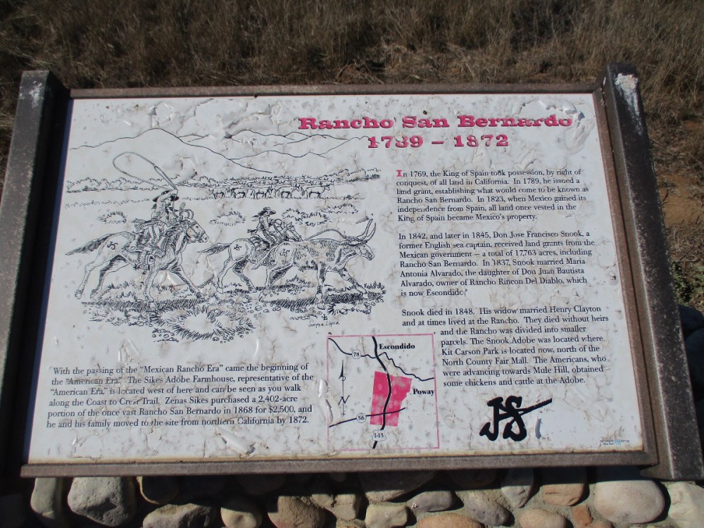
The history of Rancho San Bernardo began in the late 18th century when the King of Spain took possession of all land in California. In 1823, when Mexico gained its independence, the land became Mexico’s property. Don Jose Francisco Snook, a former English sea captain, received land grants from the Mexican government, including Rancho San Bernardo…
With the passing of the Mexican rancho era came the beginning of the American era, which is represented by the nearby Sikes Adobe Farmhouse. The restored farmhouse is a historic site that one can visit a short distance down the Coast to Crest Trail. (The Mule Hill Trail is a segment of the Coast to Crest Trail.)
…
Thanks for visiting Cool San Diego Sights!
I post new blogs pretty often. If you like discovering new things, bookmark coolsandiegosights.com and swing on by occasionally!
I live in downtown San Diego and love to walk around with my camera! You can follow Cool San Diego Sights via Facebook or Twitter!