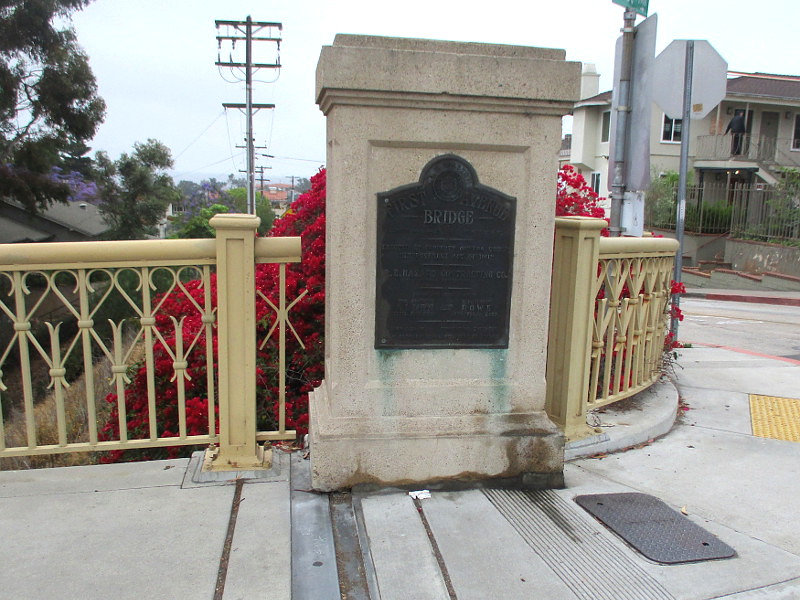
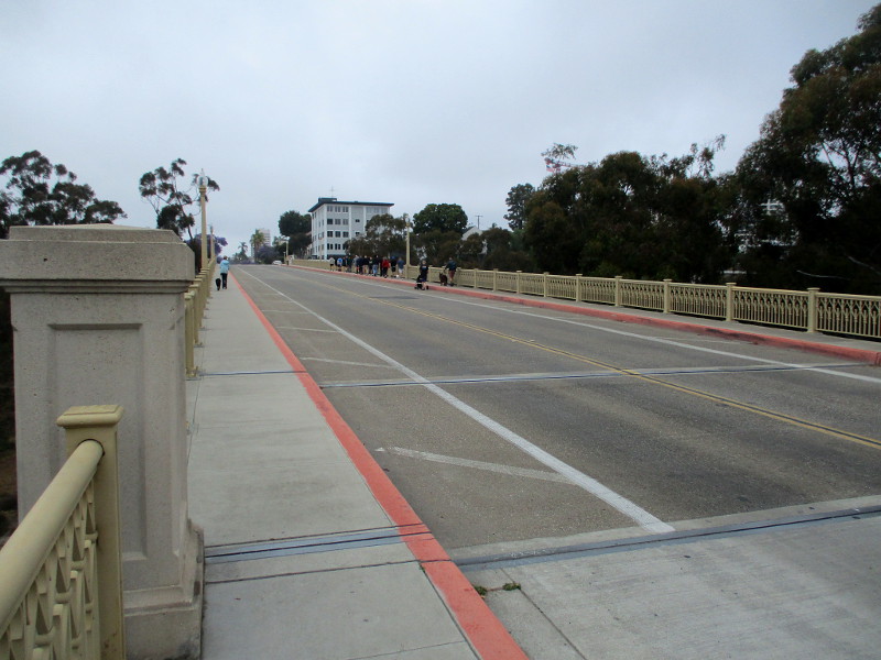
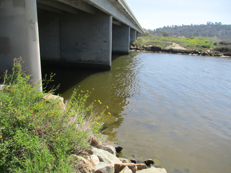
San Diego history can be viewed during a walk across the First Avenue Bridge in Bankers Hill.
Two identical bronze dedication plaques remain at either end of the arched steel bridge, which was built over Maple Canyon in 1931. The impressive structure was originally called the Peoples Bridge.
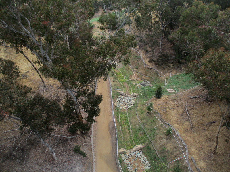
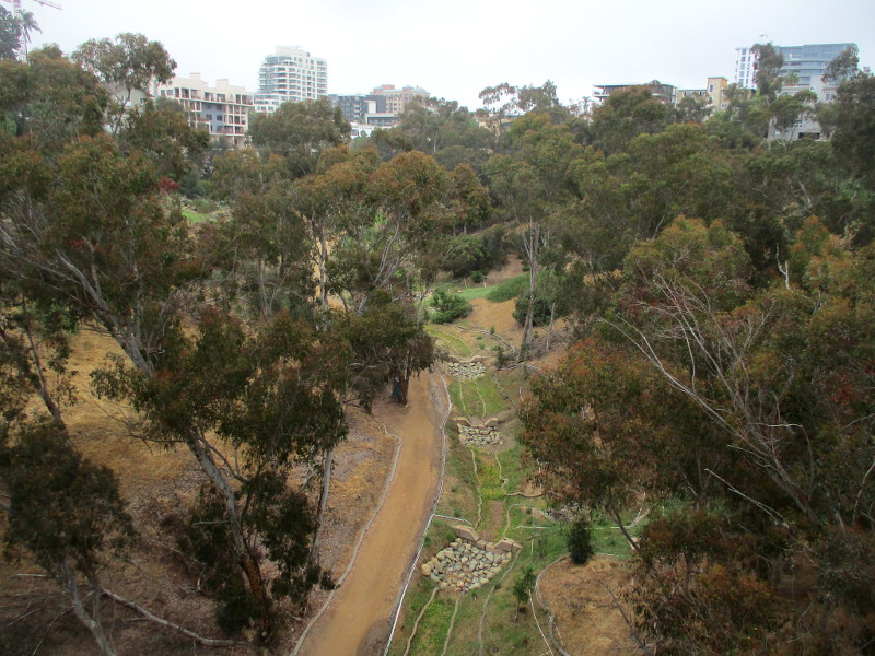
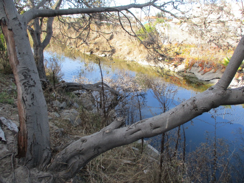
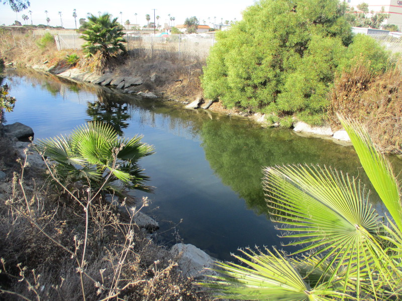
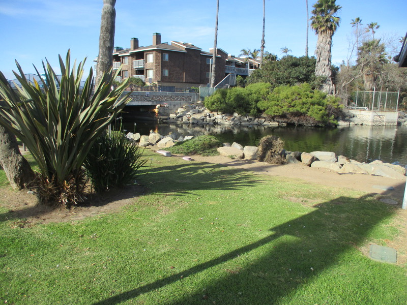
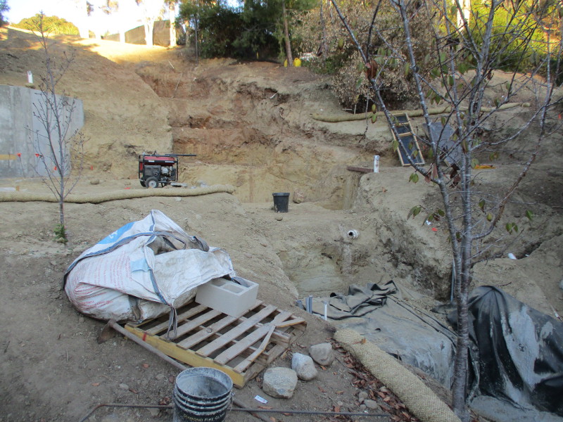
Today, looking down into Maple Canyon, you can also observe history being made. The Maple Canyon Restoration project has been underway for a couple years, replacing storm drains in the canyon, and expanding the channel to establish streambed and riparian habitats along the canyon floor.
Ten years ago I walked down Maple Canyon Trail and under the First Avenue Bridge. You can see photographs that I took here.
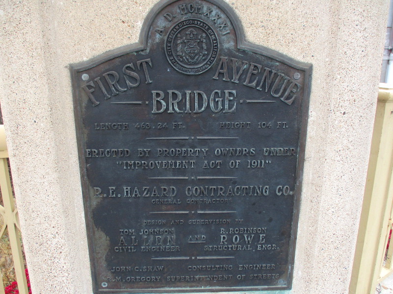
First Avenue Bridge…Length 463.24 feet…Height 104 feet…Erected by property owners under Improvement Act of 1911…R.E. Hazard Contracting Co…Tom Johnson Allen, Civil Engineer…R. Robinson Rowe, Structural Engineer…John C. Shaw, Consulting Engineer…R.M. Gregory, Superintendent of Streets
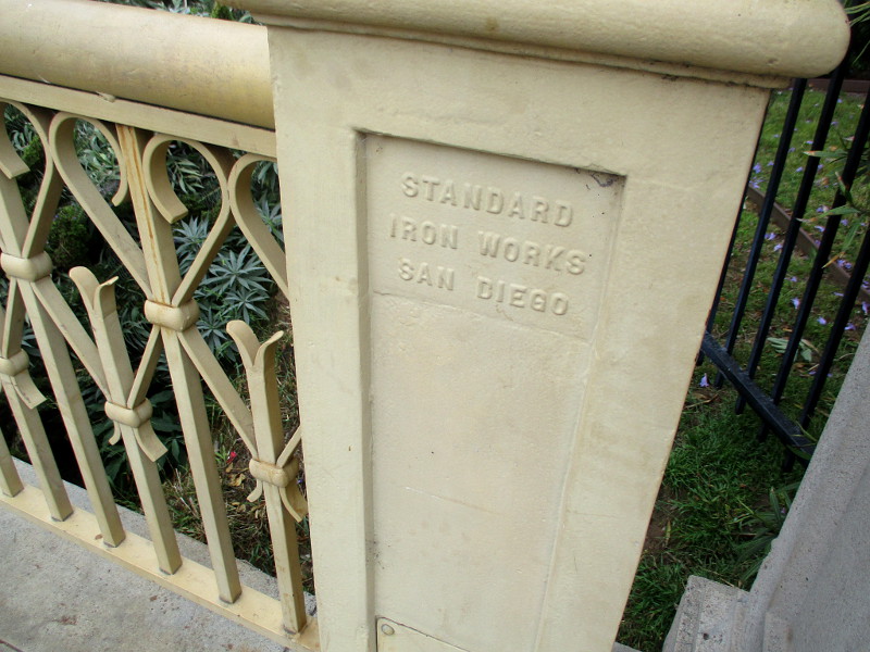
STANDARD IRON WORKS SAN DIEGO is indicated in many places along the 1931 steel bridge that spans Maple Canyon in Bankers Hill.
…
I post new blogs pretty often. If you like discovering new things, bookmark coolsandiegosights.com and swing on by occasionally!
I live in downtown San Diego and love to walk around with my camera! You can follow Cool San Diego Sights via Facebook or X.
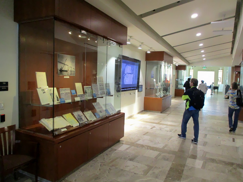
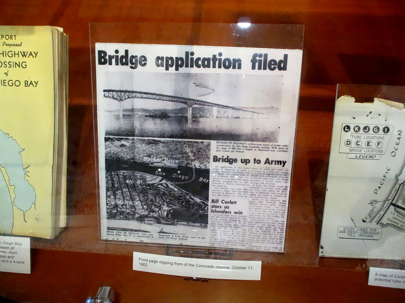
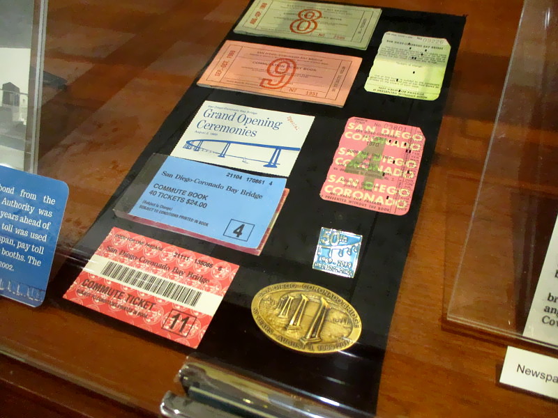
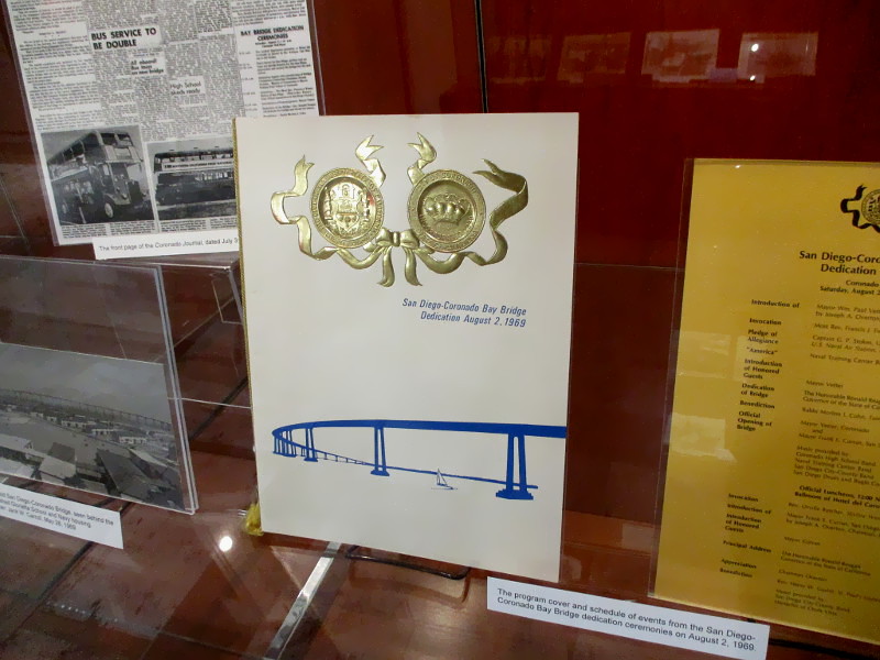
Large display cases contain old photographs, newspaper articles, documents and preserved artifacts representing the bridge’s complex history–from initial proposals to its construction to its grand opening and beyond.
Peering into the displays, reading descriptions, I learned interesting facts about the Coronado Bridge, including:
In 1926, the Spreckels Companies announced bold plans to construct a steel bridge linking Coronado to San Diego, envisioning an engineering marvel with arched spans and a lift section for maritime traffic. This news thrilled many residents eager for a fast connection to the mainland. Advocating for a tunnel instead, the Navy raised concerns about navigation and national defense. Despite initial optimism and plans for completion by 1928, the project became embroiled in decades of debate, delays, and revisions.
Mosher’s design was initially rejected by the state’s civil engineers for being too expensive. They proposed a more traditional trestle bridge, suggesting it be painted rust red or pink. Ultimately, Mosher’s design was accepted.
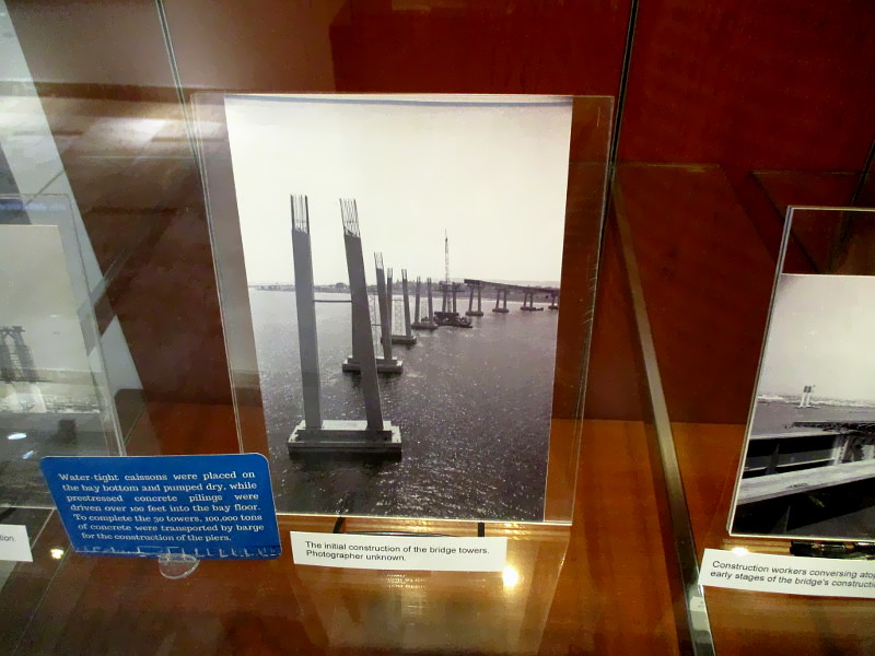
Water-tight caissons were placed on the bay bottom and pumped dry, while prestressed concrete pilings were driven over 100 feet into the bay floor. To complete the 30 towers, 100,000 tons of concrete were transported by barge for the construction of the piers.
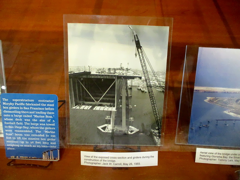
The superstructure contractor Murphy Pacific fabricated the steel box girders in San Francisco before dismantling them and loading them onto a barge called “Marine Boss,” whose deck was the size of a football field. The barge was towed to San Diego Bay, where the girders were reassembled. The “Marine Boss” boom was extended to 290 feet to lift the massive box girder sections–up to 96 feet long and weighing as much as 215 tons–into place.
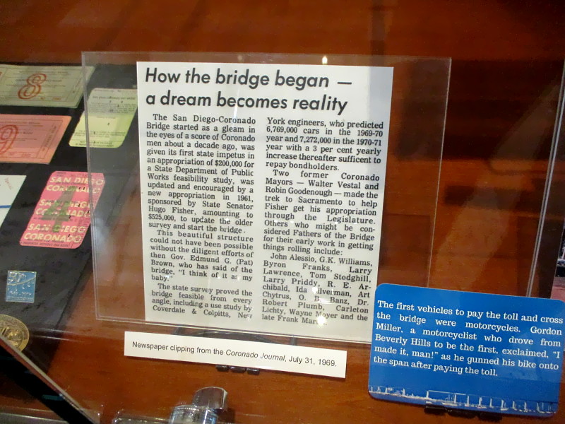
The final span, one of 27 girders, was placed on May 28, 1969. Coronado Mayor Paul Vetter participating in the informal ceremony, signing his name on the metal plate at the edge of the girder.
Mosher’s original design included lights on the low side of the railing, but they were cut to reduce costs… Coronado resident Carol Cahill…flew to Sacramento, successfully petitioned officials, and secured their installation. The lights were added in April 1970.
In 1970, the bridge received the National Award of Merit for Most Beautiful Bridge from the American Institute of Steel Construction.
The bridge’s 90-degree curve allows it to reach a height of 200 feet, tall enough for an empty aircraft carrier to pass underneath, while also providing the necessary length to ramp down to the Coronado side, which is significantly lower than the San Diego side that connects to Interstate 5.
I was told by a library employee that this fascinating exhibit will be on view through early May, 2025. Go check it out!
…
I post new blogs pretty often. If you like discovering new things, bookmark coolsandiegosights.com and swing on by occasionally!
I live in downtown San Diego and love to walk around with my camera! You can follow Cool San Diego Sights via Facebook or X.
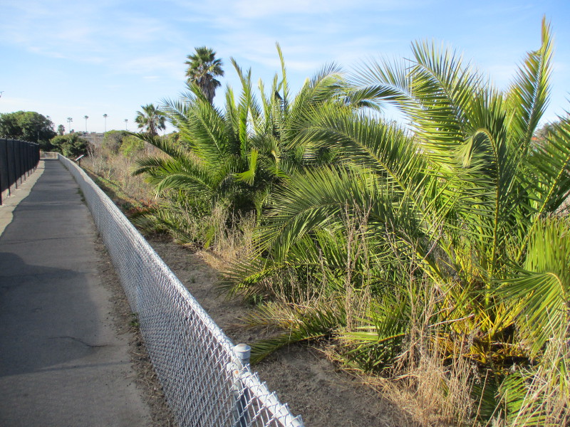
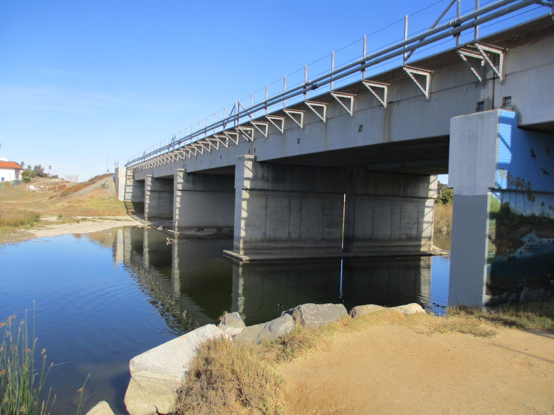
The Loma Alta Creek Nature Trail is a short, easy path in Oceanside where people in the city can see many birds.
Also known as the Loma Alta Marsh Footpath, the urban nature trail extends west from South Coast Highway (just north of Paradise by the Sea Beach RV Resort) to Buccaneer Park. The distance is about one quarter mile.
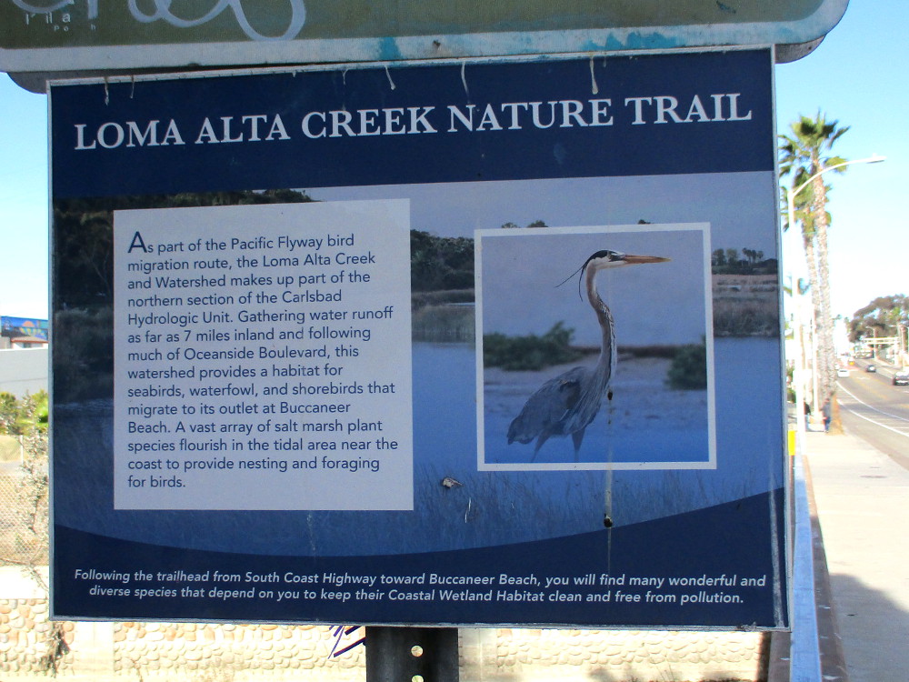
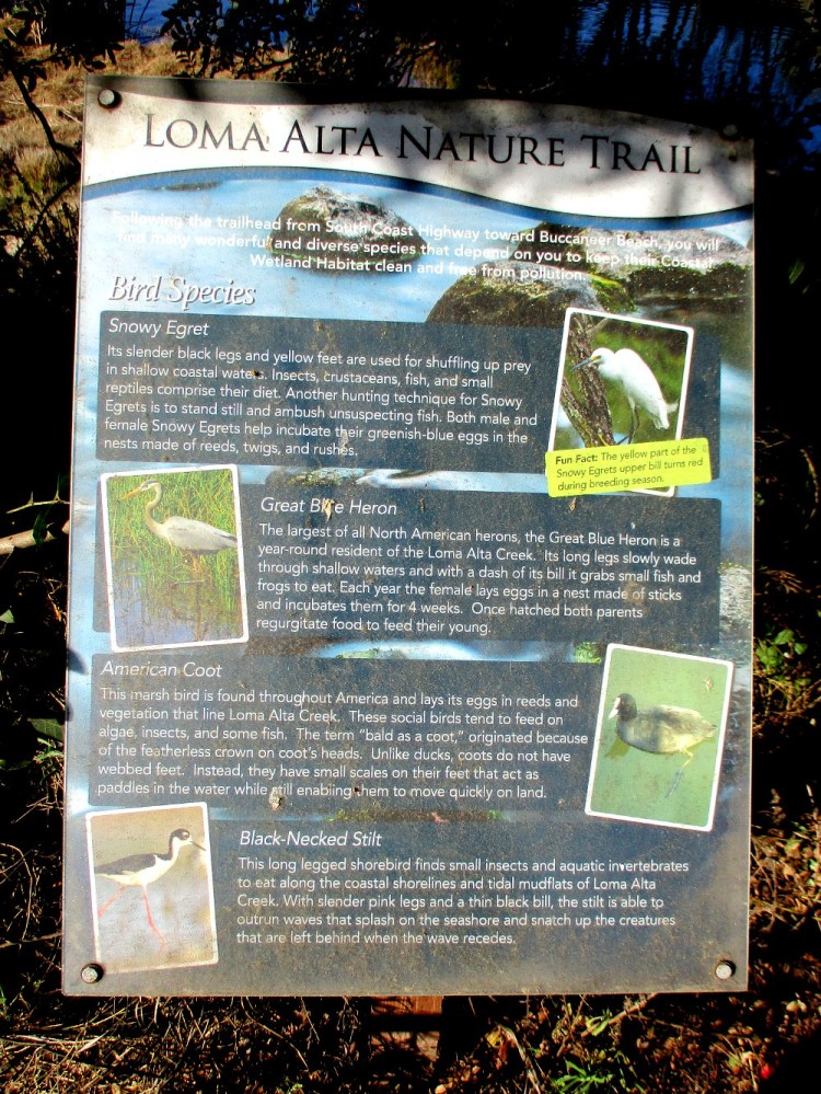
I walked the nature trail several days ago and took these photographs. I began at South Coast Highway where it passes over Loma Alta Creek. You’ll see the following sign at the trailhead.
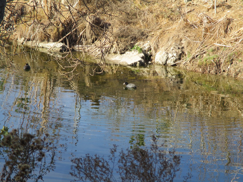
As part of the Pacific Flyway bird migration route, the Loma Alta Creek and Watershed makes up part of the northern section of the Carlsbad Hydrologic Unit. Gathering water runoff as far as 7 miles inland and following much of Oceanside Boulevard, this watershed provides a habitat for seabirds, waterfowl, and shorebirds that migrate to its outlet at Buccaneer Beach. A vast array of salt marsh plant species flourish in the tidal area near the coast to provide nesting and foraging for birds.
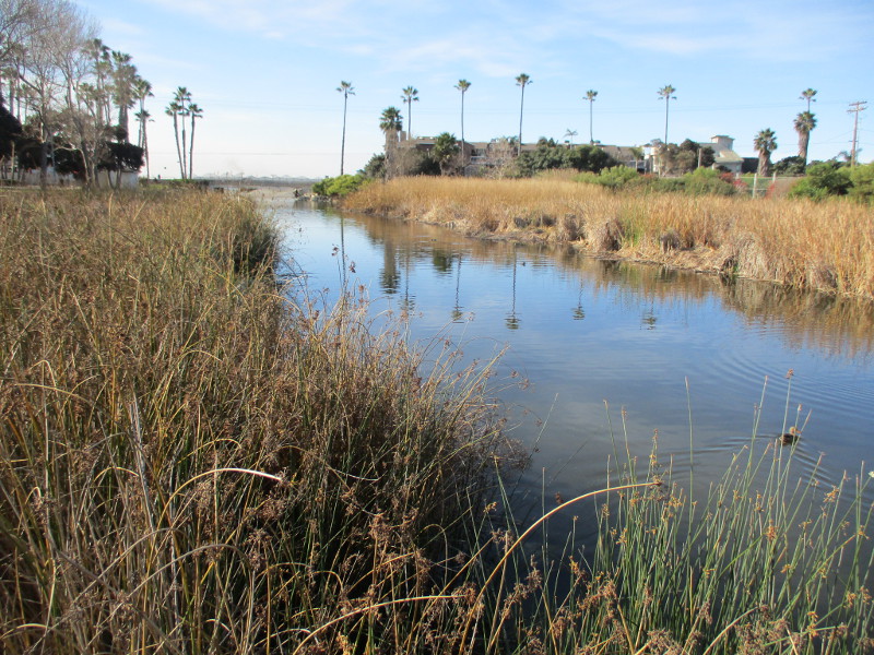
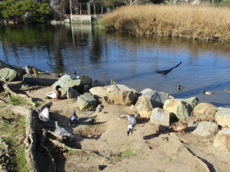
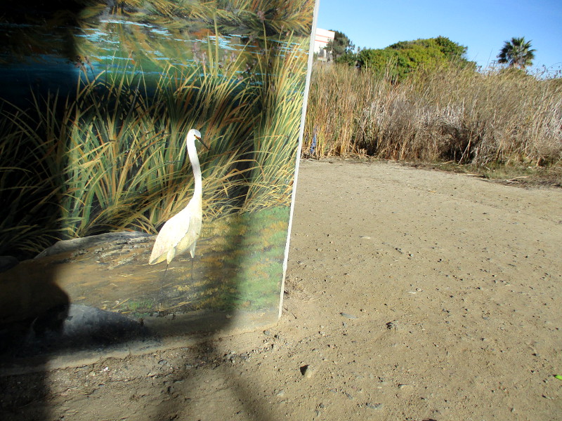
Following the trailhead from South Coast Highway toward Buccaneer Beach, you will find many wonderful and diverse species that depend on you to keep their Coastal Wetland Habitat clean and free from pollution.
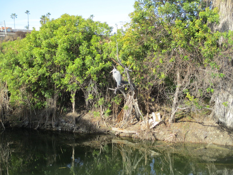
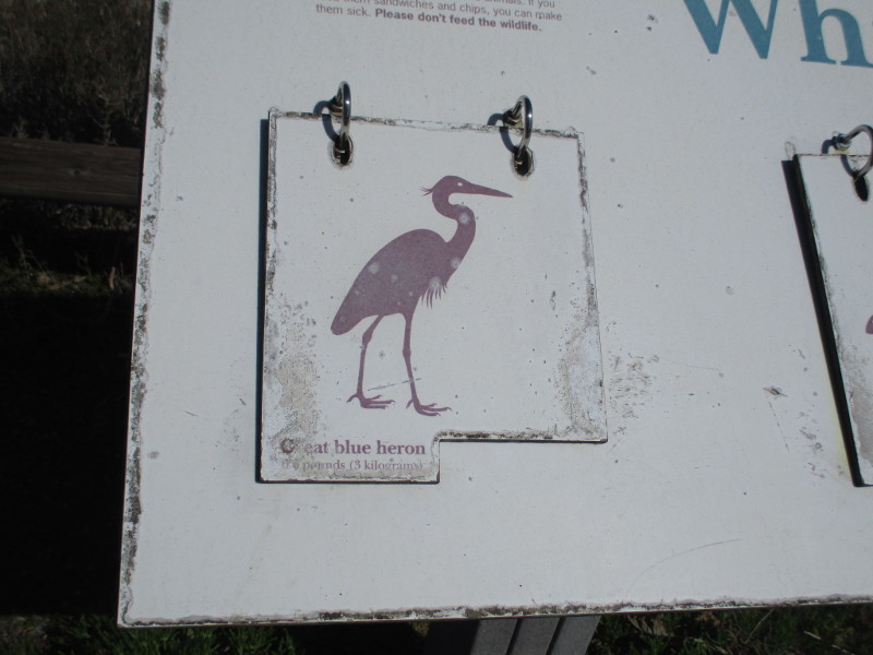
I observed a Great Blue Heron perched in a tree across the water. My camera on its automatic setting didn’t take such a great picture, unfortunately.
An old sign (I increased the image contrast) indicates that bird species one might see while walking along the Loma Alta Nature Trail include Snowy Egret, Great Blue Heron, American Coot and Black-Necked Stilt.
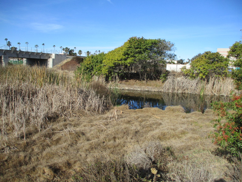
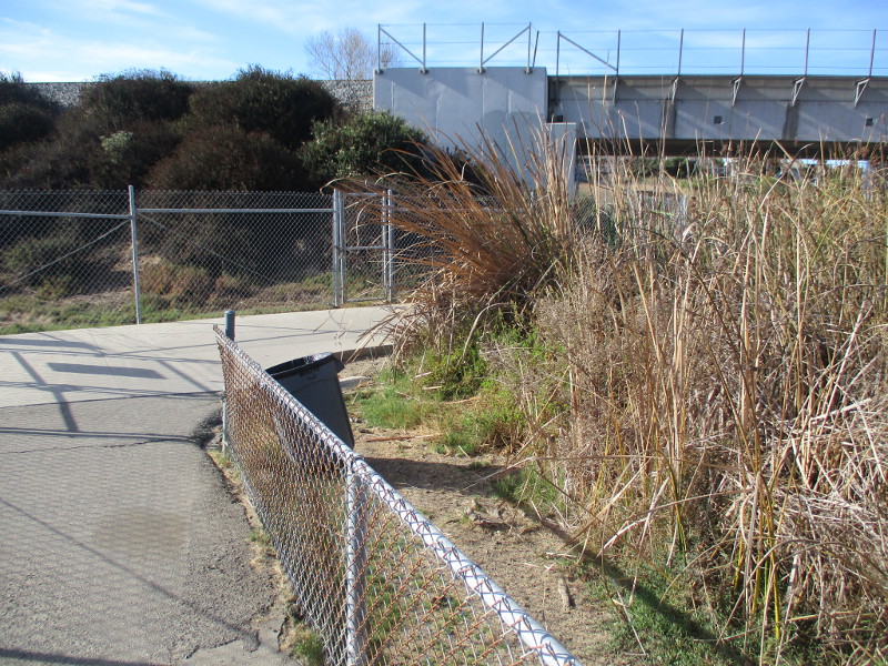
The trail passes under railroad tracks.
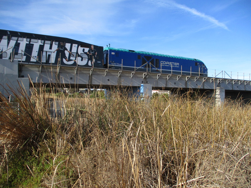
A northbound Coaster train rumbles by…
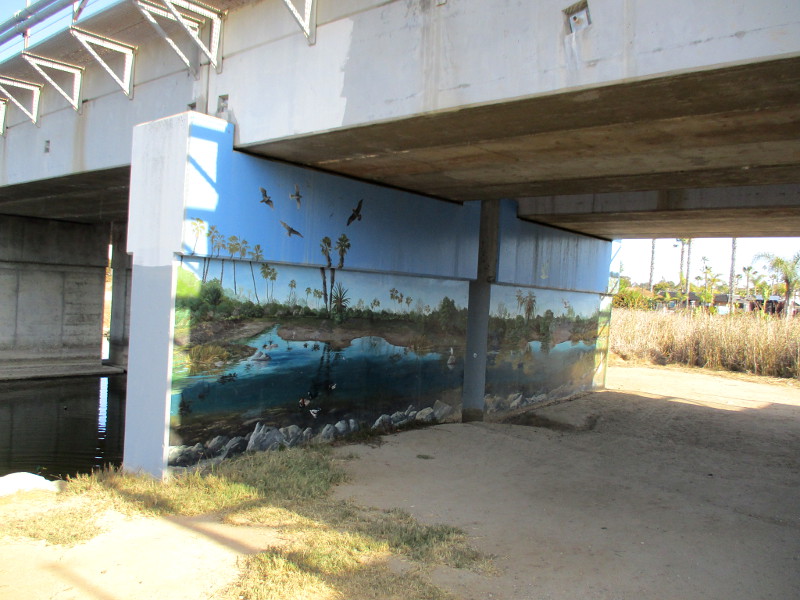
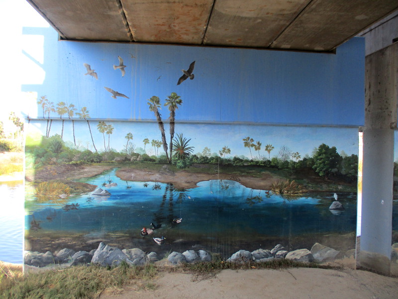
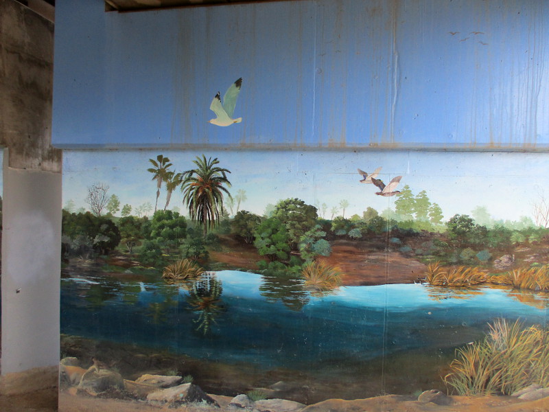
There are two beautiful murals painted under the railroad bridge. You can glimpse part of one in the next photograph. To see both murals, click here!
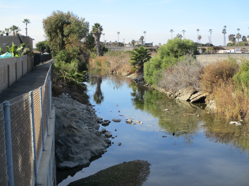
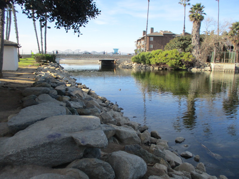
In the next photo, I continue to head west toward grassy Buccaneer Park, a popular spot for families. That bridge in the distance is where South Pacific Street passes over the creek. On the other side is Buccaneer Beach.
Lots of birds on the rocks!
…
I post new blogs pretty often. If you like discovering new things, bookmark coolsandiegosights.com and swing on by occasionally!
I live in downtown San Diego and love to walk around with my camera! You can follow Cool San Diego Sights via Facebook or X.
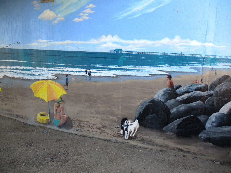
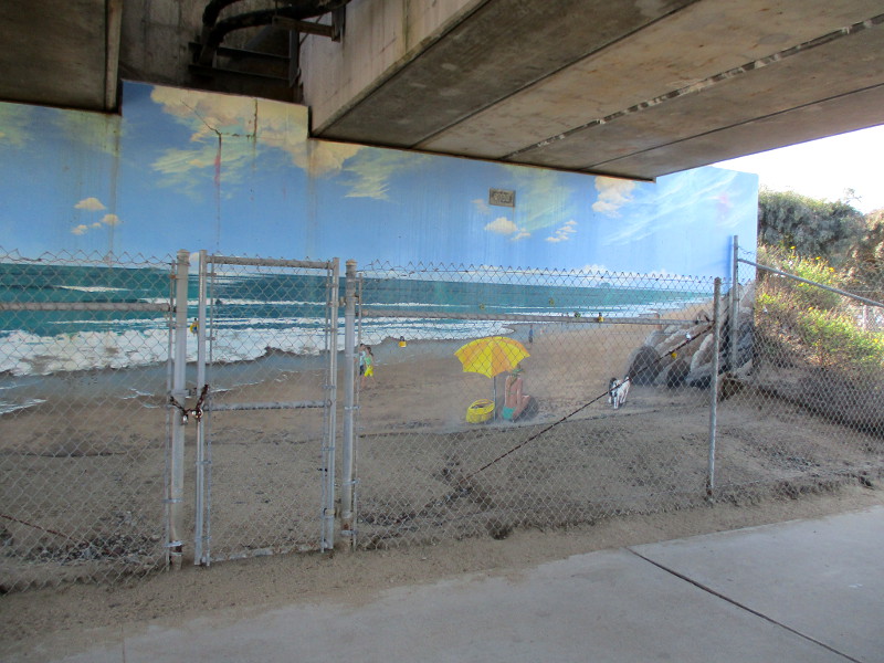
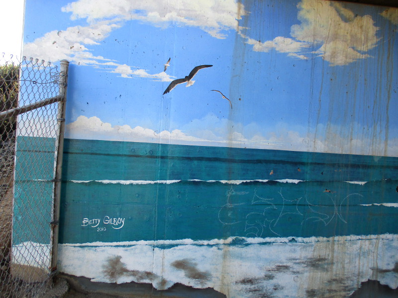
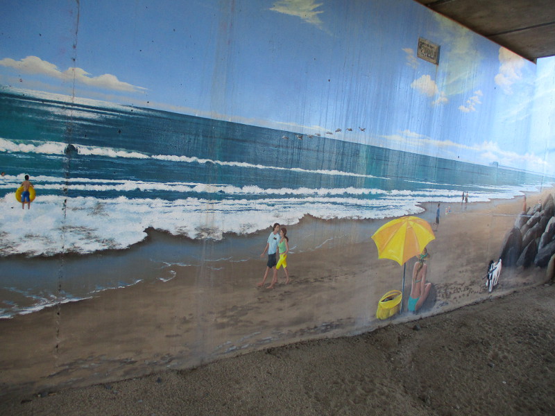
These two murals in Oceanside are seen by relatively few people. They were painted fifteen years ago along a little used nature trail, under a shadowy bridge that supports train tracks.
One of the murals seems to depict nearby Buccaneer Beach, with a view of Oceanside Pier in the distance. The opposite mural appears to show Loma Alta Creek that the nature trail–Loma Alta Marsh Footpath–follows. (I’ll be blogging about this short trail soon.)
I noticed an artist signature: Betty Gilroy 2010.
I walked under the railroad tracks last Friday. These two murals are like weather-beaten hidden treasures.
The following photos are of the Loma Alta Creek mural. You can see the actual creek beyond it. The artwork is filled with many of the birds one can see from the trail…
The next group of photos show the opposite mural, depicting people at the beach. The art was behind a chain link fence, making photography a challenge…
…
I post new blogs pretty often. If you like discovering new things, bookmark coolsandiegosights.com and swing on by occasionally!
I live in downtown San Diego and love to walk around with my camera! You can follow Cool San Diego Sights via Facebook or X.
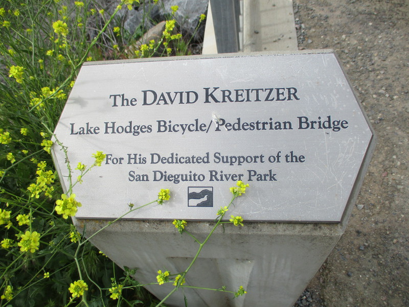
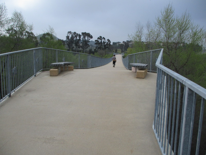
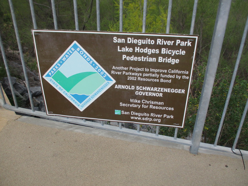
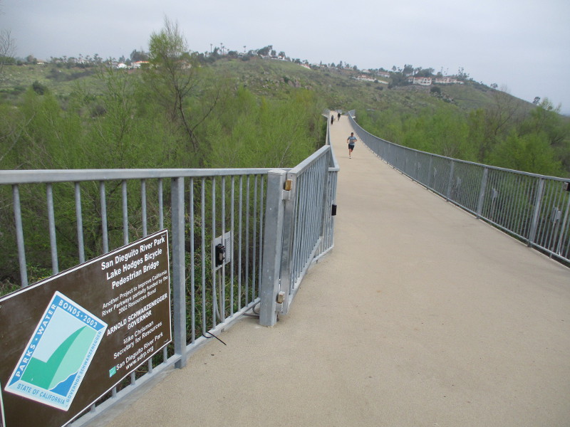
Did you know there’s a world record bridge in San Diego’s North County?
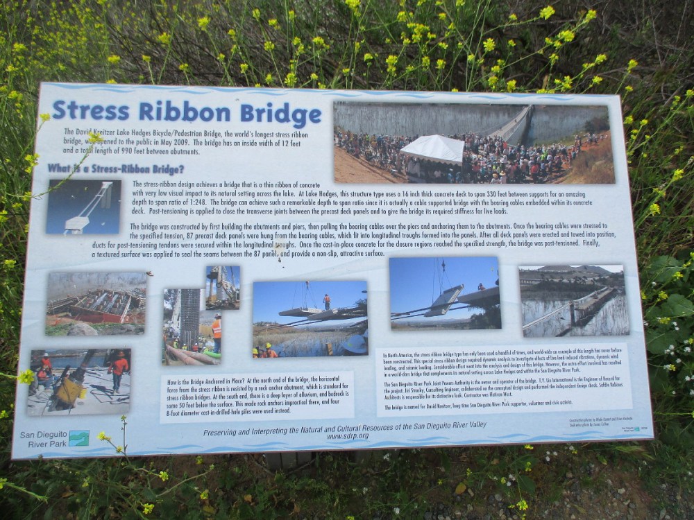
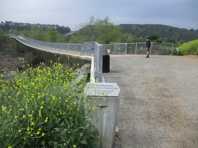
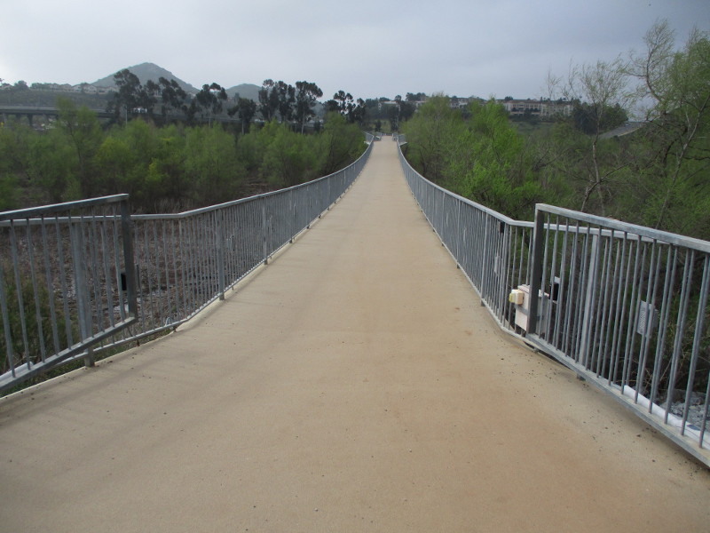
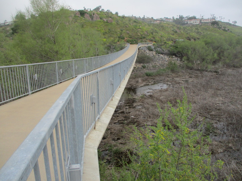
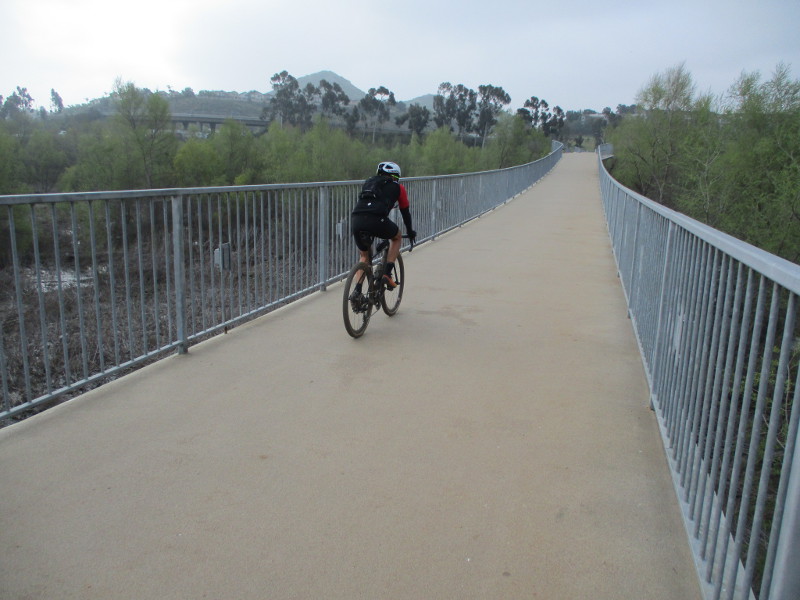
The David Kreitzer Lake Hodges Bicycle/Pedestrian Bridge is the longest stress ribbon bridge in the world!
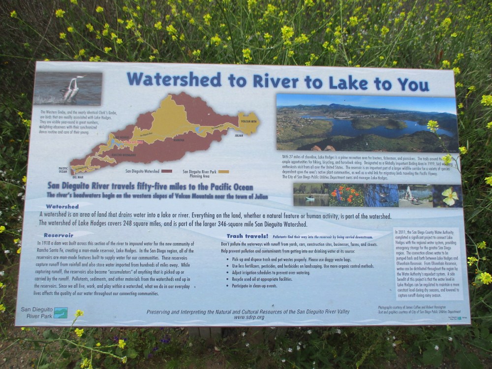
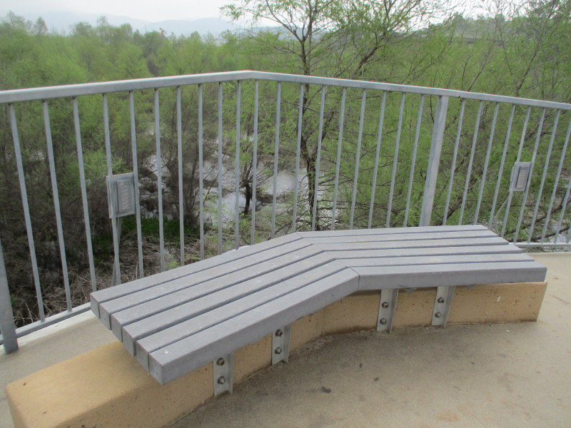
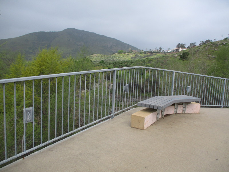
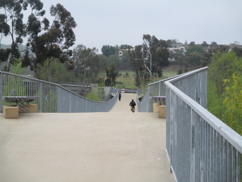
You’ve possibly seen the 990 foot long bridge when driving up Interstate 15 next to Lake Hodges. I walked across the remarkable bridge yesterday and noticed several information signs describing its history and unique characteristics.
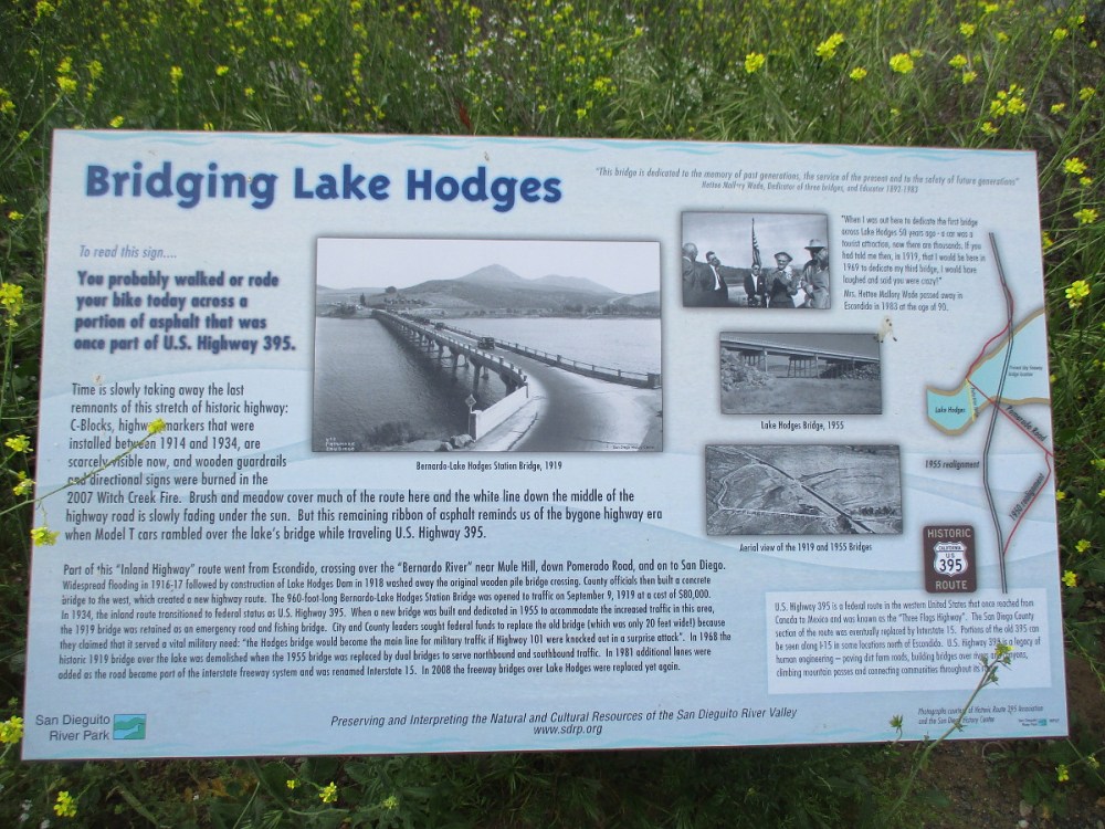
The San Dieguito River travels 55 miles to the Pacific Ocean. In 1918 this section of the river was dammed creating the reservoir Lake Hodges, which has 27 miles of shoreline. The watershed of Lake Hodges covers 248 square miles.
Lake Hodges was designated a Globally Important Birding Area in 1999.
(When I was a young man, I fished with a friend for bass in Lake Hodges.)
Historic old U.S. Highway 395 became a wide hiking trail that passes by these signs.
Several bridges have spanned the water over the past century, including a wooden pile bridge near Mule Hill that was washed away after the creation of Lake Hodges.
Pictured in the above sign is the Bernardo-Lake Hodges Station Bridge in 1919. It was demolished when a nearby 1955 bridge was replaced by the dual bridges that serve Interstate 15 today.
The David Kreitzer Lake Hodges Bicycle/Pedestrian Bridge opened in 2009.
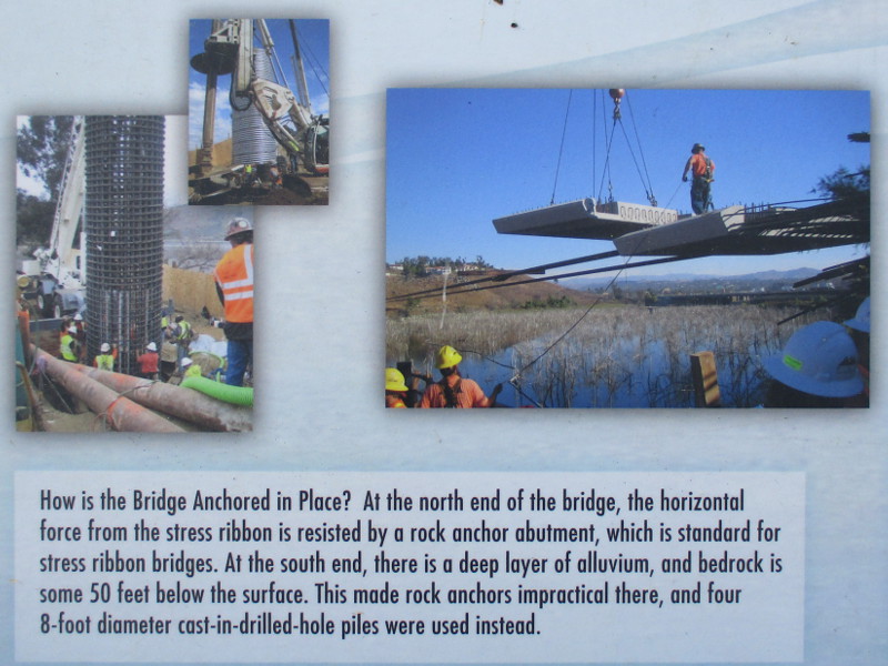
The world record bridge’s design features a long thin ribbon of concrete that produces low visual impact. Enlarge my photo of the above sign to read details of the stress ribbon bridge’s construction.
The bridge provides an elegantly simple passage through the beauty of the lake and its trees.
…
Thanks for visiting Cool San Diego Sights!
I post new blogs pretty often. If you like discovering new things, bookmark coolsandiegosights.com and swing on by occasionally!
I live in downtown San Diego and love to walk around with my camera! You can follow Cool San Diego Sights via Facebook or Twitter!
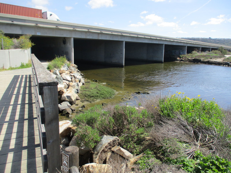
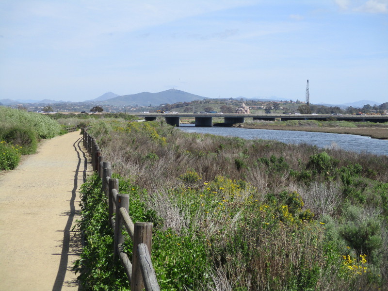
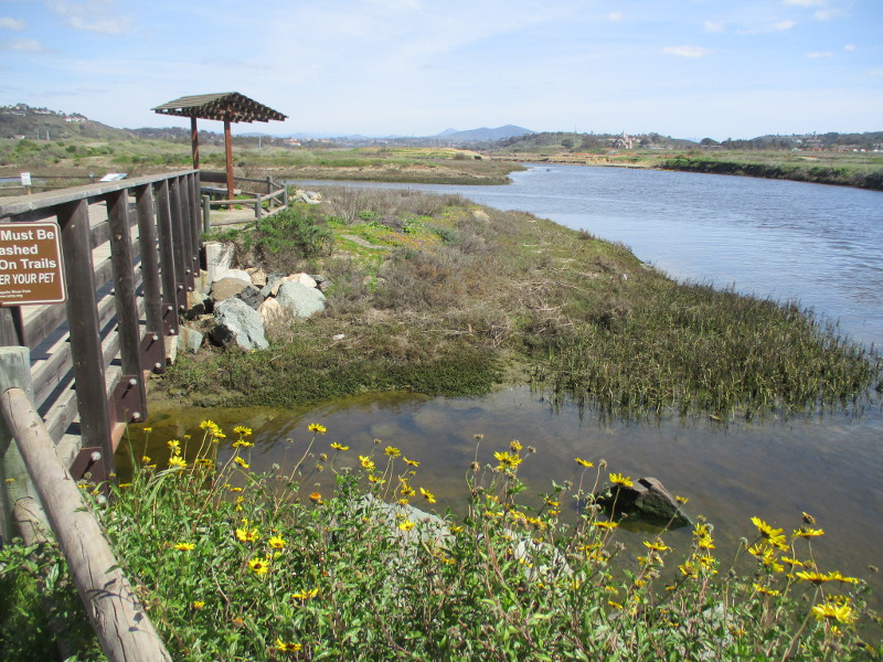
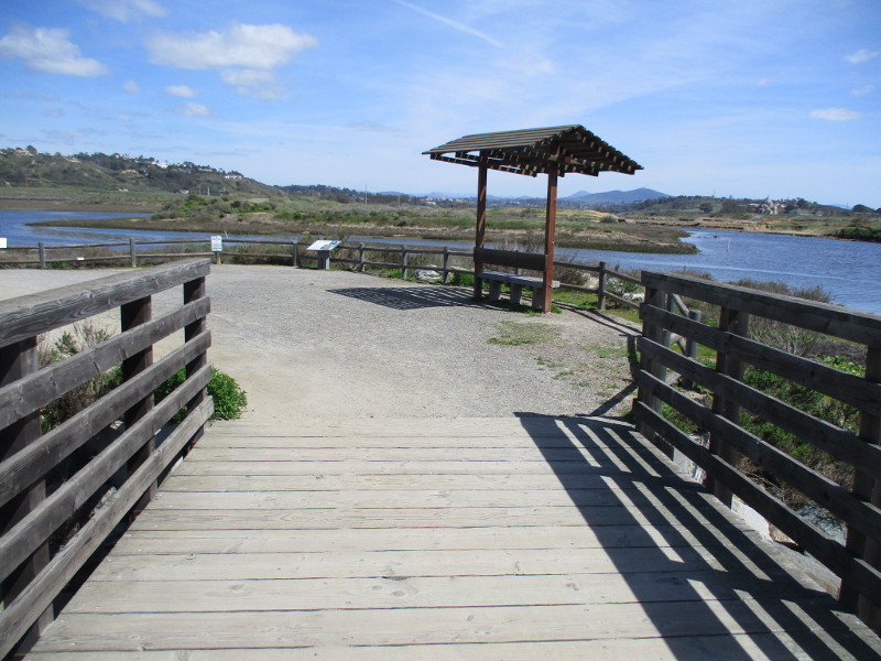
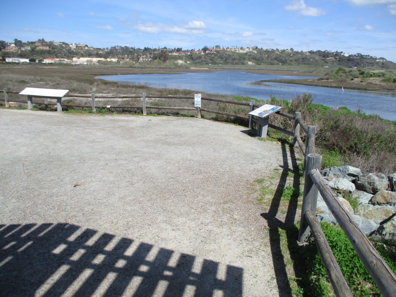
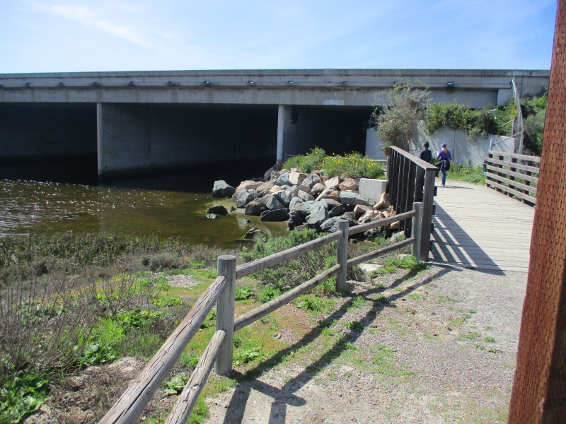
Walk the Coast to Crest Trail along the San Dieguito River where it passes under Interstate 5 and you’ll see signs of life.
Indeed, several signs east of the freeway bridge concern river life that can be found nearby!
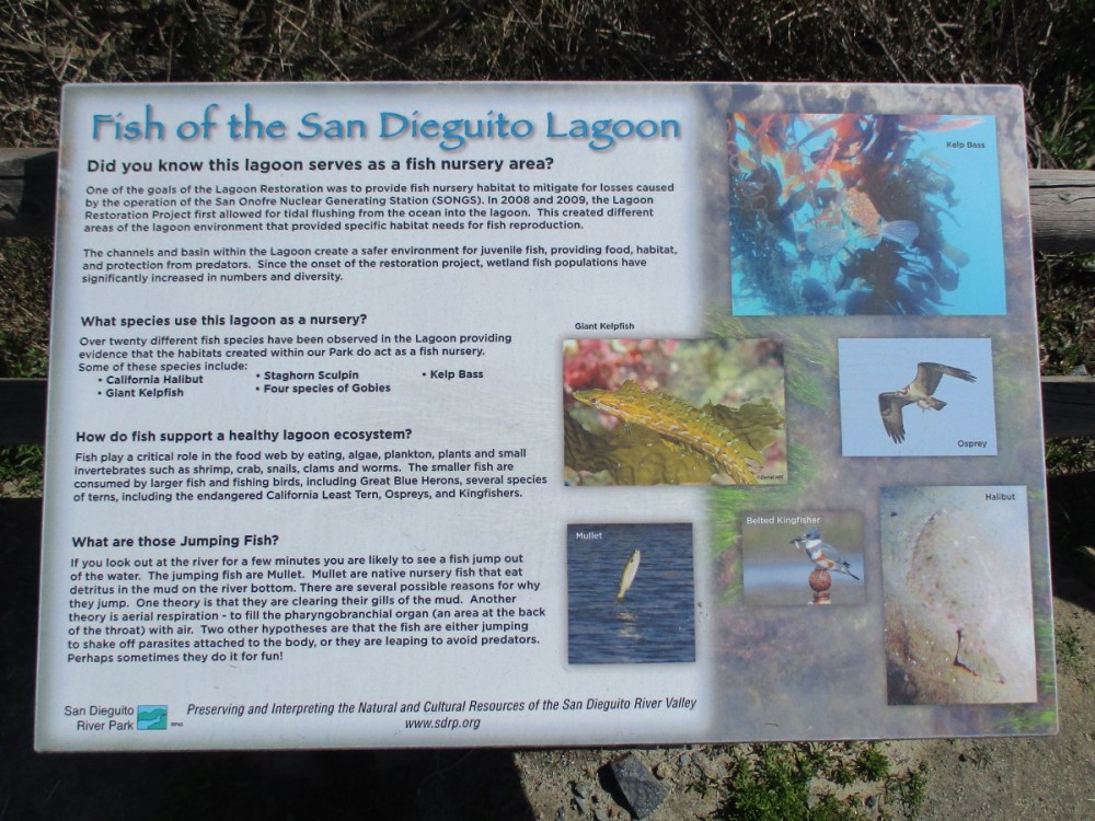
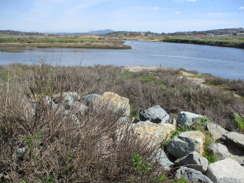
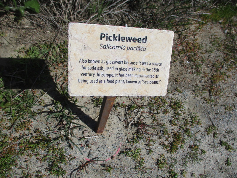
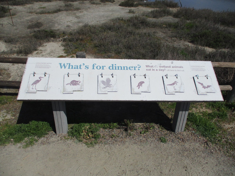
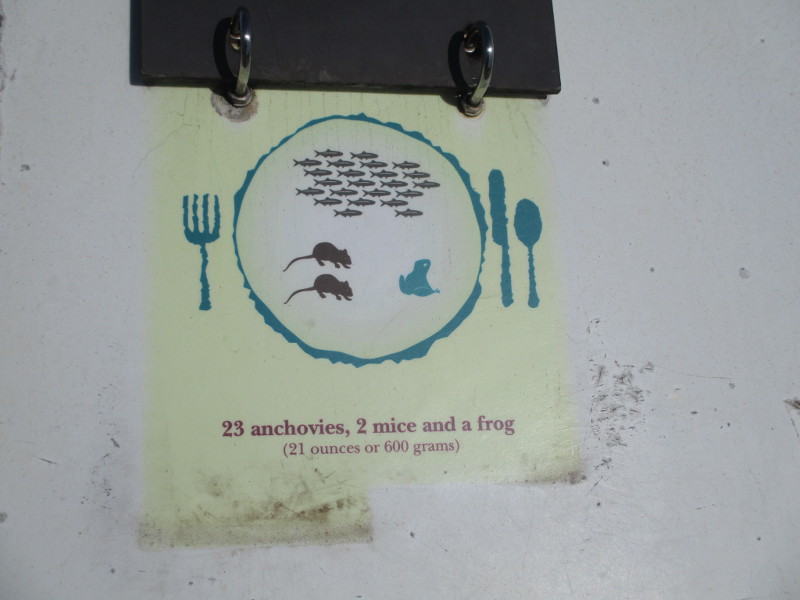
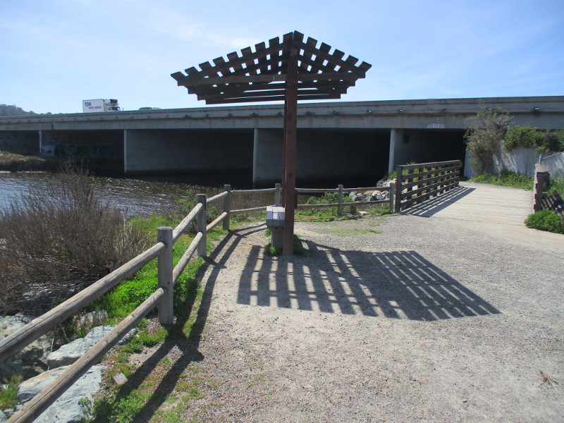
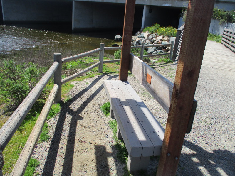
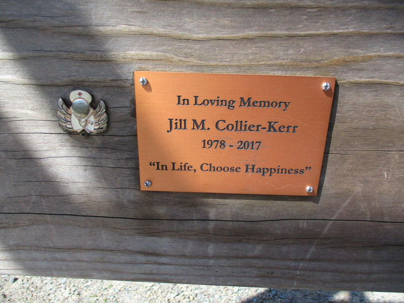
Walking east in Del Mar along the San Dieguito River, approaching the Interstate 5 bridge. It’s early March and native vegetation is green from recent rains.About to pass under the concrete freeway bridge.On the other side, near bush sunflowers, we arrive at a place where one can relax and learn about the San Dieguito Lagoon environment.Several old signs ahead…Fish of the San Dieguito Lagoon. Over twenty different fish species have been observed in the lagoon providing evidence that habitats here act as a fish nursery. Species include California Halibut, Giant Kelpfish, Staghorn Sculpin, Kelp Bass and four species of Gobies. Small jumping fish are Mullet.Pickleweed likes the salty environment in the lagoon. It is also known as sea asparagus, Pacific swampfire, or glasswort!What’s for dinner for various wetland animals who live here, including raccoons, American kestrels, killdeers and bats?In one day a Great Blue Heron will eat……23 anchovies, 2 mice and a frog. Yummy!A place near the freeway bridge to rest, gaze at the river and think about life.In Life, Choose Happiness.
…
Thanks for visiting Cool San Diego Sights!
I post new blogs pretty often. If you like discovering new things, bookmark coolsandiegosights.com and swing on by occasionally!
I live in downtown San Diego and love to walk around with my camera! You can follow Cool San Diego Sights via Facebook or Twitter!
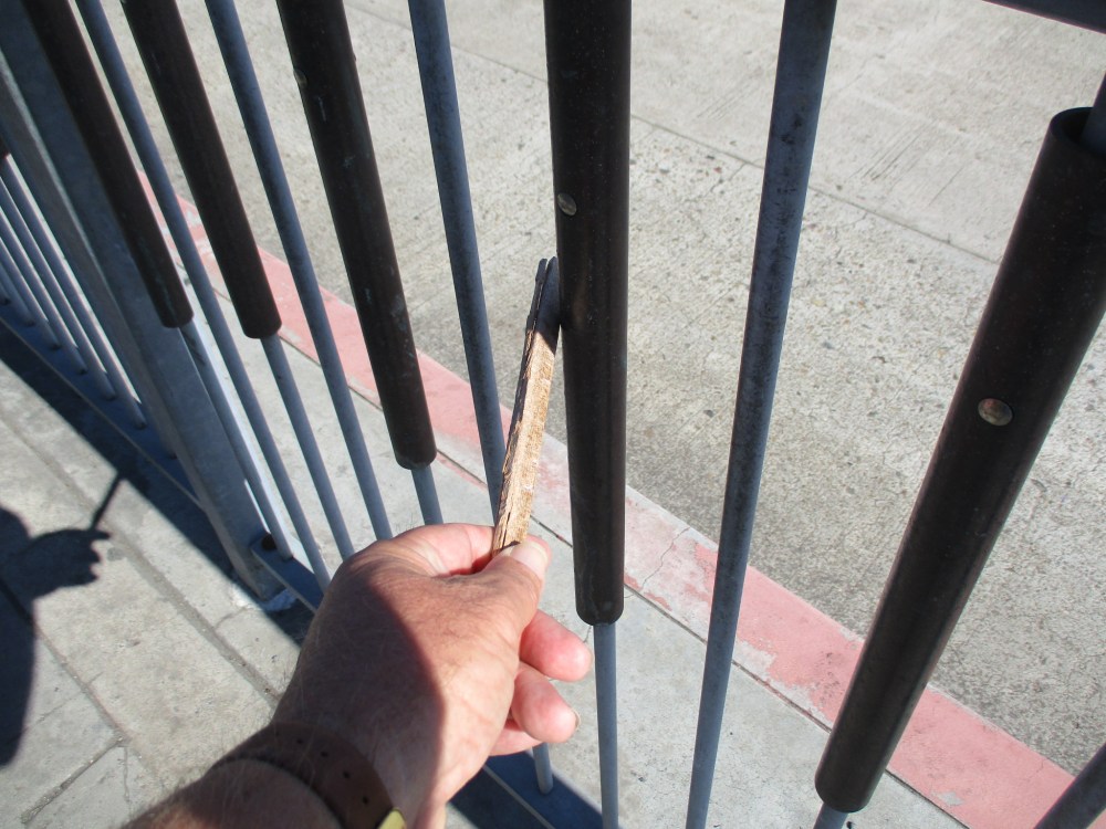
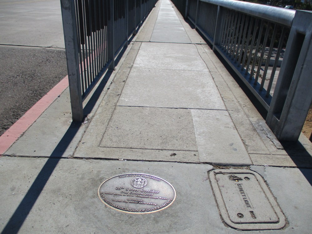
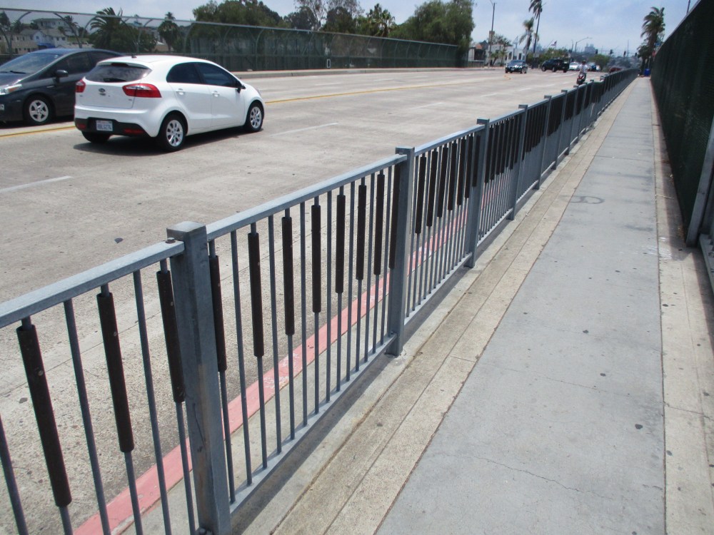
Did you know there’s a bridge over a freeway in San Diego that is also a musical instrument?
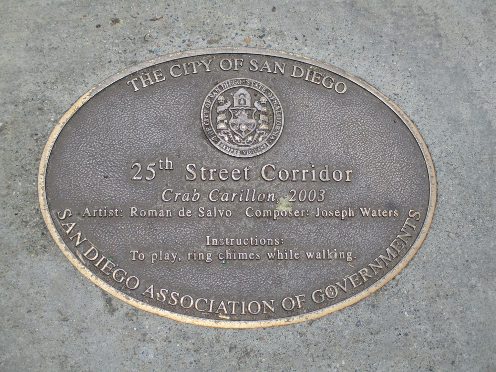
Drivers passing over State Route 94 on the 25th Street bridge might not realize they are traveling beside an interactive chime rail that pedestrians with a good stick or (better yet) metal rod can play!
Called the Crab Carillon, this musical feature of a very unique bridge is part of the City of San Diego’s Civic Art Collection. The Crab Carillon, created by artist Roman de Salvo in 2003, features 488 individually tuned chimes spanning the full length of the bridge, which can be played by passersby.
De Salvo commissioned Joseph Waters to compose a short, sophisticated palindrome, which sounds the same played forward or backward. The title refers to the way that crabs scuttle from side to side, similar to the movement of those who interact with the artwork.
As I walked south down 25th Street from Golden Hill toward Sherman Heights, I happened to find a piece of broken wood on the sidewalk. Perfect! I thought. Up ahead is San Diego’s musical bridge! Now I’m ready to play the Crab Carillon!
…
Thank you for visiting Cool San Diego Sights!
I post new blogs pretty often, so you might want to bookmark coolsandiegosights.com and check back from time to time.
You can explore Cool San Diego Sights by using the search box on this website’s sidebar. Or click a tag! There’s a lot of stuff to share and enjoy!
I live in downtown San Diego and love to walk around with my camera! You can follow Cool San Diego Sights via Facebook or Twitter!
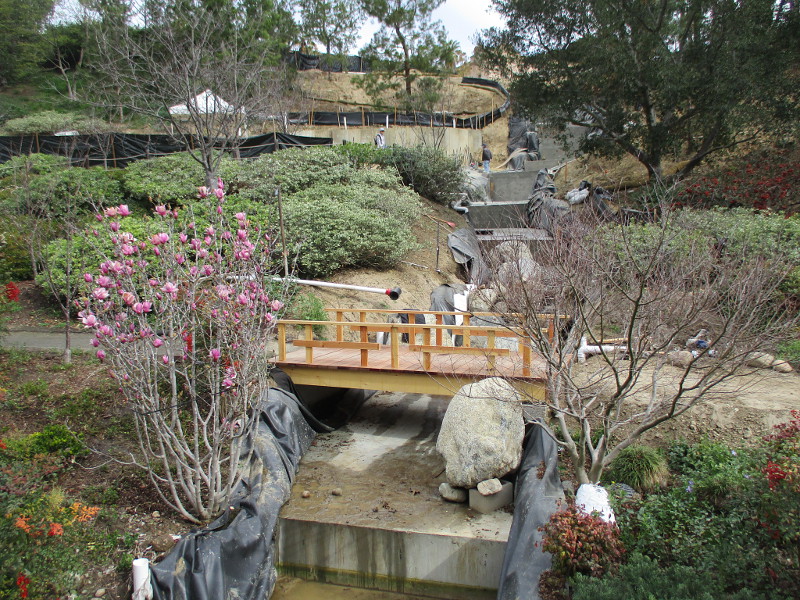
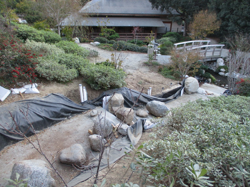
A couple months ago I blogged about a big new waterfall that is coming to the Japanese Friendship Garden in San Diego’s beautiful Balboa Park.
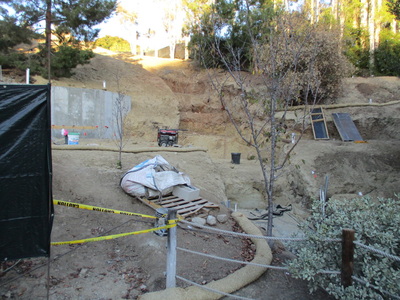
Yesterday I swung by again and noticed huge progress has been made creating the waterfall!
The step-like watercourse is being readied. Large boulders have been placed where the water will descend through the Lower Garden to the existing bridge, waterfall and koi pond by the Inamori Pavilion. Many smaller rocks will surely follow.
If you’d like to compare photos, click here for what I saw in late November.
UPDATE!
During a later visit, I noticed stairs are being built in the canyon’s side. They climb beside the waterfall. It appears there will be a viewing area up above!
…
I live in downtown San Diego and love to walk around with my camera! You can follow Cool San Diego Sights via Facebook or Twitter!
You can easily explore Cool San Diego Sights by using the search box on my blog’s sidebar. Or click a tag! There are thousands upon thousands of photos for you to enjoy!
San Diego’s crown jewel, Balboa Park, is about to become even more amazing!
How?
A big new waterfall is under construction in the Lower Garden of the Japanese Friendship Garden!
I hadn’t walked down into the Lower Garden recently, so today when I saw the new waterfall being readied, I had to take photos!
As I understand it, from a conversation I had months ago, a small structure will be built beside this new water feature. Those walking down the nearby path will have the opportunity to grab a tea and possibly other refreshments.
A new footbridge will span this new stream. The water will continue on down to the existing waterfall by the Inamori Pavilion.
I can’t wait to see it all done!
…
I live in downtown San Diego and love to walk around with my camera! You can follow Cool San Diego Sights via Facebook or Twitter!
You can easily explore Cool San Diego Sights by using the search box on my blog’s sidebar. Or click a tag! There are thousands upon thousands of photos for you to enjoy!
I was walking around the San Diego Convention Center this morning, looking for cool stuff popping up for this weekend’s Comic-Con Special Edition, when I had to pause on the Harbor Drive pedestrian bridge and marvel at the brilliant sunrise.
I took these two photos of sunrise above downtown’s trolley and rail yard.
…
I live in downtown San Diego and love to walk around with my camera! You can follow Cool San Diego Sights via Facebook or Twitter!