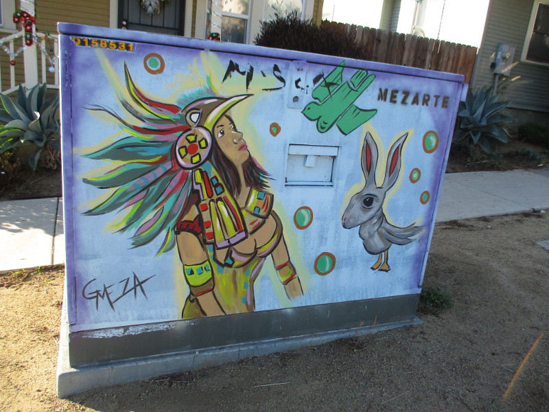
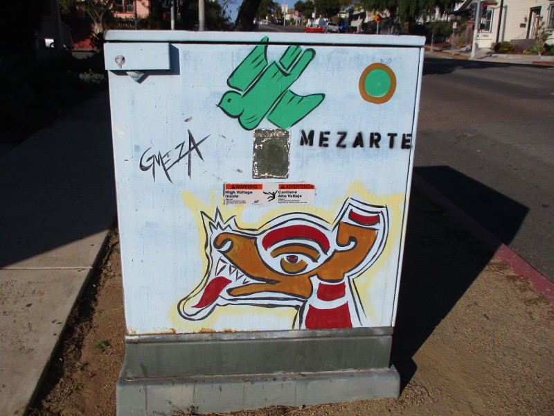
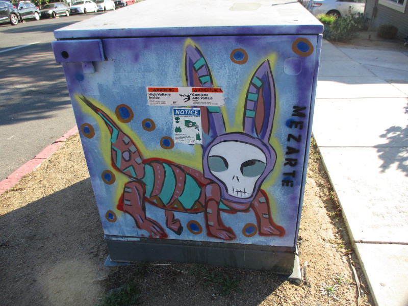
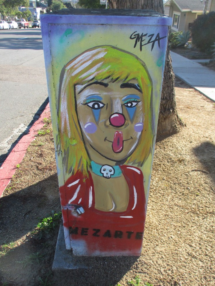
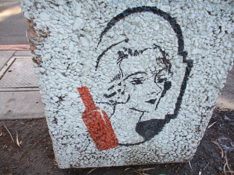
I really like the art of Gerardo Meza (@mezarte). It contains a lot of humor and personality.
You can see many examples of his colorful street art down near the border in San Ysidro. But during my walk through Sherman Heights yesterday, just east of downtown San Diego, I discovered two electrical boxes that he’d painted!
Here they are!
…
Thanks for visiting Cool San Diego Sights!
I post new blogs pretty often. If you like discovering new things, bookmark coolsandiegosights.com and swing on by occasionally!
I live in downtown San Diego and love to walk around with my camera! You can follow Cool San Diego Sights via Facebook or Twitter!
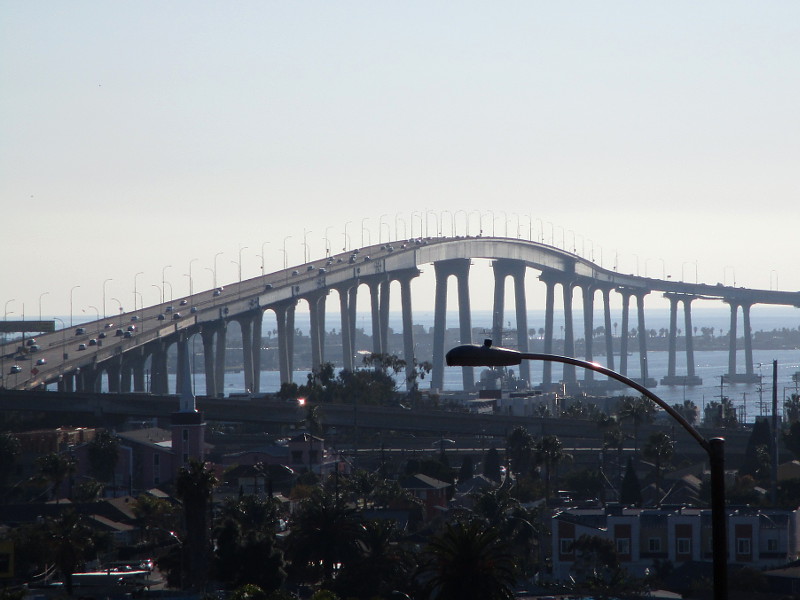
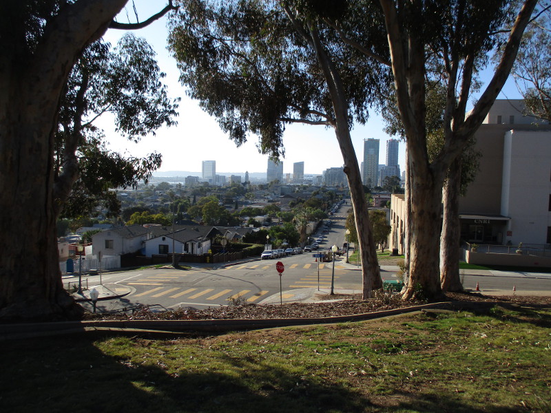
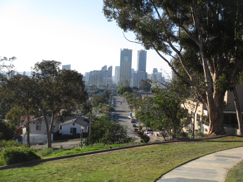
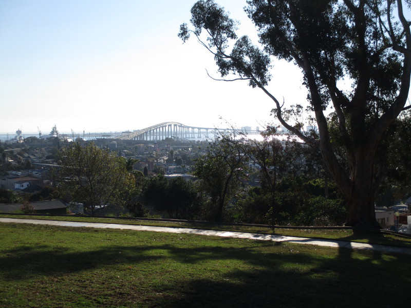
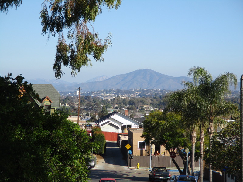
Amazing views of San Diego can be enjoyed from the top of Grant Hill.
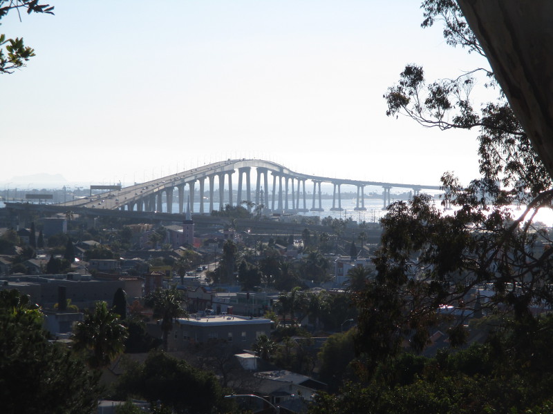
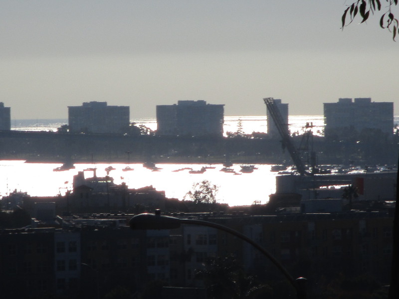
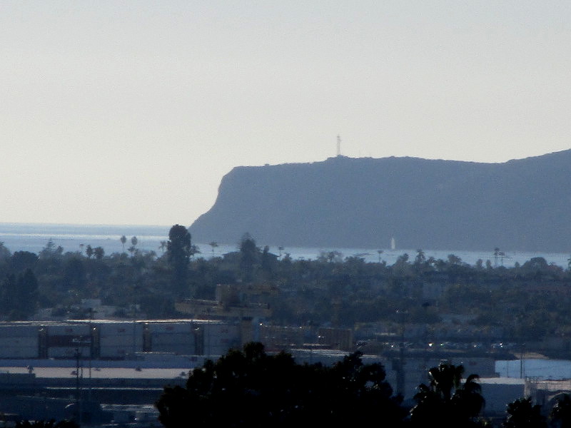
To the west lies downtown San Diego and its skyscrapers; to the northwest one can spy distant Point Loma; to the southwest the Coronado Bridge spans San Diego Bay, and boats can be seen as tiny dots in Glorietta Bay; to the south one can view Navy ships and much of South Bay; to the southeast rises distant San Miguel Mountain.
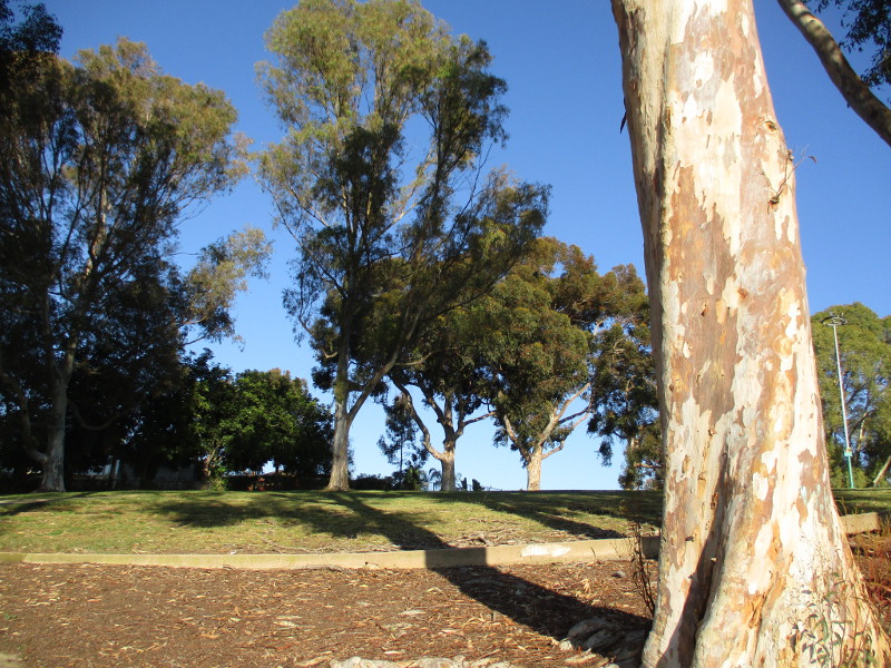
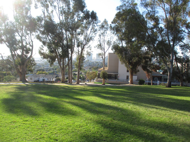
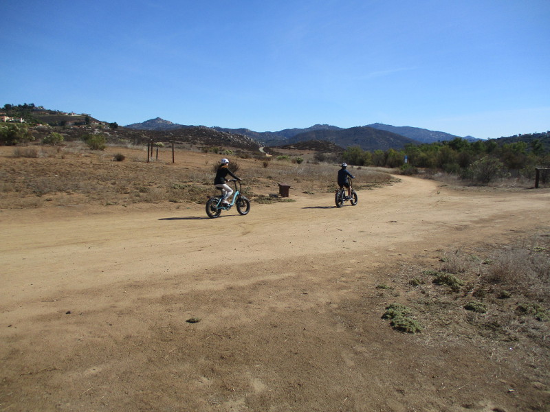
Today, after a long walk through Logan Heights and Sherman Heights, I turned east and moved into the Grant Hill neighborhood. There was a short steep climb up J Street to reach Grant Hill Neighborhood Park. It was a beautiful day with little haze, perfect for seeing almost to horizon–even over the Pacific Ocean. These photos resulted.
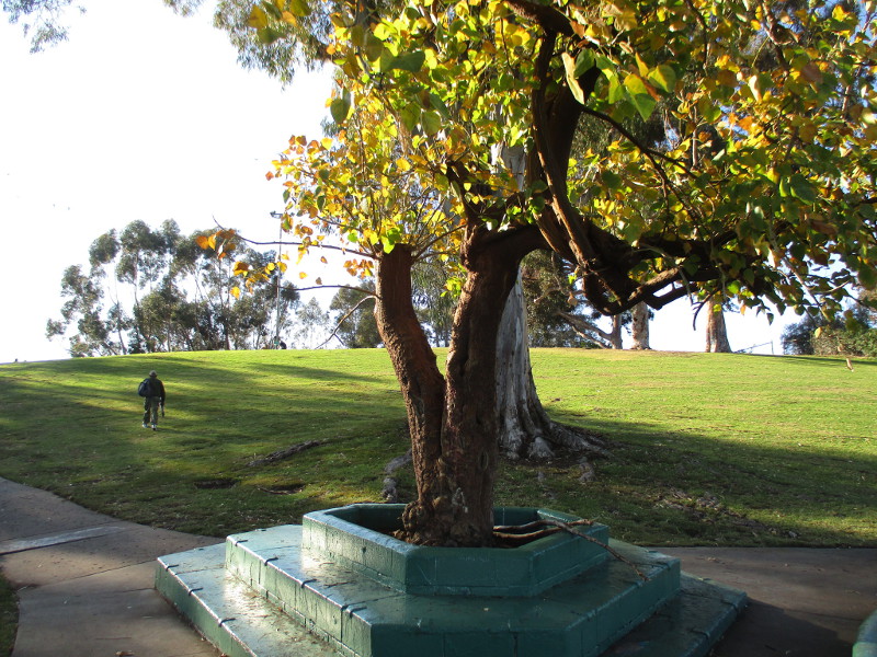
When I finally completed my exploration and walked back across the grass among the gigantic eucalyptus trees, someone was getting ready to fly a kite. It can be breezy atop Grant Hill!
Approaching Grant Hill Neighborhood Park from the west.Heading up a walking path, looking at giant eucalyptus trees atop Grant Hill.Several people were sitting on the park’s grass, enjoying the wide outdoors in the middle of a busy city.Downtown can be seen when turning back west. That’s J Street, which I climbed.Downtown San Diego seen from the top of Grant Hill.Turning a little to the left, there’s the Coronado Bridge!Coronado Bridge seen from the top of Grant Hill.A zoom photo shows Glorietta Bay and Coronado Shores buildings.A zoom photo over Coronado reveals distant Point Loma jutting into the Pacific Ocean.Walking down the Grant Hill Neighborhood Park path heading east.San Miguel Mountain seen from Grant Hill.I turned back west and passed this old tree in an interesting planter.Grant Hill Neighborhood Park is a beautiful grassy retreat in urban San Diego.
I have numerous photographs on my computer which I need to share!
Stay tuned in the next week or two for blog posts concerning Solana Beach, Cardiff, Escondido, Logan Heights, Sherman Heights, and more!
…
Thanks for visiting Cool San Diego Sights!
I post new blogs pretty often. If you like discovering new things, bookmark coolsandiegosights.com and swing on by occasionally!
I live in downtown San Diego and love to walk around with my camera! You can follow Cool San Diego Sights via Facebook or Twitter!
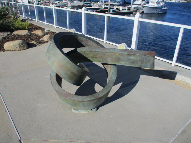
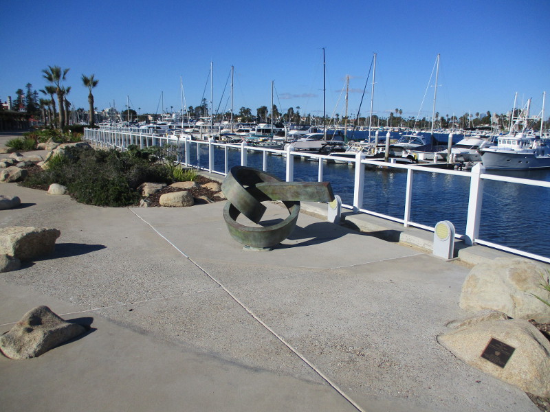
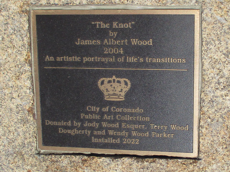
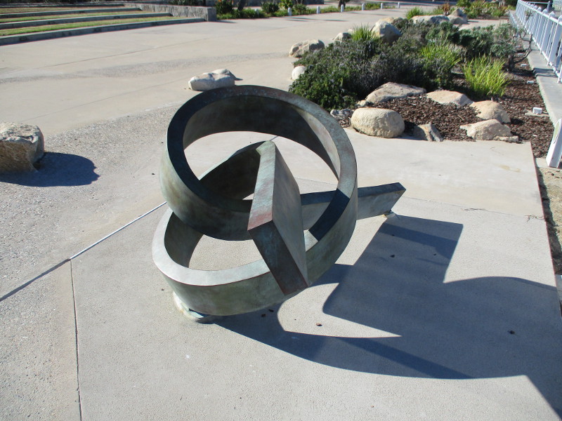
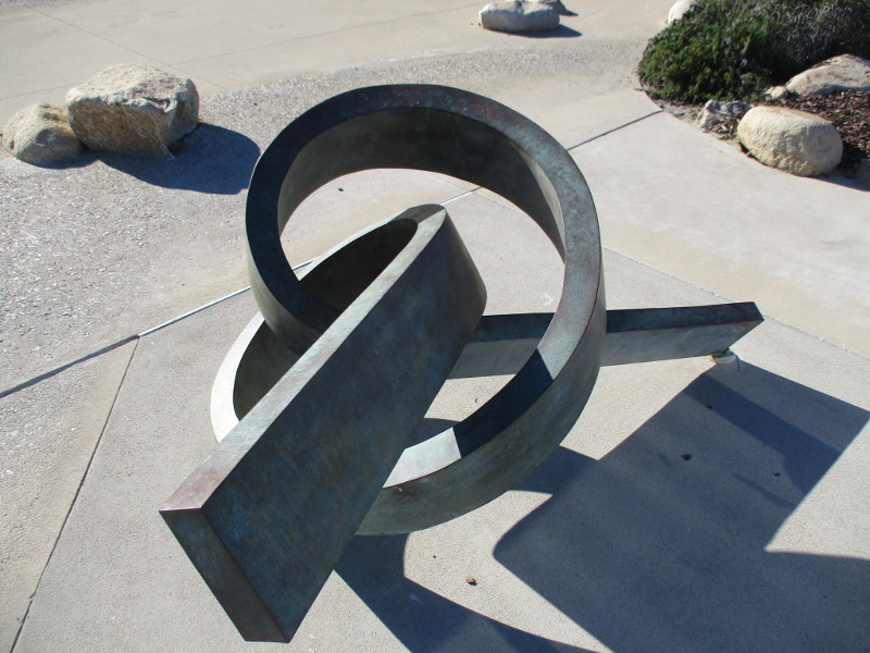
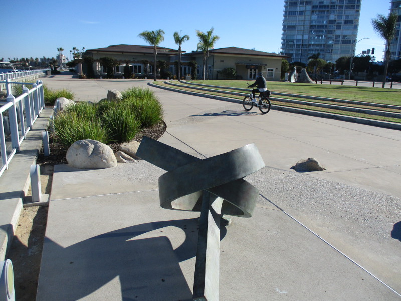
Have you seen this interesting public art in Coronado? It was installed earlier this year. You can find it north of the Coronado Community Center, on the walkway beside the Glorietta Bay Marina.
The simple but beautiful bronze sculpture is titled The Knot. It’s by James Albert Wood. Created in 2004, The Knot is described as an artistic portrayal of life’s transitions.
That makes me think. The tying of a knot is a transition, as is the untying of a knot.
The sculpture entices eyes to follow its short length through space. The bending curve is sort of like a journey in life. We are continuously moving and turning, in transition, forming ties with the world around us and with others we meet.
…
Thanks for visiting Cool San Diego Sights!
I post new blogs pretty often. If you like discovering new things, bookmark coolsandiegosights.com and swing on by occasionally!
I live in downtown San Diego and love to walk around with my camera! You can follow Cool San Diego Sights via Facebook or Twitter!
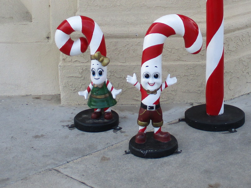
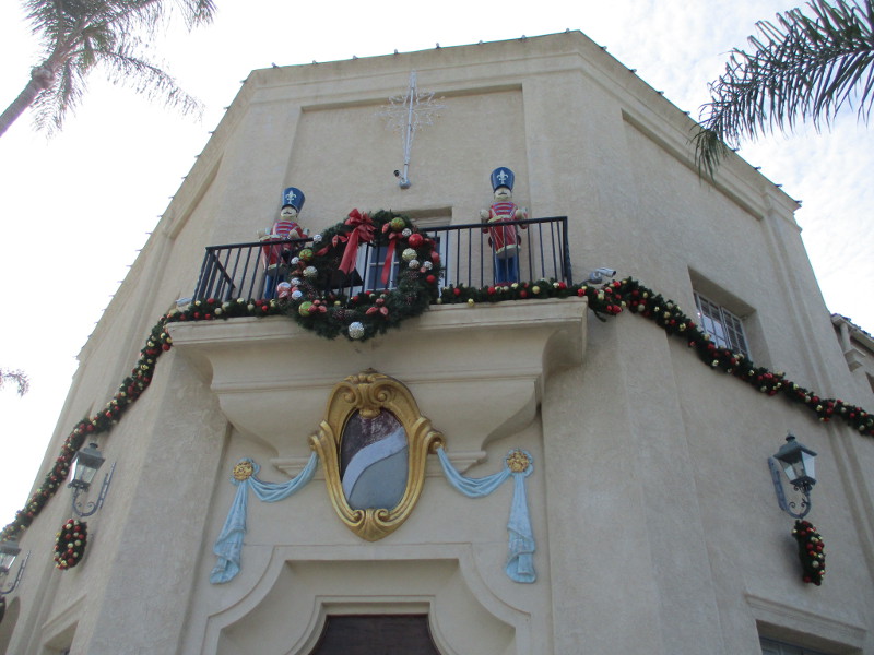
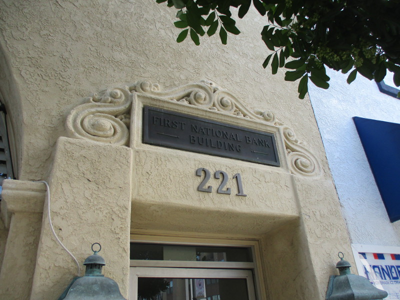
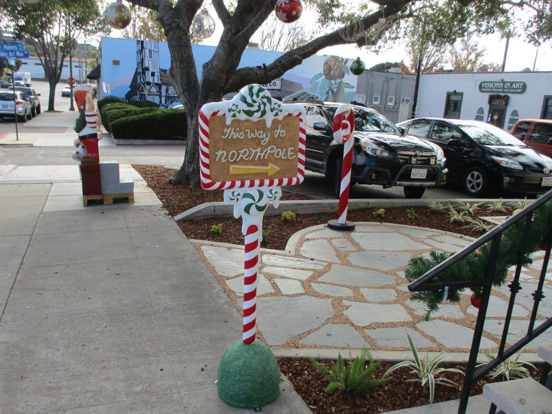
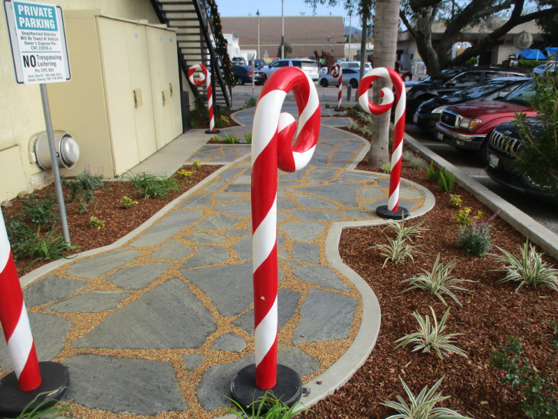
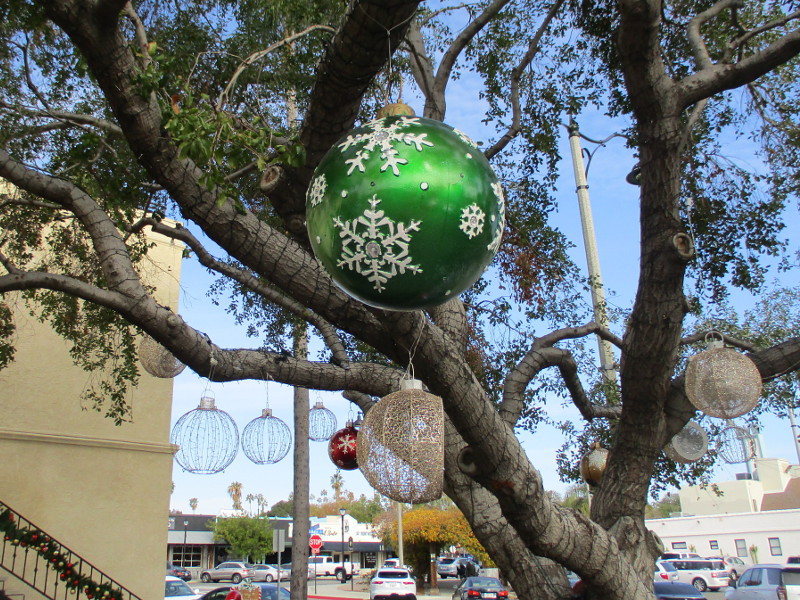
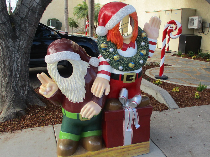
I was walking through downtown Vista today when I stumbled upon the North Pole!
The stately First National Bank Building at Main Street and Citrus Avenue is now encircled by merry holiday decorations! Nearby, a sign points to the North Pole!
I suppose Santa was greeting kids among those candy canes a couple weekends ago. This year I missed the Vista Christmas Parade.
…
Thanks for visiting Cool San Diego Sights!
I post new blogs pretty often. If you like discovering new things, bookmark coolsandiegosights.com and swing on by occasionally!
I live in downtown San Diego and love to walk around with my camera! You can follow Cool San Diego Sights via Facebook or Twitter!
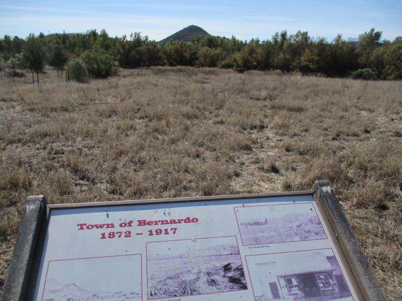
Did you know there used to be a town named Bernardo in what is now San Diego’s North County?
Bernardo was a tiny town between Escondido and Rancho Bernardo, where Lake Hodges is located today.
The creation of Lake Hodges in 1918, accomplished by damming the Bernardo River (now called San Dieguito River), put a definite end to little Bernardo. But today people hiking the Mule Hill Trail can see several information signs that recall the history of the now vanished town.
If you’d like to walk down the Mule Hill Trail yourself, take Interstate 15 to Bear Valley Parkway at the south end of Escondido. The wide dirt trail can be found about a quarter mile east of the freeway, leading south. (You’ll see it right before Beethoven Drive.)
Before reaching the site of old Bernardo, this very easy trail passes Mule Hill, where a skirmish took place during the Mexican-American War. I’ll be blogging about that coming up.
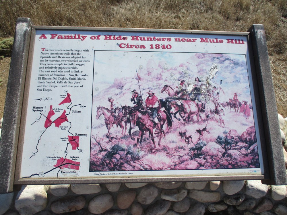
Cart roads used by the Spanish and Mexicans before the appearance of Bernardo linked a number of Ranchos–San Bernardo, El Rincon, Del Diablo, Santa Maria, Santa Ysabel, Valle de San Jose and San Felipe–with the port of San Diego.
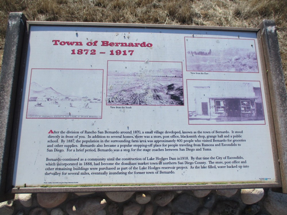
After the division of Rancho San Bernardo around 1870, a small village developed, known as the town of Bernardo. In addition to several houses, there was a store, post office, blacksmith shop, grange hall and public school. By 1887, the population in the surrounding farm area was approximately 400 people…
For a brief period, Bernardo was a stop for the stagecoaches between San Diego and Yuma.
The San Diego to Yuma Road was an overland trail in the mid-1800s. It was used by the Army of the West in 1846 and gold rush immigrants from 1848 through 1851. It passed through tiny Bernardo as it led northeast from Peñasquitos to Ramona, eventually connecting with the Butterfield Stage Route at Warner Springs.
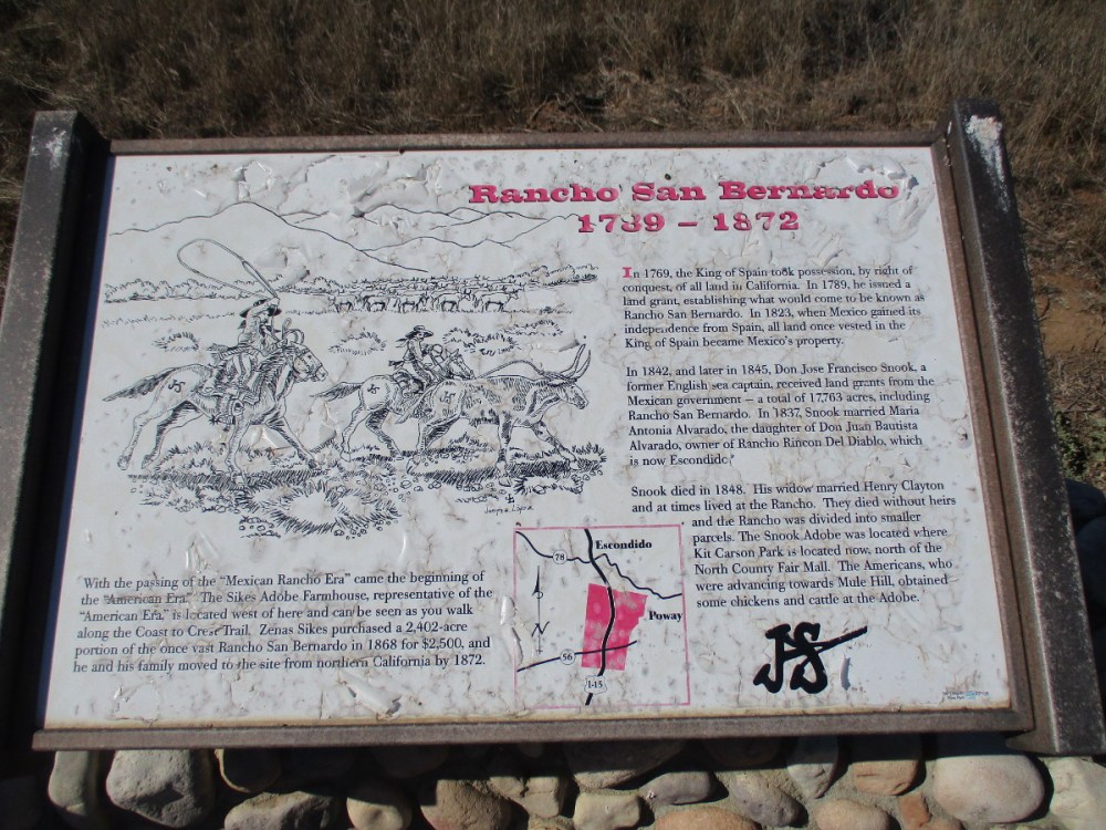
The history of Rancho San Bernardo began in the late 18th century when the King of Spain took possession of all land in California. In 1823, when Mexico gained its independence, the land became Mexico’s property. Don Jose Francisco Snook, a former English sea captain, received land grants from the Mexican government, including Rancho San Bernardo…
With the passing of the Mexican rancho era came the beginning of the American era, which is represented by the nearby Sikes Adobe Farmhouse. The restored farmhouse is a historic site that one can visit a short distance down the Coast to Crest Trail. (The Mule Hill Trail is a segment of the Coast to Crest Trail.)
…
Thanks for visiting Cool San Diego Sights!
I post new blogs pretty often. If you like discovering new things, bookmark coolsandiegosights.com and swing on by occasionally!
I live in downtown San Diego and love to walk around with my camera! You can follow Cool San Diego Sights via Facebook or Twitter!
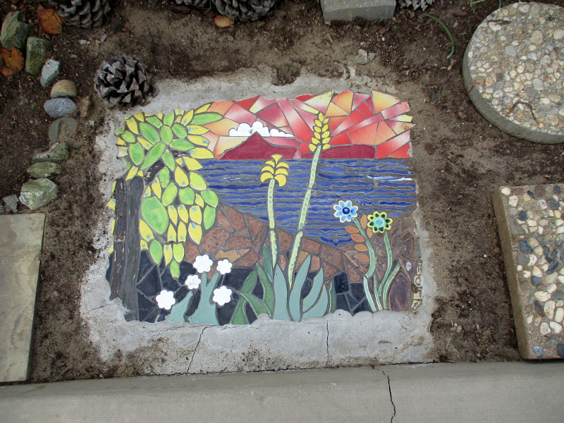
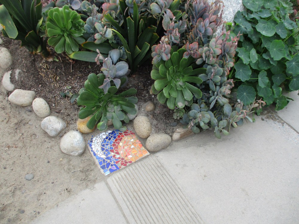
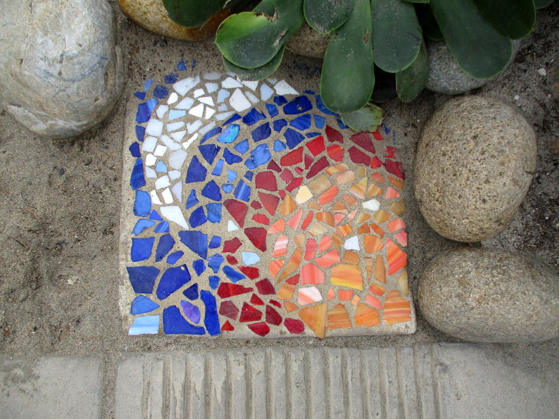
On this rainy Monday, would you like to see two beautiful mosaics at Dog Beach in Del Mar?
I spotted these small works of art as I walked along the path through the garden near the beach. I don’t know when these colorful mosaics were created, or by whom.
I once shared photographs from the Dog Beach Memorial Garden. You can see the great love people have for their four-legged friends. Those photos are here.
…
Thanks for visiting Cool San Diego Sights!
I post new blogs pretty often. If you like discovering new things, bookmark coolsandiegosights.com and swing on by occasionally!
I live in downtown San Diego and love to walk around with my camera! You can follow Cool San Diego Sights via Facebook or Twitter!
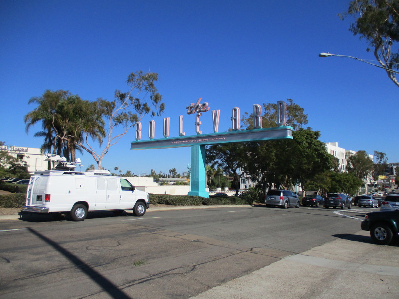
Hollywood, Tarzan, Live Wire and Vaudeville… What do these four have in common?
They’re all aspects of a short walk in University Heights!
A few days ago I walked east along the south sidewalk of El Cajon Boulevard, from Park Boulevard to Louisiana Street. My camera was out, aiming at anything that caught my fancy.
I saw street art and the iconic The Boulevard sign. I passed a strange bicycle and a fun window.
When I came to the historic Lafayette Hotel, I noticed huge banners proclaiming its rebirth in June of 2023.
The Lafayette Hotel has undergone many changes since it began as the Imig Manor in 1946. It’s very first guest was Bob Hope. It soon became a favorite playground for Hollywood stars, like Ava Gardner, Katharine Hepburn, Betty Grable, Lana Turner and singer Bing Crosby. It’s rumored Marilyn Monroe and JFK had a secret rendezvous here.
The hotel’s swimming pool was designed by Olympic gold medal winning swimmer and Tarzan movie actor Johnny Weissmuller. It was used by San Diego native Florence Chadwick to train for her record breaking swim across the English Channel. The hotel’s Mississippi Ballroom was used in the filming of Top Gun’s classic You’ve Lost That Lovin’ Feelin’ scene.
You can learn more about the amazing, elegant features of the Lafayette Hotel here.
Okay! Here are photos from my short walk…
…
Thanks for visiting Cool San Diego Sights!
I post new blogs pretty often. If you like discovering new things, bookmark coolsandiegosights.com and swing on by occasionally!
I live in downtown San Diego and love to walk around with my camera! You can follow Cool San Diego Sights via Facebook or Twitter!
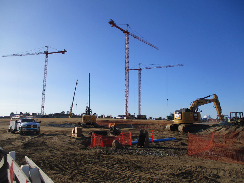
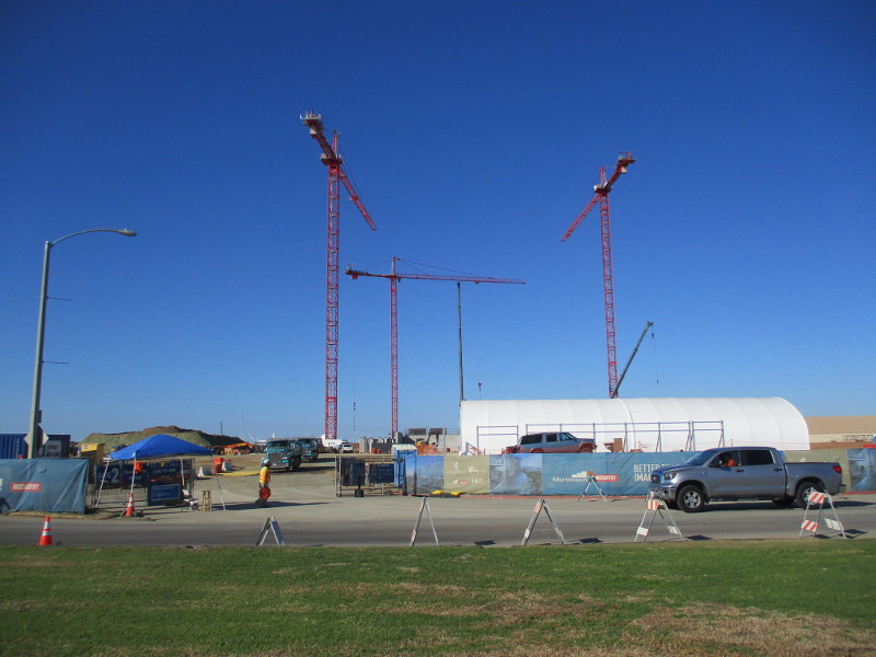
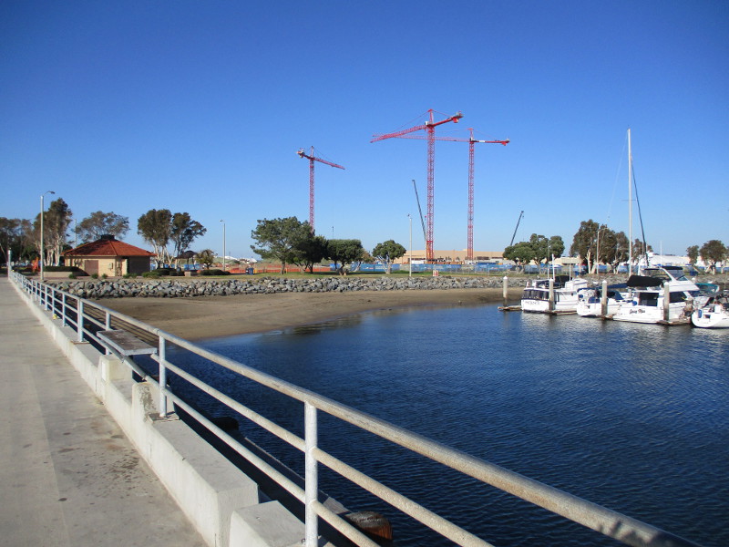
I was walking recently through Chula Vista’s Bayside Park, and out onto the peaceful Chula Vista Marina fishing pier when I took these photos.
The new resort and convention center is going to be gigantic. According to this article from last year, the total estimated cost for the resort hotel, convention center, parking structure and associated public infrastructure and parks is estimated to be approximately $1.23 billion. The plan is for the project to be completed in 2025. Fortunately, the long, grassy Bayside Park, at the edge of San Diego Bay, will remain open to the public.
About all I could see during my walk were these big cranes, some trucks, excavation machinery and mounds of dirt. The last couple photos were taken from the fishing pier, then from a point next to a sculpture called The Fisherman.
…
Thanks for visiting Cool San Diego Sights!
I post new blogs pretty often. If you like discovering new things, bookmark coolsandiegosights.com and swing on by occasionally!
I live in downtown San Diego and love to walk around with my camera! You can follow Cool San Diego Sights via Facebook or Twitter!
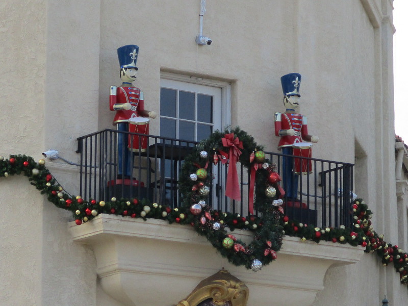
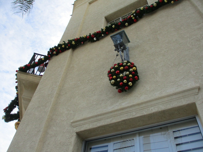
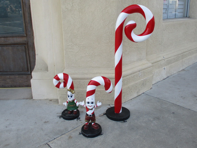
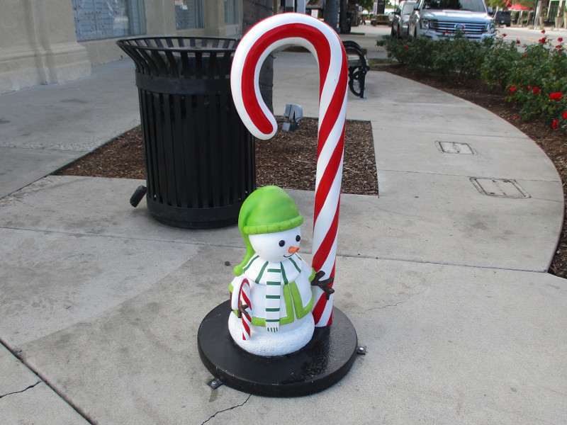
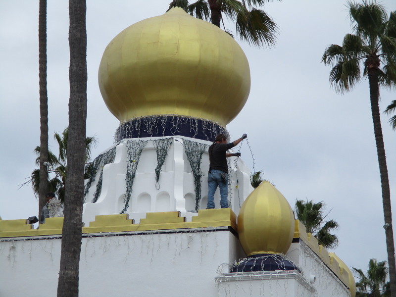
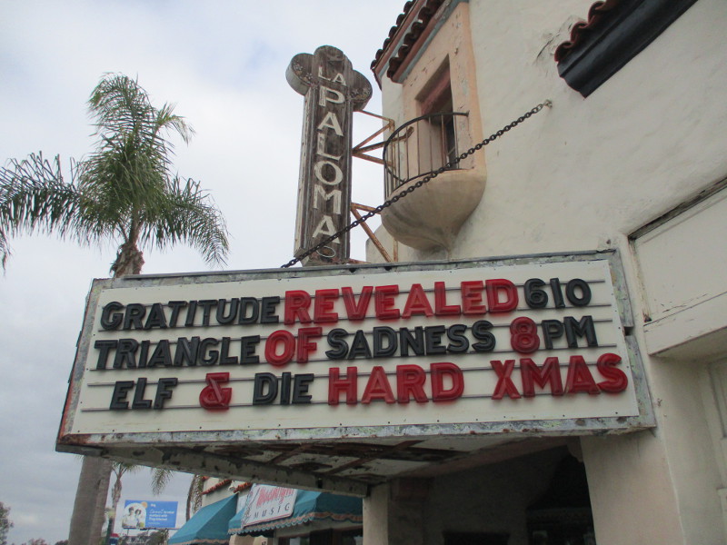
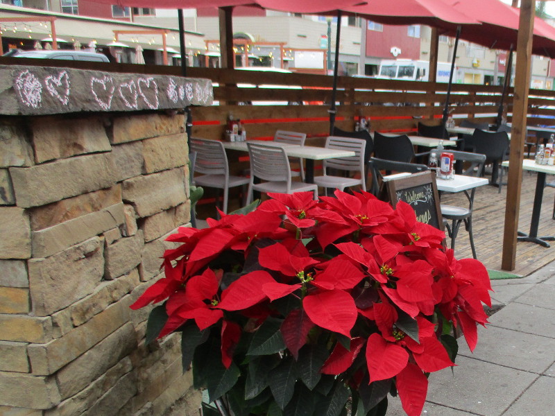
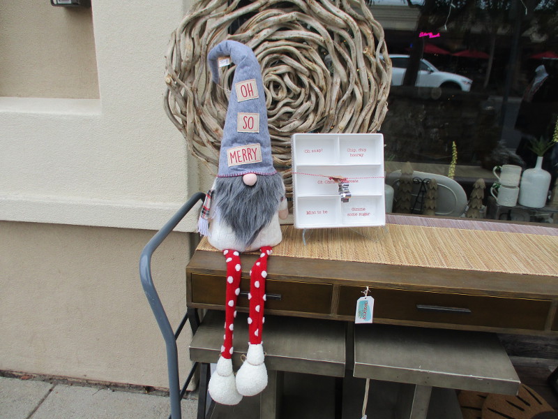
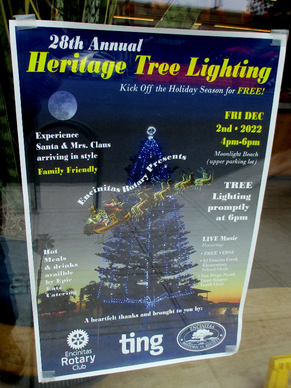
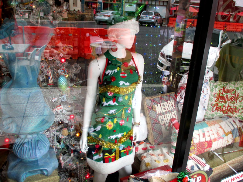
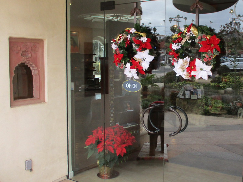
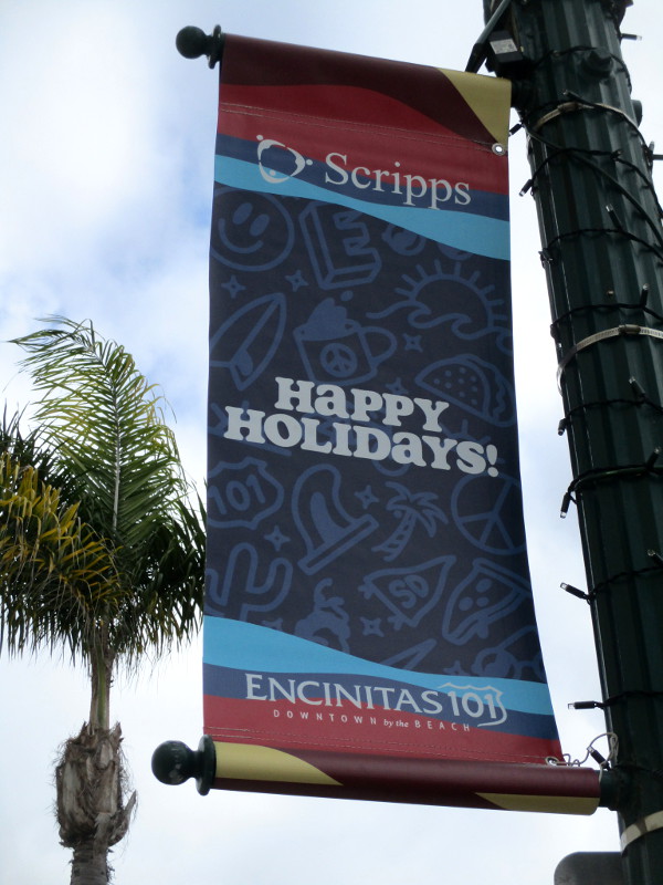
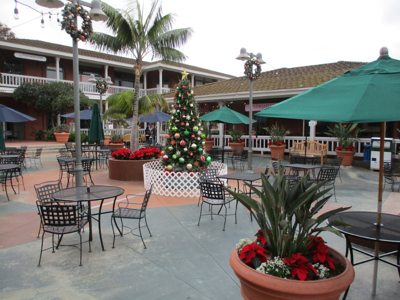
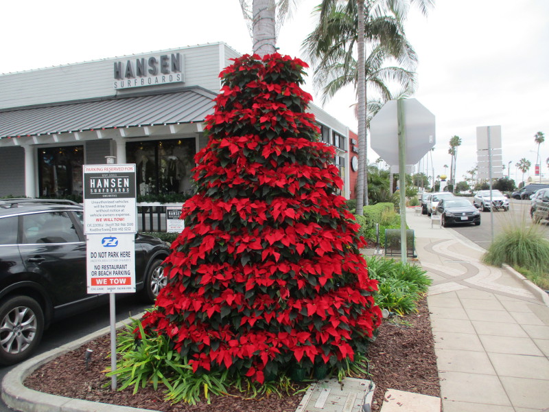
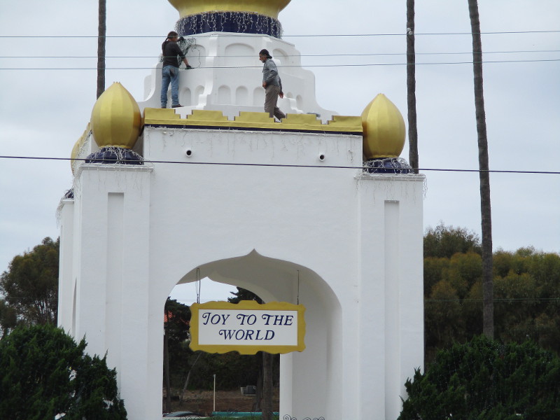
I headed back to North County today. During my walk through Encinitas, along Coast Highway 101, I noticed many signs of the Holiday Season!
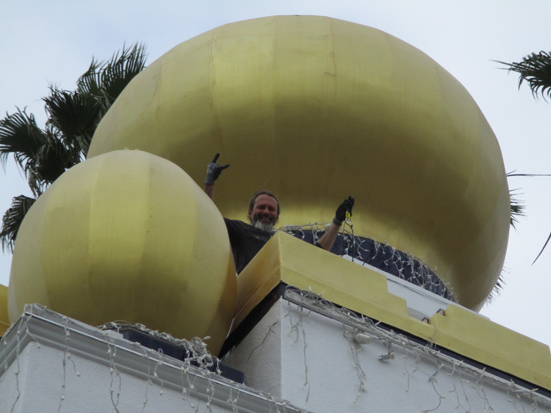
Not only did I spy workers hanging holiday lights on the Golden Lotus Tower of the Self-Realization Fellowship ashram, I saw the marquee of La Paloma Theatre features Elf and Die Hard XMAS.
Along the sidewalks and in shop windows I noticed poinsettias, wreaths, Christmas trees, and even ugly sweaters!
Enjoy a few fun photos!
…
Thanks for visiting Cool San Diego Sights!
I post new blogs pretty often. If you like discovering new things, bookmark coolsandiegosights.com and swing on by occasionally!
It’s easy to explore Cool San Diego Sights by using the search box on this website’s sidebar. Or click a tag. There’s a lot of stuff to share and enjoy!
I live in downtown San Diego and love to walk around with my camera! You can follow Cool San Diego Sights via Facebook or Twitter!
A small pocket park by the ocean in Del Mar provides visitors with very beautiful views.
Sea Cliff Park is located immediately south of Powerhouse Park, and west of Seagrove Park, which is situated on the bluffs above it.
The unmarked entrance to Sea Cliff Park is a swinging gate. It leads from Powerhouse Park to a dirt path and a small, easy walking loop. The gate is just south of what Google Maps calls the Powerhouse Playground.
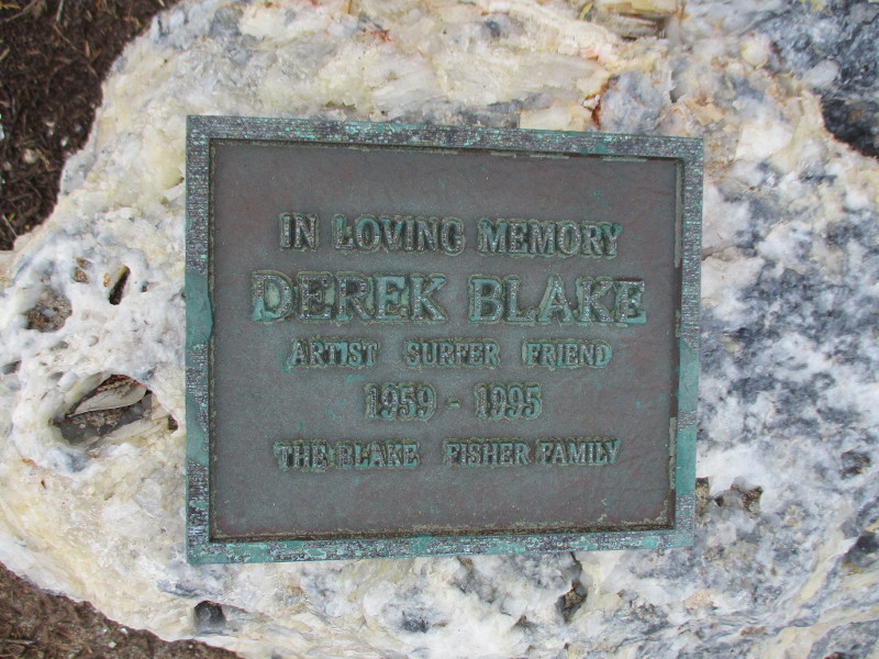
The drought tolerant vegetation of Sea Cliff Park is native to our coastal region. I discovered several plaques as I walked about, taking in the scenery. Two plaques were dedicated to loved ones.
I walked the short distance south to where the main path ascends to the railroad tracks. Then I turned back.
Surfers were out on the cloudy late November day. Looking down at the beach from the bluffs, I saw tide pools! I’ll have to explore them some day…
…
Thanks for visiting Cool San Diego Sights!
I post new blogs pretty often. If you like discovering new things, bookmark coolsandiegosights.com and swing on by occasionally!
It’s easy to explore Cool San Diego Sights by using the search box on this website’s sidebar. Or click a tag. There’s a lot of stuff to share and enjoy!
I live in downtown San Diego and love to walk around with my camera! You can follow Cool San Diego Sights via Facebook or Twitter!